| Category 5 hurricane (SSHS) | |
|---|---|
| Formed | October 18 |
| Dissipated | November 2 |
| Highest winds | 170 (mph) |
| Lowest pressure | 914 mb |
| Damages | None |
| Fatalities | None |
| Areas affected | Alaska |
| Part of the 2012 Pacific hurricane season | |
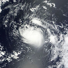
Olivia struggling to intensify
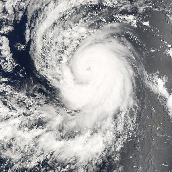
Hurricane Olivia as a major hurricane
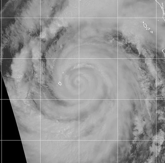
Olivia with a triple eyewall.
Hurricane Olivia was an exceptionally powerful storm from the 2012 Pacific hurricane season that took an extremely unusual track.
Meteorological history
Formation

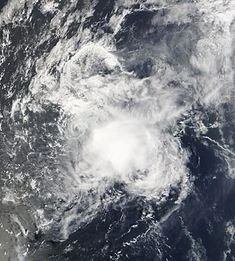
Olivia as a tropical depression
The wave that ultimately became Hurricane Olivia started out as a weak tropical disturbance over Central America. It was tracked slowly along the Mexican coastline. Land interaction caused the disturbance to struggle to organize, until 17 October, when it turned away from Mexico. A closed circulation formed, and well, unique, spiral rainbands were noticed on satellite imagery. Thus at 1200 UTC, the wave was designated Tropical Depression Eighteen-E. The depression moved west-northwest at 6 miles per hour (mph), aided by a non-tropical low pressure system.
As a tropical storm
Tropical Depression Eighteen-E quickly strengthened, with a minimum pressure of 992 millibars (mb) recorded at 0300 UTC 20 October when it was had 35 mph winds - the strength of a weak Category 1 hurricane on the Saffir-Simpson Hurricane Scale (SSHS). Three hours later, the depression had 40 mph winds, as recorded by a NHC buoy. As such, it became Tropical Storm Olivia, about 494 miles southwest of Cabo San Lucas, Baja California Sur. However, 15-20 knots of wind shear prevented Olivia from intensifying beyond 45 mph. Despite this, a Hurricane Hunters flight into the tropical storm recorded a pressure of 977 mb. For the next few days, the shear stopped Olivia's intensification, but it still remained tropical. Then, on 26 October, the shear dissipated, and Olivia started intensifying rapidly. Winds increased from 45 mph to 70 mph in a span of 30 hours. Then (at last), at 1500 UTC 27 October, Olivia became a hurricane unusually far north (810 miles north-northwest of San Diego).
Hurricane strength and peak intensity
Hurricane Olivia soon developed an eye (a "calm" spot in the center of a hurricane) on satellite imagery on 28 October. It became a Category 2, then a major hurricane (a major hurricane has winds of 111 mph or greater and is a Category 3 or greater on the SSHS) on 29 October. As Olivia became a major hurricane, an eyewall replacement cycle (ERC) occured, and it developed a rare set of triple eyewalls. Gradually intensifying, Olivia became a Category 4 hurricane at 1500 UTC 30 October, then a Category 5 hurricane at 0100 UTC 1 November, becoming the strongest post-November 1 tropical cyclone, beating a record set by Kenneth the previous year. At this time, it was centered approximately 750 miles south of Anchorage, Alaska. It reached a peak intensity of 170 mph and 914 mb.
Dissipation
However, shear in the Gulf of Alaska began to take over. Olivia ran into the shear, and weakened to a Category 4 just nine hours after reaching Category 5 status. Colder waters and an increasing forward speed indicated that Olivia was becoming extratropical. At 1200 UTC, the weakening hurricane was downgraded to a Category 3 about 250 miles south of Anchorage and entered the region of the Alaska Hurricane Center. The rapidly weakening trend continued until Olivia was just a mere tropical storm. The storm made landfall at the Prince William Sound as a 30 mph tropical depression. It then became extratropical. The extratropical cyclone, renamed Alonzo, exited back into the Gulf of Alaska, made several loops, became a Category 1, then was absorbed into a polar low.
Impact
A tropical storm warning was put up as Olivia neared Alaska. It was downgraded to a tropical storm watch when the hurricane rapidly weakened. Eventally, it was canceled.
Impact from Hurricane Olivia was extremely minimal. Several showers were reported and a few trees were knocked down in Anchorage, but elsewhere, there was no impact whatsoever.
No reported impacts other than a light drizzle was reported from Hurricane Alonzo (the remains of Olivia).