| Category 6 major hurricane (SSHWS/NWS) | |
|---|---|
 | |
| Formed | August 6, 1996 |
| Dissipated | August 31, 1996 |
| Highest winds | 1-minute sustained: 835 km/h (520 mph) |
| Lowest pressure | 718 hPa (mbar); 21.2 inHg |
| Fatalities | 10,500,000 |
| Damage | $1.9 trillion (1996 USD) |
| Areas affected | The Bahamas, Greater Antilles, United States (Florida, New York), Europe (Italy) |
| Part of the 1996 Atlantic hurricane season | |
Hurricane Kyle was the worst hurricane to hit the U.S. East Coast ever.
The storm started out as a tropical depression that formed while still over Africa, 50 miles, as a matter of fact.
As soon as it hit the water, it was already at 75 mph. On August 10, it explosively intensified in size and intensity, in went from a diameter of 250 miles to twice the size of Australia, its winds went from 90 mph to 195 mph, and its pressure going from 967 millibars (mbars) to 861 mbars.
On August 12, Kyle explosively intensified again. It was now the size of the Pacific Ocean. Its winds went from 215 to 290 mph, and its pressure went from 846 mbars to 800 mbars.
On August 15, it hit an area of no shear and water tempratures of 129 degrees Farenheit, the perfect ingredients for a hypercane. Scientists feared the potential Kyle had.
Kyle hit the sweet spot and explosively intensified and expanded in size even faster than before, with winds going from 295 to 425mph, and the pressure going from 801 to 726 mbars in only seconds, maybe as fast as one or two seconds.
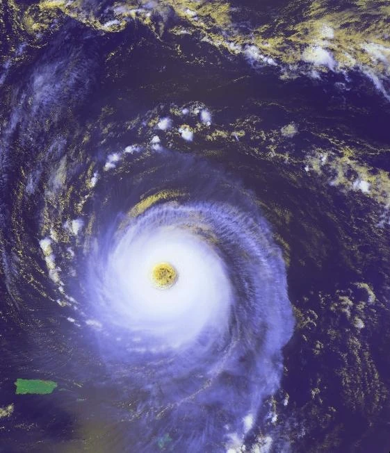
Kyle almost completely covered the whole planet and had an eye the size of Australia. It strengthened some more to a wind speed of 450 mph and a pressure of 718 mbars.
On August 17, Kyle shrunk a ton and lost intensity. It weakened to 300 mph and had a pressure of 770 mbars.
Kyle had shrunk to the size of Australia and had an eye the size of Madagascar. As Kyle proceeded northwest, mandatory evacuations were up for the U.S. East Coast. Hurricane and tropical storm warnings and watches were up for the entire Atlantic side of North America because of Kyle's massive size, surf & 300+ mph winds.
On August 19, while still maintaining 300 mph winds, Kyle shrunk some more, thus decreasing the amount of watches, warnings and evacuations.
Between August 20 and 22, Kyle's winds fluctated between 280 and 330 mph. At the same time, its winds were shredding apart the Greater Antilles and the Bahamas. In addition, Kyle sent a wave 125 feet tall into the Bahamas and Florida. The Bahamas was completely underwater and no longer visible on satellites, and all of Southern Florida and the northern parts of the Greater Antilles were underwater.
Then, on August 25, Kyle made landfall near New York City with winds of 300 mph.
As it made landfall, a wave more chaotic than the last formed. It was up to 145 feet. At this point, everywhere from Northwestern Florida to Italy was underwater.
By the time Kyle dissipated, it was still a Category 1 and it was over Russia.
Kyle caused a total of $1.9 trillion in damage and killed a staggering 10.5 million.
Kyle was one of the most terrible Category-6 hurricanes ever.
Its name will be retired but its up-to everyone else to decide what it should be replaced with.