| |
| First storm formed | January 5, 2008 |
| Last storm dissipated | Season currently active |
| Strongest storm | Verne – 110 kts, 938 hPa |
| Total disturbances | 12 |
| Tropical depressions | 9 |
| Tropical cyclones | 6 |
| Severe tropical cyclones | 3 |
| Total damages | $50 million |
| Total fatalities | 3 |
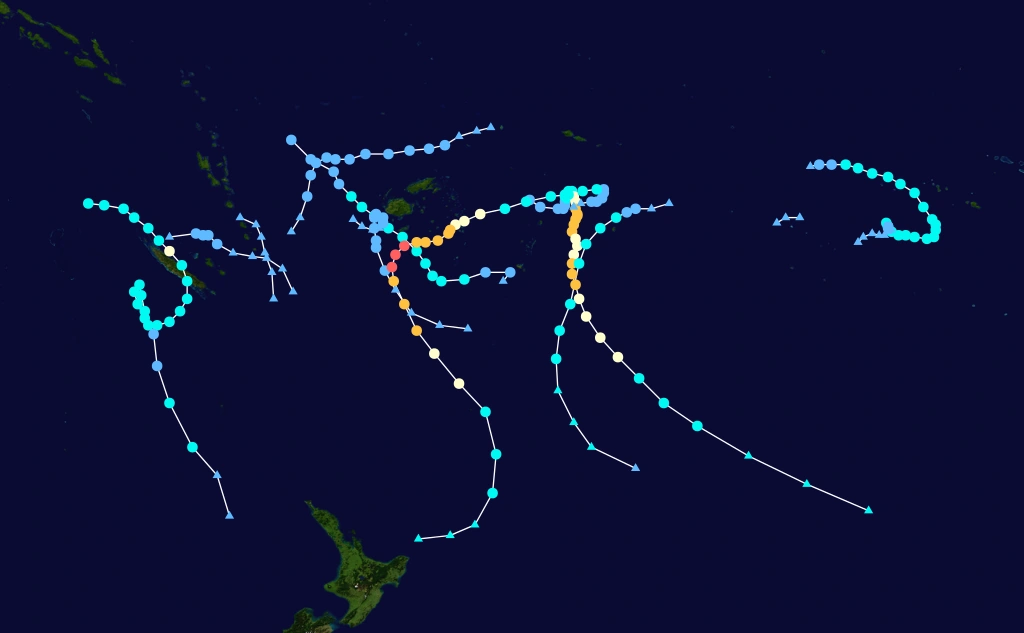
The 2007-08 South Pacific cyclone season was an annual event of tropical cyclone formation in the southern Pacific Ocean east of 160E.
Storms[]

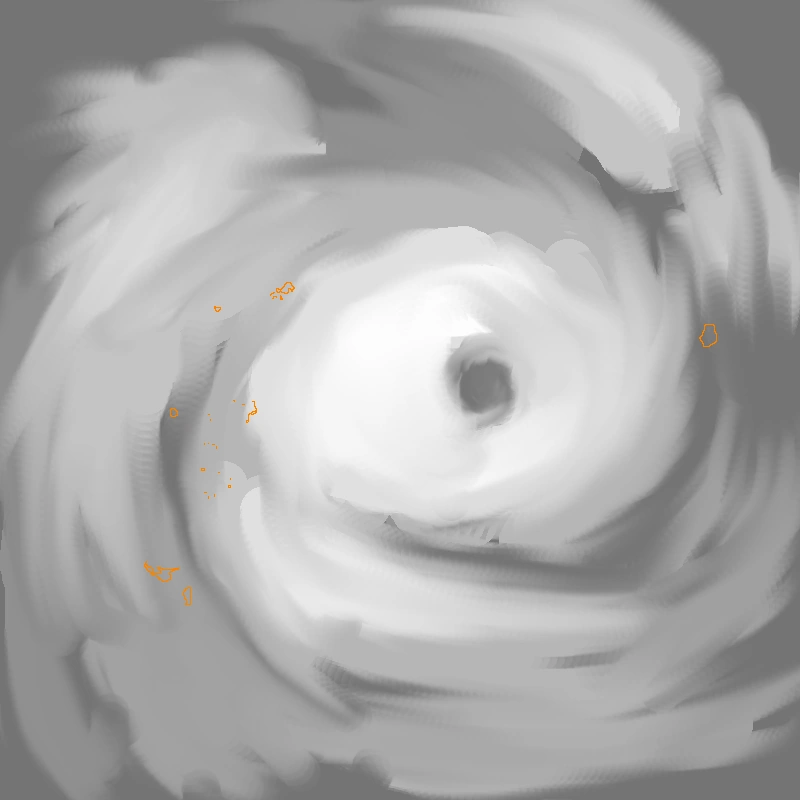
Severe Tropical Cyclone Sepa[]
| Category 4 severe tropical cyclone (Australian scale) | |
| Category 4 tropical cyclone (SSHWS) | |
  | |
| Duration | January 5 – January 13 |
|---|---|
| Peak intensity | 195 km/h (120 mph) (10-min) 958 hPa (mbar) |
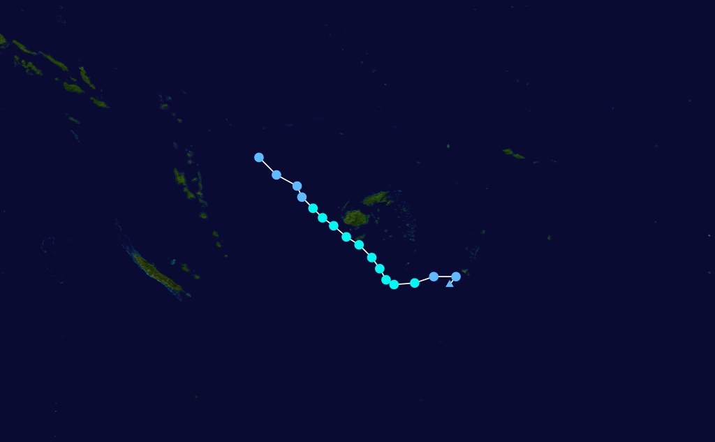
A monsoon trough intensified into a tropical depression on January 5 just northwest of Vava'u. The depression moved east over Tonga until turning north on January 6 and becoming a tropical cyclone late that day and the system was named Sepa. Sepa executed a hairpin very slowly, turning south by midday on January 7, steadily intensifying. Early on January 8, Sepa began to more readily intensify and went from a minimal category 3 cyclone to category 4. Nadi reported that the storm peaked in intensity at 06z on January 9 with winds of 105 knots while travelling south-southwest at only a few knots per hour. It turned to the south-southeast near the latitude of Niue and underwent an eyewall replacement cyclone, weakening into a category 3. After the eyewall was replaced, Sepa took advantage of the conducive environment and re-intensified to a category 4 cyclone. Sepa began to accelerate and started to weaken again on January 11. It weakened back into a category 2 by the 12th and transitioned into an extratropical cyclone 24 hours later.
As a depression, Sepa caused damage in Tonga. Reports of flooding and several downed bridges were reported, and there were 2 fatalities on Vava'u. Both Niue and Tonga were bombarded by gale force gusts and high surf for several days while hurricane warnings were issued by RSMC Nadi.
Tropical Disturbance 02F[]
| Tropical depression (Australian scale) | |
 | |
| Duration | January 10 – January 11 |
|---|---|
| Peak intensity | 45 km/h (30 mph) (10-min) 1002 hPa (mbar) |
A weak disturbance was tracked near the island nation of Vanuatu. There were no reports of damage associated with 02F.
Tropical Cyclone Tirol[]
| Category 2 tropical cyclone (Australian scale) | |
| Tropical storm (SSHWS) | |
  | |
| Duration | January 25 – January 29 |
|---|---|
| Peak intensity | 95 km/h (60 mph) (10-min) 986 hPa (mbar) |
A weak disturbance formed on January 25 northwest of Fiji. The disturbance quickly intensified into a tropical depression by the next day, eventually becoming a category 1 cyclone which received the name Tirol. Tirol passed Fiji at the closest point southwest of Sigatoka on January 27 at around 06z, bringing heavy rains. The storm tracked southeast, becoming a category 2 cyclone for several hours, but vertical wind shear in the area was picking up and Tirol began to weaken. It turned south late on January 28 and weakened into a tropical depression the following day. Tirol became a tropical disturbance while stalling to the southeast of Fiji and weakened to the point that the remnants could no longer be tracked at one specific point.
Tirol brought heavy rains and minor flooding to Fiji causing minimal damages, along with high surf for several days. There was one report of death.
Tropical Cyclone Ursula[]
| Category 1 tropical cyclone (Australian scale) | |
| Tropical storm (SSHWS) | |
 | |
| Duration | February 1 – February 3 |
|---|---|
| Peak intensity | 75 km/h (45 mph) (10-min) 993 hPa (mbar) |
An area of low pressure equidistant from Samoa and Niue persisted in the south Pacific ocean while drifting south until it was declared a tropical disturbance, and later, depression, by RSMC Nadi. Within twenty four hours, the depression had intensified enough to be named Ursula. Ursula intensified while beginning to accelerate as it passed the island nation of Niue. The system tracked south, peaking as a category one cyclone, and became extratropical.
Moderate effects from Ursula in Niue were reported, several power lines were downed and some roads were closed due to flooding attributed to Ursula.
Tropical Depression 05F[]
| Tropical depression (Australian scale) | |
| Tropical storm (SSHWS) | |
| | |
| Duration | February 7 – February 9 |
|---|---|
| Peak intensity | 55 km/h (35 mph) (10-min) 1001 hPa (mbar) |
A tropical depression formed over New Caledonia on February 7. The system weakened into a tropical disturbance, travelling southeast until it dissipated on February 9.
Minimal effects in both New Caledonia and Vanuatu were reported.
Tropical Depression 06F[]
| Tropical depression (Australian scale) | |
| Tropical depression (SSHWS) | |
| | |
| Duration | February 9 – February 11 |
|---|---|
| Peak intensity | 55 km/h (35 mph) (10-min) 998 hPa (mbar) |
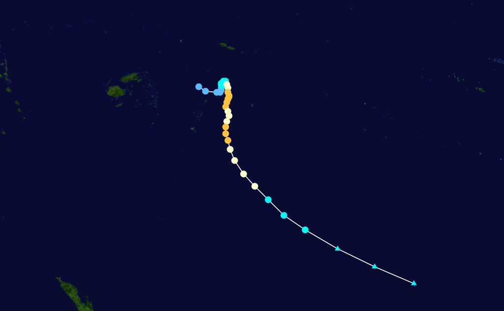
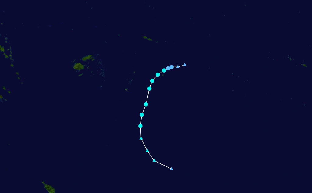
Severe Tropical Cyclone Verne[]
| Category 5 severe tropical cyclone (Australian scale) | |
| Category 4 tropical cyclone (SSHWS) | |
 | |
| Duration | February 13 – February 21 |
|---|---|
| Peak intensity | 205 km/h (125 mph) (10-min) 938 hPa (mbar) |
Tropical Disturbance 08F[]
| Tropical depression (Australian scale) | |
| | |
| Duration | March 6 – March 6 |
|---|---|
| Peak intensity | 45 km/h (30 mph) (10-min) 1003 hPa (mbar) |
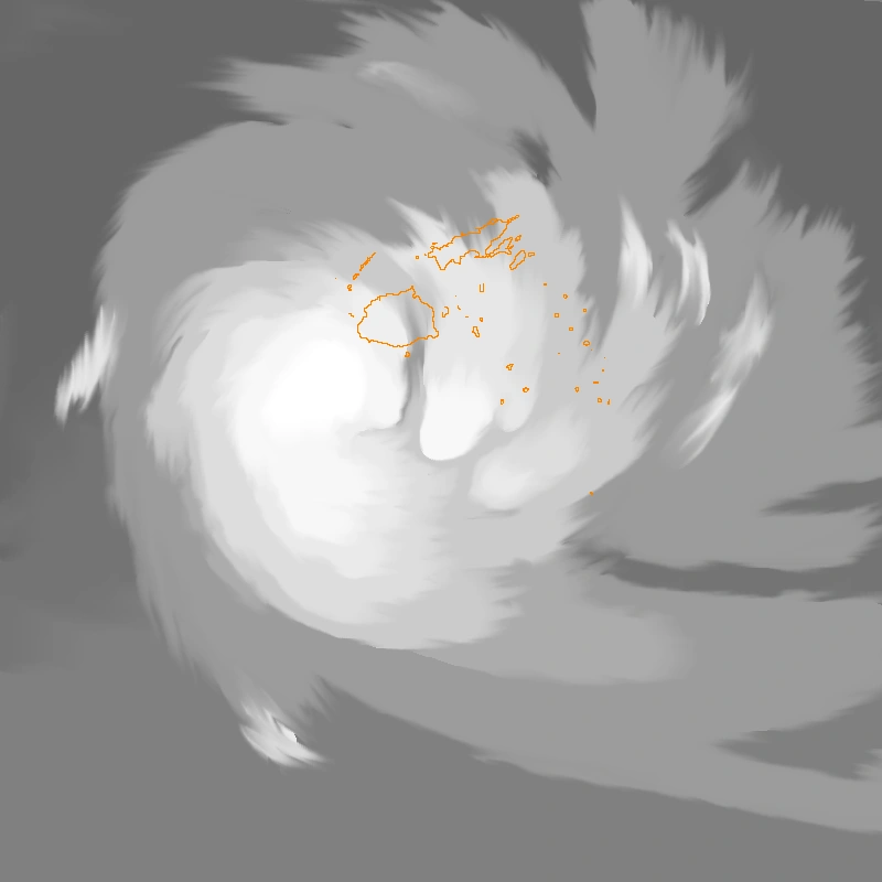
Severe Tropical Cyclone Xia[]
| Category 3 severe tropical cyclone (Australian scale) | |
| Category 1 tropical cyclone (SSHWS) | |
 | |
| Duration | March 17 – March 22 |
|---|---|
| Peak intensity | 120 km/h (75 mph) (10-min) 981 hPa (mbar) |
Tropical Depression 10F[]
| Tropical depression (Australian scale) | |
| | |
| Duration | March 30 – April 2 |
|---|---|
| Peak intensity | 55 km/h (35 mph) (10-min) 997 hPa (mbar) |
Tropical Cyclone Yaka[]
| Category 2 tropical cyclone (Australian scale) | |
| Tropical storm (SSHWS) | |
| Duration | April 5 – April 12 |
|---|---|
| Peak intensity | 95 km/h (60 mph) (10-min) 986 hPa (mbar) |
Tropical Disturbance 12F[]
| Tropical depression (Australian scale) | |
| | |
| Duration | April 17 – April 17 |
|---|---|
| Peak intensity | 45 km/h (30 mph) (10-min) 1000 hPa (mbar) |
Season effects[]
This table lists all the storms that developed in the South Pacific to the east of longitude 160°E during the 2007-08 season. It includes their intensity on the Australian Tropical cyclone intensity scale, duration, name, landfalls, deaths, and damages. All data is taken from RSMC Nadi and/or TCWC Wellington, and all of the damage figures are in 2008 USD.
| Storm Name |
Dates active | Storm category at peak intensity |
Peak 10-min sustained winds |
Pressure | Areas affected | Damage (USD) |
Deaths | Refs
|
|---|---|---|---|---|---|---|---|---|
| Sepa | January 5 – 13 | Category 4 severe tropical cyclone | 195 km/h (105 kts) | 958 | Tonga, Niue | 50 million | 2 | |
| 02F | January 10 – 11 | Tropical Disturbance | 45 km/h (25 kts) | 1002 | Vanuatu | |||
| Tirol | January 25 – 29 | Category 2 tropical cyclone | 95 km/h (50 kts) | 986 | Fiji, Tonga | Minimal | 1 | |
| Ursula | February 1 – 3 | Category 1 tropical cyclone | 75 km/h (40 kts) | 993 | Niue, Tonga | Minimal | 0 | |
| 05F | February 7 – 9 | Tropical Depression | 55 km/h (30 kts) | 1001 | ||||
| 06F | February 9 – 11 | Tropical Depression | 55 km/h (30 kts) | 998 | ||||
| Season Aggregates | ||||||||
| 3 Systems | January 5 – Still Active | 105 kts | 958 | $50 million | 3 |
Storm names[]
- See also: Lists of tropical cyclone names
Within the Southern Pacific a tropical depression is judged to have reach tropical cyclone intensity should it reach winds of 65 km/h, (35 kts) and it is evident that gales are occurring at least halfway around the center. When a tropical depression is declared a tropical cyclone it will be given a name from the following list.
Yaka
|