NOTICE: If you are new to the usercane concept, check out this page. All updated usercane information is provided here, including an overview of the NUC functions.

The 2016 Atlantic usercane season was the first Atlantic usercane season to be tracked operationally by the National Usercane Center, and was the final season in a consecutive series of three extremely active and intense seasons. However, it was much less destructive and deadly compared to 2014 and 2015. This season featured 33 tropical usercyclones, 29 tropical userstorms, 14 hurricanes, and 12 major hurricanes. At the time, this was the most active season along with 2015, until the following season saw more named storms.
The season ran throughout 2016, with most tropical usercyclones typically developing between June and December. The season got off to a torrid pace in January, before slowing down later. The first storm of the season, Tropical Depression One, formed on January 5th, making it the earliest start for an Atlantic usercane season, also setting a record for the earliest first storm formation date. One later intensified into Tropical Storm Destiny, which would dissipate and regenerate several times until turning extratropical on March 15. The first hurricane of the season was Keranique, which acquired hurricane intensity on February 1. Keranique and Bittersweet both attained major hurricane intensity on March 2, the latter of which would make a destructive landfall as an extratropical cyclone. Hurricane Bittersweet was the costliest storm of the season, while Keranique was the strongest and longest-lived. Although the season was very active, most of the storms were short lived, with only 6 of the 31 usercanes active by July 2017.
Advisories for usercanes were issued by the National Usercane Center weekly on Fridays. Many other usercane prediction centers, such as the SMWC, KMC, HTMC, CDMC, FMC and ICON branches, also issue advisories.
All HHW users that joined in 2016 and made at least 5 edits were included in this season. If they made at least 10 edits, they became a named storm.
Seasonal forecasts[]
| Source | Date | Named storms |
Hurricanes | Major hurricanes | |
| Average (2010–2015) | 12 | 6.7 | 5.3 | ||
| Record high activity | 32 | 21 | 14 | ||
| Record low activity | 4 | 2 | 2† | ||
| BNWC | December 31, 2015 | 18 | 10 | 3 | |
| NKWC | January 3, 2016 | 24 | 6 | 2 | |
| HTMC | January 3, 2016 | 28 | 8 | 3 | |
| HOWC | January 3, 2016 | 34 | 21 | 9 | |
| CDMC | January 3, 2016 | 20 | 11 | 3 | |
| SMWC | January 4, 2016 | 15 | 6 | 4 | |
| BNWC (revised) | January 17, 2016 | 35-40 | 6-8 | 2-4 | |
| FMC | January 18, 2016 | 38* | 7 | 3 | |
| CDMC (revised) | January 21, 2016 | 29 | 7 | 2-3 | |
| HOWC (revised) | January 21, 2016 | 67 | 33 | 10 | |
| KMC | February 15, 2016 | 27 | 11-12 | 3-4 | |
| BMC | February 24, 2016 | 30-35 | 15-20 | 6-12 | |
| SMWC (revised) | February 24, 2016 | 20-25 | 8-10 | 4-6 | |
| BNWC (revised) | March 8, 2016 | 30-35 | 10-12 | 5-7 | |
| FMC (revised) | April 10, 2016 | 25-30* | 9-11 | 5-6 | |
| CDMC (revised) | April 18, 2016 | 29-33 | 9-13 | 3-5 | |
| BNWC/NUC (revised) | June 3, 2016 | 27-32 | 8-10 | 5-7 | |
| FMC/INK (revised) | June 4, 2016 | 27-33* | 8-13 | 3-7 | |
| SMWC (revised) | July 9, 2016 | 28-35 | 10-14 | 7-9 | |
| ICON | September 9, 2016 | 50 | 10 | 7 | |
| Actual activity |
30 | 12 | 10 | ||
| * June–November only. † Most recent of several such occurrences. (see all) | |||||
In late December 2015, pre-season forecasts began to be issued for the 2016 Atlantic hurricane HHW user season. The first agency to predict was the Bob Nekaro Weather Center, which forecast 18 named storms, 10 hurricanes and 3 major hurricanes on December 31, a less active season than 2015, mainly due to increased dry air prohibiting development of strong storms. Three days later, four additional weather agencies made 2016 predictions, all predicting an above-average season. The NKWC predicted 24 named storms, 6 hurricanes and 2 major hurricanes, also citing increased dry air but lower wind shear in their prediction. The HTMC followed, predicting 28 named storms, 8 hurricanes, and 3 major hurricanes, yet again citing similar conditions forecast to be present during the 2016 season.
The HOWC then made a surprising prediction of 34 named storms, 21 hurricanes and 9 major hurricanes, a prediction based off minimal wind shear and dry air. The CDMC also made a prediction, predicting 20 named storms, 11 hurricanes and 3 major hurricanes. The next day the SMWC came in with a prediction of 15 named storms, 6 hurricanes and 4 major hurricanes.
To this point, most forecasting groups have expected this season to be an above average season, due to a combination of factors including an expected transition to La Niña, although it failed to materialize.
Season summary[]
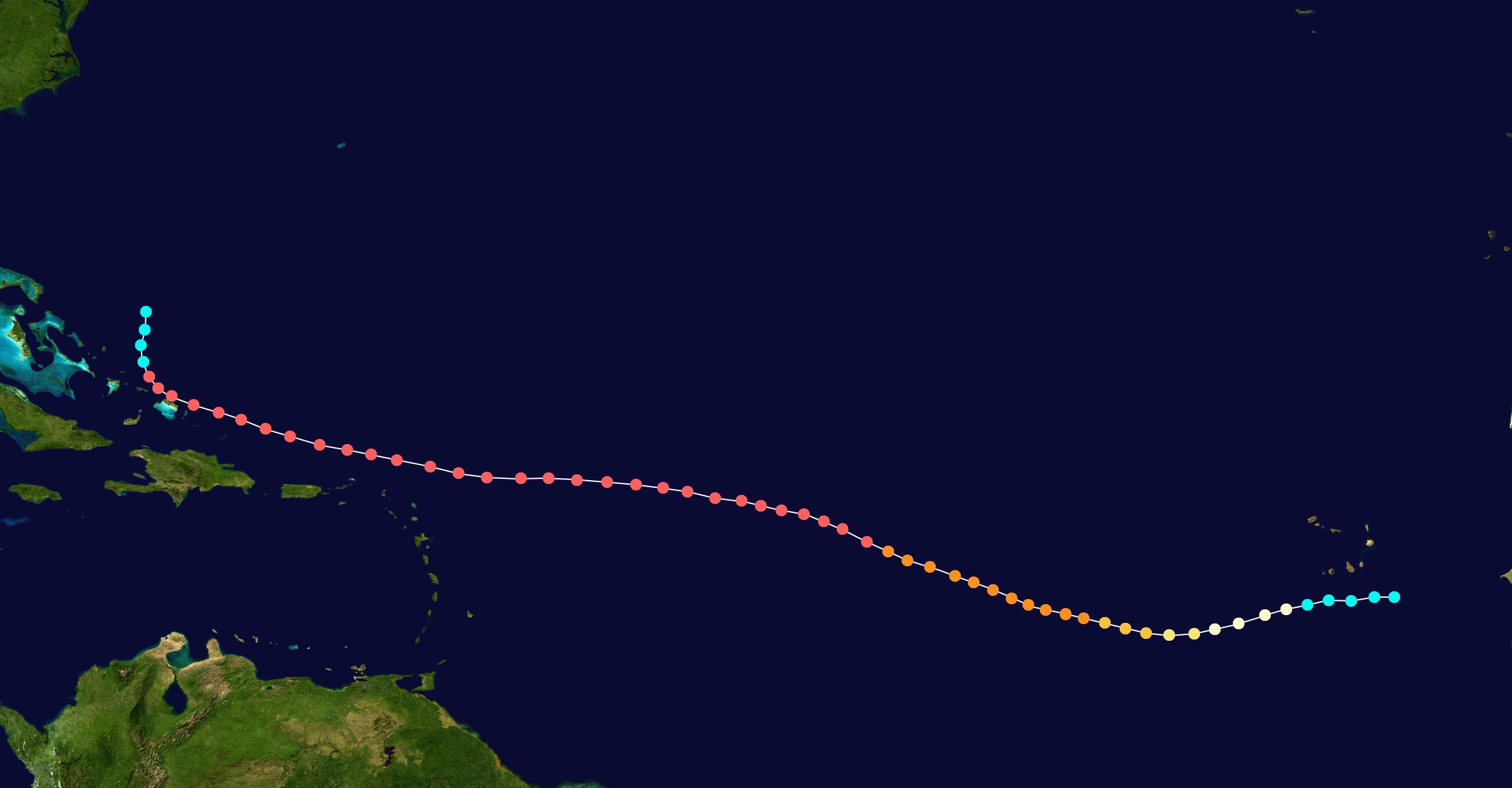
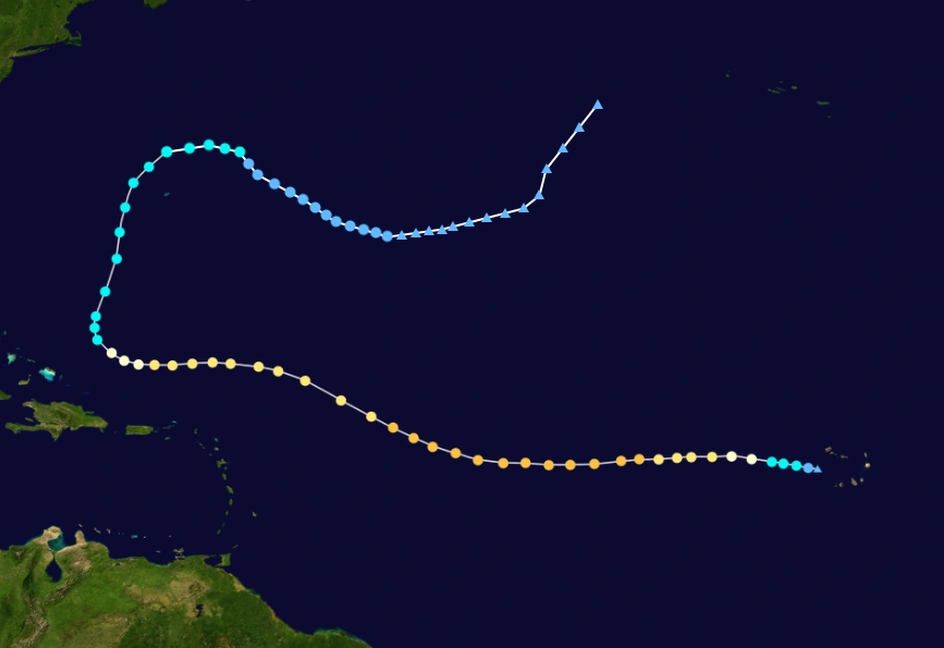
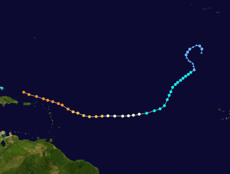
The landscape of HHW users, as of December 31, 2015, entering the season.
Numerous storms that formed in 2015 or earlier were active at the start of 2016: Major hurricanes included Hurricane Hype, Hurricane Nkechinyer, Hurricane Michelle, Hurricane Bob, Hurricane Ryne, Hurricane Layten, Hurricane Floyd, Hurricane Jack and Hurricane Marcus. There were also several non-major hurricanes as well as tropical storms.
January[]

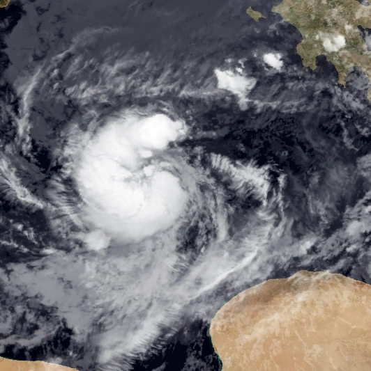
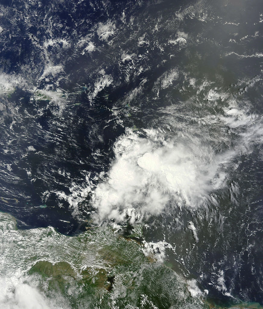
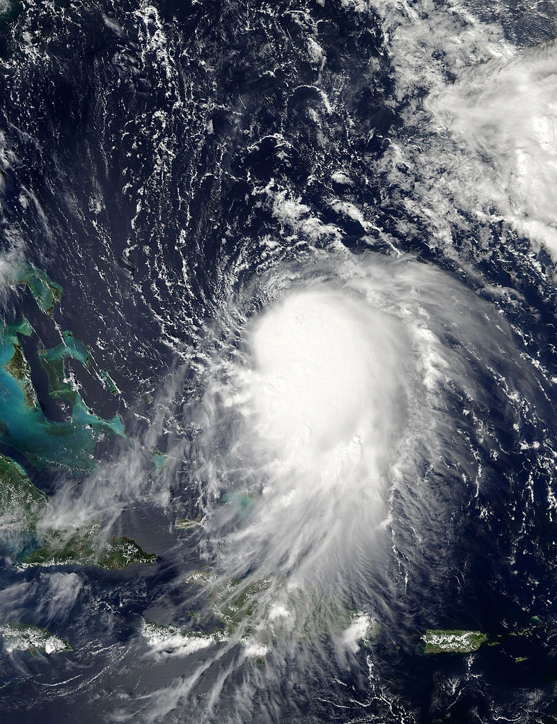
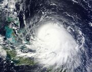
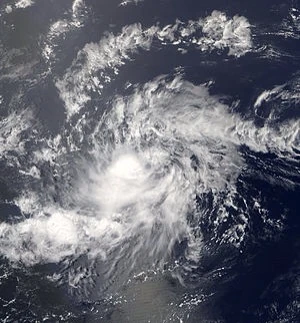
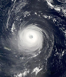
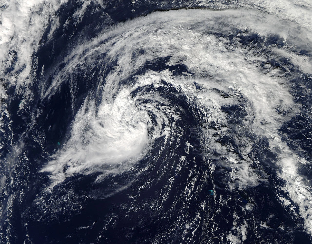
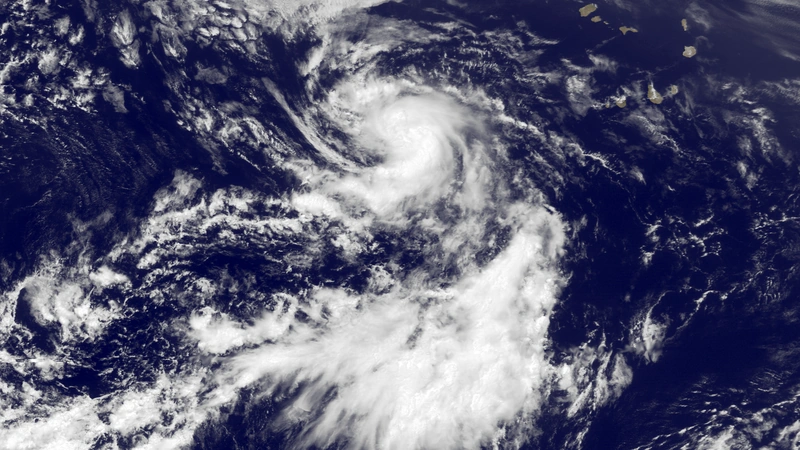
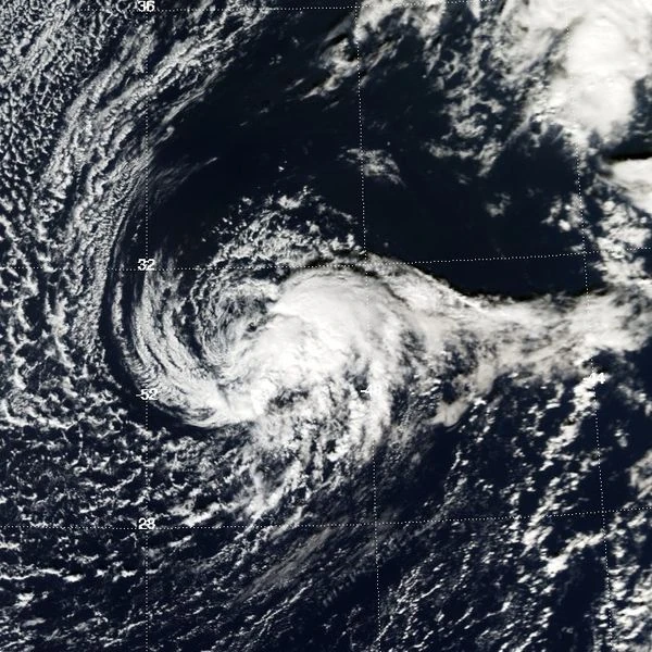
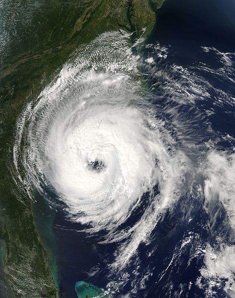
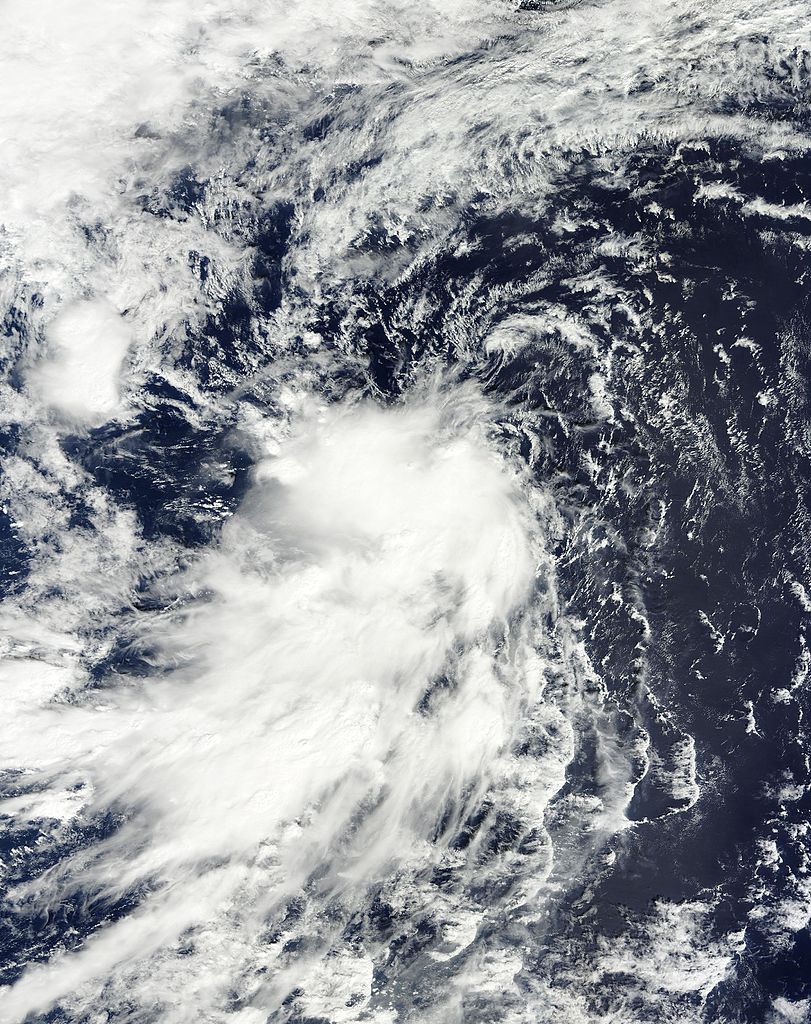
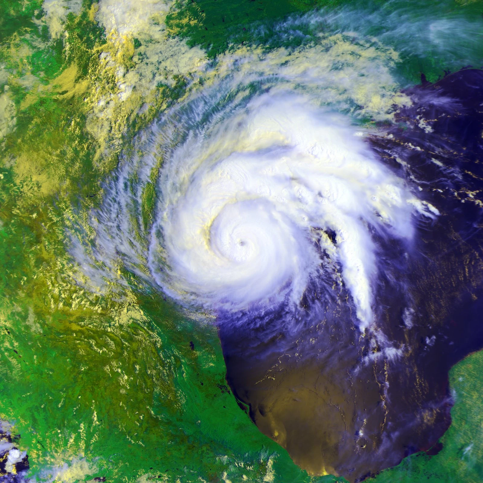
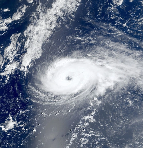
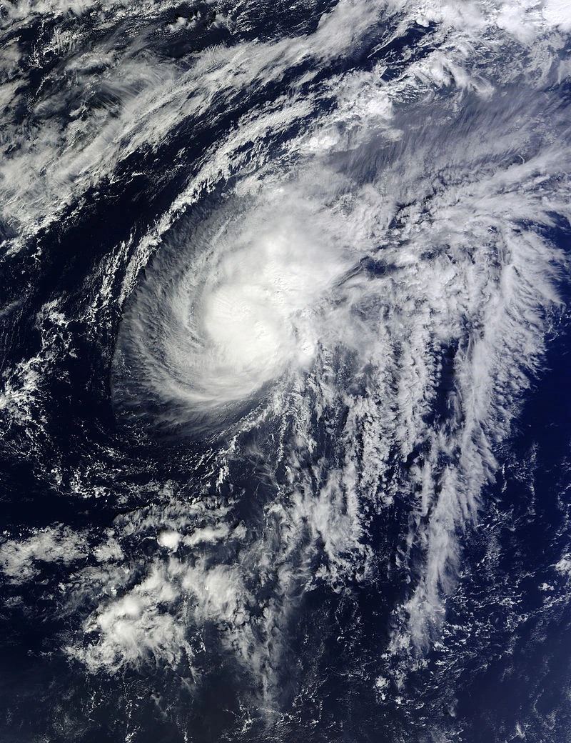
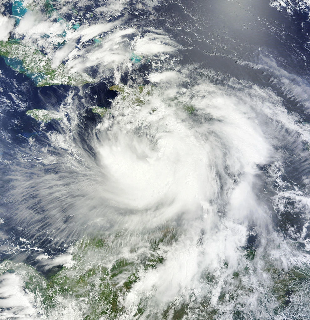
ISS View of Hurricane Keranique rapidly intensifying on February 2
Tropical Depression One formed on January 12, eventually slowly developing into Hurricane Bittersweet. On January 15, a weak and disorganized Tropical Storm Yolo formed near the Cape Verde Islands from the remnants of Tropical Storm Telamon in 2015, operationally, Yolo was thought to have been a new storm, however.
A trio of tropical storms formed the next day, Nuno, RAM and Keranique. Nuno rapidly dissipated two days later, and RAM dissipated 6 days later. Keranique, however, began to intensify, becoming the strongest storm of the season by late January. On January 30, another weak tropical storm, Matthew, developed southeast of Cape Verde, but struggled to intensify amongst dry air.
February[]

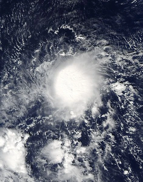
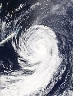
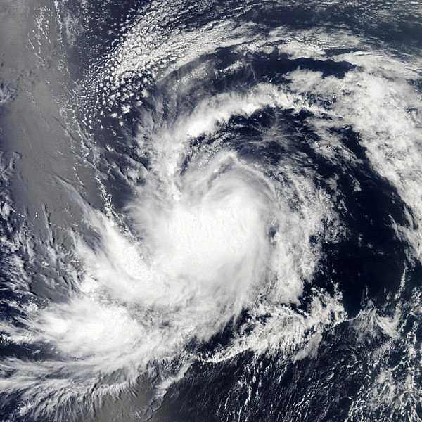
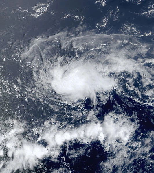
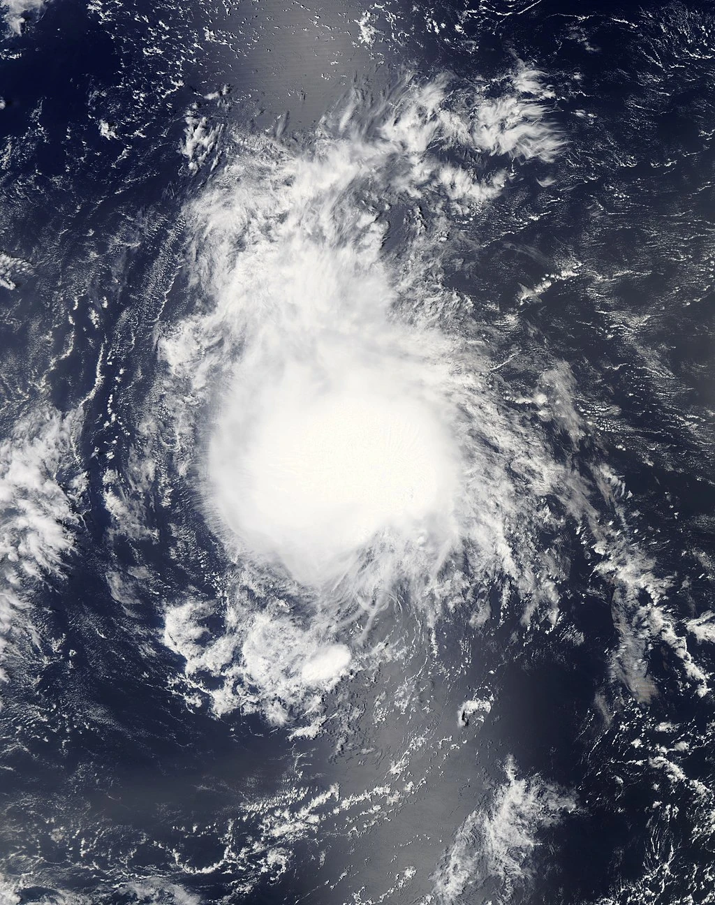
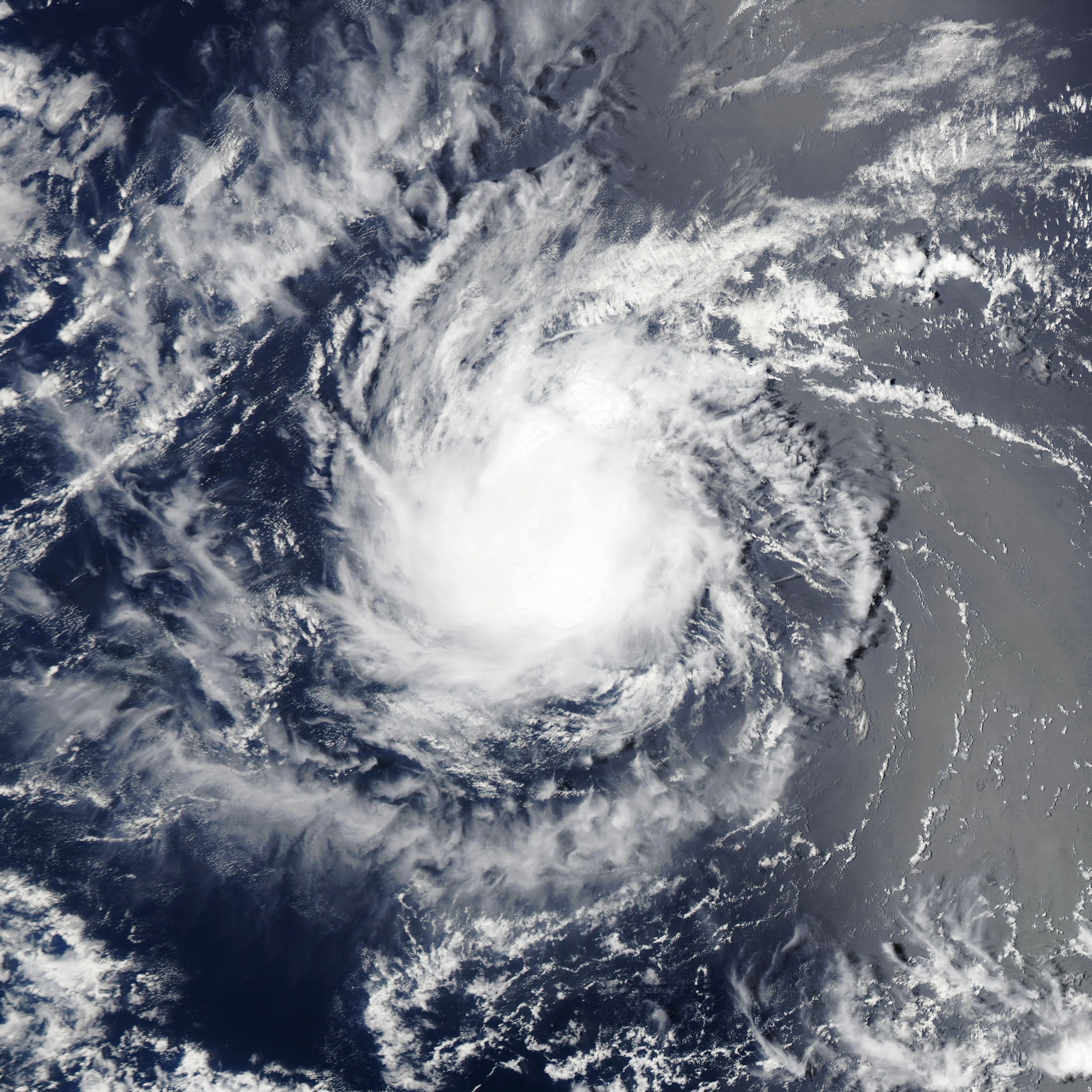
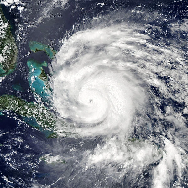
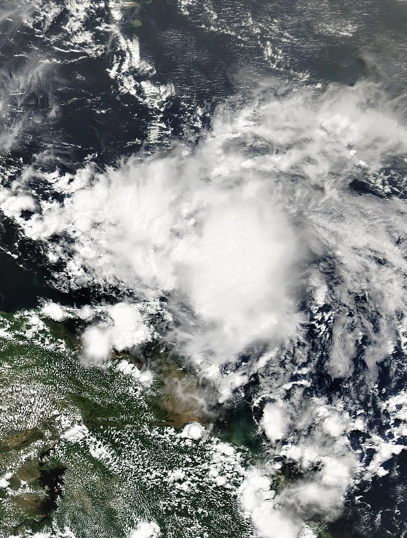
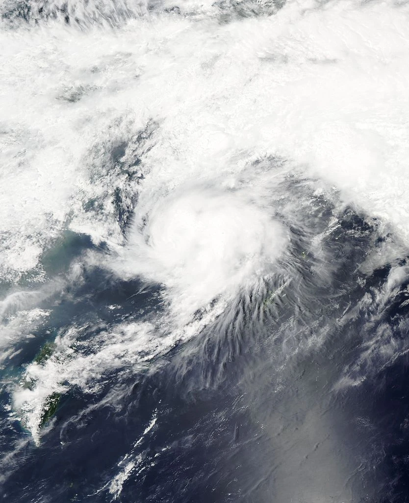
Tropical Storm Darren shortly after becoming a tropical storm, on February 13.
On February 1, Keranique was upgraded into a category 1 hurricane - effectively becoming the first hurricane of the season. Three days later, Bittersweet intensified into a category 1 storm, becoming the second hurricane of the season. In addition, Keranique was upgraded to a category 2 storm as it remained in a favorable environment. February did not feature as much activity as January due to increased wind shear and drier air than the previous month.
Nonetheless, on February 12, Tropical Depression Ten developed from an upper-level low northeast of the Bahamas. Ten would later intensify into Tropical Storm Darren. On February 15, Bittersweet was upgraded to a category 2 hurricane. On February 19, Tropical Depression Eleven developed southwest of the Cape Verde Islands.
March[]

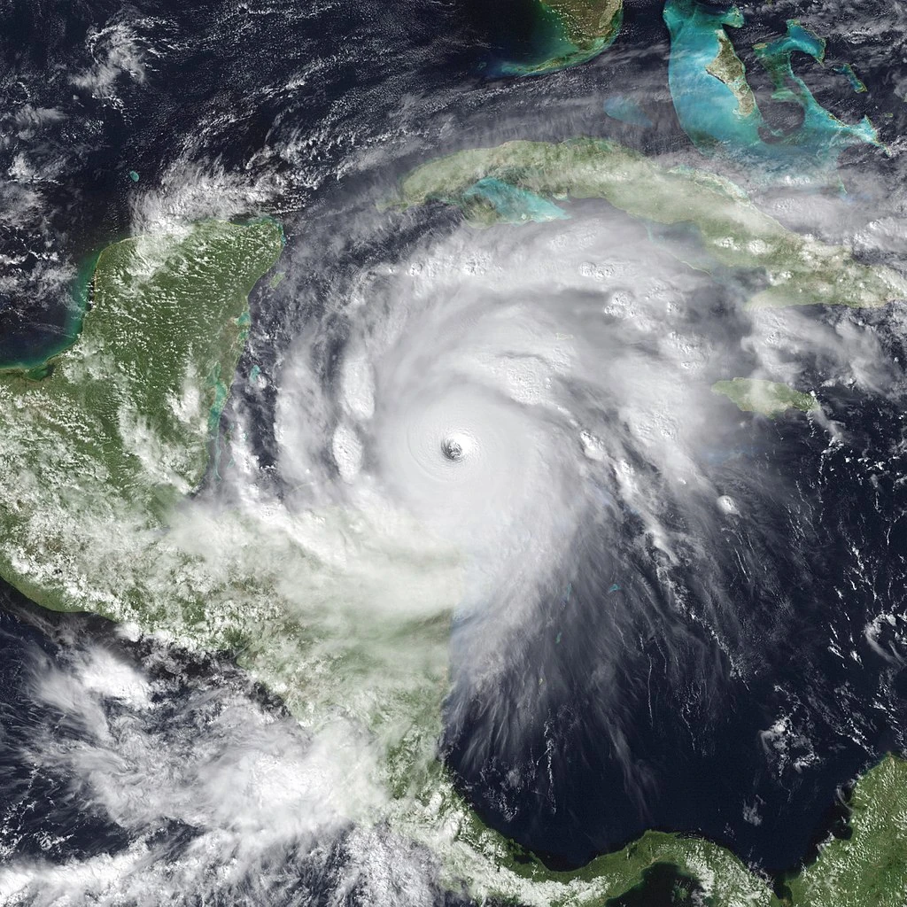
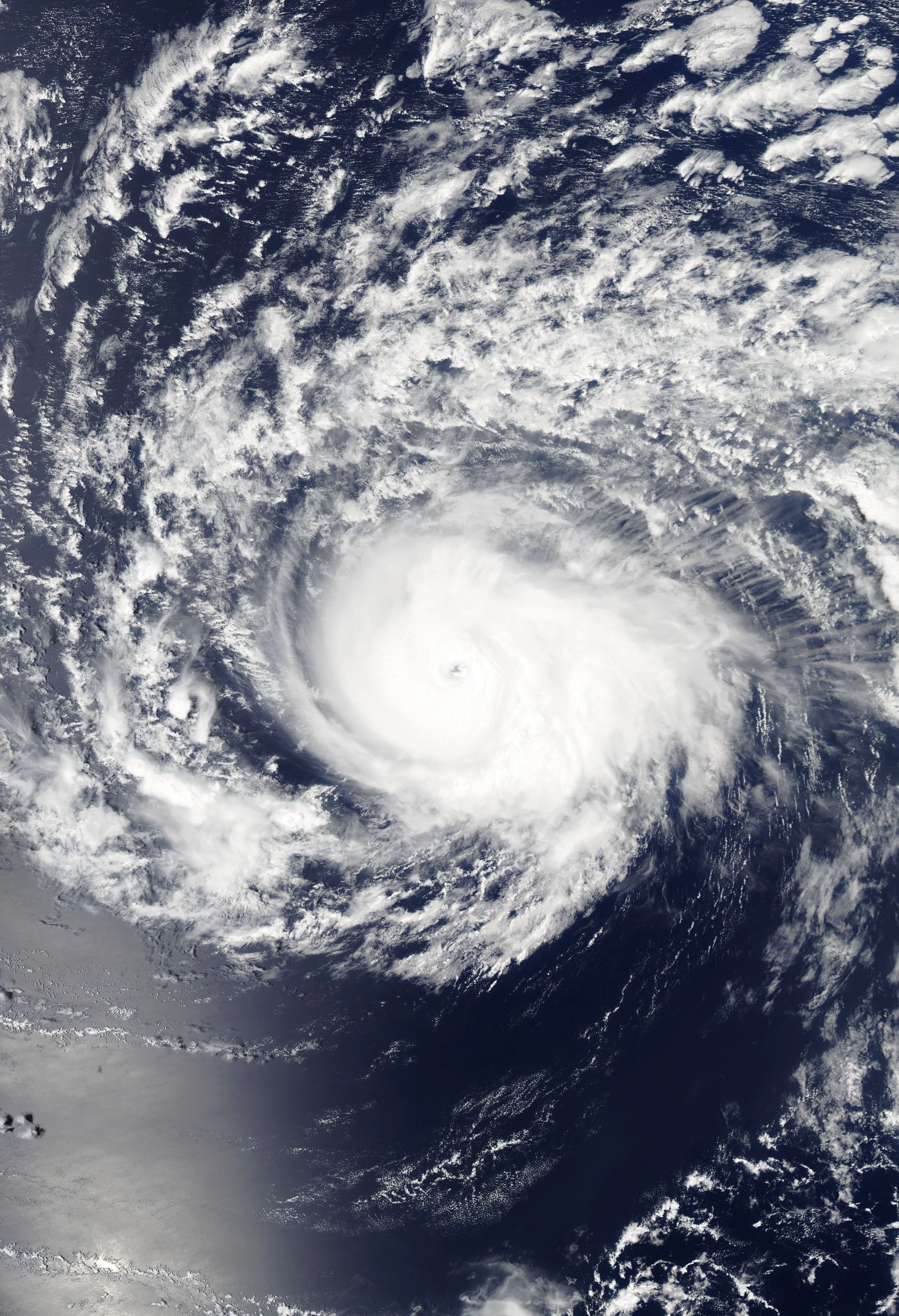
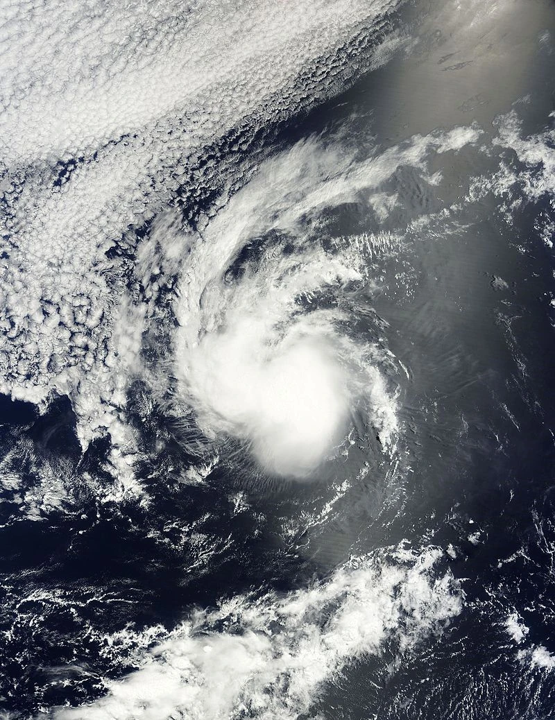
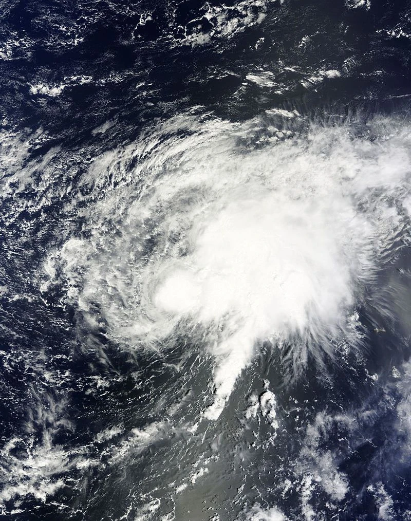
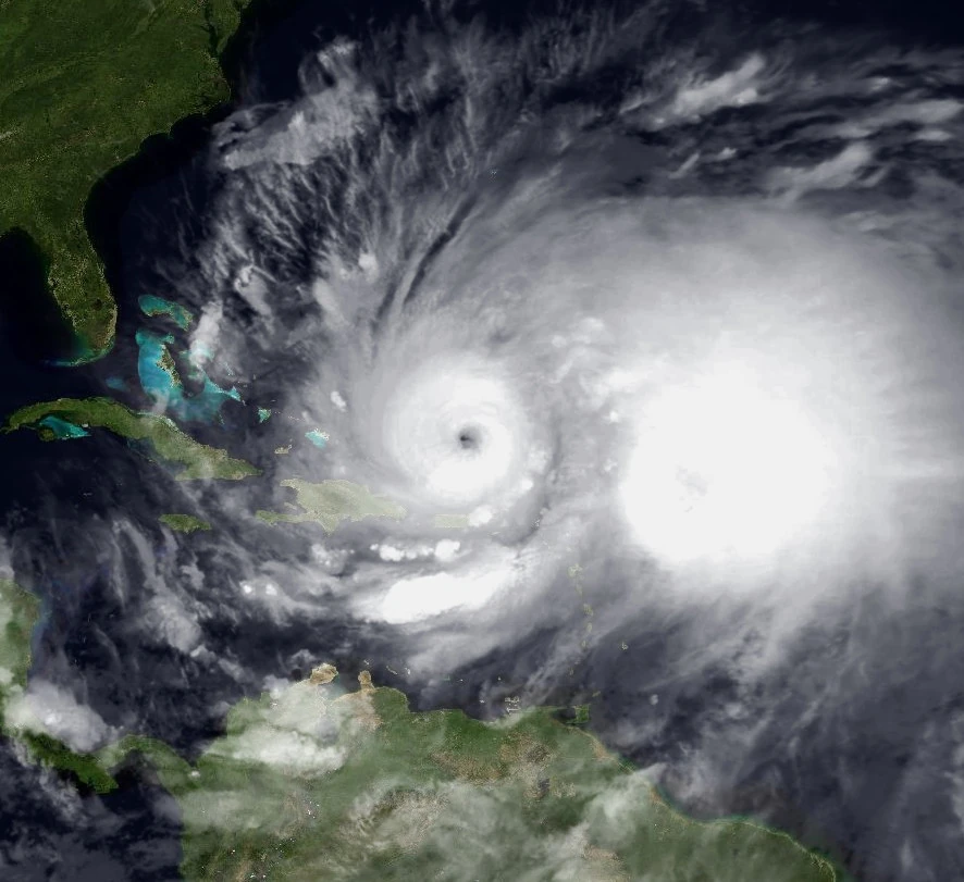
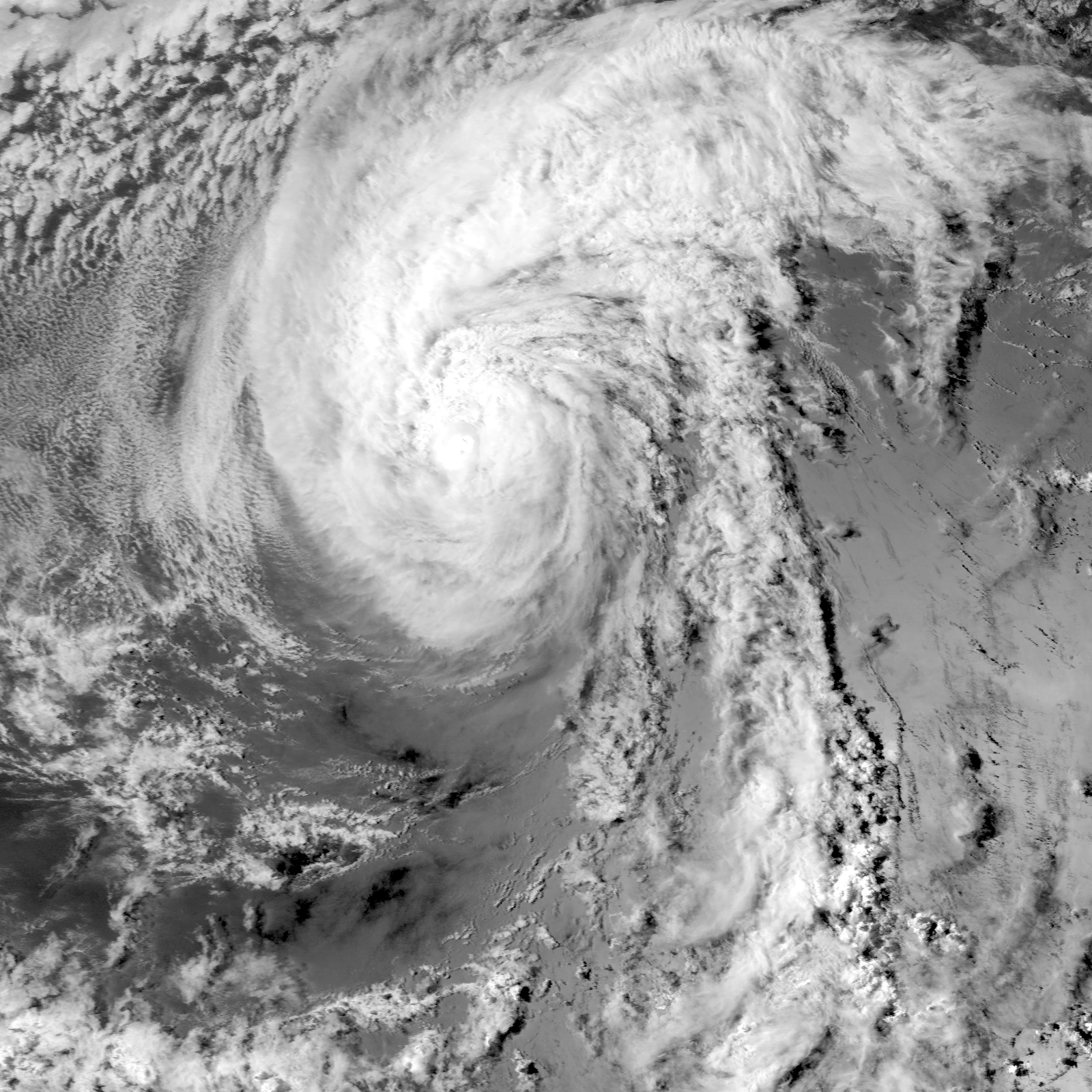
Hurricane Bittersweet intensifying on March 1.
March began with the unexpected regeneration of Nuno into a subtropical storm on March 1, south of the Azores. On March 2, both Hurricanes Bittersweet and Keranique intensified into category 3 major hurricanes - becoming the first two major hurricanes of the season. On March 4, Tropical Storm Darren intensified into a category 1 hurricane. Tropical quietude continued throughout March as high wind shear and low sea surface temperatures dominated. On March 15, Tropical Storm Destiny turned into an extratropical cyclone as it begun to track northward. On March 31, just one day after weakening to a tropical storm, Bittersweet turned extratropical. March passed without any new cyclones forming throughout the entire month. The inactivity in March was likely a result of strong wind shear and a positive phase of the North Atlantic Oscillation, which peaked in the third week of the month.
April[]
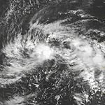
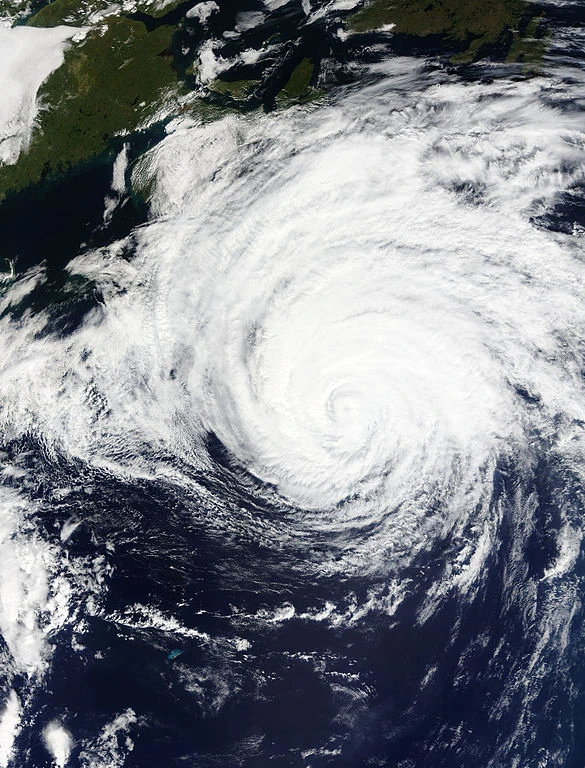
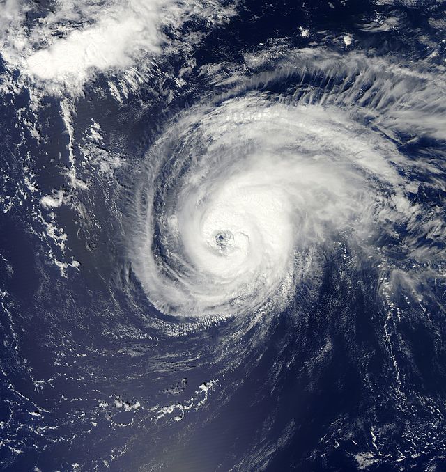
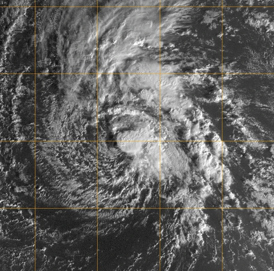
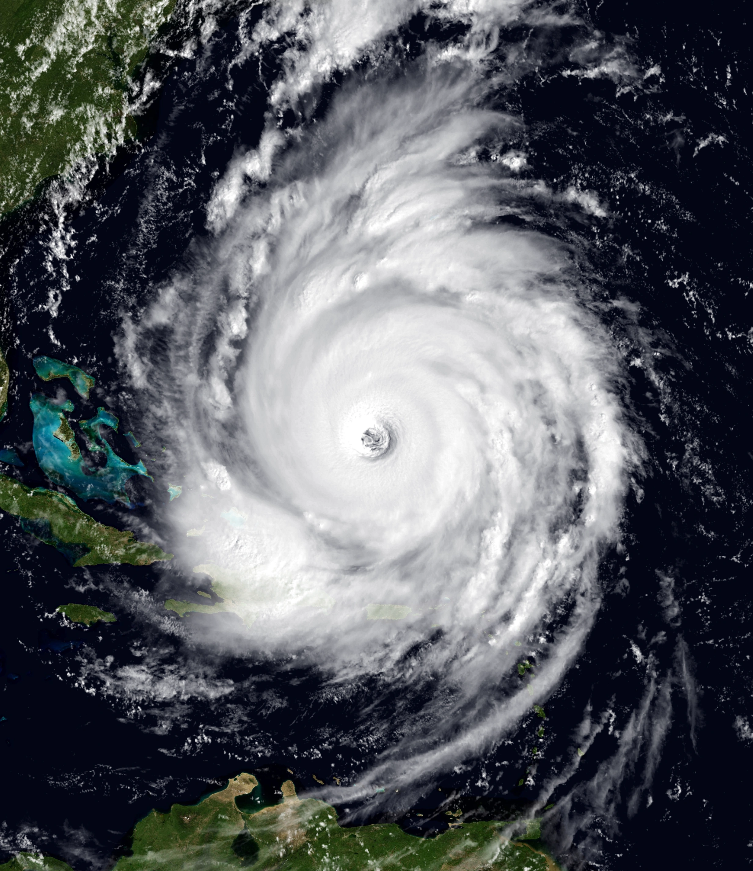
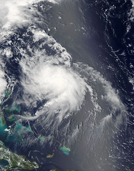
Hurricane Darren on April 3
On April 3, the extratropical remnants of Bittersweet made landfall near Newfoundland. The storm caused significant damage, and was re-assessed in post-analysis to have caused over $1 billion in damage. The +NAO pattern that dominated in March began to ease, allowing a more favorable environment for usercane development. Also on April 3, Tropical Depression Twelve formed from an invest that had actually formed in February, becoming a tropical storm hours later and receiving the name "Pearl". On April 9, Tropical Depression Thirteen formed east of Cape Verde, later developing into Tropical Storm David. On April 17, Tropical Depression Fourteen formed near Bermuda, followed by Tropical Depression Fifteen just the next day east of Cape Verde. Fourteen would later grow into Tropical Storm RS, while Fifteen would become Tropical Storm Chris; both storms would fail to last more than two weeks. On April 19, Subtropical Depression Sixteen formed in the Northern Atlantic and rapidly dissipated after just one advisory. On April 24, 2016, Tropical Depression Seventeen developed east of Cape Verde, which would later grow into Tropical Storm Orlando. On April 29, 2016, Hurricane Darren intensified into a category 3 major hurricane - the third major hurricane of the season. Also late that month, Subtropical Storm Nuno regenerated into a subtropical cyclone.
May[]

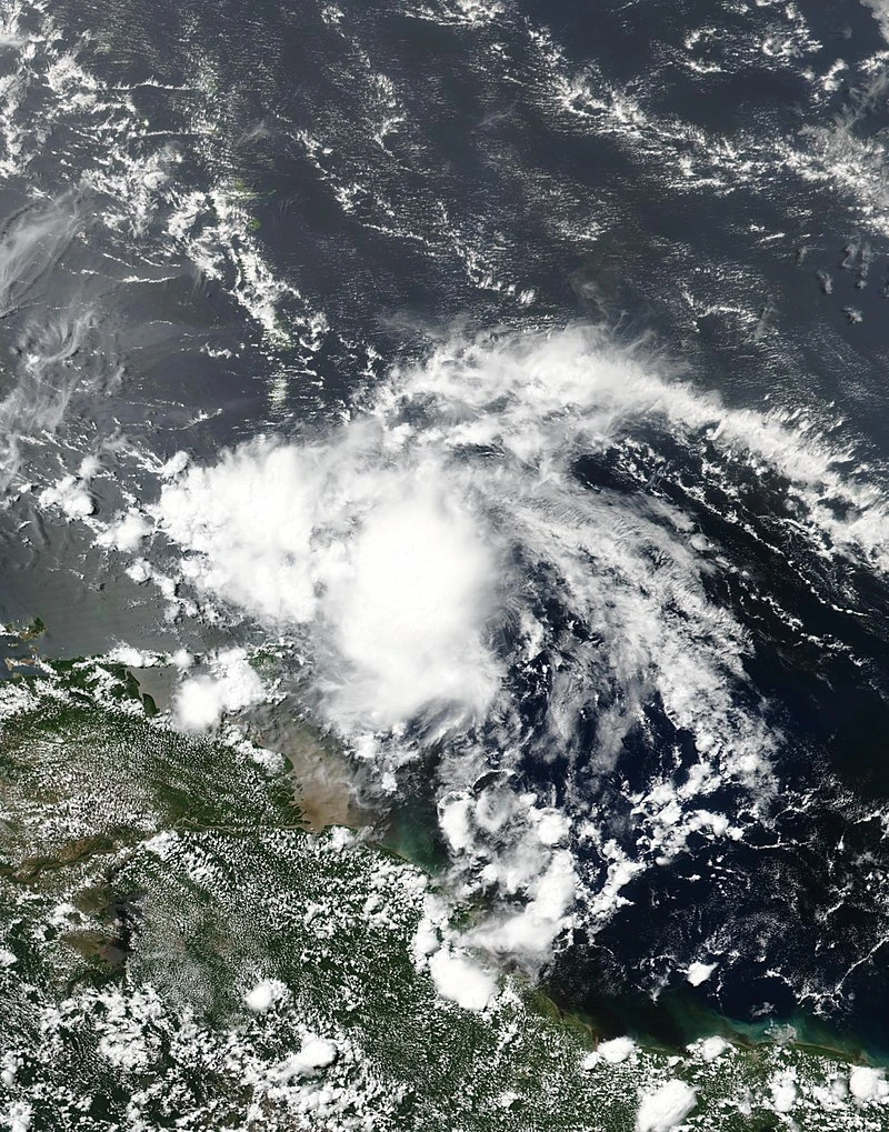
Tropical Storm James on May 31.
May started off quiet, with no new storms forming. On May 12, a weak Tropical Storm Lance developed North of the Lesser Antilles and struggled to intensify further. The following day, Hurricane Keranique became the season's first category 4 hurricane. However, on May 16, a tropical wave exited the coast of Africa and rapidly developed into Tropical Storm James. James rapidly intensified to near hurricane status by end of the month due to a well-defined structure. On May 25, Tropical Storm Orlando intensified into the season's fourth hurricane.
June[]
June blossomed with activity, with a multitude of tropical depressions developing into named storms. Tropical Depression Twenty persisted throughout the month, but fell just short of tropical storm status. On June 9, a tropical wave exited western Africa and organized into Tropical Depression Twenty-One. Twenty-One rapidly intensified into Tropical Storm Minecraft. Minecraft would later intensify into a strong tropical storm. Tropical Depression Twenty-Two formed on the same day, but dissipated after the initial advisory. Tropical Storm Thomas developed two days later east of the Windward Islands.
On June 12, an unnamed storm, which formed in the far northeastern Atlantic and later turned extratropical and made landfall in Europe, was found in post-analysis. The cyclone formed in between advisories and was already a non-tropical remnant low by the time it would have been classified. It was briefly tracked by the FMC, where it was labeled as "24L.NONAME", although no name was assigned for the storm, as it was thought the storm was extratropical when it was going to be assigned an name.
Activity simmered down thereafter, though Hurricane Orlando intensified into a category 2 storm, while Tropical Storm James rapidly intensified into the season's fifth hurricane on the same day of Tropical Storm Thomas' formation. Tropical cyclogenesis began once again on June 26, with Tropical Depression Twenty-Four becoming Tropical Storm Wiz. At the end of the month, the remnants of Tropical Storm Pearl regenerated into a weak subtropical depression, while Tropical Storm Nuno struck Portugal as a post-tropical cyclone.
July[]

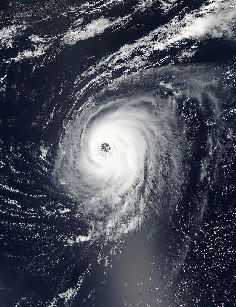
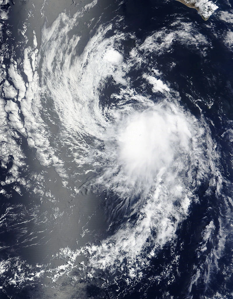
.jpg)
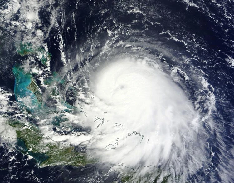
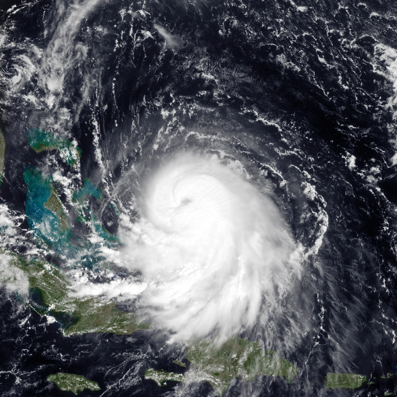
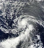
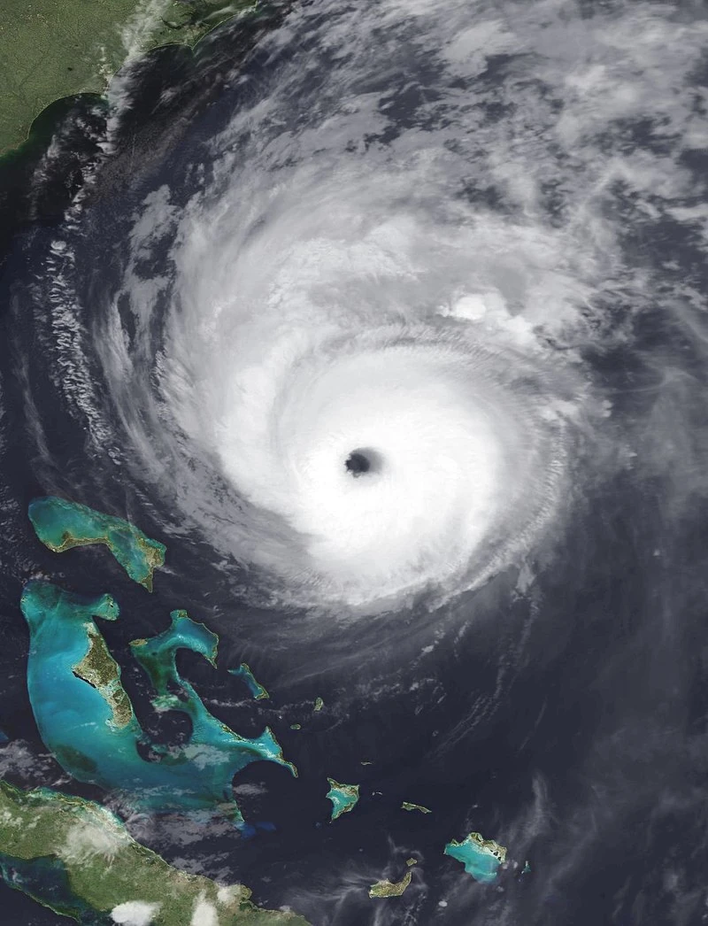
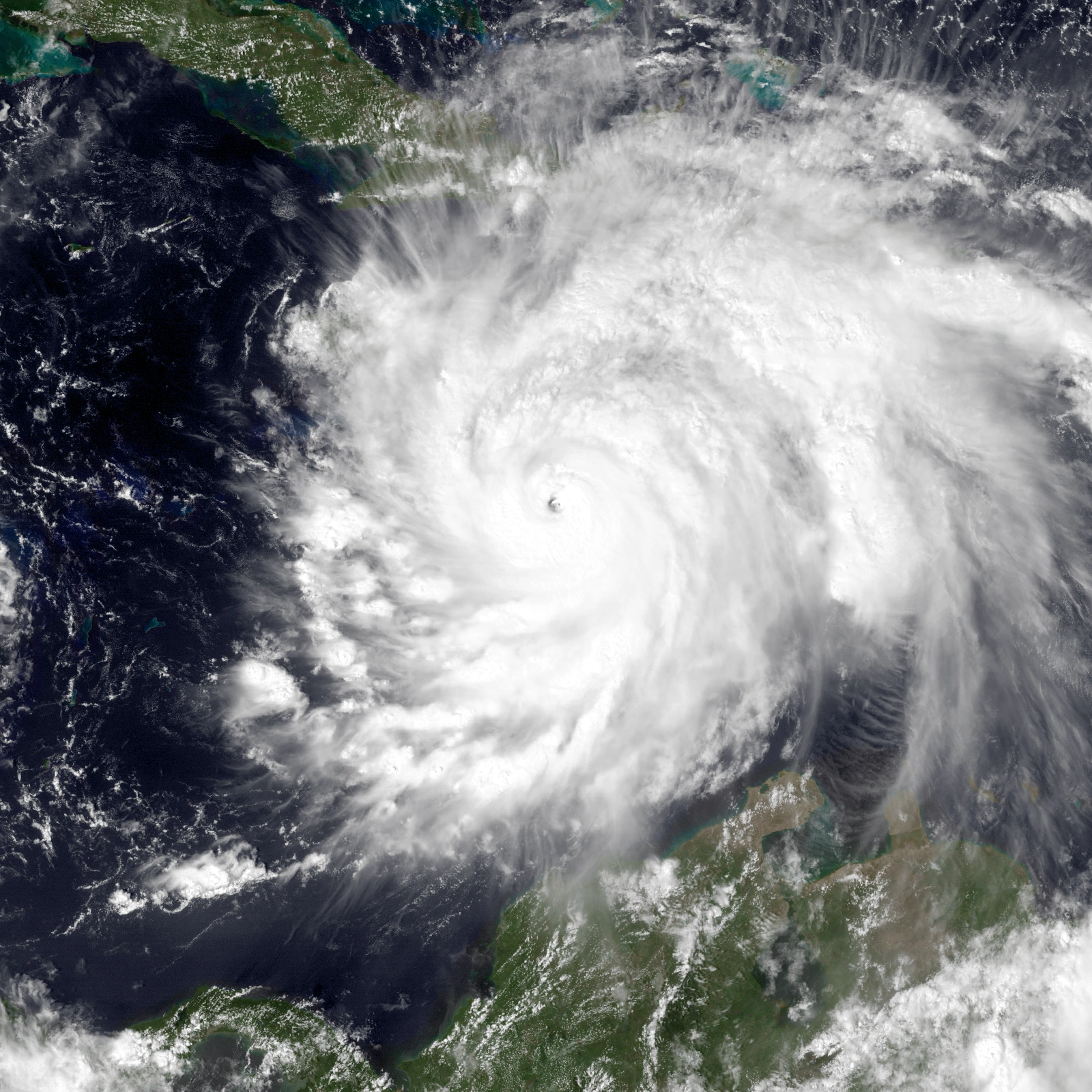
Orlando after reaching peak intensity on July 10.
July started off at a torrid pace, with Nuno re-attaining subtropical characteristics as it re-emerged into the subtropical Atlantic. On July 6, Tropical Depression Twenty-Six rapidly developed into Tropical Storm Garfield. The following day, Hurricane Darren intensified into a category 4 hurricane - the second of the season. Meanwhile, Hurricane James became a category 2 storm. On July 8, Hurricane Orlando intensified into the season's fourth major hurricane. Only three days later, Orlando intensified into the season's third Category 4 hurricane. Orlando later weakened to a tropical storm shortly thereafter, before explosively intensifying back into a Category 3 major hurricane again.
August[]
Early in the month, Tropical Depression Thirty intensified into Tropical Storm Derp, which would remain a weak tropical storm throughout the month. After the formation of Derp, Tropical Storm Lover would form, but would dissipate just days later. Tropical Depression Thirty-Two would also develop, but It would dissipate very quickly. The remnants of Tropical Storm Ram then spawned Tropical Storm Akio, which would remain a tropical storm throughout that month. Then, the final storm that month, Tropical Storm Brick, developed near Cape Verde. Late in the month, Brick became a severe tropical storm.
September[]
The first tropical cyclone of September developed on September 9 from a tropical wave that had moved off the coast of Africa a few days prior. This storm was designated as Tropical Storm Pastaroni just a few hours after formation. That same day, another weak tropical depression briefly attained tropical characteristics before dissipating by the next morning. On September 10, at approximately 17:00 UTC, Usercane Brick attained minimal hurricane status while quickly intensifying. The remnants of Tropical Storm Wiz regenerated not long after, and began strengthening. In the subtropical Atlantic, Nuno continued to struggle against intense wind shear, and on September 12 weakened to a weak tropical storm with a ragged satellite presentation.
October[]
Tropical Storm Moon formed in October alongside Tropical Storms Connor and Adam. Of these three, Moon was the longest-lived, remaining active until November. Major hurricane Mario also formed late in October. It would strengthen to become a category 3 major usercane and enter the 2017 season along with previous storms such as Keranique and Bittersweet. Hurricane Gary also formed in late October, also entering 2017.
November/December[]
November saw 2 new tropical userstorms. Hurricane Farm formed in early November and strengthened into a

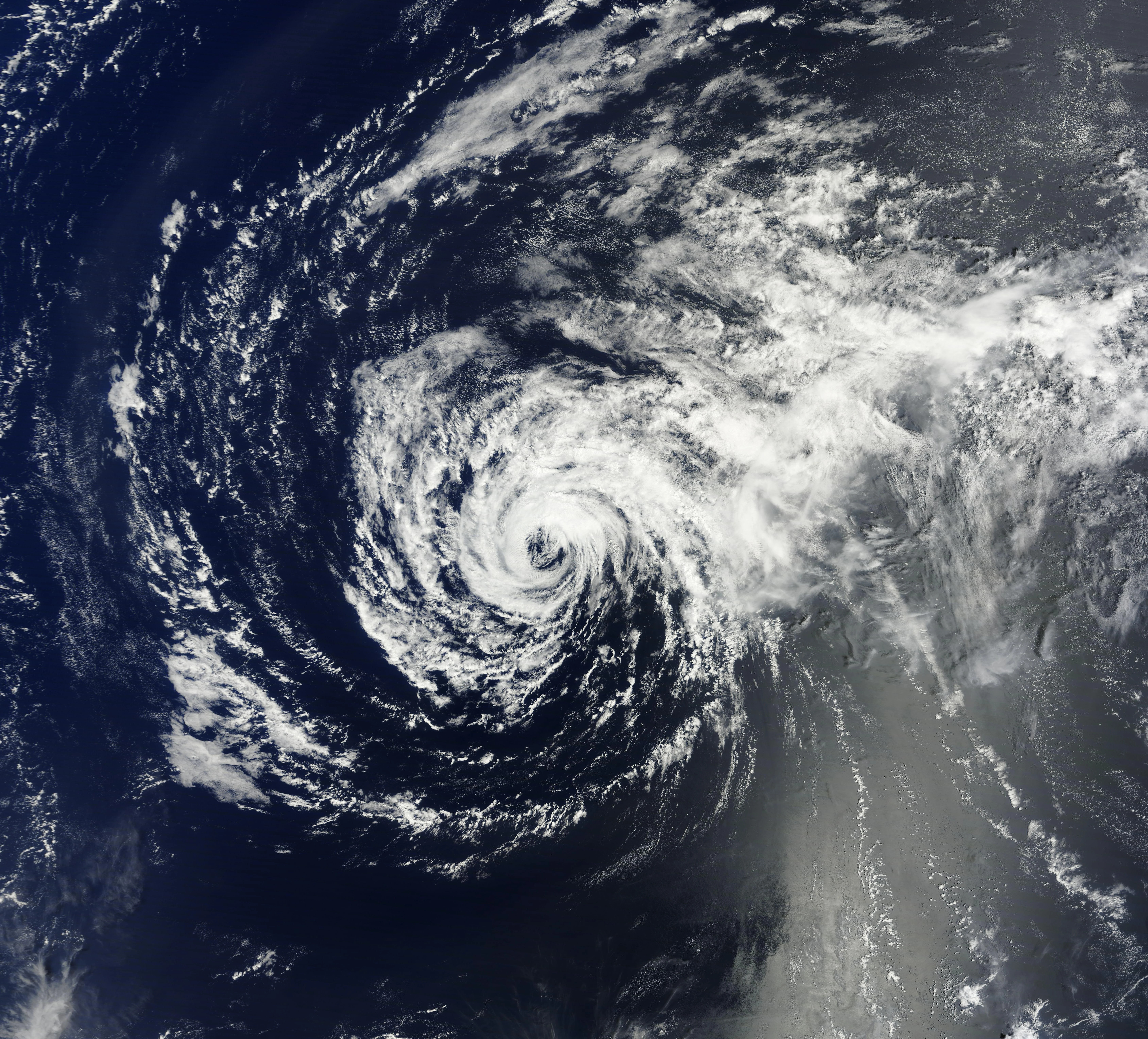
Tropical Userstorm Farm on December 20.
category 3 major usercane and entered the 2017 season. Tropical Storm Brony formed later in the month and entered the 2017 season with Farm.
The last tropical userstorm to develop was Tropical Storm NoJO. Forming in mid-December, it spent less of its time in the 2016 season as the 2017 began.
Timeline[]

Systems[]
|
Usercane Bittersweet (A Bittersweet Journey)[]
| Category 3 usercane (NUC) | |
| Category 3 hurricane (SSHWS) | |
  | |
| Duration | January 13 – March 31 |
|---|---|
| Peak intensity | 115 mph (185 km/h) (1-min) 965 mbar (hPa) |
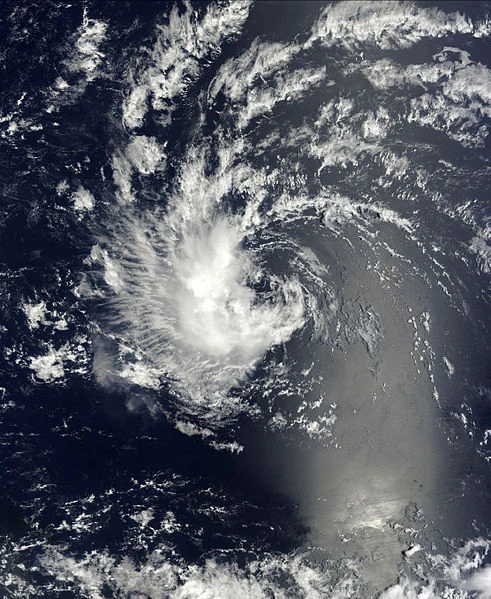
On January 8, a non-tropical low near Bermuda began to be monitored for possible tropical cyclogenesis. On January 13, it organized itself into Tropical Depression Two. Due to only marginally sufficient sea surface temperatures, Two was not initially expected to intensify beyond tropical storm status. Nonetheless, Two intensified to Tropical Storm "Bittersweet" in a special advisory in January 21. Bittersweet would further intensify to 45 mph shortly afterward. Due to a sudden lack of wind shear and warmer-than-normal sea surface temperatures, Bittersweet began to intensify in late January. On February 4, Bittersweet intensified into a category 1 hurricane. 11 days later on February 15, Bittersweet was upgraded to a category 2 storm. On February 29, in a favorable environment, Bittersweet intensified to 110 mph as the hurricane's core became increasingly well organized. On March 2, Bittersweet intensified into a category 3 major hurricane, the first of the season. Due to cooling sea surface temperatures, intensification was limited for Bittersweet. On March 30, Bittersweet rapidly weakened to a tropical storm due to increasing wind shear from nearby storms. On March 31, Bittersweet transitioned to an extratropical cyclone. The following day, the extratropical cyclone struck Newfoundland and resulted in widespread destruction. Bittersweet then dissipated shortly after.
Tropical Userpression Four (HurricaneHistory)[]
| Tropical depression (SSHWS) | |
  | |
| Duration | January 5 – January 15 |
|---|---|
| Peak intensity | 30 mph (45 km/h) (1-min) 1008 mbar (hPa) |
On January 3, the BNWC began monitoring a tropical wave located off the coast of West Africa. The wave briefly acquired tropical depression intensity on January 5, but was not operationally classified due to an apparent lack of a closed circulation. However, it degenerated into a remnant trough the next day. Due to dry air, the wave struggled to re-develop. However, on January 15, the low formed into Tropical Depression Four. It eventually degenerated into a trough of low pressure later that evening. On March 15, the remnants of Four pulled back together, and regeneration in May was predicted – although that did not happen.
Post-Analysis[]
In post-season analysis, it was discovered that Four actually was a weak 25 mph tropical depression for 24 hours beginning on January 5 and ending on January 6. Operationally, Four did not form until January 15, however. Its peak winds were also lowered from 35 to 30 mph, due to the fact that peak winds observed were in the 30-31 mph range.
Usercane RAM-Akio (AkioTheOne)[]
| Category 5 usercane (NUC) | |
| Category 5 hurricane (SSHWS) | |
 | |
| Duration | January 15, 2016 – Active |
|---|---|
| Peak intensity | 180 mph (285 km/h) (1-min) 893 mbar (hPa) |
In mid-January, a series of tropical waves rapidly developed west of Africa. One of them, the southernmost one, developed a closed circulation on January 15 and became Tropical Depression Five. Five would later strengthen into Tropical Storm RAM about 200 miles south-southeast of the Cape Verde islands. However, dry air and entertainment from the Saharan Air Layer caused RAM to rapidly weaken to a tropical depression by later that week. On January 22, RAM dissipated.
On August 10, RAM's remnants began circulation again, and developed into a tropical storm northeast of Puerto Rico, and the system was renamed Akio 2 days later, as forecasters thought Akio actually originated from a tropical wave that split (of which the northernmost part would develop into Tropical Storm Brick), and not RAM. The southern part would dissipate quickly, however forecasters thought that it did not dissipate and became Tropical Storm Akio. It wasn't until September 27 when the forecasters learned this, and the system was then renamed Hurricane RAM-Akio. A few days later, a convective blow-up happened near the storm's core, and RAM-Akio strengthened to 50 mph, based on Dvorak estimates. RAM-Akio had another convective blow-up on August 27, strengthening from 50 to 65 MPH. RAM-Akio slowly strengthened to 70 mph before weakening back to 65 mph. The weakening was only temporary, as RAM-Akio strengthened into the seasons eighth hurricane a week later.
RAM-Akio then continued its ways of slowly strengthening. On October 15, RAM-Akio reached Category 2 status, and on December 5, it became a major usercane. It then strengthened much faster, and on January 9, 2017, it reached Category 4 status. In May 2017, the winds in the center of RAM-Akio were measured at 135 knots, or 155 mph. RAM-Akio then began to stall, as multiple RECON missions were sent, but they did not find any indications that system fulfilled the threshold to be upgraded into a Category 5 major usercane. In Mid-July, RAM-Akio weakened back to 150 MPH, and over the next 2 weeks, refused to restrengthen. On August 4, a NUC Recon mission supported 155 MPH winds, and therefore RAM-Akio was upgraded back up to 155 MPH.
On October 30, 2017 a recon plane found 139 kt winds in the eyewall of Usercane RAM-Akio, supporting an upgrade to Category 5 status. RAM-Akio would eventually peak in 2018 with winds of 180mph and a minimum pressure of 893 millibars. Throughout late 2018 and early 2019, RAM-Akio began to weaken, and lost Category 5 status on April 1, 2019. On May 17, 2019, RAM-Akio explosively weakened back down to a Tropical Storm, and fully dissipated on July 16.
RAM-Akio regained Tropical Storm status on November 27, 2019, however would weaken back to a Tropical Depression in early 2020.
Reanalysis[]
During RAM's tropical cyclone reanalysis (TCR), it was discovered that RAM formed one day earlier, on January 15. It was operationally stated that RAM formed on January 16, however.
Tropical Userstorm Nuno (NunoLava1998)[]
| Tropical userstorm (NUC) | |
| Tropical storm (SSHWS) | |
  | |
| Duration | January 16 – January 11, 2017 |
|---|---|
| Peak intensity | 65 mph (100 km/h) (1-min) 991 mbar (hPa) |
In mid-January, a tropical wave split into two portions. The southern portion developed into Hurricane Keranique. The northern portion, however, took its own track, developing into Tropical Depression Six and eventually Tropical Storm Nuno on January 16. Nuno acquired peak winds of 40 mph before degenerating into a remnant low on January 18. The remnants of Nuno would remain weak for over a month before pulling itself together into a subtropical storm south of the Azores on March 1. Several days later, Nuno weakened into a subtropical depression. Nuno then transitioned back into a non-tropical trough of low pressure. On April 28, 2016, Nuno once again regenerated into a subtropical depression, later becoming a subtropical storm. On May 7, Nuno once again became fully tropical as it hit a new peak intensity. However, on June 10, Nuno became subtropical once again. Nuno would continue to fluctuate in intensity over coming weeks, eventually being declared post-tropical on June 29 while brushing Portugal. Several days later, Nuno re-attained subtropical characteristics. On July 31, a recon mission found Nuno had 60 mph constant winds and a minimum central pressure of 995 mb. On the same day, review of satellite imagery found Nuno fully tropical. Nuno then strengthened into its peak intensity of 65 mph by the middle of August 2016. However, Nuno began to reacquire subtropical characteristics by mid-September 2016 and weakened slightly. Nuno then accelerated northeast and made landfall in Portugal on October 26, 2016. Nuno then re-emerged into the Atlantic in December 2016 and regenerated into a weak subtropical storm one last time. Nuno then turned back eastward, and made a second Portugal landfall on January 11, 2017. Nuno dissipated later that day.
Usercane Keranique (AGirlCalledKeranique)[]
| Category 5 usercane (NUC) | |
| Category 5 hurricane (SSHWS) | |
  | |
| Duration | January 16, 2016 – Currently active |
|---|---|
| Peak intensity | 165 mph (270 km/h) (1-min) 921 mbar (hPa) |
The origins of Hurricane Keranique were traced back to a tropical wave that developed over central Africa on December 22, the northern portion of which would produce Tropical Storm Nuno, and the southern portion of which would produce Tropical Storm RAM. Moving very slowly over land, the wave exited the African coast, and the NUC noted it had a 40% chance of developing. It developed enough convention, and was classified as Tropical Depression Seven. An ASCAT pass later detected tropical-storm force winds in the storm, and this was upgraded into a tropical storm, receiving the name "Keranique".
Keranique steadily started to intensify, becoming 60 mph a week later, and later having 70 mph on February 1. On the same day, Keranique intensified into a Category 1 hurricane, the first of the season. Due to unusually warm SST's that existed southwest of Cape Verde and unusually low shear, Keranique rapidly strengthened into a Category 2 hurricane located around 124 miles south-southwest of Cape Verde. Only marginal favorable conditions were in Keranique's way after that day until March 2, where Keranique, along with Usercane Bittersweet, intenfisied both into major hurricanes, Keranique being the second of the season. On May 13, Keranique intensified into the first category 4 hurricane of the season. To date, Keranique remains active, having attained a new peak intensity of 150 mph. At this point, forecasters from the NUC, FMC and the CDMC, in addition to the SMWUPC and HTMCUPC, predicted that Keranique will attain category 5 status late in the forecast period. Keranique still remains the season's the strongest storm to date. On September 23, Keranique intensified to a Category 5 hurricane, the first of the season. Keranique then reached its peak intensity a few months later with maximum winds of 165 mph. However, by early 2017, Keranique began to lose a lot of its central convection, and explosive weakening occurred. On February 16, Keranique weakened to a tropical userstorm, and weakened to a remnant low shortly after. Keranique remains active as a remnant low.
Tropical Userstorm Matthew (NY WX)[]
| Tropical userstorm (NUC) | |
| Tropical storm (SSHWS) | |
  | |
| Duration | January 30 – February 2 |
|---|---|
| Peak intensity | 40 mph (65 km/h) (1-min) 1003 mbar (hPa) |
In late January, a tropical wave formed 242 miles east of Sierra Leone. The wave eventually became Tropical Depression Eight on January 30 and soon strengthened into a tropical storm, being named "Matthew", at 7.3°N and becoming the southernmost named usercane on record. Matthew then dissipated on February 2 after failing to intensify beyond minimal tropical storm status.
Subtropical Userstorm Callum (Callum Fawsitt)[]
| Subtropical storm (SSHWS) | |
  | |
| Duration | February 4 – August 6 |
|---|---|
| Peak intensity | 40 mph (65 km/h) (1-min) 1005 mbar (hPa) |
In early January, the BNWC began monitoring a non-tropical low near Bermuda, for possible tropical or subtropical cyclogenesis. Conditions were initially unfavorable for development. Nonetheless, the low became Subtropical Storm Callum on February 4. Callum has continued to meander around the central Atlantic as a weak subtropical storm for over a month. In mid-March, Callum weakened to a subtropical depression. On April 8, Callum re-intensified back into a subtropical storm. Callum would persist through coming months, despite unfavorable conditions, fluctuating in intensity. On early August, however, Callum unexpectedly raced north and made landfall in Newfoundland, transitioning into a post-tropical cyclone, before later dissipating.
Usercane Darren (DarrenDude)[]
| Category 5 usercane (NUC) | |
| Category 5 hurricane (SSHWS) | |
  | |
| Duration | February 12 – March 21, 2017 |
|---|---|
| Peak intensity | 165 mph (270 km/h) (1-min) 918 mbar (hPa) |
On February 12, a new tropical depression formed northeast of the Bahamas. The next day it intensified into Tropical Storm Darren. Darren would slowly intensify during the next few weeks. On March 4, Darren intensified into a category 1 hurricane. Darren later further intensified into a category 2 hurricane late that month. A temporary collapse of deep convection in April caused forecasting groups to briefly forecast weakening of Darren. However, the hurricane's eye cleared out later that month. On April 29, 2016, Darren became a category 3 major hurricane, the third major hurricane of the season. After maintaining intensity for several months, Darren eventually acquired Category 4 status on July 7, the second category 4 storm of the season. On January 23, 2017, after remaining nearly steady in intensity for several months again, Darren finally strengthened into a category 5 storm. On March 21, Darren accelerated northeastwards, became the northernmost Category 5 usercane on record, explosively weakened and became extratropical.
Tropical Userpression Eleven (YogeetaALT5)[]
| Tropical depression (SSHWS) | |
  | |
| Duration | February 19 – March 29 |
|---|---|
| Peak intensity | 35 mph (55 km/h) (1-min) 1009 mbar (hPa) |
On February 14, the BNWC began monitoring a new invest east of Cape Verde. On February 19, tropical depression Eleven formed about 100 miles southwest of Cape Verde. Shortly after forming, Eleven began to weaken as it turned northwestward. On March 29, Eleven dissipated, becoming the second storm of the season to not strengthen past tropical depression intensity. The extratropical remnants of Eleven made landfall in Africa, causing minimal damage.
Tropical Userstorm Pearl (Bluepearl6660)[]
| Tropical userstorm (NUC) | |
| Tropical storm (SSHWS) | |
 | |
| Duration | February 20, 2016 – November 22, 2017 |
|---|---|
| Peak intensity | 60 mph (95 km/h) (1-min) 992 mbar (hPa) |
On February 20, a tropical wave began to move off the coast of Africa. Moving very slowly, the wave struggled to intensify due to dry air. Nonetheless, on April 3, the wave developed into Tropical Depression Twelve, intensifying to Tropical Storm Pearl hours later, becoming the first storm in over 6 weeks to form. Pearl would later peak with 60 mph winds, eventually unexpectedly dissipating into a remnant trough due to dry air entrainment. In late June, Pearl regenerated as a subtropical depression.
Tropical Userstorm David (Wafflemaster135)[]
| Tropical userstorm (NUC) (SSHWS) | |
| Tropical storm (SSHWS) | |
 | |
| Duration | April 10 – May 13 |
|---|---|
| Peak intensity | 45 mph (75 km/h) (1-min) 1004 mbar (hPa) |
Around 18:00 UTC April 9, a tropical wave was noted about 250 miles east of Cape Verde Islands. The next day, it intensified into Tropical Depression Thirteen at 00:00 UTC on April 10. A few hours later, Thirteen intensified into Tropical Storm David. Initially favorable conditions were expected to allow intensification, and David was at one point expected by the NUC to become a hurricane. Struggling to intensify amongst the Saharan Air Layer, David weakened to a Tropical Depression on April 16 in its possible final advisory. David re-strengthened back to a tropical storm on May 13. However, the regeneration was short-lived, as David almost immediately degenerated back into an open trough.
Tropical Userstorm RS (Rs1010)[]
| Tropical userstorm (NUC) (SSHWS) | |
| Tropical storm (SSHWS) | |
 | |
| Duration | April 17 – April 23 |
|---|---|
| Peak intensity | 40 mph (65 km/h) (1-min) 1009 mbar (hPa) |
On April 17, a tropical wave rapidly developed into Tropical Depression Fourteen. Advisories were then initiated for the depression the following day. Briefly, Tropical Depression Fourteen intensified into Tropical Storm RS, before weakening back to a tropical depression. RS dissipated on April 23 as dry air became entrained in its circulation.
Subtropical Userpression Sixteen (StarmanW)[]
| Subtropical depression (SSHWS) | |
 | |
| Duration | April 19 – April 19 |
|---|---|
| Peak intensity | 30 mph (45 km/h) (1-min) 1014 mbar (hPa) |
On April 19, an extratropical cyclone near the Azores briefly gained subtropical characteristics for six hours as a subtropical depression, the sixteenth of the year. Just afterward, it degenerated into a remnant non-tropical low pressure area.
Usercane Orlando (Adolf Coffee; formerly Njsupercane1)[]
| Category 4 usercane (NUC) | |
| Category 4 hurricane (SSHWS) | |
 | |
| Duration | April 24, 2016 – March 19, 2017 |
|---|---|
| Peak intensity | 130 mph (215 km/h) (1-min) 965 mbar (hPa) |
On April 10, a tropical wave exited the coast of Africa. On April 23, a burst of convection caused the BNWC to begin monitoring it for development. However, a collapse in convection due to moderate wind shear nearly caused the storm to dissipate. However, the wave improved its organization. 2 days later on April 25, it developed into Tropical Depression Seventeen just south-southeast of Cape Verde. On April 27, while located just south of Cape Verde, the low strengthened into Tropical Storm Orlando. On May 25, Orlando intensified into a category 1 hurricane, the fourth hurricane of the season. Orlando intensified further, later becoming the season's fourth major hurricane on July 8. Unexpectedly, on July 10, Orlando intensified into a Category 4 major hurricane, the third of the season. However, several days later, Orlando's eyewall collapsed, resulting in explosive weakening to a tropical storm. However this eyewall collapsation was due to an unstable eyewall replacement cycle and after the storm further organized, Orlando went under rapid intensification back into a major hurricane.
Tropical Userstorm Lance (Monsterjam19)[]
| Tropical userstorm (NUC) (SSHWS) | |
| Tropical storm (SSHWS) | |
 | |
| Duration | May 12 – May 25 |
|---|---|
| Peak intensity | 45 mph (75 km/h) (1-min) 1007 mbar (hPa) |
On May 12, an upper-level low developed into a tropical storm, and was named "Lance." Lance shortly afterwards acquired a peak intensity of 45 mph. The depression lost its closed circulation and degenerated into a trough on May 25.
Usercane James (Money Hurricane)[]
| Category 5 usercane (NUC) | |
| Category 5 hurricane (SSHWS) | |
 | |
| Duration | May 16 – December 16, 2020 |
|---|---|
| Peak intensity | 180 mph (290 km/h) (1-min) 898 mbar (hPa) |
On May 16, a tropical wave exited the coast of Africa and rapidly developed into a Tropical Storm the next day. The system rapidly expanded in size, and was named "James" by the National Usercane Center. A small eye rapidly appeared, and on June 11, James strengthened into a category 1 hurricane. James continued to rapidly intensify, attaining Category 2 status on July 7. James explosively intensified on July 30th, and on July 31st James became a category 3 hurricane, thus becoming the 5th major of the season. James is also one of the largest category 3 hurricanes on record. On August 17, 2016, James was upgraded into a Category 4 major hurricane, becoming the 4th category 4 hurricane of the season. James reached Category 5 usercane status on March 14, 2017, and maintained this status until February 21, 2020, when it explosively weakened to a tropical userstorm. Somewhat unexpectedly, James explosively intensified back to a Category 5 usercane on March 21, 2020, maintaining minimal Category 5 usercane status until it explosively weakened to a tropical userstorm yet again on December 16, 2020. James then promptly dissipated, and is currently active as a remnant low.
Usercane Jake (TheHurricaneGod)[]
| Category 1 usercane (NUC) | |
| Category 1 hurricane (SSHWS) | |
 | |
| Duration | June 7, 2016 – May 27, 2020 |
|---|---|
| Peak intensity | 80 mph (130 km/h) (1-min) 986 mbar (hPa) |
On June 7, a tropical wave in the Bay of Campeche unexpectedly strengthened into Tropical Depression Twenty. The cyclone dissipated on June 23 amid a dry and stable environment in the southern Bay of Campeche. However, at 5:00 UTC on July 19, the remnants of TD Twenty regenerated into a tropical storm, being named "God.". In July 31, however, God would weaken into a remnant low. It would regenerate on October 2, but would again weaken into a remnant low on October 21. In June 20, 2017, however, God regenerated again and would eventually become a tropical storm. This time, to avoid controversy, the NUC renamed the storm "Jake". Jake would then intensity into a 50 mph storm. On September 17, 2017, Jake intensified into a Category 1 Usercane. However, shear weakened it to Severe Tropical Storm, and Tropical Storm thereafter. It regained usercane status on late-April and maintained minimal usercane status for several weeks. On June 2, Jake suddenly dissipated and was absorbed into Usercane Bob. Jake regenerated in October 2018, but did not exceed tropical userstorm intensity before making landfall over southeastern Florida on June 15, 2019. Jake then regenerated once again off the Gulf Stream on January 21, 2020, and dissipated on May 27, as it encountered strong wind shear.
Usercane Minecraft (Minecraft8369)[]
| Category 4 usercane (NUC) | |
| Category 4 hurricane (SSHWS) | |
 | |
| Duration | June 9, 2016 – Currently active |
|---|---|
| Peak intensity | 145 mph (230 km/h) (1-min) 936 mbar (hPa) |
On June 9, a tropical wave southeast of Cape Verde rapidly developed into Tropical Depression Twenty-One. Twenty-One quickly intensified into a tropical storm and was named "Minecraft." Initially, very favorable conditions were expected to allow Minecraft to intensify into a hurricane, with a few organizations even predicting major hurricane intensity. However, convection waned the next month after peaking as a strong tropical storm and slight weakening began by mid-July. Minecraft then started to strengthen again, and then surpassed its first peak. Minecraft then became the seventh hurricane of the season. Favorable conditions allowed Minecraft to further intensify. Eventually, Minecraft became the seventh major hurricane of the season.
Tropical Userpression Twenty-Two (Omar.j.roldan)[]
| Tropical depression (SSHWS) | |
 | |
| Duration | June 9 – June 10 |
|---|---|
| Peak intensity | 30 mph (45 km/h) (1-min) 1013 mbar (hPa) |
Tropical Storm Thomas (ThomasX43/ThomasX64)[]
| Severe tropical userstorm (NUC) | |
| Tropical storm (SSHWS) | |
 | |
| Duration | June 20, 2016 – March 7, 2018 |
|---|---|
| Peak intensity | 65 mph (100 km/h) (1-min) 998 mbar (hPa) |
On June 11, yet another tropical wave exited the African Coast and developed into Tropical Storm Thomas. Thomas has very slowly intensified.
Unnamed Tropical Userstorm (Dv6615517)[]
| Tropical storm (SSHWS) | |
 | |
| Duration | June 12 – June 12 |
|---|---|
| Peak intensity | 45 mph (75 km/h) (1-min) 1005 mbar (hPa) |
As part of post-analysis, it was determined an unnamed tropical storm formed in the far northeastern Atlantic on June 12 for just a few hours. It turned extratropical and made landfall in Europe. The cyclone formed in between advisories and was already a non-tropical remnant low by the time it would have been classified.
The storm was tracked by the FMC, but was never assigned a name because it was originally believed the storm was actually extratropical. Regardless, it was labeled "24L.NONAME" by the FMC forecast models, "PLS" and "DRAMA".
Tropical Userstorm Wiz-Alpha (HurricaneWiz/HurricaneAlpha96)[]
| Tropical userstorm (NUC) | |
| Tropical storm (SSHWS) | |
 | |
| Duration | June 26, 2016 – Currently Active |
|---|---|
| Peak intensity | 60 mph (95 km/h) (1-min) 992 mbar (hPa) |
On June 26, a tropical depression developed from a tropical wave off the coast of Africa. It soon upgraded to a tropical storm and received the name Wiz. It dissipated in December 2016, but reformed in late 2017, and was renamed Alpha.
Tropical Userstorm Missouri (MissouriBear)[]
| Tropical userstorm (NUC) | |
| Tropical storm (SSHWS) | |
 | |
| Duration | July 2 – July 2 |
|---|---|
| Peak intensity | 40 mph (65 km/h) (1-min) 1008 mbar (hPa) |
Usercane Garfield (MasterGarf)[]
| Category 5 usercane (NUC) | |
| Category 5 hurricane (SSHWS) | |
  | |
| Duration | July 6 – Currently active |
|---|---|
| Peak intensity | 205 mph (335 km/h) (1-min) 865 mbar (hPa) |
- Main article: Usercane Garfield
On July 6, a tropical wave exited the coast of Africa. It is estimated that the wave developed into Tropical Storm Garfield a few hours later. However, the NUC did not officially recognize the system until July 12, due to NUC's lead forecaster being on vacation. Over time, Garfield steadily intensified, becoming the season's sixth hurricane in early August. Days later, Garfield reached 80 mph, while an eye feature was located to be in the center of the storm. On August 22, Garfield strengthened to 85 mph, based on Dvorak estimates alongside a visible eye feature. Garfield continued to intensify under favorable conditions, reaching category 4 intensity. However, Garfield entered an area of moderate wind shear in December, weakening it slightly. Garfield entered 2017 and began to re-intensify, eventually attaining category 5 status in March 2017. Garfield then become the fourth strongest usercanes of all time. In May 22, 2018, it was renamed Vile, but still continued to strengthen. It was later changed back to Garfield in August, however. In September, it was renamed for a final time to Porygon. Garfield retained Category 5 strength until October 31, when it suddenly rapidly weakened to a userstorm, due to increasing wind shear. It intensified slightly into a severe tropical userstorm a few hours later. It remained steady until March 21, 2020, when it suddenly re-intensified to a Category 5 storm. Garfield maintained this intensity until November 13, 2020, when it explosively weakened to a tropical userstorm. Since that time, Garfield has continued to weaken, and now consists of only a few low-level clouds and meager convection.
Usercane Derp (Derpmeister99)[]
| Category 3 usercane (NUC) | |
| Category 3 hurricane (SSHWS) | |
 | |
| Duration | August 2, 2016 – May 19, 2017 |
|---|---|
| Peak intensity | 125 mph (205 km/h) (1-min) 956 mbar (hPa) |
Usercane Brick (HurricaneBrick)[]
| Category 5 usercane (NUC) | |
| Category 5 hurricane (SSHWS) | |
 | |
| Duration | August 17, 2016 – Currently active |
|---|---|
| Peak intensity | 160 mph (260 km/h) (1-min) 908 mbar (hPa) |
On August 17, a vigorous tropical wave exited the coast of Africa. An ASCAT pass nearby showed maximum winds of 40 kt and a pressure of 1004 mbar, and thus, the wave was the upgraded into a tropical storm, receiving the name "Brick". Brick started to gradually strengthen, with 65 mph winds detected on the storm on September 2. On September 10, Brick strengthened into the seventh hurricane of the season. Hurricane Brick continued its slow track westward, strengthening and expanding in the process. Brick was over very favorable conditions, and was not expected to weaken. Brick continued to expand and strengthen at a steady pace, and in early October, Brick became a Category 2 Hurricane. Brick continued to get even larger as it traveled the Atlantic at a very slow pace. Brick strengthened steadily, with no sign of rapid intensification or weakening. In late October, Brick was predicted to be a major. In early November Brick strengthened into a major hurricane. At the onset of December, Brick intensified further, eventually strengthening into a Category 4 Hurricane on December 6. Brick continued into 2017, eventually strengthening into a Category 5 on March 5. A few weeks later, an eyewall replacement cycle briefly weakened Brick to a Category 3 hurricane, before restregthening into a Category 5 once more. However, on April 3, Brick explosively weakened into a Category 1 hurricane. On April 17, Brick rapidly intensified into a Category 4 once more. On May 22, very unfavorable conditions weakened Brick to a tropical storm, and shortly after it turned Subtropical. Eventually, Brick regained tropical characteristics, and on June 22, Brick became a Category 1 hurricane due to environmentally favorvale conditions. Brick further strengthened into a Category 4 hurricane months later.
Tropical Userstorm Darrel (IntensePastaroni)[]
| Tropical userstorm (NUC) | |
| Tropical storm (SSHWS) | |
 | |
| Duration | September 4, 2016 – November 26, 2017 |
|---|---|
| Peak intensity | 60 mph (95 km/h) (1-min) 998 mbar (hPa) |
Usercane Monsoon (Monsoonjr99)[]
| Category 3 usercane (NUC) | |
| Category 2 hurricane (SSHWS) | |
 | |
| Duration | October 9 – Currently active |
|---|---|
| Peak intensity | 115 mph (185 km/h) (1-min) 959 mbar (hPa) |
Using data from satellite imagery of userstorms in 2016, an unnumbered userpression formed in the Mediterranean Sea on October 9, 2016. It dissipated on October 17, 2016, after encountering wind shear. The remnants associated with the userpression emerged into the Atlantic on August 31, 2017, where it would later re-organize into the same userpression and into a userstorm. The system would later go on to become a severe userstorm. Until early 2020, the system went unnoticed, before being named Monsoon after it's discovery.
Tropical Userstorm Moon (RainbowMoon101)[]
| Tropical userstorm (NUC) | |
| Tropical userstorm (NUC) | |
 | |
| Duration | October 15, 2016 – December 17, 2016 |
|---|---|
| Peak intensity | 45 mph (75 km/h) (1-min) 1003 mbar (hPa) |
Tropical Userstorm Connor (ConnorTheTurtle582)[]
| Tropical userstorm (NUC) | |
| Tropical storm (SSHWS) | |
 | |
| Duration | October 15, 2016 – December 12, 2016 |
|---|---|
| Peak intensity | 45 mph (75 km/h) (1-min) 1005 mbar (hPa) |
Usercane Mario (MarioProtIV)[]
| Category 3 usercane (NUC) | |
| Category 3 hurricane (SSHWS) | |
  | |
| Duration | October 22 – Active |
|---|---|
| Peak intensity | 120 mph (195 km/h) (1-min) 955 mbar (hPa) |
On October 22, a tropical wave formed west of Cape Verde, which would eventually become Tropical Userstorm Mario. It strengthened fast, becoming a severe tropical storm on early November, and strengthened to Category 1 on November 12, and to Category 2 on November 26. Then, it strengthened on January 24 next year to Category 3. However, it remained Category 3 for months, eventually start to weaken. In July 9, it weakened to Category 2, then it weakened to Category 1 on October 25, and eventually weakening to strong tropical storm on November 8. Mario then continues as a tropical storm but was expected to restrengthen soon. However, it further weakened to a tropical depression before degenerating into a remnant low, which continues to meander around the northern Atlantic as of now.
Usercane Gary (GaryKJR)[]
| Category 4 usercane (NUC) | |
| Category 4 hurricane (SSHWS) | |
 | |
| Duration | October 26 – Active |
|---|---|
| Peak intensity | 150 mph (240 km/h) (1-min) 930 mbar (hPa) |
On October 26, a tropical wave that spawned Mario developed into a tropical userpression, which would eventually develop into tropical storm naming "Gary". Like Mario, it quickly strengthened fast, and in November 12, it became a severe tropical storm, and in December 5, Gary strengthened into Category 1. Eventually, it strengthened into Category 2 on January 10, the following year. However, it began to weaken, and it highly weakened into a tropical storm on February 24, and it weakened into remnant low on April. However, favorable conditions began aided Gary regenerate on September. Gary then regenerates and continues as a tropical storm. It then was upgraded to a usercane and later Category 2. Gary strengthened to a Category 4 usercane and it maintained intensity for less than a year before explosively weakening to a tropical storm. Gary continued to decline, weakening to a tropical userpression in January 2020.
Usercane Ava (SPCBlackfordCounty995Main; formerly NoJO/Blackford)[]
| Tropical userstorm (NUC) | |
| Category 1 hurricane (SSHWS) | |
 | |
| Duration | December 14, 2016 – Active |
|---|---|
| Peak intensity | 75 mph (120 km/h) (1-min) 987 mbar (hPa) |
Usercane Farm (Farm River)[]
| Category 5 usercane (NUC) | |
| Category 5 hurricane (SSHWS) | |
  | |
| Duration | November 7 – Active |
|---|---|
| Peak intensity | 160 mph (260 km/h) (1-min) 894 mbar (hPa) |
- Main article: Usercane Farm
On November 7, a tropical depression formed off the coast of Africa. It eventually became Tropical Userstorm "Farm" on day later. However, it remained disorganized and shows no sign of development until a brief period of strengthening on December 20. However, no signs of development came until February 26 on the following year. It began to strengthen then since, but not fast. It remained a userstorm for months, becoming a severe tropical userstorm on late-March, but it grow bigger and bigger in the following months, and in August 4, it strengthened into a Category 1 usercane, then, it continues to strengthen and it become a Category 3 on September 18. The usercane remained Category 3 for months, until it got upgraded on January 6, 2018, to a Category 4 usercane. It finally strengthened to a Category 5 usercane two years after it's upgrade to a Category 4, breaking the record for largest Category 5 usercane on record.
As of August 2019, Usercane Farm has grown up to 1700 mi in diameter, making it the third largest usercane ever recorded.
Disputed storms[]
Some of the storms in this season were not classified by most weather centers, but were recognized by the HOWC.
Tropical Userstorm Telamon-Yolo (Heythereyolo123123123)[]
| Tropical storm (SSHWS) | |
 | |
| Duration | August 18, 2015 – June 27, 2016 |
|---|---|
| Peak intensity | 45 mph (75 km/h) (1-min) 1008 mbar (hPa) |
Tropical Storm Telamon formed on August 18, but was not operationally warned upon as the NUC did not exist at that time. The weak tropical storm slowly moved and intensified slightly. The system degenerated to a remnant low in early October 2015.
On January 15, a westward-moving tropical wave associated with the remnants of Tropical Storm Telamon developed into Tropical Depression Three about 1,000 miles east of the Lesser Antilles. Late that evening, the system became considerably more well-defined, and eventually intensified into Tropical Storm Yolo. However, interaction with the Saharan Air Layer and moderate wind shear caused the system to degenerate into a remnant low the next day. On January 29, Yolo re-intensified back to a tropical storm. However, the storm accelerated westward and made landfall in Northern South America, peaking as a 45 mph disorganized tropical storm. Yolo wrought moderate damage to South America, causing an estimated $100 million in damage. Due to the Brown Ocean Effect, Yolo nearly regenerated several times before becoming a very weak remnant low. Moving back into the Caribbean, Yolo began to regain tropical characteristics. The weak and extremely disorganized cyclone regenerated into a tropical depression on three separate occasions, on March 3, March 30, and June 29.
On July 13, as part of post-analysis it was determined that Yolo was actually not a 2016 storm, but formed from the remnants of Tropical Storm Telamon in 2015.
Tropical Userpression Twelve (Karl Kaapstad)[]
| Tropical depression (SSHWS) | |
 | |
| Duration | March 1 – March 2 |
|---|---|
| Peak intensity | 35 mph (55 km/h) (1-min) 1008 mbar (hPa) |
As part of post-season analysis, the HOWC identified a possible tropical depression that existed on March 1 and 2, which could have been Tropical Depression Twelve. This depression is thought to have developed from a merger between the weak remnants of Hurricane Nkechinyer and a tropical wave. However, the BNWC and FMC do not recognize this storm; they view it as the remnants of Hurricane Nkechinyer.
Tropical Userstorm Pug (1789 Pug)[]
| Tropical storm (SSHWS) | |
 | |
| Duration | March 23 – March 24 |
|---|---|
| Peak intensity | 40 mph (65 km/h) (1-min) 1007 mbar (hPa) |
On March 23, a tropical wave formed over Africa. It rapidly developed into a tropical depression over land. On March 24, the system briefly acquired tropical storm status and would have been named "Pug", according to the HOWC. Late that afternoon, Pug dissipated. It is believed by the BNWC and FMC that Pug is associated with the remnants of Hurricane Douglas from 2014.
Tropical Userstorm Ashlyn (CycloneAshlyn2002)[]
| Tropical storm (SSHWS) | |
 | |
| Duration | April 1 – April 1 |
|---|---|
| Peak intensity | 40 mph (65 km/h) (1-min) 1014 mbar (hPa) |
Ashlyn was associated with the remnants of Hurricane Douglas from 2014, according to the FMC and the NUC.
Tropical Userstorm Chris (ChristopherEarl)[]
| Tropical storm (SSHWS) | |
 | |
| Duration | April 18 – April 25 |
|---|---|
| Peak intensity | 45 mph (75 km/h) (1-min) 1008 mbar (hPa) |
On April 18, a tropical wave exited the coast of Africa, and rapidly developed into Tropical Storm Chris. On April 25, Chris was downgraded to a tropical depression. Chris then dissipated shortly after. Post-analysis revealed Chris was associated with Usercane Collin.
Tropical Userstorm Jeff (TheSeabear, formerly JeffMang)[]
| Tropical storm (SSHWS) | |
 | |
| Duration | June 25 – July 1 |
|---|---|
| Peak intensity | 45 mph (75 km/h) (1-min) 1009 mbar (hPa) |
According to the HOWC, on July 25, the remnants of an extratropical wave developed into a tropical depression 329 miles northeast of Cape Verde. Hours later, 35 knots were detected in the storm's core, thus the storm was upgraded into a tropical storm, being named by the HOWC as "Jeff". Jeff slowly intensified, reaching a peak of 45 mph on June 29, before being sheared by strong wind shear, later dissipating on July 1. The FMC and the NUC claim Jeff was not a storm, but in fact, a small and compact monsoon gyre related to the remnants of Hurricane Douglas from 2014.
Tropical Userstorm Omega (VOmega)[]
| Tropical storm (SSHWS) | |
 | |
| Duration | August 13 – August 13 |
|---|---|
| Peak intensity | 45 mph (75 km/h) (1-min) 1009 mbar (hPa) |
According to the HOWC, on August 13, an area of cloudiness exited the African coast. Two hours later, it gained enough organization, and was upgraded into a tropical depression. Three hours later, as cloud padding began to improve, and 10-minute sustained winds of 40 mph were detected, it was upgraded into a tropical storm, being named "Omega" by the HOWC. Omega remained a storm for only 4 hours, as it was sheared and dissipated soon after. The FMC and the NUC claim Omega was not a storm, but in fact, a small and compact monsoon gyre related to the remnants of Hurricane Douglas from 2014.
Usercane Sunlight (BeamOfSunlight)[]
| Category 1 hurricane (SSHWS) | |
 | |
| Duration | August 10, 2016 – September 12, 2016 |
|---|---|
| Peak intensity | 75 mph (120 km/h) (1-min) 1001 mbar (hPa) |
On August 10, an area of cloudiness and thunderstorms in the western Atlantic, related to the remnants of Tropical Storm Sounic from 2015, started moving slowly westnorthward, soon acquiring enough deep convection to be classified as a tropical storm. Being named "Sunlight", a ASCAT pass the following day showed a closed circulation and winds of up to 40 kt. On August 17, briefly, Sunlight unexpectedly explosively intensified into a weak hurricane, before later explosively weakening back to a 50 mph tropical storm. Sunlight's structure began to improve, with a well-defined center of circulation developing. NUC does not consider this storm a separate storm, but rather a regeneration of TS Sonuic from 2015.
Tropical Userstorm Destiny (UniversalSolo)[]
| Tropical storm (SSHWS) | |
  | |
| Duration | January 5 – March 15 |
|---|---|
| Peak intensity | 50 mph (85 km/h) (1-min) 997 mbar (hPa) |
On January 5, a tropical wave rapidly developed in the southern Caribbean. Later that evening, advisories were initiated for Tropical Depression One. Amid low wind shear and warm water temperatures, TD One intensified into TS Destiny less than 30 minutes later as part of a special advisory. The next day, Destiny changed little in intensity. Operationally, Destiny was expected to have peaked in intensity at 45 mph (40 knots), however, post-analysis confirms that Destiny did reach 50 mph winds at one advisory. Destiny would fluctuate in intensity over the next several weeks, nearly dissipating several times. On March 15, Destiny had completed its extratropical transition east of the Bahamas, and began to turn northward with a slight chance of regeneration.
In post analysis, it was determined that Destiny was associated with Hurricane Collin, of 2015.
Tropical Storm Adam (HurricaneAdam)[]
In late 2016, it was determined Adam was spawned by the inland remnants of Hurricane Emma-Michelle-Hunter of 2015, and therefore was not an official storm.
Accumulated cyclone energy (ACE)[]
| ACE (104 kt2) – Storm: Source | |||||
|---|---|---|---|---|---|
| 1 | 20.01 | Keranique | 9 | 0.84 | James |
| 2 | 11.93 | Darren | 10 | 0.53 | Yolo |
| 3 | 6.84 | Bittersweet | 11 | 0.44 | Lance |
| 4 | 2.08 | Callum | 12 | 0.28 | David |
| 5 | 1.83 | Orlando | 13 | 0.25 | Chris |
| 6 | 1.61 | Destiny | 13 | 0.25 | RAM |
| 7 | 1.33 | Nuno | 15 | 0.16 | Matthew |
| 8 | 1.31 | Pearl | 16 | 0.12 | RS |
| Total = 49.81 | |||||
This is the order of the storms in the 2016 Atlantic usercane season by Accumulated Cyclone Energy. As of June 3, 2016, the season as a whole has an ACE of 49.81 units. ACE is calculated based off a storm's intensity and duration, so strong, long-lasting storms (like Darren and Keranique) have higher amounts of ACE.
Season effects[]
This is a table of all the storms that have formed in the 2016 Atlantic usercane season. It includes their duration, names, landfall(s), denoted in parentheses, damages, and death totals. Deaths in parentheses are additional and indirect (an example of an indirect death would be a traffic accident), but were still related to that storm. Damage and deaths include totals while the storm was extratropical, a wave, or a low, and all the damage figures are in 2016 USD.
| Saffir–Simpson hurricane wind scale | ||||||
| TD | TS | C1 | C2 | C3 | C4 | C5 |
| Storm name |
Dates active | Storm category at peak intensity |
Max 1-min wind mph (km/h) |
Min. press. (mbar) |
Areas affected | Damage (USD) |
Deaths | |||
|---|---|---|---|---|---|---|---|---|---|---|
| Bittersweet | January 8 – March 31 | Category 3 hurricane | 115 | 960 | Atlantic Canada | $1.27 billion | Unknown | |||
| Four | January 5 – January 15 | Tropical depression | 30 | 1008 | None | None | None | |||
| RAM-Akio | January 15 - Currently active | Category 5 hurricane | 155 | 904 | Cape Verde Islands, Central America | $15 billion | 100,000-500,000 | |||
| Nuno | January 16 – January 7 | Tropical storm | 65 | 989 | Azores, Portugal | Minimal | None | |||
| Keranique | January 16 – June 8 | Category 5 hurricane | 165 | 932 | None | None | None | |||
| YT | January 26 - November 15 | Tropical storm | 50 | 997 | None | None | None | |||
| Matthew | January 30 – February 2 | Tropical storm | 45 | 1003 | None | None | None | |||
| Callum | February 4 – August 2 | Subtropical storm | 45 | 1004 | Bermuda, Atlantic Canada | Unknown | Unknown | |||
| Darren | February 12 – Currently active | Category 5 hurricane | 165 | 918 | None | None | None | |||
| Eleven | February 19 – March 9 | Tropical depression | 35 | 1009 | Western Africa | Unknown | None known | |||
| Pearl | April 3 – July 22 | Tropical storm | 60 | 995 | None | Minimal | None | |||
| David | April 9 – June 29 | Tropical storm | 45 | 1004 | None | None | None | |||
| RS | April 17 – April 23 | Tropical storm | 40 | 1007 | None | None | None | |||
| Sixteen | April 19 – April 19 | Subtropical depression | 30 | 1014 | None | None | None | |||
| Orlando | April 24 – Currently active | Category 4 hurricane | 130 | 958 | None | None | None | |||
| Lance | May 12 – May 25 | Tropical storm | 45 | 1007 | None | None | None | |||
| James | May 16 – Currently active | Category 5 hurricane | 155 | 927 | None | None | None | |||
| God | June 7 – October 22 | Tropical storm | 50 | 1001 | None | None | None | |||
| Minecraft | June 9 – Currently active | Category 4 hurricane | 140 | 943 | None | None | None | |||
| Twenty-Two | June 9 – June 10 | Tropical depression | 30 | 1013 | None | None | None | |||
| Thomas | June 11 - Currently active | Tropical storm | 65 | 996 | None | None | None | |||
| Unnamed | June 12 - Currently active | Tropical storm | 45 | 1005 | Azores | Minimal | None | |||
| Wiz | June 26 - October 7 | Tropical storm | 60 | 994 | Cape Verde | Minimal | None | |||
| Missouri | July 2 - July 2 | Tropical storm | 40 | 1008 | None | None | None | |||
| Vile | July 6 - Currently active | Category 5 hurricane | 160 | 929 | None | None | None | |||
| Danny | August 2 - Currently active | Category 3 hurricane | 115 | 958 | None | None | None | |||
| Brick | August 17 - Currently active | Category 5 hurricane | 160 | 930 | None | None | None | |||
| Darrel | September 4 - October 9 | Tropical storm | 60 | 996 | None | None | None | |||
| GT | September 22 - October 13 | Tropical storm | 50 | 1000 | Cape Verde | Minimal | None | |||
| Moon | October 15 - December 16 | Tropical storm | 45 | 1004 | None | None | None | |||
| Connor | October 15 - December 11 | Tropical storm | 45 | 1002 | None | None | None | |||
| Mario | October 22 - Currently active | Category 3 hurricane | 120 | 955 | None | None | None | |||
| Gary | October 26 - April 6, 2017 | Category 2 hurricane | 105 | 968 | None | None | None | |||
| Farm | November 7 - Currently active | Category 5 hurricane | 160 | 894 | None | None | None | |||
| Brony | November 22 - April 10, 2017 | Tropical storm | 50 | 998 | None | None | None | |||
| Ava | December 14 - currently active | Tropical storm | 75 (120) | 987 | None | None | None | |||
| Season aggregates | ||||||||||
| 35 systems | January 5 – Season ongoing | 175 (280) | 885 | >$16.42 billion | 100,000-600,000 | |||||
| v • e Atlantic usercane seasons | |
|---|---|
| Pre-2010 • 2010 • 2011 • 2012 • 2013 • 2014 • 2015 • 2016 • 2017 • 2018 • 2019 2020 • 2021 • 2022 • 2023 • 2024 • Post-2024 | |