Disclaimer: The content on this wiki is fictional and NOT a resource for real tropical cyclones. NONE of this wiki's content should be taken as a real indication of inclement weather.
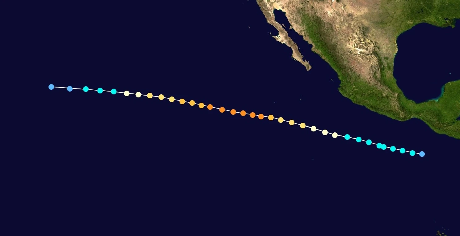
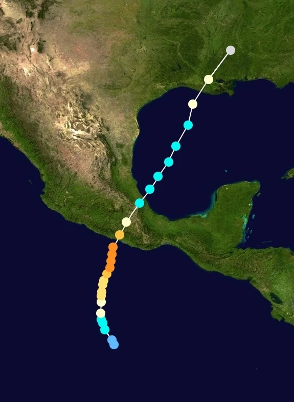
The 2022 Pacific Hurricane Season is often regarded as the most eventful Pacific Hurricane Season on record, as there was a record number of notable storms in this season. A moderate El Niño event allowed this year to be far above average. The season began with Tropical Storm Agatha on May 16, and ended with Hurricane Virgil on December 10. The season had 25 named storms, 16 hurricanes, and 9 major hurricanes.
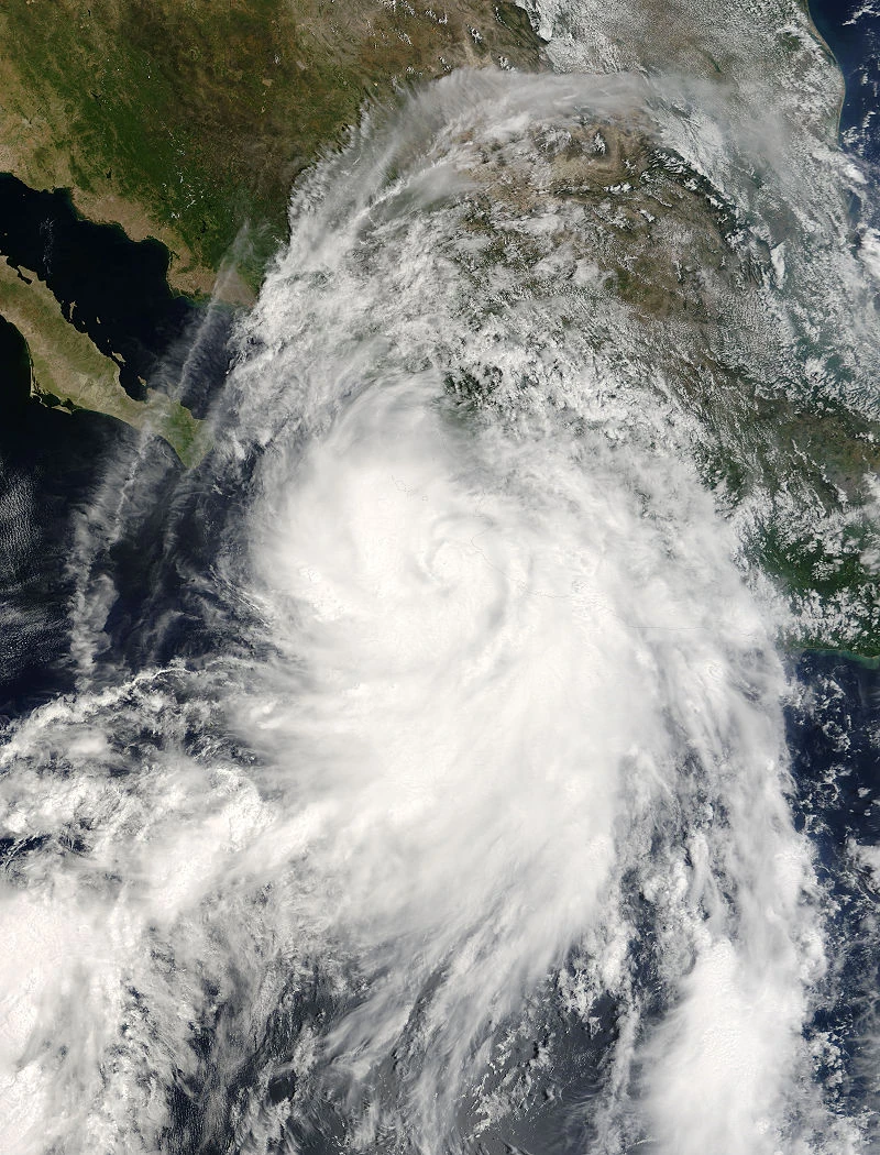
As stated above, this season had many notable storms. In May, Hurricane Blas was the first of many hurricanes to make landfall in Mexico. In July, Hurricane Georgette also hit Mexico, but as a possible borderline major. In August, Hurricane Ivette became the strongest hurricane to make landfall on the Baja California Peninsula. In September, Hurricane Moke made landfall in Hawaii at Category 1 status, and Hurricane Newton struck Mexico as a Category 3 hurricane. In October, Hurricane Paine became the strongest storm of the year, and exited the basin, and Hurricane Tina made landfall in Mexico. In December, Hurricane Virgil became an off-season hurricane and made landfall in Mexico.
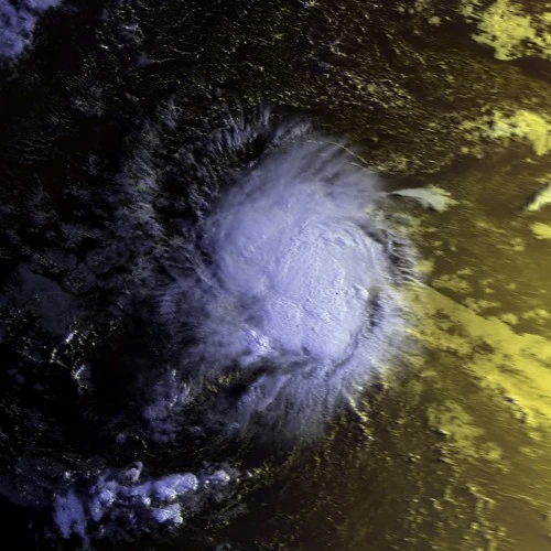
A tropical wave moved off the coast of Africa, and little development occurred as it crossed the Atlantic. It entered the East Pacific on May 14, and began to develop convection. On May 16, Tropical Depression One-E formed. The next day, it intensified into Tropical Storm Agatha. Agatha intensified very gradually as it was in an area of moderate wind shear. It peaked with 45 mph winds, before weakening due to entering an area of drier air. Agatha dissipated on May 20.
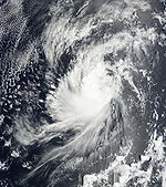
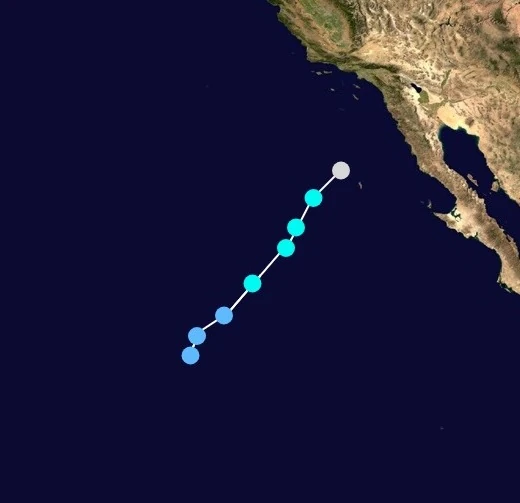
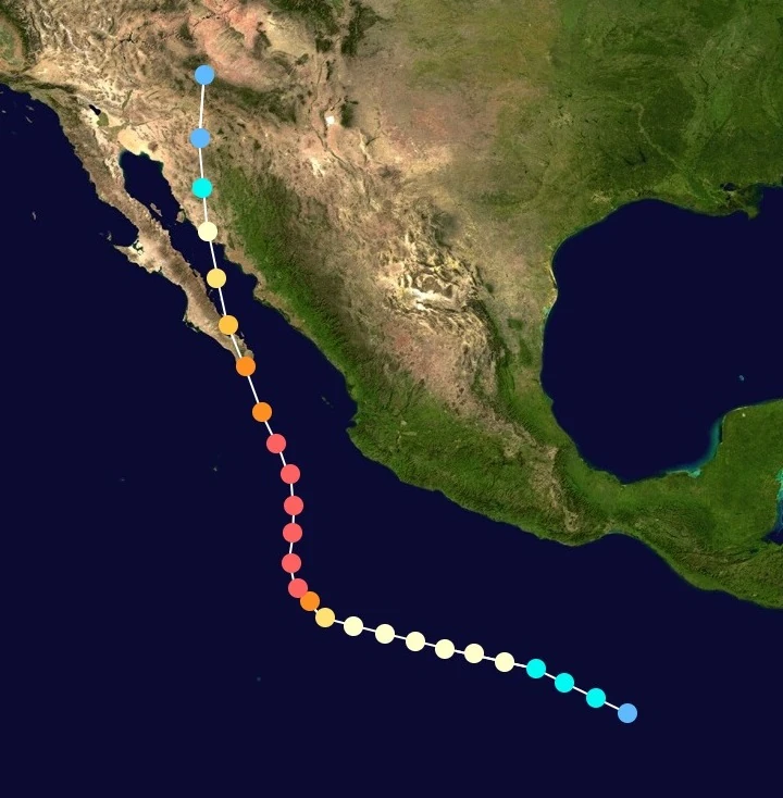
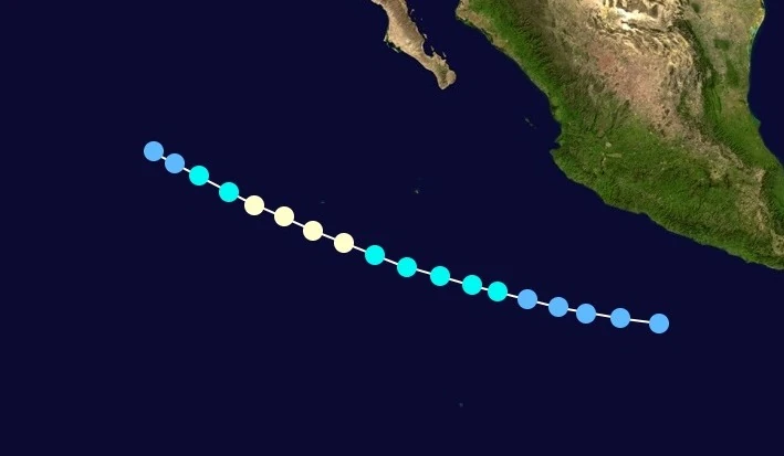
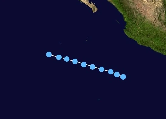
Tropical Depression Two-E formed on May 23. Within favorable conditions, it intensified into Tropical Storm Blas later that day. Despite only near-average sea surface temperatures, low wind shear allowed Blas to quickly intensify. Blas became the first hurricane of the year on May 25. Although it weakened slightly as wind shear increased slightly, an area of extremely warm waters allowed Blas to briefly re-intensified into a hurricane before making landfall in Mexico, with 80 mph winds. The remnants of Blas dissipated near the Gulf of Mexico on May 28. Despite making a similar landfall to Hurricane Manuel in 2013, damage was low to moderate.
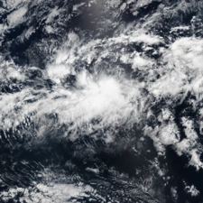
A low pressure area developed into Tropical Depression One-C on June 13. It intensified into Tropical Storm Iona late on June 14, and rapidly intensified to peak winds of 50 mph. It then rapidly weakened again as wind shear significantly increased. Iona weakened to a depression on June 15, and dissipated that day, only bringing light rain to Hawaii. Iona could have possibly contributed to a storm in the West Pacific.
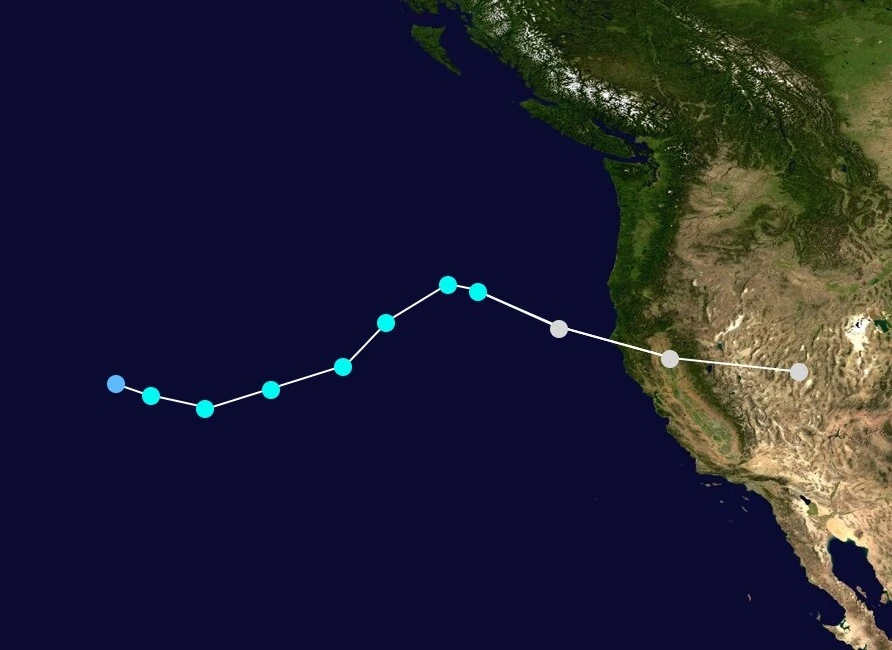
An unusual low pressure area began to show subtropical characteristics, while located off the coast of Mexico. It developed into Subtropical Depression Three-E on June 21, and became Subtropical Storm Celia on June 22. It quickly became tropical, and moved northeast. While it briefly threatened California, it quickly became post-tropical on June 25, after a few days of meandering. The remnants of Celia eventually moved inland, causing light damage in northern Mexico and southern California.
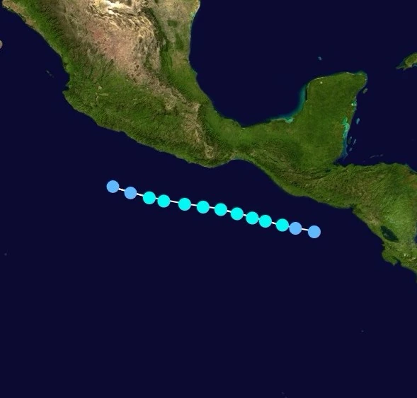
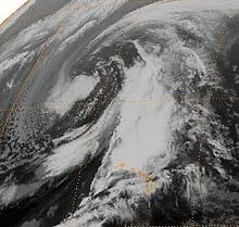
Another low in the Central Pacific developed into Tropical Depression Two-C on June 22. Despite being located in marginal conditions, it developed into Tropical Storm Keli on June 24. It briefly peaked with 40 mph winds before weakening, and quickly dissipating on June 25. The precursor to Keli dropped heavy rains in Hawaii, but damage was otherwise minimal.
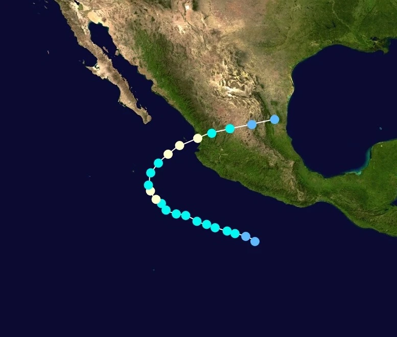
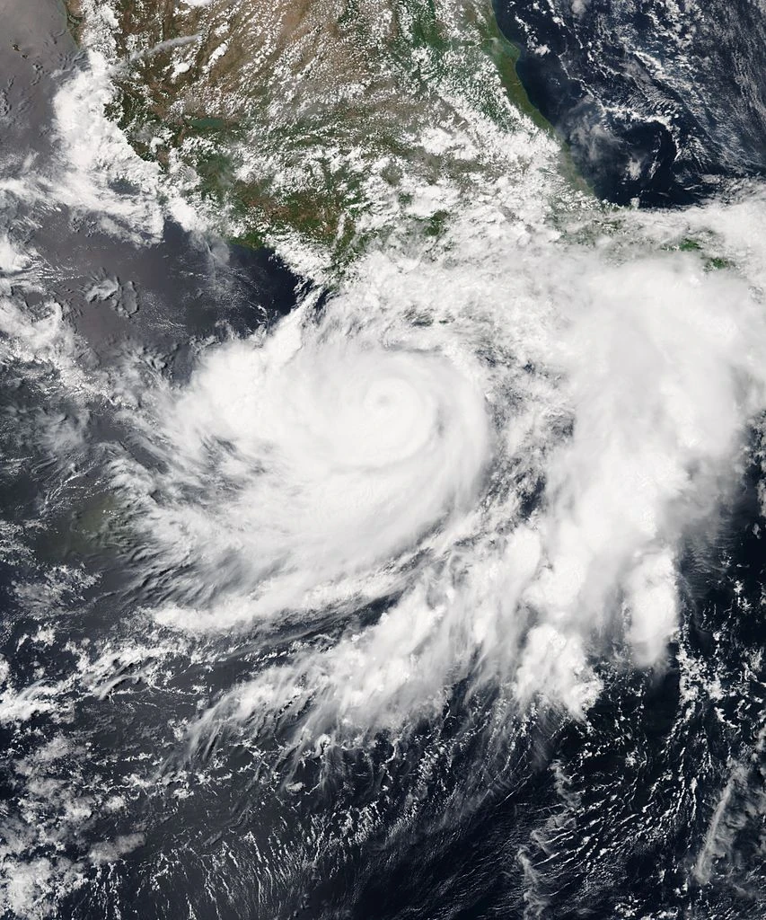
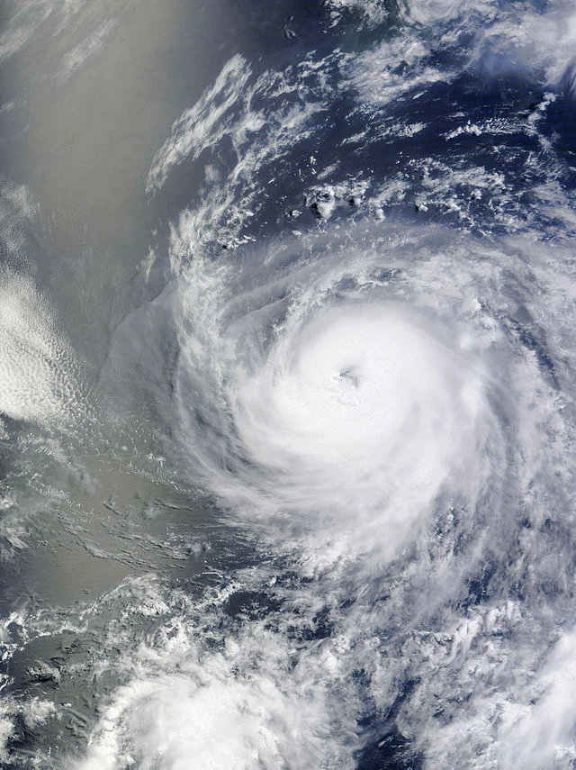
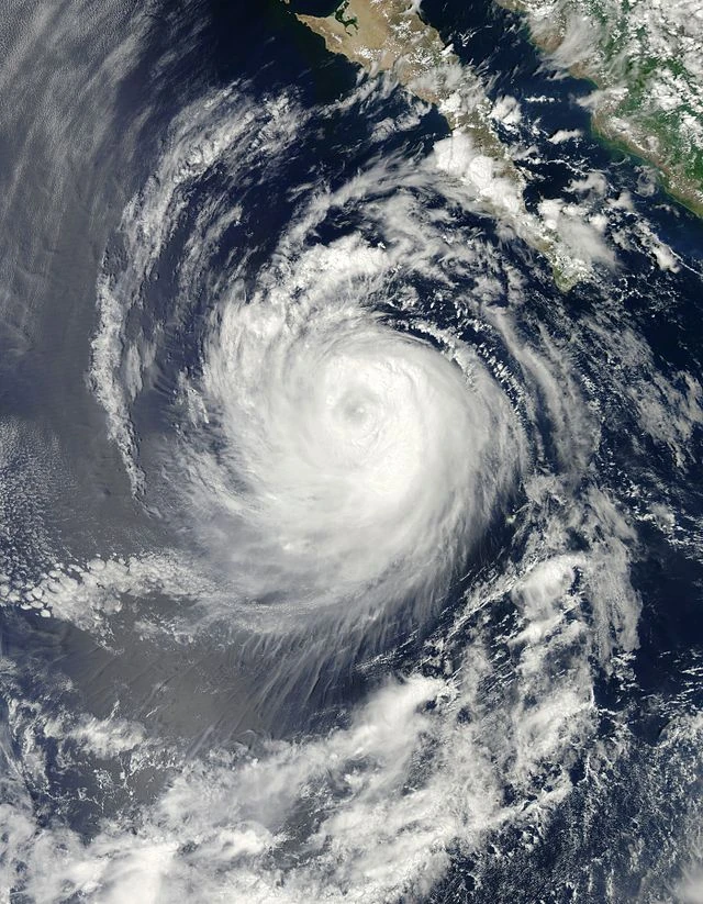
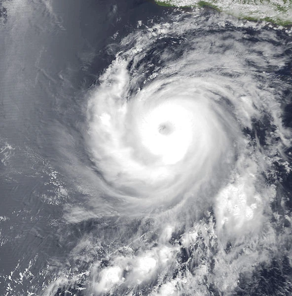
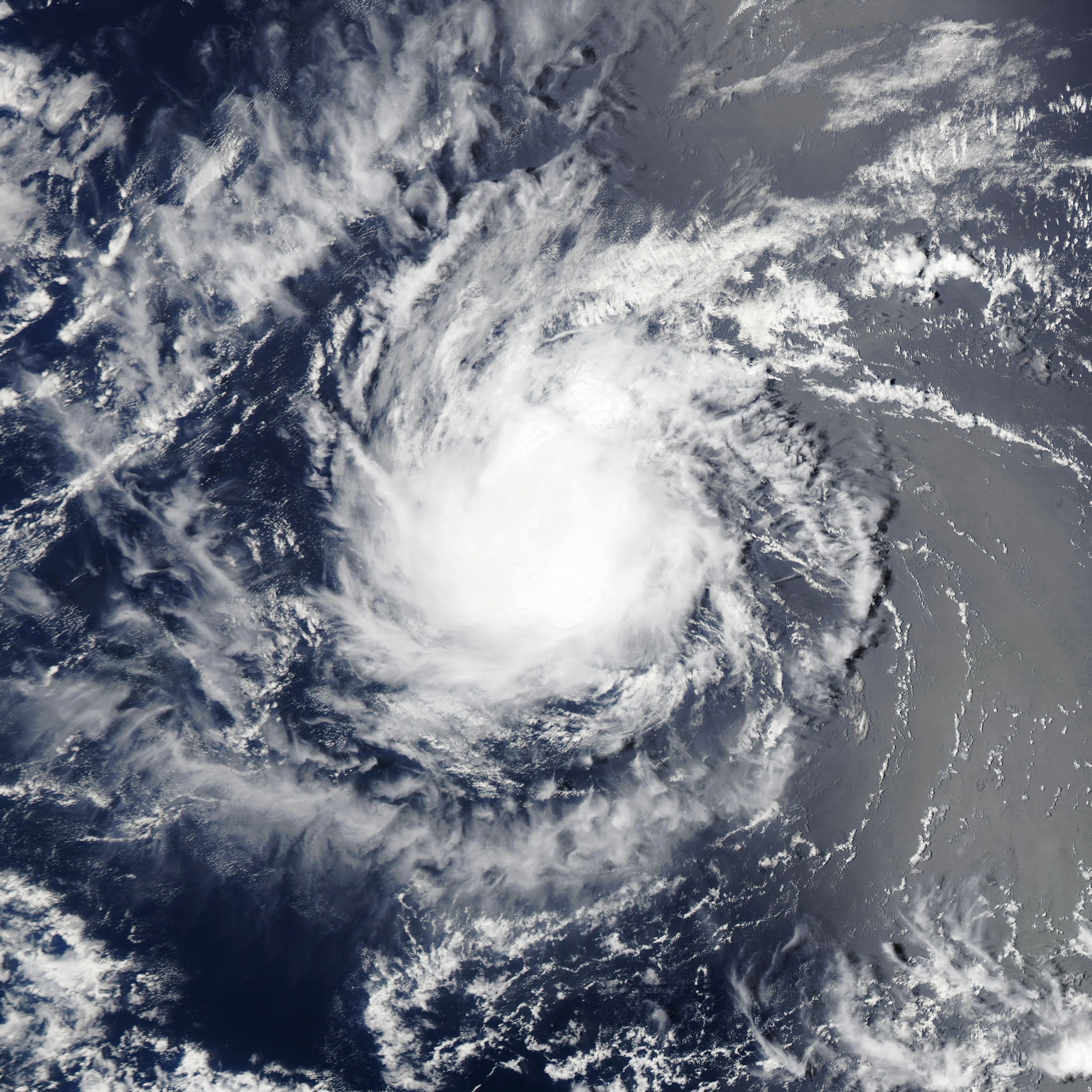
A tropical wave spawned Tropical Depression Four-E on June 28. Within a very favorable environment, it intensified into Tropical Storm Darby. Almost instantly, Darby began to undergo a phase of rapid intensification, with an eye becoming visible on satellite. Darby was upgraded to hurricane status late on June 29. This phase continued through June 30, with Darby ultimately peaking early the next day, as a Category 4 hurricane with winds of 140 miles per hour, and a pressure of 947 millibars. Not too long after, upwelling of colder waters and increasing wind shear caused Darby to weaken. Darby steadily weakened over the next few days, until the storm dissipated on July 5. Darby dropped high rains over Mexico, but impacts were overall light.
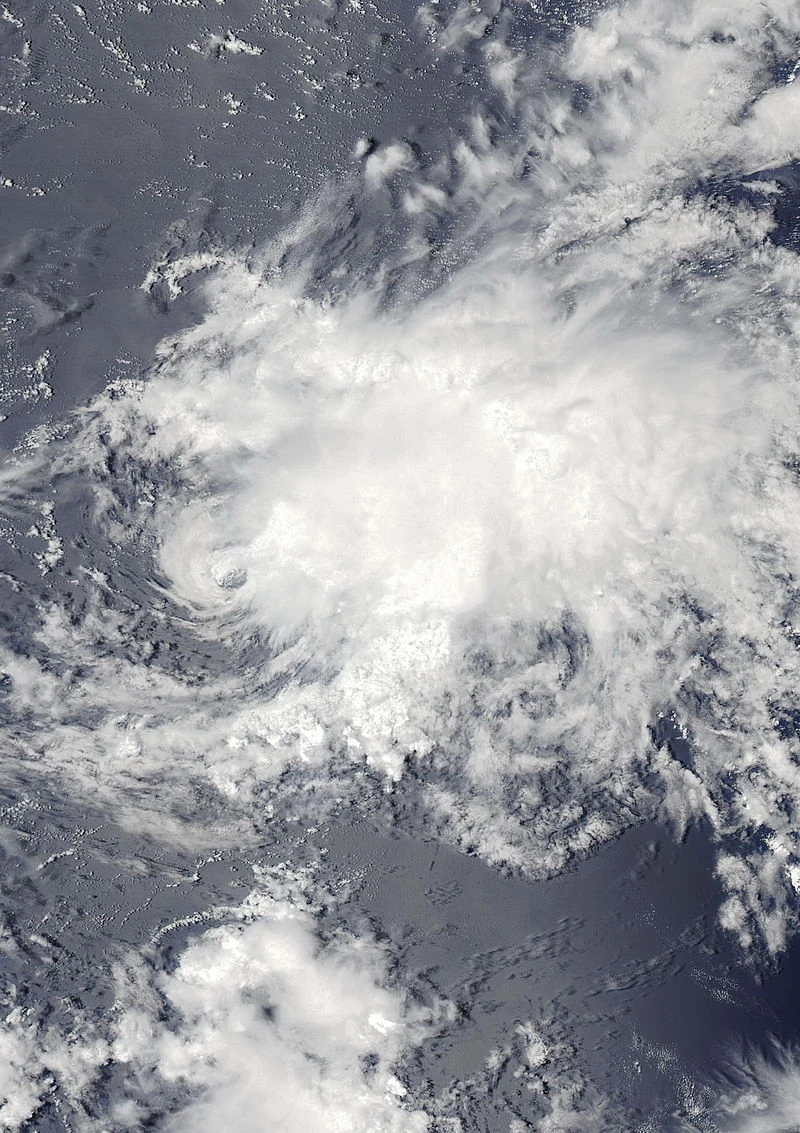
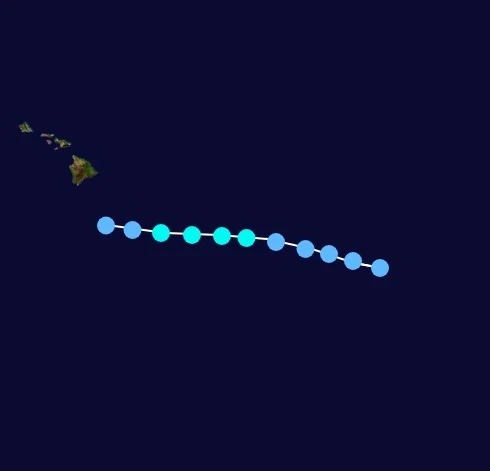
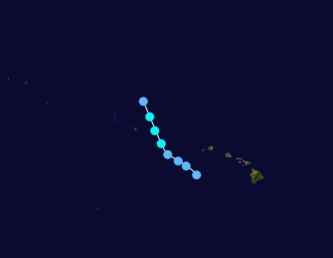
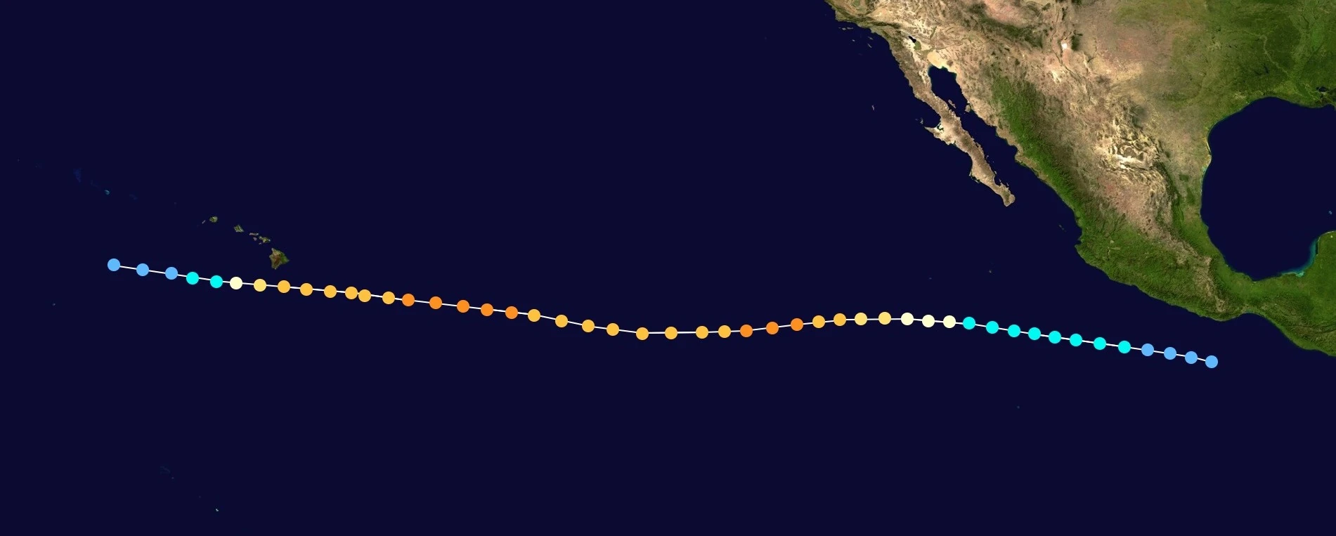
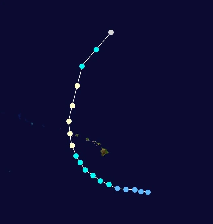
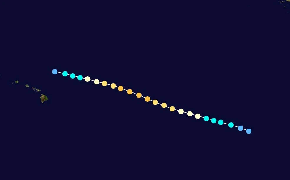
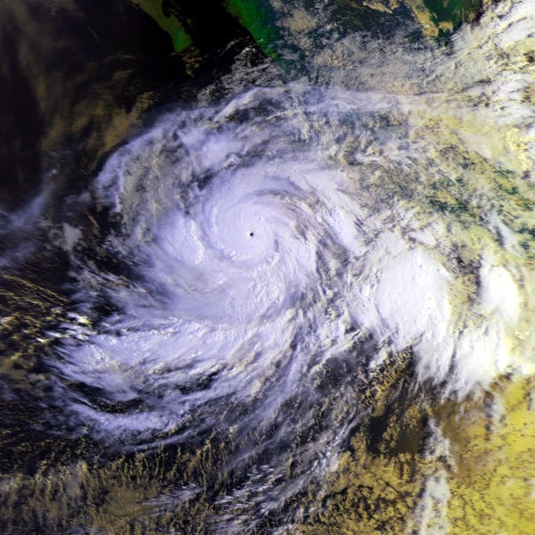
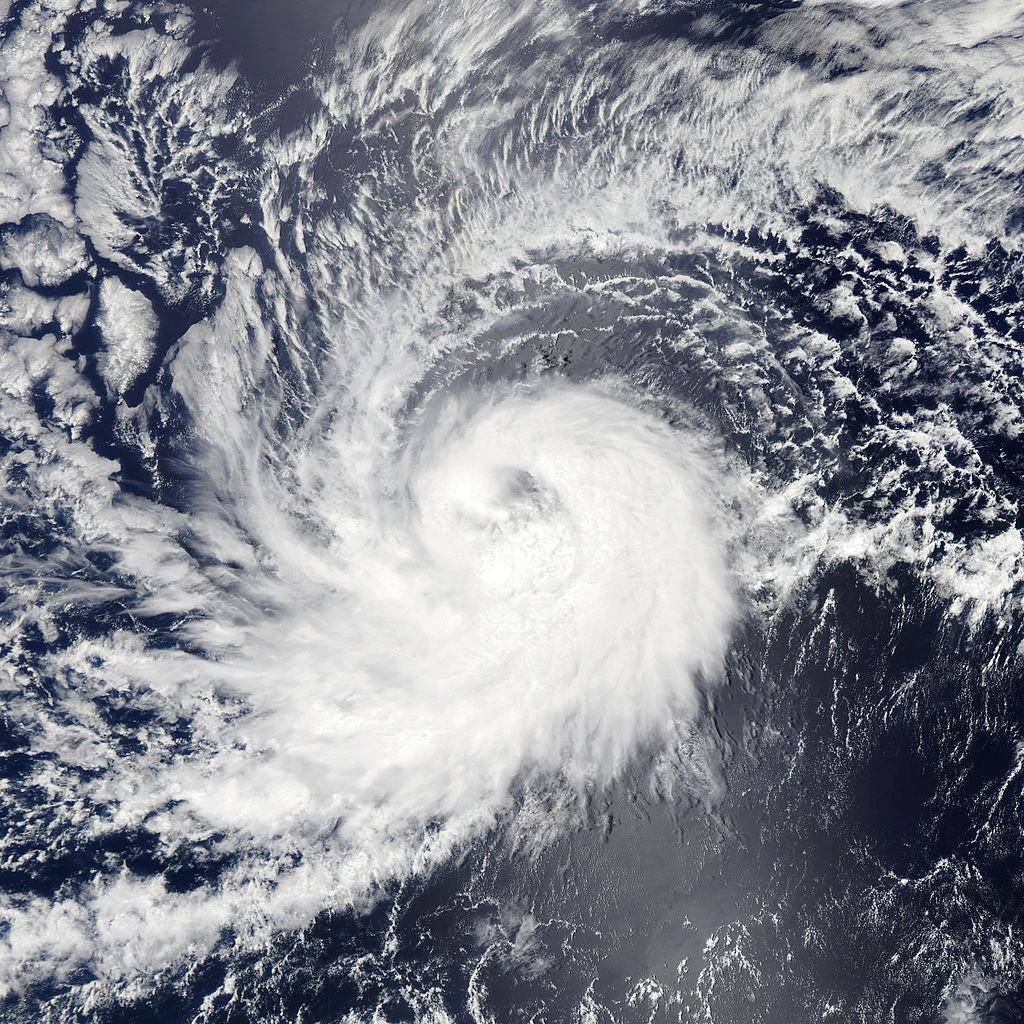
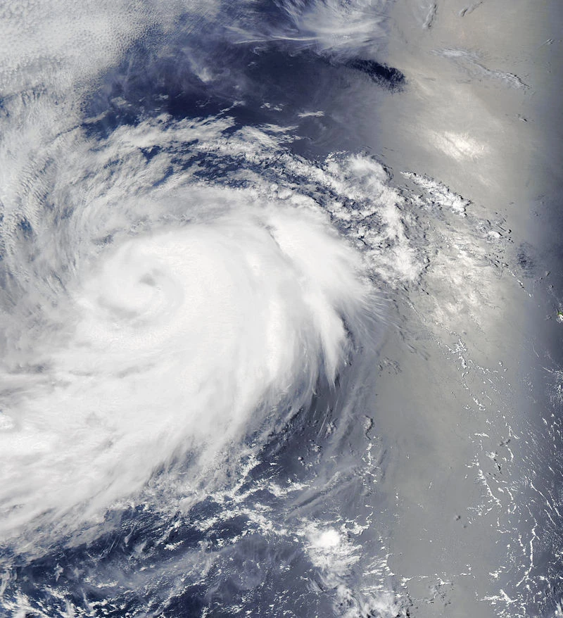
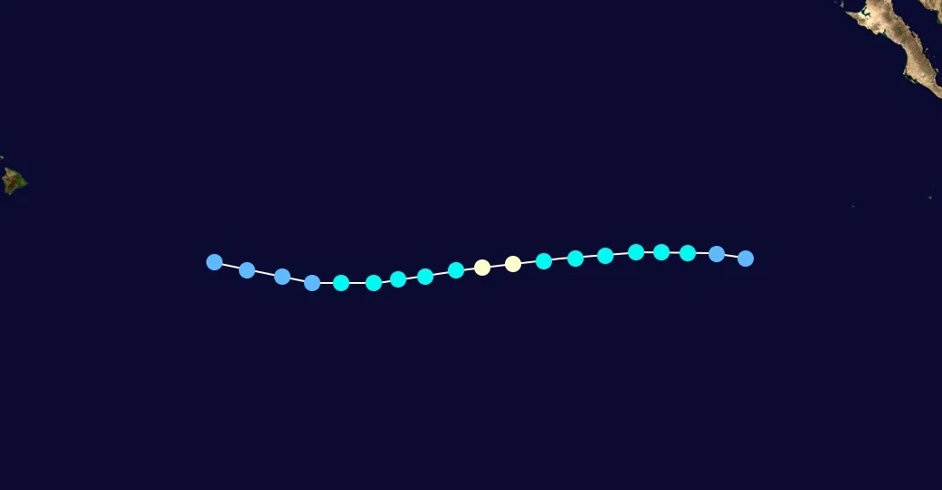
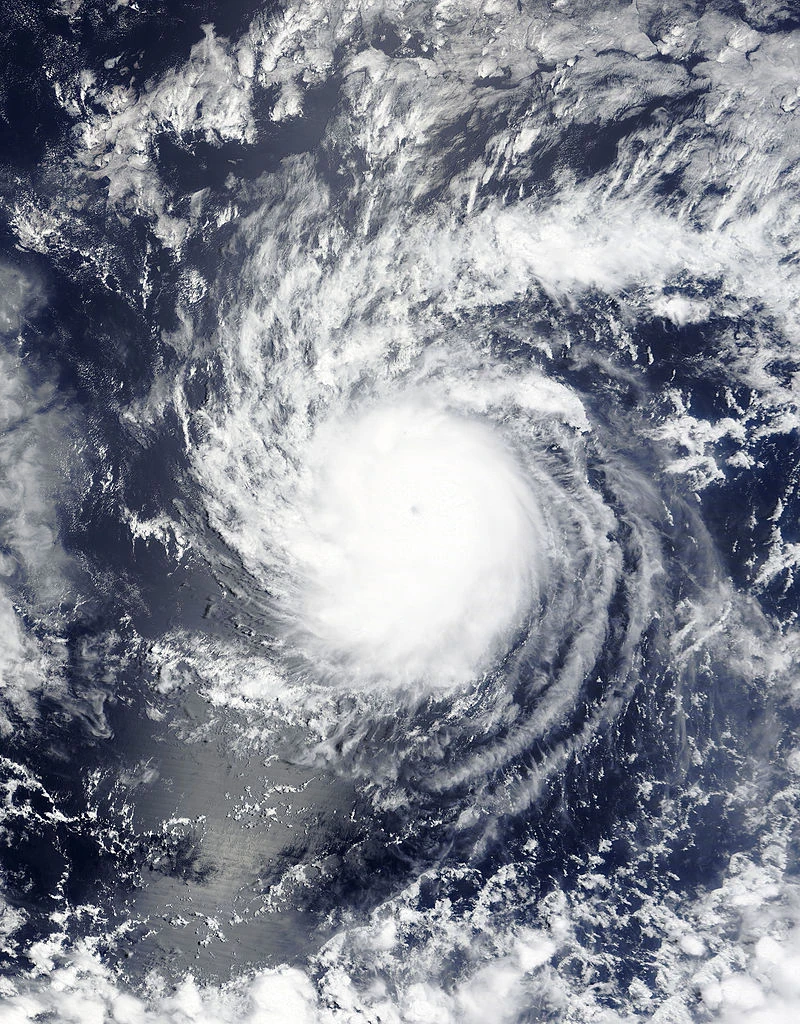
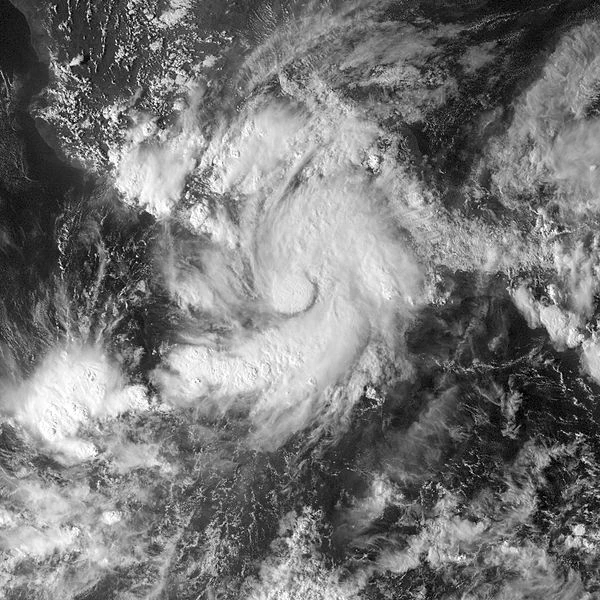
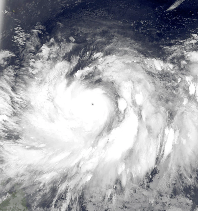
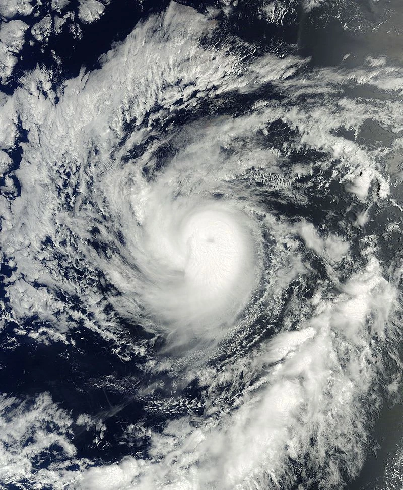
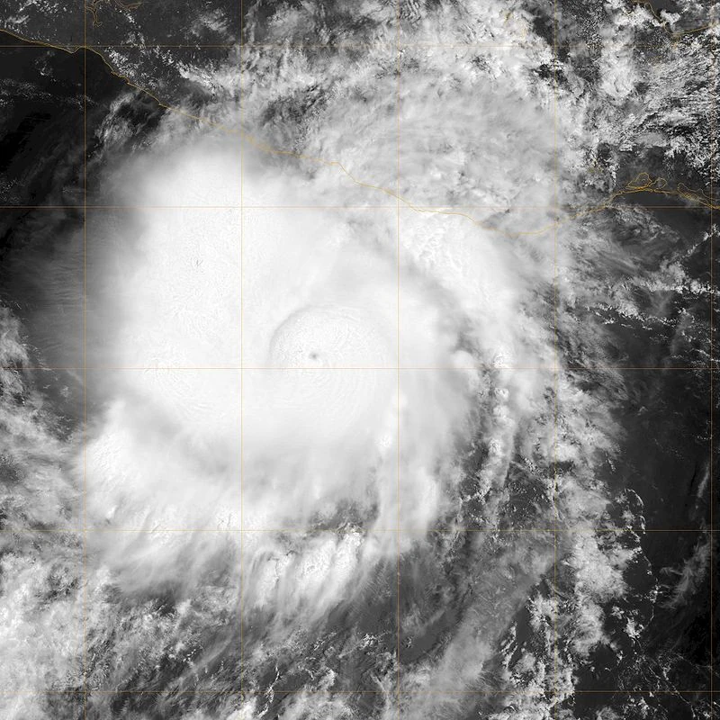
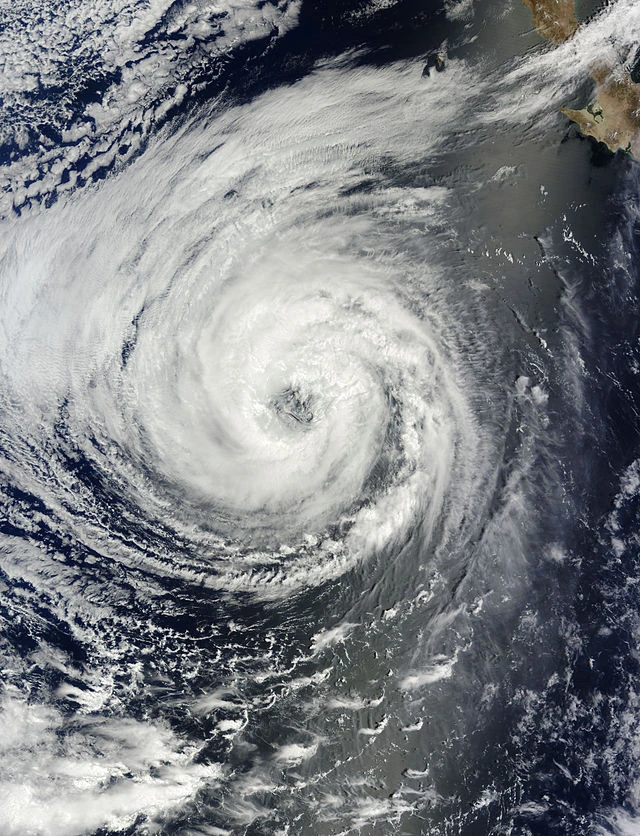
Tropical Depression Five-E formed on July 1, and intensified into Tropical Storm Estelle that day. Initially, Estelle struggled to intensify due to the influence of moderate wind shear. This shear abated on July 3, and allowed Estelle to quickly intensify into a hurricane. Estelle reached an initial peak on July 5, with 145 mph winds. An eyewall replacement cycle began, however, and weakened Estelle back to a Category 3. However, with a new, more stable structure, Estelle rapidly intensified to a peak of 155 mph, just shy of Category 5 status. Estelle maintained this intensity for 12 hours before weakening due to decreasing sea surface temperatures and dry air intrusion. Estelle passed uncomfortably close to the Hawaiian Islands on July 10 as a major hurricane, prompting hurricane warnings in the state. However, Estelle travelled south of the islands due to a ridge. Estelle began to quickly weaken west of Hawaii, and it dissipated on July 13. Two people in Hawaii died in a car crash.
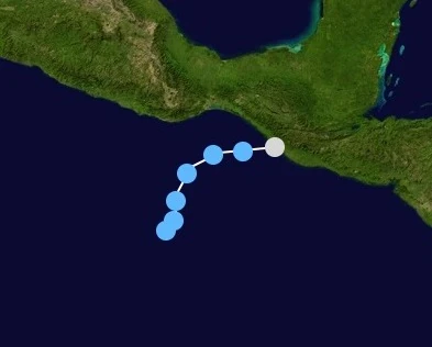
A tropical wave entered the eastern Pacific, and developed into Tropical Depression Six-E on July 12. The next day, it intensified into Tropical Storm Frank. In an area of marginal conditions, Frank steadily intensified to peak winds of 50 mph, before weakening due to less favorable conditions. Frank was forecast to re-intensify later on, but the storm's center collapsed and the storm regressed into a tropical wave on July 16.
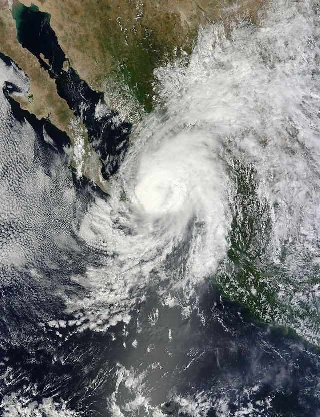
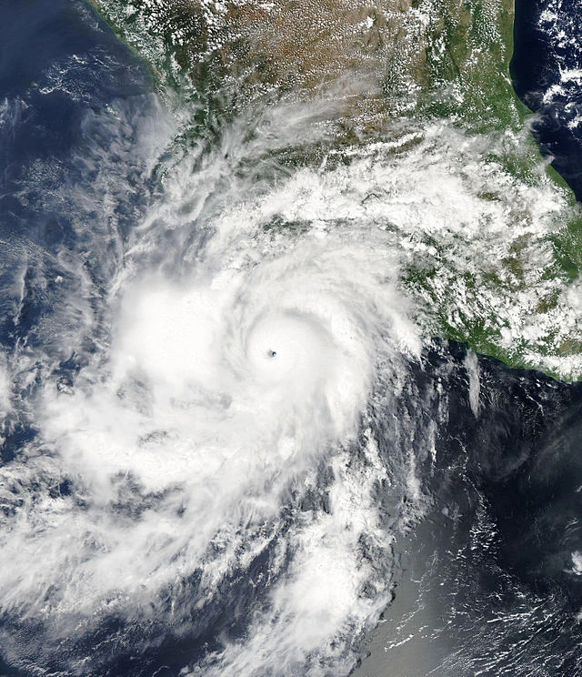
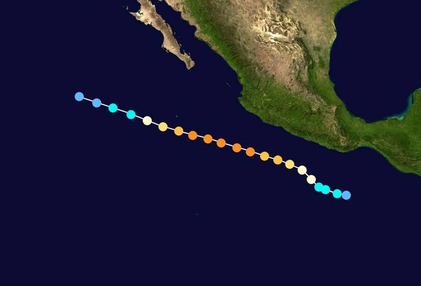
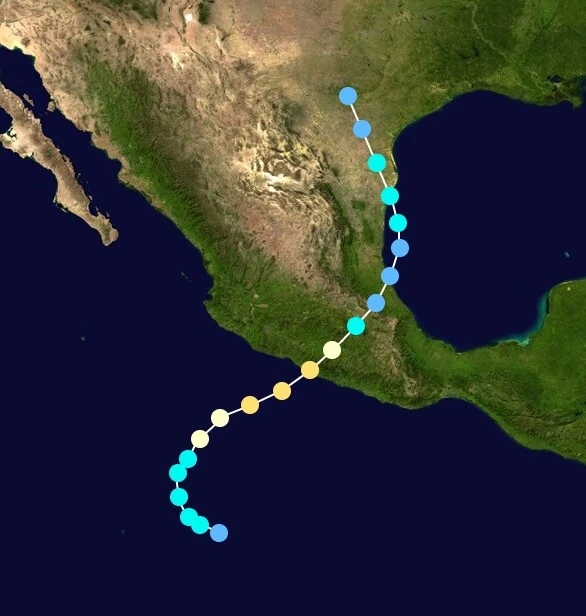
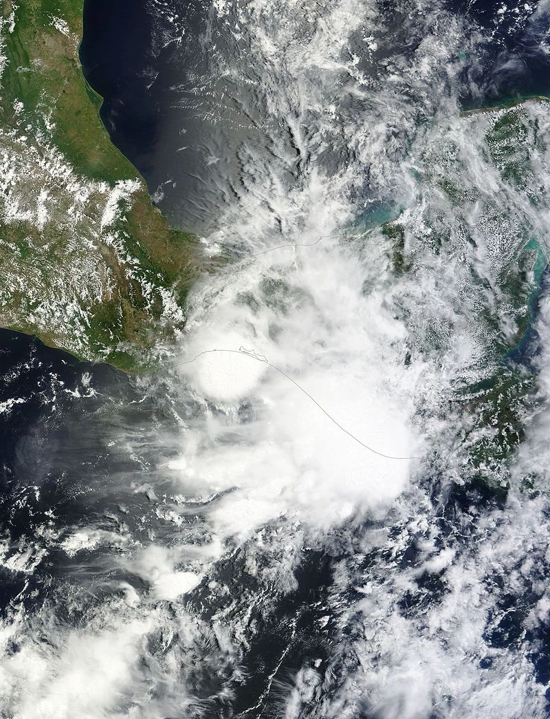
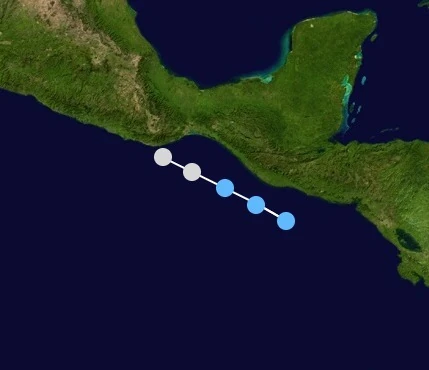
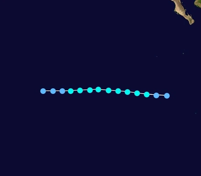
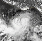
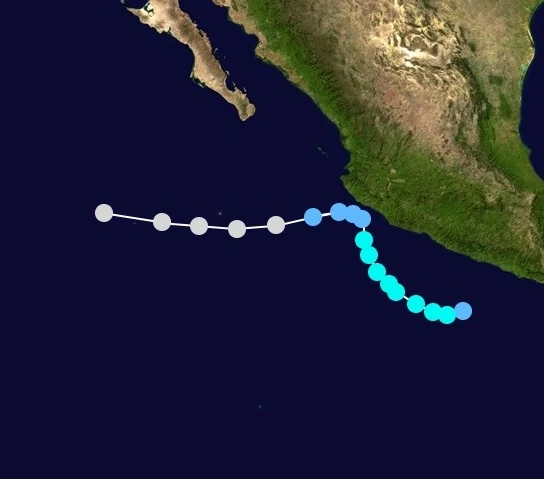
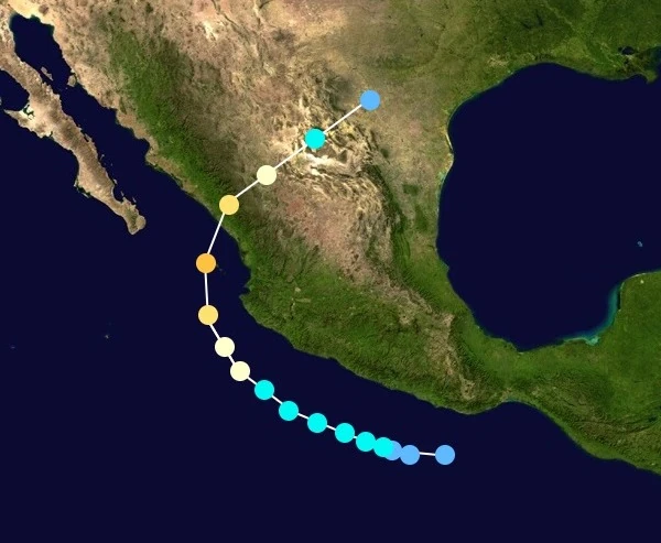
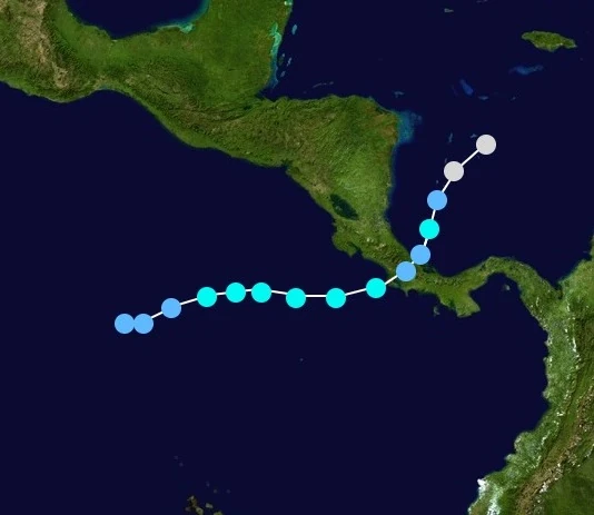
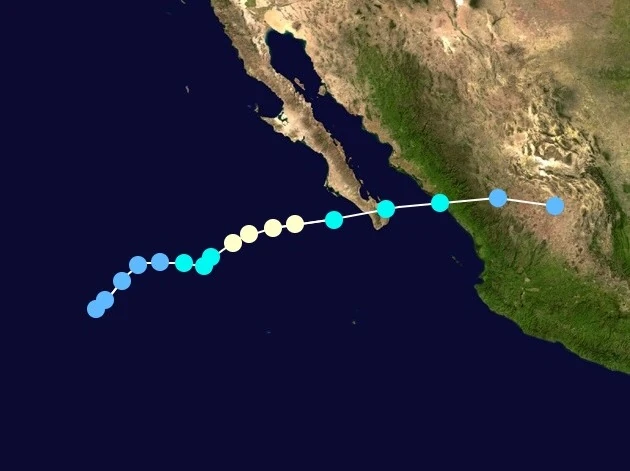
A large area of thunderstorms developed into a low pressure area, and further into Tropical Depreasion Seven-E on July 15. It intensified into Tropical Storm Georgette six hours later. Georgette quickly began to intensify, developing an eye structure. Georgette became a hurricane on July 17, and peaked at 100 mph that evening. The following morning, Georgette made landfall in Mexico near peak intensity. It was forecast to dissipate quickly, but Georgette managed to enter the Gulf of Mexico late on July 20. The storm turned west due to a low and made a second Mexico landfall, as a minimal tropical storm. Georgette crossed into Texas, dissipating on July 22.
These names were used to name storms in the Eastern Pacific in 2022. The names not retired from this list will be re-used in the 2028 season. This name list was last used in the 2016 season.
Agatha
Blas
Celia
Darby
Estelle
Frank
Georgette
Howard
Ivette
Javier
Kay
Lester
Madeline
Newton
Orlene
Paine
Roslyn
Seymour
Tina
Virgil
Winifred (unused)
Xavier (unused)
Yolanda (unused)
Zeke (unused)
Central Pacific[]
The Central Pacific region was very active this year, 5 storms formed in this region.