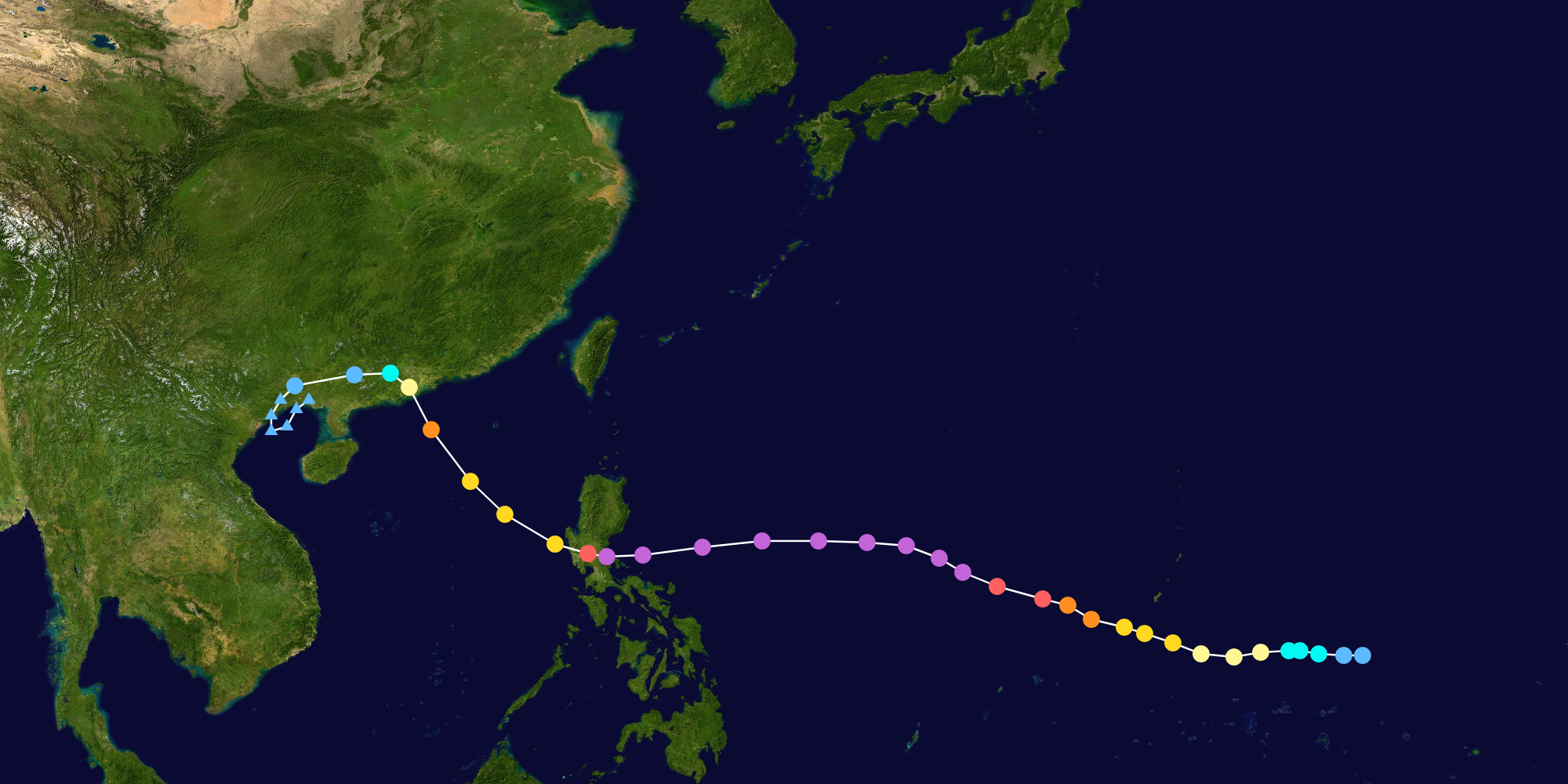
The 2023 Pacific typhoon season is an event in the annual cycle of tropical cyclone formation in which tropical cyclones form in the western Pacific Ocean. The season runs throughout the year, though most tropical cyclones typically develop between May and October.
The scope of this article is limited to the Pacific Ocean to the north of the equator between 100°E and 180th meridian. Within the northwestern Pacific Ocean, there are two separate agencies that assign names to tropical cyclones, which can often result in a cyclone having two names. The Japan Meteorological Agency (JMA) names a tropical cyclone should it be judged to have 10-minute sustained wind speeds of at least 65 km/h (40 mph) anywhere in the basin, whilst the Philippine Atmospheric, Geophysical and Astronomical Services Administration (PAGASA) assigns names to tropical cyclones which move into or form as a tropical depression in their area of responsibility located between 135°E and 115°E and between 5°N and 25°N, regardless of whether or not a tropical cyclone has already been given a name by the JMA. Tropical depressions that are monitored by the United States' Joint Typhoon Warning Center (JTWC) are given a number with a "W" suffix.
Timeline[]

Systems[]
Tropical Storm Merbok (Amang)[]
| Tropical storm (JMA) | |
| Tropical storm (SSHWS) | |
| Duration | April 9 – April 22 |
|---|---|
| Peak intensity | 65 km/h (40 mph) (10-min) 995 hPa (mbar) |
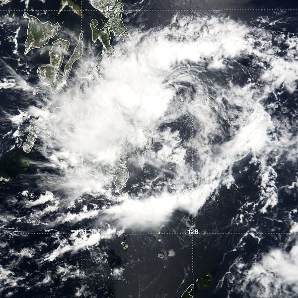
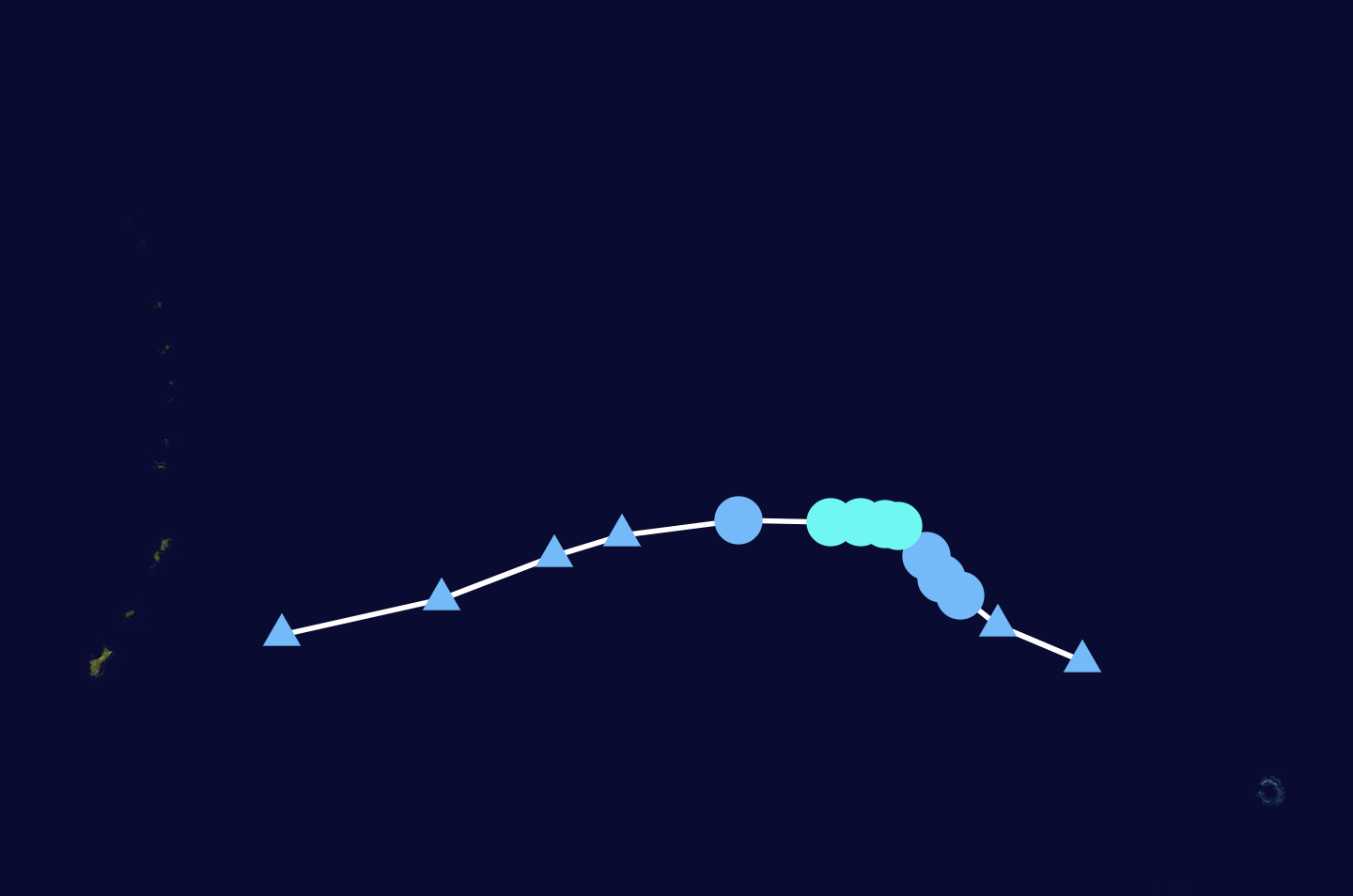
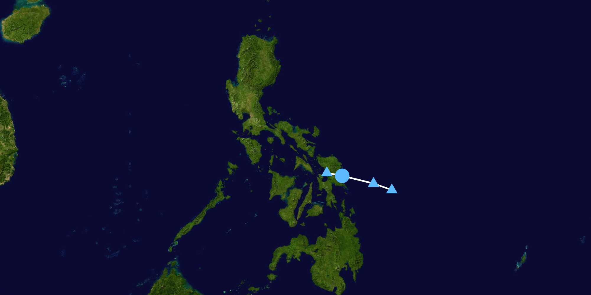
A tropical low developed south of the Mariana Islands on April 8, and was issued a medium warning by the Joint Typhoon Warning Center (JTWC). On April 9, the Japan Meteorological Agency upgraded it to a tropical depression. In the evening, the JTWC designated it as Tropical Depression 01W as it moved westwards near Yap. By April 10, 01W drifted westward near Yap bringing heavy rainfall to the island which killed 7 people. On the morning of April 11, the Japan Meteorological Agency upgraded 01W to a tropical depression, naming it Merbok. Merbok pursued a southwestward course due to a strengthening ridge of high pressure. Merbok moved slowly east of Palau for another day before entering the Philippine Area of Responsibility (PAR) on April 13, with PAGASA naming it Amang. Merbok, due to high wind shear, weakened into a tropical depression as it moved slowly westward on April 15. As the Low Level Circulation Center got exposed and did not produce any convection anymore, Merbok was downgraded into a tropical depression by the JTWC, which would be followed by JMA and PAGASA a day later. By April 18, the JTWC issued it's last advisory on Merbok as it's circulation became increasingly elongated. The JMA and PAGASA continued to track it as a Tropical Depression until it made landfall in Baganga, Davao Oriental, Philippines on April 20, and PAGASA issued their last advisory on April 21, but JMA continued giving advisories until it was over the Sulu Sea by April 22.
Tropical Storm Nanmadol[]
| Tropical storm (JMA) | |
| Tropical storm (SSHWS) | |
| Duration | May 5 – May 10 |
|---|---|
| Peak intensity | 65 km/h (40 mph) (10-min) 995 hPa (mbar) |

Nanmadol churned in the open sea and it's circulation was eventually ripped apart by strong vertical wind shear.
Typhoon Talas (Betty)[]
| Typhoon (JMA) | |
| Category 3 typhoon (SSHWS) | |
| Duration | June 2 – June 15 |
|---|---|
| Peak intensity | 155 km/h (100 mph) (10-min) 960 hPa (mbar) |

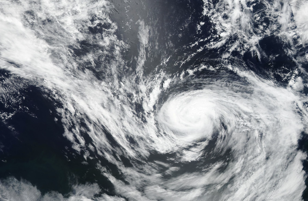
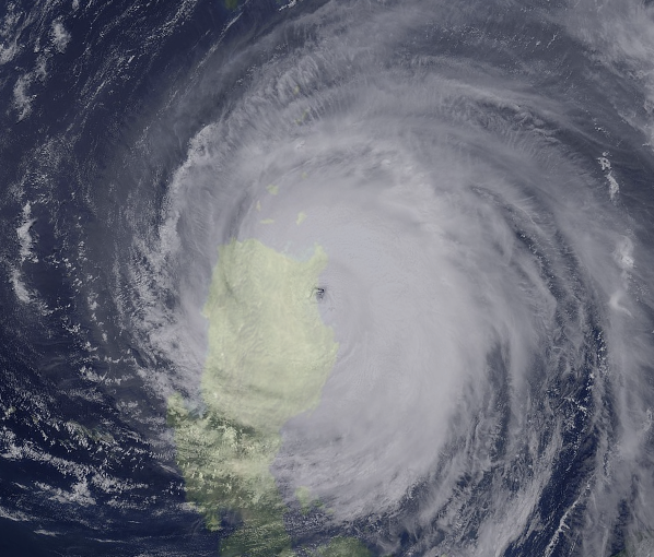
An area of disturbed weather became Tropical Depression 03W on June 2. It continued a west northwestward track until it became Tropical Storm Talas on June 4. Talas continued to steadily intensify a large monsoonal structure, and became a severe tropical storm on the evening of June 5. Talas continued to intensify, and was beginning to form a central dense overcast by the evening of June 6, which prompted the Joint Typhoon Warning Center (JTWC) and the Japan Meteorological Agency (JMA) to upgrade it into a typhoon. Talas steadily intensified, and by June 10, it was a Category 2 typhoon packing winds of 155 km/h. Talas entered the Philippine Area of Responsibility on the same day and was named by PAGASA as Betty. Talas reached it's peak intensity on June 11 as a Category 3 typhoon with winds of 205 km/h, before undergoing an eyewall replacement cycle. As a trough picked it up on June 14, baroclinic forcing allowed Talas to reach a second peak intensity of 120 mph, passing close to Okinawa, bringing showers. Talas weakened into a Category 1 by June 15, and completed it's extratropical transition by June 16, and had it's last advisory southeast of Japan.
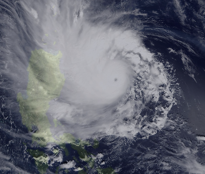
Typhoon Noru (Chedeng)[]
| Typhoon (JMA) | |
| Category 5 super typhoon (SSHWS) | |
| Duration | July 21 – August 1 |
|---|---|
| Peak intensity | 185 km/h (115 mph) (10-min) 910 hPa (mbar) |
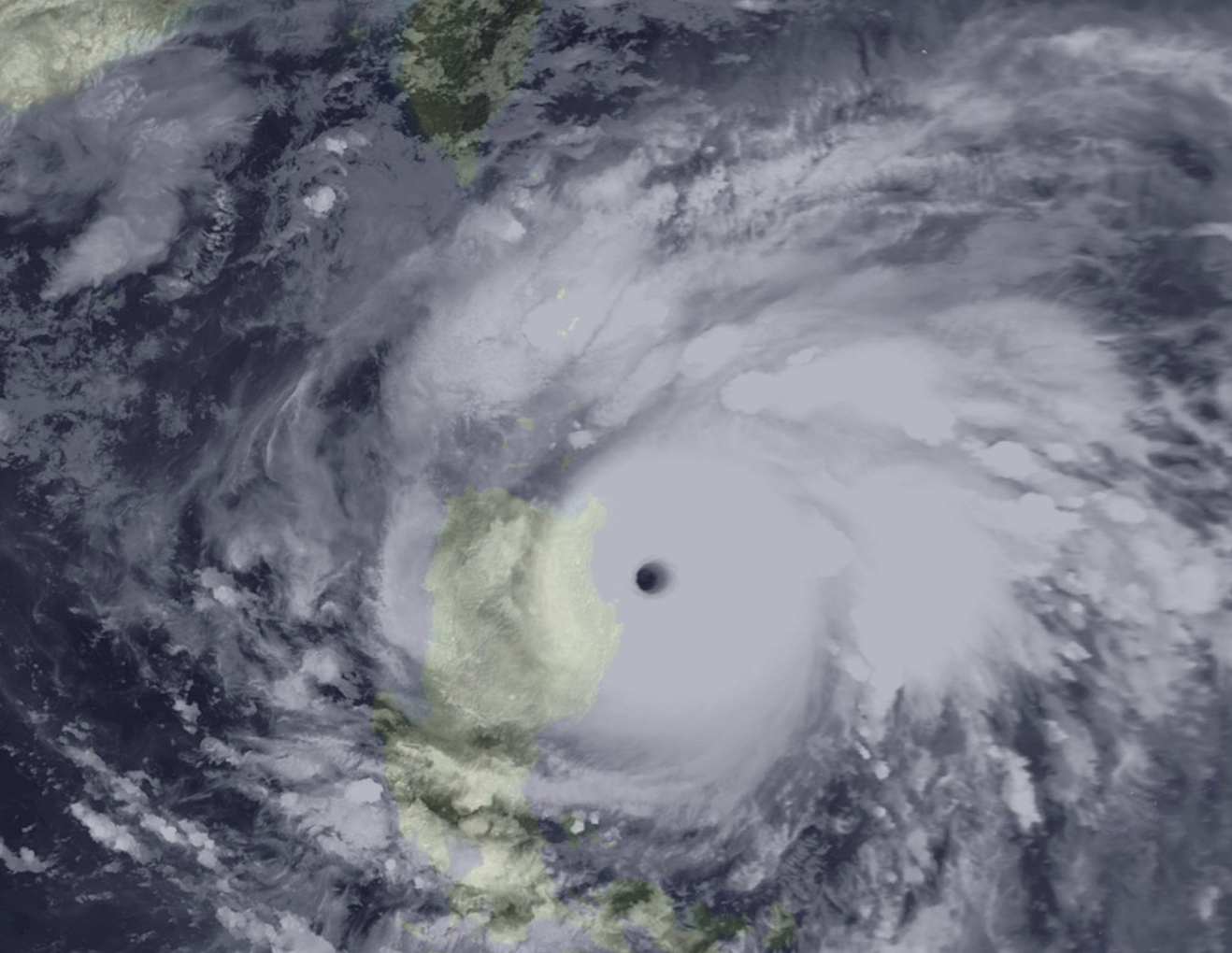
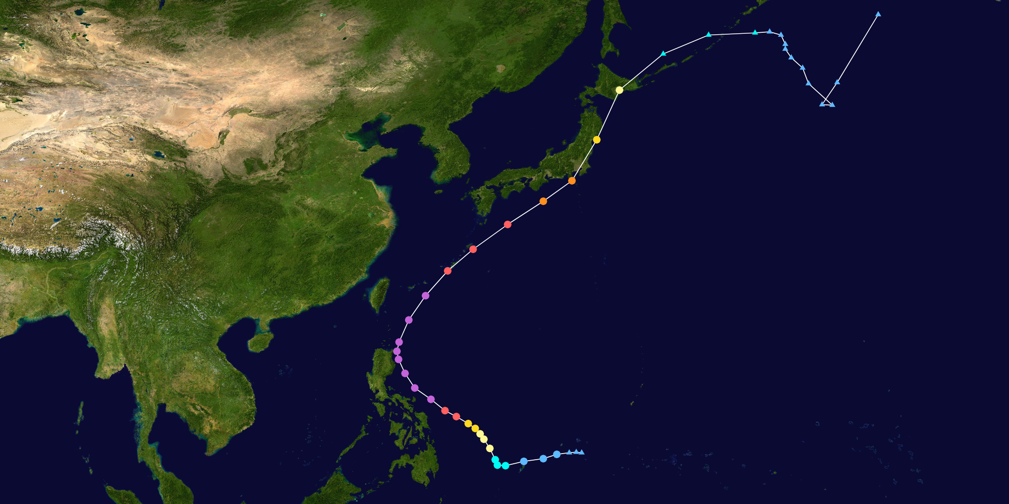

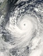
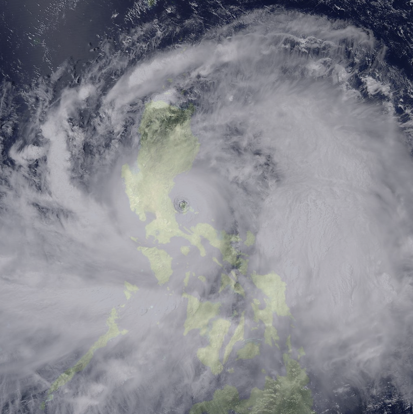
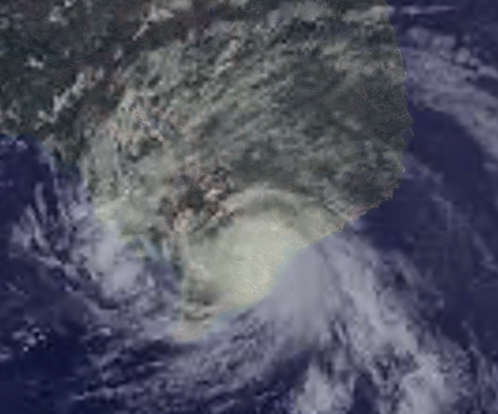
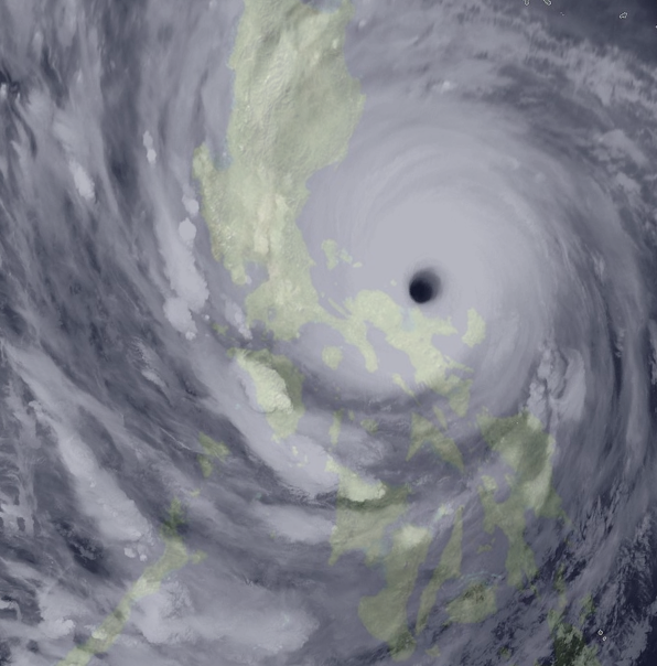
Tropical Depression 04W rapidly formed from an area of disturbed weather on July 21. It moved westwards and entered the Philippine Area of Responsibility the next day, and was given the local name Chedeng by the PAGASA. Chedeng began a series of rapid intensification, intensifying into a tropical storm only 6 hours later and was given the name Noru. Noru continued intensifying, until it became a severe tropical storm by the end of the day. By July 23, Noru became a typhoon and the PAGASA began issuing tropical cyclone wind signals for Eastern Visayas and Cagayan. By the evening, Noru reached Category 3 status, forming an eye as it moved towards the Bicol Region. Noru reached Category 4 status on July 24, and by evening reached Category 5 status, as the eye got better defined and a ring of cold convection formed around it's center. Noru passed close to Catanduanes on July 26, while reaching it's peak intensity on July 27, almost hitting Cagayan, but a trough picked it up, and Noru began to weaken slightly. Noru was downgraded to a Category 4 as it passed through the Okinawa Islands on July 28, and it struck Tokyo as a strong Category 2 on July 29. Noru continued heading northward, and becoming fully extratropical by August 1.
Typhoon Kulap (Dodong)[]
| Typhoon (JMA) | |
| Category 1 typhoon (SSHWS) | |
| Duration | August 2 – August 11 |
|---|---|
| Peak intensity | 120 km/h (75 mph) (10-min) 987 hPa (mbar) |
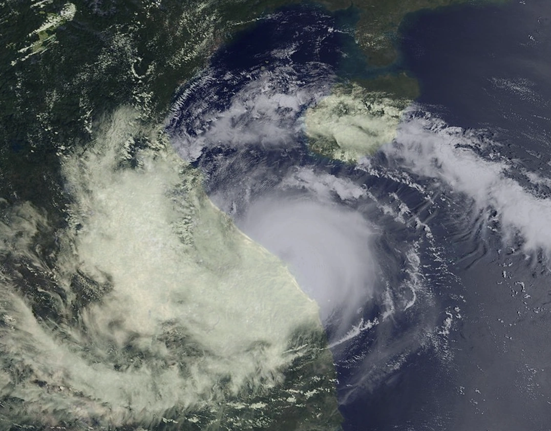
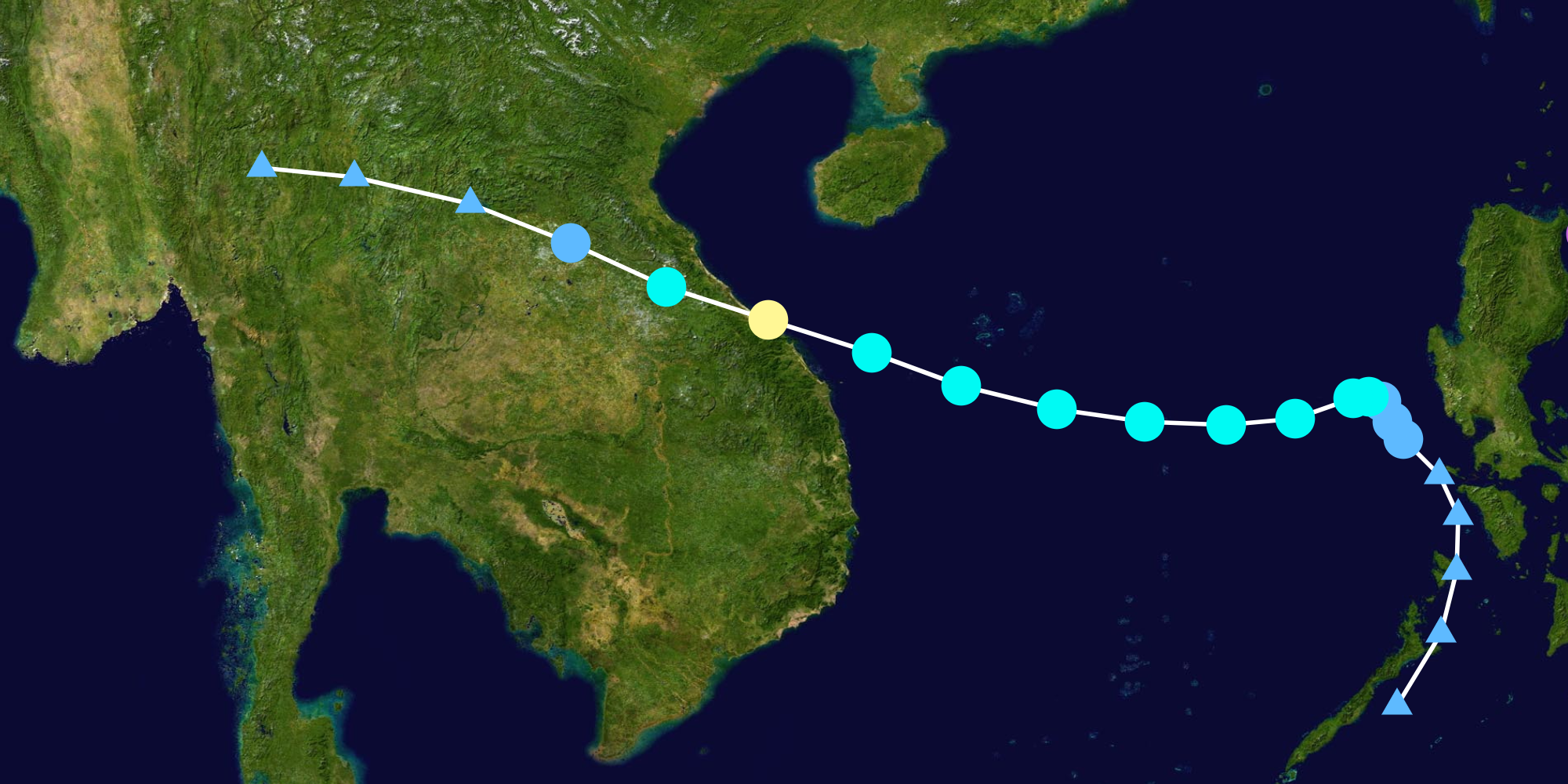
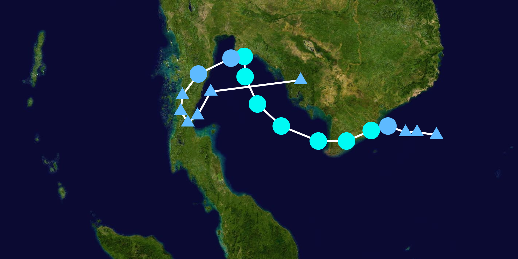
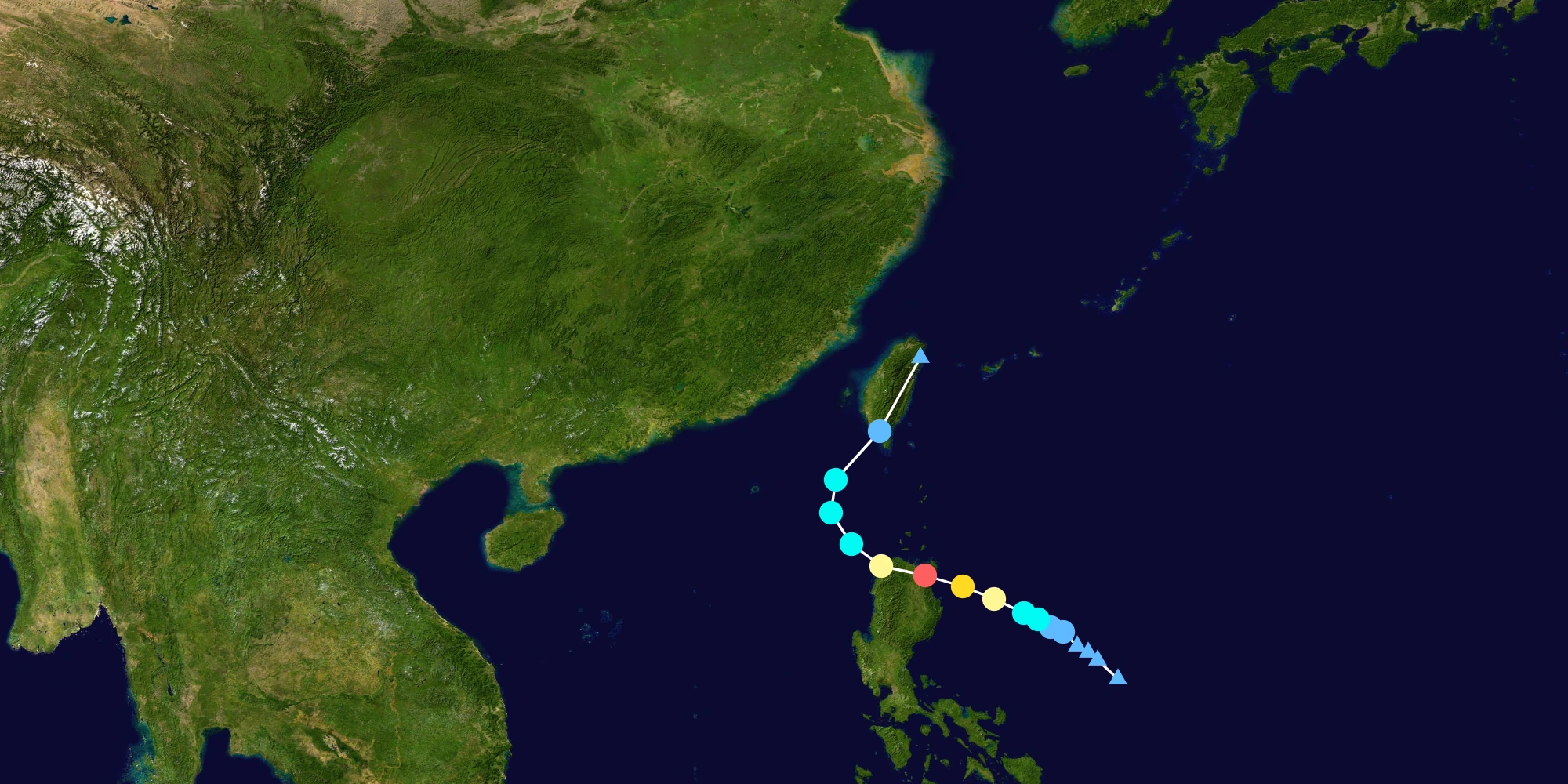
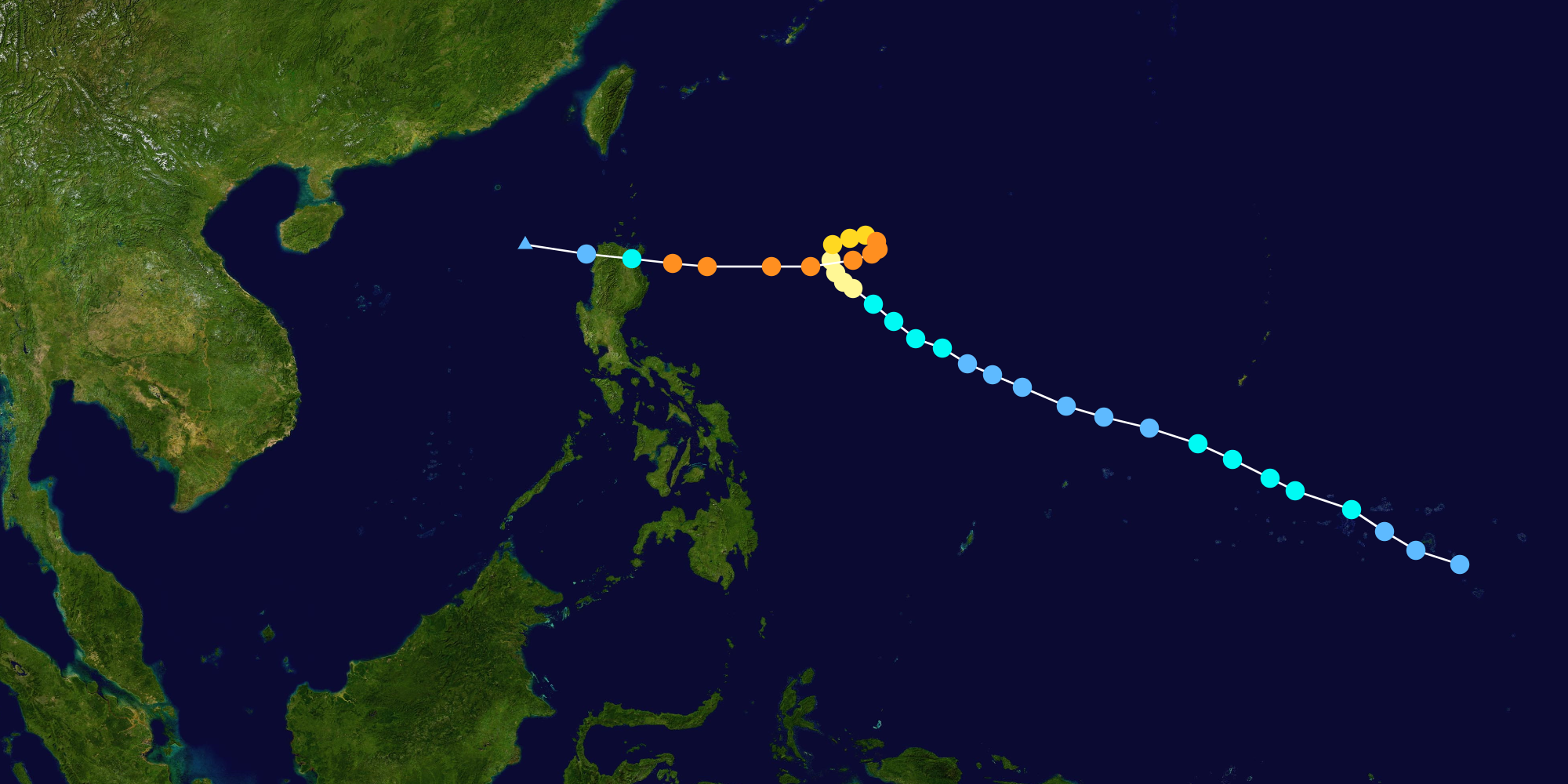
A tropical depression formed from the monsoon trough in the Sulu Sea on August 2, which was named Dodong by PAGASA, and was designated as 05W by JTWC after a day. It moved north-northeast, nearing Luzon, eventually intensifying into Tropical Storm Kulap on August 4. Kulap then began heading westwards, steadily intensifying. PAGASA issued their last advisory on August 6 as Kulap exited the PAR. Kulap then became a severe tropical storm on August 7. Kulap reached it's peak intensity as a typhoon as it made landfall on Central Vietnam on August 9. By the next day, Kulap weakened into a tropical depression, and dissipated on August 11, as it continued to bring heavy rainfall to many areas of Indochina.
Tropical Storm Roke[]
| Tropical storm (JMA) | |
| Tropical storm (SSHWS) | |
| Duration | August 2 – August 11 |
|---|---|
| Peak intensity | 65 km/h (40 mph) (10-min) 999 hPa (mbar) |

Roke was a waste of a name.
Typhoon Sonca (Falcon)[]
| Typhoon (JMA) | |
| Category 5 super typhoon (SSHWS) | |
| Duration | August 20 – September 1 |
|---|---|
| Peak intensity | 220 km/h (140 mph) (10-min) 909 hPa (mbar) |

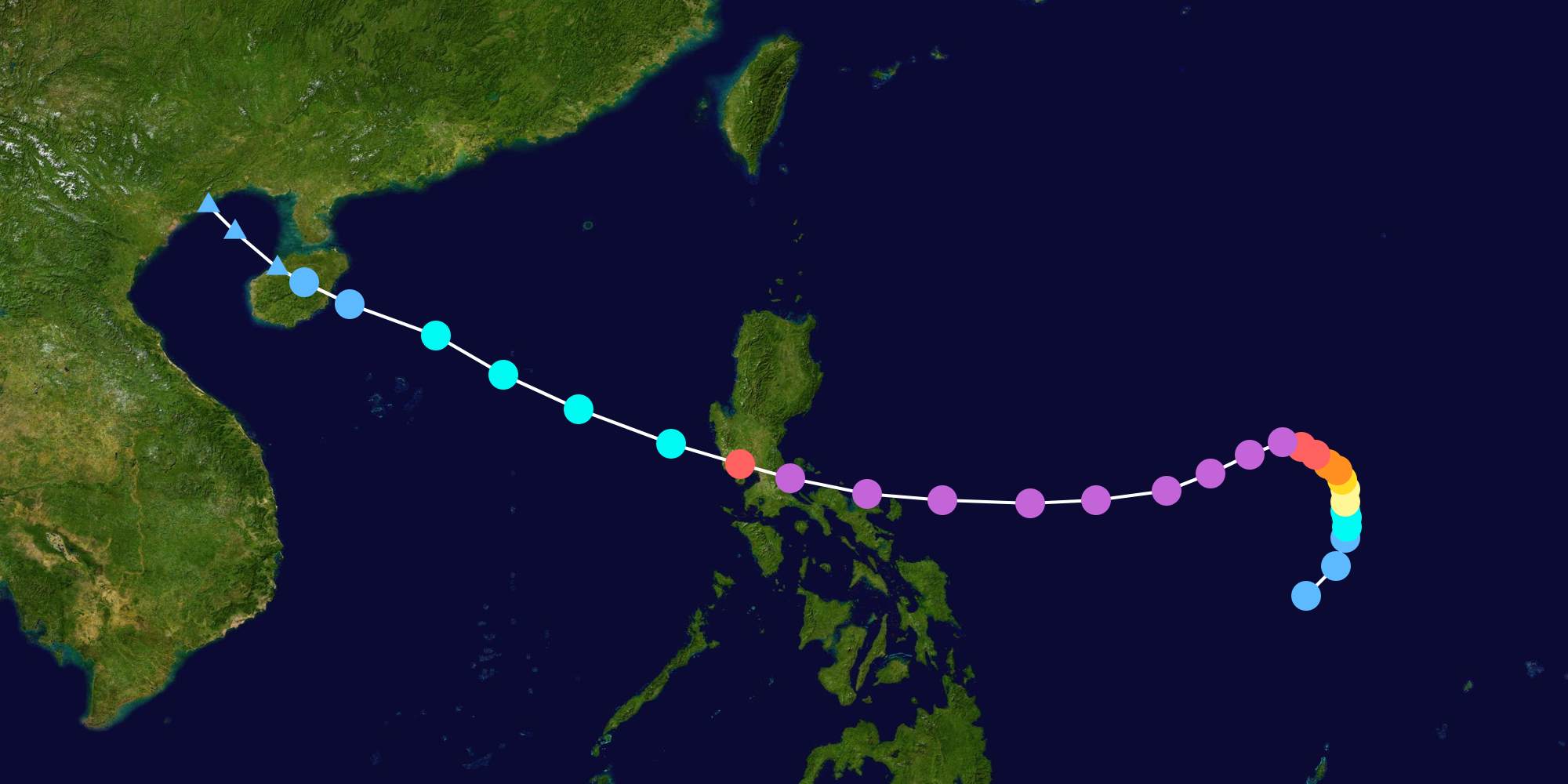
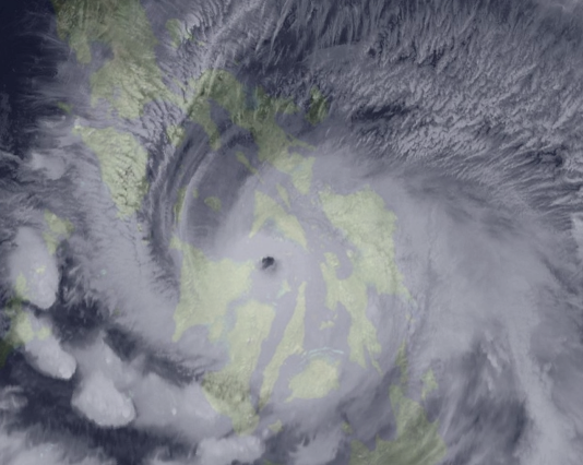
Typhoon Sonca, known in The Philippines as Super Typhoon Falcon, was a very devastating tropical cyclone that ravaged Southern and Central Luzon including China in late August to early September. Sonca originated from a monsoon trough, before rapidly intensifying as it struck Infanta, Quezon.
Tropical Depression 07W (Egay)[]
| Tropical depression (JMA) | |
| Tropical depression (SSHWS) | |
| Duration | August 21 – August 23 |
|---|---|
| Peak intensity | 55 km/h (35 mph) (10-min) 1005 hPa (mbar) |

Egay formed east of Visayas on August 21. It struck Samar on the next day. Due to the mountainous terrain of the island, it dissipated the next day, but left Samar under floodwaters.
Tropical Storm Nesat[]
| Tropical storm (JMA) | |
| Tropical storm (SSHWS) | |
| Duration | September 4 – September 9 |
|---|---|
| Peak intensity | 65 km/h (40 mph) (10-min) 999 hPa (mbar) |


Nesat formed near the WPAC-CPAC boundary. After Nesat briefly dissipated, it's remnants contributed to the formation of Tropical Storm Hone, which was considered the same system in post-analysis.
Tropical Storm Haitang[]
| Tropical storm (JMA) | |
| Tropical storm (SSHWS) | |
| Duration | September 8 – September 12 |
|---|---|
| Peak intensity | 85 km/h (50 mph) (10-min) 997 hPa (mbar) |

Haitang was an erratic tropical storm that formed near Vietnam and affected Indochina and some parts of Malaysia, bringing flooding.
Typhoon Nalgae (Goring)[]
| Typhoon (JMA) | |
| Category 4 typhoon (SSHWS) | |
| Duration | September 20 – September 30 |
|---|---|
| Peak intensity | 185 km/h (115 mph) (10-min) 954 hPa (mbar) |

Nalgae recurved out to sea.
Typhoon Banyan (Hanna)[]
| Typhoon (JMA) | |
| Category 4 typhoon (SSHWS) | |
| Duration | October 1 – October 10 |
|---|---|
| Peak intensity | 140 km/h (85 mph) (10-min) 945 hPa (mbar) |

Banyan was pulled by a trough out to sea.
Typhoon Yamaneko (Ineng)[]
| Typhoon (JMA) | |
| Category 4 typhoon (SSHWS) | |
| Duration | October 7 – October 18 |
|---|---|
| Peak intensity | 150 km/h (90 mph) (10-min) 952 hPa (mbar) |

Yamaneko struck the Philippines.
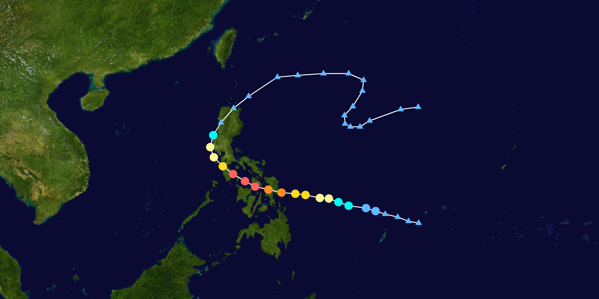
Typhoon Pakhar (Jenny)[]
| Typhoon (JMA) | |
| Category 5 super typhoon (SSHWS) | |
| Duration | October 25 – November 10 |
|---|---|
| Peak intensity | 230 km/h (145 mph) (10-min) 909 hPa (mbar) |

Pakhar struck the Philippines powerfully on November 1.
Typhoon Sanvu (Kabayan)[]
| Typhoon (JMA) | |
| Category 3 typhoon (SSHWS) | |
| Duration | November 1 – November 11 |
|---|---|
| Peak intensity | 130 km/h (80 mph) (10-min) 969 hPa (mbar) |

Sanvu struck an ailing Philippines, which has just been hit by powerful Pakhar. Sanvu struck areas previously hit by a stronger Yamaneko.
Typhoon Mawar (Liwayway)[]
| Typhoon (JMA) | |
| Category 4 typhoon (SSHWS) | |
| Duration | December 8 – December 17 |
|---|---|
| Peak intensity | 185 km/h (115 mph) (10-min) 935 hPa (mbar) |

_KZ.png)
_KZ.png)
_KZ.png)
_KZ.png)
_-_KZ%27s_2023.png)
.png)
_track.png)
_Track.png)
_track.png)
_track.png)
_track.png)
_track.png)
Mawar entered the Philippine Area of Responsibility as a tropical depression before intensifying. By December 11, it rapidly intensified into a typhoon and hitting Leyte didn't stop it from reaching it's peak intensity as a Category 4 in the Sibuyan Sea.
Storm names[]
Within the Northwest Pacific Ocean, both the Japan Meteorological Agency (JMA) and the Philippine Atmospheric, Geophysical and Astronomical Services Administration (PAGASA) assign names to tropical cyclones that develop in the Western Pacific, which can result in a tropical cyclone having two names. The Japan Meteorological Agency's RSMC Tokyo — Typhoon Center assigns international names to tropical cyclones on behalf of the World Meteorological Organization's Typhoon Committee, should they be judged to have 10-minute sustained windspeeds of 65 km/h (40 mph). PAGASA names to tropical cyclones which move into or form as a tropical depression in their area of responsibility located between 135°E and 115°E and between 5°N and 25°N even if the cyclone has had an international name assigned to it. The names of significant tropical cyclones are retired, by both PAGASA and the Typhoon Committee. Should the list of names for the Philippine region be exhausted then names will be taken from an auxiliary list of which the first ten are published each season.
International names[]
During the season, 13 tropical storms developed in the Western Pacific and each one was named by the JMA, when the system was judged to have 10-minute sustained windspeeds of 65 kilometres per hour (40 mph). The JMA selected the names from a list of 140 names, that had been developed by the 14 members nations and territories of the ESCAP/WMO Typhoon Committee. Retired names, if any, will be announced by the WMO in 2024; though replacement names will be announced in 2025.
|
|
Philippine names[]
During the season PAGASA used its own naming scheme for the N/A tropical cyclones, that either developed within or moved into their self-defined area of responsibility. The names were taken from a list of names, that had been last used during 2019 and are scheduled to be used again during 2027. Unused names are marked in gray.
| Main list | ||||
|---|---|---|---|---|
| Amang | Betty | Chedeng | Dodong | Egay |
| Falcon | Goring | Hanna | Ineng | Jenny |
| Kabayan | Liwayway | Marilyn (unused) | Nimfa (unused) | Onyok (unused) |
| Perla (unused) | Quiel (unused) | Ramon (unused) | Sarah (unused) | Tamaraw (unused) |
| Ugong (unused) | Viring (unused) | Weng (unused) | Yoyoy (unused) | Zigzag (unused) |
| Auxiliary list | ||||
| Abe (unused) | Berto (unused) | Charo (unused) | Dado (unused) | Ernie (unused) |
| Felion (unused) | Gening (unused) | Herman (unused) | Irma (unused) | Jaime (unused) |
Retirement[]
International names[]
The WMO retired Noru, Yamaneko, Pakhar and Mawar after the season. They were replaced with Sora, Tokei, Xekatam and Rotan after the season.
Philippines[]
After the season, PAGASA retired the names Falcon, Ineng, Jenny and Liwayway after they caused over P1 billion in damages. They were replaced with Fuga, Ibalon, Junior and Lam-ang.
Season effects[]
The following table lists all of the storms that have formed in the 2023 Pacific typhoon season. It includes their duration, names, landfall(s)—denoted by bold location names—damages, and death totals. Damage and deaths include totals while the storm was extratropical, a wave, or a low, and all of the damage figures are in 2023 USD.
| Name | Dates active | Peak classification | Sustained wind speeds |
Pressure | Areas affected | Damage (USD) |
Deaths | Refs |
|---|---|---|---|---|---|---|---|---|
| Merbok (Amang) | April 9 – April 22 | Tropical storm | 65 (40) | 995 | Palau, Philippines | Unknown | 0 | |
| Nanmadol | May 5 - May 10 | Tropical storm | 65 (40) | 1002 | none | none | 0 | |
| Talas (Betty) | June 2 - June 16 | Typhoon | 185 (100) | 960 | Japan | $15.3 million | 3 | |
| Noru (Chedeng) | July 21-August 3 | Typhoon | 275 (150) | 910 | Philippines, Taiwan, Japan, Palau | $70.8 million | 21 | |
| Kulap (Dodong) | August 2-August 11 | Typhoon | 120 (65) | 978 | Philippines, Vietnam, Laos, Thailand | $50.2 million | 56 | |
| Roke | August 10-August 15 | Tropical storm | 65 (35) | 999 | none | none | 0 | |
| Sonca (Falcon) | August 20-September 1 | Typhoon | 275 (150) | 909 | Philippines, China | $145.8 million | 30 | |
| 07W (Egay) | August 21-August 23 | Tropical depression | 55 (30) | 1005 | Philippines | Unknown | 2 | |
| Nesat | September 4-September 9 | Tropical storm | 65 (35) | 998 | None | Unknown | None | |
| Haitang | September 8-September 12 | Tropical storm | 65 (35) | 998 | None | Unknown | None | |
| Nalgae (Goring) | September 20-September 30 | Typhoon | 225 (120) | 954 | None | Unknown | None | |
| Banyan (Hanna) | October 1-October 10 | Typhoon | 215 (115) | 952 | None | Unknown | None | |
| Yamaneko (Ineng) | October 7-October 18 | Typhoon | 215 (115) | 945 | Philippines | $89.49 million | 10 | |
| Pakhar (Jenny) | October 25-November 10 | Typhoon | 285 (150) | 921 | Philippines | $1.3 billion | 25 | |
| Sanvu (Kabayan) | November 1-November 11 | Typhoon | 185 (100) | 956 | Philippines | $1.3 million | 2 | |
| Mawar (Liwayway) | December 8-December 17 | Typhoon | 225 (120) | 940 | Philippines | $145.3 million | 22 | |
| Season aggregates | ||||||||
| N/A systems | March 11 – N/A | N/A | N/A | $N/A | N/A | |||