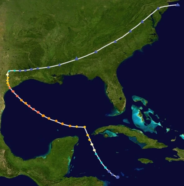
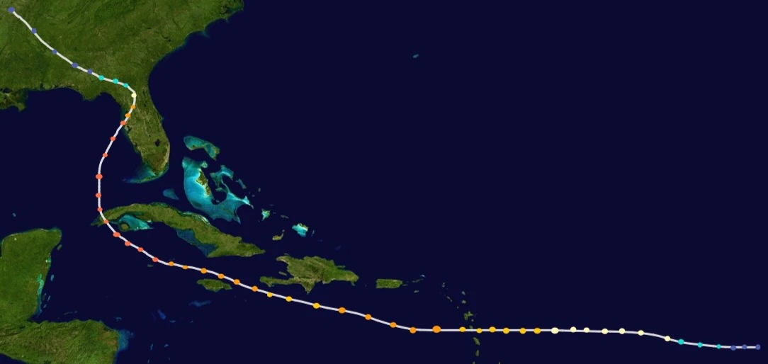
The 2001 Atlantic hurricane season was a near-average season and was fairly active. Unlike the 1995 Atlantic hurricane season, this season was inactive, though deadly and destructive. The 2001 Atlantic hurricane season featured 17 depressions, 13 storms, 7 hurricanes and 4 major hurricanes. The reason to its activity is due to the developing La Niña.
2 of the major hurricanes— Hugo and Marilyn, were both retired due to their impacts on land and deaths. Gabrielle, also one of the storms that reached major hurricane intensity, was also retired after making landfall on Texas.
Timeline & summary[]

Activity[]
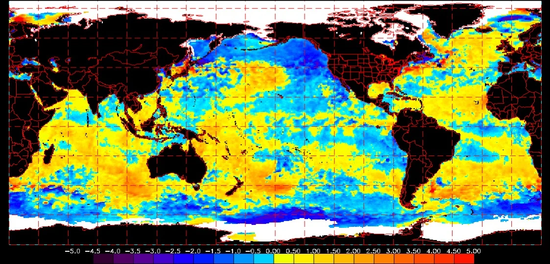
Sea temperatures during September 2001.
The season was fairly active and above-average, but less active than the infamous 1995 Atlantic hurricane season. During spring, a weak La Niña started to develop. As usual, September was the most active month of the year. The season featured 5 major hurricanes, most of them forming between late August and mid September. Despite warming of the sea temperatures, the season started late (the first storm of the season formed on June 27).
Impact[]
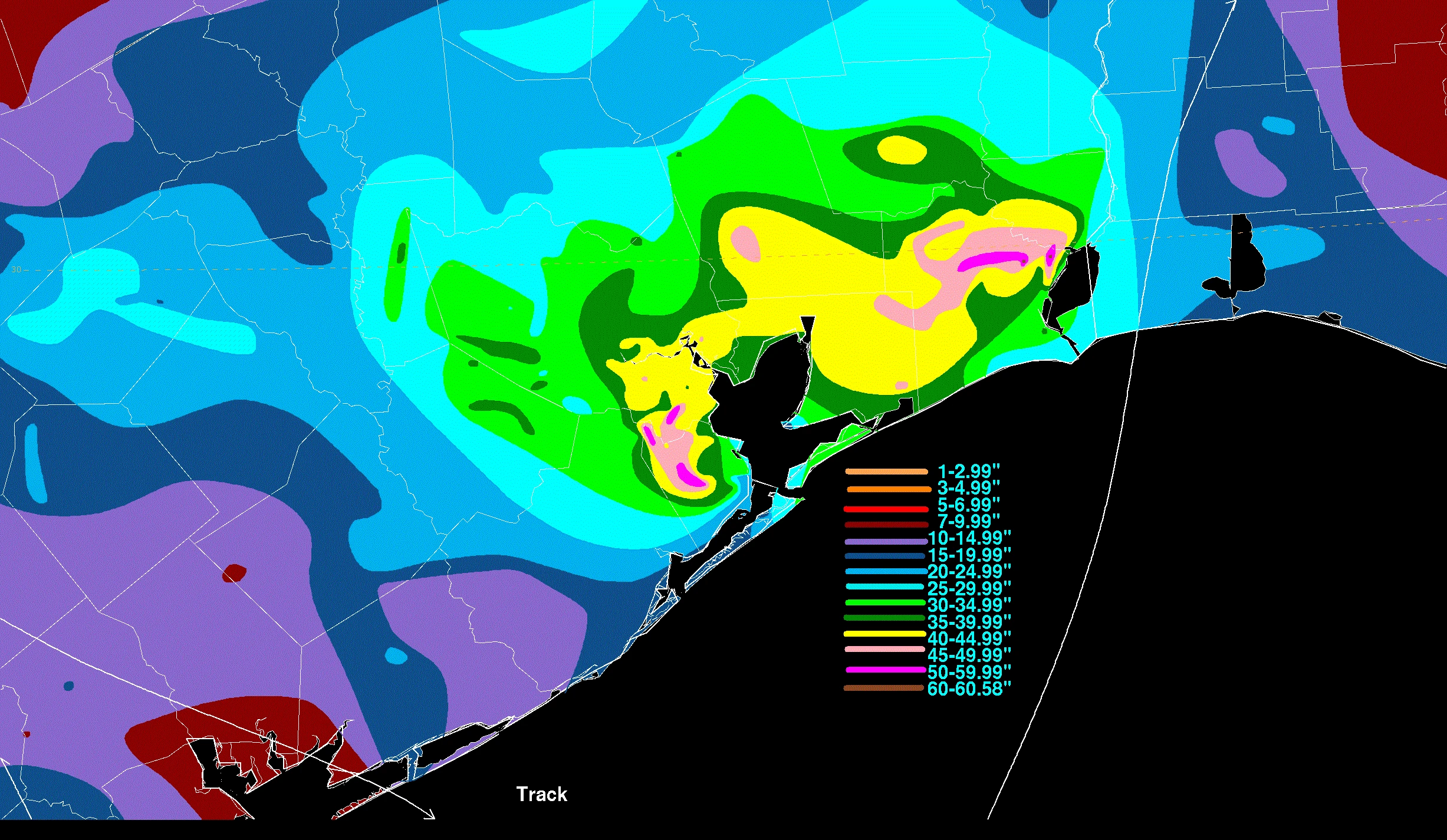
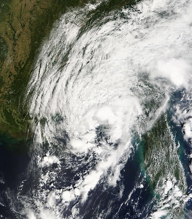
Rainfall map of Gabrielle.
Despite being less active than the 1995 season, it featured deadly and destructive storms. The most notable one being Gabrielle. Gabrielle dropped 58.55 mm of rain on Texas and surrounding areas, which caused catastrophic damage. Another notable storm was Hurricane Luis, which was infamos due to the sinking of a RO-RO vessel near Bermuda. The sinking of the ferry caused 1,150 deaths and 600 million USD of damages. Despite this, Luis was not retired.
Records[]

The Southwest Freeway underwater due to Hurricane Gabrielle.
Some records have been broken by significant storms, such as Hurricane Gabrielle, that broke Noel 1995's record of being the costliest Atlantic hurricane on record. Gabrielle's record was shattered 10 years later, when Hurricane Philippe of 2011 made catastrophic damage to Florida. Luis was one of the deadliest ship disasters ever recorded in maritime history. It was the deadliest ship accident caused by a natural disaster.


Rescue team saving passengers from the sinking vessel near Cape Hatteras.
Marilyn, one of the major hurricanes of the season, became the most intense hurricane on the month of November on the 21st century, after reaching Category 4 on its peak intensity. This season had the most name retirements since the 1995 season, having 4 names retired — Dorian, Gabrielle, Hugo, and Marilyn. It also was the latest start since 1997, the first storm forming on late June.
Systems[]
Tropical Storm Amelia[]
| Tropical storm (SSHWS) | |
  | |
| Duration | June 27 – June 29 |
|---|---|
| Peak intensity | 100 km/h (65 mph) (1-min) 1001 hPa (mbar) |
On June 20, an area of thunderstorms located on the Caribbean Sea was being monitored for cyclogenesis. The area was then designated as Potential Tropical Cyclone One on June 24 as it neared Cuba.
On June 27, it was officially declared as a depression by the NHC as it made landfall on the Isle of Youth and Eastern Cuba. As it neared Florida on June 28, it intensified into Tropical Storm Amelia.
On June 29, before making landfall on the Florida Panhandle, Amelia reached its peak intensity. It shortly then make landfall on the Florida Panhandle later on. Amanda became extratropical over Georgia and became an extratropical low later on.
Amelia was absorbed by a strong extratropical cyclone slashing the eastern coast of USA (including Florida and New England) known as Winter Storm Kaylee, which caused more catastrophic damage to Florida and surrounding states.
Amelia caused $800 million USD of damages and claimed 45 lives, 7 of them being indirect.
Tropical Storm Barry[]
| Tropical storm (SSHWS) | |
  | |
| Duration | July 1 – July 7 |
|---|---|
| Peak intensity | 65 km/h (40 mph) (1-min) 1005 hPa (mbar) |
On late June, an area of thunderstorms above the Yucatán Peninsula was being monitored for cyclogenesis. On July 1, the area was designated as a depression. Despite favorable conditions, the depression did not intensify any further due to upper-level wind shear.
On July 4, the depression intensified into Tropical Storm Barry. Barry fluctuated between tropical storm intensity and tropical depression intensity from July 4 to July 5.
On July 6, Barry intensified into a tropical storm again above land as it made landfall near the Texas-Mexico border. On July 7, Barry dissipated.
Barry caused minimal damage and no deaths were recorded.
Tropical Storm Chantal[]
| Tropical storm (SSHWS) | |
  | |
| Duration | July 22 – July 27 |
|---|---|
| Peak intensity | 95 km/h (60 mph) (1-min) 1000 hPa (mbar) |
During early July, a tropical wave emerged off the coast of Africa. The slow moving wave then approached Bahamas as it strengthened. On July 22, it was classified as a depression.
On July 23, the depression intensified into Tropical Storm Chantal as it neared Bahamas. On July 24, Chantal reached its peak intensity. As Chantal moved away from the Gulf Stream, it started to weaken.
On July 26, Chantal became fully extratropical and made landfall on North Carolina and Virginia. It then dissipated later.
Chantal caused $100 million USD of damages and claimed 2 lives after killing two surfers due to rip tides on Georgia.
Tropical Depression Four[]
| Tropical depression (SSHWS) | |
  | |
| Duration | July 23 – July 28 |
|---|---|
| Peak intensity | 55 km/h (35 mph) (1-min) 999 hPa (mbar) |
An extratropical low dancing on the Central Atlantic turned into tropical later on. The low then became a depression on July 23.
The depression did not intensify further due to unfavorable conditions, but lived for 5 days and made 2 loops along its lifetime.
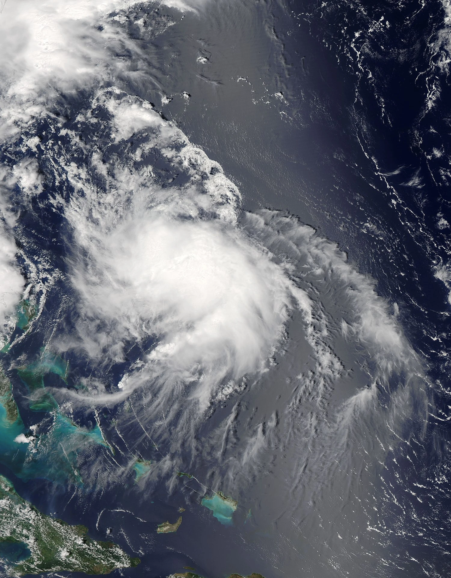
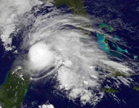
Hurricane Dorian[]
| Category 2 tropical cyclone (SSHWS) | |
  | |
| Duration | August 3 – August 15 |
|---|---|
| Peak intensity | 165 km/h (105 mph) (1-min) 974 hPa (mbar) |
On late July, a tropical wave exited the coast of Africa. The wave was then split into half, but the other portion of the wave absorbed a remnant low near the Lesser Antilles. On August 3, it was then classified as a depression.
On August 4, the depression intensified into Tropical Storm Dorian. Dorian started to strengt
hen as it approached towards favorable conditions. On August 6, Dorian attained hurricane status and became the first hurricane of the season.

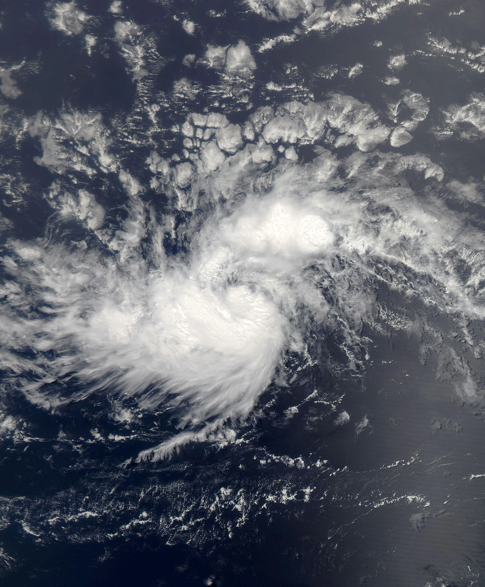
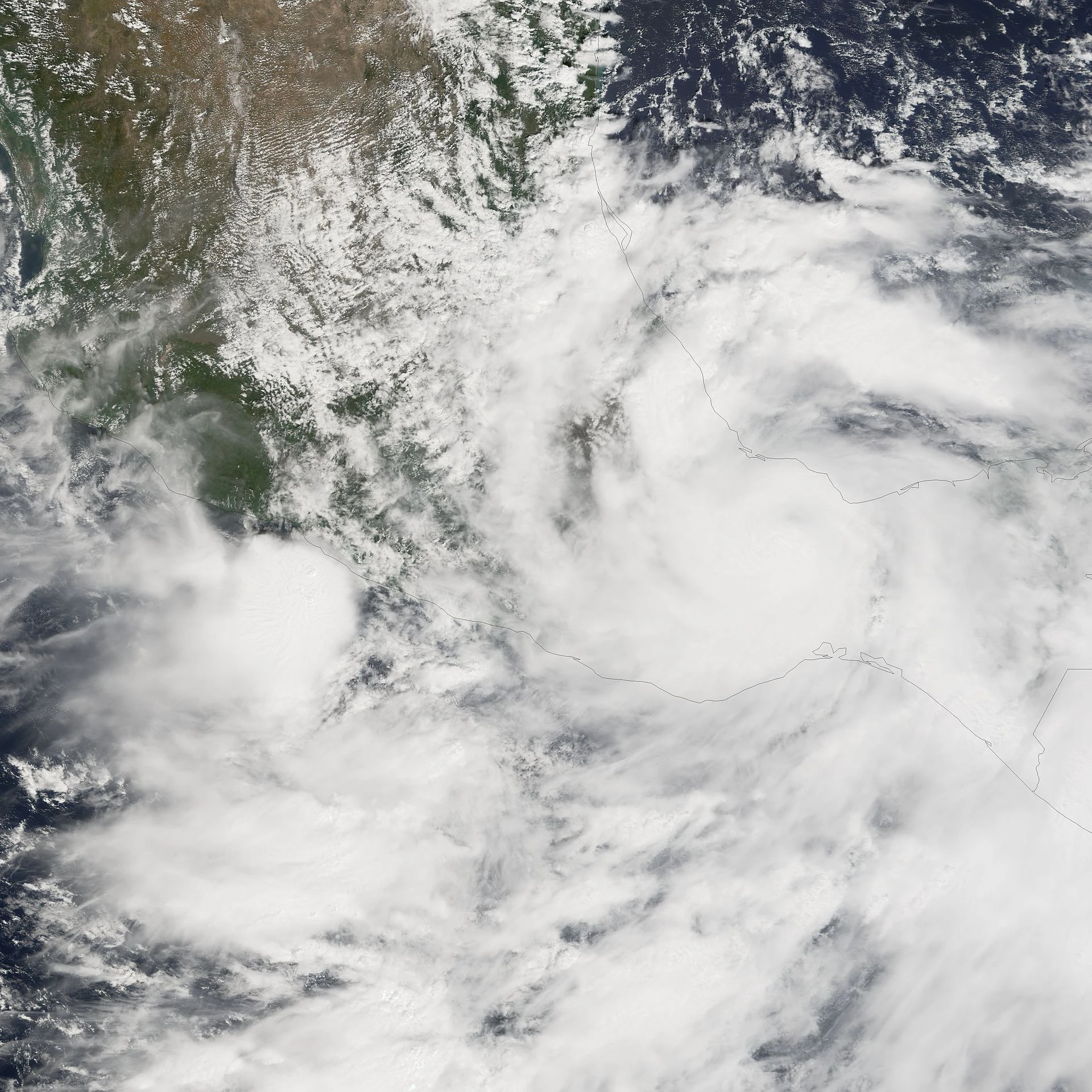
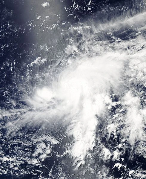
Dorian north of Puerto Rico after attaining hurricane intensity.
Dorian then made landfall on the Greater Antilles as it strengthened much more. On August 8, as it made landfall on Bahamas and the Turks & Caicos Islands, Dorian intensified into a Category 2 hurricane. Before making landfall on Florida, Dorian reached its peak intensity. On August 9, Dorian made landfall on Florida.
Dorian weakened into a Category 1 after interacting with land later on. On August 11, Dorian made its second landfall on Northern Florida and Georgia as a Category 1 hurricane. Dorian then weakened into a tropical storm shortly after landfall. On August 12, Dorian weakened into a depression as it shifted off the Gulf Stream. On August 14, Dorian became fully extratropical and became an extratropical low on August 15.
Dorian caused $10 billion USD of damages and claimed 66 lives.
Tropical Storm Erin[]
| Tropical storm (SSHWS) | |
  | |
| Duration | August 5 – August 9 |
|---|---|
| Peak intensity | 100 km/h (65 mph) (1-min) 997 hPa (mbar) |
An extratropical low southeast of Bermuda was being monitored for possible cyclogenesis. On August 5, the low became fully tropical and became a depression.
The depression then intensified into Tropical Storm Erin. On August 7, Erin reached its peak intensity. As wind shear started to affect Erin, On August 8, Erin became extratropical and was declared as an extratropical low on August 9.
Erin caused minimal damage and no deaths were reported.
Tropical Depression Seven[]
| Tropical depression (SSHWS) | |
  | |
| Duration | August 10 – August 13 |
|---|---|
| Peak intensity | 50 km/h (30 mph) (1-min) 1007 hPa (mbar) |
On late July, a tropical wave emerged off the coast of Africa. The wave was split into two, the other part being Hurricane Dorian. On August 9, the wave reached the Bay of Campeche.
On August 10, it was declared as a depression. Due to its proximity to land, Seven did not intensify further. It then dissipated on August 13.
Seven caused $250 million USD of damages and claimed 34 lives. Despite being a weak depression, Seven was deadly and destructive.
Tropical Storm Fernand[]
| Tropical storm (SSHWS) | |
  | |
| Duration | August 20 – August 25 |
|---|---|
| Peak intensity | 110 km/h (70 mph) (1-min) 995 hPa (mbar) |
A subtropical low located 30 miles east of Florida became a subtropical depression on August 20. The subtropical depression then made landfall on Florida hours later.
On August 21, the subtropical depression intensified into Subtropical Storm Fernand, and became the first subtropical storm to be named excluding Subtropical Storm Alpha of 1972.
On August 23, Fernand became fully tropical. On August 24, Fernand reached its peak intensity before making landfall on North Carolina. Hours later, Fernand made landfall on North Carolina. It became extratropical and dissipated on the next day.
Fernand caused $100 million USD of damages and claimed 12 lives.
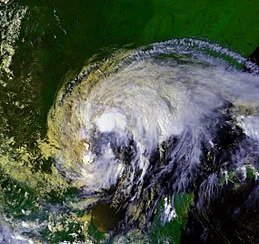
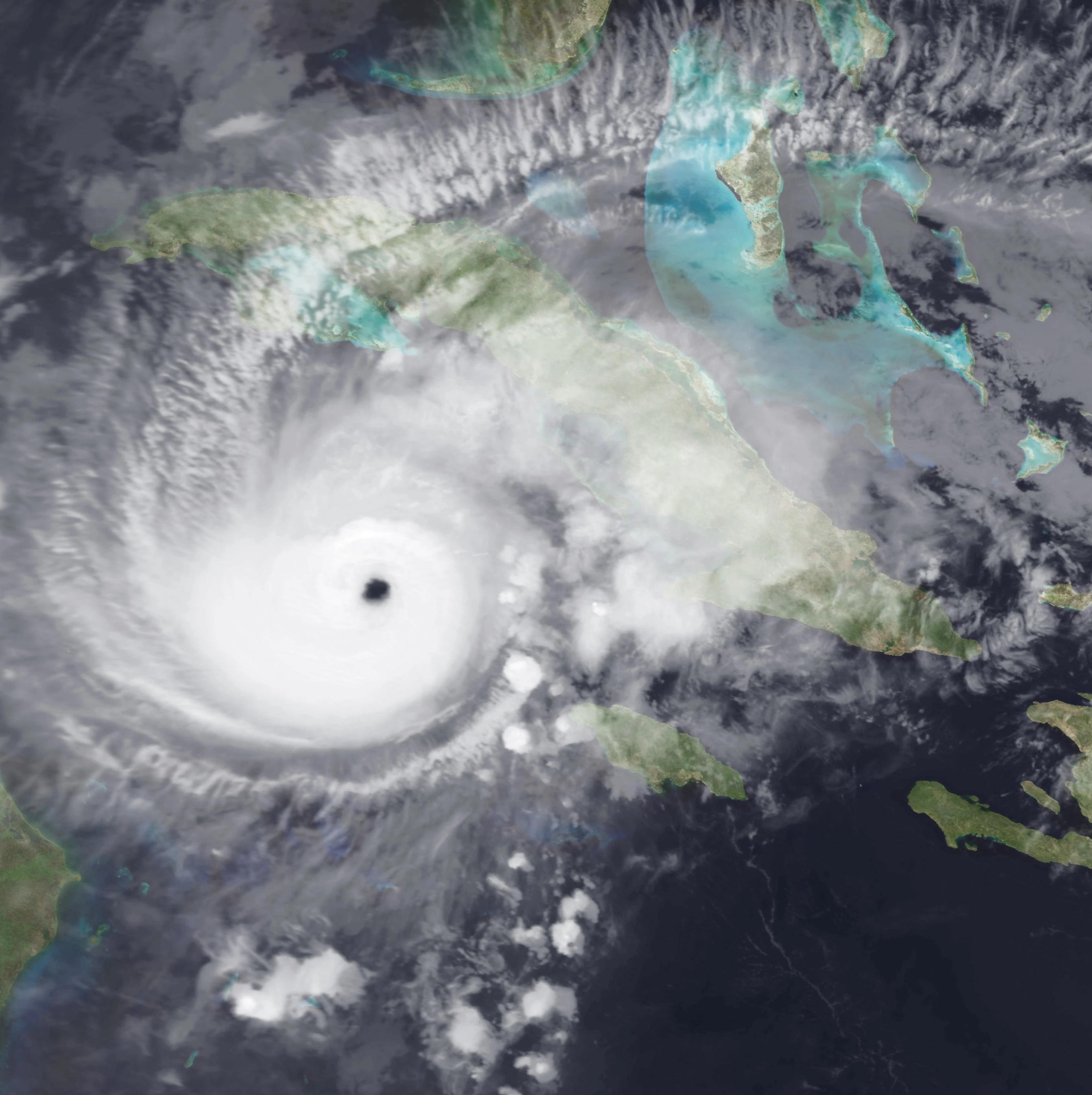
Hurricane Gabrielle[]
| Category 4 tropical cyclone (SSHWS) | |
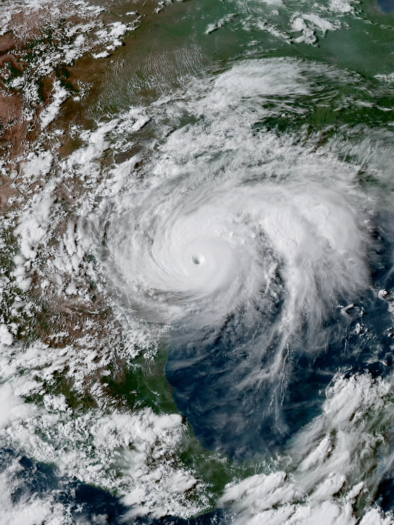  | |
| Duration | August 26 – September 6 |
|---|---|
| Peak intensity | 220 km/h (140 mph) (1-min) 929 hPa (mbar) |
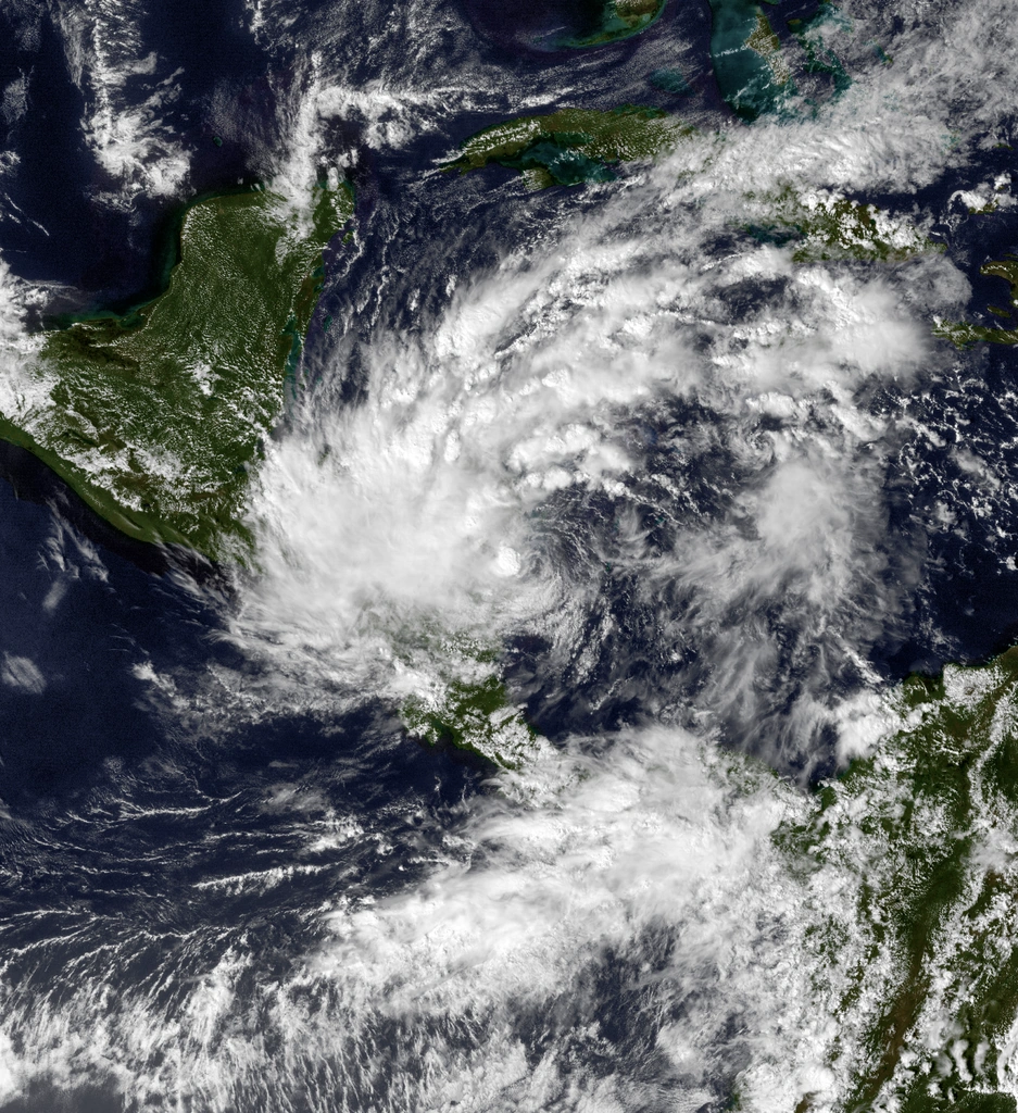
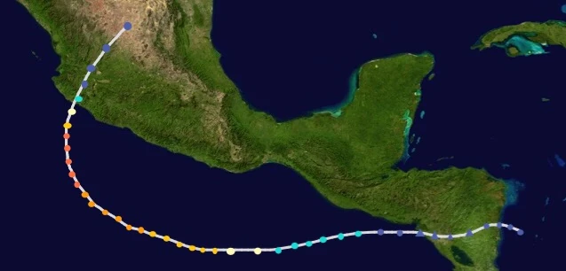
On mid-August, a tropical wave exited off the coast of Africa. On August 24, the wave entered the Caribbean Sea. The wave was then assigned as Potential Tropical Cyclone Nine the next day. On August 26, Potential Tropical Cyclone Nine was classified as a depression.
Hours later, the depression intensified into Tropical Storm Gabrielle. On August 27, Gabrielle attained hurricane status. On August 28, Gabrielle rapidly intensified into a Category 2 hurricane just west of Cuba.

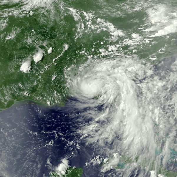
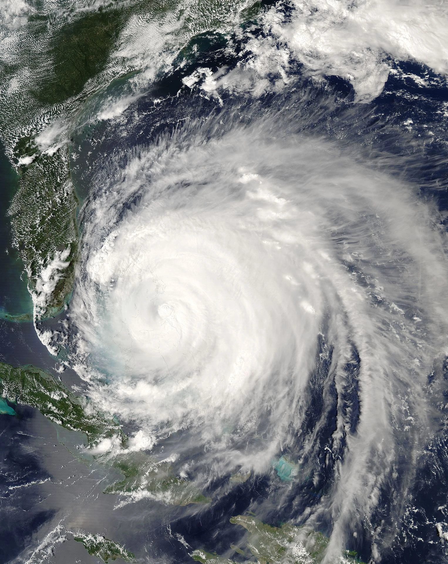
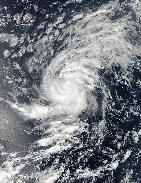
Gabrielle after being classified as a Category 2 hurricane.
On August 29, Gabrielle attained major hurricane status, which made Gabrielle the first major hurricane of the season. On August 30, Gabrielle rapidly intensified into a Category 4 hurricane.
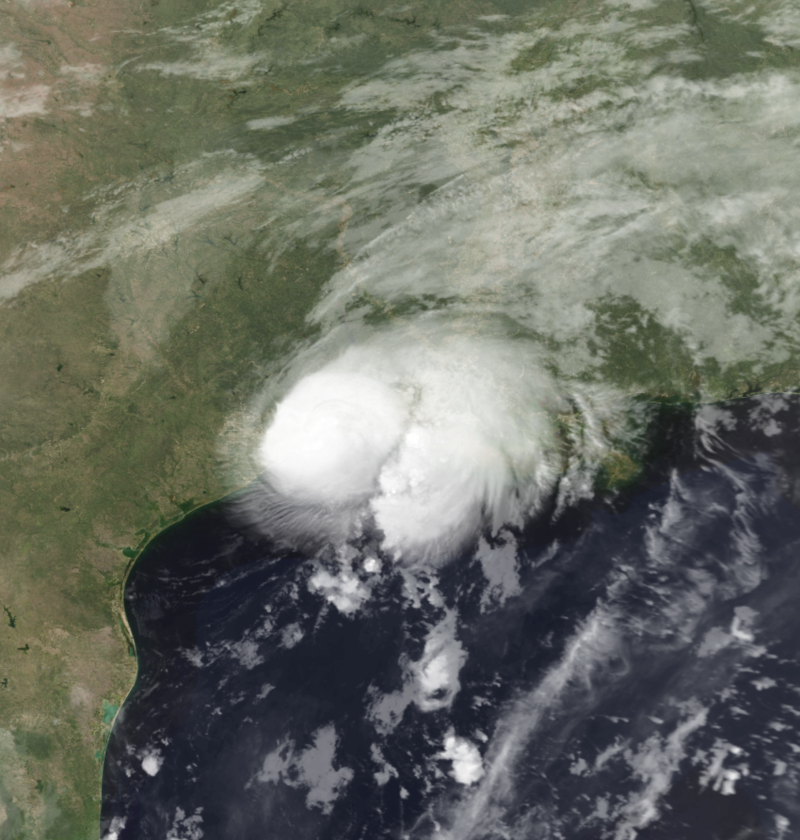
On August 31, Gabrielle weakened back into a Category 3 hurricane, after an eyewall replacement cycle. On September 1, Gabrielle re-intensified into a Category 4 hurricane before making landfall on Texas and reached peak intensity as it made landfall.
As it made landfall, Gabrielle rapidly weakened due to its interaction with land. On September 4, Gabrielle became extratropical as it began to affect inland states. On September 6, just off the coast of Virginia, Gabrielle became an extratropical low.
Gabrielle caused widespread & catastrophic flooding across several states. Gabrielle was the wettest Texas hurricane and the wettest U.S. hurricane on record, until on 2017, where Hurricane Harvey shattered Gabrielle's record. Gabrielle caused $34 billion USD of damages which made Gabrielle the costliest hurricane and shattered Noel's record at that time until Hurricane Ivory of 2011 shattered Gabrielle's record. 1,170 deaths were hurricane-related, 299 of them being indirect.
Hurricane Hugo[]
| Category 4 tropical cyclone (SSHWS) | |
  | |
| Duration | September 6 – September 19 |
|---|---|
| Peak intensity | 250 km/h (155 mph) (1-min) 922 hPa (mbar) |
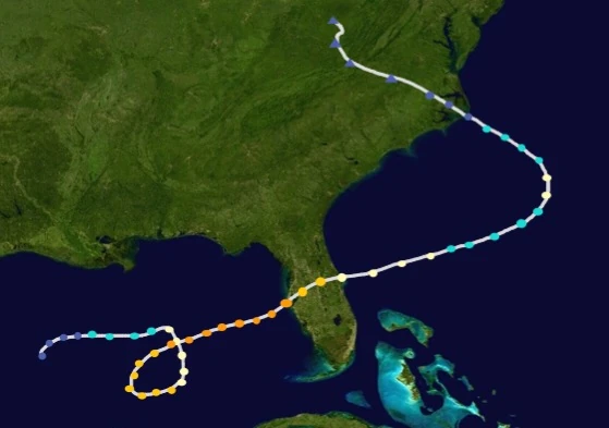
On early September, a tropical wave exited the coast of Africa. As it headed towards the west, it started to organize and strengthen. On September 6, it was classified as a tropical depression.
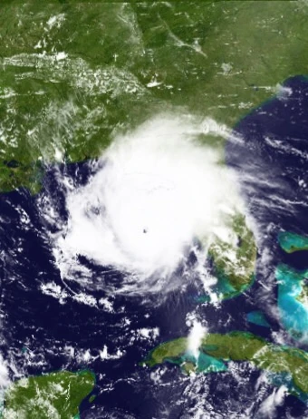
18 hours later, it intensified into Tropical Storm Hugo. On September 7, Hugo attained hurricane intensity. On September 9, Hugo intensified into a Category 2 as it neared the Lesser Antilles. On September 10, as Hugo developed an eye, Hugo attained major hurricane intensity as it made landfall near Puerto Rico and the Lesser Antilles.
On September 12, Hugo weakened due to an eyewall replacement cycle as it made landfall on Jamaica. On September 14, Hugo intensified into a Category 4 as it made landfall on Cuba and the Isle of Youth. On September 16, Hugo reached its peak intensity before making landfall on Florida. On September 17, Hugo weakened as it made landfall. Hugo then affected nearby states as a storm and a depression. On September 19, Hugo was degenerated into a remnant low.
Hugo caused $11.5 billion USD of damages and claimed 88 lives, 13 of them being indirect.
Tropical Depression Eleven[]
| Tropical depression (SSHWS) | |
  | |
| Duration | September 25 – September 26 |
|---|---|
| Peak intensity | 55 km/h (35 mph) (1-min) 1005 hPa (mbar) |
On the midnight of September 25, a depression formed near the Florida Panhandle. Due to its proximity to land, it did not intensify further. The depression then became extratropical. Eleven caused $1 million USD of damages and claimed 2 lives.
Tropical Storm Ingrid[]
| Tropical storm (SSHWS) | |
  | |
| Duration | September 26 – October 2 |
|---|---|
| Peak intensity | 100 km/h (60 mph) (1-min) 985 hPa (mbar) |
On September 26, a tropical depression formed near Bahamas. It then began to gained convection. On September 27, the depression intensified into Tropical Storm Ingrid.
On September 29, Ingrid reached its peak intensity as it shifted off the Gulf Stream. On October 1, Ingrid weakened into a depression as it made landfall near Bermuda. It became extratropical hours later. On October 2, Ingrid became an extratropical low.
Ingrid caused minimal damages and no deaths were reported.
Hurricane Jerry[]
| Category 1 tropical cyclone (SSHWS) | |
  | |
| Duration | October 1 – October 8 |
|---|---|
| Peak intensity | 140 km/h (85 mph) (1-min) 982 hPa (mbar) |
On late September, Tropical Storm Lorena made landfall on Central America. Shortly after landfall, Lorena dissipated and its mid-level circulation survived. On October 1, an interaction of the circulation and a tropical wave led to the formation of a tropical depression.
The tropical depression moved eastwards for a while. On October 2, the depression intensified into Tropical Storm Jerry. After a while, Jerry then headed northwestwards. As Jerry neared favorable conditions, it started to strengthen. On October 4, Jerry attained hurricane intensity.
As Jerry attained hurricane intensity, Jerry made landfall on the Yucatán Peninsula. Due to Jerry's fast speed, Jerry did not intensify further. On October 6, Jerry made landfall on Louisiana on peak intensity. On October 7, Jerry became extratropical. On the next day, Jerry was declared as an extratropical low.
Jerry caused $500 million USD of damages and claimed 24 lives.
Hurricane Karen[]
| Category 2 tropical cyclone (SSHWS) | |
  | |
| Duration | October 5 – October 16 |
|---|---|
| Peak intensity | 165 km/h (100 mph) (1-min) 970 hPa (mbar) |
A tropical wave emerged off the coast of Africa on early October. The wave then led to the formation of a tropical depression near Cape Verde.
On October 6, the depression intensified into Tropical Storm Karen as it started to organize. On the next day, Karen attained hurricane intensity. Karen then shifted its track to the northeast as it interacted with a low. On October 9, Karen weakened into a tropical storm as it headed north.
On October 11, Karen reattained hurricane strength. Twelve hours later, Karen intensified into a Category 2 hurricane despite unfavorable conditions. After intensifying, Karen reached its peak intensity. On October 12, Karen rapidly weakened as it headed towards unfavorable conditions. Six hours later, Karen became extratropical.
On October 14, Karen made landfall on Azores as an extratropical cyclone. On October 16, Karen became an extratropical low. After being an extratropical low, it made landfall on the Iberian Peninsula.
Karen caused $1 million USD of damages and no lives were claimed.
Tropical Depression Fifteen[]
| Tropical depression (SSHWS) | |
  | |
| Duration | October 10 – October 11 (exited basin) |
|---|---|
| Peak intensity | 35 km/h (25 mph) (1-min) 1002 hPa (mbar) |
An interaction between a tropical wave and a tropical low led to the formation of a tropical depression near Nicaragua. The depression then made landfall on Nicaragua after being declared as a depression. The depression's remnants moved towards the Eastern Pacific basin, and regenerated as Tropical Storm Priscilla.
Fifteen caused minimal damage and claimed 17 lives on Central America.
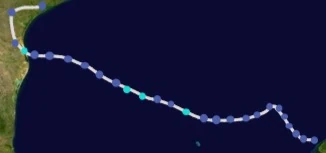
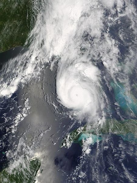
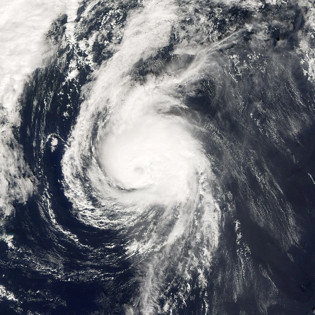
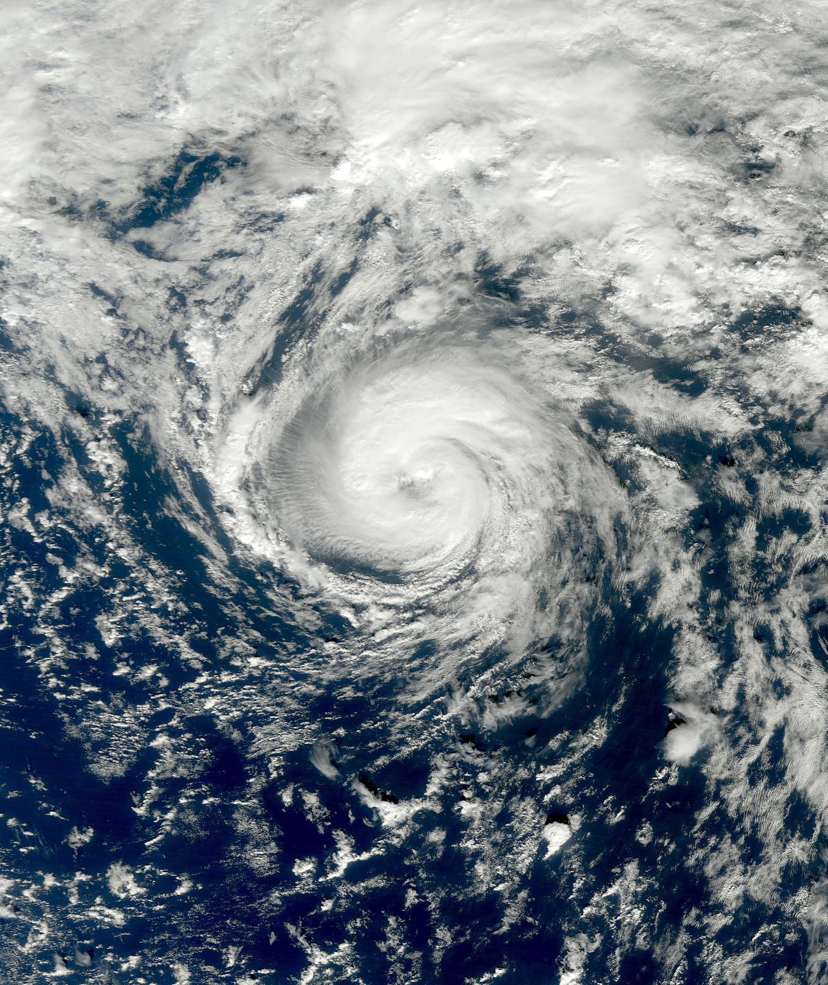
Hurricane Luis[]
| Category 3 tropical cyclone (SSHWS) | |
  | |
| Duration | November 1 – November 13 |
|---|---|
| Peak intensity | 185 km/h (115 mph) (1-min) 950 hPa (mbar) |
An interaction between a trough and a tropical wave led to the formation of a tropical disturbance on the Gulf of Mexico somewhere on late October. On November 1, it was classified as a depression. On November 2, the depression intensified into Tropical Storm Luis.
Luis then attained hurricane intensity as it started to execute a loop on November 3. On November 4, Luis intensified into a Category 2 hurricane. On November 6, Luis attained major hurricane intensity as it neared Florida. On November 7, Luis reached its peak intensity.
Hours after reaching its peak, Luis made landfall on Florida. On the next day, Luis weakened into a Category 2 hurricane. Hours later, Luis weakened into a minimal hurricane. On November 10, Luis restrengthened into a minimal hurricane after weakening into a tropical storm.
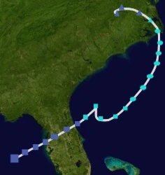
On November 11, a ferry miles away off the coast of North Carolina, was being attacked by rogue waves on 0000 UTC. The ferry then sent distress signals to nearby ships on 0300 UTC. On 0600 UTC, the ferry capsized as rogue waves carried the ship. The ferry was found afloat near Cape Hatteras. According to authorities, the ferry sunk due to overload and unfavorable conditions, which made the ferry sink faster. On November 12, before the ferry would fully sink, Luis made landfall on North Carolina, which worsened conditions. On November 13, Luis became extratropical and was absorbed by another extratropical cyclone.
Luis caused 600 million USD of damages and claimed 1,150 deaths, with 300 missing. Despite this, Luis was not retired, but was retired on the 2007 season.
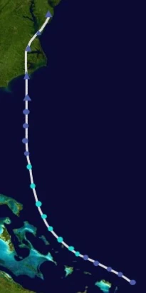
Hurricane Marilyn[]
| Category 4 tropical cyclone (SSHWS) | |
  | |
| Duration | November 17 – November 25 |
|---|---|
| Peak intensity | 220 km/h (140 mph) (1-min) 930 hPa (mbar) |
A tropical wave exited off the coast of Africa on early November. The slow-moving tropical wave then reached the Caribbean Sea during mid November. The tropical wave then coalesced and formed a tropical depression on November 17.
18 hours after being declared as a depression, the system swiftly intensified into Tropical Storm Marilyn. On November 18, Marilyn attained hurricane intensity 30 hours after being declared as a system. As Marilyn began to strengthen, an eye began to develop.
On November 19, the NHC upgraded Marilyn into a major hurricane reaching winds of 111 mph and above. On the same day, Marilyn rapidly intensified into a Category 4 hurricane. On November 20, Marilyn reached its peak intensity, and made landfall shortly after. As Marilyn made landfall, it was downgraded into a high-end Category 3 on 1800 UTC by the NHC. As the weakening trend continued, Marilyn was downgraded into Category 2 status on November 22. On November 23, Marilyn weakened into a tropical storm and underwent extratropical transitioning. On November 24, Marilyn was fully extratropical. On November 25, Marilyn merged with another extratropical low off Bermuda.
Marilyn caused $5 billion USD of damages and claimed 38 lives on Cuba alone.
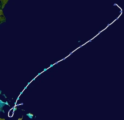
2001 Azores tropical storm[]
| Tropical storm (SSHWS) | |
  | |
| Duration | December 8 – December 11 |
|---|---|
| Peak intensity | 85 km/h (50 mph) (1-min) 992 hPa (mbar) |
During post-season analysis, two forecasters identified a tropical storm above Azores during December.
Retirement & names[]
Names[]
The following names were the same list that was used during the 1995 Atlantic hurricane season, with the exception of Amelia, Dorian, Fernand, Ingrid, and Nestor which were the replacements for the names Andrea, Dean, Felix, Iris, and Noel after being retired. Amanda, Dorian, Fernand, and Ingrid were used for the first time. Nestor was not used during the course of the season, but will be reused for the 2007 Atlantic hurricane season.
|
|
|
Retirement[]
On the spring of 2002, the World Meteorological Organization has retired the names Dorian, Gabrielle, Hugo, and Marilyn due to their impacts on land and deaths that they have caused and they will be never used for another Atlantic hurricane. They were replaced by Dylan, Geraldine, Hayden, and Mylene respectively for the 2007 Atlantic hurricane season.
2007 Atlantic hurricane naming list[]
|
|
|