
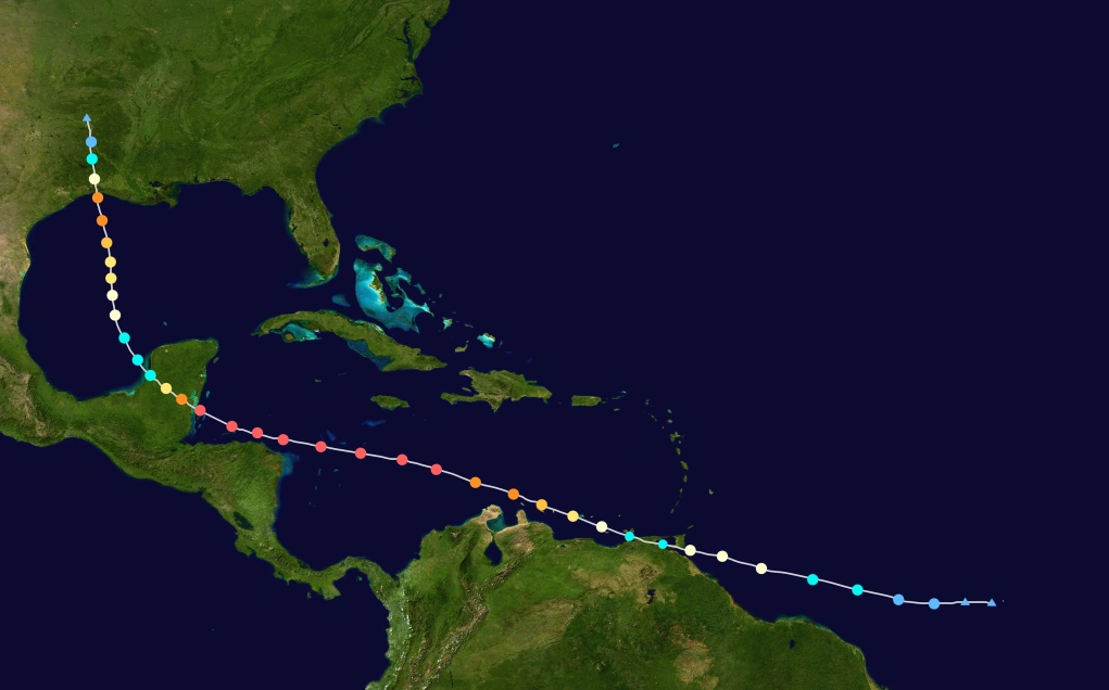
The 2017 Atlantic hurricane season was an extraordinary, intense, and hyperactive season in the Atlantic basin, as well as the costliest and deadliest cyclone season worldwide. It consisted of 28 named storms, 22 hurricanes, and 13 major hurricanes, with 6 being Category 5s. In total, the season caused an incomprehendible $5 trillion in damages, greatly surpassing the record set in 2005. This would also bring places such as Central America, Florida, the Lesser Antilles, and the US East Coast to their knees from an onslaught of extremely powerful storms. is also the deadliest hurricane season, and one of the deadliest worldwide.
The season officially began on June 1 and ended on November 30. These dates historically describe the period of year when most tropical cyclones form in the Atlantic basin. However, as shown by Hurricane Arlene in April, the formation of tropical cyclones is possible at other times of the year. At July, Hurricane Ghita hit areas of Guyana, Venezuela and later Dominica as a strong hurricane, causing mass death toll. Hurricane James is a weak major hurricane, causing some damage in Mexico. Hurricane Maria caused a lot of deaths in Central America, and later devastated Texas and Louisiana. The "triple megas", which are Hurricane Rita, Seth and Taylor. The former caused unexpected damage, and it later grow up to a really huge hurricane, and also considered as the most intense and strongest winds on record. It also brought Florida to rubble. The second one didn't cause as much damage, but feared upon by most people. The latter caused huge damage in Mexico. Hurricane Whitney, known as "Hypercane Whitney" by the public, is the most devastating hurricane of all time. It also brought the East Coast to ruins, displacing people in areas such as New York. Hurricane Beta caused a lot of damage in Louisiana, with Category 5 winds. Hurricane Gamma caused unusual impact in Western Europe, causing a lot of damage.The last storm of the season is Hurricane Eta, which moved inside the Mediterranean Sea and classified as 'medicane'.
Season summary[]


2017 Atlantic Hypothetical Hurricane Season Animation (Farm River)
The animated version of this season!
The Atlantic hurricane season officially began on June 1, 2017. Among the busiest on record, the season produced twenty-eight tropical depressions, all of which further intensified into tropical storms. twenty-two hurricanes were recorded. Thirteen of the twenty-two hurricanes further strengthened into major hurricanes. Unlike the pattern of previous years that acted to steer many tropical cyclones harmlessly into the open Atlantic, 2017 featured a pattern conducive for landfalls; in fact, the season culminated into many separate landfalls by Atlantic named storms. Almost 50,000 deaths were recorded while total damage reached over $5 trillion, making the 2017 season as the costliest in recorded history.
April, May and June[]
Hurricane Arlene as a rare April hurricane
Two months before the official hurricane season started, Hurricane Arlene formed as a subtropical depression, later becoming a subtropical storm, and later, a full tropical hurricane. It remained away from land, causing no impact. Arlene is also one of the few rare hurricanes to exist in April.
Tropical Storm Bret is another short-lived off-season storm, but in this case, it formed as full tropical. Bret caused some flooding in Gulf Cost, but the effects were not severe.
Eighteen days after the official start of the season, Hurricane Collette is another unusual South American-impacting hurricane. It impacted the areas of Guyana, French Guiana and Venezuela as minimal hurricane. It caused almost $600 million in damages and 89 deaths.
Hurricane Dennis is the next hurricane, which peaked at Category 2. It formed as a tropical wave, peaked intensity and hits Texas at it's peak. It caused a lot of damage, through wide-scale flooding. It caused almost $800 million damage.
July[]

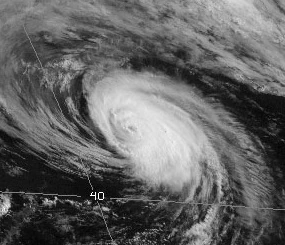
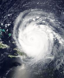
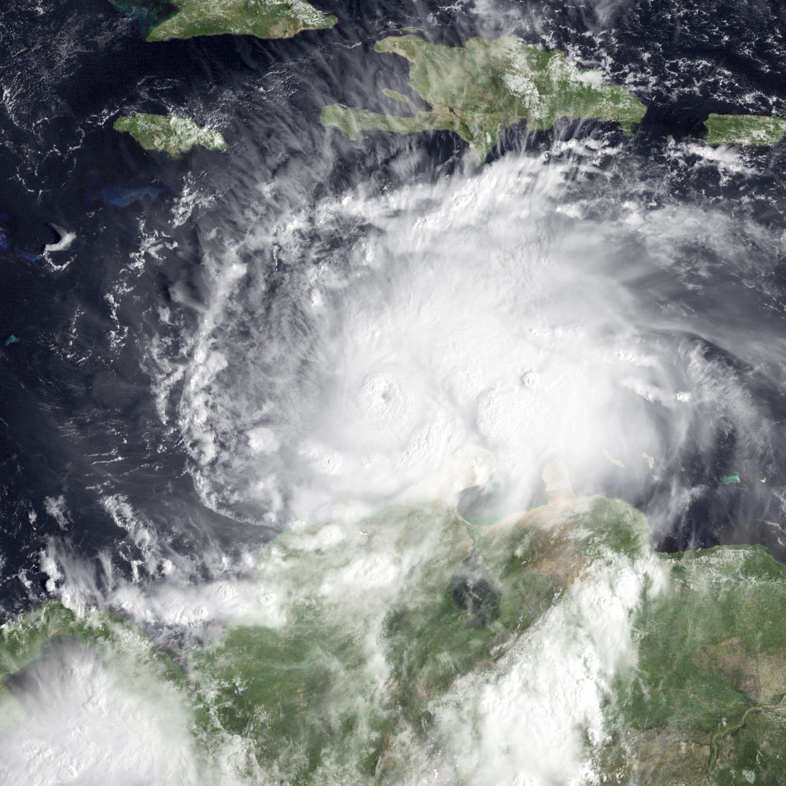
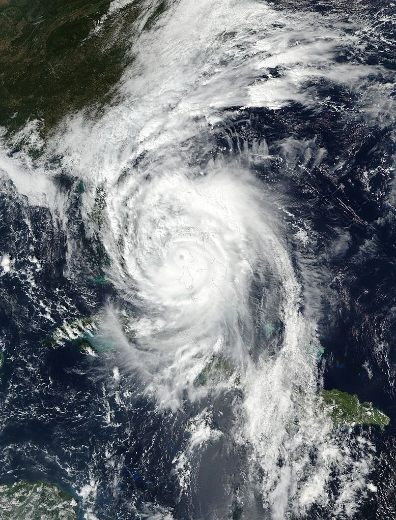
Hurricane Ghita at peak intensity.
The third hurricane of the season, Hurricane Elizabeth, is a Category 2 hurricane which affected areas such as Caribbean and later, New England. It caused rough waves in all areas it affected, and it caused moderate damage.
Tropical Storm Flynn is another weak tropical cyclone which affected the Cuba and Floridan coastline. It only caused rough waters and not much impact is caused.
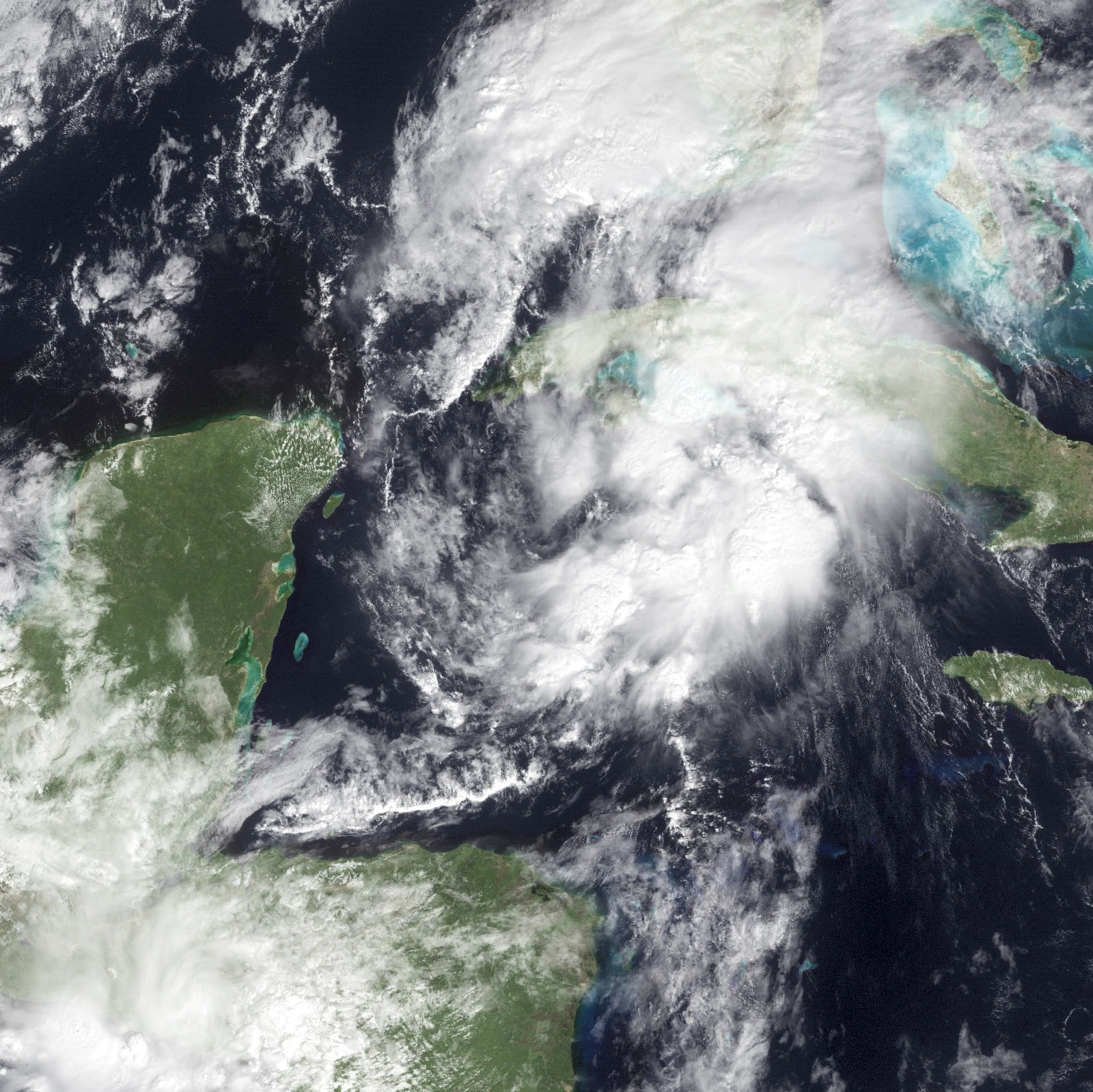
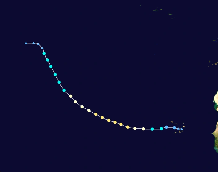
The first major hurricane of the season, Hurricane Ghita, is the first of all destructive hurricanes. It peaked as a Category 4 and impacted Lesser Antilles, Guyana, Venezuela, Hispaniola and rest of the Caribbean. This July monster caused almost more than 1150 deaths and $4 billion in damages, mostly in Guyana, Venezuela and Hispaniola.
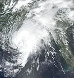
Hurricane Harold is a less destructive hurricane, which transversed Florida and Newfoundland. It peaked at Category 3 strength, making it the second major hurricane of the season. It caused light impact in areas affected.
August[]

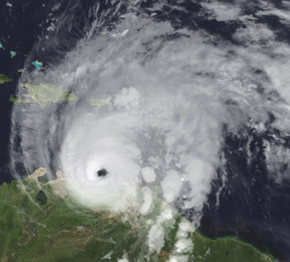
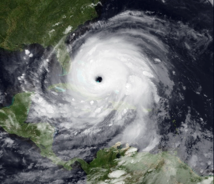
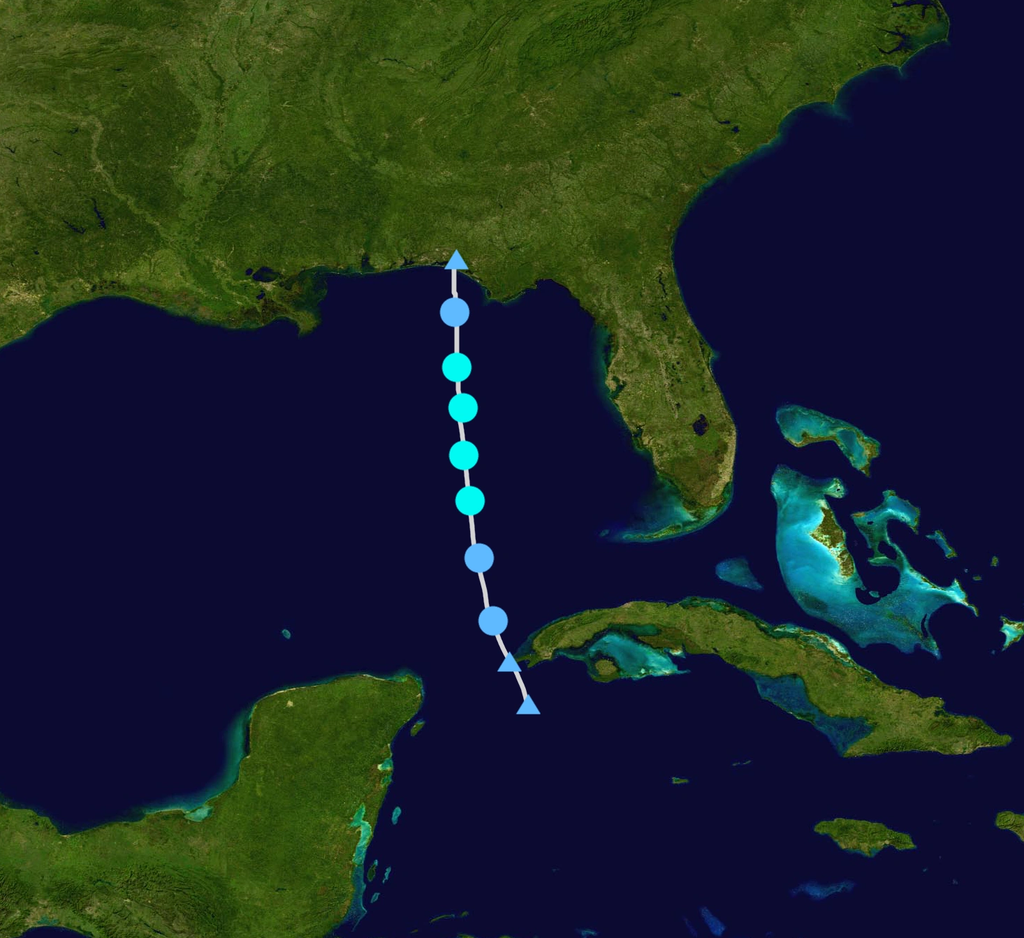
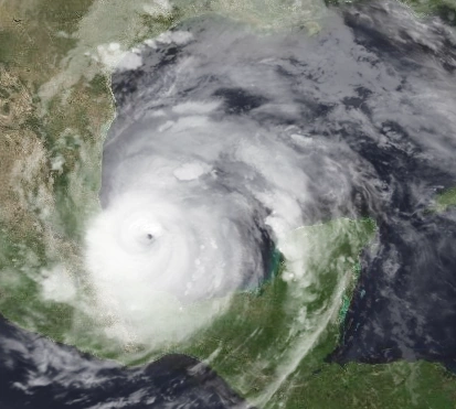
Hurricane Maria at peak intensity.
Tropical Storm Irma is another tropical storm which affects Cuba and Florida. It forms on August 2 as a wave, and intensifying at peak winds of 50 mph. It slowly weakened and it later dissipated.
Hurricane James is another major hurricane which caused heavy damage in Mexico. It formed in August 6, making it's first minimal hurricane landfall, and later it underwent explosive intensification, peaking at 130 mph, and it made landfall in Mexico. It caused heavy damage, amounting to $450 million.
A harmless storm, Tropical Storm Katrina, formed in August 9 off the coast of Africa. It didn't cause any known impact, and it peaked at 65 mph. It dissipated later on.
Hurricane Pierre north of Caribbean.
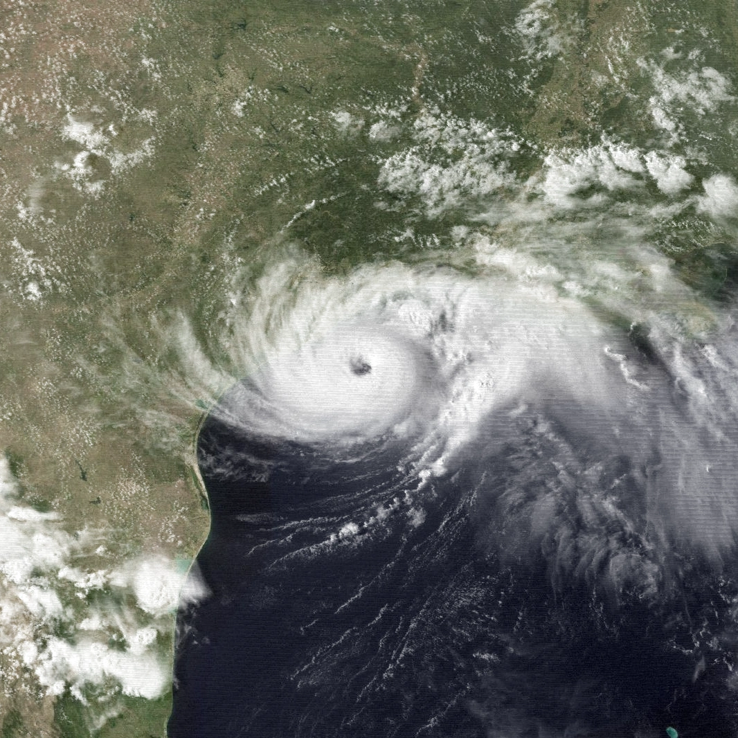
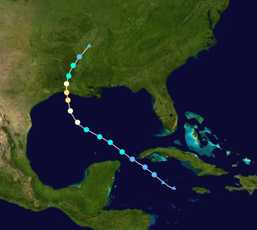
Hurricane Maria is the first Category 5 hurricane of the season, causing catastrophic damage in Central America. It peaked with winds of 185 mph, and pressure of 899 mbar. It formed on August 17 and later it made landfall in South America. Later it grow to be a powerful Central American hurricane, and later it made landfall in Texas as Category 4. It caused massive damage in Texas and Central America, and one of the deadliest in the recent years. It caused a total damage of $75 billion and death toll of 6355.
Another tropical storm, Tropical Storm Nate, formed in Caribbean Sea as an invest, and it intensified and peaked with winds of 45 mph. It only caused minimal impact, mostly in Haiti and Cuba.
Tropical Storm Oriana is another weak tropical storm which formed in the Gulf of Mexico. It made landfall on Texas as a weak tropical storm, and didn't cause much impact.

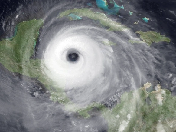
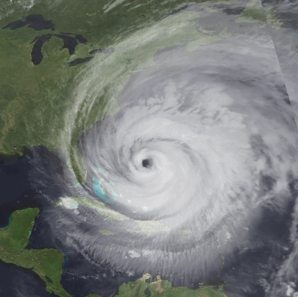
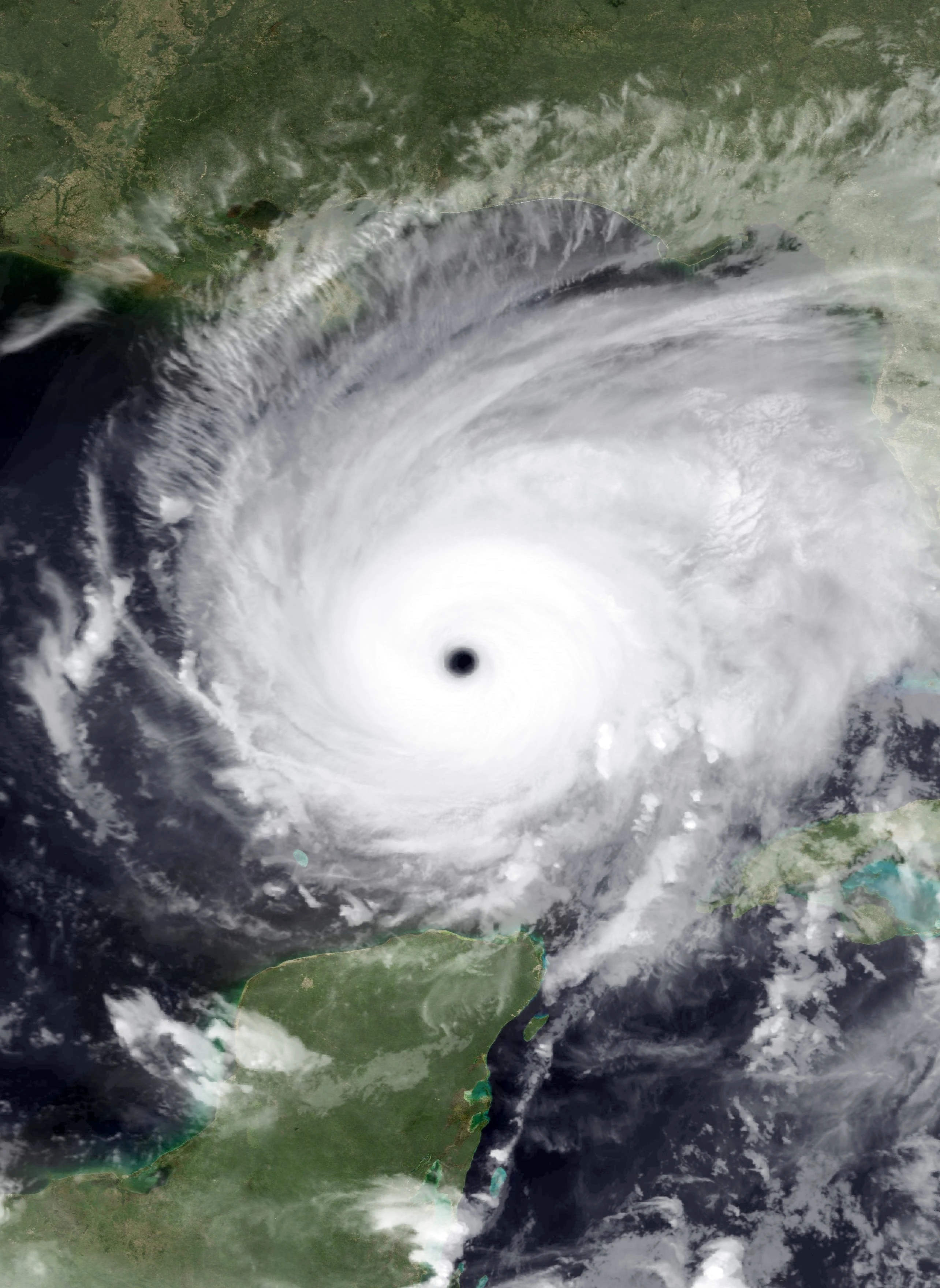
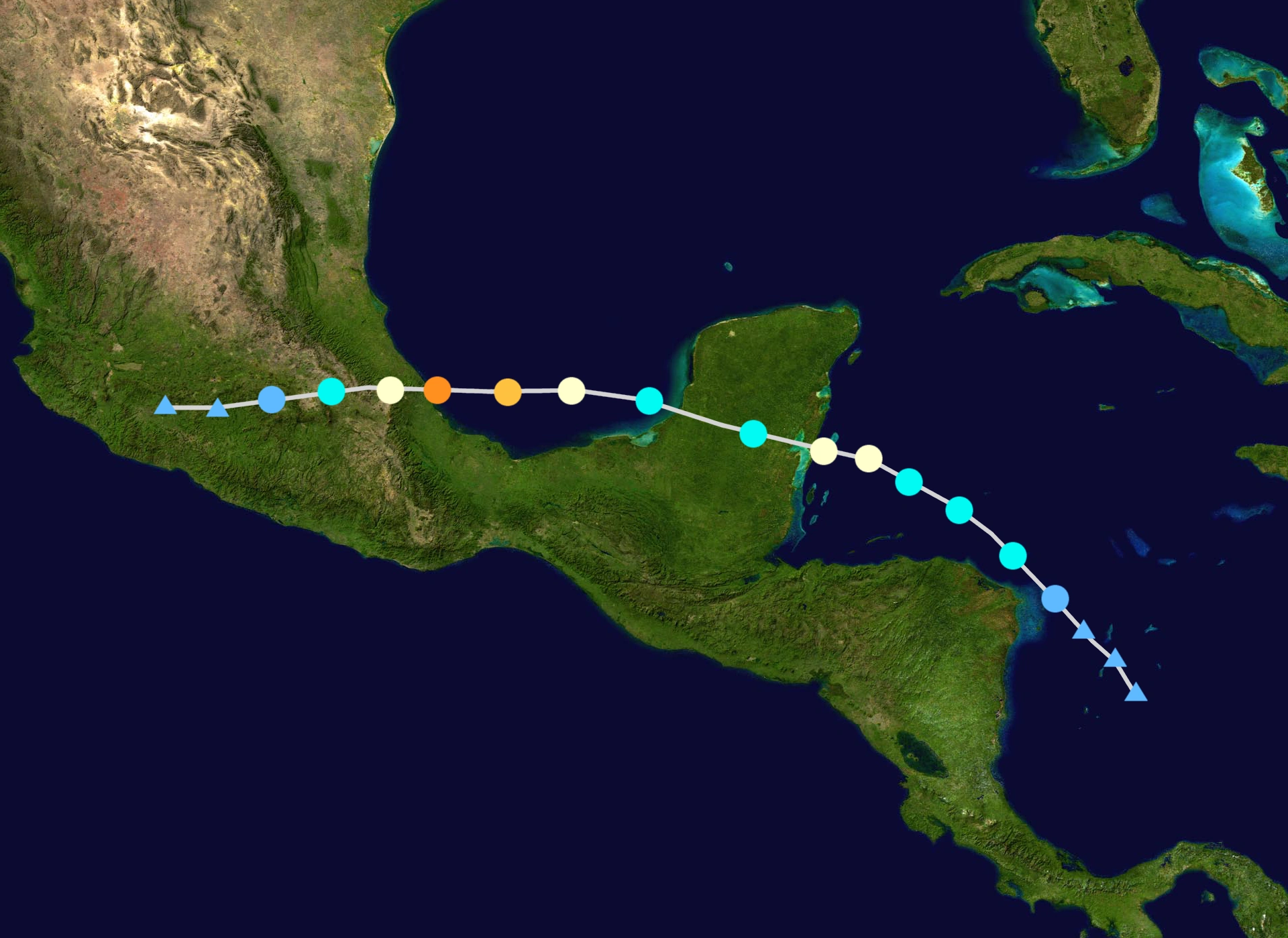
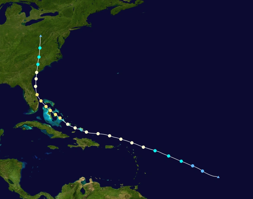
Hurricane Rita at peak intensity.
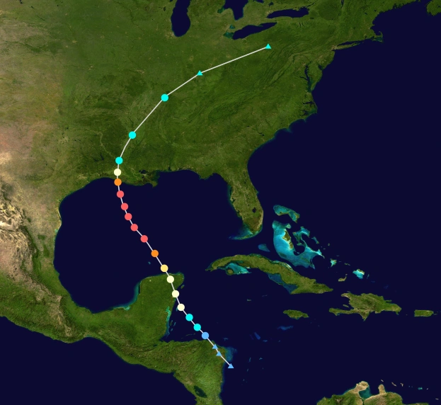
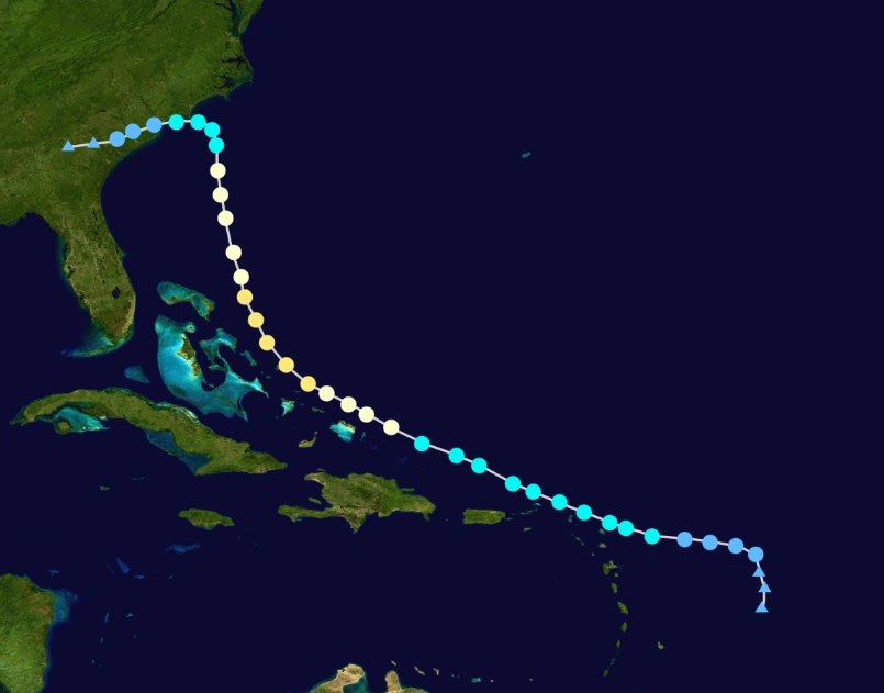
One of the costliest storms ever recorded, Hurricane Rita, otherwise known as "The Great Storm of 2017" and "Megastorm Rita", due to it's massive structure and unforgettable impact. Rita formed as a tropical wave and later emerged as a strong Category 5 hurricane in the Main Development Region. As it passes the Caribbean, it becomes larger and larger, at the same time, more intense, until it becomes super intense. It becomes so intense, reaching barometric pressure of 854 mbar, making it most intense storm ever recorded. It also has winds of 230 mph, some speculate it could have been much stronger. It made landfall in Florida, but it didn't weaken to Category 4 for a day, leaving Florida in ruins. Most of the well-known buildings, such as the Disneyland and the NHC Headquarters were rubbled and NHC was forced to retreat to a different place. It later weakened and turned extratropical. It almost totally destroyed Florida, as well as most of Caribbean, and leaving almost 15,000 dead, one of the highest in history, and damage of $1.7 trillion, making it the costliest hurricane ever recorded until Whitney, and the first natural disaster to reach $1 trillion in damages.
September[]

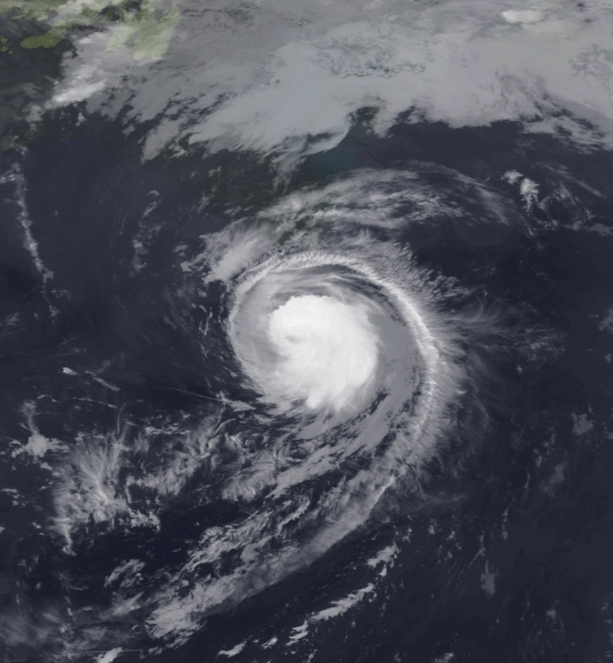
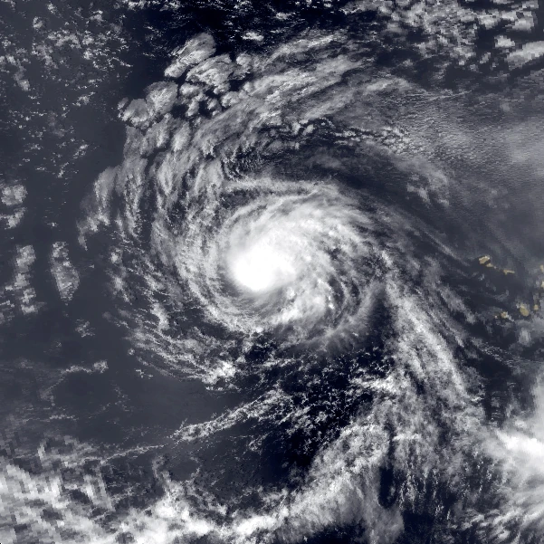
Hurricane Seth near the Caribbean
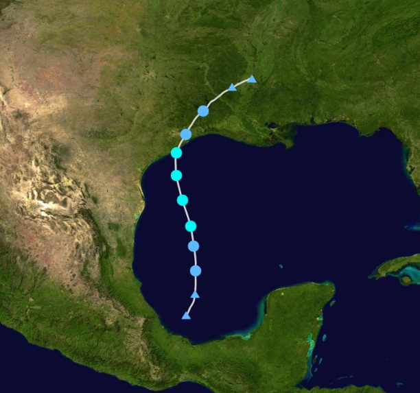
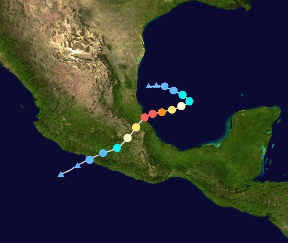
A rare Category 5 hurricane, Hurricane Taylor formed in the Gulf of Mexico, then it emerged in the Bay of Campeche. Rapid intensification allowed Taylor to reach Category 5 status. It hit Mexico at peak intensity, causing damage more than $2.5 billion. It was weakened by mountain terrain, and degenerated. It's remnants contributed to a formation of a major hurricane in the Pacific.
Hurricane Vernon is a non-destructive Category 2 hurricane which only affected Cape Verde. It peaked as a Category 2 with winds of 105 mph and it's remnants later contributed to a stronger Hurricane Alpha.

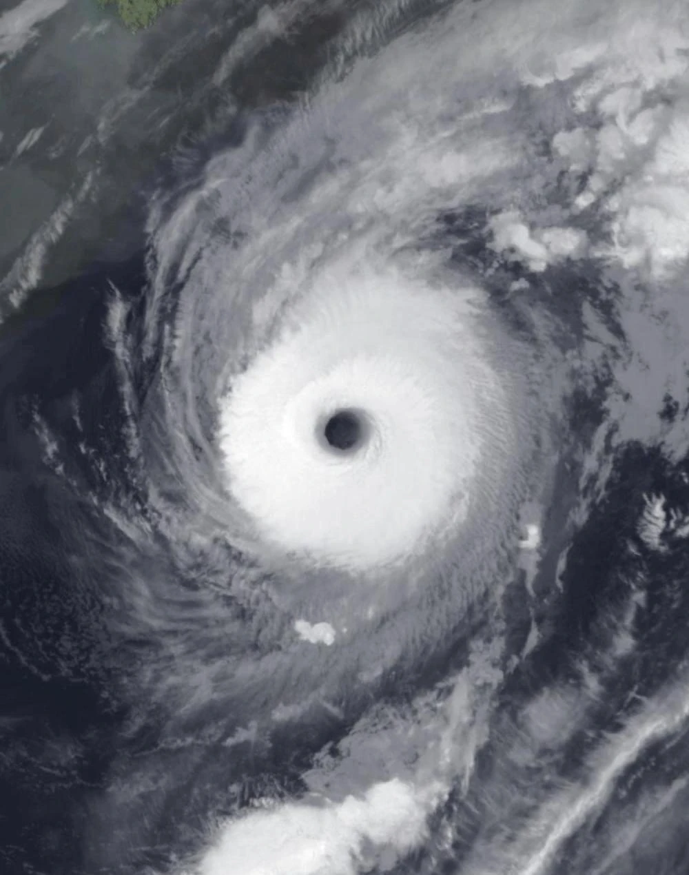
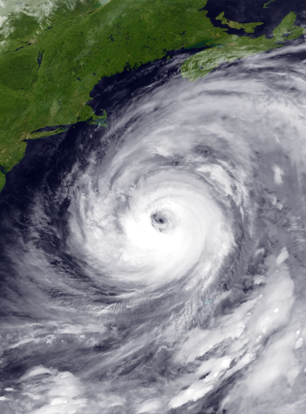
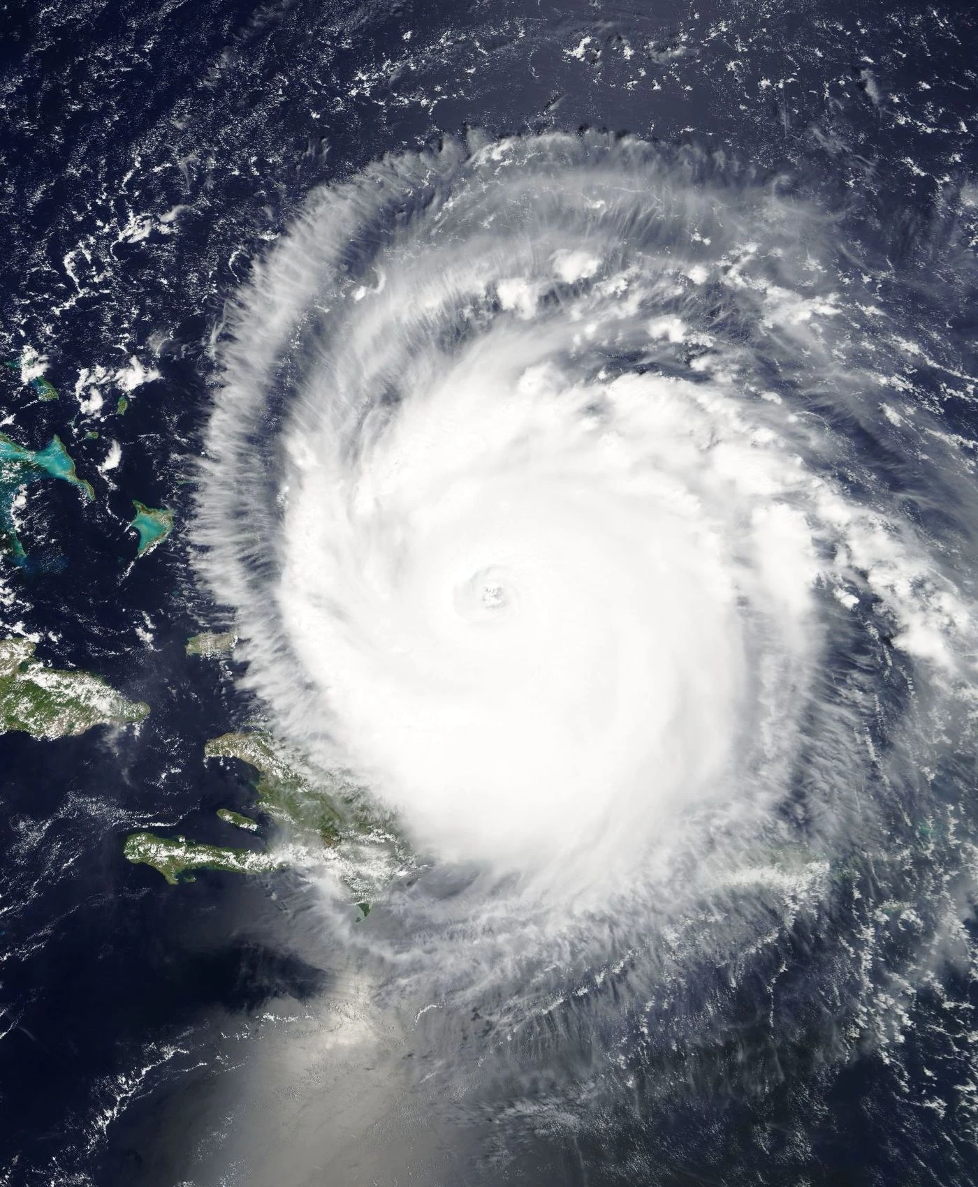
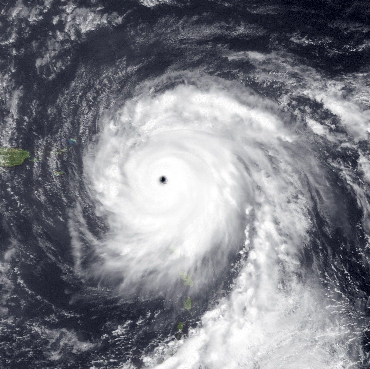
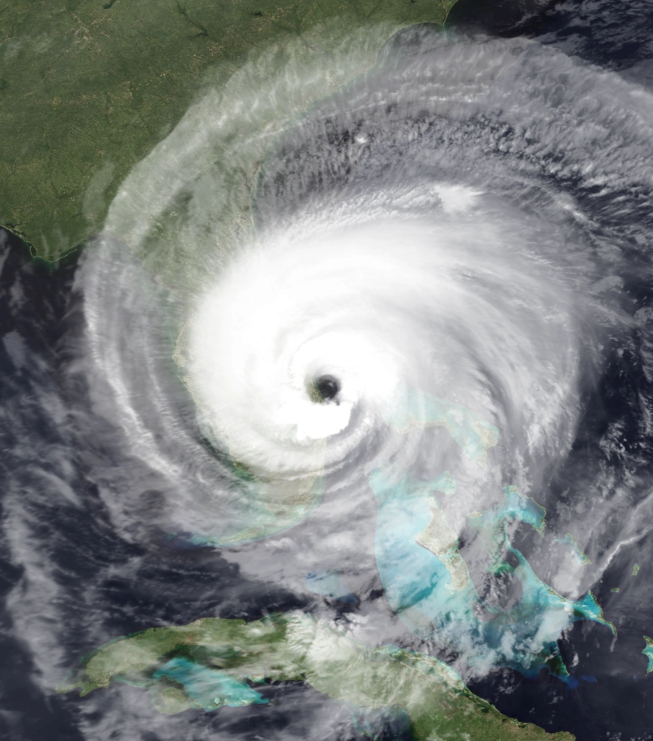
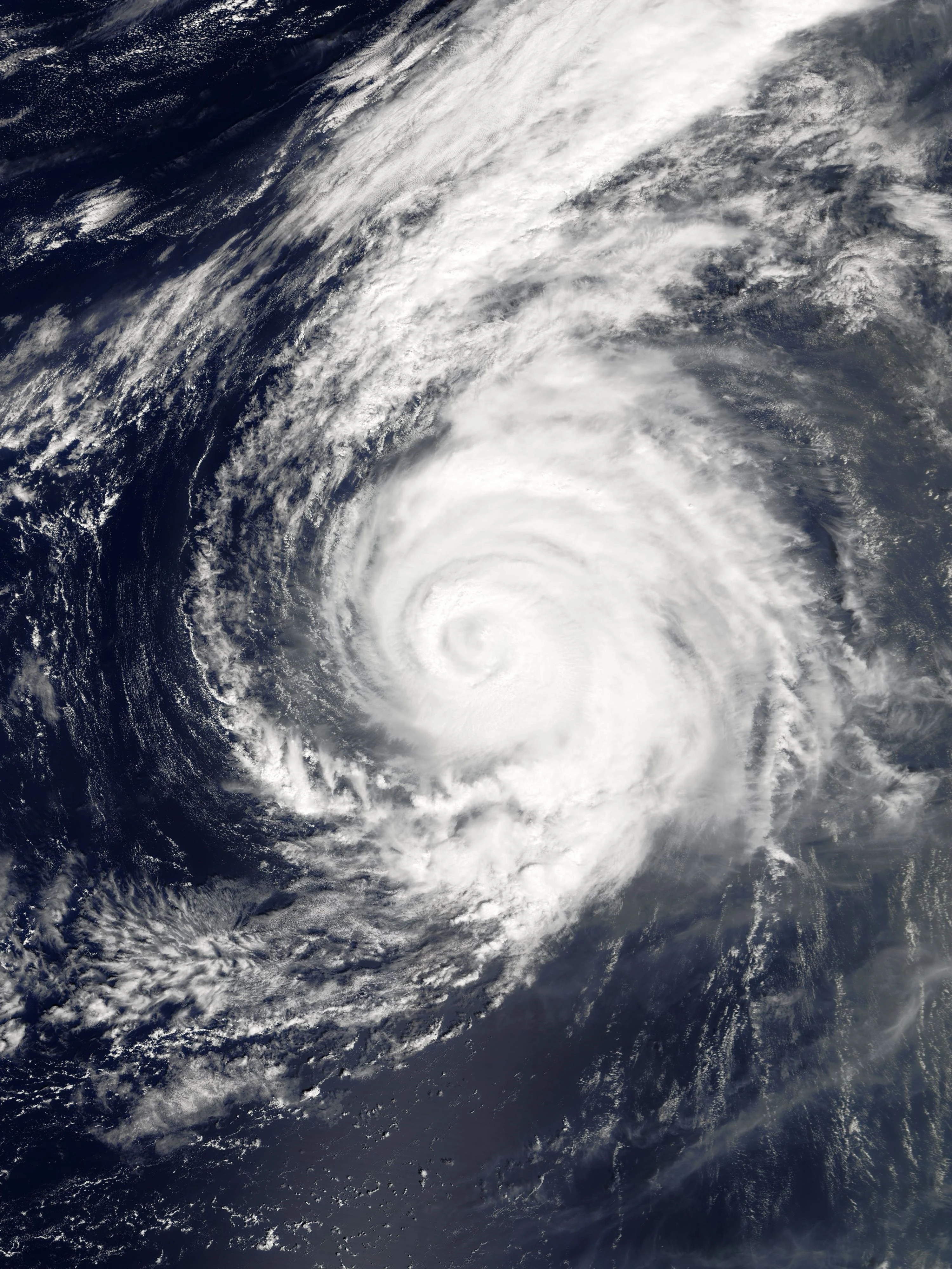
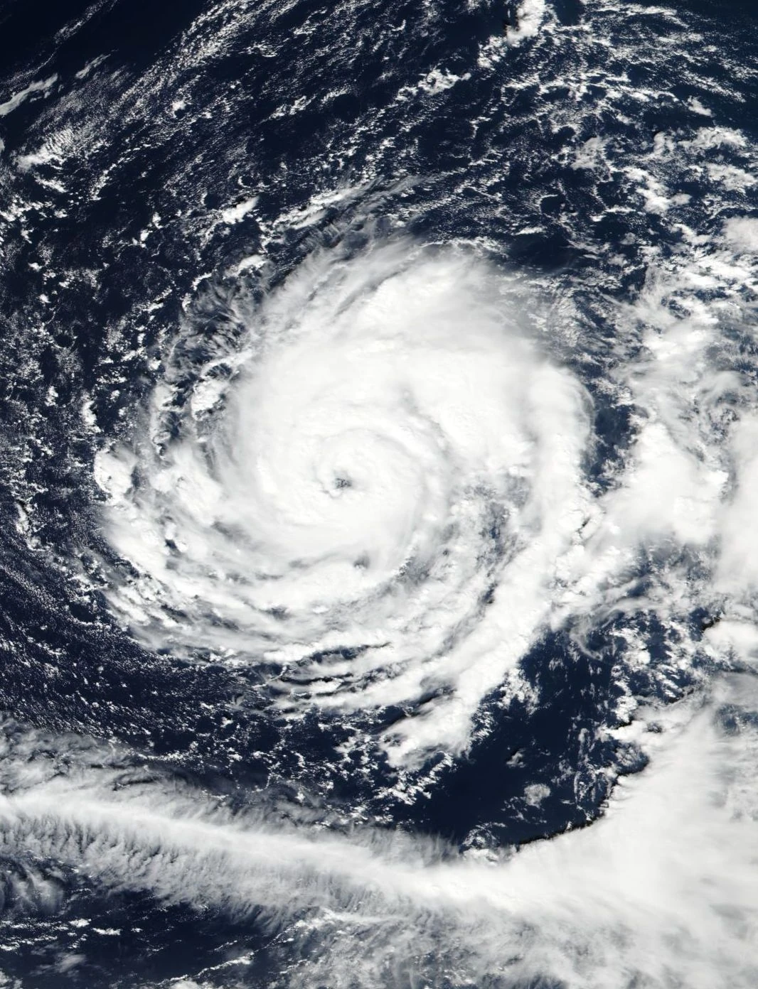
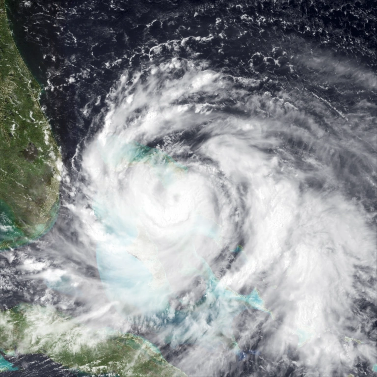
Monster Hurricane Whitney at it's full size.
From the remnants of Hurricane Vernon, Hurricane Alpha formed and executed a cyclonic loop. It began to strengthen and became a hurricane. It further intensified and peaked at winds of 155 mph, almost reaching Category 5 intensity. Alpha began to weaken and turned northeast. It didn't cause any known impact.
October and November[]

Hurricane Beta in Gulf of Mexico
Developing in the Central Atlantic, Hurricane Gamma later evolved as a weak, and later strong hurricane with winds of 150 mph. It passed Azores near peak intensity, and slowly weakened while accelerating northeast. It passed near Spain as Category 3, and later it turned extratropical, with hurricane-force winds. Later it transverse through France and later England. Impact were quite severe. It caused heavy winds particularly in Portugal, Spain and England. Impact in France was quite severe too and the surge damaged most of the coastline. Meteorologists in France dubbed the storm "Eurocane Gamma" due to the unusual track going through Europe. Experts said that heavily warm SSTs caused by global warming may be the cause of the storm, as well as mega-sized hurricanes above. Total damage was $45 billion.
Hurricane Delta is another MDR-born hurricane which affected the Caribbean. The storm peaked at 105 mph and it is expected to be a "megastorm" but it failed due to heavy shear developing. It soon made landfall in South Carolina and damage was about $220 million.

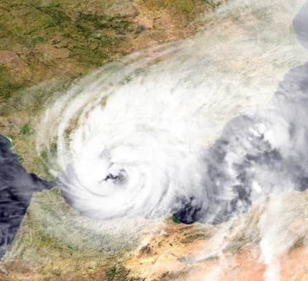
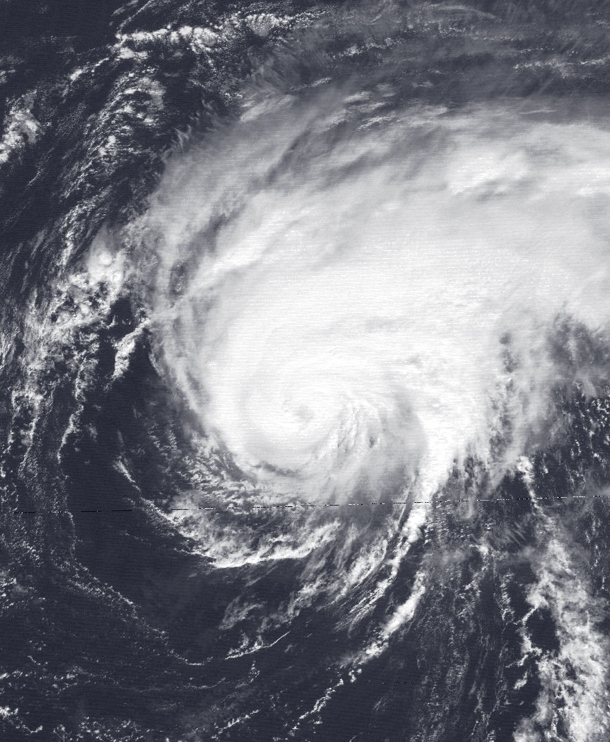
Hurricane Eta near Spain,
Hurricane Epsilon is another hurricane which transverse Cuba. Epsilon then strengthened into a minimal hurricane and it moved east. It caused rough seas across Bahamas and Florida, but overall damage was $150 million.
The first November hurricane, Hurricane Zeta, formed as a weak tropical storm and later emerged as a Category 1 hurricane. It weakened soon and restrengthened and eventually peaked as a Category 3 hurricane. It formed a cyclonic loop and weakened. It didn't cause any damages.
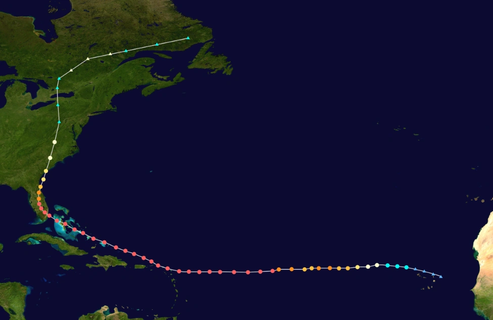
The last storm of the season, Hurricane Eta, formed from the remnants of Hurricane Zeta and developed as a subtropical storm. Later it strengthened to a hurricane and weakened thereafter. It restrengthened and crossed the Strait of Gibraltar. It transitioned into a subtropical hurricane, and publicly known as "Medicane Eta" and fluctuated between subtropical and tropical. It then made landfall near Andorra as a subtropical hurricane and transitioned to a extratropical hurricane. The weird track it made puzzled a lot of experts of what caused this phenomenon. It caused a lot of flooding from Azores to United Kingdom, with worst hit areas include Andorra and Gibraltar. Barcelona was also badly hit by the storm. In France and England, heavy winds blow up some of the well-known structures, though no major damage in the area. It also killed almost 1,000, making one of the deadliest storm in European history, and a damage of $4.8 billion.
Systems[]
|
Hurricane Arlene[]
| Category 1 hurricane (SSHWS) | |
  | |
| Duration | April 19 – April 25 |
|---|---|
| Peak intensity | 80 mph (130 km/h) (1-min) 973 mbar (hPa) |
An extratropical cyclone formed well east of Bermuda on April 15. The cyclone moved east, becoming disconnected from the surrounding environment and gradually losing its frontal characteristics. Deep convection formed in bands by 12:00 UTC on April 19, leading to the formation of a subtropical depression. Despite an unfavorable environment,, convection coalesced near the center and allowed the subtropical depression to become Subtropical Storm Arlene by 00:00 UTC on April 20. Shear began to rapidly dissipate and further intensification came as it intensified into a hurricane. After attaining peak winds of 80 mph (130 km/h), Arlene began to rotate around a larger extratropical low. The storm tracked into the cold sector of the cyclone, causing Arlene to weaken and six hours later, it lost it's tropical characteristics on April 24. The post-tropical cyclone moved northeast, before dissipating well north of the Azores on April 25.
Tropical Storm Bret[]
| Tropical storm (SSHWS) | |
  | |
| Duration | May 3 – May 5 |
|---|---|
| Peak intensity | 50 mph (85 km/h) (1-min) 999 mbar (hPa) |
In late April, a dissipating cold front extended into the northeastern Gulf of Mexico, where the NHC began forecasting the development of an area of low pressure over the next day on May 1. A rapid period of organization occurred over the next 24 hours and the system was deemed as Tropical Depression Two at 06:00 UTC on May 3, strengthening into Tropical Storm Bret twelve hours later. The rapidly-forming storm then reached its peak intensity with winds of 50 mph (85 km/h). Weakening quickly occurred, and later that day the convection of Bret is disappearing as it was downgraded to a tropical depression. The disrupted system degenerated into a remnant low early on May 5, just before it made landfall.
Hurricane Collette[]
- Main article: Hurricane Collette (2017)
| Category 1 hurricane (SSHWS) | |
  | |
| Duration | June 18 – June 24 |
|---|---|
| Peak intensity | 85 mph (140 km/h) (1-min) 980 mbar (hPa) |
A tropical wave moved off the coast of Africa on June 13 and was first monitored by the National Hurricane Center shortly afterwards. Development, however, was not expected due to its low latitude and relatively fast motion. As it moved swiftly across the Main Development Region of the Atlantic Ocean, the disturbance began to gradually organize, and the NHC raised development chances on June 16. Little change in organization occurred until June 18, at which point a burst of convection near the center of the disturbance prompted the NHC to designate the system as Tropical Depression Three at 18:00 UTC. The storm continued to organize as it accelerated towards Trinidad and Tobago throughout the night. Later on June 19, the system developed a closed low-level circulation and was upgraded to Tropical Storm Collette at 21:00 UTC. One day later, at 12:00 UTC on June 20, it made landfall near Guyana. It intensified a day later to a minimal hurricane. However, shear was weakening the storm and it further weakened on June 23, at 18:00 UTC. It dissipated the next day.
In Trinidad and Tobago, five person were killed due to drowning. Venezuelan president Nicolás Maduro declared the State of Emergency due to effects of Collette. Total damage was $635 million, and 89 deaths were reported, mostly in Venezuela.
Hurricane Dennis[]
| Category 2 hurricane (SSHWS) | |
  | |
| Duration | June 20 – June 25 |
|---|---|
| Peak intensity | 100 mph (155 km/h) (1-min) 967 mbar (hPa) |
The NHC first began monitoring the potential for tropical cyclone formation over the northwestern Caribbean Sea on June 16. A large area of disturbance developed within the region.and it slowly organized while entering the western Caribbean. A reconnaissance aircraft investigating the system around 21:00 UTC on June 20 was able to pinpoint a well-defined center, indicating the formation of Tropical Depression Four. It strengthened into Tropical Storm Dennis 12 hours later. Despite the presence of dry air and cold surface temperatures, the cyclone still managed to strengthen to a Category 1 hurricane by June 22. A reconnaissance aircraft indicated that Dennis peaked with winds of 100 mph around 12:00 UTC on June 23, making it a Category 2, before making landfall. It made landfall early on June 24. Dennis weakened while progressing inland and transitioned to a post-tropical cyclone on June 25.
Impact on affected areas, including Louisiana and Texas are quite severe. The massive flooding forced schools and some businesses to close while the storm is active. Dennis also caused 20 fatalities and $880 million in damage, in Texas and Louisiana.
Hurricane Elizabeth[]
| Category 2 hurricane (SSHWS) | |
  | |
| Duration | July 5 – July 15 |
|---|---|
| Peak intensity | 105 mph (165 km/h) (1-min) 962 mbar (hPa) |
Tropical Depression Five formed from a tropical wave west of Cape Verde on the afternoon of July 5, the first Cape Verde-type storm of the season. The system encountered dry air and wind shear as it turned to the west as it became Tropical Storm Elizabeth, around 12:00 UTC on July 6. Shear and dry air briefly disrupted the cyclone's structure, However, the storm continued to move westward into more favorable conditions and again, rapidly strengthening to a Category 1 hurricane around 21:00 UTC on July 9. Later, it strengthened even further in low shear conditions under an upper level anticyclone. On July 10 it briefly to a Category 2 hurricane, but began to gradually weaken in cooler waters shortly thereafter. It weakened as a tropical storm, making landfall in New York, and it became extratropical near Quebec around 10:00 UTC, July 15. Elizabeth caused rough waves in Caribbean and the New England. Damage wasn't that severe, though. It caused a total of $155 million in damages.
Tropical Storm Flynn[]
| Tropical storm (SSHWS) | |
  | |
| Duration | July 9 – July 11 |
|---|---|
| Peak intensity | 45 mph (75 km/h) (1-min) 1002 mbar (hPa) |
On July 5, the NHC forecasted that an area of low pressure would form in the southwestern Caribbean Sea. On July 6, as predicted, a low formed off of the northeastern coast of Honduras. However, the system remained disorganized for the next several days until the afternoon of July 9, when it quickly organized, prompting the NHC to upgrade the system into Tropical Depression Six, since it formed a well-defined center. Over the next day, rapid organization occurred as it strengthened into Tropical Storm Flynn six hours later. Strong wind shear and land interaction quickly began to cause the system to become disorganized, and Flynn made landfall near Florida Keys as a very disorganized tropical storm with winds of 45 mph (75 km/h). It dissipated hours later.
Hurricane Ghita[]
- Main article: Hurricane Ghita (2017)
| Category 4 hurricane (SSHWS) | |
 | |
| Duration | July 15 – July 23 |
|---|---|
| Peak intensity | 130 mph (215 km/h) (1-min) 949 mbar (hPa) |
A tropical wave developed into Tropical Storm Ghita near in Main Development Region on July 15. Continuing westward under the influence of a mid-level ridge, the storm steadily intensified to attain hurricane intensity by 18:00 UTC on July 17. The effects of wind shear unexpectedly abated late that day, and Ghita began a period of rapid intensification from Category 1 to Category 3 in 3 hours, making it the first July hurricane to attain Category 3 intensity since 2014. It made landfall and it weakened to a Category 1 hurricane later on July 17. However, Ghita made an unexpected intensification to a Category 4 hurricane, but it also weakened due to shear. It reattained and peaked with winds of 130 mph and pressure of 949 mbar, Ghita weakened for the second time, fluctuating between Category 2 and 3 status as it passed Windward Passage. Wind shear further disrupted Ghita's convection. It was downgraded to a tropical storm by 12:00 UTC on July 22 and it turned post-tropical the next day.
Hurricane Harold[]
| Category 3 hurricane (SSHWS) | |
  | |
| Duration | July 31 – August 5 |
|---|---|
| Peak intensity | 115 mph (185 km/h) (1-min) 968 mbar (hPa) |
The interaction between a trough and tropical wave resulted in the development of a tropical depression on July 31, while centered southwest of Tampa, Florida. After initially being poorly organized, the depression strengthened into Tropical Storm Harold late on August 1. The storm tracked northeastward and became a hurricane on August 2. As Harold moved out to sea, it intensified into a Category 3 hurricane and peaked with winds of 115 mph (185 km/h). Eventually, Harold weakened due to cooler sea surface temperatures. The hurricane fell to tropical storm intensity around 12:00 UTC on August 5. Six hours later, it became extratropical while located east of Cape Race, Newfoundland, and was soon absorbed by a large extratropical cyclone.
Rough seas and a storm surge on Key West caused minor beach erosion and washed out portions of a highway. A man drowned due to these conditions. Strong winds also pelted the area, with sustained winds reaching 65 mph (100 km/h) and gusts up to 105 mph (169 km/h) in Bahamas. As a result, 5,000 buildings and houses were left without electricity. Damage in Florida reached about $50 million.
Tropical Storm Irma[]
| Tropical storm (SSHWS) | |
  | |
| Duration | August 2 – August 5 |
|---|---|
| Peak intensity | 50 mph (85 km/h) (1-min) 1003 mbar (hPa) |
On July 27, a tropical wave entered the Atlantic from the west coast of Africa. A low pressure area developed after a burst in convection near Jamaica around July 30, but dry air and wind shear inhibited further development. At 12:00 UTC on August 2, the system maintained sufficient organization to become a tropical depression. The depression intensified into Tropical Storm Irma over Cuba and peaked with winds of 50 mph (85 km/h) shortly thereafter. The cyclone drifted northeastward. The shear caused fluctuations in intensity, while there were bursts of convection around the disorganized center. By August 5, the center of Irma was devoid of strong convection, as convection rapidly diminished, and soon degraded into a remnant low. It dissipated on August 5.
Hurricane James[]
- Main article: Hurricane James (2017)
| Category 4 hurricane (SSHWS) | |
  | |
| Duration | August 6 – August 12 |
|---|---|
| Peak intensity | 130 mph (215 km/h) (1-min) 953 mbar (hPa) |
A tropical wave in the Main Development Region was spotted for possible development on August 1. After organizing for a few days, advisories were initiated on Potential Tropical Cyclone Ten at 06:00 UTC on August 6, the first ever designation of POTC on potential tropical cyclones. The disturbance became Tropical Storm James at 06:00 UTC on August 7. After strengthening into a minimal hurricane, James made its first landfall in Yucatan on August 8. The cyclone weakened while over the peninsula, however its convection remained well-defined, with the inner core tightening up considerably. Later that day, James emerged into the Bay of Campeche, and began strengthening again, becoming a hurricane late on August 10. James began to rapidly intensify, from a Category 1 to 4 in just 12 hours. It peaked winds of 130 mph. before making landfall in Mexico, and thereafter began to rapidly weaken. On August 12, James degenerated to a remnant low and dissipated afterwards.
Hurricane warnings were issued for the eastern side of the Yucatán Peninsula on August 8. Heavy rains temporarily closed most businesses and school. In mainland Mexico, due to the rapid intensification, damage was heavy, mostly in cities of Veracruz and Mexico City. Total damage was about $450 million, and it killed around 11 people, mostly in Veracruz.
Tropical Storm Katrina[]
| Tropical storm (SSHWS) | |
  | |
| Duration | August 9 – August 13 |
|---|---|
| Peak intensity | 65 mph (100 km/h) (1-min) 1001 mbar (hPa) |
On August 3, the NHC noted the potential for tropical cyclone development in the East Atlantic later in the week. A tropical wave moved off the west coast of Africa on August 7, developing into a tropical depression by 06:00 UTC on August 9. On August 10, the depression strengthened to Tropical storm Katrina. Around 18:00 UTC on August 11, Katrina peaked with sustained winds of 65 mph (100 km/h) and a minimum pressure of 1001 mbar. The storm soon began weakening due to colder sea temperatures. Battling unfavorable conditions, it weakened to a tropical depression on August 13. Katrina became a remnant low at 20:00 UTC.
Hurricane Lee[]
| Category 4 hurricane (SSHWS) | |
  | |
| Duration | August 14 – August 20 |
|---|---|
| Peak intensity | 150 mph (240 km/h) (1-min) 938 mbar (hPa) |
On August 5, the NHC began monitoring a tropical wave and its associated convection over the western coast of Africa. As the disturbance tracked northwest, its structure changed little in organization, but conditions were expected to support the formation of a tropical cyclone. Instead, the system remained poorly defined and entered a less conducive environment with more shear. However, due to the the formation of a well-defined circulation, the disturbance was upgraded to a tropical depression on August 14. It intensified into Tropical Storm Lee. On August 16, Lee intensified to a minimal hurricane with maximum sustained winds of 75 mph (120 km/h). Accelerating east-northeast, Lee was upgraded to a major hurricane and peaked as a high-end Category 4 on August 18 at an unusually high latitude of 41°N. Due to increasing shear, Lee began to rapidly weaken as it shifted from the Gulf Stream over cooler waters. It gradually weakened so it became a hurricane at very high latitude. It degenerated into an extratropical cyclone on August 20, and was absorbed by a larger extratropical low.
Despite it's intensity, Lee only caused about $22 million, mostly in Nova Scotia. However, high waves and tides caused minimal flooding in Newfoundland and Nova Scotia. One person died due to the storm. The remnants merged with another extratropical low causing some impact in Ireland.
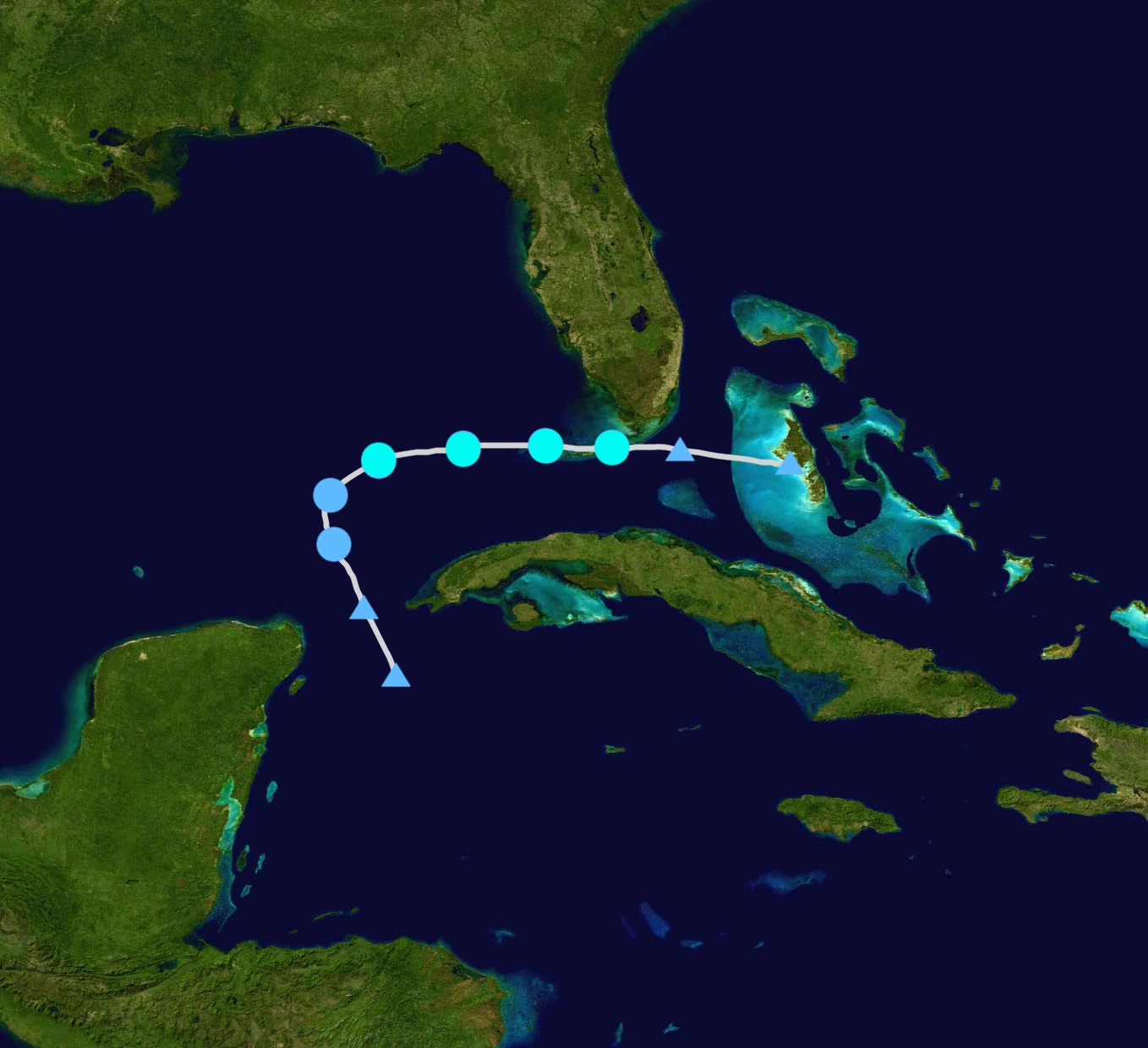
Hurricane Maria[]
- Main article: Hurricane Maria (2017)
| Category 5 hurricane (SSHWS) | |
 | |
| Duration | August 17 – August 28 |
|---|---|
| Peak intensity | 185 mph (295 km/h) (1-min) 899 mbar (hPa) |
An area of low pressure southwest of Cape Verde on August 12 was spotted, which was expected to merge with a tropical wave that just emerged off the coast of Africa within a few days. Instead the two systems remained separate, with the first low pressure area coalescing into Potential Tropical Cyclone Thirteen by 12:00 UTC on August 17, and the other system moving farther north, eventually becoming Potential Tropical Cyclone Fourteen, which also split to separate systems, which would have been become Tropical Storm Nate and Hurricane Pierre. A reconnaissance aircraft investigating the system was able to locate a well-defined circulation, and the disturbance was upgraded to Tropical Storm Maria. On a westward course into the Caribbean Sea, the storm was upgraded to a minimal hurricane, and made landfall hours after strengthening. It weakened, but restrengthened by 06:00 UTC on August 20. It was upgraded to a major hurricane, and later it become the first Category 5 hurricane of the season.A reconnaissance aircraft determined that Maria had peaked at 185 mph, with pressure of 899 mbar. Maria made landfall near Belize as a Category 5 at 12:00 UTC on August 23, and heavily weakened thereafter. Maria emerged into the Bay of Campeche as a tropical storm, where more conducive environmental conditions led to gradual intensification, attaining hurricane intensity by 12:00 UTC on August 26, and eventually as Category 4 with winds of 145 mph. Maria made landfall near Lousiana/Texas boarder. The system weakened to a tropical depression over eastern Texas late that day before losing tropical characteristics on August 28.
Tropical Storm Nate[]
| Tropical storm (SSHWS) | |
  | |
| Duration | August 19 – August 21 |
|---|---|
| Peak intensity | 45 mph (75 km/h) (1-min) 1004 mbar (hPa) |
The tropical wave which formed into Potential Tropical Cyclone Fourteen split into two and the first one combined with a broad area of low pressure over the northeastern Caribbean to form Tropical Storm Nate by 18:00 UTC on August 19. Affected by strong westerly shear, Nate was characterized by an ill-defined circulation west of most convection, with the strongest winds well displaced from the center. The cyclone attained peak winds of 45 mph (75 km/h) a day after formation, but its center of circulation became increasingly diffuse as Nate tracked toward the Cuba coastline, leading to degeneration into a remnant low by 06:00 UTC on August 21. The low moved north-northeast into the Bahamas, where it became extratropical.
Tropical Storm Oriana[]
| Tropical storm (SSHWS) | |
  | |
| Duration | August 20 – August 22 |
|---|---|
| Peak intensity | 50 mph (85 km/h) (1-min) 1002 mbar (hPa) |
A tropical wave emerged off the western coast of Africa on August 15. Tracking westward, the disturbance produced sporadic convection, but remained disorganized through its passage into the Caribbean due to wind shear and dry air. Once there, shower and thunderstorm began to develop within an environment marginally conducive for tropical cyclogenesis. A broad area of low pressure formed and consolidated over the Bay of Campeche, and the NHC subsequently designated Potential Tropical Cyclone Fifteen on August 20; the system further intensified into Tropical Storm Oriana. The cyclone strengthened initially under low wind shear, attaining a peak intensity with maximum sustained winds of 50 mph (85 km/h) and a minimum barometric pressure of 1002 mbar. Oriana weakened to a tropical depression as it moved ashore in Texas, the system degenerated into a remnant area of low pressure by 06:00 UTC on August 22.
Hurricane Pierre[]
| Category 2 hurricane (SSHWS) | |
  | |
| Duration | August 22 – August 28 |
|---|---|
| Peak intensity | 100 mph (155 km/h) (1-min) 971 mbar (hPa) |
In mid-August, a tropical wave moved off the coast of Africa. It did not organize further until it was roughly halfway across the Main Development Region. It became Potential Tropical Cyclone Fourteen on August 17, which later split to two. The first one intensified into Tropical Storm Nate, while the second one did not strengthen until August 22, and it intensified into Tropical Storm Pierre at 12:00 UTC. It moved through the Lesser Antilles, and it began to intensify again, and Pierre became a hurricane on August 24. It peaked with 100 mph winds when it neared the Bahamas at 06:00 UTC on August 26, and the NHC noted further intensification was possible. However, it began to weaken due to interaction with Florida, and it weakened to weak hurricane status on August 27. The storm continued northwest and made landfall near Gerorgia, with winds of 75 mph. The storm continued up the Peninsula while steadily weakening. Pierre became a remnant low on August 28. The storm only caused $1 billion, but experts warned for a potential mega-hurricane by September, but some said it's Pierre, until Rita hit the region. The storm caused 26 deaths.
Hurricane Rita[]
- Main article: Hurricane Rita (2017)
| Category 5 hurricane (SSHWS) | |
 | |
| Duration | August 30 – September 16 |
|---|---|
| Peak intensity | 230 mph (370 km/h) (1-min) 854 mbar (hPa) |
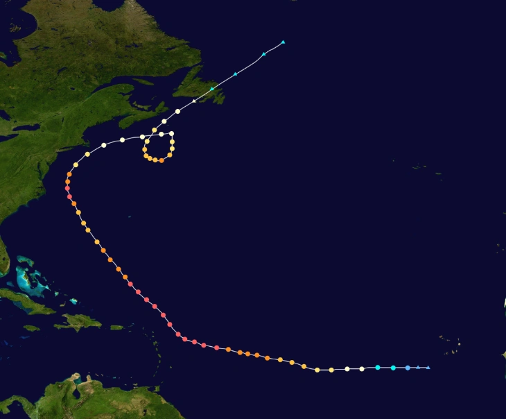
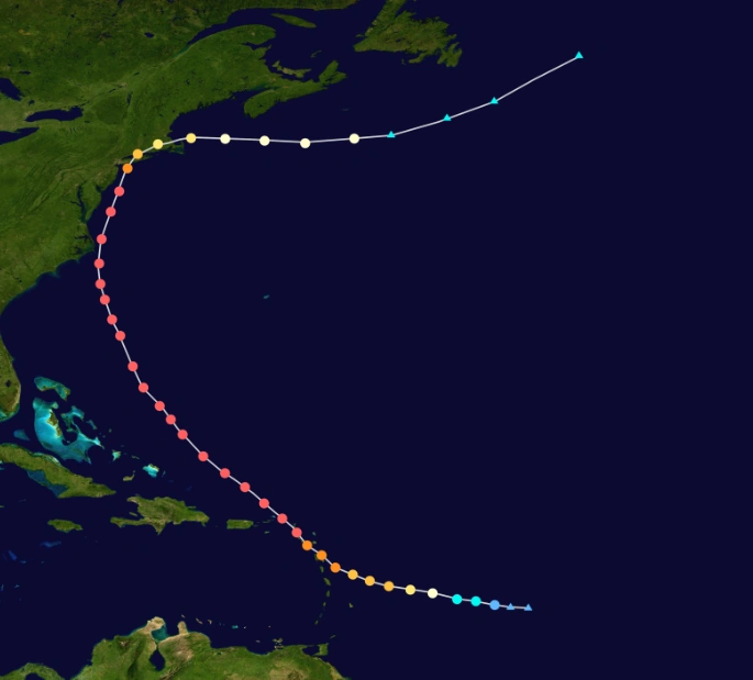
A westward-moving organized tropical wave, first monitored over western Africa on August 25, organized into Tropical Storm Rita around 12:00 UTC on August 30. Amid an environment of low wind shear and warm ocean temperatures, the newly formed cyclone moved generally westward while it began to rapidly intensify. It became a Category 1, and a major hurricane in few days. A reconnaissance aircraft investigating the system near Main Development Region on September 5 found the cyclone at Category 5 intensity. With a clear eye surrounded by a ring of extremely deep convection, Rita began it's rapid deepening phase, and upgraded this intensity as it moved through the northern Leeward Islands. Experts expected weakening, but the cyclone never retaliates, it continues to highly deepen and intensify, reaching maximum winds of 230 mph, the highest winds ever recorded from a tropical cyclone, It also reached 854 mbar, making it the most intense hurricane ever recorded, and experts suggested it was a huge anomaly, It continues to head for Bahamas, but the cyclone retained Category 5 intensity before making landfall near Miami, Florida in September 12. Though after making landfall, the storm only weakened to Category 4 after 18 hours. Rita continued north and east, steadily weakening over the Southeastern United States and it made another landfall on Georgia as a weak hurricane, before losing tropical characteristics in North Carolina, early on September 14. It became extratropical with hurricane-force winds, but it got absorbed by a low the next day.
Hurricane Seth[]
- Main article: Hurricane Seth (2017)
| Category 5 hurricane (SSHWS) | |
 | |
| Duration | September 4 – September 23 |
|---|---|
| Peak intensity | 190 mph (305 km/h) (1-min) 899 mbar (hPa) |
A tropical wave exited the west coast of Africa on August 30, organizing into Tropical Storm Seth over eastern Atlantic by 12:00 UTC on September 4.The quickly-strengthening cyclone attained hurricane intensity late on September 6, reached major hurricane strength late on September 8, Some wind shear slightly weakened the storm, but it was abe to restrengthen. It peaked as a Category 5 hurricane with winds of 190 mph (305 km/h) early on September 12. Moderate wind shear showed up again and it weakened the cyclone as it moves northwest. It was able to restrengthen as a weak Category 5 despite wind shear is still active. Steering currents collapsed by early on September 18, causing the system to stall and weaken. It made a cyclonic loop and it was able to regain Category 4 status despite unfavorable conditions. It started to move northeast as a weakening storm, and NHC declared Seth a post-tropical cyclone around 09:00 UTC on September 23, and was absorbed by a larger extratropical low which would later impact United Kingdom.
Hurricane Taylor[]
- Main article: Hurricane Taylor (2017)
| Category 5 hurricane (SSHWS) | |
  | |
| Duration | September 5 – September 9 |
|---|---|
| Peak intensity | 165 mph (270 km/h) (1-min) 936 mbar (hPa) |
A trough was present over the southwestern Gulf of Mexico on September 1, producing a widespread area of convection. Four days later, a distinct low pressure area formed. At 21:00 UTC that day, the NHC designated the system as Tropical Depression Nineteen after an organized area of convection formed. Located in an area of weak steering currents, the depression drifted gradually eastward. Decreasing wind shear and warm water temperatures made the system intensified into Tropical Storm Taylor on September 6, as the convection rapidly organized. Later that day, an aircraft reconnaissance flight into the storm found surface winds of 75 mph (120 km/h); which made NHC upgrade Katia to hurricane status. The convection organized into a central dense overcast as the system stalled. It formed an organized eyewall as it began to rapidly intnsify. Reconnaissance aircraft found out that Taylor had strengthened to 165 mph, prompting NHC to upgrade it to Category 5. Late in the evening of September 8, Katia made landfall in Mexico at it's peak. The system rapidly dissipated over land the next day.
Hurricane Vernon[]
| Category 2 hurricane (SSHWS) | |
  | |
| Duration | September 15 – September 22 |
|---|---|
| Peak intensity | 105 mph (165 km/h) (1-min) 966 mbar (hPa) |
A well-defined tropical wave developed into a tropical depression just offshore Africa, early on September 15. About six hours later, the depression intensified into a tropical storm. The next day, Vernon further grew to a Category 1 hurricane and later Category 2. Several hours later peaked with peak winds of 105 mph (165 km/h) and a minimum pressure of 966 mbar. It entered a phase of steady weakening, dropping below hurricane status by September 19. Vernon then turned to the northwest and endured increasingly hostile wind shear, but maintained its status as a tropical cyclone for several days. By September 22, Vernon's circulation pattern had diminished considerably and the cyclone degenerated into a remnant low. It's remnants later reformed and later grow to be Hurricane Alpha.
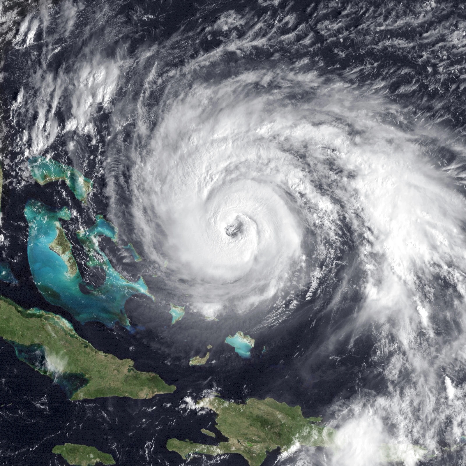
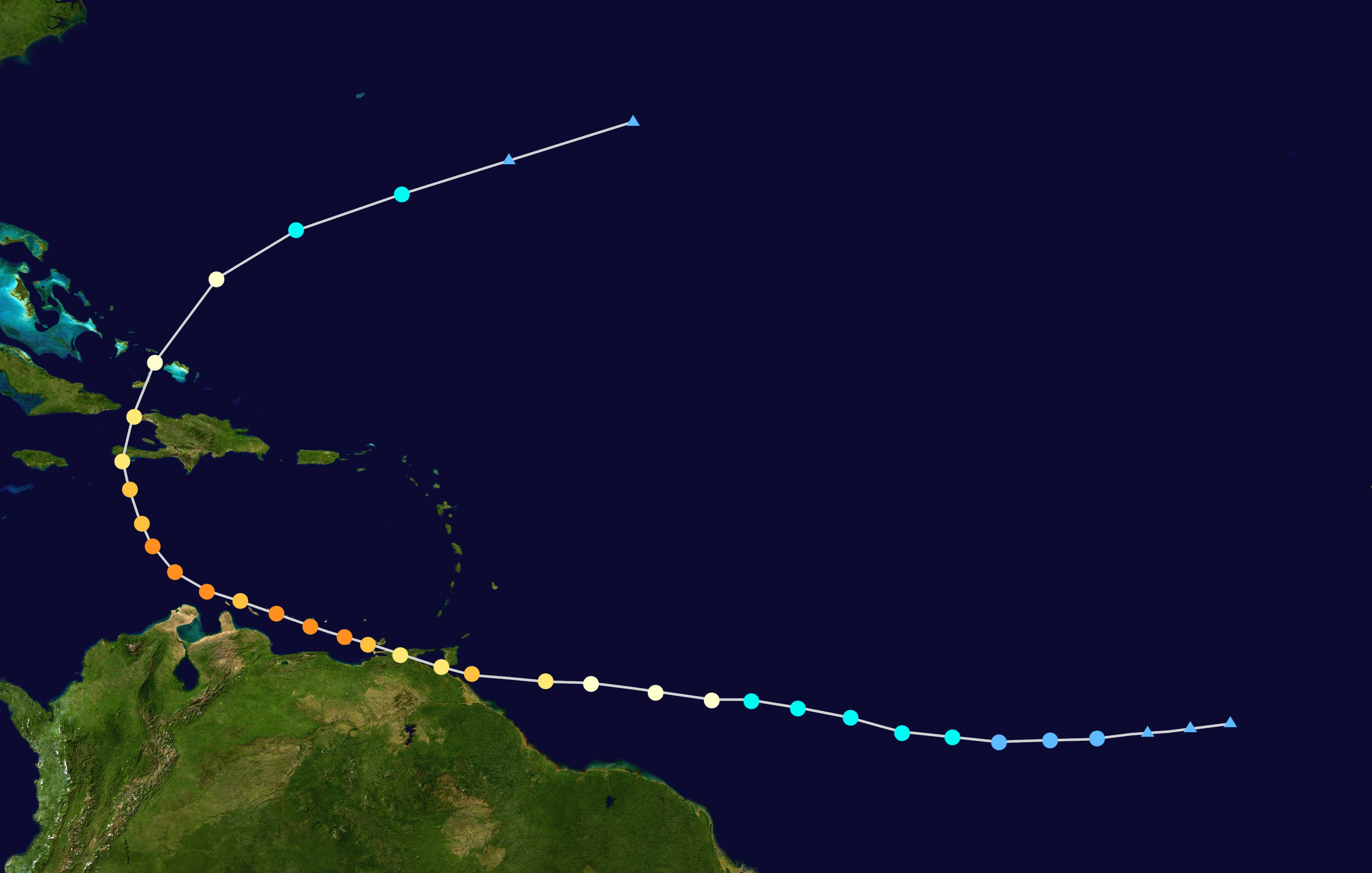
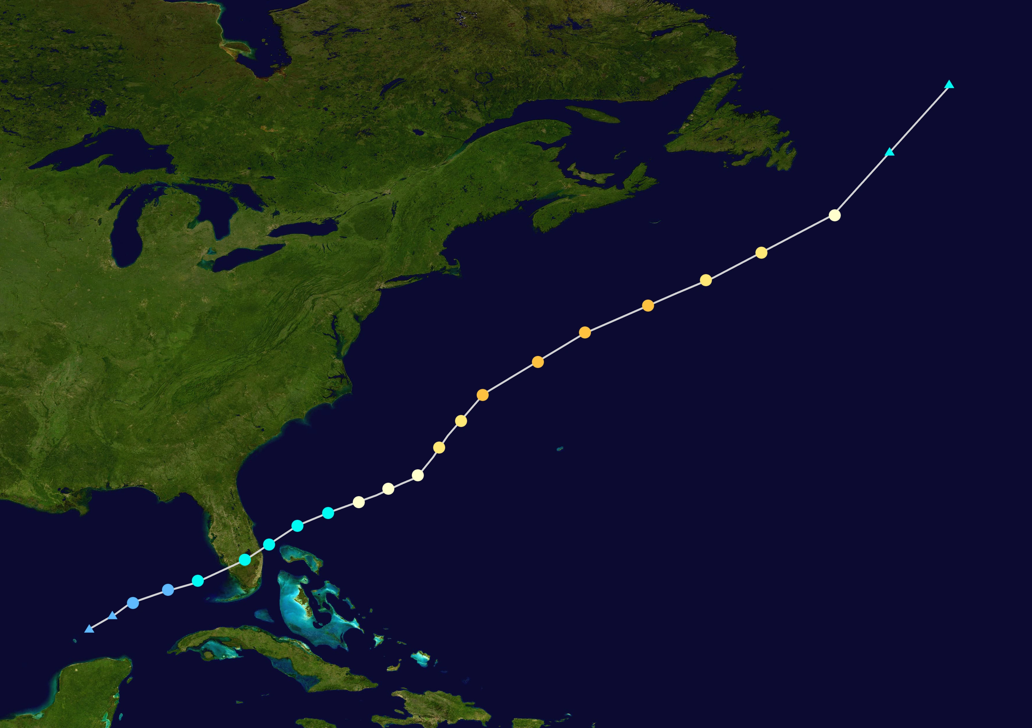
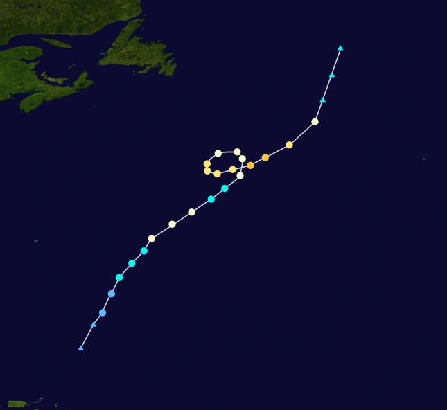
Hurricane Whitney[]
- Main article: Hurricane Whitney (2017)
| Category 5 hurricane (SSHWS) | |
 | |
| Duration | September 16 – September 29 |
|---|---|
| Peak intensity | 225 mph (360 km/h) (1-min) 858 mbar (hPa) |
On September 12, a tropical wave was spotted near Cape Verde. The disturbance moved west, organizing into a tropical depression at 13:00 UTC on September 16 and Tropical Storm Whitney six hours later. On a west-northwest course, Whitney intensified gradually, due to slightly cool MDR, but didn't weakened but instead reached Category 5 status in 2 days. It's interaction with slight shear slowed it's intensification ,but it became persistent as it grows bigger. It crossed the islands east of Puerto Rico, didn't weakened by it's crossing. Growing in size and curving northwest, Whitney began it's rapid deepening phase, from pressure of 928 mbar to 858 in just 48 hours. It also did a rapid intensification phase, from 185 mph to 225 mph in 60 hours. It began to gradually weaken due to colder waters and shear, but was able to reach intensity of 190 mph and pressure of 899 mbar off the cost of North Carolina. It made landfall in Long Island as a high end Category 4 hurricane by 12:00 UTC on September 26. After landfall, the system turned sharply east away from the United States as a weak hurricane, and ultimately evolved into an extratropical cyclone over the far northern Atlantic, on September 29.
Hurricane Alpha[]
| Category 4 hurricane (SSHWS) | |
  | |
| Duration | September 22 – September 30 |
|---|---|
| Peak intensity | 155 mph (250 km/h) (1-min) 935 mbar (hPa) |
The mid-level remnants of Vernon became intertwined with an upper-level trough, then a deep burst of convection led to a new circulation. On September 22, the system organized into Tropical Depression Twenty-Two. The depression intensified to Tropical Storm Alpha six hours later. It made a cyclonic loop due to a ridge and moderate convection with presence of eye on satelite imagery prompted the NHC to upgrade Alpha to a hurricane on September 23. After attaining winds of 90 mph (150 km/h), the storm began it's rapid intensification phase. By 05:00 UTC on September 24, the storm attained Category 2 strength, and by 18:00 UTC on September 25, Alpha was upgraded to a major hurricane. 24 hours later, Alpha peaked with winds of 155 mph (250 km/h) indicating a high-end Category 4. It quickly succumbed to strong northerly wind shear and progressively cooler ocean waters, and it was downgraded below major hurricane intensity. The system recurved northeast and faced stronger wind shear. It fell below hurricane strength by 18:00 UTC on September 29, and degenerated to a post-tropical cyclone by 12:00 UTC on September 30, after lacking deep convection.
Hurricane Beta[]
- Main article: Hurricane Beta (2017)
| Category 5 hurricane (SSHWS) | |
 | |
| Duration | October 5 – October 12 |
|---|---|
| Peak intensity | 175 mph (280 km/h) (1-min) 905 mbar (hPa) |
An area of disturbed weather over the Central America was favorable enough for development, and it developed into a tropical depression on October 5 at 08:00 UTC, becoming a tropical storm on October 6 at 12:00 UTC and named Beta. Sea surface temperatures are favorable enough for intensification, becoming a hurricane on October 7 that morning. It made landfall in Yucatan Peninsula, emerging a few hours later into the Gulf of Mexico. Due to low wind shear, Beta rapidly intensified to Category 5 status on the morning of October 8, It peaked with winds of 175 mph (280 km/h) at 20:00 UTC on the same day. Due to wind shear, the hurricane weakened to a Category 4 as it turned northward, before making landfall near Louisiana, causing massive weakening. It degenerated to an extratropical cyclone at 05:00 UTC on October 12 and was absorbed six hours later.
Hurricane Gamma[]
- Main article: Hurricane Gamma (2017)
| Category 4 hurricane (SSHWS) | |
  | |
| Duration | October 9 – October 17 |
|---|---|
| Peak intensity | 150 mph (240 km/h) (1-min) 936 mbar (hPa) |
On October 6, a low pressure area developed at the end of a cold front in the northeast Atlantic, While the low drifted slowly to the northeast, it began to acquire subtropical characteristics by October 7. The next day, the storm became more organized though it was slightly halted by some wind shear. Early on October 9, the system fully transitioned into a tropical cyclone, declaring Potential Tropical Cyclone Twenty-Four. The cyclone continued to strengthen as it took an erratic track due to a ridge, becoming Tropical Storm Gamma later that day. Gamma continued to strengthen due to low wind shear and on October 11, Hurricane hunters saw an eyewall. making Gamma reached Category 1 status. Gamma became a Category 2 hurricane on October 12, and a major hurricane next day. Contrary to previous forecasts, Gamma unexpectedly strengthened to a high end Category 4 hurricane, despite little wind shear, due to warm sea surface temperatures, making Gamma the strongest north-easternmost hurricane on record. On October 15, Gamma began to weaken, while accelerating northeastward towards France and Great Britain, with the storm's wind field also expanding. Early on October 17, Gamma transitioned into a hurricane-strength extratropical cyclone, as it began impacting Ireland and Britain.
Hurricane Delta[]
| Category 2 hurricane (SSHWS) | |
  | |
| Duration | October 14 – October 24 |
|---|---|
| Peak intensity | 105 mph (165 km/h) (1-min) 968 mbar (hPa) |
At the start of October, a tropical wave moved off the coast of Africa. It did not organize further due to strong wind shear. This wind shear caused the NHC to almost drop the wave at one point. It became Potential Tropical Cyclone Twenty-Five on October 14, and it intensified into Tropical Storm Delta that evening. It moved through the Lesser Antilles and Puerto Rico. It crossed over the island without losing much intensity, though shear is preventing it from strengthening. In north of Hispaniola, it began to intensify again, and Delta became a hurricane on October 18. It peaked with 105 mph winds early the next morning, making Delta a Category 2 hurricane. Delta moved to colder waters with high shear, and it weakened below hurricane status on October 21. The storm continued northwest and made landfall near Georgia, with winds of 55 mph. The storm continued up while steadily weakening. Delta became a remnant low on October 23, and dissipating a day after. The storm caused at least $226 million in damages.
Hurricane Epsilon[]
| Category 2 hurricane (SSHWS) | |
  | |
| Duration | October 25 – October 30 |
|---|---|
| Peak intensity | 100 mph (155 km/h) (1-min) 972 mbar (hPa) |
The complex interaction between a cold front and a broad area of low pressure led to the formation of a tropical depression on October 25. The disorganized cyclone intensified into Tropical Storm Epsilon six hours later, briefly moving ashore the northeastern tip of Honduras late on October 25 before re-emerging into the northwestern Caribbean. It did gradually strengthen and it made landfall on Cuba and crossed the Florida Strait. Due to a favorable environment, Epsilon intensified into a hurricane on October 28 and attained peak winds of 100 mph (155 km/h) while accelerating northeast. An increase in shear prompted a steady weakening trend, as it accelerates faster. Epsilon turned extratropical on October 30, though it's extratropical remnants contributed to a winter storm which impacted Britain and Ireland. The other remnants is get absorbed by a larger extratropical low. The storm caused $150 million in damages.
Hurricane Zeta[]
| Category 3 hurricane (SSHWS) | |
  | |
| Duration | November 4 – November 11 |
|---|---|
| Peak intensity | 115 mph (185 km/h) (1-min) 967 mbar (hPa) |
A powerful tropical wave moved off the coast of Africa on November 1. As it moved west into the Atlantic, it became more organized and the system developed into Tropical Depression Twenty-Seven on November 4. The depression gradually strengthened as it moved to the northwest across the open Atlantic Ocean, becoming Tropical Storm Zeta on November 6 and reaching hurricane strength on September 7. It began to weaken due to wind shear but was able to restrengthen as wind shear carries away. In the central Atlantic, Hurricane Zeta continued to strengthen in favorable conditions, while making a cyclonic loop, and on November 9 briefly became a Category 3 hurricane with 115 mph (185 km/h) winds. Increasing shear and cooler waters caused the storm to rapidly weaken to a minimal hurricane on a day after. Operationally, the NHC believed that Zeta had briefly weakened further into a tropical storm, but post-season analysis confirmed this did not occur. As Hurricane Zeta moved to the northeast the official forecasts called for the storm to continue to weaken, it rapidly become extratropical on November 11 and was absorbed hours after.
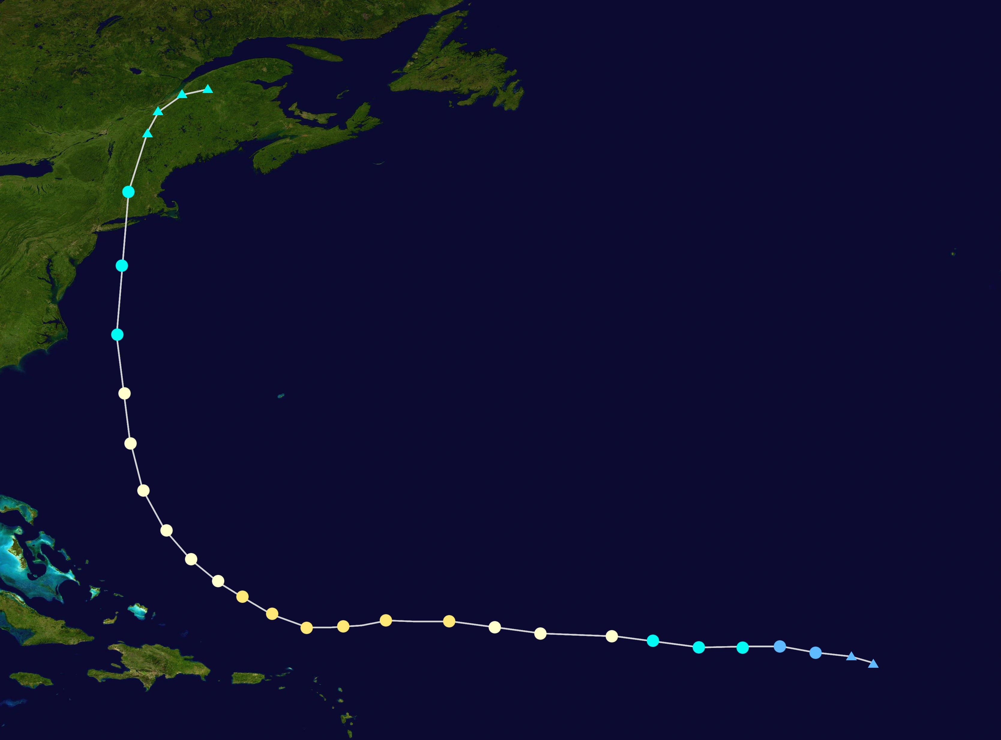
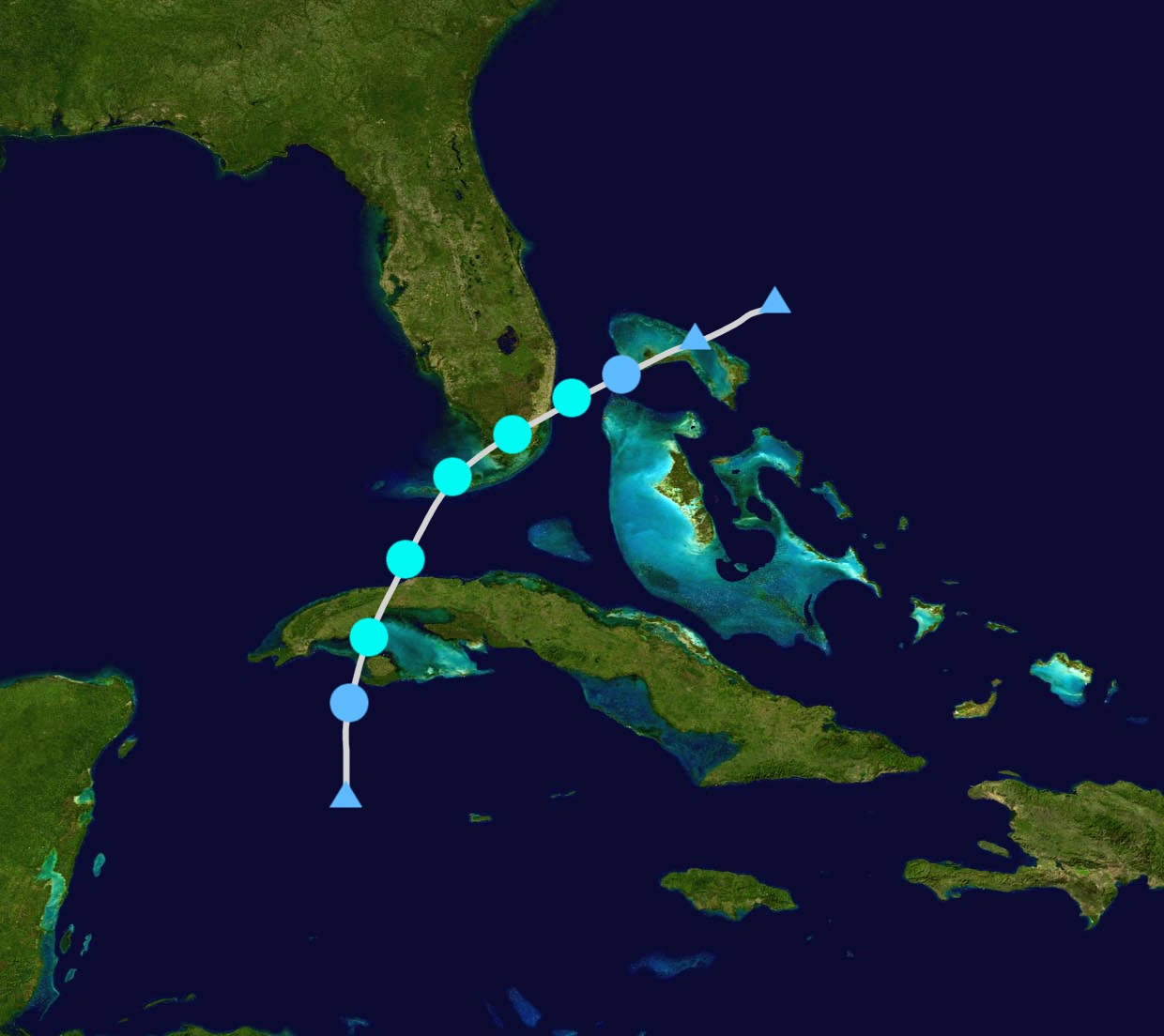
Hurricane Eta[]
- Main article: Hurricane Eta (2017)
| Category 1 hurricane (SSHWS) | |
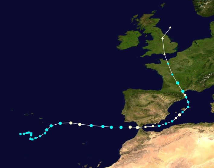 | |
| Duration | November 13 – November 20 |
|---|---|
| Peak intensity | 80 mph (130 km/h) (1-min) 983 mbar (hPa) |
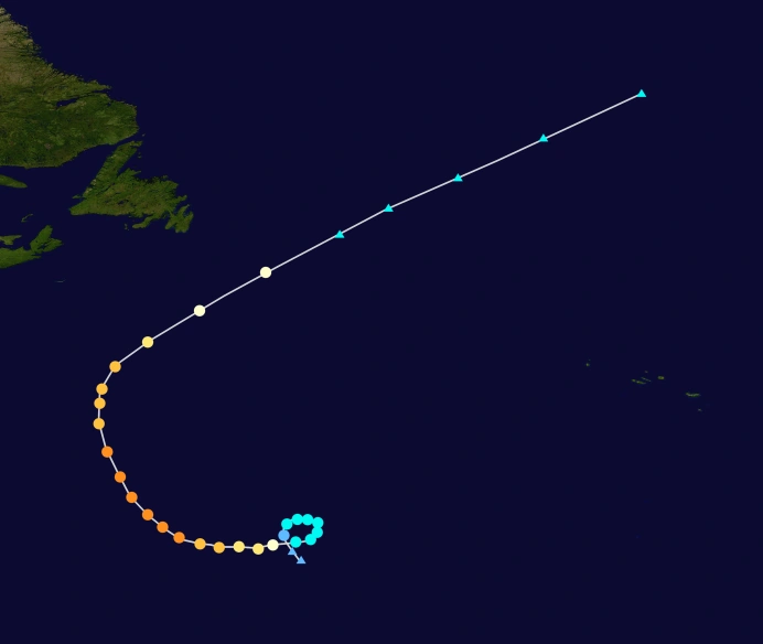
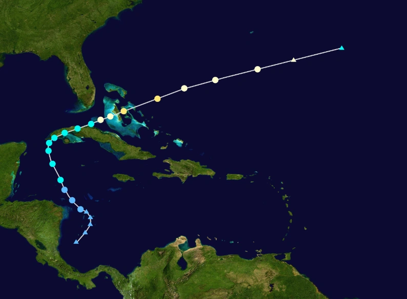
The remnants of Hurricane Zeta and a frontal low led to the formation of a subtropical storm southwest of Azores. It stalled for a few days before eventually showing tropical characteristics, prompting NHC to name it Tropical Storm Eta. Eta intensified fast and become a hurricane late on November 14, but weakened back the next morning. It continues to head towards Europe and unexpectedly reintensified to a hurricane on November 16, just before crossing the Gibraltar Strait. It began showing subtropical characteristics and became a subtropical hurricane in Mediterranean Sea, popularly known as "Medicane Eta". It weakened to a subtropical storm due to warm waters, but did not retaliate. As it approached the Balearic Islands, it become a subtropical hurricane again, and briefly transitioned to tropical phase, making Eta the only known fully tropical storm in the Mediterranean Sea with hurricane winds. It transitioned again to subtropical and hit the Balearic Islands, and it briefly regained hurricane status before making landfall in Catalonia, Spain, near the city of Barcelona. It eventually turned tropical but again became extratropical with hurricane force winds as it impact Britain. It caused a total of 1004 deaths and $4.8 billion in damages, mostly in Catalonia, Andorra and Gibraltar, where heavy flooding took place. Impact to Spain and Andorra was extensive, and worldwide attention is closely observed. Some scientists hypothesized that these storms are caused by ongoing global warming, which heated up the Mediterranean Sea.
Seasonal Impact[]
The storms in this season is extraordinary and extremely world-changing. Total damage is estimated to be about $5.346 trillion (2018 US$), and an estimated 53,864 people were confirmed dead. However, due to some variety in the death toll caused by a lot of other storms, the death toll from the season could be as high as 75,000 people. The hardest hit areas include all of coastal areas in United States, Central America, Western Europe, Caribbean, Northern South America, and Mexican coast, basically all of Atlantic coast, where the only areas that escaped the biggest storms which is Atlantic Canarda, Bermuda and South Central America (Panama, Costa Rica).
East Coast[]

The areas which received the worst impact include the East Coast. Hurricane Whitney, otherwise known as "The Great Nightmare", is pretty obvious, it almost destroyed the Eastern Coast, and decimated big cities like New York, Boston, and Washington D.C, which forced the president to relocate in other safe places. Gusts with winds of 295 mph were reported in New Jersey. Aside from winds, rainfall is also very severe, causing a whopping 60 ft surge, destroying the entire coastline, Almost 100% of New York City was flooded, destroying much of the coastline. Total damage is reported about $3.1 trillion, making the costliest storm of the season, and not just storm, but the most destructive disaster of all-time. It also caused 28 thousand deaths, making it the deadliest storm in Atlantic region. Additionally, Hurricane Seth also caused billions of damage in East Coast, though not as much as severe.
Florida also received the worst impact from the season, due to Hurricane Rita, Rita is the most intense hurricane ever recorded, impacting neighboring areas as well. It submerged several big cities for days, including Miami, Orlando, and Tampa. Rita also startes the "hurricane revolution" among Floridans, and led to resignation of Governor Rick Scott. Aside from Rita, the precursor hurricane, Pierre, already caused a lot of damage, though not as severe as Rita.
Caribbean[]
Caribbean also received the worst storms, with Hurricane Rita almost destroying all of Caribbean. Most of little islands were made uninhabitable due to the storm. Whitney also brought heavy surge across the area, with Puerto Rico badly hit by the storm. Hispaniola and Jamaica received the worst damage from Hurricane Ghita, with additional 1150 deaths, mostly in Haiti, the worst since Wallace last year. Cuba was also damaged by Rita, due to the surge brought by very large storm. About 280 mph wind gusts were reported in Havana, with 30 ft surge. Other storms like Elizabeth, Pierre, Seth, and Delta caused minimal damage to the area.
Gulf Coast[]
In the Gulf Coast, impact was also very bad, mainly due to Hurricane Beta, along with other storms like Dennis and Maria. Beta caused the most impact, affecting Louisiana and neighboring states, where the impact was highly bad. Beta caused similar thing to Orla, which also devastated the areas of Louisiana. It caused $294 billion and almost 674 deaths. Dennis also flooded the region, which caused the worst flooding event in years, until beaten by bigger storms. Maria affected the Texas region, also causing worst flooding in cities of Brownsville and Houston.
Mexico and Central America[]
In Mexico, Hurricanes James and Taylor caused major damage in the area, particularly Veracruz, and reached it's capital Mexico City. Both caused heavy mudslides which caused death to a lot of people. In Central America, Maria caused the worst impact. It caused a lot of deaths in Honduras, Belize, Guatemala, El Salvador and Nicaragua, as well as Mexico and United States. Maria caused total of $75 billion and 6355 deaths, mostly in Honduras, the worst sincePaula.
South America[]
The worst storm to hit South America was Hurricane Ghita. Ghita caused a lot of damage in Guyana, Trinidad, French Guiana and Suriname. It also caused a number of deaths, despite the worst casualty was on Dominica and Haiti. Ghita caused 75 deaths in the area, and $1 billion of damage in this area. Another notable storm was Hurricane Collette, which affected the South American coast as well. The worst hit country was Venezuela, with damage of $650 million and 58 deaths, flooding the capital city and other cities and towns.
Europe[]

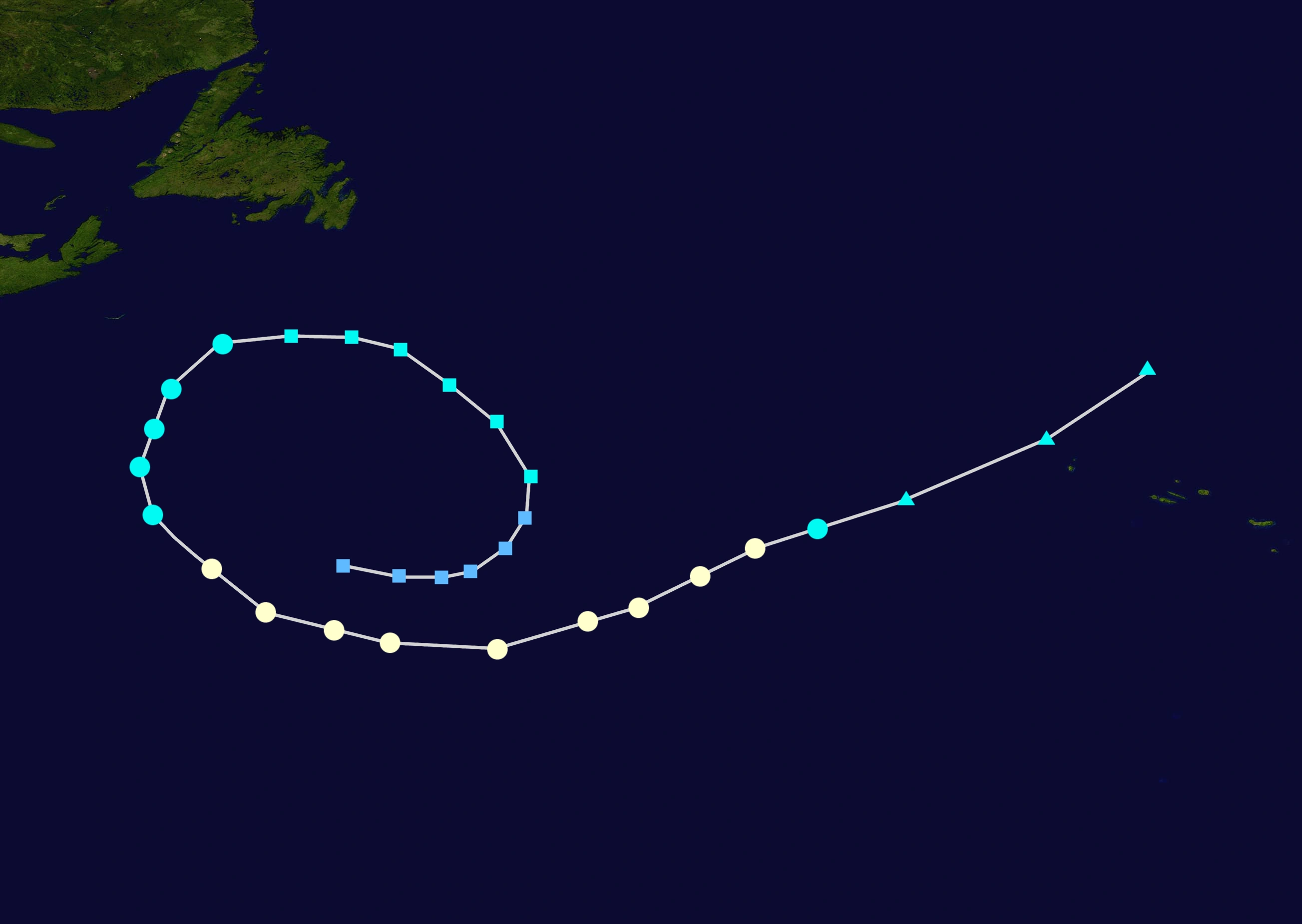
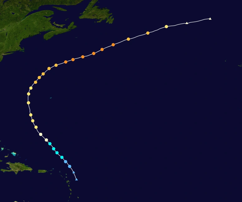
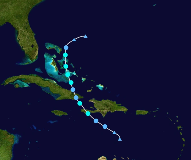
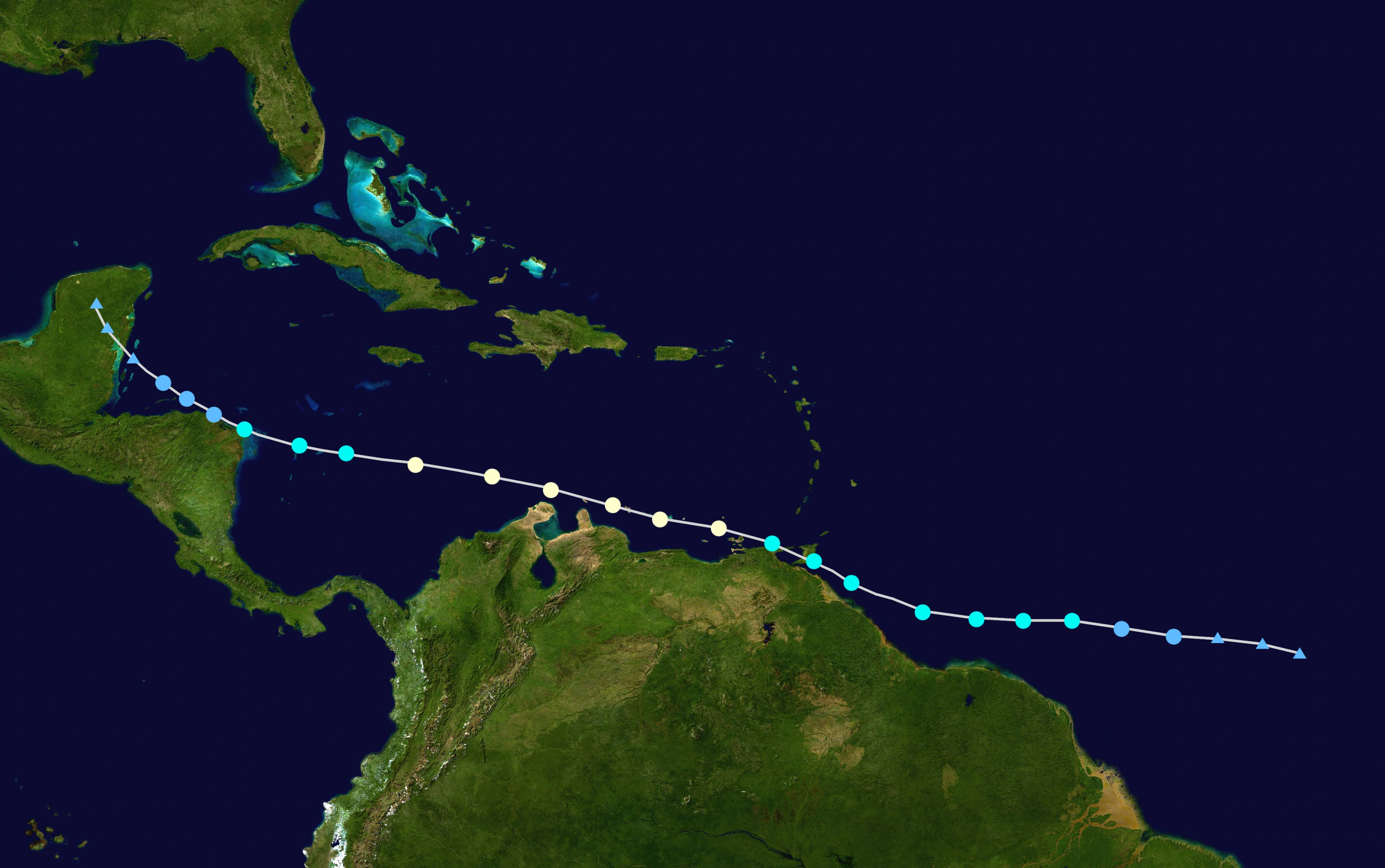
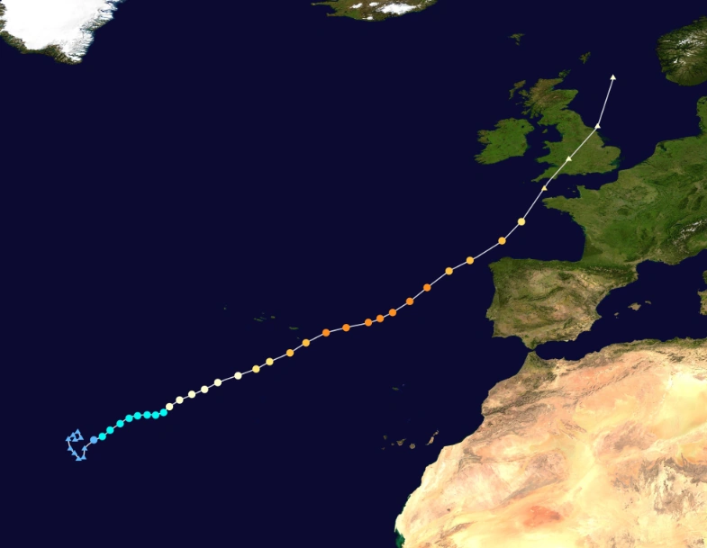
The track of Hurricane Eta.
Europe receives a very rare and unusual event that sought the attention of the world. The first "Eurocane" European hurricane which directly affects the continent was Hurricane Gamma, which impacted Portugal, France and Britain, while the other, which transformed to a full "medicane", or a cyclone in the Mediterranean Sea, was Hurricane Eta, which impacted the countries of Portugal, Spain, Morocco, France, Andorra and Britain.
Both causes extensive impact. Gamma highly impacted Portugal, France and Britain, and caused heavy flooding. Gamma prompted the national emergency in Portugal and France where most of the impact comes. It caused $45 billion and 264 deaths. Eta, which transformed to a Mediterranean Sea cyclone, popularly known as, "medicane", caused extensive damage in Spain and Morocco, and flooded big cities like Gibraltar, Andorra and Barcelona, causing massive casualties, reaching thousands. The storms are attributed to the massive global warming which affected the tropics in the basin.
Others[]
Only few areas like Cape Verde, Newfoundland, and Bermuda escaped the worst storms. Hurricanes Arlene, Harold, Lee and Seth caused some impact, but not as worse as the storms mentioned above. Some places where hurricanes rarely hit, like Panama and Iceland, didn't receive much impact from the storms.Season Effects[]
| Storm name |
Dates active | Storm category at peak intensity |
Max 1-min wind mph (km/h) |
Min. press. (mbar) |
Areas affected | Damage (USD) |
Deaths | |||
|---|---|---|---|---|---|---|---|---|---|---|
| Arlene | April 19 – April 25 | Category 1 hurricane | 85 | 973 | Bermuda, Newfoundland | None | None | |||
| Bret | May 3 – May 5 | Tropical storm | 50 | 999 | United States, Cuba | 15 | 8 | |||
| Collette | June 18 – June 24 | Category 1 hurricane | 85 | 980 | Guyana, Venezuela, Honduras, Mexico | 635.6 | 89 | |||
| Dennis | June 20 – June 25 | Category 2 hurricane | 100 | 967 | Mexico, Cuba, United States | 889 | 20 | |||
| Elizabeth | July 5 – July 15 | Category 2 hurricane | 105 | 962 | Puerto Rico, Dominican Republic, United States | 155.5 | 3 | |||
| Flynn | July 9 – July 1 | Tropical storm | 45 | 1002 | United States, Cuba | 3.6 | 4 | |||
| Ghita | July 15 – July 23 | Category 4 hurricane | 130 | 949 | Guyana, Venezuela, Haiti, Jamaica, Dominican Republic, Cuba | 4307 | 1150+ | |||
| Harold | July 31 – August 5 | Category 3 hurricane | 115 | 968 | Cuba, United States, Newfoundland | 53 | 2 | |||
| Irma | August 2 – August 5 | Tropical storm | 50 | 1003 | United States, Cuba | 65 | 4 | |||
| James | August 6 – August 12 | Category 4 hurricane | 130 | 953 | Mexico, Belize, Honduras | 450 | 11 | |||
| Katrina | August 9 – August 13 | Tropical storm | 60 | 1001 | None | None | None | |||
| Lee | August 14 – August 20 | Category 4 hurricane | 150 | 938 | Bermuda, Canada | 22 | 1 | |||
| Maria | August 17 – August 28 | Category 5 hurricane | 185 | 899 | Guyana, Venezuela, Nicaragua, Honduras, Belize, El Salvador, Guatemala, Mexico, United States | 75340 | 6355 | |||
| Nate | August 19 – August 21 | Tropical storm | 45 | 1004 | Haiti, Cuba, Bahamas | 64 | 3 | |||
| Oriana | August 20 – August 22 | Category 3 hurricane | 50 | 1002 | United States | 35 | 11 | |||
| Pierre | August 22 – August 28 | Category 2 hurricane | 100 | 971 | Lesser Antilles, Cuba, Dominican Islands, Bahamas, United States | 1145 | 26 | |||
| Rita | August 30 – September 6 | Category 5 hurricane | 230 | 854 | Cape Verde, Puerto Rico, Lesser Antilles, Dominican Republic, Haiti, Cuba, Bahamas, United States, Canada, Newfoundland | 1767900 | 15300+ | |||
| Seth | September 4 – September 23 | Category 5 hurricane | 190 | 899 | Lesser Antilles, Bermuda, United States, Canada, Newfoundland | 1564 | 56 | |||
| Taylor | September 5 – September 9 | Category 5 hurricane | 165 | 936 | Mexico | 2640 | 87 | |||
| Vernon | September 15 – September 22 | Category 2 hurricane | 105 | 966 | Cape Verde | None | None | |||
| Whitney | September 16 – September 29 | Category 5 hurricane | 225 | 858 | Lesser Antilles, Puerto Rico Dominican Republic, United States, Canada | 3145686 | 28778 | |||
| Alpha | September 22 – September 30 | Category 4 hurricane | 155 | 935 | None | None | None | |||
| Beta | October 5 – October 12 | Category 5 hurricane | 175 | 905 | Honduras, Mexico, Belize, United States | 294788 | 674 | |||
| Gamma | October 9 – October 17 | Category 4 hurricane | 150 | 936 | Azores, Portugal, Spain, France, United Kingdom | 45877 | 264 | |||
| Delta | October 14 – October 24 | Category 2 hurricane | 105 | 968 | Bahamas, Puerto Rico, United States | 226 | 5 | |||
| Epsilon | October 25 – October 30 | Category 2 hurricane | 100 | 972 | Cuba, Honduras, United States, Bahamas | 151 | 12 | |||
| Zeta | November 4 – November 11 | Category 3 hurricane | 115 | 967 | None | None | None | |||
| Eta | November 13 – November 20 | Category 1 hurricane | 80 | 983 | Azores, Spain, Portugal, Morocco, Andorra, France, United Kingdom | 4875 | 1004 | |||
| Season aggregates | ||||||||||
| 28 systems | April;19 – November 20 | 235 | 838 | $5.346 Trillion | 53867 | |||||
Storm Names[]
The following names were used for named storms that formed in the North Atlantic in 2017. The names not retired from this list were used again in the 2023 season. This is the same list used for the 2011 season, except for James, Seth, and Taylor, which replaced Jorge, Sean, and Tilda. Names that were not assigned are marked in gray.
|
|
|
|
Retirement[]
On April 11, 2018, at the 40th session of the RA IV hurricane committee, the World Meteorological Organization retired the names Collette, Dennis, Ghita, James, Maria, Pierre, Rita, Seth, Taylor, Whitney, Beta, Gamma and Eta from its rotating naming lists due to the amount of deaths and damage they caused, and they will not be used again for another Atlantic hurricane. They will be replaced with Cassandra, Don, Griselda, Jesse, Margot, Pepin, Rina, Saul, Tiffany, and Wilda for the 2023 season, respectively.
Equivalents[]
| Storm in this article | In real life 2017 season |
| Arlene | Arlene |
| Bret | [NEW] |
| Collette | Bret |
| Dennis | Cindy |
| Elizabeth | TD Four |
| Flynn | [NEW] |
| Ghita | Don |
| Harold | Emily |
| Irma | [NEW] |
| James | Franklin |
| Katrina | [NEW] |
| Lee | Gert |
| Maria | Harvey |
| Nate | [NEW] |
| Oriana | [NEW] |
| Pierre | PTC 10 |
| Rita | Irma |
| Seth | Jose |
| Taylor | Katia |
| Vernon | Lee's 1st phase |
| Whitney | Maria |
| Alpha | Lee's 2nd phase |
| Beta | Nate |
| Gamma | Ophelia |
| Delta | [NEW] |
| Epsilon | Philippe |
| Zeta | Rina |
| Eta | Rina's remnants, what would become Numa |