The 1980 Minecraft hurricane season was a very active and strong hurricane season for the Minecraft basin. Even with 18 total systems forming in the region, 12 hurricanes, and a rare 7 major hurricanes, the season was also very undestructive and not deadly. Only two storms made landfall in the season (Carmen and Orchid), killing a total of 36 people for the season. The most intense storm of the season was Hurricane Ida, becoming a high latitude Category 5 hurricane in early September. Ida made no landfalls and killed nobody, even when Rough Surf warnings were issued on the Yandere Coast. The deadliest storm of the season was actually one of the weakest, Tropical Storm Orchid, making landfall in Awesome World with 55 MPH winds. Orchid killed a total of 21 people.
Timeline[]

Accumulated Cyclone Energy (ACE)[]
The totaled Accumulated Cyclone Energy (ACE) amount for the 1980 hurricane season was... (Calculating...)
Systems[]
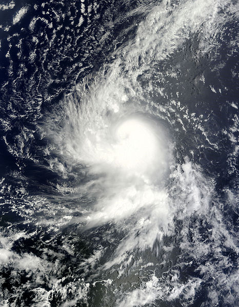
Tropical Storm Abby[]
| Tropical storm (SSHWS) | |
 | |
| Duration | May 31 – June 3 |
|---|---|
| Peak intensity | 70 mph (110 km/h) (1-min) 994 mbar (hPa) |
A tropical depression was reportedly located southeast of Set-Up Survival with 35 MPH on May 31. The next day, June 1, the depression upgraded to Tropical Storm Abby. Abby reached peak of 70 MPH winds and dissipated east of Set-Up Survival on June 3.
Tropical Storm Ben[]
| Tropical storm (SSHWS) | |
 | |
| Duration | June 13 – June 18 |
|---|---|
| Peak intensity | 65 mph (100 km/h) (1-min) 989 mbar (hPa) |
Tropical Storm Ben formed in the open basin and reached peak intensity of 65 MPH. Ben dissipated a few thousand miles north of City.
Hurricane Carmen[]
Main Article: Hurricane Carmen (1980 - CycloneMC)
| Category 2 hurricane (SSHWS) | |
 | |
| Duration | June 23 – July 3 |
|---|---|
| Peak intensity | 100 mph (155 km/h) (1-min) 973 mbar (hPa) |
A tropical depression formed south of Set-Up Survival, and intensified into Tropical Storm Carmen on June 24. Carmen stalled in the Bay of Vosaline and intensified further. Carmen reached peak intensity of 100 MPH on June 30, and began moving north towards, Woolworth, Set-Up Survival. Carmen made landfall as a 95 MPH storm, killing two. Carmen moved inland, causing major flooding, due to Carmen's large wind span and cloud cover. Carmen dissipated off the northern coast of Set-Up Survival on July 3.
Hurricane Dom[]
| Category 4 hurricane (SSHWS) | |
 | |
| Duration | July 2 – July 14 |
|---|---|
| Peak intensity | 145 mph (230 km/h) (1-min) 952 mbar (hPa) |
A tropical depression formed in the open basin on July 2. The next day, the depression was upgraded to Tropical Storm Dom with 40 MPH winds. Dom met a very favorable environment for development and entered a phase of rapid intensification, becoming a Category 4 hurricane on July 5. Dom met peak intensity of 145 mph and 952 mbar on July 6, and began a very slow weakening phase on July 7. Dom weakened to a Category 3 hurricane on July 8, then a Category 2 hurricane on July 10, and a tropical storm on July 12. Dom's cloud cover was sheared away as it entered a region with high shear levels and dissipated on July 14.
Hurricane Ellen[]
| Category 1 hurricane (SSHWS) | |
 | |
| Duration | July 10 – July 16 |
|---|---|
| Peak intensity | 85 mph (140 km/h) (1-min) 972 mbar (hPa) |
A tropical depression formed north of Vosaline and was upgraded to Tropical Storm Ellen on July 10. Ellen organized and spun into a Category 1 hurricane on July 12 and met peak intensity of 85 MPH on July 14. Ellen entered a sheared environment and Ellen dissipated on July 16.
Hurricane Forrest[]
| Category 3 hurricane (SSHWS) | |
 | |
| Duration | July 24 – August 10 |
|---|---|
| Peak intensity | 120 mph (195 km/h) (1-min) 952 mbar (hPa) |
Tropical Storm Forrest formed in the open basin on July 24 and rapidly intensified into a Category 2 hurricane on July 26. However, Forrest quickly de-generated into a tropical depression on July 28, due to a sheared environment. TD Forrest moved into a more favorable environment and regenerated into a tropical storm on August 1 at 5:00 STST. Forrest rapidly intensified into a Category 3 hurricane, becoming the second major hurricane of the season on August 2. Forrest met peak intensity of 120 mph, with 952 mbar on August 4, but Forrest immediately began weakening. Forrest deteriorated into a remnant low on August 10, never be seen as a tropical cyclone again.
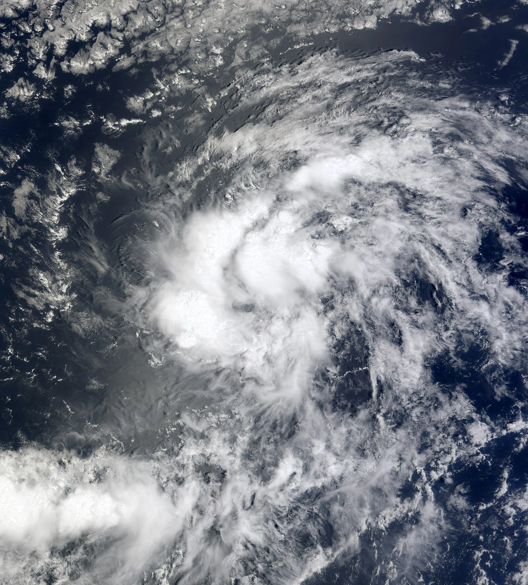
Tropical Depression 07[]
| Tropical depression (SSHWS) | |
 | |
| Duration | July 31 – August 2 |
|---|---|
| Peak intensity | 35 mph (55 km/h) (1-min) 1009 mbar (hPa) |
Tropical Depression 07 was a short lived system that remained unnamed its whole life and never impacted land or caused any fatalities or damage.
Hurricane Georgia[]
| Category 4 hurricane (SSHWS) | |
 | |
| Duration | August 5 – August 14 |
|---|---|
| Peak intensity | 130 mph (215 km/h) (1-min) 965 mbar (hPa) |
A tropical wave developed north of City on August 3, and organized slowly over the next few days. On August 5, the wave was upgraded to Tropical Storm Georgia. Tropical Storm Georgia strengthened gradually over the next few days. Georgia became a Category 1 hurricane on August 7, a Category 2 on August 9, and a Category 4 (after entering a very favorable environment) on August 10. Georgia curved away from Set-Up Survival and began weakening on August 12. Georgia dissipated on August 14.
On the Eastern Coast of Set-Up Survival, one person drowned on the coast due to rough surf caused by Georgia.
Hurricane Herbert[]
| Category 4 hurricane (SSHWS) | |
 | |
| Duration | August 13 – August 24 |
|---|---|
| Peak intensity | 155 mph (250 km/h) (1-min) 935 mbar (hPa) |
A wave of tropical origin formed northeast of City on August 12, and on the next day, became Tropical Storm Herbert, when the Hurricane Hunters found 40 MPH winds at 6:30 AM MTC. Herbert churned to the west-northwest while gradually intensifying. The Hurricane Hunters and Hurricane Center of City were flying into the storm as it neared Set-Up Survival, according to the forecast. As Herbert entered a period of rapid deepening and intensified into a strong Category 4 hurricane with 155 MPH winds on August 14, the Hurricane Hunters decided to cancel all missions into or near the storm. Herbert reached peak of 155 MPH, with a 935 millibar pressure on August 15, and the Hurricane Center of Set-Up Survival began issuing Hurricane Watches and Hurricane Warnings as Hurricane Herbert got closer. Hurricane Herbert stalled just off of the coast of Set-Up Survival, bringing occasional heavy rain bands around the Eastern Coast, causing flash flooding around Terracotta, Set-Up. Herbert began moving again, however, Herbert began moving northeast; away from Set-Up Survival. All warnings and watches were discontinued on August 20 at 9:00 PM MTC. Herbert moved away farther and began weakening. Herbert dissipated fully on August 24.
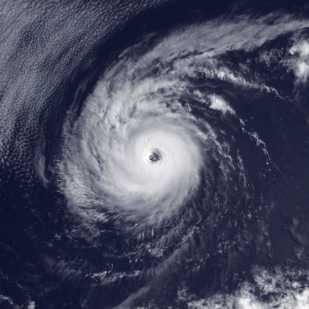
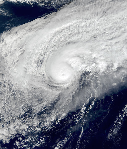
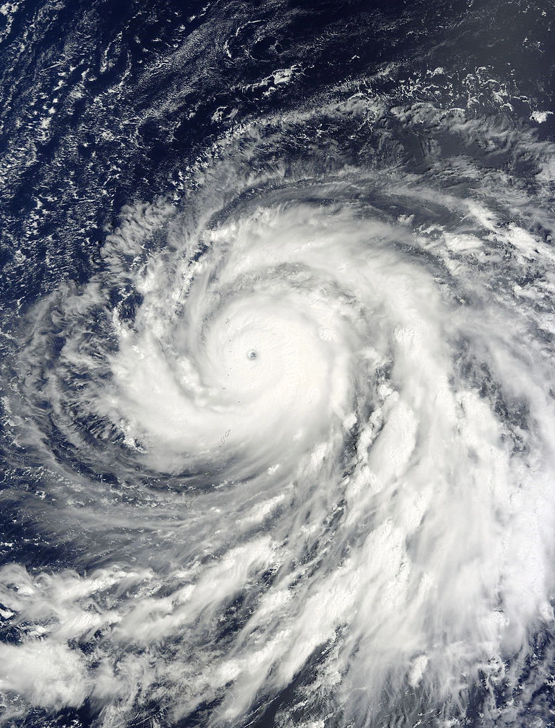
Hurricane Ida[]
| Category 5 hurricane (SSHWS) | |
 | |
| Duration | August 28 – September 8 |
|---|---|
| Peak intensity | 165 mph (270 km/h) (1-min) 915 mbar (hPa) |
A tropical wave organized itself into Tropical Storm Ida on August 28, north of City. The storm began moving due north, but due to strong wind shear, failed to develop into a healthy storm. Ida briefly was downgraded to a tropical low on September 1, and moved it's way through the wind shear. Once Ida had moved into a favorable environment, it began to strengthen quickly. Ida regenerated as a tropical storm on September 3, and was later that day upgraded to a Category 2 hurricane. Ida began moving into the higher latitude region of the basin, and rapidly intensified into a Category 5, with 160 MPH winds, on September 5. Although conditions were somewhat favorable, somehow Ida was able to rapidly strengthen with waters of only 79 degrees Fahrenheit. Ida began moving quickly to the northeast, into the extratropical region of the basin and rapidly weakened. Ida was declared extratropical on September 8, never to be seen again.
Hurricane Joe[]
| Category 4 hurricane (SSHWS) | |
 | |
| Duration | September 3 – September 12 |
|---|---|
| Peak intensity | 145 mph (230 km/h) (1-min) 938 mbar (hPa) |
A tropical wave increased its convection around the center on September 3. Later that day, it was upgraded to Tropical Storm Joe at 8:00 p.m. MCT. The storm moved directly northwest at 5 mph and began to rapidly intensify. Joe became a hurricane on September 4, at 11:00 p.m. MCT and continued to intensify into a major hurricane on September 6 in the early morning hours of the Minecraft States (MCS). Joe achieved Category 4 intensity on September 6 as well as reaching its peak intensity of 145 mph winds with a low pressure of 938 millibars. The storm grew a small eye, but was soon clouded over by it's deep convection, and weakened due to wind shear that formed near the storm. Joe waltzed towards the extremely strong wind shear in the Bay of Vosaline,, and weakened down to a Category 1 hurricane by 5:00 am on September 10. Joe continued to deteriorate itself by integrating it's core into the wind shear. It weakened to a tropical storm late on September 11 and eventually dissolved on September 12 as its core became exposed and all convection was ripped away.
Hurricane Kim[]
| Category 1 hurricane (SSHWS) | |
 | |
| Duration | September 13 – September 20 |
|---|---|
| Peak intensity | 80 mph (130 km/h) (1-min) 998 mbar (hPa) |
Hurricane Kim formed from a front moving east-southeast from Seoul, Yandere on September 12, until being officially named and analyzed by the MWHA at 01:00 a.m. on September 13. The newly named Tropical Storm Kim began to stall just 100 square miles southeast of 南東の浜, Yandere (Southeast Beach), causing the beach to close and for any outside events on the beach to be cancelled. As the storm began to pick up speed, all cancellations and postponed events are lifted and activities continue in 南東の浜. At 6:30 a.m. on September 15, Kim became a minimal hurricane with 75 mph and began to accelerate to the east-northeast at 17 mph. As Kim began to merge with a nearby low pressure, it peaked with 80 mph and a pressure of 998, rather high for a hurricane of Kim's intensity. It simultaneously formed a mid-level eye before beginning to lose convection and form cirrus clouds around the outer bands. Kim was absorbed by the dominant low pressure on September 20, with the last advisory being issued by the MWHA on September 19 at 8:00 p.m. MCT.
Tropical Storm Lex[]
| Tropical storm (SSHWS) | |
 | |
| Duration | September 26 – September 28 |
|---|---|
| Peak intensity | 50 mph (85 km/h) (1-min) 1008 mbar (hPa) |
A tropical depression formed on September 26 at 3:00 a.m. MCT. It stalled around Terracotta, SUS and eventually took advantage of the warm waters it was located above and strengthened to Tropical Storm Lex later that day. Lex began to move quickly away from land, achieving its peak intensity of 50 mph on September 27, before becoming extratropical on September 28.
Tropical Storm Marge[]
| Tropical storm (SSHWS) | |
 | |
| Duration | October 3 – October 7 |
|---|---|
| Peak intensity | 70 mph (110 km/h) (1-min) 1002 mbar (hPa) |
A tropical wave emerged from the monsoon rain around the state of Set-Up Survival and was given a 60%/80% chance of developing within the week on October 2. To much surprise, the system formed rapidly into Tropical Depression Fourteen-M, and later Tropical Storm Marge. Marge moved northwest at a steady rate and gradually intensified. Marge failed to reach hurricane intensity due to what would have been an eyewall replacement cycle as it was undergoing the transition to a category 1 hurricane. The "eyewall" failed to wrap around the core and hence Marge began to weaken while executing a loop to the east. It weakened to a tropical depression and eventually a remnant low on October 7.
Hurricane Norris[]
| Category 1 hurricane (SSHWS) | |
 | |
| Duration | October 14 – October 21 |
|---|---|
| Peak intensity | 80 mph (130 km/h) (1-min) 992 mbar (hPa) |
A tropical gyre formed between Vosaline and the surrounding New York Cities. The gyre spawned a tropical disturbance within it, and became Tropical Depression Fifteen on October 14 at 5:00 a.m. The MWHA began issuing Tropical Storm Warnings for Set-Up Survival and Hurricane Watches as all models were predicting a possible Category 4 landfall near Woolworths, SUS. The mayor of SUS at the time (Susan BloCks) ordered a mandatory evacuations for the areas under the warning in advance of Hurricane Norris. It strengthened to a Category 1 hurricane at 6:00 p.m. on October 16, and began to stall, which raised the evacuations further, as Norris was now expected to hit SUS as a strong Category 4 hurricane. More than 5,000 people began to evacuate from the approaching Norris. On October 17, Norris weakened back down to a tropical storm because of a clouded eye and wind shear, turning to the west, away from SUS. Norris degenerated into a remnant low and was unrecognizable within a dominant low pressure on October 21.
Because of the false alarm and useless evacuations, the MWHA decided to re-analyze their equipment and models. Mayor BloCks apologized for the evacuations and gave everyone who prepared their houses for the hurricane a refund on their supplies and gave citizens who evacuated refunds on gas.
Tropical Storm Orchid[]
Main Article: Tropical Storm Orchid (CycloneMC)
| Tropical storm (SSHWS) | |
 | |
| Duration | October 20 – October 24 |
|---|---|
| Peak intensity | 60 mph (95 km/h) (1-min) 999 mbar (hPa) |
Hurricane Percy[]
| Category 4 hurricane (SSHWS) | |
 | |
| Duration | November 12 – November 26 |
|---|---|
| Peak intensity | 140 mph (220 km/h) (1-min) 962 mbar (hPa) |
Hurricane Ruth[]
| Category 1 hurricane (SSHWS) | |
 | |
| Duration | November 30 – December 1 |
|---|---|
| Peak intensity | 75 mph (120 km/h) (1-min) 976 mbar (hPa) |
Storm Names[]
The following list of names was used for named storms that formed in the Minecraft Basin in 1980. The names not retired from this list will be reused in the 1984 season. This was the first year in which names were used for Minecraft hurricanes.
|
|
|
Retirement[]
On March 20, 1981, at the 1st session of the MC HC hurricane committee, the Minecraft Weather and Hurricane Association retired the name Orchid from its rotating naming lists due to the amount of deaths and damage it caused, and it will not be used again for another Minecraft hurricane. It will be replaced with Odina for the 1984 season, respectively.
Season Effects[]
| Storm name |
Dates active | Storm category at peak intensity |
Max 1-min wind mph (km/h) |
Min. press. (mbar) |
Areas affected | Damage (USD) |
Deaths | |||
|---|---|---|---|---|---|---|---|---|---|---|
| Abby | May 31 – June 3 | Tropical storm | 70 | 994 | None | 0 | 0 | |||
| Ben | June 13 – June 18 | Tropical storm | 65 | 989 | None | 0 | 0 | |||
| Carmen | June 23 – July 3 | Category 2 hurricane | 100 | 973 | Set-Up Survival | minimal | 2 | |||
| Dom | July 2 – July 14 | Category 4 hurricane | 145 | 952 | None | 0 | 0 | |||
| Ellen | July 10 – July 16 | Category 1 hurricane | 85 | 986 | None | 0 | 0 | |||
| Forrest | July 24– August 10 | Category 3 hurricane | 120 | 952 | None | 0 | 0 | |||
| Seven | July 31– August 2 | Tropical depression | 35 | 1009 | None | 0 | 0 | |||
| Georgia | August 4 - August 14 | Category 4 hurricane | 130 | 965 | None | 0 | 0 | |||
| Herbert | August 13– August 24 | Category 4 hurricane | 155 | 935 | Set-Up Survival | #3 million | 0 | |||
| Ida | August 28 – September 8 | Category 5 hurricane | 165 | 915 | Yandere | 0 | (1) | |||
| Joe | September 3 - September 12 | Category 4 hurricane | 145 | 938 | None | 0 | 0 | |||
| Kim | September 13 - September 20 | Category 1 hurricane | 80 | 998 | None | 0 | 0 | |||
| Lex | September 26 - September 28 | Tropical storm | 50 | 1008 | None | 0 | 0 | |||
| Marge | October 3 - October 7 | Tropical storm | 70 | 1002 | None | 0 | 0 | |||
| Norris | October 14- October 21 | Category 1 hurricane | 80 | 992 | Set-Up Survival, New York City #2 | 0 | 0 | |||
| Orchid | October 20 - October 24 | Tropical storm | 60 | 999 | Set-Up Survival, Awesome World, Yandere, Stampy's Funland | $1.5 billion | 24 | |||
| Percy | November 12 - November 26 | Category 4 hurricane | 140 | 962 | None | 0 | 0 | |||
| Ruth | November 30 - December 1 | Category 1 hurricane | 140 | 962 | None | 0 | 0 | |||
| Season aggregates | ||||||||||
| 18 systems | May 31 – December 1 |
165 | 915 | Set-Up Survival, Yandere, New York City #2, Awesome World, Stampy's Funland | $1.7 billion | 27 | ||||