Disclaimer: The content on this wiki is fictional and NOT a resource for real tropical cyclones. NONE of this wiki's content should be taken as a real indication of inclement weather.
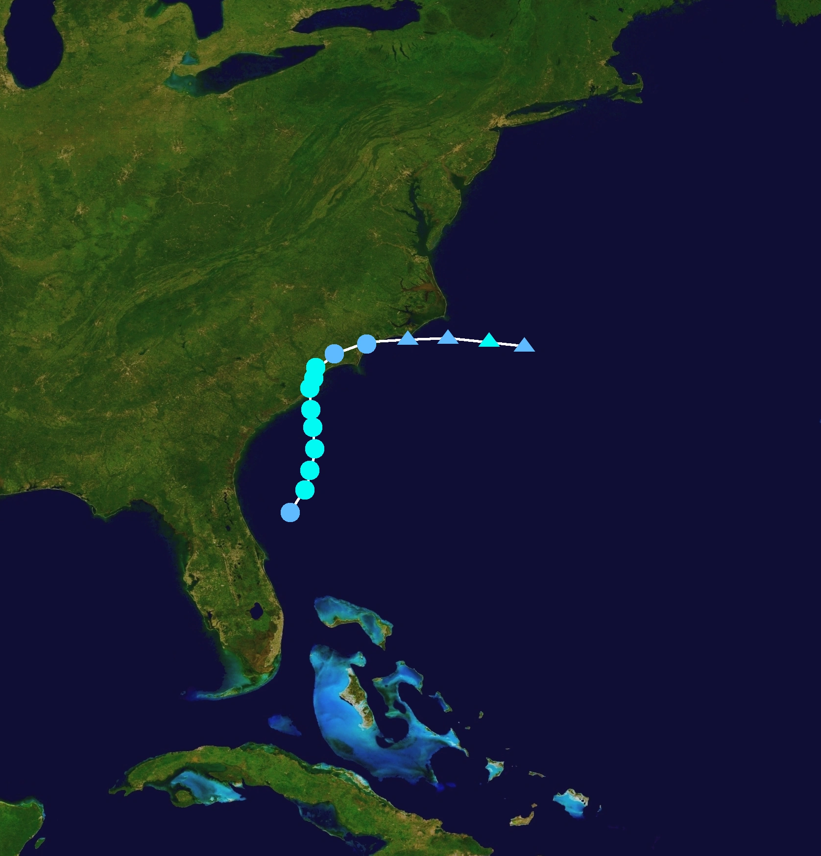
On May 18, an area of low pressure became a tropical depression off the northeast coast of Florida. The depression quickly strengthened into Tropical Storm Arlene the next day. Arlene then moved into South Carolina at peak the next day, before dissipating by May 21st off the North Carolina coast.
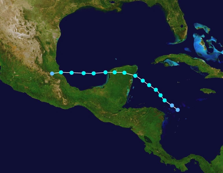
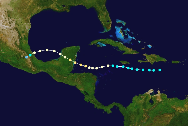
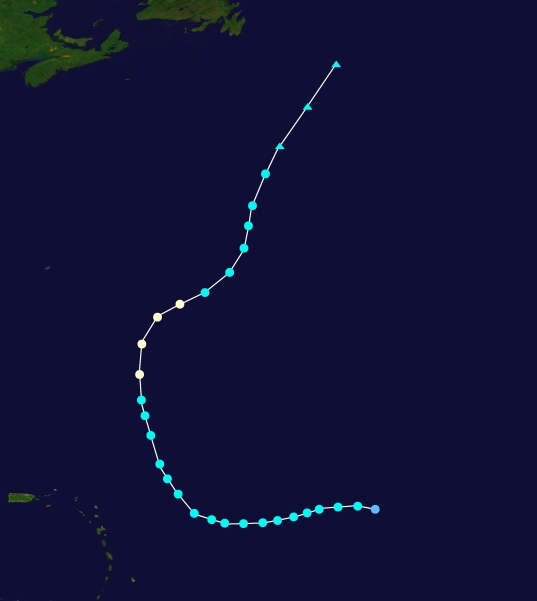
A weak area of low pressure developed in the Bahamas on May 15, and was given a low chance of developing, also stating that if it did, it would be subtropical. However, over the next several hours, it became more apparent that this system was turning tropical. The NHC kept the chance of development low, but said that it would cause severe flooding issues in the US, and the Bahamas. As this low pressure gained more tropical characteristics, the NHC gave it a medium chance of development on May 16. The area of low pressure was nearly stationary. It was expected to head north, which would cause major promblems in Florida, Georgia and the Carolinas. The low was getting even better organized, and started to head north. On May 17, it was given a high chance of development, and was designated Potential Tropical Cyclone One, the first usage of this designation. Warnings were issued from Jacksonville, Florida, to Wilimington, North Carolina. One was intensifying, and was expected to be a tropical depression soon. On May 18, recon discovered that One had developed into a tropical deprsssion near Jacksonville. It was moving north- northeast, and was expected to curve north and go into South Carolina. However, the storm was moving very slowly. Recon then discovered 35kt winds and the storm was named Tropical Storm Arlene. On May 19, the storm began its turn north. It wasnt strengthening at first, as the Sea Surface Temperatures (SSTs), were somewhat cool. However, Arlene was expected to move into more favorable conditions as it neared South Carolina
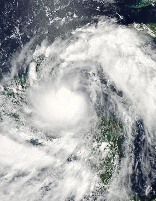
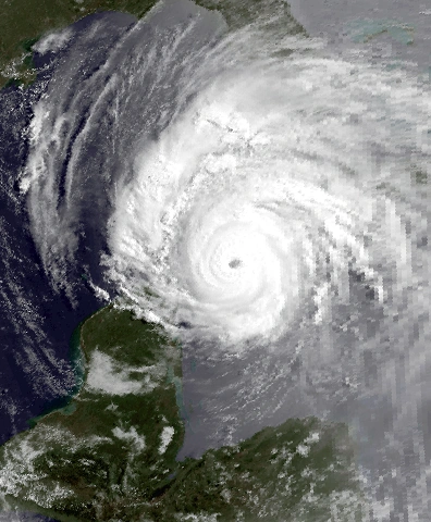
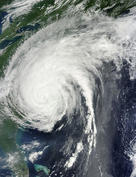
As it began to move straight for the South Carolina coast, the governor issued a state of emergency for the entire state. On May 20, the storm began to near landfall. Heavy rains from the outer bands started flash flooding. Recon flew into the center and discovered 50 mph winds and a pressure of 999 mbars. This was the storms peak. At around 2 PM EDT, Arlene made landfall near Charleston, South Carolina. Strong winds gusted up to 66 mph in that city, blowing out power in that area. However, the storm began to weaken quickly. It moved over Mytrle Beach and casued flooding issues and then moved into extreme southeast North Carolina, and weakening to a tropical depression on May 21. As it was moving off the coast, it became a remanant low and the last advisory was issued. The main impact from Arlene was a minor flood issues. One waterspout was reported to have moved onshore at the time of landfall before quickly dissipating. Arlene killed one person due to a car being swept away in flash flooding. Arlene cost 10 million dollars in damages.
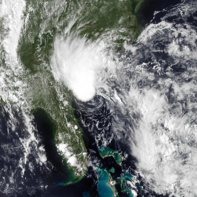
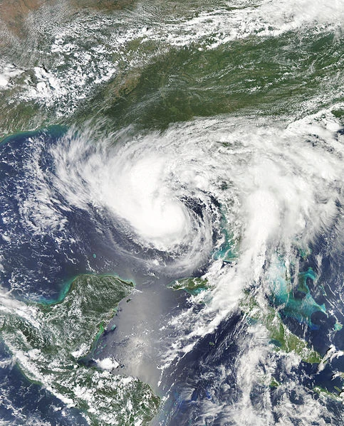
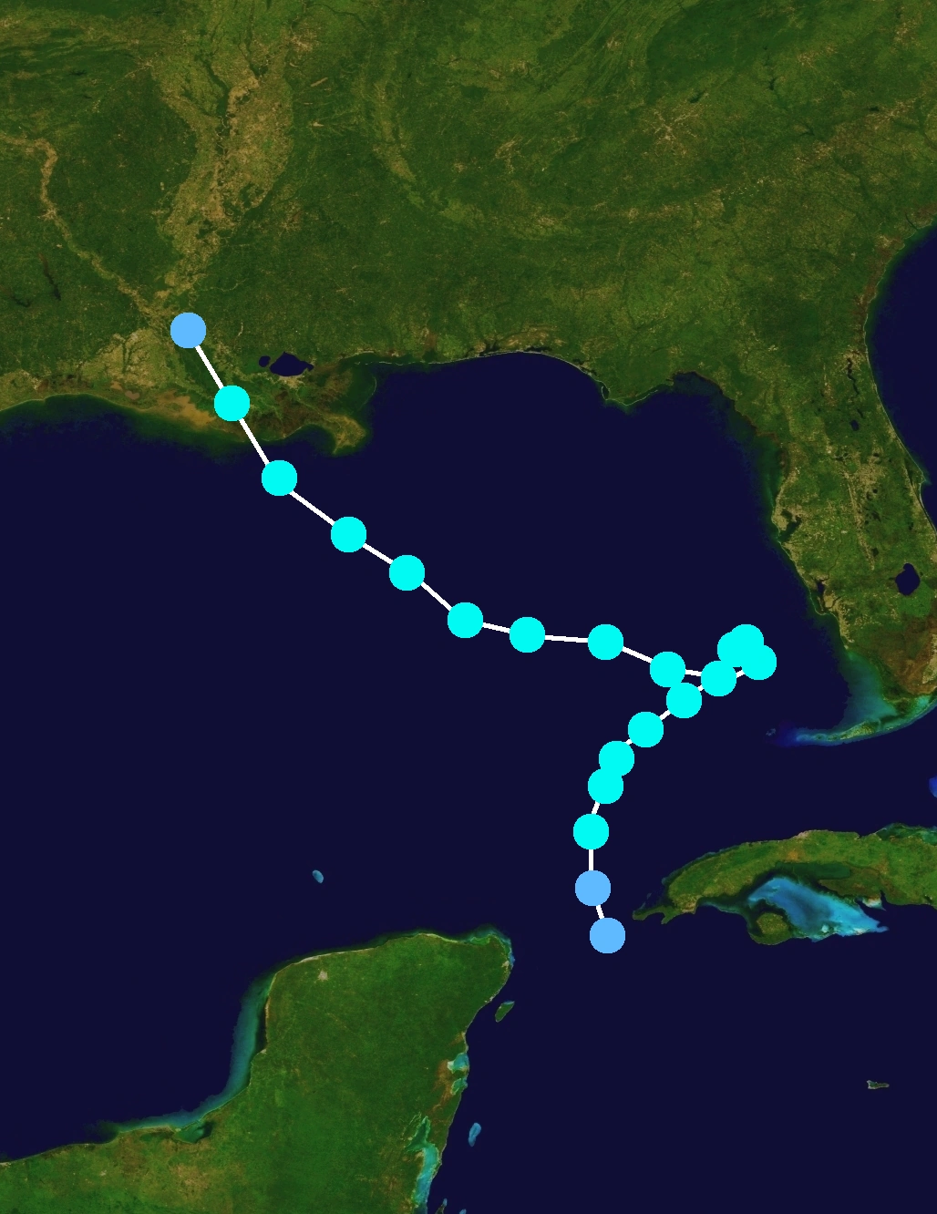
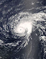
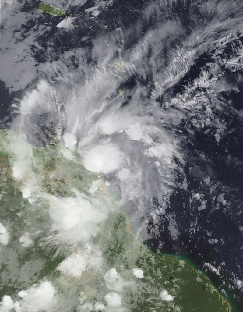
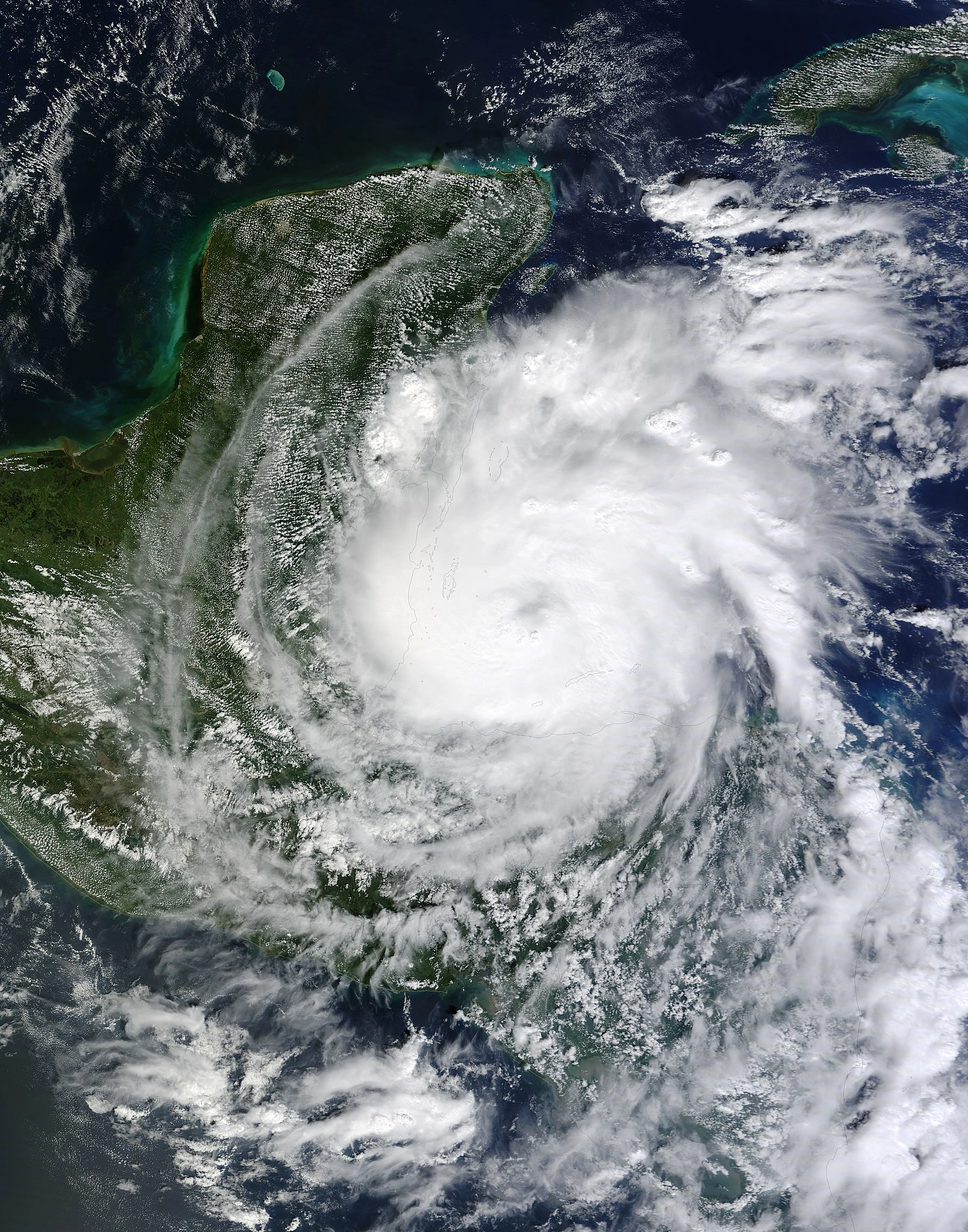
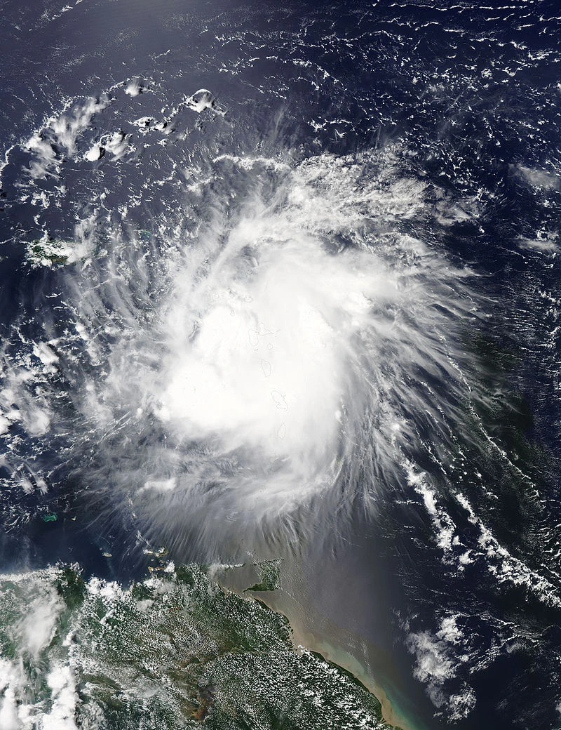
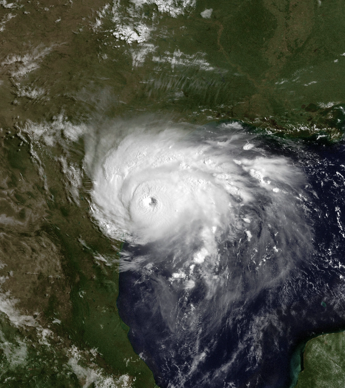
A tropical wave developed south of Jamaica on June 9 . The NHC noted it for a low chance of development a few hours later. However, throughout the day, it kept organizing, quite rapidly. A recon flight was scheduled for the next day. The wave was dumping rain on Jamaica. 1 person was killed in a flood. By the end of the day, the NHC had upped the chances to medium. When recon flew in the next day, they found the wave was trying to develop a circulation, and the NHC designated the wave Potential Tropical Cyclone Two, and given a high chance of development. It was moving towards the Yucatan Channel. The wave had two circulations, and could not be designated. As most models had the storm aiming for Florida, Tropical Storm Warnings were issued. The next dag, recon flew into the system, and found the two circulations had become one, and the wave was designated Tropical Depression Two in the Yucatan Channel.