The 2011–12 South Pacific cyclone season is the current period of tropical cyclone formation within the South Pacific Ocean to the east of 160°E. The season officially runs from November 1, 2011 to April 30, 2012. However, any tropical cyclones that form between July 1, 2011 and June 30, 2012 will count towards the season total.
Within the South Pacific, tropical cyclones are monitored by the Regional Specialized Meteorological Center (RSMC) in Nadi, Fiji, and the Tropical Cyclone Warning Center (TCWC) in Wellington, New Zealand. RSMC Nadi attaches a number and an F suffix to tropical disturbances that form in or move into the South Pacific. The United States Joint Typhoon Warning Center (JTWC) issues unofficial warnings within the South Pacific, designating tropical cyclones with a number and a P suffix. RSMC Nadi and TCWC Wellington both use the Australian Tropical Cyclone Intensity Scale, and measure wind speeds over a period of ten minutes, while the JTWC measures sustained winds over a period of one minute and uses the Saffir–Simpson Hurricane Scale.
Storms[]
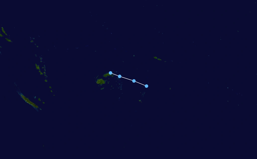
Tropical Depression 01F[]
| Tropical depression (Australian scale) | |
 | |
| Duration | November 4 – November 5 |
|---|---|
| Peak intensity | 55 km/h (35 mph) (1-min) 1004 hPa (mbar) |
RSMC Nadi reported that a tropical depression had formed over Fiji on November 4. This depression moved slowly southeastwards while gradually intensifying. Late on November 5, RSMC Nadi said that this low is no longer forecast to become a tropical cyclone and issued their final advisory.
Tropical Depression 02F[]
| Tropical depression (Australian scale) | |
 | |
| Duration | November 28 – December 4 |
|---|---|
| Peak intensity | 45 km/h (30 mph) (1-min) 998 hPa (mbar) |
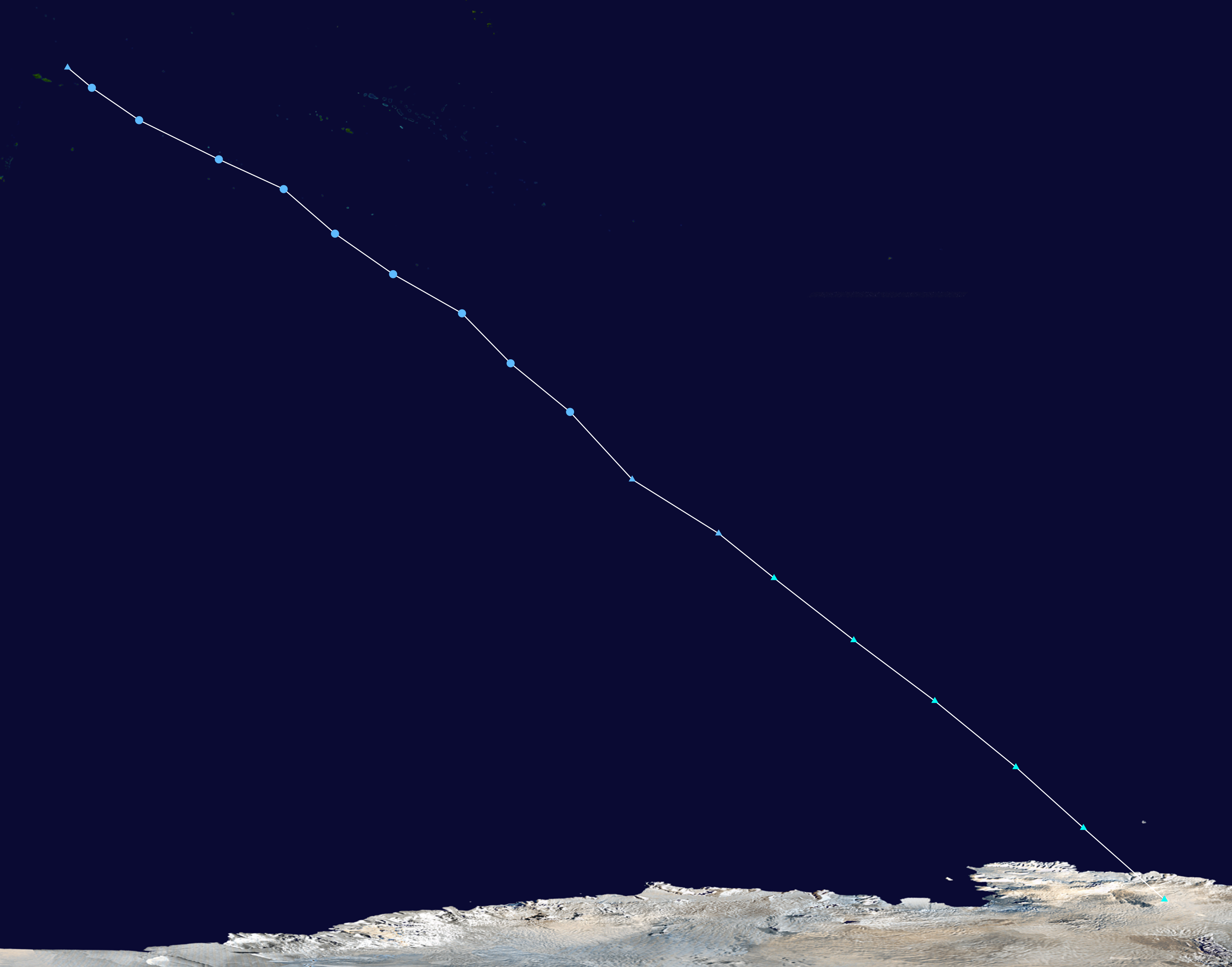
A long lived depression, 02F formed on November 28 and gradually moved southeastwards. It became extratropical on December 5 and made landfall on Antarctica on December 8.
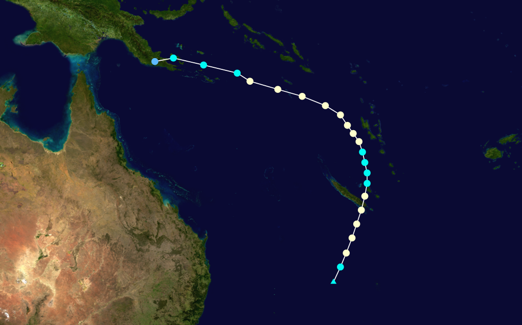
Severe Tropical Cyclone Cyril[]
| Category 3 severe tropical cyclone | |
 | |
| Duration | December 18 – December 21 |
|---|---|
| Peak intensity | 130 km/h (80 mph) (1-min) 970 hPa (mbar) |
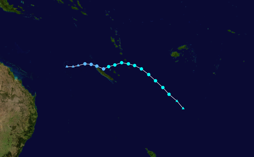
On December 18, a tropical low formed in TCWC Brisbane's area of responsibility and moved into RSMC Nadi's area a few hours later. It was immediately named Cyril after attaining wind speeds of 40 mph. RSMC Nadi continued to follow it as it became a severe tropical cyclone west of Vanuatu. The cyclone then crossed the islands with winds near 80 mph causing widespread damage. The JTWC did not designate this storm as a tropical cyclone because 'it didn't have a proper circulation'.
In Vanuatu, Cyril killed 3 people and injured 15 people. Damage was estimated at $301 million (2011 USD).
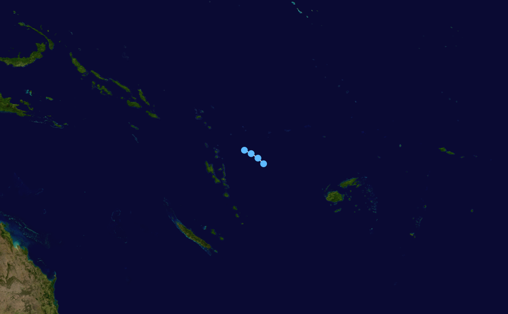
Tropical Disturbance 04F[]
| Tropical disturbance (Australian scale) | |
 | |
| Duration | December 20 – December 20 |
|---|---|
| Peak intensity | 30 km/h (15 mph) (1-min) 1000 hPa (mbar) |
An area of convective activity formed north of Vanuatu on December 19 and moved southeastwards. On December 20, it was classified as Tropical Disturbance 04F but dissipated late that day.
Tropical Cyclone Daphne[]
| Category 1 tropical cyclone | |
 | |
| Duration | December 24 – December 25 |
|---|---|
| Peak intensity | 85 km/h (50 mph) (1-min) 988 hPa (mbar) |
On December 24, a tropical depression formed to the northwest of New Caledonia. It was named Daphne hours later and it moved out of RSMC Nadi's area of responsibility on December 25. The JTWC designated it as Tropical Cyclone 10P. On December 29, Daphne made landfall on the Queensland coast as a Category 4 severe tropical cyclone, killing four people.
Severe Tropical Cyclone Evan[]
| Category 4 severe tropical cyclone | |
 | |
| Duration | December 30 – January 2 |
|---|---|
| Peak intensity | 175 km/h (110 mph) (1-min) 950 hPa (mbar) |
On December 29, RSMC Nadi noted in their Tropical Cyclone Outlook that a significant tropical depression would develop the next day. The next day, Tropical Depression 06F developed and only a few hours later strengthened into a Category 1 tropical cyclone. The storm rapidly strengthened into a Category 4 severe tropical cyclone on December 31, before gradually weakening and dissipating on January 2.
Tropical Cyclone Freda[]
| Category 2 tropical cyclone | |
 | |
| Duration | January 3 – January 7 |
|---|---|
| Peak intensity | 100 km/h (65 mph) (1-min) 984 hPa (mbar) |
Severe Tropical Cyclone Alu[]
| Category 3 severe tropical cyclone | |
 | |
| Duration | January 7 – January 11 |
|---|---|
| Peak intensity | 150 km/h (90 mph) (1-min) 964 hPa (mbar) |
Timeline[]

Storm names[]
Within the Southern Pacific a tropical depression is judged to have reach tropical cyclone intensity should it reach winds of 65 km/h, (40 mph) and it is evident that gales are occurring at least halfway around the center. With tropical depressions intensifying into a tropical cyclone between the Equator and 25°S and between 160°E – 120°W named by the Regional Specialized Meteorological Center in Nadi, Fiji (RSMC Nadi). However should a tropical depression intensify to the south of 25°S between 160°E and 120°W it will be named in conjunction with RSMC Nadi by the Tropical Cyclone Warning Center in Wellington, New Zealand (TCWC Wellington). Should a tropical cyclone move out of the basin and into the Australian region it will retain its original name. The next name that will be used this season is Garry.
|
|