2012 Atlantic Hurricane Season[]
The 2012 Atlantic Hurricane Season was extremely active, with almost every single storm becoming hurricanes. 2012 was the most active hurricane season ever recorded and the first to last 2 years. Hurricane Zeta is the strongest, and latest major hurricane recorded, reaching the status on January 1, while Hurricane Allen is the earliest Category 5, reaching the status on January 12th. Hurricane Jake, was the strongest cyclone on Earth with winds of 300 mph and a pressure of 830 mbar. Hurricane Tammy is the strongest storm and only Category 5 in November. The super-catastrophic season finally ended on January 10, 2013
Accumulated Cyclone Energy (ACE) Rating[]
| ACE (104 kt2) – Storm: Source | |||||
|---|---|---|---|---|---|
| 1 | 200.62 | Jake | 12 | 60.18 | Paloma |
| 2 | 100.00 | Johnathan | 13 | 59.21 | Cindy |
| 3 | 89.60 | Zeta | 14 | 59.09 | Isabella |
| 4 | 80.99 | Allen | 15 | 59.92 | Wilma |
| 5 | 79.54 | Jesse | 16 | 51.02 | Vick |
| 6 | 77.64 | Alex | 17 | 39.85 | Fred |
| 7 | 74.42 | Gillian | 18 | 35.20 | Kim |
| 8 | 72.00 | Julian | 19 | 29.01 | Dennis |
| 9 | 70.00 | Harry | 20 | 26.09 | Ophelia |
| 10 | 69.84 | Logan | 21 | 24.98 | Vick |
| 11 | 64.81 | Ron | |||
| 22 | 23.97 | Tammy | |||
| Total=1493.30 (1,493) | |||||
ACE is the result of a storm's winds multiplied by how long it lasted for, so storms that lasted a long time (like Dennis, Fabian, Nathan, and Cindy), as well as particularly strong hurricanes (like Jake, Allen, Johnathan, Jesse, and Alex), have higher ACE totals. 2012 was extraordinarily active in these terms; with an ACE total of 1493.30, the ACE of the 2012 season was higher than any other Atlantic hurricane season on Planet Earth. The 2012 season also holds the record for the most storms with an ACE higher than 20, twenty, (Jake, Johnathan, Allen, Jesse, Alex, Julian, Gillian, Ida, Harry, Paloma, Logan, Cindy, Isabella, Wilma, Vick, Kim, Nick, Cindy, Dennis, Ron, and Ophelia.) With an ACE of 200.62, Hurricanes Jake and Johnathan are the only ones of the Atlantic hurricanes on Earth with an ACE exceeding 100. Since subtropical storms are not included in season totals, Subtropical Storm 2,3,4 are omitted out of this list.
Timeline[]
Timeline of tropical activity in the 2012 Atlantic hurricane season

Timeline of tropical activity in the 2013 Atlantic hurricane season

Storms[]
Hurricane Alberto[]
Main article: Hurricane Alex (2012)
| Category 5 hurricane (SSHWS) | |
 | |
| Duration | April 8 – April 19 |
|---|---|
| Peak intensity | 160 mph (260 km/h) (1-min) 910 mbar (hPa) |
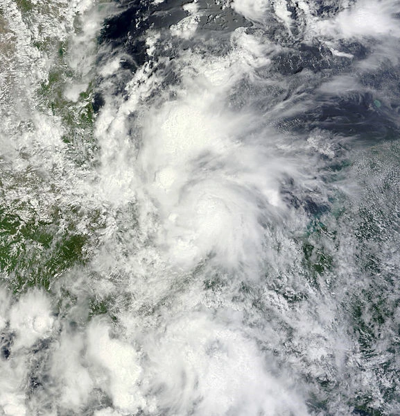
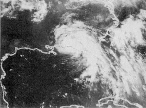
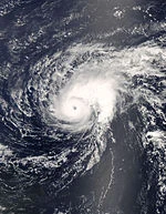
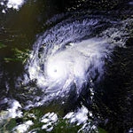
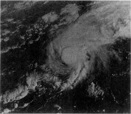
Hurricane Alberto formed from a wave that had heavy rain . The first advisory was announced from the NHC on 10:45 am stating that the 1st depression of the season has formed 800 miles from The Bahamas. Under favorable conditions, it quickly developed into Tropical Storm Alberto. A small ragged eye was starting to appear on infrared satellite. NHC set the winds at 70 mph (110 km/h). After flunctuating in intensity, it became a Category 1 hurricane wih winds of 80 mph (130 km/h). A advisory from the NHC was announced on 12:00 PM April 10, stating that a clear eye has formed and winds have reached 145 mph (230 km/h). A recon was sent to Tropical Depression 3 and Hurricane Alberto. When the recon went to Alberto, it recorded winds of 160 mph (260 km/h) and NHC upgraded the storm to a Category 5 hurricane, the first since Hurricane Felix of 2007. Alberto reached a peak of 160 mph. Alberto made landfall on the Yucatan with winds of 160 mph. Alberto continued west into the Gulf of Mexico with winds of 145 mph. Alberto made landfall in Mexico with winds of 115 mph. Alberto weakened into a tropical storm the next day. Alberto decayed into a remnant low.
Tropical Storm Beryl[]
| Tropical storm (SSHWS) | |
 | |
| Duration | April 9 – April 10 |
|---|---|
| Peak intensity | 40 mph (65 km/h) (1-min) 1010 mbar (hPa) |
Beryl formed from a wave that spawned 3 tropical lows. One moved into the Caribbean and didn't develop while the other became TD 1. It became Tropical Storm Beryl south of Central America. It crossed Central America and dissipated. A day later, it regenerated inthe pacific, turned into a hurricane, no, a HYPERCANE and swallowed Mexico WHOLE!
Hurricane Chris[]
Main article: Hurricane Celia (2012)
| Category 5 hurricane (SSHWS) | |
 | |
| Duration | April 10 – April 18 |
|---|---|
| Peak intensity | 160 mph (260 km/h) (1-min) 920 mbar (hPa) |
Hurricane Chris formed from a wave that spawned 3 systems. Two went into the Carribean while the other went towards Bermuda. NHC issued it's first advisory stating that the low has become Tropical Depression Three. NHC issued an Tropical Storm watch for Bermuda. At 4:00 pm on August 11 it became Tropical Storm Chris, upgrading the Bermuda storm watch to a warning. A hurricane warning was announced on 10:00 from the NHC stating that an small eye has formed and winds have increased to 110 mph (175 km/h). A advisory was announced right after that stating that Chris went east and passed Bermuda with winds of 160 mph (260 km/h). Chris continued north and lost tropical characteristics. Chris became extratropical the next day.
Hurricane Debby[]
| Category 2 hurricane (SSHWS) | |
 | |
| Duration | May 8 – May 15 |
|---|---|
| Peak intensity | 105 mph (165 km/h) (1-min) 973 mbar (hPa) |
Hurricane Debby formed from a low that moved off Africa. It moved north-northwest. NHC gave it a 60% chance to develop. The chance dropped to 50% then 20%. It started to develop and NHC increased the chance to 90%. NHC issued it's first advisory on Tropical Depression Four. It's winds increased to 45 mph (75 km/h), but no LLC. A weak LLC formed and NHC upgraded TD 4 to Tropical Storm Debby. Debby slowly strengthened churning towards Bermuda. Debby turned slightly west, causing dangerous wave conditions on the US coast. Debby rapidly strengthened to a peak of 105 mph (165 km/h). Debby turned east-northeast and became a strong extratropical storm over Greenland.
Tropical Storm Ernesto[]
| Tropical storm (SSHWS) | |
| Duration | May 19 – May 22 |
|---|---|
| Peak intensity | 65 mph (100 km/h) (1-min) 989 mbar (hPa) |
Tropical Storm Ernesto formed from a wave that moved into the Bay of Compeche. NHC issued it's first advisory on Tropical Depression Five. Tropical Depression 5 had 48 hours to strengthen into a Tropical Storm. Tropical Depression 5 became Tropical Storm Ernesto. Tropical Storm Ernesto slowly organized, and made landfall in Mexico with winds of 65 mph (105 km/h). Ernesto dissipated in Oklahoma on May 21.
Hurricane Florence[]
| Category 4 hurricane (SSHWS) | |
| Duration | May 25 – June 2 |
|---|---|
| Peak intensity | 155 mph (250 km/h) (1-min) 935 mbar (hPa) |
Hurricane Florence developed from a wave from the Cape Verde Islands. After moving into the open waters, NHC issued it's first advisory on Tropical Depression Six. TD 6 quickly became Tropical Storm Florence. Convective banding features began to show on satellite images, and an eye was starting to form. A small eye, 5 to 10 miles formed, and NHC upgraded Tropical Storm Florence to a hurricane with winds of 85 mph (140 km/h). Florence continued to develop and became a major hurricane with winds of 120 mph (195 km/h). Fabian entered the Caribbean with winds slightly higher, 125 mph (205 km/h). Fabian made landfall in Haiti as a high Category 4 hurricane with winds of 155 mph (250 km/h). Fabian continued northeast as it was slowly weakening. Fabian went into the open waters and lost tropical characteristics.
Hurricane Gordon[]
| Category 5 hurricane (SSHWS) | |
 | |
| Duration | June 26 – July 3 |
|---|---|
| Peak intensity | 190 mph (305 km/h) (1-min) 891 mbar (hPa) |
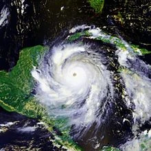
Hurricane Gillian formed from a wave near Belize. A recon recorded tropical storm force winds and a strong LLC and NHC upgraded the low to Tropical Storm Gillian. NHC noted that Gillian was starting to explosively strengthen. Gillian rapidly strengthened to winds of 130 mph (215 km/h). Gillian continued to strengthen and Gillian reached Category 5 status, the second to do so this season. Gillian reached it's peak of 195 mph (315 km/h) while entering the Gulf of Mexico, as confirmed by NOAA. Gillian made landfall in Cameron and Vermillion Parishes with those winds. Gillian continued north as an depression and dissipated near Shreveport, LA. Gillian was the first deadly hurricane to hit in those parishes since Hurricane Rita.
Hurricane Helene[]
| Category 5 hurricane (SSHWS) | |
| Duration | July 11 – July 22 |
|---|---|
| Peak intensity | 165 mph (270 km/h) (1-min) 900 mbar (hPa) |
Hurricane Harry formed from a Cape Verde type low. NHC started the monitor the storm as it developed quickly. NHC issued it's first advisory on Tropical Depression Eight. Tropical Depression Eight continued to organize, and the circulation of the system closed, and NHC upgraded TD 8 to Tropical Storm Harry. Harry continued to strengthen due to favorable conditions and reached hurricane status 450 miles from the Windward Islands. Harry began to strengthen more rapidly and became a major hurricane. Harry entered the Caribbean with winds of 145 mph (230 km/h). Harry reached it's peak intensity of 165 mph (275 km/h). Harry made landfall in Haiti and caused catastrophic damage before entering water. Harry became extratropical the next day.
Hurricane Issac[]
Main article: Hurricane Isabella (2012)
| Category 5 hurricane (SSHWS) | |
| Duration | July 23 – August 3 |
|---|---|
| Peak intensity | 160 mph (260 km/h) (1-min) 920 mbar (hPa) |
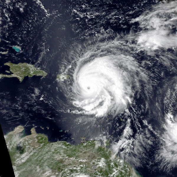
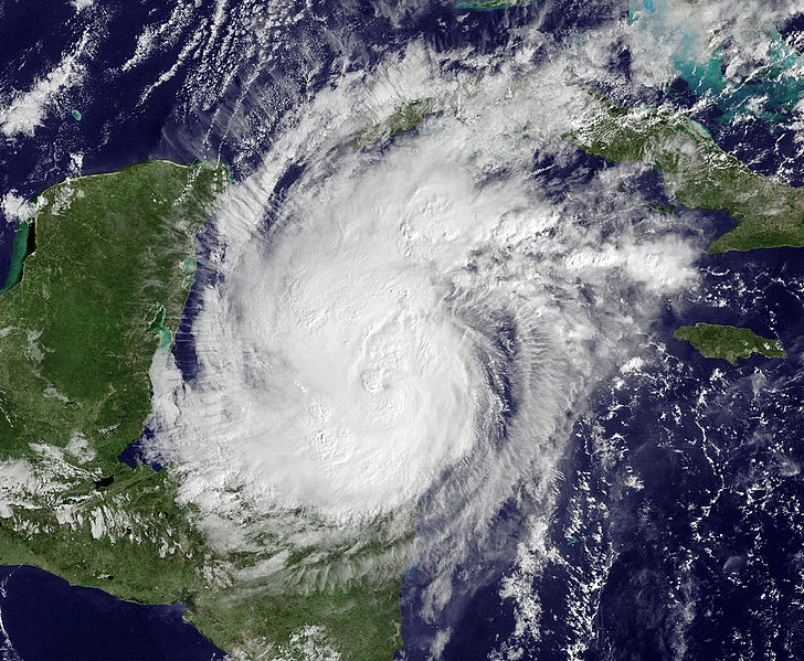
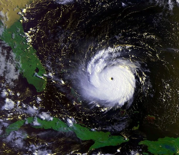
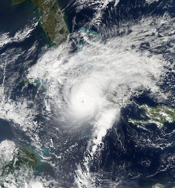
Hurricane Isabella formed from a wave moving off Africa. The wave spawned an area of low pressure roughly 120 miles from the Cape Verde Islands. NHC began monitoring the system as it started to circulate and organize. A ship found a weak surface circulation and NHC upgraded the low into Tropical Depression Nine. It was upgraded to a storm later that day, but NHC didn't go with the update until the next day. Tropical Storm Isabella continued west-northwest instead of east-northeast. NHC made hurricane watches and tropical storm warnings for the coast of the Carolinas. A recon was sent to Isabella as it progressed. Winds were recorded of 80 mph (130 km/h) and NHC upgraded Isabella to the 7th hurricane of the season. Isabella continued to strengthen and reached major hurricane status 400 miles from South Carolina. Isabella reached peak winds of 160 mph (260 km/h), just barely at Category 5. Isabella made landfall in South Carolina and rapidly decayed into a remnant low. The remnant low became a Mesoscale Convective Vortex the next day.
Hurricane Joyce[]
| Category 5 hurricane (SSHWS) | |
| Duration | August 17 – August 31 |
|---|---|
| Peak intensity | 190 mph (305 km/h) (1-min) 862 mbar (hPa) |
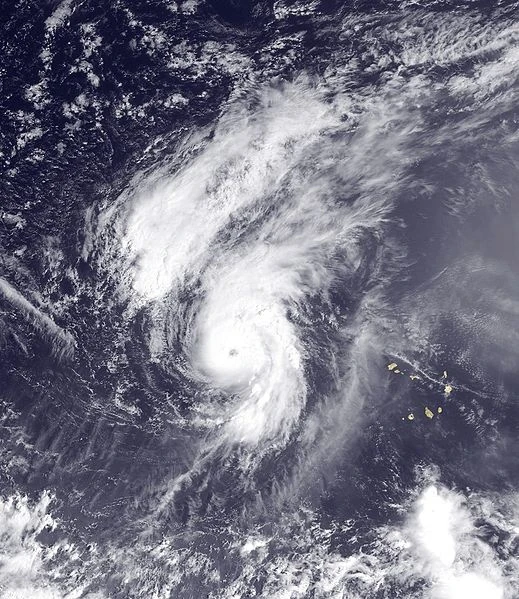
Hurricane Julian formed from a low that moved off Africa. NHC started to monitor the storm when it became Tropical Depression Ten. Tropical Depression 10 became disorganized due to Hurricane Isabella north of it. Isabella made landfall shortly after that, and NHC upgraded Tropical Depression Ten to Tropical Storm Julian. Julian strengthened moderate due to a low that would become Hurricane Jake. Julian began to strengthen rapidly and reached hurricane status 155 miles west of Cape Verde. A special update was announced by NHC stating that Julian has reached winds of 120 mph (195 km/h). Julian continued to strengthen and reached winds of 190 mph (305 km/h). The strong storm was later absorbed by even stronger Hurricane Jake.
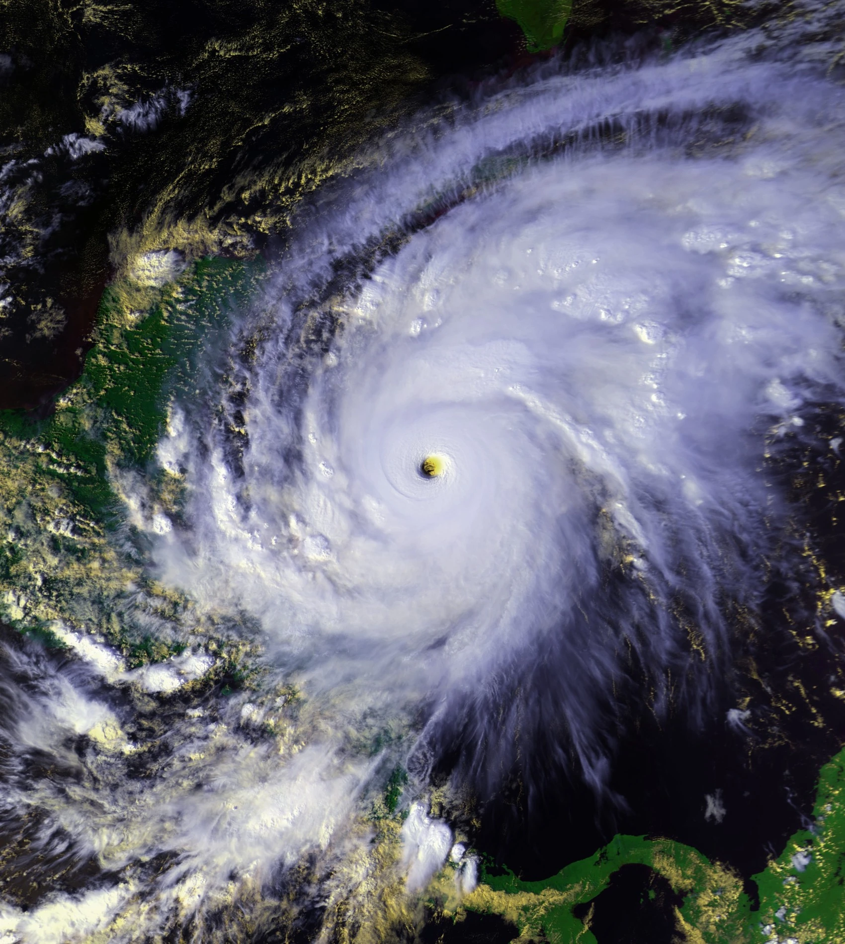
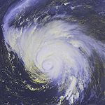
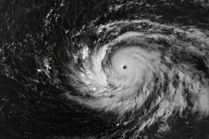
Hypercane Jake[]
| Hypercane | |
 | |
| Duration | August 20 – November 19 |
|---|---|
| Peak intensity | 500 mph (805 km/h) (1-min) 700 mbar (hPa) |
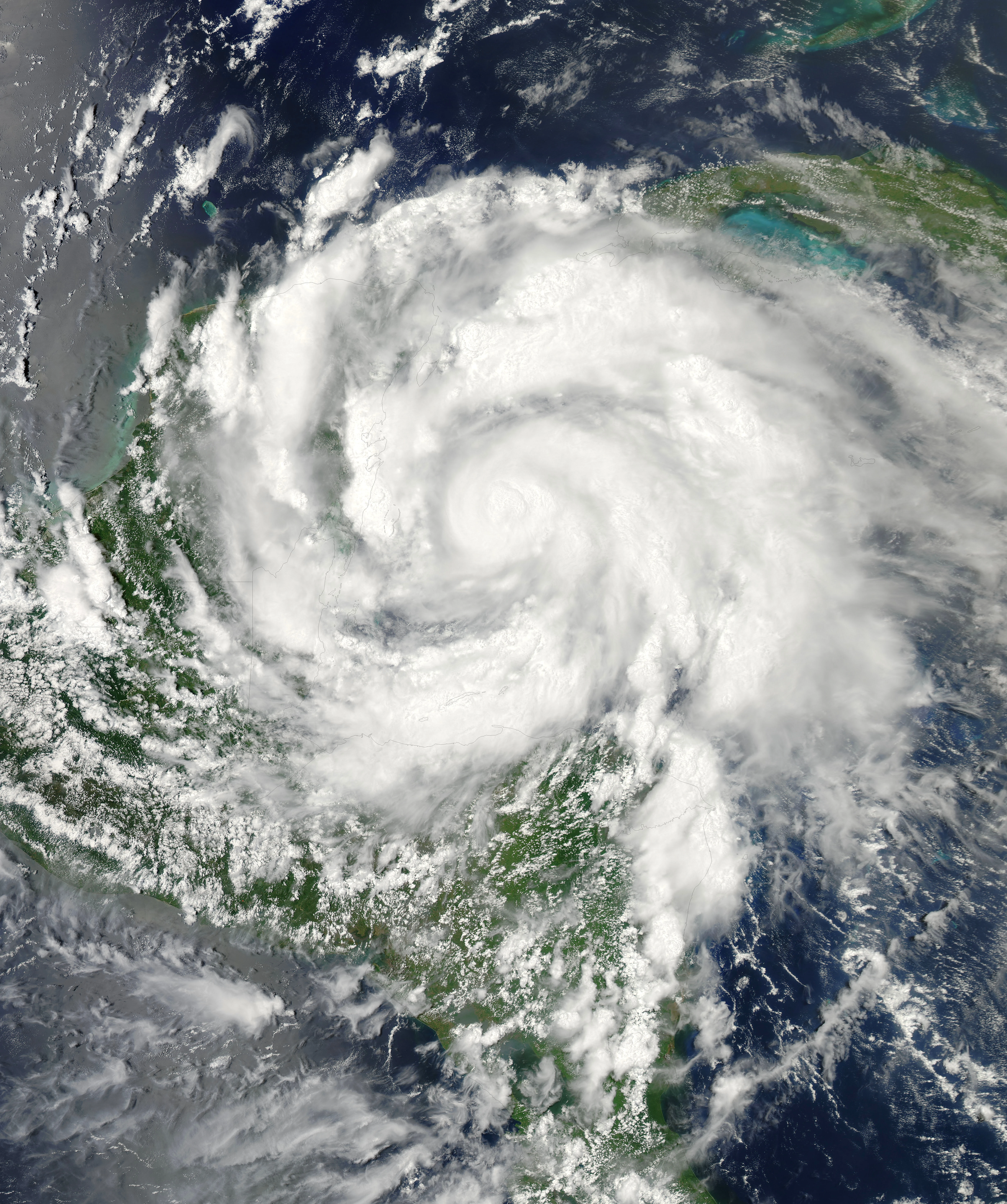
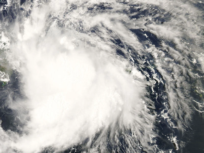
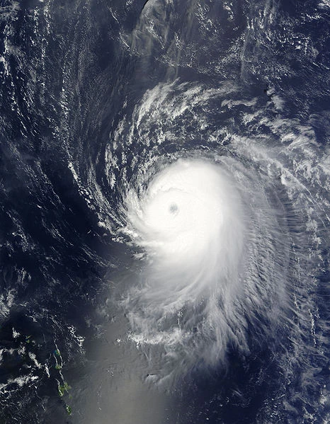
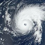
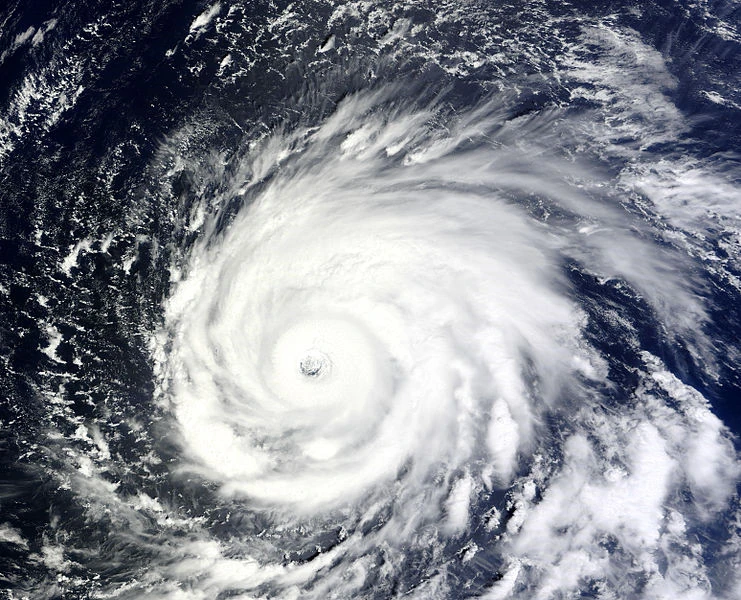
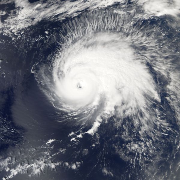
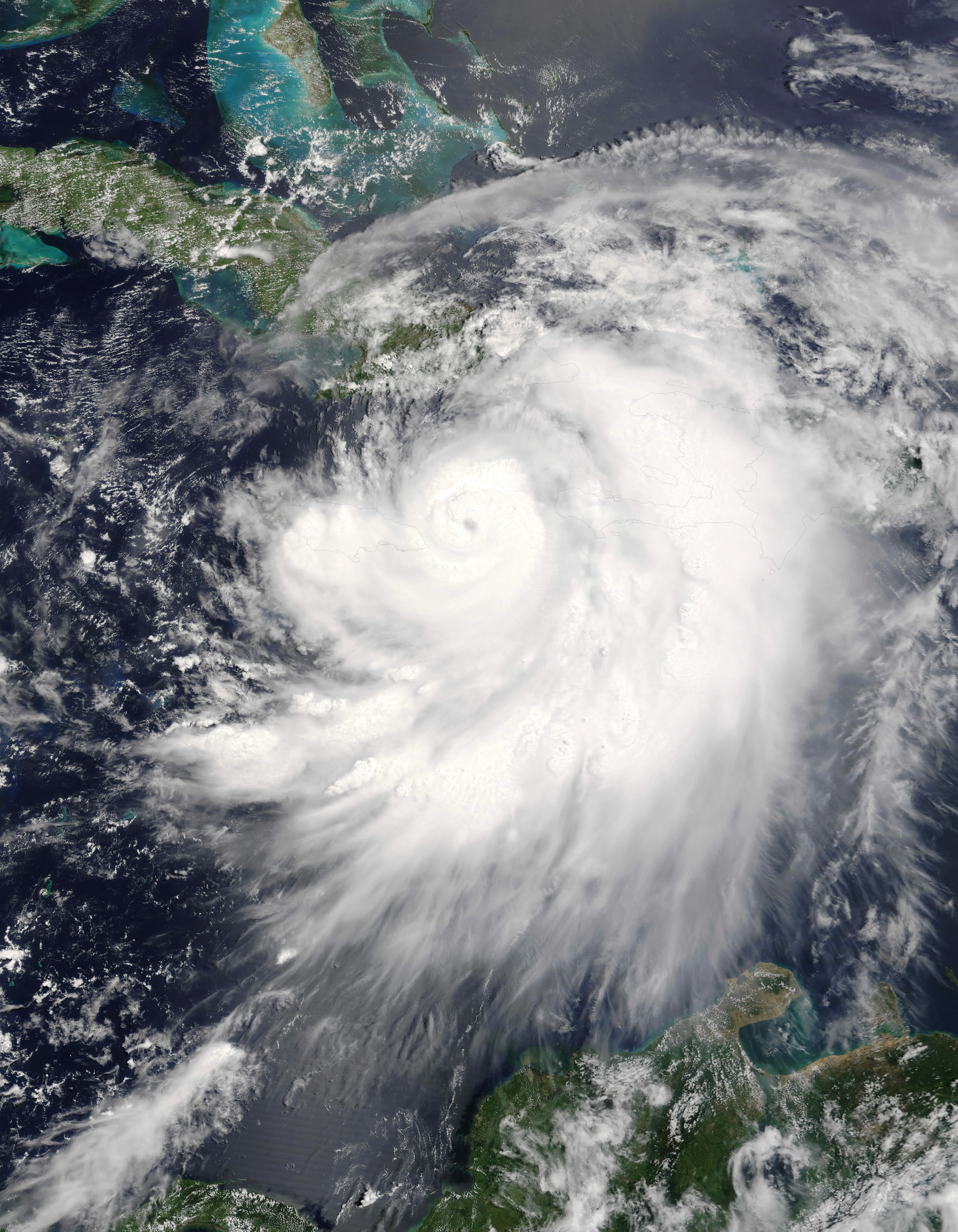
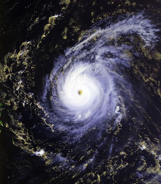
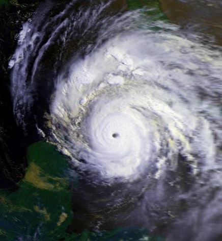
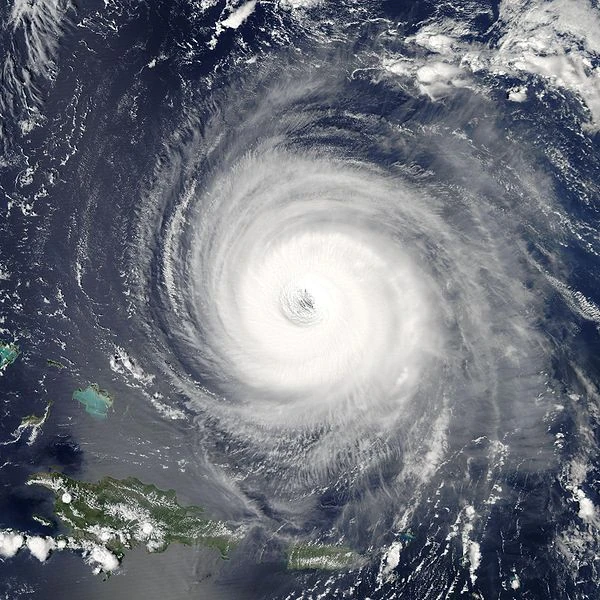
Hypercane Jake formed from a wave that moved into Africa. It dissipated inland, but still remained well defined. It continued westward, entering the Eastern Atlantic on August 18. The wave began to organize, and spawned an area of low pressure 120 miles east of the Cape Verde Islands. The system rapidly organized and was likely to develop into a depression. At 12:00 pm NHC declared that the low had developed into a depression, the 11th of the 2012 Atlantic hurricane season. The outflow of the system was very well developed, shear was practically gone, extremely high moisture content, and sea surface temperatures extremely above average in the path of the system was certainly for explosive development. The storm was steered west-northwest by a strong steering current. 3 minutes after becoming a depression, the storm quickly intensified into a Tropical Storm, at the time it was given the name Jake. An eyewall was seen 10 minutes later, meaning Jake intensified into a Category 1 hurricane with winds of 90 mph (150 km/h). The explosive intensification was fueled by waters of 120 F. A clear eye was seen in satellite and infrared images, and NHC upgraded Jake into a major hurricane with winds of 125 mph (205 km/h). Less than 15 minutes, the NHC issued an special advisory stating Jake has intensified into a Category 4 hurricane with winds of 150 mph (240 km/h). Continuing to strengthen, a giant eyewall with an statium effect was noted. Jake went through a eyewall replacement cycle that took 3 hours and got an eye 875.4 miles in diameter, the biggest eye in a cyclone recorded. Tropical Storm force winds extended up to 9,000,000 mi and hurricane force winds extended up to 900,000 mi. At 3:55 pm, the NHC issued the second special advisory, stating that Jake has became a Category 5 hurricane with winds of 175 mph (280 km/h). Continuing to strengthen in the Caribbean, it entered the Gulf with winds of 215 mph. Jake explosively deepened and reached peak intensity of 500 mph (805 km/h) and a minimum central pressure of 700 mbar. Jake made landfall near Baton Rouge and New Orleans with winds of 400 mph (645 km/h). Jake maintained it's intensity until it reached Florida and weakened to Category 3 hurricane. Jake entered open waters and Jake continued north and made landfall in Iceland and the North Pole as a Category 1 hurricane. It became a snowstorm and dissipated on November 19.
Hurricane Kirk[]
Main article: Hurricane Kim (2012)
| Category 3 hurricane (SSHWS) | |
 | |
| Duration | September 1 – September 10 |
|---|---|
| Peak intensity | 120 mph (195 km/h) (1-min) 943 mbar (hPa) |
Kim formed from Julian's remnants. NHC issued it's first advisory on Subtropical Depression Twelve. SD 12 began to transfer into a Tropical Depression with it's circulation changing due to Hurricane Jake's outflow. NHC renamed the depression "Tropical Depression 12." Twelve was upgraded to Tropical Storm Kim shortly after that. Substantial strengthening began, and Kim made it to hurricane strength. A special advisory was announced by the NHC stating that Kim has reached a peak of 120 mph (195 km/h). Kim turned northwest and made landfall on the Delmarva Peninsula, one of only 4 storms in recorded history to do so, after Tropical Storm Dean of 1983. Kim survived a remnant low until it reached Atlantic Canada and dissipated. Kim caused numerous deaths in the East Coast.
Hurricane Leslie[]
Main article: Hurricane Logan (2012)
| Category 5 hurricane (SSHWS) | |
 | |
| Duration | September 9 – September 18 |
|---|---|
| Peak intensity | 180 mph (285 km/h) (1-min) 891 mbar (hPa) |
A wave spawned 2 systems, one of them dissipated, while the other became the 13th depression of the season. Thirteen organized slowly due to a strong wave that would later spawn Tropical Storm Mary and Nick. NHC upgraded TD 13 to Logan, the 13th named storm of the season. Lee was showing signs of rapid intensification, as shown by satellite images. A special advisory was issued from the NHC stating that Logan has reached winds of 150 mph (240 km/h), a high end Category 4 hurricane. Logan continued to strengthen, largely because of the strong La Nina and SSTS up to 105 F. A large, but perfect eye was seen on all satellites. Lee reached it's final peak intensity of 180 mph (285 km/h) and a pressure of 891 mbar. Lee made landfall near Nicaragua and weakened into a remnant low. The remnant low entered the Pacific and became Tropical Depression One-E.
Tropical Storm Michael[]
| Tropical storm (SSHWS) | |
| Duration | September 18 – September 23 |
|---|---|
| Peak intensity | 60 mph (95 km/h) (1-min) 991 mbar (hPa) |
A wave spawned two systems. One went out to sea and the other in the Caribbean. It was nearly absorbed by Hurricane Logan. When it neared Belize, a closed circulation was found by satellite, and NHC issued it's first advisory on Tropical Depression Fourteen. Fourteen made landfall on the Yucatan and weakened into an remnant low. When the remnant low reached the Gulf of Mexico, NHC reupgraded the remnant low to TD Fourteen. TD 14 continued to organize, and a recon was sent to Fourteen. NHC upgraded TD 14 to Mary, the 14th storm of the season. Mary strengthened to a peak of 60 mph (95 km/h) before making landfall in Southeast Mexico. Mary quickly dissipated.
Hurricane Nadine[]
| Category 1 hurricane (SSHWS) | |
 | |
| Duration | September 19 – October 1 |
|---|---|
| Peak intensity | 80 mph (130 km/h) (1-min) 988 mbar (hPa) |
A wave spawned two systems, one would be Tropical Depression Fourteen, and the other TD Fifteen. Tropical Depression 15 moved northeast towards Europe. Unusually high temperatures allowed Fifteen to strengthen into Nick, the 15th storm of the season, and the first season to use the N letter since 2011. Nick reached a peak of 80 mph (130 km/h). Nick strengthened into a Category 1 before becoming extratropical.
Post storm analysis[]
Records show that Nick was a hurricane shortly before weakening.
Hurricane Oscar[]
| Category 2 hurricane (SSHWS) | |
| Duration | September 26 – October 5 |
|---|---|
| Peak intensity | 105 mph (165 km/h) (1-min) 963 mbar (hPa) |
Hurricane Ophelia formed from a depression that was found 400 miles of the Outer Banks of North Carolina. It was named Tropical Depression Sixteen. It became Subtropical, then Tropical. It was upgraded to Ophelia, but NHC didn't follow suit until later that day. Ophelia was predicted to rapidly strengthen, but was lowered to modest, because of land interaction. Ophelia became a hurricane 600 miles from Newfoundland and reached a peak of 105 mph (165 km/h). A front absorbed Ophelia later that day.
Tropical Storm Patty[]
| Tropical storm (SSHWS) | |
 | |
| Duration | September 30 – October 1 |
|---|---|
| Peak intensity | 65 mph (100 km/h) (1-min) 995 mbar (hPa) |
A vigorous low formed near the Mississippi River. Satellite found tropical storm force winds and the low was upgraded to Tropical Storm Peter. mircowave images shown a 16 to 21 mile wide eye forming and was upgraded to a hurricane, and later made landfall at Pensacola, Florida with winds of 65 mph (100 km/h). Nearly a day after landfall, Peter dissipated.
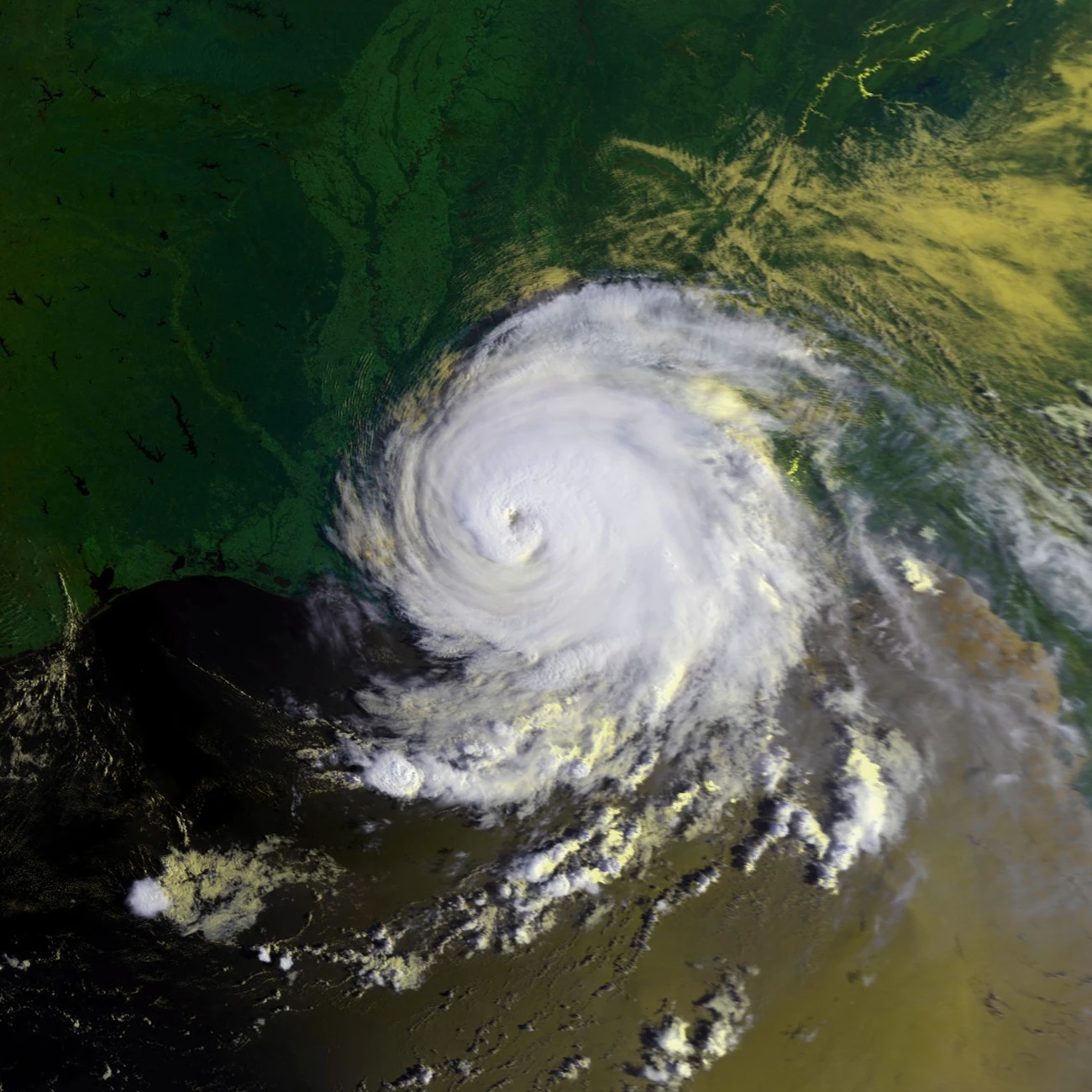
Hurricane Rafael[]
| Category 5 hurricane (SSHWS) | |
| Duration | October 8 – October 19 |
|---|---|
| Peak intensity | 180 mph (285 km/h) (1-min) 900 mbar (hPa) |
A wave moved off Africa on October 6. A subtropical high pushed the wave west-northwestward towards The Bahamas and Florida. The thunderstorms became more concentrated, and strong rainbands formed. It was designated as Tropical Depression Eighteen. Eighteen continued to organize, and NHC upgraded the depression to Tropical Storm Ron. On October 9, the convection deepened even more, and an eye was forming. Later that day, Ron was upgraded to an hurricane with winds at 90 mph (150 km/h). When Rachel encountered very favorable conditions, Ron rapidly intensified. In a 14 hour period, Ron's pressure dropped from 984 to 913, 71 mbars. Ron made landfall in Jupiter, Florida with winds of 140 mph (220 km/h). Ron emerged into the Gulf with winds of 125 mph (200 km/h) and a pressure of 947 mbar. Ron rapidly intensified, reaching peak winds of 180 mph (285 km/h) and a pressure of 900 mbar. Ron made landfall near Lafayette, LA and weakened into a storm. When Ron reached Tennessee, it dissipated.
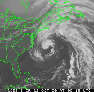
Hurricane Sandy[]
| Category 4 hurricane (SSHWS) | |
| Duration | October 14 – October 24 |
|---|---|
| Peak intensity | 145 mph (230 km/h) (1-min) 945 mbar (hPa) |
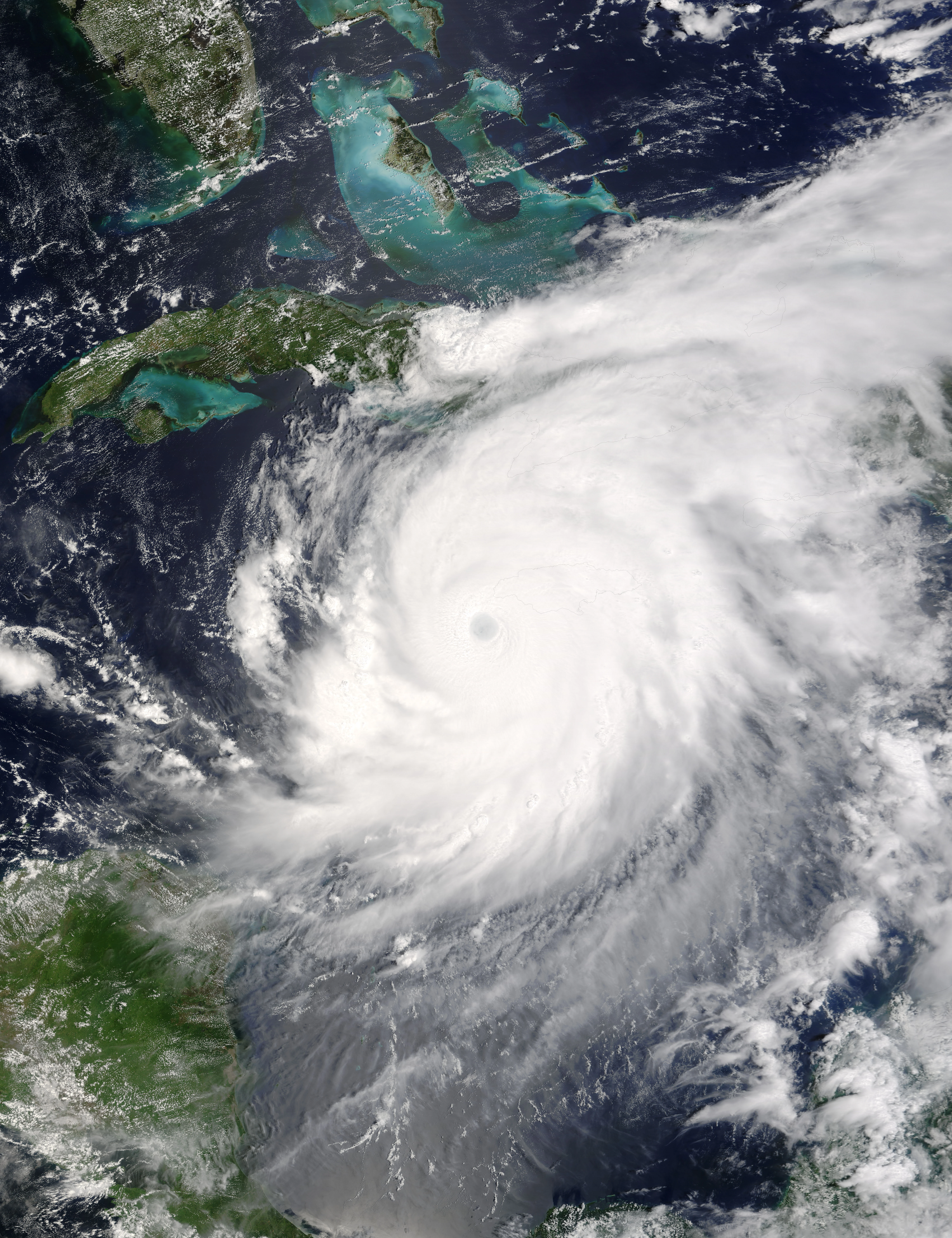
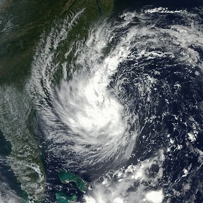
A wave moved off Africa on August 12. Deep convection formed near the center of the wave. The wave spawned an area of low pressure 200 miles south of the Cape Verde Islands. Thunderstorms inside the low became more concentrated, and a well defined surface circulation was found. It was designated as Tropical Depression Nineteen. Nineteen gained enough convection to be named as Stan. Stan strengthened rapidly and on the morning of October 16, Stan became the 13th hurricane of the season. Stan became a Category 2 hurricane while entering the Caribbean. Stan reached a peak of 145 mph (230 km/h) while nearing Jamaica. Stan reached the Gulf of Mexico and turned east. Stan did a loop and made landfall in Orlando, Florida. Stan dissipated when it entered Georgia.
Subtropical Storm Tony[]
| Subtropical storm (SSHWS) | |
| Duration | November 1 – November 10 |
|---|---|
| Peak intensity | 75 mph (120 km/h) (1-min) 969 mbar (hPa) |
An extratropical low formed at an edge of a front. It began traveling south, gaining subtropical looks. An special advisory was announced from the NHC stating that an Subtropical Dperession has formed. A recon was sent into the storm and recorded winds of 75 mph, and was upgraded to a Subtropical Storm. After brushing The Bahamas, Subtropical Storm 2 aimed for Florida. SS2 passed through Florida, but dissipated when it reached Louisiana.
Hurricane Valerie[]
| Category 5 hurricane (SSHWS) | |
 | |
| Duration | November 5 – November 19 |
|---|---|
| Peak intensity | 200 mph (325 km/h) (1-min) 870 mbar (hPa) |
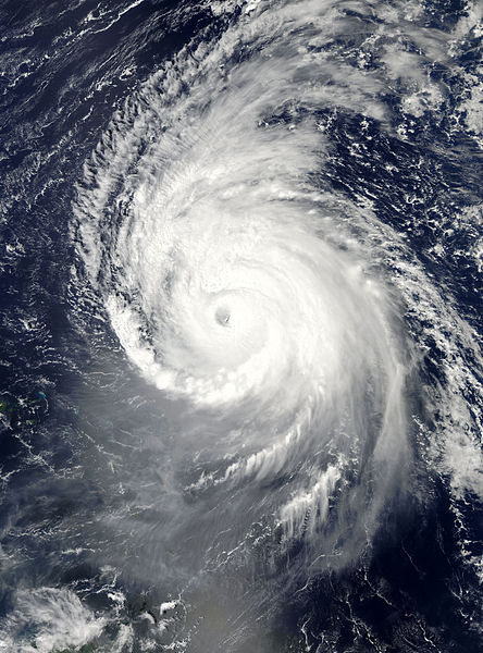
A vigorous low entered the Caribbean. Strong thunderstorms and deep convection formed at the center. It was designated as the 21th depression of the season. Twenty continued to organize, and reached storm status 300 miles southwest of Haiti. Tammy rapidly intensified and reached hurricane status. Tammy began explosive intensification, and dropped from 952 to 898, 54 mbar. Tammy made landfall on the Yacatan at it's peak of 180 mph (285 km/h) and a pressure of 870 mbar. Tammy became disorganized quickly and entered the Gulf as a 40 mph (65 km/h) storm. Tammy slightly strengthened and mad landfall in Pensacola, Florida with winds of 65 mph (100 km/h). Tammy dissipated in Georgia.
Hurricane William[]
| Category 4 hurricane (SSHWS) | |
 | |
| Duration | November 18 – December 3 |
|---|---|
| Peak intensity | 130 mph (215 km/h) (1-min) 929 mbar (hPa) |
A low formed from the ITCZ. It's circulation gradually developed, and the low was upgraded to Tropical Depression Twenty-two. Winds increased to Tropical storm force, and it was named Vick. Low wind shear and warm waters allowed Vick to reach hurricane status 750 miles from the Windward Islands on November 20. Vick continued to intensify gradually due to warm waters and very low wind shear of 1 knot. Vick achieved major hurricane status 400 miles north of the Lesser Antilles. Vick began to parallel the East Coast of the US when it reached it's peak of 130 mph (210 km/h). Interaction with the East Coast weakened Vick back into a Category 2 hurricane with winds of 100 mph (155 km/h). Vick made landfall in Nova Scotia shortly after that, and became extratropical on December 3rd.
Hurricane Alpha[]
| Category 5 hurricane (SSHWS) | |
 | |
| Duration | November 30 – December 12 |
|---|---|
| Peak intensity | 180 mph (285 km/h) (1-min) 892 mbar (hPa) |
A large wave of thunderstorms moved into the Caribbean. An area of low pressure was spawned 200 miles south of Haiti, and quickly became more concentrated. On the last day of the hurricane season, it was well organized enough to be upgraded to Tropical Depression Twenty-three. Twenty-three reached winds of 65 mph (100 km/h), but there was no well defined low level circulation. Twenty-three was upgraded to Tropical Storm Wilma due from a rapidly organizing circulation. An eye was seen from infrared satellite, and Wilma was upgraded to a hurricane, the 17th of the active season. Wilma explosively intensified, reaching peak winds of 135 mph (215 km/h) near Cozumel. Wilma recurved and became extratropical 1,980 miles from the East Coast of the US.
Subtropical Storm Beta[]
| Category 1 hurricane (SSHWS) | |
 | |
| Duration | December 5 – December 13 |
|---|---|
| Peak intensity | 80 mph (130 km/h) (1-min) 989 mbar (hPa) |
An extratropical low formed at an edge of a front. It began traveling south, gaining subtropical looks. An special advisory was NHC saying an Subtropical Storm has formed. A recon was sent into the storm and recorded winds of 75 mph, but the Storm wasn't tropical for it to be a hurricane. After brushing The Bahamas, Subtropical Storm 2 aimed for Florida. Two passed through Florida, but dissipated when it reached the Gulf of Mexico.
Subtropical Storm Gamma[]
| Category 1 hurricane (SSHWS) | |
 | |
| Duration | December 10 – December 17 |
|---|---|
| Peak intensity | 75 mph (120 km/h) (1-min) 985 mbar (hPa) |
The last subtropical storm of the season, Subtropical Storm 4, formed from a cold front extended from the US to Europe. It failed to develop an warm core until December 10, when it became Subtropical Storm 4, skipping depression status. It weakened into a hybrid low while preforming a loop northeast. It regained storm status and then a hurricane and reached peak winds of 75 mph (120 km/h). Dry air entrained into Beta's circulation made it become disorganized and it dissipated.
Hurricane Delta[]
| Category 5 hurricane (SSHWS) | |
 | |
| Duration | December 31 – January 13, 2013 |
|---|---|
| Peak intensity | 195 mph (315 km/h) (1-min) 872 mbar (hPa) |
The last storm of the year, but not the season, formed in the ITCZ. Moving north, it developed into Tropical Depression Twenty-six. It slowly intensified, reaching storm status and given the name Zeta. Wind shear slowly increased, and Zeta nearly weakened into a depression. Zeta dropped it's winds to 35 mph (55 km/h), but was still kept a tropical storm due to a low level circulation. Zeta began to gradually strengthen, and reached hurricane status on December 31 at 10.1 north latitude, nearly beating Hurricane Jake. Zeta reached it's peak on January 5 with winds of 195 mph (315 km/h). Zeta began to weaken, and became extratropical.
The True 2013 Atlantic hurricane season[]
This season was the fifth most active hurricane season, behind 1995, 2010, 2011, 1933, 2012, and 2005.
Hurricane Andrea[]
| Category 5 hurricane (SSHWS) | |
 | |
| Duration | January 12 – January 31 |
|---|---|
| Peak intensity | 190 mph (305 km/h) (1-min) 862 mbar (hPa) |
A vigorous low formed west of the Windward Islands. It began organizing on January 11. It reached depression strength while moving westward. It stalled in the Carribean with no change in intensity. Tropical Depression Twenty-seven intensified to winds of 45 mph and was given the name Allen. It gradually intensified while moving at 24 knots. It became the 19th hurricane of the season, reaching winds of 80 mph (130 km/h). Allen continued to intensify rapidly, and reached major hurricane 145 miles south of Haiti. An eye 65 to 75 mi. wide was seen on satellite, and Allen was upgraded to a Category 4 hurricane with winds of 150 mph (240 km/h). Allen's intensity flunctuated because of an eyewall replacement cycle, and Allen weakened into a Category 2 hurricane. Allen regained Category 4 status the next day, and reached Category 5 later that day. Allen reached it's peak of 190 mph (305 km/h) for 48 hours before gradually weakening due to interaction with Mexico. Allen reached the Gulf of Mexico as a weakened tropical storm. Allen rapidly intensified and made landfall near Soto la Marina as a moderate Category 4 hurricane. Allen quickly lost it's circulation, and dissipated inland over South Texas.
Tropical Storm Barry[]
| Tropical storm (SSHWS) | |
| Duration | January 19 – January 24 |
|---|---|
| Peak intensity | 65 mph (100 km/h) (1-min) 987 mbar (hPa) |

A non-tropical wave formed in the Caribbean. It continued northwest without developing. It crossed into the Yucatan, and started to organize. Over land, It became Tropical Depression Twenty-eight, at a unusual place for tropical cyclones to form. Twenty-eight entered the Bay of Campeche and intensified into a storm and was named Bonnie. Bonnie rapidly intensified and reached peak of 65 mph (120 km/h). Bonnie made landfall again on the Yucatan and weakened back into a depression. Bonnie struggled to survive due to Tropical Depression Twenty-nine. Bonnie was absorbed by Cindy.
Hurricane Chantal[]
| Category 3 hurricane (SSHWS) | |
 | |
| Duration | January 23 – February 2 |
|---|---|
| Peak intensity | 120 mph (195 km/h) (1-min) 950 mbar (hPa) |
A wave moved off Africa. It spawned a low roughly 1,200 miles northwest of the Cape Verde Islands. As it approached the Bahamas, It rapidly organized. After moving through the Florida Keys, It was upgraded to Tropical Depression Twenty-nine. Twenty-nine became Cindy shortly before absorbing Bonnie. Cindy rapidly intensified and skipped Category 1 and 2. Cindy reached peak strength of 120 mph (185 km/h). Cindy made landfall in Venice, Louisiana at peak. Cindy became extratropical over Arkansas.
Hurricane Dorian[]
| Category 2 hurricane (SSHWS) | |
 | |
| Duration | February 20 – March 6 |
|---|---|
| Peak intensity | 105 mph (165 km/h) (1-min) 949 mbar (hPa) |
A low moved off Africa. It became Tropical Depression Thirty. Thirty slowly intensified and was upgraded to a Tropical Storm, at the time given the name David. David began to gradually intensify and neared hurricane strength March 2. The next day, David reached hurricane strength. David reached it's peak of 105 mph (165 km/h). David slowly weakened and became extratropical as a Category 1 hurricane.
Tropical Storm Erin[]
| Tropical storm (SSHWS) | |
 | |
| Duration | April 18 – April 26 |
|---|---|
| Peak intensity | 65 mph (100 km/h) (1-min) 989 mbar (hPa) |
Ethan formed of an Subtropical low. It had half tropical and subtropical. It became more tropical, and it became the 31st depression of the season. After continued organizing and strengthening, a closed circulation formed, and it became Tropical Storm Ethan. Tropical Storm Ethan was predicted to strengthen into a hurricane, but it didn't. Ethan went north and reached it's peak near the North Pole. It dissipated after that.
Hurricane Fernand[]
| Category 3 hurricane (SSHWS) | |
 | |
| Duration | April 25 – May 9 |
|---|---|
| Peak intensity | 115 mph (185 km/h) (1-min) 969 mbar (hPa) |
A wave formed from the ITCZ. It spawned a giant area of low pressure 120 miles south of the Cape Verde. It quickly organized and becme Tropical Depression Thirty-two. Under favorable conditions, besides the time of the year, Thirty-two became Tropical Storm Fred. Fred organized and gradually intensified continuing north. The NOAA sent a aircraft to do an investigation of Fred. Aircraft recorded strong winds of 105 mph (165 km/h), and Fred was upgraded to a Category 2 hurricane. Fred continued to strengthen, and reached peak winds of 115 mph (185 km/h), a weak Category 3. Fred began to weaken, but weakened very slowly. The same with David, Fred became extratropical as a Category 1.
Hurricane Gabrielle[]
| Category 1 hurricane (SSHWS) | |
| Duration | April 27 – May 4 |
|---|---|
| Peak intensity | 75 mph (120 km/h) (1-min) 990 mbar (hPa) |
Hurricane Gert formed from a low in the ITCZ with Hurricane Fred. It became TD 35. TD 35 headed towards the US coast. It became Tropical Storm Gert halfway there. When Gert was 145 miles of the coast it had winds of 70 mph. Gert became a Category 1 Hurricane when it made landfall. It dissipated on the 4th of May.
Hurricane Humberto[]
| Category 2 hurricane (SSHWS) | |
 | |
| Duration | June 15 – June 23 |
|---|---|
| Peak intensity | 110 mph (175 km/h) (1-min) 968 mbar (hPa) |
Hurricane Henri formed as a depression near the Azores. Thirty-four reached storm status and was named Henri. Henri continued to strengthen and became a hurricane. Henri reached it's peak as a strong Category 2 hurricane near the Azores. Henri became extratropical two days after.
Hurricane Ingrid[]
| Category 5 hurricane (SSHWS) | |
 | |
| Duration | July 6 – July 19 |
|---|---|
| Peak intensity | 195 mph (315 km/h) (1-min) 876 mbar (hPa) |
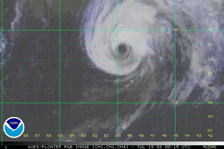
One of the strongest Category 5s of the season, Hurricane Ida, formed from a wave that moved off Africa. It quickly developed into Tropical Depression Thirty-five. It quickly intensified into a storm, at the time was given the name Ida. Ida rapidly intensified during the day, reaching hurricane status the next day. Ida continued to strengthen, and reached Category 5 status near the Dominican Republic. Ida made landfall in the islands, at it's peak of 195 mph (315 km/h). Ida maintained it's peak until moving near the East Coast of the US. Ida paralleled the coast and went out to sea. Ida became extratropical over Europe.
Hurricane Jarry[]
| Category 5 hurricane (SSHWS) | |
 | |
| Duration | August 2 – August 13 |
|---|---|
| Peak intensity | 195 mph (315 km/h) (1-min) 862 mbar (hPa) |
Hurricane Jesse formed out of Tropical Depression Thirty-six. The depression rapidly strengthened to Tropical Storm Jesse. Jesse explosively strengthened to a peak of 195 mph (315 km/h). Jesse nearly made landfall on the Yucatan, but made landfall in Louisiana as a weak Category 5. Jesse quickly dissipated.
Hypercane Johnathan[]
| Hypercane (NHC) | |
| Category 6 hurricane (AMS) | |
 | |
| Duration | August 20 – September 3 |
|---|---|
| Peak intensity | 200 mph (325 km/h) (1-min) 858 mbar (hPa) |
A well defined wave moved off Africa. It quickly developed into Tropical Depression Thirty-seven. Nearly 1 hour later, it was upgraded to Hurricane Johanthan. Johnathan explosively strengthened to a peak of 200 mph (325 km/h). Johnathan made landfall in Louisiana with those winds and dissipated over Maine.
Hurricane Karen[]
| Category 3 hurricane (SSHWS) | |
 | |
| Duration | September 1 – September 9 |
|---|---|
| Peak intensity | 115 mph (185 km/h) (1-min) 962 mbar (hPa) |
Hurricane Kate formed from a strong depression in the Bay of Campeche. Rapidly intensifying, Kate reached peak intensity of 115 mph (185 km/h). Kate made landfall in South Mexico and dissipated over the high mountains.
Hurricane Lorenzo[]
| Category 3 hurricane (SSHWS) | |
| Duration | September 10 – September 20 |
|---|---|
| Peak intensity | 125 mph (205 km/h) (1-min) 960 mbar (hPa) |

Hurricane Linda formed as a depression leaving the Yucatan. It rapidly intensified in the Gulf, making landfall with peak winds of 125 mph (205 km/h). Linda dissipated over the high mountains of Texas.
Hurricane Melissa[]
| Category 1 hurricane (SSHWS) | |
 | |
| Duration | September 15 – September 29 |
|---|---|
| Peak intensity | 80 mph (130 km/h) (1-min) 980 mbar (hPa) |
Tropical Storm Mick formed from a depression over the Bahamas. It quickly became Tropical Storm Mick and gained an eye feature, and became a minimal hurricane on the 17th. Mick gradually weakened and became extratropical over Newfoundland.
Hurricane Nestor[]
| Category 3 hurricane (SSHWS) | |
 | |
| Duration | September 20 – October 2 |
|---|---|
| Peak intensity | 125 mph (205 km/h) (1-min) 939 mbar (hPa) |
Hurricane Nathan formed from a depression that came from Central America. Traveling northeast, it reached a peak of 125 mph (205 km/h). Nathan became extratropical over the Atlantic.
Tropical Storm Olga[]
| Tropical storm (SSHWS) | |
 | |
| Duration | September 30 – October 11 |
|---|---|
| Peak intensity | 60 mph (95 km/h) (1-min) 987 mbar (hPa) |
Tropical Storm Oliver was found as a tropical depression near the Lesser Antilles. It reached a peak of 60 mph (95 km/h) and became extratropical soon after.
Hurricane Pablo[]
| Category 5 hurricane (SSHWS) | |
 | |
| Duration | October 12 – October 22 |
|---|---|
| Peak intensity | 165 mph (270 km/h) (1-min) 920 mbar (hPa) |
The third to last storm, Hurricane Paloma, was found as a tropical storm. It rapidly strengthened to a peak of 165 mph (265 km/h) and made landfall in Cuba. It survived as a depression, made landfall near Pensacola, Florida and later dissipated over Savannah, Georgia.
Hurricane Rebeckah[]
| Category 5 hurricane (SSHWS) | |
 | |
| Duration | October 26 – November 5 |
|---|---|
| Peak intensity | 160 mph (260 km/h) (1-min) 910 mbar (hPa) |
Tropical Depression Forty-four formed from a tropical wave moving northwest. It was upgraded to Tropical Storm Rick the next day. Like it's predessors, it rapidly strengthened to become a hurricane. Rick continued to strengthen due to favorable conditions, and became a Category 5 hurricane at 45.1 W, second to only Hurricane Jake. Rick reached a peak of 160 mph (260 km/h). Rick weakened and met it's demise as it was becoming extratropical.
Hurricane Sebastien[]
| Category 4 hurricane (SSHWS) | |
 | |
| Duration | November 4 – November 15 |
|---|---|
| Peak intensity | 150 mph (240 km/h) (1-min) 923 mbar (hPa) |
The second last storm of the season, Hurricane Sarah, developed from a tropical low that developed Tropical Depression Forty-five. Forty-five quickly developed into Tropical Storm Sarah. Sarah gained hurricane status passing north of the Virigin Islands. Sarah became the last major hurricane of the season, reaching peak winds of 150 mph (240 km/h). Sarah passed near Newfoundland and became extratropical near iceland.
Storm names[]
The following names were used to name storms that formed in the north Atlantic in 2012. The names not retired from this list were used again in the 2018 season. Some of the names were used in previous seasons, such as Fabian was used in 2003.
|
|
|
|
|
|
|
|
|
|
|
|
|
|
|
|
|
|
- Rick
- Sarah