The 2049 Atlantic hurricane season was an extremely active season. The season began on June 1, 2049, and ended on November 30, 2049, dates of which conventionally delimit the period of each year when most tropical cyclones form in the Atlantic basin. However, the season exceeded these bounds when Kappa, Omicron, and Pi lasted into December. This extremely active season has produced a total of 40 depressions, with 37 becoming a named tropical storm, 24 becoming a hurricane and 13 majors. Two of these majors strengthened to at least hypercane strength (Theta and Kappa), with Kappa becoming exceptionally powerful, reaching the incredible 'megacane' intensity. This season was also extremely destructive, with at least 7 storms destructive enough to be retired.
Season summary[]
June[]
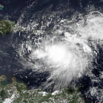
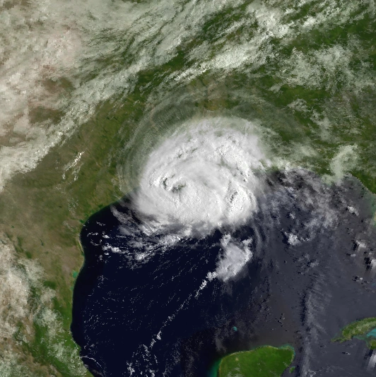
The season began early, with the first storm, Ashley, forming on June 4 only a few days after the official start of the season. It struck near the Texas-Louisiana border and caused plenty of damage in the affected regions. After that, a second storm named Brandon strengthened to Category 1 hurricane status, but remained mostly out to sea with slight impacts in Bermuda. Brandon crossed over to the first couple days of July.
July[]
The month began with Brandon active, and later in the month, seven storms (Chantal, Derek, Erin, TD 6, Felipe, Georgina, and Humphrey) have formed. Chantal was a weak TS that caused impacts in the southeast US and Derek was a Category 2 that stayed completely out to sea. Derek formed west of the Cape Verdes and moved through the central Atlantic, before dissipating between Newfoundland and the Azores. (Will be continued once the other parts of the season are done)
Timeline[]

List of storms[]
Descriptions and tracks are currently being worked on.
Tropical Storm Ashley[]
| Tropical storm (SSHWS) | |
  | |
| Duration | June 4 – June 8 |
|---|---|
| Peak intensity | 60 mph (95 km/h) (1-min) 994 mbar (hPa) |
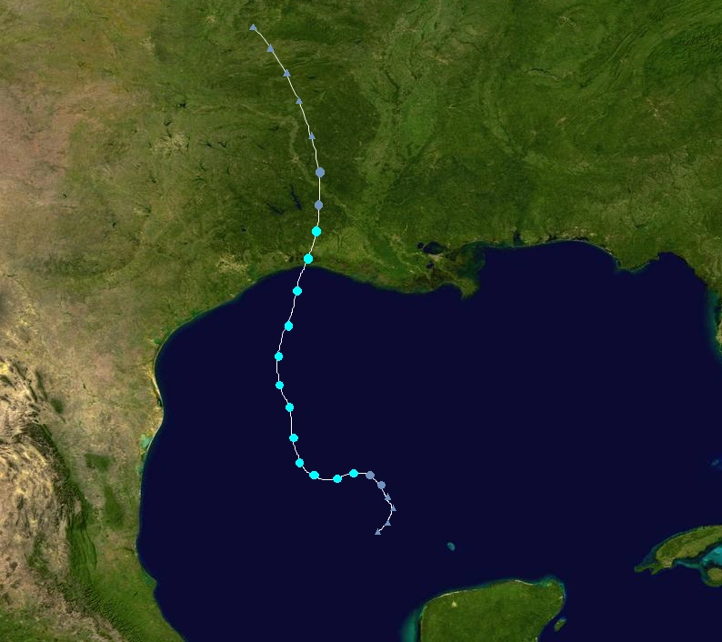
Ashley was a tropical storm that formed in the Gulf of Mexico and struck near the Texas-Louisiana border at its peak intensity of 60 mph/994 mbars. It caused $824 million dollars in damage and 48 deaths throughout its path.
Hurricane Brandon[]
| Category 1 hurricane (SSHWS) | |
  | |
| Duration | June 23 – July 2 |
|---|---|
| Peak intensity | 85 mph (140 km/h) (1-min) 981 mbar (hPa) |
Brandon mainly stayed out in open waters during its lifespan, however it did bring slight effects to Bermuda. No damage/deaths were caused.
Tropical Storm Chantal[]
| Tropical storm (SSHWS) | |
  | |
| Duration | July 5 – July 7 |
|---|---|
| Peak intensity | 50 mph (85 km/h) (1-min) 995 mbar (hPa) |
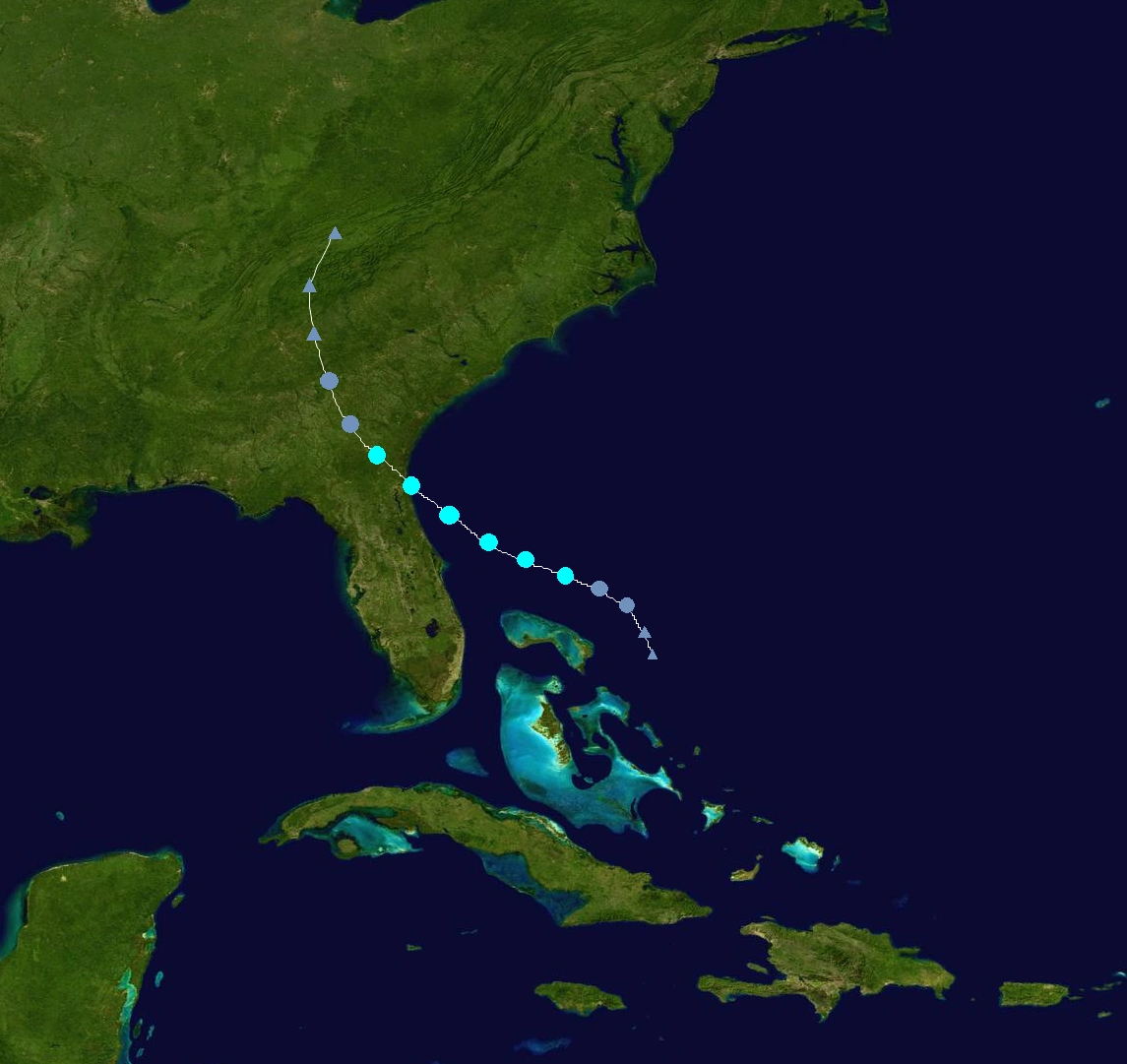
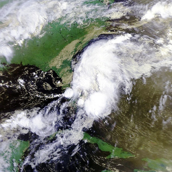
Chantal was a weak tropical storm that formed near the Bahamas and moved northwestward to strike the Northern Florida-Georgia areas. A total of $318 million dollars in damage and 7 deaths was caused by Chantal.
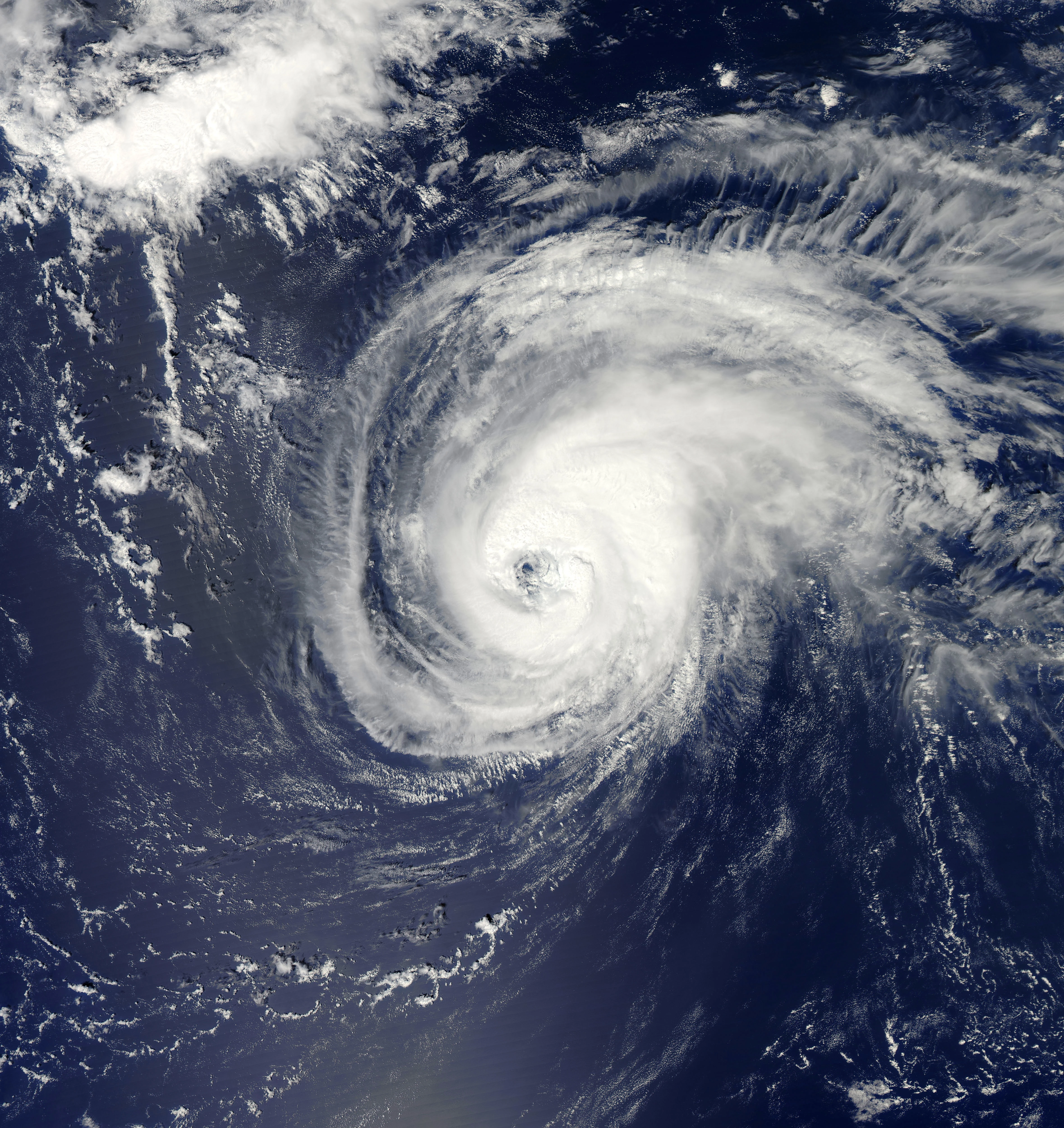
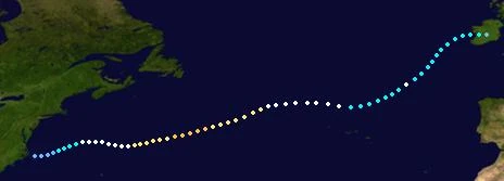
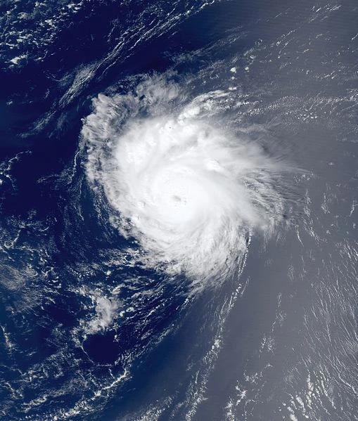
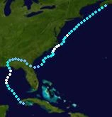
Hurricane Derek[]
| Category 2 hurricane (SSHWS) | |
  | |
| Duration | July 10 – July 19 |
|---|---|
| Peak intensity | 105 mph (165 km/h) (1-min) 973 mbar (hPa) |
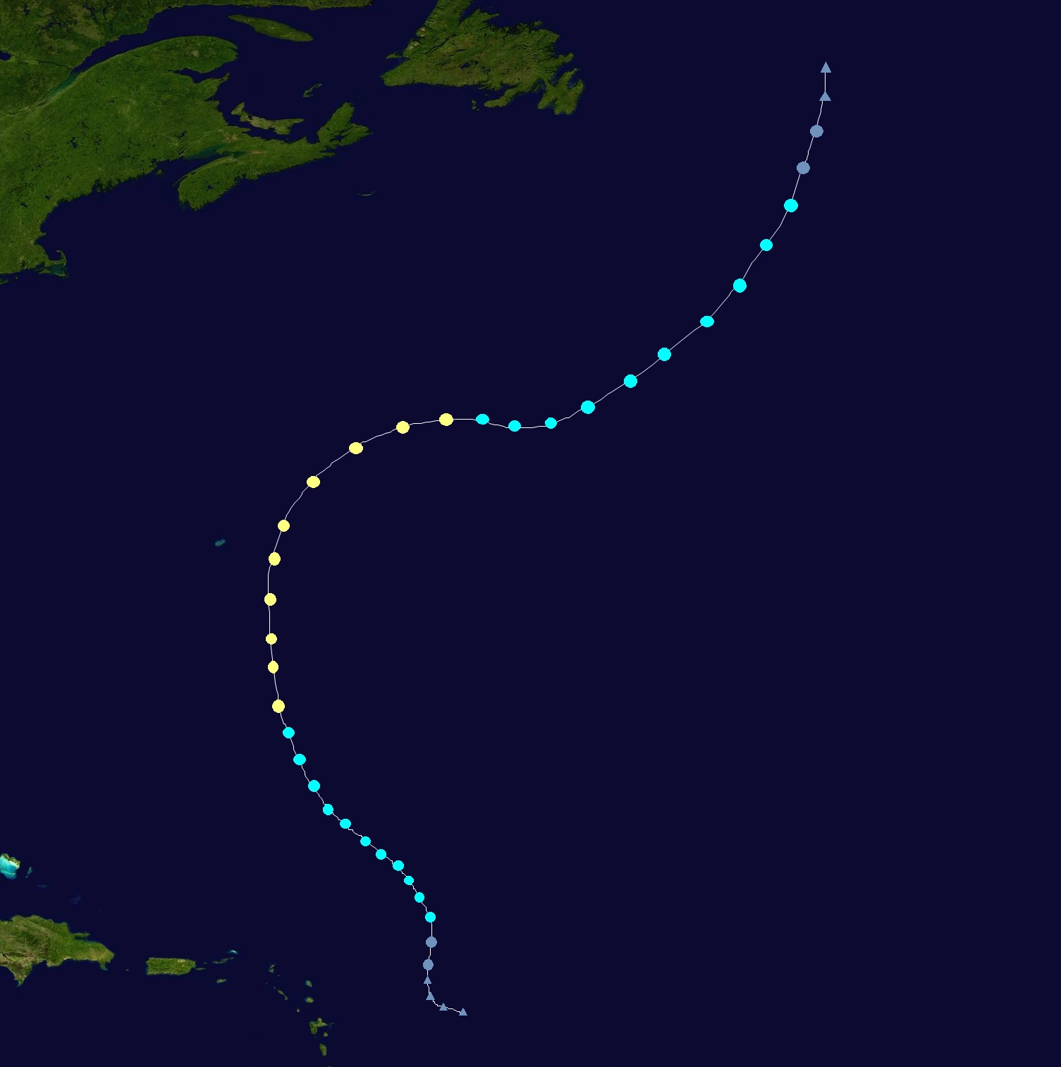
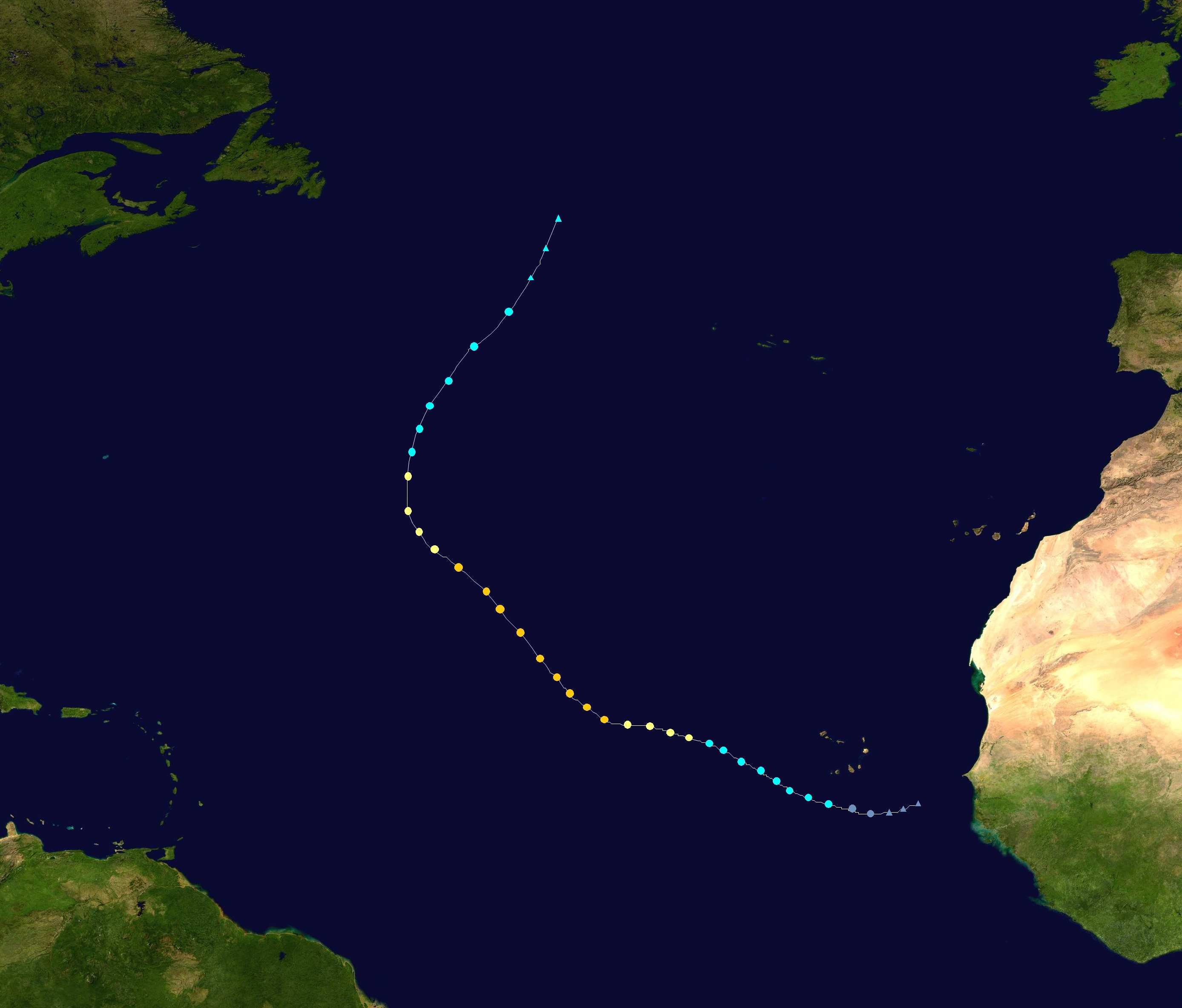
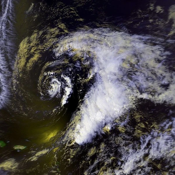
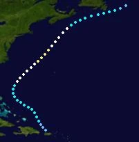
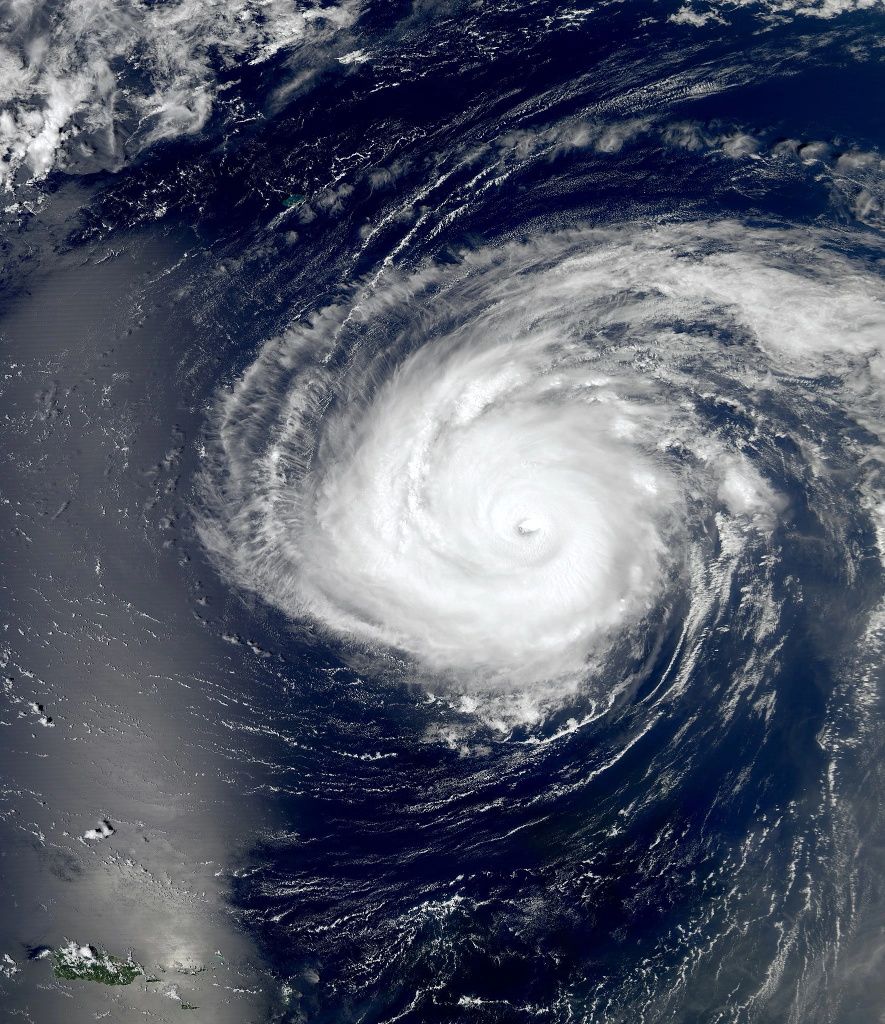
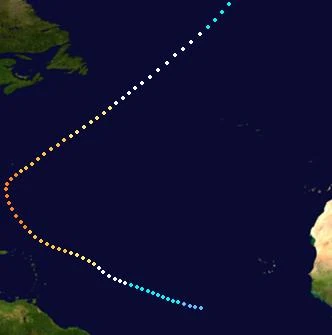
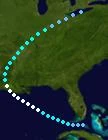
Derek, a Category 2, stayed completely out in open waters. It formed near Cape Verde, moved through the central Atlantic before turning northward, and it dissipated in the northern Atlantic hundreds of miles west of the Azores. No damage/deaths were caused due to it not affecting land.
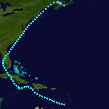
Hurricane Erin[]
| Category 4 hurricane (SSHWS) | |
  | |
| Duration | July 16 – July 31 |
|---|---|
| Peak intensity | 135 mph (215 km/h) (1-min) 940 mbar (hPa) |
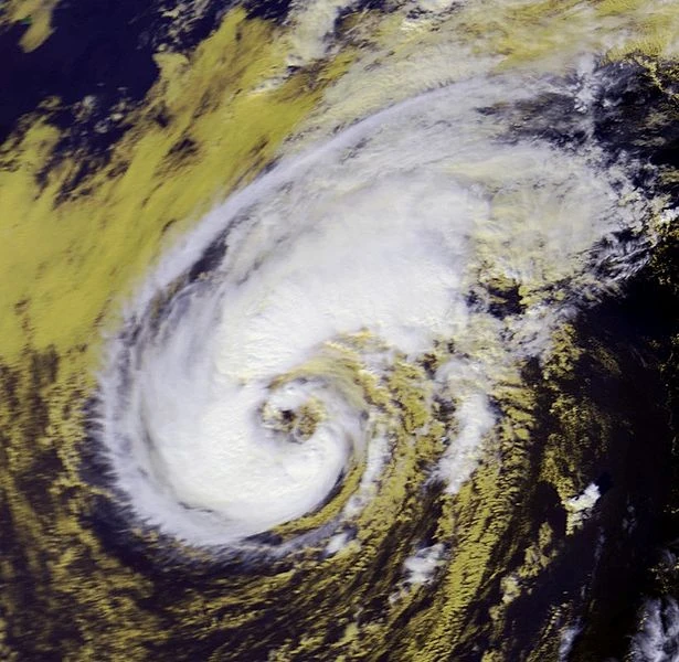
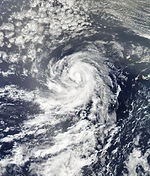
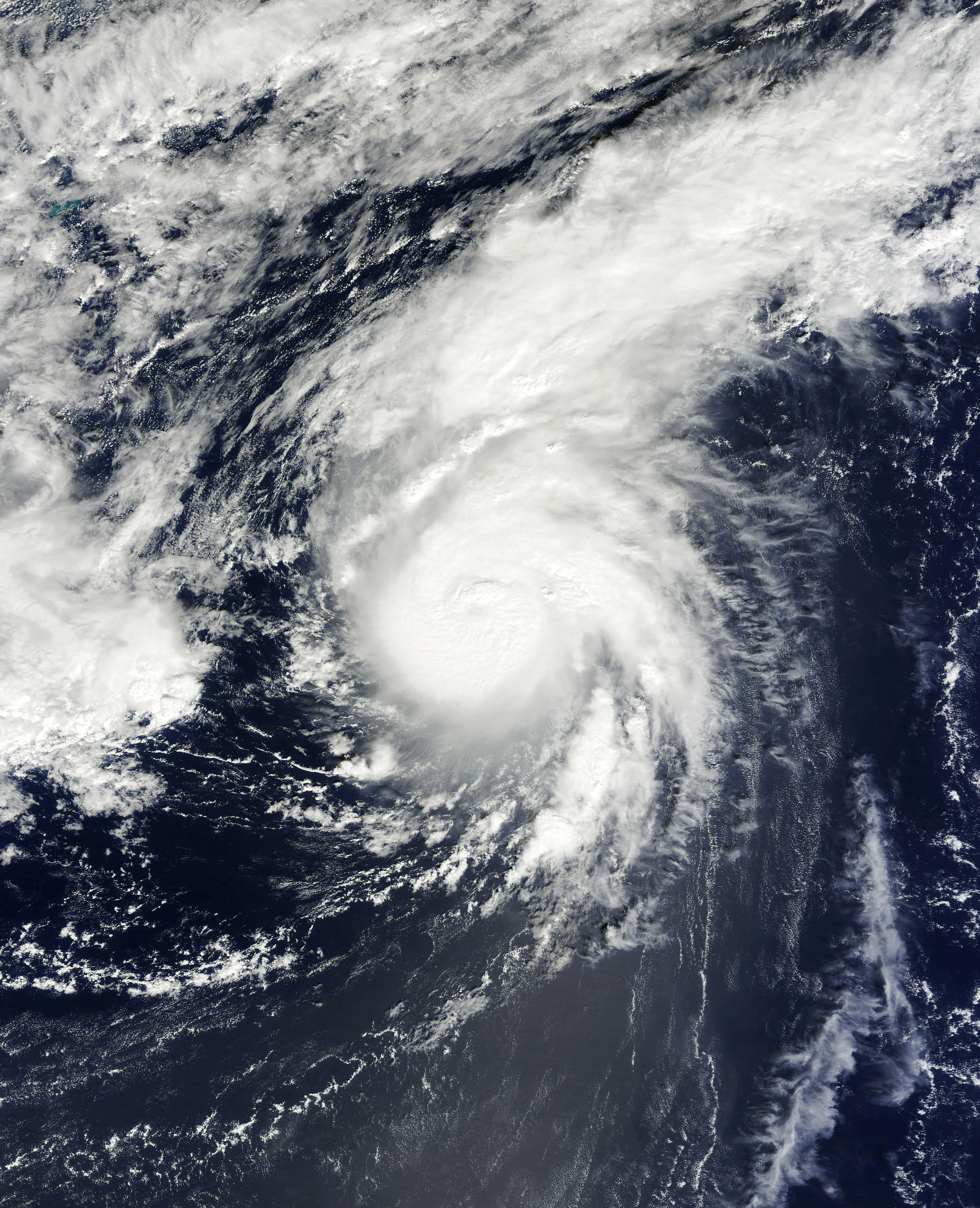
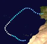
Erin was a classic Cape-Verde type hurricane that stayed out in open waters but later on struck the Azores. It formed from a tropical wave moving off the African coast, rapidly strengthened to a hurricane, weakened back into a TS due to dry air, and after that, the dry air weakened and allowed Erin to gradually restrengthen to Category 4 status. It turned northeast and struck Azores as a weak hurricane before it became extratropical. A total of $355 million dollars in damage and 7 deaths were caused when Erin struck the Azores.
Tropical Depression Six[]
| Tropical depression (SSHWS) | |
  | |
| Duration | July 17 – July 18 |
|---|---|
| Peak intensity | 35 mph (55 km/h) (1-min) 1003 mbar (hPa) |
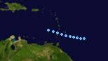
A tropical wave moved off the coast of Africa early on July 17, and it became a tropical depression soon afterwards. Because of dry air and its disorganized structure, little if any strengthening was expected. A day after being declared a depression, the storm dissipated within the dry air. Its remnants moved out into the Atlantic with barely any chance of regeneration. The depression caused very slight effects in the Cape Verdes but no damage/deaths were caused.
Tropical Storm Felipe[]
| Tropical storm (SSHWS) | |
  | |
| Duration | July 19 – July 21 |
|---|---|
| Peak intensity | 40 mph (65 km/h) (1-min) 1000 mbar (hPa) |
Felipe formed near the Yucatan Peninsula on July 19. It moved northeast and struggled to become a named storm until July 20 due to wind shear in its path. That night, it struck Florida, weakened, and dissipated on July 21. Felipe caused a total of $187 million dollars in damage and 4 deaths throughout its path.
Hurricane Georgina[]
| Category 3 hurricane (SSHWS) | |
  | |
| Duration | July 24 – August 3 |
|---|---|
| Peak intensity | 115 mph (185 km/h) (1-min) 960 mbar (hPa) |
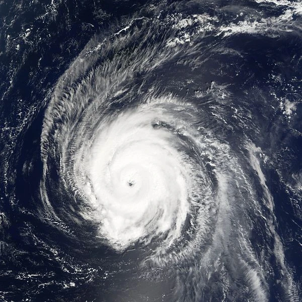
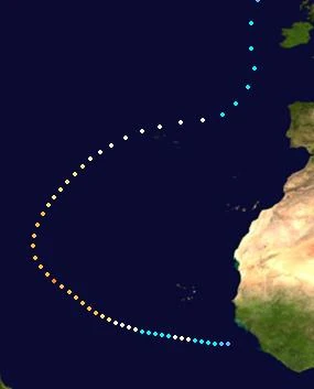
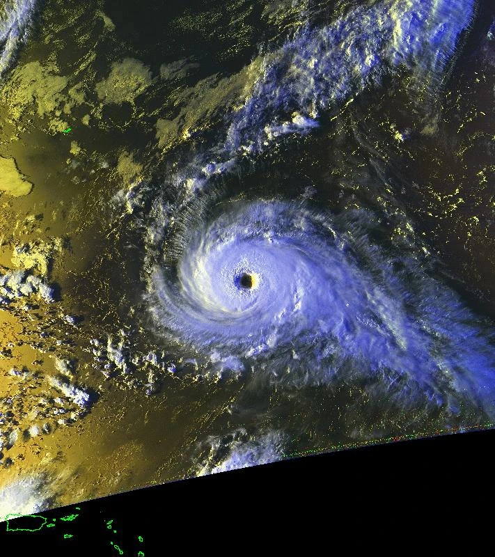
A tropical wave moved off the coast of Africa early on July 24, becoming a tropical storm later that day. Georgina moved northwest and gradually strengthened until it briefly reached Category 3 status. After that, wind shear struck the storm and caused it to weaken, and once it was weakening to a tropical storm, a ridge forced the storm to slow down and turn southward. The ridge soon weakened and allowed Georgina to move slowly northeast, and the wind shear also weakened, allowing the storm to strengthen again. It restrengthened to a Category 1 and then Cat. 2 status as it approached and struck the Azores, and once it began to leave the Azores, Georgina maintained hurricane status before being declared extratropical on August 3 while still producing hurricane-force winds. Throughout its path, Georgina caused a total of $484 million dollars in damage and 24 deaths, particularly in the Azores.
Hurricane Humphrey[]
| Category 1 hurricane (SSHWS) | |
  | |
| Duration | July 26 – August 2 |
|---|---|
| Peak intensity | 90 mph (150 km/h) (1-min) 970 mbar (hPa) |
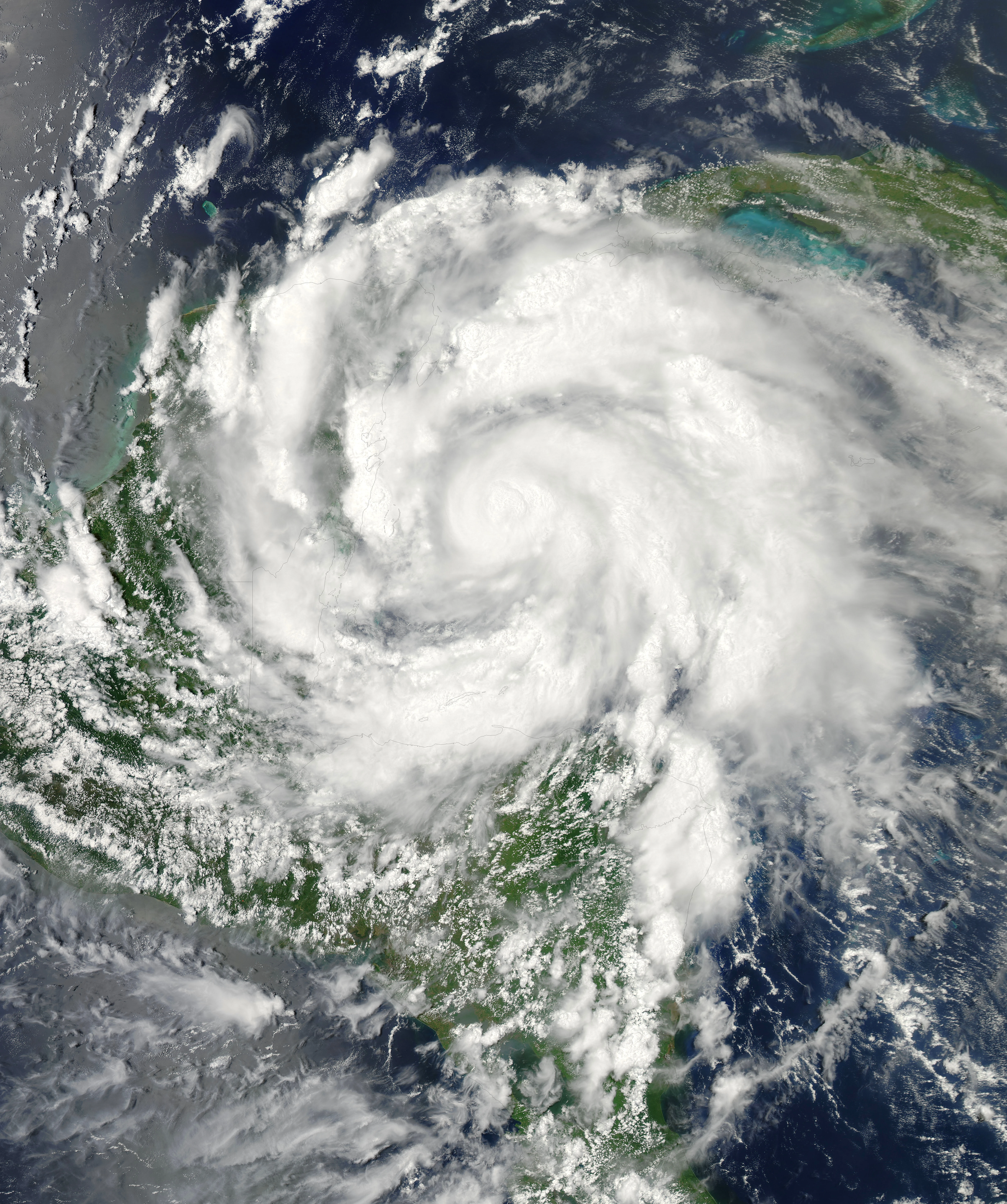
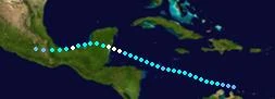
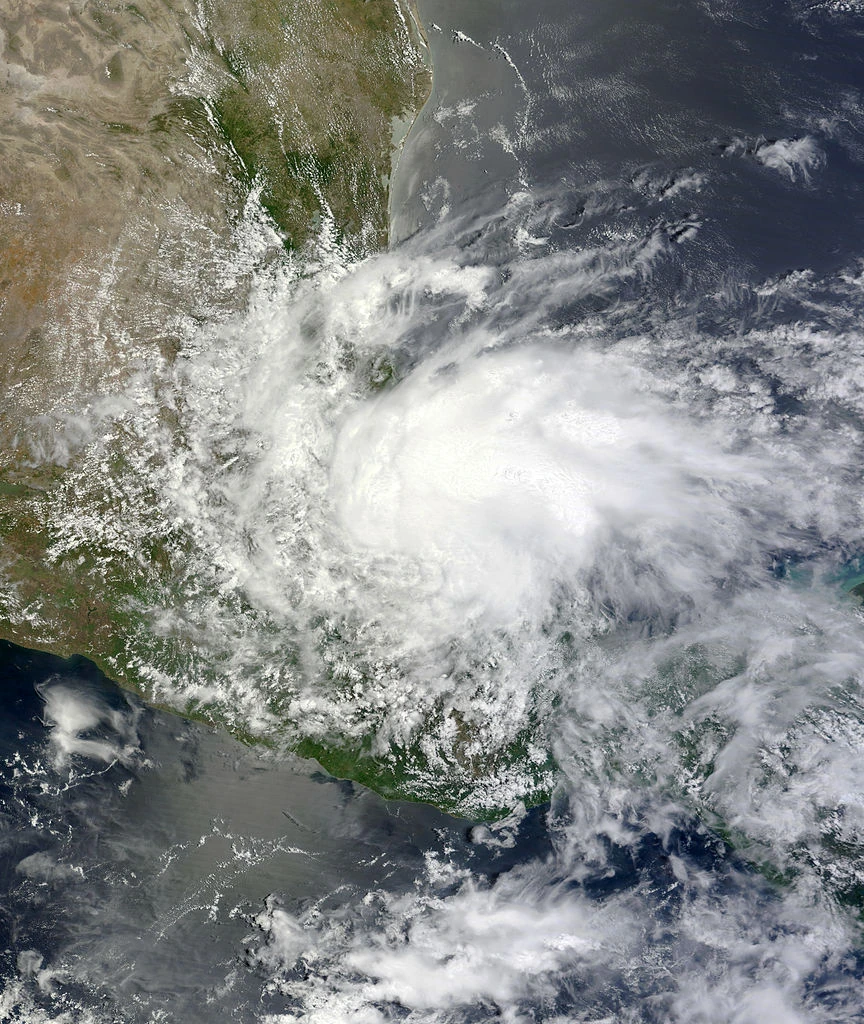
Humphrey formed from a tropical wave in the central Caribbean on July 26. It slowly strengthened, but wind shear affected the storm during its journey into the western Caribbean. Because of this wind shear, the storm struggled to strengthen, and in fact, on July 29, Humphrey briefly weakened to tropical depression status before strengthening again. The wind shear quickly weakened as Humphrey moved closer to Belize and the Yucatan Peninsula, and the increasing lack of wind shear allowed the storm to strengthen at a more rapid pace. Humphrey became a hurricane as it closed in on the Yucatan Peninsula, and rapid strengthening caused the storm to almost reach Category 2 status (peaking at 90 mph and a relatively low pressure of 970 mbar) before landfall near Belize. As Humphrey moved across the Yucatan Peninsula, it gradually weakened and emerged into the Bay of Campeche as a 60 mph TS. The bay's favorable conditions allowed Humphrey to quickly restrengthen to hurricane status, but it retained that status only briefly before land interaction with Mexico resulted in the storm weakening to a TS again. It made landfall and rapidly weakened due to Mexico's mountains, and it dissipated on August 2. Throughout its path, Humphrey caused a total of $788 million dollars in damage along with 114 deaths, however these damage/death tolls weren't enough to get it retired.
Subtropical Storm Ivy[]
| Subtropical storm (SSHWS) | |
  | |
| Duration | August 1 – August 4 |
|---|---|
| Peak intensity | 50 mph (85 km/h) (1-min) 996 mbar (hPa) |
An upper-level low formed into a subtropical depression on August 1. It strengthened to Subtropical Storm Ivy soon afterwards, moved northeast, and it reached a peak of 50 mph and 996 mbars before it affected some of the Azores islands. By August 4, Ivy weakened back into a depression before dissipating without ever becoming tropical. Ivy caused minimal damage in the Azores.
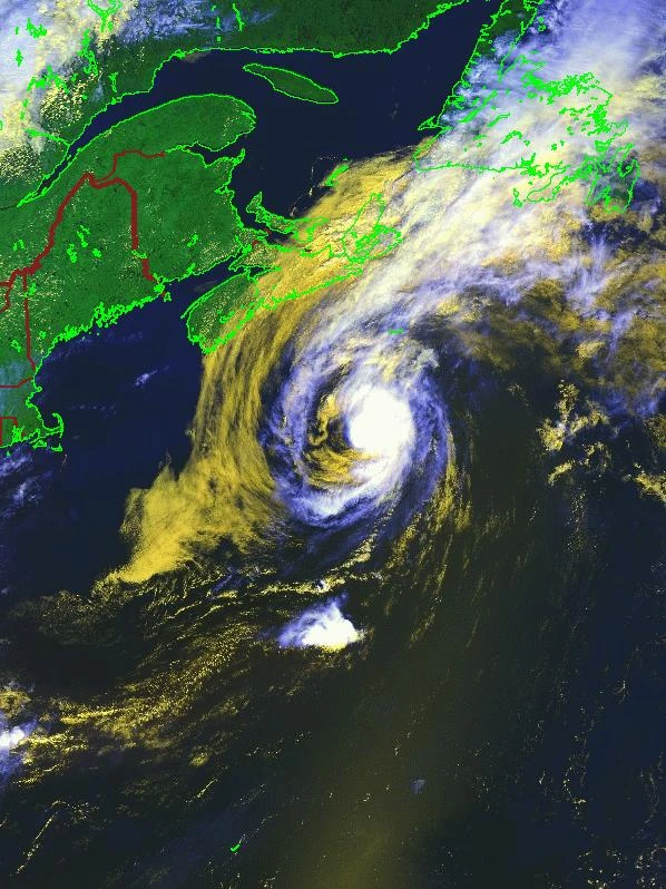
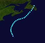
Hurricane Jerry[]
| Category 2 hurricane (SSHWS) | |
  | |
| Duration | August 6 – August 12 |
|---|---|
| Peak intensity | 110 mph (175 km/h) (1-min) 961 mbar (hPa) |
A tropical wave combined with the remnants of a cold front to produce a tropical depression near Puerto Rico on August 6. It strengthened to Tropical Storm Jerry and moved northwestward, and later on, as it turned towards the northeast, it strengthened to a hurricane. Jerry continued to strengthen and soon reached C2 status, and then it peaked at 110 mbar/961 mbar northwest of Bermuda. Jerry approached Nova Scotia and Newfoundland as it weakened into a TS due to increasing wind shear, and the storm briefly made landfall on the tip of Newfoundland before becoming extratropical. Throughout its path Jerry caused a total of $48 million dollars in damage and 3 deaths.
Tropical Depression Twelve[]
| Tropical depression (SSHWS) | |
  | |
| Duration | August 9 – August 11 |
|---|---|
| Peak intensity | 35 mph (55 km/h) (1-min) 1002 mbar (hPa) |
A disorganized tropical wave unexpectedly became a depression on August 9 east of the Windward Islands. Barely any strengthening was expected due to wind shear and dry air, and it struck the Windward Islands early on August 10, moved into the Caribbean, and dissipated that night while in the eastern Caribbean. TD Twelve caused minimal damage in the Windwards.
Tropical Storm Kara[]
| Tropical storm (SSHWS) | |
  | |
| Duration | August 11 – August 15 (Became Extratropical on August 14) |
|---|---|
| Peak intensity | 60 mph (95 km/h) (1-min) 993 mbar (hPa) |
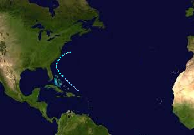
On August 10, an upper level low merged with a tropical wave north of Puerto Rico. It slowly gained deep convection, and on August 11, was designated a tropical depression. It gradually strengthened further and on August 12, it became a tropical storm and was named "Kara". While approaching the Mid-Atlantic Coast it strengthened further to its peak intensity of 60 mph while nearing its closest point to Florida. It started to weaken as increasing wind shear and its convection blew off except at the southern semicircle of Kara. By August 14, Kara had weakened into a minimal tropical storm just offshore of South Carolina. Late on August 14, due to it interacting with a cold front, Kara became Extratropical and turned northeast. In the afternoon hours of August 15, it got absorbed into a larger extratropical storm a few hundred miles offshore of North Carolina. A total of $28 million dollars in damage and 1 death was caused by Kara.
Hurricane Louise[]
| Category 5 hurricane (SSHWS) | |
  | |
| Duration | August 15 – August 26 |
|---|---|
| Peak intensity | 165 mph (270 km/h) (1-min) 910 mbar (hPa) |
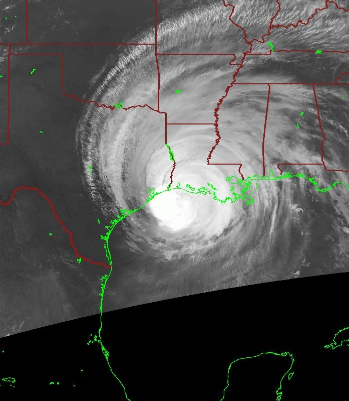
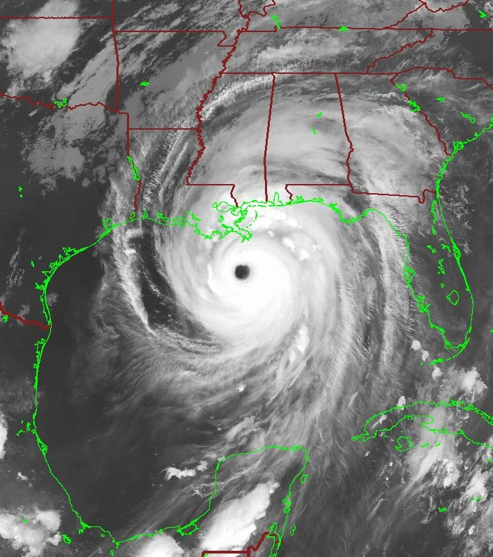
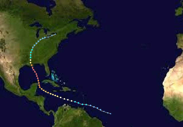
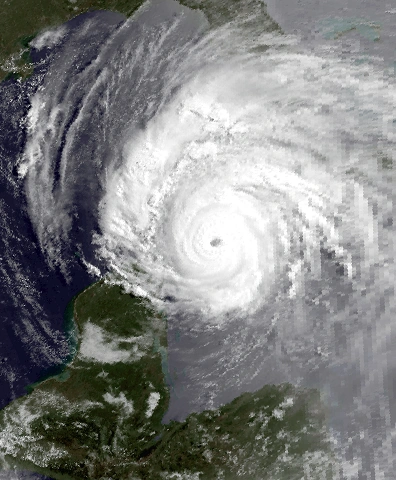
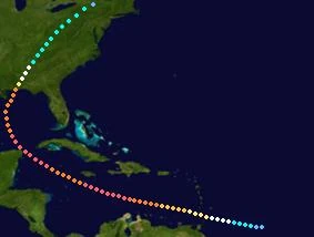
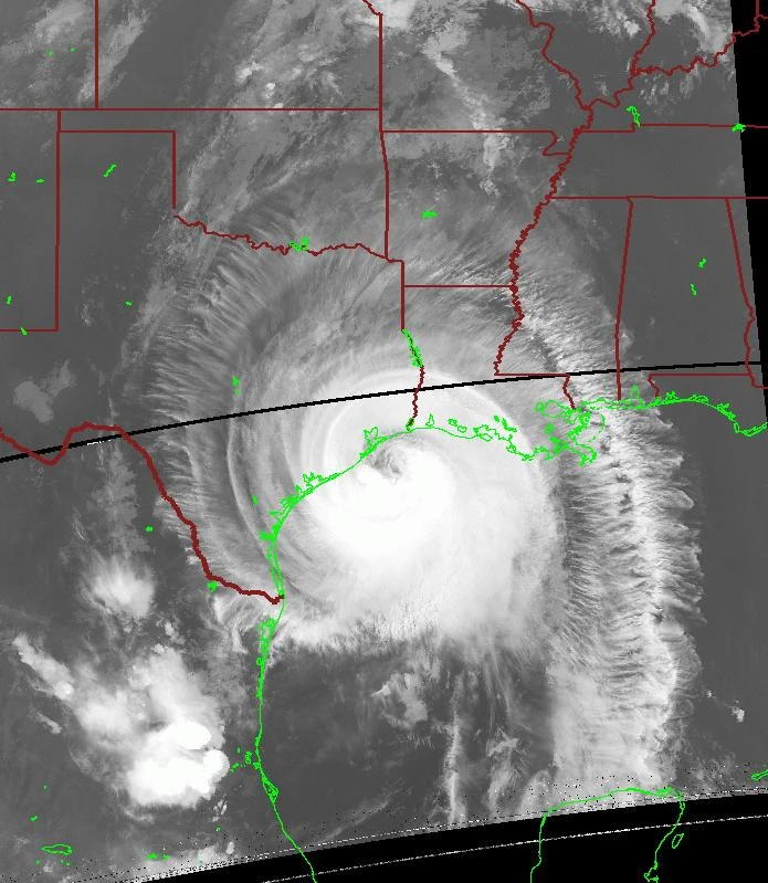
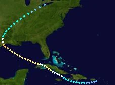
On August 14, a tropical disturbance formed just north of the equator and started to move to the north and the west. By August 15, the disturbance became organized enough to become a tropical depression, and it started to gradually strengthen further and later on August 15 it became a tropical storm near the Leeward Islands and was named "Louise". It struck the Leeward Islands as a 65 mph tropical storm, and by August 16 it became a hurricane south of Puerto Rico, and it was still gradually intensifying when it became a major hurricane on August 18 while nearing the Yucatan Peninsula. On August 19, it became a Category 4 hurricane while brushing the Yucatan Peninsula bringing heavy rain and winds to the peninsula, and on the next day, it became a Category 5 hurricane while turning to the northwest. During the mid afternoon on August 21, it struck Louisana with sustained winds of 160 mph, causing $160 billion and claiming 675 lives. It maintained hurricane status for 12 hours while tracking inland. Finally, while over Lake Erie, it degenerated into a remnant low which lasted 18 more hours before dissipating completely near Lake Ontario. Louise was a very devastating storm, causing $51 billion dollars in damage and 375 deaths, and due to these factors, the name was retired in the spring of 2050 and its replacement name is Lonnie for use in 2055.
Hurricane Madison[]
| Category 2 hurricane (SSHWS) | |
  | |
| Duration | August 20 – August 27 |
|---|---|
| Peak intensity | 105 mph (165 km/h) (1-min) 977 mbar (hPa) |
On August 18, a tropical wave merged with a surface low north of Puerto Rico. Over the next two days it steadily gained deep convection and organization. By August 20, it became organized enough to become Tropical Depression Fifteen. On August 21 it became a tropical storm and was named "Madison". On August 22, it became a hurricane it then turned toward the east coast of the US and later that day it became a Category 2 hurricane while only 80 miles from North Carolina. Luckily for North Carolina a frontal trough pushed Madison away and eventually was absorbed into it near Newfoundland as it was a tropical depression.
Hurricane Nestor[]
| Category 6 hurricane | |
 | |
| Duration | August 25 – September 10 |
|---|---|
| Peak intensity | 210 mph (340 km/h) (1-min) 859 mbar (hPa) |
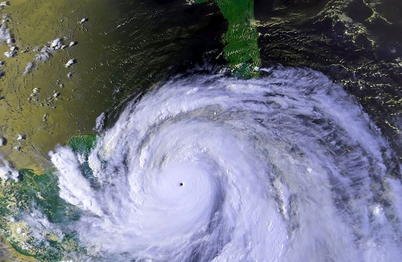
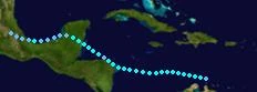
Nestor formed in the central Atlantic on August 25. It moved slowly westward and then began to rapidly strengthen. By the time it reached the Windward Islands, Nestor was already a Category 5 and was raging through the islands with massive destruction occurring. It continued moving through the Caribbean going up and down in intensity, before it hit very favorable conditions in the western Caribbean which allowed it to rapidly strengthen to Cat. 6 status. The storm peaked at 210 mph and 859 mbar making it one of the strongest hurricanes of the year, and then it approached the Yucatan Peninsula with its residents preparing for potentially devastating impacts. Nestor struck the tip of the Yucatan Peninsula at C5 intensity and weakened to a Category 3 after emerging into the Gulf of Mexico. Conditions were favorable for the restrengthening of Nestor, and it gradually strengthened as it moved closer to Mexico, reaching Cat. 5 intensity and briefly reaching Cat. 6 strength once again right before landfall. The landfall at C6 intensity brought massive devastation to the area. After landfall, Nestor quickly weakened over Mexico's mountains until it reached TS intensity, and then it weakened at a slower pace until it reached near the Pacific coast of Mexico, where it dissipated on September 10. Throughout its path Nestor caused $23 billion dollars in damage along with 688 deaths, these damage and death tolls were enough to result in the name being retired in the spring of 2050 and its replacement name was chosen as Nigel for use in the 2055 season.
Tropical Storm Olga[]
| Tropical storm (SSHWS) | |
  | |
| Duration | August 28 – September 5 |
|---|---|
| Peak intensity | 60 mph (95 km/h) (1-min) 999 mbar (hPa) |
A tropical wave formed into a depression on August 28 near Venezuela. It moved westward and gradually strengthened, becoming a tropical storm several hours after being declared a depression and it was named "Olga". The storm continued westward and soon made landfall on the Honduras-Nicaragua border as a 50 mph storm. After landfall, Olga turned back into the western Caribbean, and reached its peak intensity of 60 mph/999 mbars before landfall near Belize. Over the Yucatan Peninsula, Olga weakened into a depression and emerged into the Bay of Campeche. Olga hugged the southern coast of Mexico on the Bay of Campeche and briefly restrengthened back into a TS, before land interaction resulted in it weakening back into a depression. Mexico's mountains caused the dissipation of the storm on September 5. Throughout its path, Olga caused a total of $568 million dollars in damage and 410 deaths, most of the deaths were caused by deadly mudslides and flash floods that Olga produced throughout southern Mexico.
Subtropical Depression Eighteen[]
| Subtropical depression (SSHWS) | |
  | |
| Duration | August 31 – September 2 |
|---|---|
| Peak intensity | 35 mph (55 km/h) (1-min) 1004 mbar (hPa) |
An upper-level low developed into a subtropical depression on August 31 between the US east coast and Bermuda. It moved westward towards North Carolina but failed to strengthen significantly. On September 2 it made landfall on the outer banks of North Carolina, and it dissipated over land later that day without ever becoming tropical. Subtropical depression Eighteen caused $14 million dollars in damage and no deaths.
Hurricane Paolo[]
| Category 7 hurricane | |
  | |
| Duration | September 2 – September 16 |
|---|---|
| Peak intensity | 265 mph (425 km/h) (1-min) 803 mbar (hPa) |
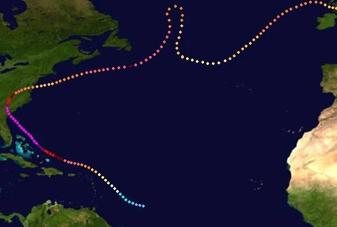
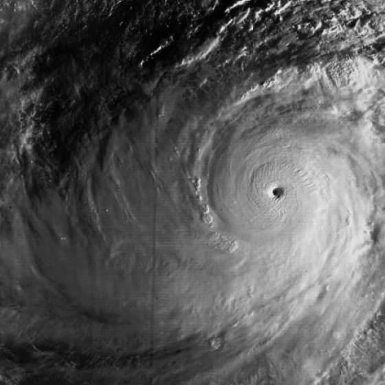
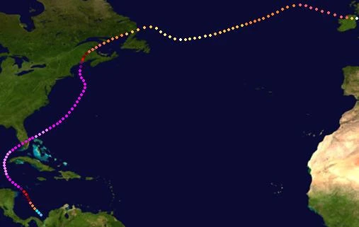
A well-organized tropical wave rushed off the coast of Africa on September 2, becoming a depression later that day. It strengthened to a tropical storm and earned the name "Paolo". It moved westward and rapidly strengthened under unusually favorable conditions, and it was already a Category 5 by the time it was west-northwest of the Cape Verdes. This strengthening resulted from SSTs of 90+ F and very low wind shear. Paolo continued to strengthen and became a Category 6 on September 7, and a record-breaking Category 7 was reached by the next day. Its peak was 265 mph and 803 mbar; and then a combination of an eye-wall replacement cycle and slightly cooler waters weakened Paolo back into a C6 as it turned northeast. The eyewall replacement cycle was short-lived however, and it continued to slowly weaken, becoming a Cat. 5 as it posed big threats to the Azores. It struck the eastern islands of Azores as a Category 4, causing lots of devastation as they aren't well-prepared for hurricanes and major hurricanes rarely strike those islands. Paolo left the Azores behind as it continued to slowly weaken, and it kept major hurricane intensity until it neared Europe due to unusually warm waters in the area. It then struck northern Portugal as a C2 and moved into northwestern France as a C1, where it became extratropical on September 16. It turned into a European windstorm and struck England and Norway before being last noted over northwestern Russia. Throughout its path Paolo caused $14 billion in damage and 438 deaths, these damage and death tolls resulted in the name being retired in the spring of 2050. Its replacement for 2055 is Percy.
Hurricane Rebekah[]
| Category 1 hurricane (SSHWS) | |
  | |
| Duration | September 5 – September 10 |
|---|---|
| Peak intensity | 80 mph (130 km/h) (1-min) 978 mbar (hPa) |
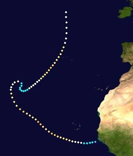
A tropical wave formed into a depression on September 5. It became a tropical storm and was named "Rebekah" early on the 6th, and it continued to gradually strengthen along a northward path. Rebekah became a hurricane on September 7 and soon a peak of 80 mph/978 mbars was reached. It then weakened to a tropical storm due to increasing wind shear, and on September 9 it weakened to a depression as it performed a loop northeast of Bermuda. The storm restrengthened to a tropical storm as it turned to the east after wind shear weakened a bit, but this strengthening was short-lived however, so it again weakened to a depression and late on September 10, Rebekah finally dissipated. Throughout its path, Rebekah only affected the Lesser Antilles and damage, if any, was minimal. No deaths resulted.
Tropical Storm Smith[]
| Tropical storm (SSHWS) | |
  | |
| Duration | September 9 – September 14 |
|---|---|
| Peak intensity | 70 mph (110 km/h) (1-min) 996 mbar (hPa) |
A tropical wave crossing the Windwards developed straight into a tropical storm on September 9 and was named "Smith". It moved westward and gradually strengthened under relatively favorable conditions to attain a peak of 70 mph and 996 mbar, almost reaching hurricane status before a patch of wind shear in the central Caribbean resulted in the storm weakening. It weakened to a tropical depression south of Jamaica, and at the same time, the wind shear weakened slightly and allowed the storm to survive for a little while longer. It remained a depression for a couple more days before dissipating on September 14 near Cuba. Since Smith didn't affect any land expect for rain in the Greater Antilles, Jamaica, and Cuba; no damage/deaths resulted.
Hurricane Tasha[]
| Category 4 hurricane (SSHWS) | |
  | |
| Duration | September 13 – September 22 |
|---|---|
| Peak intensity | 145 mph (230 km/h) (1-min) 923 mbar (hPa) |
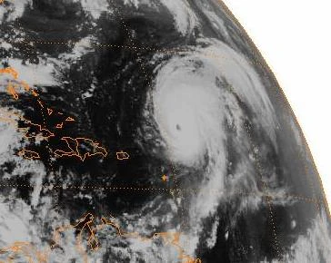
Tasha was a Category 4 that took a classic Cape-Verde hurricane style track, but it did bring very slight effects to the Lesser Antilles and Bermuda. No damage/deaths were caused.
Hurricane Van[]
| Category 2 hurricane (SSHWS) | |
  | |
| Duration | September 16 – September 25 |
|---|---|
| Peak intensity | 110 mph (175 km/h) (1-min) 963 mbar (hPa) |
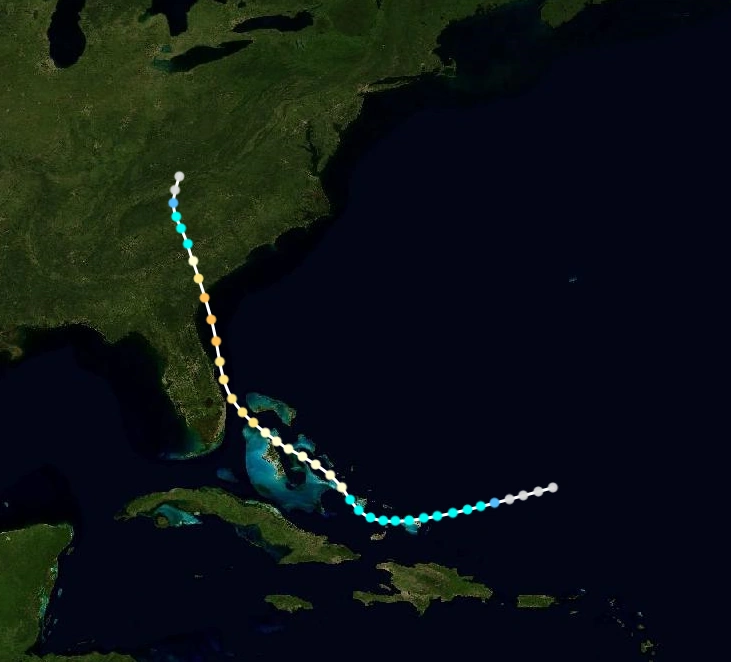
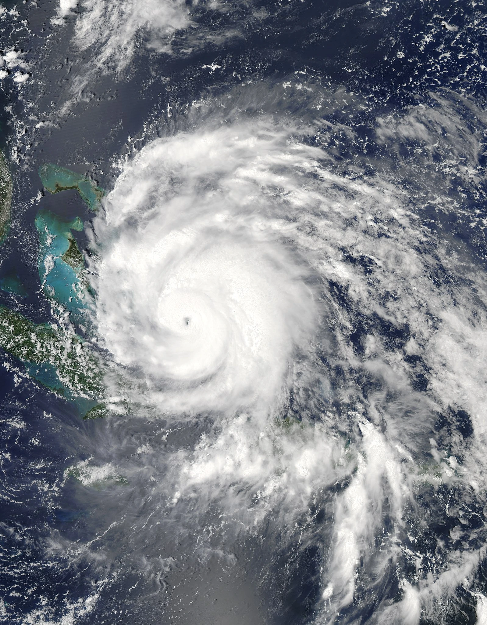
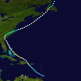
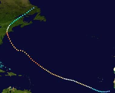
Van formed near the Windward Islands and struck Hispaniola/Puerto Rico as a Category 1, the Turks & Caicos Islands at Category 2 intensity and near its peak of 110 mph/963 mbar, the Bahamas also at Category 2 intensity, and then, it made landfall near South Carolina as a Category 1. Van weakened to a tropical storm and emerged back into the Atlantic, where it again strengthened to a Cat. 1 hurricane and reached a secondary peak of 85 mph before it affected Nova Scotia. It made landfall in Newfoundland, still as a Category 1, and became extratropical while leaving Newfoundland. Throughout its path $5.2 billion dollars in damage and 63 deaths were caused, resulting in the name being retired and being replaced by Vincent for 2055.
Tropical Storm Wendy[]
| Tropical storm (SSHWS) | |
  | |
| Duration | September 22 – September 26 |
|---|---|
| Peak intensity | 55 mph (90 km/h) (1-min) 1002 mbar (hPa) |
Wendy formed west of the Windward Islands and struck Haiti, Jamaica, Cuba, and Florida, all at a weak to moderate TS intensity. It then weakened to a depression while emerging into the Atlantic, restrengthened to a TS before striking the Carolinas, and went up and down in intensity as it tracked along the US East Coast. The storm entered Nova Scotia and dissipated. Wendy caused $885 million dollars in damage and 37 deaths, however the name wasn't retired.
Hurricane Alpha[]
| Category 3 hurricane (SSHWS) | |
  | |
| Duration | September 27 – October 6 |
|---|---|
| Peak intensity | 120 mph (195 km/h) (1-min) 952 mbar (hPa) |
Alpha formed just east of North Carolina from a cold front, it then moved eastward and gradually strengthened to attain a peak of Category 3 strength (120 mph and 952 mbar). Later on, Alpha began to weaken and moved north of the Azores as a strong tropical storm. The storm unexpectedly restrengthened to a Category 1 briefly at a very high latitude, before weakening to a TS again. Environmental conditions in this area are usually very hostile, but Alpha took advantage of unusually warm waters which allowed it to remain a TS until it made a landfall in Ireland. Over Ireland, Alpha quickly dissipated. Throughout its path, a total of $358 million dollars in damage and 14 deaths were caused, with the large majority happening in Ireland.
Tropical Storm Beta[]
| Tropical storm (SSHWS) | |
  | |
| Duration | October 3 – October 7 |
|---|---|
| Peak intensity | 65 mph (100 km/h) (1-min) 992 mbar (hPa) |
Beta was a tropical storm that formed near Puerto Rico and moved northwestward, striking the Turks & Caicos Islands and The Bahamas as a strong tropical storm. It then made landfall in Florida and weakened to a depression, and remained a depression as it turned northeast before finally dissipating near the coast of the Carolinas. A total of $324 million dollars in damage and 7 deaths was caused by Beta throughout its path.
Hurricane Gamma[]
| Category 4 hurricane (SSHWS) | |
  | |
| Duration | October 5 – October 14 |
|---|---|
| Peak intensity | 140 mph (220 km/h) (1-min) 943 mbar (hPa) |
Hurricane Delta[]
| Category 1 hurricane (SSHWS) | |
  | |
| Duration | October 8 – October 17 |
|---|---|
| Peak intensity | 85 mph (140 km/h) (1-min) 980 mbar (hPa) |
Tropical Storm Epsilon[]
| Tropical storm (SSHWS) | |
  | |
| Duration | October 14 – October 17 |
|---|---|
| Peak intensity | 70 mph (110 km/h) (1-min) 990 mbar (hPa) |
Tropical Storm Zeta[]
| Tropical storm (SSHWS) | |
 | |
| Duration | October 16 – October 20 |
|---|---|
| Peak intensity | 65 mph (100 km/h) (1-min) 993 mbar (hPa) |
Hurricane Eta[]
| Category 1 hurricane (SSHWS) | |
  | |
| Duration | October 19 – October 25 |
|---|---|
| Peak intensity | 85 mph (140 km/h) (1-min) 977 mbar (hPa) |
Hypercane Theta[]
| Hypercane | |
  | |
| Duration | October 21 – November 30 |
|---|---|
| Peak intensity | 500 mph (805 km/h) (1-min) 674 mbar (hPa) |
Hurricane Iota[]
| Category 5 hurricane (SSHWS) | |
  | |
| Duration | October 24 – November 9 |
|---|---|
| Peak intensity | 195 mph (315 km/h) (1-min) 876 mbar (hPa) |
Megacane Kappa[]
| Megacane | |
  | |
| Duration | October 30 – December 16 |
|---|---|
| Peak intensity | 5000 mph (8045 km/h) (1-min) 6 mbar (hPa) |
Hurricane Lambda[]
| Category 3 hurricane (SSHWS) | |
  | |
| Duration | October 31 – November 10 |
|---|---|
| Peak intensity | 115 mph (185 km/h) (1-min) 958 mbar (hPa) |
Hurricane Mu[]
| Category 1 hurricane (SSHWS) | |
  | |
| Duration | November 4 – November 12 |
|---|---|
| Peak intensity | 85 mph (140 km/h) (1-min) 978 mbar (hPa) |
Tropical Storm Nu[]
| Tropical storm (SSHWS) | |
  | |
| Duration | November 15 – November 21 |
|---|---|
| Peak intensity | 65 mph (100 km/h) (1-min) 998 mbar (hPa) |
Hurricane Xi[]
| Category 2 hurricane (SSHWS) | |
  | |
| Duration | November 23 – November 29 |
|---|---|
| Peak intensity | 110 mph (175 km/h) (1-min) 968 mbar (hPa) |
Hurricane Omicron[]
| Category 4 hurricane (SSHWS) | |
  | |
| Duration | November 27 – December 10 |
|---|---|
| Peak intensity | 150 mph (240 km/h) (1-min) 930 mbar (hPa) |
Subtropical Storm Pi[]
| Subtropical storm (SSHWS) | |
  | |
| Duration | November 30 – December 3 |
|---|---|
| Peak intensity | 40 mph (65 km/h) (1-min) 1000 mbar (hPa) |
Storm names[]
The following names were used to name tropical cyclones this year. This is the same list used in the 2043 season. Unused names are marked in gray. The names not retired from this list will be used again in the 2055 season.
|
|
|
Greek Alphabet[]
Due to extreme activity and the normal list being exhausted, the Greek Alphabet had to be used.
- Alpha
- Beta
- Gamma
- Delta
- Epsilon
- Zeta
- Eta
- Theta
- Iota
- Kappa
- Lambda
- Mu
- Nu
- Xi
- Omicron
- Pi
Any comments?[]
If you want to suggest something new to be added or something changed, or if you just want to express your opinions on this season, leave interesting and creative responses in the comment section BELOW ↓ ↓ ↓ !
Whether it be a simple compliment such as "Nice season guys!" or "This season is extremely awesome!!! Great work!" or something even more interesting like "This season is bursting with awesomeness!! Great job dudes!", you guys are free to express your opinions on this season.
NOTE: Please don't leave harmful comments, do personal attacks on us, or harass us. Please remain civil, as harmful comments, personal attacks, harassment, and all that other bad stuff will not be tolerated at all, and leaving these type of comments could result in you being reported to the VSTF wiki, being blocked, or even being blocked/banned indefinitely in extremely serious cases.