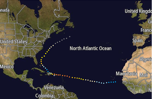
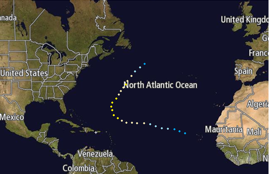
The 2046 Atlantic hurricane season was an active season, in which a total of 18 named storms developed in the June 1 - November 30 period. The season officially ran from June 1, 2046 to November 30, 2046, a time period in which depicts when most tropical cyclones develop in the tropical Atlantic Ocean. Additionally, 12 hurricanes formed, of which 8 became major on the SSHWS during the course of their lives. The most significant storms of the season became a category 4, striking the Florida Panhandle as a category 2 hurricane, before moving inland and dissipating.
Seasonal forecasts[]
| Source | Date | Named
storms |
Hurricanes | Major
hurricanes | |
| NOAA | April 1, 2046 | 17-22 | 7-10 | 2-4 | |
| ––––––––––––––––––––––––––––––––––––––––––––––––––––––– | |||||
| Actual activity | 18 | 12 | 7 | ||
Season summary[]
|
Timeline[]

Storms[]
Tropical Storm Abraham[]
| Tropical storm (SSHWS) | |
  | |
| Duration | June 1 – June 4 |
|---|---|
| Peak intensity | 70 mph (110 km/h) (1-min) 992 mbar (hPa) |
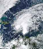
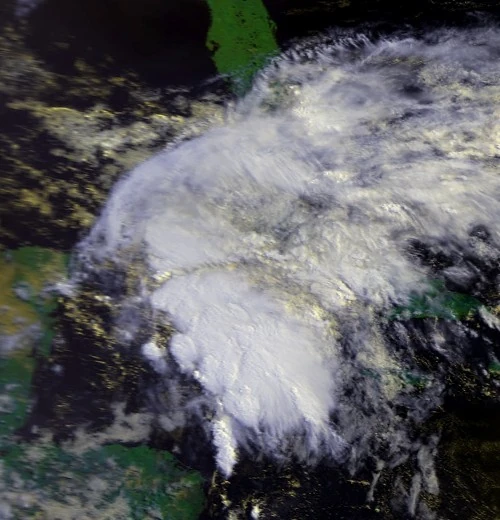
Tropical Storm Abraham began as a tropical wave on May 27th, off the coast of Venezuela. Moving quickly westward, the tropical wave was able to intensify significantly, and was designated as Tropical Depression One on the morning of June 1st, the start of the Atlantic hurricane season. The following morning, as convection became wrapped around the low level circulation, the NHC upgraded the system into Tropical Storm Abraham, the first named storm of the 2046 Atlantic hurricane season. By evening, Abraham had passed very close to the Cuban coastline, near to Pinar Del Sur. Once the cyclone had passed the coastline, it began a slow weakening phase, and was downgraded to a tropical depression at the 2pm update on the 4th, before dissipating in the central Gulf Coast. Impacts from the cyclone was minimal, with no deaths, and $20,000 in damages reported during and after the storm.
Tropical Depression Two[]
| Tropical depression (SSHWS) | |
  | |
| Duration | June 18 – June 20 |
|---|---|
| Peak intensity | 35 mph (55 km/h) (1-min) 1005 mbar (hPa) |
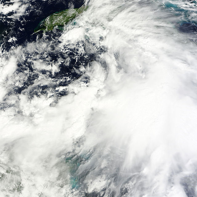
A tropical disturbance formed on the morning of the 18th, and began to move to the northwest at speed. On the evening, the NHC designated the system as Tropical Depression Two, and anticipated strengthening to tropical storm status before landfall on San Juan Island. However, increased wind shear prevented the anticipated strengthening, and the system made landfall on the 20th as a weak tropical depression, and dissipated 6 hours later. The impacts of Tropical Depression two were minimal, although 2 deaths were caused by a landslide, due to rainfall of 425mm being dropped during the cyclones duration.
Tropical Depression Three[]
| Tropical depression (SSHWS) | |
  | |
| Duration | July 2 – July 3 |
|---|---|
| Peak intensity | 35 mph (55 km/h) (1-min) 1008 mbar (hPa) |
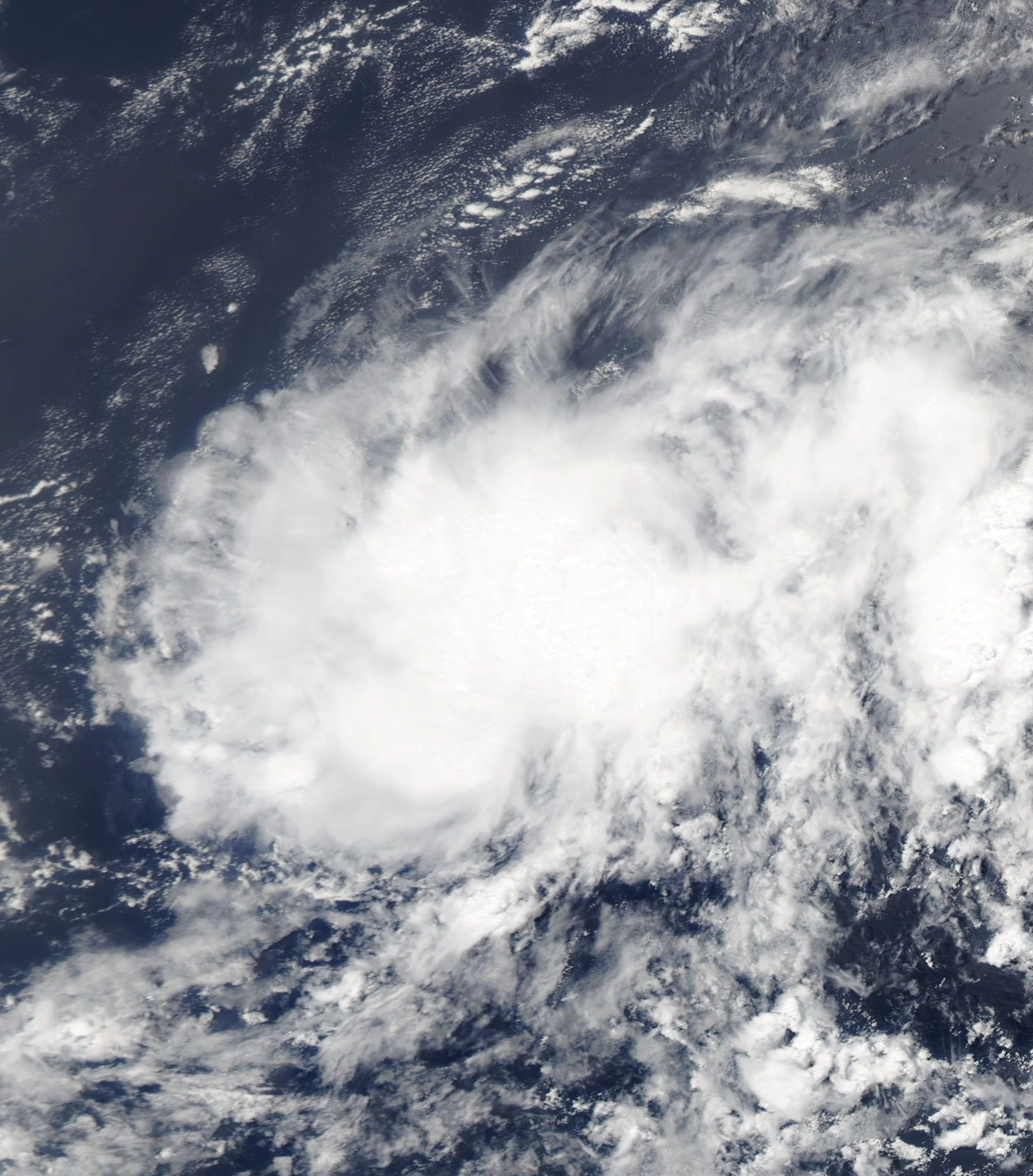
An area of atmospheric instability formed over the Lesser Antilles on June 29th, and began to unusually to the east-northeast, becoming Tropical Depression Three on July 2nd. However, as the cyclone sped to the northeast, it encountered strong shear, and began to transition into an extratropical cyclone as it did so, which completed the following evening. There were no impacts on land from Tropical Depression Three, although a sea buoy recorded a significant wave height of 4 metres on the morning of the 3rd as the cyclone passed 22 miles to the south of the instrument in place.
Hurricane Bonnie[]
| Category 1 hurricane (SSHWS) | |
  | |
| Duration | July 14 – July 22 |
|---|---|
| Peak intensity | 90 mph (150 km/h) (1-min) 968 mbar (hPa) |
On July 12th, an area of non-tropical low pressure formed off the coast of the Cape Verde Islands, and on the morning of July 14th was upgraded into Tropical Depression Three, with anticipation of strengthening into a hurricane highlighted as the system drifted steadily to the west-northwest, intensifying into Tropical Storm Bonnie on the 16th. Further strengthening occurred the following day, with the cyclone attaining hurricane status as it approached the Lesser Antilles on the 17th. 2 days later, Bonnie entered an area of increased wind shear, and as a result, convection began to rapidly diminish, and the storm was downgraded to a tropical storm on the 19th, though after entering warmer waters off the northern coast of Hispaniola allowed the cyclone to reattain hurricane status the following morning of Haiti. The cyclone rapidly deepened, and reached peak strength the following morning as it entered the Bahamas, where it finally began to weaken. By the afternoon of July 22nd, Bonnie had only a low cloud swirl present in the mid level regions, and the last advisory on Bonnie was issued 6 hours later, as the storm degenerated into a trough of low pressure off the coast of North Carolina. Along the storms track, heavy rainfall was reported, with the highest total of 655mm being recorded in Nassau in the Bahamas, leading to severe flooding, and 5 deaths along the storms duration. Total damages were reported at $142 million.
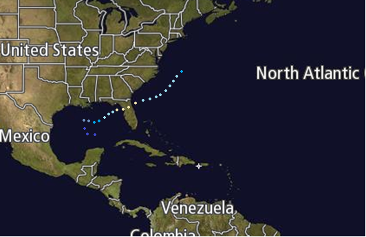
Hurricane Carlos[]
| Category 4 hurricane (SSHWS) | |
  | |
| Duration | July 20 – July 31 |
|---|---|
| Peak intensity | 150 mph (240 km/h) (1-min) 929 mbar (hPa) |
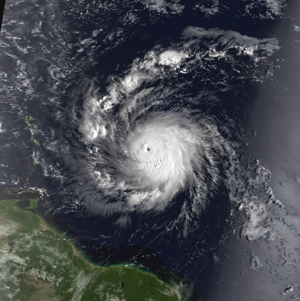
Little is known about the precursor low of Hurricane Carlos, except the fact that it developed into Tropical Depression Four off the coast of the Cape Verde Islands on the morning of July 20th. The following day, as the storm moved due west out into the Atlantic Ocean, it intensified into the third named tropical storm of the season. Again, the following day, Carlos was able to attain hurricane status, and began to slowly but surely intensify as it entered the eastern Caribbean Sea the following afternoon, bringing the cyclone to category 2 strength at that time, and the following morning, it became the first major hurricane of the season, as it neared the Lesser Antilles. The following day, whilst passing directly over some of the islands, Carlos peaked with winds of 150mph, making it a violent category 4 hurricane. On July 27th, Carlos hit San Juan Island, still at category 4 strength, and later the same day had hit Punta Carda, at Category 3 intensity. The following day, Carlos weakened to a tropical depression by evening, due to the mountainous terrains of Hispaniola disrupting the storms circulation centre. After clearing land, Carlos was able to regain strength rapidly, and 36 hours later was rated as a category 2 hurricane, with secondary peak winds of 110mph, just below major hurricane strength. By the evening of July 31st, Carlos was downgraded to an 80mph category 1 hurricane, where ot became an extratropical cyclone, weakening over the next day, before dissipating several hundred miles off the Nova Scotia coast the following day. 14 people lost their lives during the cyclone, which dropped 566mm of rain over the Haitian mountains. Damage was later assessed as reaching $67 million over the Caribbean.
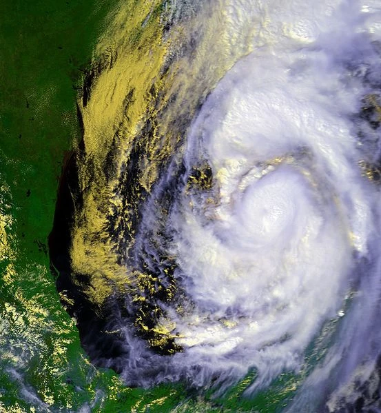
Hurricane Dorothy[]
| Category 5 hurricane (SSHWS) | |
  | |
| Duration | July 25 – August 2 |
|---|---|
| Peak intensity | 165 mph (270 km/h) (1-min) 918 mbar (hPa) |
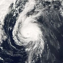
On the morning of July 24, an area of disorganized convection formed over the Cape Verde Islands. Moving to the south, a low pressure area, and a closed low level circulation developed by the evening. After a hurricane hunter aircraft reached the system in the afternoon of the following day, the NHC initiated advisories on Tropical Depression Six. However, in a post season analysis, it was determined that the low had become a tropical cyclone at 4am, not 2pm as initially thought. Either way, by the 8pm update on the 25th, the storm had intensified, and after the noting of distinct rainbands over the centre of circulation, the NHC upgraded the system not Tropical Storm Dorothy, which then began to steadily intensify as it was steered westward to west north-westward by a developing subtropical ridge to its north. By the afternoon of the 26th, the NHC had upgraded the cyclone into a hurricane, after a well defined banding eye feature had become apparent on satellite imagery. By evening, an anticyclone had become entrained on Dorothys circulation aloft, and as a result, the NHC upgraded the storm into a category 2, as well as noting the possibility for rapid intensification over the coming days, with the possibility of a violent hurricane occurring within 48 hours. By the evening of the 27th, 24 hours later, Dorothy had strengthed into a category 4 major hurricane, with maximum sustained surface winds of 135 mph, and a pressure of 951 hpa, showing a drop of 24 hpa in 24 hours. Therefore, it was no surprise when the storm intensified into the first category 5 hurricane of the season, reaching peak winds of 165 mph as it approached the Lesser Antilles the following day. Quite surprisingly, Dorothy began to weaken, and was down to a low category 4 by the time it reached the Lesser Antilles the following day, on the 29th, passing less than 100 miles to the north of the island chain. On the morning of the 30th, Dorothy attained a secondary peak strength of 160 mph, equivalent of a category 5 major hurricane on the Saffir-Simpson hurricane wind scale, before weakening, due to an eyewall replacement cycle, and increased wind shear. By August 1, the system was situated near the Bahamas, and was down to category 2status. On that afternoon, Dorothy weakened to a category 1, and began to undergo extratropical transition, which completed the next day, after the NHC had downgraded the storm to a tropical depression. Dorothy was responsible for minimal damages, and 1 death in the Lesser Antilles, but other than that, there were no significant impacts from the storm. An ocean trawler went mossing after encountering the storm, but was found 2 days later, with only minor damages reported.
Tropical Depression Seven[]
| Tropical depression (SSHWS) | |
  | |
| Duration | July 31 – August 3 |
|---|---|
| Peak intensity | 35 mph (55 km/h) (1-min) 1004 mbar (hPa) |
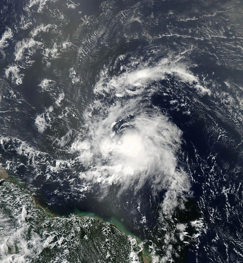
After an area of disorganized showers and thunderstorms developed near the Cape Verde Islands on the evening of July 30th, the 48 hour tropical weather outlook called for a high chance of a tropical cyclone developing within 48 hours. On the morning of the 31st, it is estimated that Tropical Depression Seven developed to the south of the islands. The forecast issued by the NHC called for strengthening into a tropical storm, with a peak of 50 mph before an increase in vertical wind shear impacted on the systems circulation. In reality, high shear was present throughout the storms lifecycle, and as a result, the depression never intensified into the anticipated tropical storm before dissipating on August 2nd, in the far eastern Caribbean Sea. There are no known deaths or damage related to this tropical cyclone during its existence.
Hurricane Eduardo[]
| Category 1 hurricane (SSHWS) | |
  | |
| Duration | August 4 – August 9 |
|---|---|
| Peak intensity | 80 mph (130 km/h) (1-min) 980 mbar (hPa) |
The origins of Hurricane Eduardo can be traced back to an area of disturbed weather that developed off the coast of French Guiana on the morning of August 3. As the system drifted very slowly to the due northwest, a motion it would carry on for the next few days, and became sufficiently organized enough to be classified as Tropical Depression Eight on the morning of the 4th, and then intensified into tropical storm Eduardo early the following morning, and then further into a hurricane on the 7th, passing the Lesser Antilles as it did so. On August 9th, wind shear was finally able to penetrate the well defined tropical cyclone, and it weakened to tropical storm status on the early morning, as it began to recurve back out to sea, weakening to a tropical depression early on August 9th. The cyclone then further weakened to an area of disturbed weather, which persisted for 3 days before being absorbed by a developing cold front situated over the Azores.
Tropical Storm Faith[]
| Tropical storm (SSHWS) | |
  | |
| Duration | August 12 – August 15 |
|---|---|
| Peak intensity | 50 mph (85 km/h) (1-min) 1000 mbar (hPa) |
Once the subtropical ridge had moved to the north on August 9th, an area of low pressure of non-tropical origin was able to form in the Lesser Antilles. By the morning of August 12th, it was sufficiently organized enough to be classified as Tropical Depression Nine on the 2am update. The following morning, whilst the storm was moving to the west-northwest, it was reported by the NHC to be intensifying, and as a result was upgraded into tropical storm Faith. Over eh following few days, the cyclone was able to intensify, until reaching the Bahamas on the 14th, hitting two of the islands during the process. Here, Faith encountered higher shear, and began to slowly weaken as a result, making landfall in Jupiter, Florida, with winds of 40 mph. As the system moved over land, it weakened to a tropical depression, shortly before emerging into the Gulf of Mexico on the afternoon of August 15th. The cyclone dissipated that evening, before moving ashore in Tampa the following morning and fully dissipating. Impacts were moderate, with 155mm of rain falling at the landfall location in Florida, which lead to minor flooding. No deaths were reported, besides the $15.2 million in damages.
Hurricane Gaston[]
| Category 2 hurricane (SSHWS) | |
  | |
| Duration | August 18 – August 24 |
|---|---|
| Peak intensity | 110 mph (175 km/h) (1-min) 965 mbar (hPa) |
A non-tropical area of low pressure developed over the Cape Verde Islands on August 17th, and a sudden increase in convection prompted the NHC to upgrade the system into Tropical Depression Ten as a result. The folllowing morning, once shear over the system had abated, the NHC reported that the depression had intensified into Tropical Storm Gaston, which began to move rapidly on an erratic track along the southern edge of the subtropical ridge, intensifying into a well defined hurricane on the afternoon of August 20th. The following day, Gaston began to recurve, and intensified into a category 2 hurricane in the process, before weakening to category 1 strength as it moved to the northeast on the 22nd, then further to a tropical storm on the morning of August 24th, due to cooler sea surface temperatures, and increased wind shear, and then to a tropical depression in the evening, the last NHC advisory on the system. No impacts were reported as a result of eh cyclone during its life time.
Tropical Depression Eleven[]
| Tropical depression (SSHWS) | |
  | |
| Duration | August 25 – August 27 |
|---|---|
| Peak intensity | 35 mph (55 km/h) (1-min) 1007 mbar (hPa) |
Tropical Depression Eleven developed from an area of disorganized low pressure over the Lesser Antilles on the 25th of August. Moving generally to the northwest, no intensification occurred, and by the evening of the 27th, the system had deteriorated to such an extent that it was no longer deemed tropical. During its lifecycle, the depression hit several Lesser Antilles islands, as well as San Juan, causing heavy rainfalls, with up to 700mm being recorded in some areas as a result of the storm. 3 people were killed during the depression, and $2 million in damages was inflicted on the islands n the eastern Caribbean Sea during the storm.
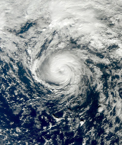
Hurricane Hope[]
| Category 5 hurricane (SSHWS) | |
  | |
| Duration | August 31 – September 8 |
|---|---|
| Peak intensity | 180 mph (290 km/h) (1-min) 894 mbar (hPa) |
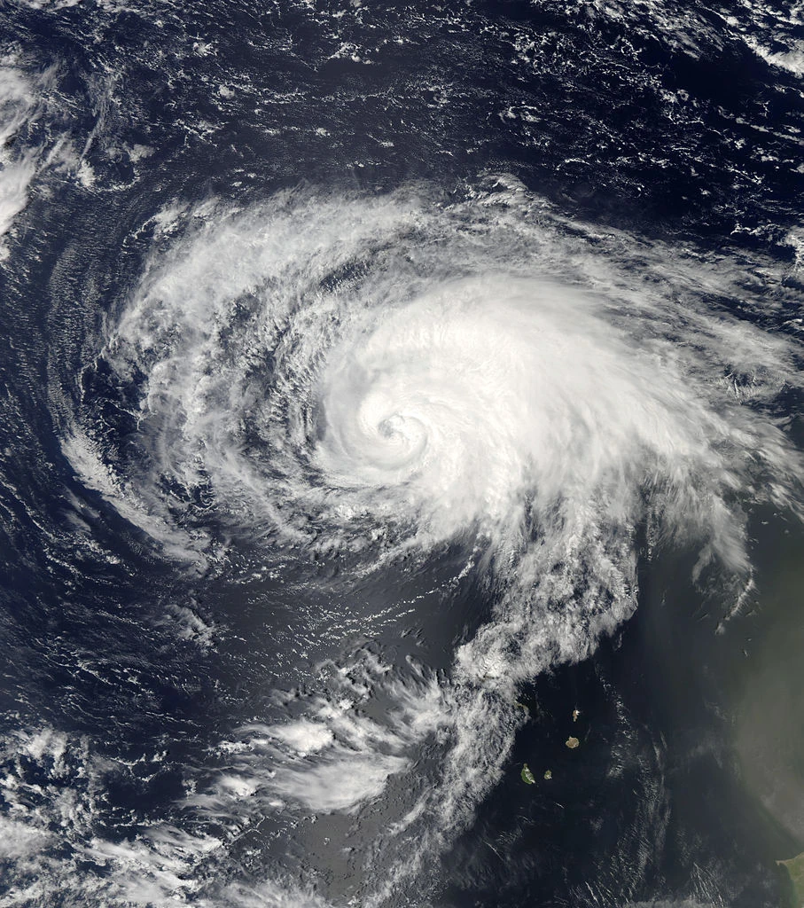
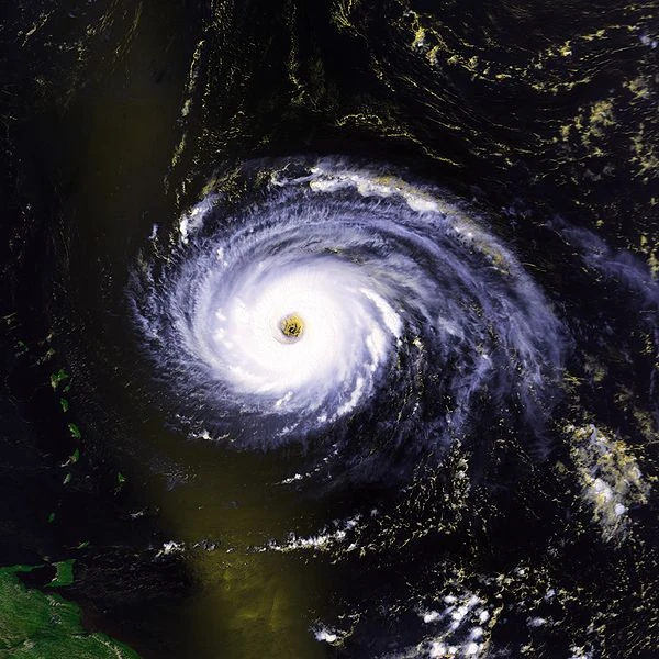
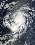
The origins of Hurricane Hope, the most violent storm of the season, can be traced to a stalled frontal trough, which developed into Tropical Depression Twelve early on August 31st. Moving generally to the west, the storm intensified into a tropical storm the following day, and was given the name Hope by the NHC up on the upgrade being made. Hope had little change in intensity over eh next several days, due to unfavourable conditions in the local vicinity. On August 4th, Hope was finally upgraded into a hurricane over the Lesser Antilles, where rapid deepening immediately began to occur, with the cyclone being at category 5 strength 24 hours after reaching hurricane status, having hit the Lesser Antilles as a category 3 hurricane during this time. As the cyclone began to recurve around a subtropical ridge, it finally began to weaken, and on August 6th, weakened to category 4 strength. By the end of the day, the storm had an intensity of 135 mph, and began to weaken even more rapidly as it entered cooler waters. On the afternoon of August 30, Hope was downgraded to a tropical storm, and 24 hours later, had deteriorated to tropical depression status near the coast of Nova Scotia, where the last NHC advisory was issued on the system, before it was absorbed into another extratropical cyclone to the southeast. 5 deaths were reported in the Lesser Antilles as a result of the storm, where 255 mm of rain fell, adding to the onslaught of appalling weather or the Lesser Antilles, after tropical Depression Seven had passed through he area only days before. Minimal damage was done by Hope along its track.
Hurricane Indigo[]
| Category 3 hurricane (SSHWS) | |
  | |
| Duration | August 31 – September 9 |
|---|---|
| Peak intensity | 125 mph (205 km/h) (1-min) 951 mbar (hPa) |
The thirteenth tropical depression was designated to have formed on August 31st, from a low pressure area that had developed the former evening near to the Cape Verde Islands. The following morning, the storm strengthened to tropical storm status, and was named Indigo by the NHC up on the upgrade advisory, becoming a hurricane the following afternoon. Steady strengthening continued, and on September 3rd, was upgraded into category 2 status as it neared the Lesser Antilles islands. The following day, Indigo strengthened unexpectedly into a major hurricane, and remained so for the rest of the day, before weakening to category 2 again as it passed to the north of the Lesser Antilles island chain the following day, and to category 1 by September 7th. Continued weakening continued as the cyclone approached Nova Scotia, where the cyclone made land fall on the last NHC advisory, with winds of 30 mph. No deaths or damage were reported during Indigo's existence as a tropical cyclone, although significant beach erosion did occur along the US East Coast as the storm passed the area on its approach to Nova Scotia.
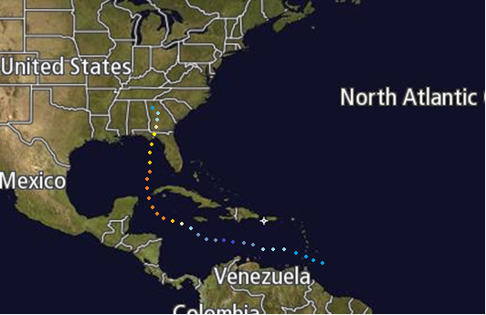
Tropical Storm Jewel[]
| Tropical storm (SSHWS) | |
  | |
| Duration | September 10 – September 14 |
|---|---|
| Peak intensity | 65 mph (100 km/h) (1-min) 992 mbar (hPa) |
An area of low pressure formed over Venezuela on September 4th. Over the next 6 days, the system slowly moved offshore, and was declared a tropical depression, the fourteenth of the season, on the morning of September 10th. The following afternoon, the low was declared as Tropical Storm jewel, after a hurricane hunter investigation of the system revealed dense convection near the centre of circulation within the system. On the following evening, Jewel made landfall in Honduras at peak strength, and then moved out back into the Caribbean sea 6 hours later, weakening to a minimal tropical storm, before making landfall on the Belize/Mexico border, emerging into the Gulf of Mexico on the 14th, devoid of deep convection. By the evening update, the cyclone had become extratropical, and so the last NHC advisory was issued on the system. During its lifecycle, Jewel was responsible for 1150mm of rainfall in central America, which lead to severe flooding, which caused 114 deaths, and $562 million in damages.
Tropical Depression Fifteen[]
| Tropical depression (SSHWS) | |
  | |
| Duration | September 15 – September 17 |
|---|---|
| Peak intensity | 35 mph (55 km/h) (1-min) 1004 mbar (hPa) |
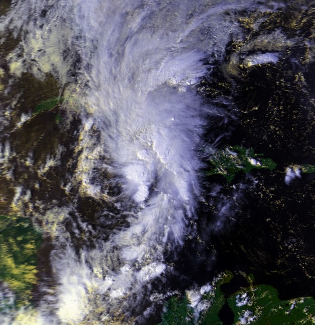
An area of non-tropical low pressure formed off the coast of Venezuela on September 14th, and began to acquire subtropical characteristics as it moved northwestward. The following morning, the NHC declared the system to be Subtropical Depression Fifteen, just as it began to recurve to the west, then southwest, due to interaction with another area of low pressure, which was located off the coast of Guatemala. On the 16th, Fifteen became to acquire more tropical characteristics, and by the evening update, was able to be classified as a fully tropical cyclone, aftera hurricane hunter investigation was able to confirm the fact that the low level circulation of the storm was near the centre of circulation. on the 17th, the depression began to weaken and lose organization as it neared landfall in Cuba. In the afternoon of the 17th, tropical Depression Fifteen made landfall in Pinar Del Rio, and in the evening, the NHC reported the cyclone to have become extratropical. During its lifecycle, the system caused minimal damages, and no deaths. However, heavy rainfalls associated with Fifteen impacted Cuba during the cyclones life, which totaled to 680mm, causing moderate flooding, and a few landslides in the mountainous regions.
Tropical Storm Ken[]
| Tropical storm (SSHWS) | |
  | |
| Duration | September 21 – September 24 |
|---|---|
| Peak intensity | 50 mph (85 km/h) (1-min) 997 mbar (hPa) |
An area of disturbed weather developed off the coast of Venezuela on September 19th, and began to steadily organize over the next 48 hours, being designated as Tropical Depression Sixteen on the morning of the 21st. After being designated, intensification was initially limited, due to upwelling of colder waters from the previous 2 storms to develop. Finally, though, on the following afternoon, the hurricane hunters investigated the system, and as a result of organized convective activity and a well defined rain band over the centre of circulation, and the NHC upgraded the storm into a tropical storm, naming it Kim in the process. Overnight, Kim moved between the Yucatan Peninsula and Cuba, bringing squally weather to the countries in the process of doing so. Once in the Gulf, Kim began to weaken, and was downgraded to a tropical depression off he US Gulf Coast on the afternoon of the 24th, eventually dissipating off the county of New Orleans, Louisiana, causing 2 tornadoes, and severe thunderstorms as it weakened and dissipated over the following few hours. Damages were placed at $3 million, due to the tornadoes, and a death occurred in the Florida Keys due to dangerous rip currents off he coastline generated by the cyclone as it passed by.
Hurricane Lily[]
| Category 3 hurricane (SSHWS) | |
  | |
| Duration | October 1 – October 10 |
|---|---|
| Peak intensity | 115 mph (185 km/h) (1-min) 958 mbar (hPa) |
The precursor to Lily was an organized area of thunderstorms, which formed of the Cape Verde Islands On September 30th, and was upgraded to Tropical Depression Seventeen early on October 1. The following morning, Tropical Storm Lily was declared near to the Cape Verde Islands, and then the following afternoon as found to have 1-minute sustained winds of 80 mph, and as a result was estimated to have become a hurricane 3 hours before, and so was upgraded into a hurricane as a result. From here, rapid deepening occurred, and Lily went from a category 1 on the afternoon of the 2nd, to a category 3 18 hours later. After holding peak strength for 54 hours, during which a recurvature had occurred, Lily dropped to category 2 status, and began to steadily weaken, dropping to category 1 status 30 hours later. However, due to abnormally warm waters near to the Azores, Lily was able to briefly intensify to a category 2 hurricane on the 7th as it approached the Azores islands, before dropping to category 1 again 6 hours later. The storm weakened to tropical storm strength late on the 8th, then further to a depression on the afternoon of the 10th, dissipating to the north east of the Azores at 8pm that evening. the impacts from Lily were minor, with no deaths or damage being reported during the cyclones lifecycle.
Hurricane Mort[]
| Category 1 hurricane (SSHWS) | |
  | |
| Duration | October 5 – October 10 |
|---|---|
| Peak intensity | 90 mph (150 km/h) (1-min) 972 mbar (hPa) |
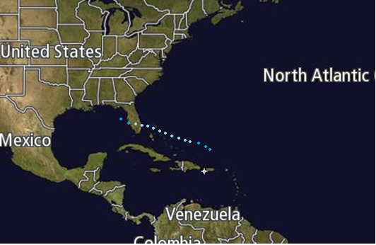
A subtropical disturbance formed in the Gulf of Mexico near the Florida keys on October 4th, and became Subtropical Depression Eighteen the following morning, before turning to the southwest, then to the northwest, becoming tropical near to the New Orleans coastline, before turning north and approaching the Florida Gulf Coast on 7th, and reaching tropical storm strength, when it was named Mort. The following morning, Mort reached hurricane status, and reached a peak strength of 90 mph before hitting t he Tampa Bay area 6 hours later. Over the next 9 hours, Mort transversed the Florida Panhandle, and emerged into the western Atlantic with winds of 75 mph, before weakening to a tropical storm 6 hours later, and continuing its steady weakening phase, until it was down graded to a tropical; depression on the evening of October 10th, the last advisory to be issued by the NHC. During its lifecycle, the cyclone caused 3 deaths, and $677 in damages, due mainly to its slow and erratic motion whilst moving over land.
Hurricane Norris[]
| Category 4 hurricane (SSHWS) | |
  | |
| Duration | October 18 – October 25 |
|---|---|
| Peak intensity | 145 mph (230 km/h) (1-min) 937 mbar (hPa) |
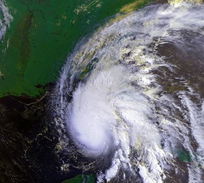
Tropical Depression Nineteen formed off the coast of Venezuela on the morning of October 18th, and the following afternoon, it intensified into Tropical Storm Norris, as it paralleled the north coast of South America. Strangely, on October 20th, the cyclone transitioned into a subtropical storm, before weakening to a subtropical depression, despite favourable conditions for further development. However, by the following evening, Norris re-intensified into a subtropical storm, and began to undergo tropical transition, which was complete by the morning of the 21st, an dthen into a category 1 hurricane by 8am the following morning, when it began to explosively deepen under unusually favourable conditions for the time of year in the western Caribbean Sea and 24 hours later, the cyclone was at category 4 strength. On the afternoon of the 23rd, Norris weakened to category 3 strength, and by landfall in Florida on the 24th, had weakened to a low end category 2 hurricane, where it moved inland and weakened into a trough of low pressure on the following evening over Georgia. During the cyclones lifecycle, 6 people were killed, and $544 million in damages was inflicted on the areas affected.
Tropical Storm Olga[]
| Tropical storm (SSHWS) | |
  | |
| Duration | October 25 – October 28 |
|---|---|
| Peak intensity | 50 mph (85 km/h) (1-min) 1002 mbar (hPa) |
A subtropical area of low pressure formed near to Bermuda on October 21st, and stalled as it began to interact with a frontal system on the 24th. The following day, the NHC initiated advisories on Subtropical Depression Nineteen in the early morning. The following morning, the storm was upgraded into a subtropical storm, and was named Olga by the NHC. Over the following day, the system became fully tropical, and reached peak strength, then began weakening as it approached the Azores Islands, weakening to a tropical depression on the afternoon of the 28th. The last NHC advisory on the system was issued at 8pm that evening, as the system was downgraded to an extratropical low pressure area, which dissipated the following morning. The impacts from Olga were minor, with 27mm of rain being recorded by the pre-cursor to the tropical cyclone. No deaths or damages were reported as a result of the tropical cyclone.
Hurricane Patrick[]
| Category 3 hurricane (SSHWS) | |
  | |
| Duration | October 29 – November 5 |
|---|---|
| Peak intensity | 120 mph (195 km/h) (1-min) 948 mbar (hPa) |
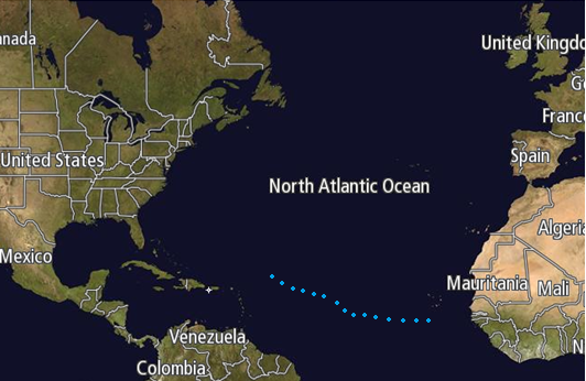
On the morning of October 29th, Subtropical Depression Twenty-one formed just to the south of the Cape Verde Islands, and 6 hours later became a tropical depression, whilst beginning to move to the west. The following afternoon, the NHC designated the system as Hurricane Patrick, skipping tropical storm status during an explosive deepening phase, making it the most eastward forming hurricane on record, due mainly to unusually low wind shear and warm waters. After becoming a hurricane, intensification slowed somewhat, and on the afternoon of November 1st, the NHC finally made the upgrade to category 2 status, and 2 days later, as the cyclone was moving to the north, and then to category 3 status on the following update, again due to unusually warm waters and low wind shear in the area, as well as an anticyclone becoming established above the low level circulation of the system. The following evening, the cyclone had degenerated to category 1 status, and began to rapidly weaken as it approached Newfoundland, and 12 hours later turned to the due east, weakening to tropical storm status as it began to undergo extratropical transition as it did so, due to increased shear and cooler sea surface temperatures By the evening, Patrick had degenerated to an extratropical storm, with a lack of deep convection, about halfway between Newfoundland and the Azores Islands. Minimal impacts were noted during the cyclones existence. A ship went missing on the 2nd, but later reported in to port unscathed.
Hurricane Roxanne[]
| Category 1 hurricane (SSHWS) | |
  | |
| Duration | November 4 – November 15 |
|---|---|
| Peak intensity | 85 mph (140 km/h) (1-min) 972 mbar (hPa) |
A non-tropical area of low pressure formed near the Cape Verde Islands on November 1st, and drifted erratically for the next several days, finally becoming Subtropical Depression Twenty-two on the 4th, halfway between the Cape Verde Islands and the Lesser Antilles. The following morning, the NHC sent an aircraft into the system, and as a result of the data collected, the cyclone was upgraded into Subtropical Storm Roxanne, which began to move to the north soon after being designated, becoming fully tropical the following morning, on the 8am update, due to the dry air and shear within the system abating over the circulation. However, at 2pm, upwelling from the previous cyclone, Patrick, caused the storm to weaken briefly to a tropical depression. At 8pm, the system was re-upgraded to tropical storm status, and began to rapidly deepen, being designated as a hurricane by the following morning, on the 8th. For the next several days, Roxanne remained a hurricane, and at one point became annular, remaining at winds of 85 mph for 3 days, before it finally weakening as dry air finally penetrated the core of rotation. On the 13th, Roxanne was finally downgraded to tropical storm status, as it began to curve out from the East Coast towards the Azores, being downgraded to a tropical depression on the morning of the 15th to the northwest of the islands, then further to a remnant low by the evening update. During its existence, Roxanne caused a death in North Carolina, due to rip currents as the cyclone passed several hundred miles offshore, and damages were minimal in Bermuda, limited to hurircane force winds on the 8th to the 11th, as the cyclone passed by 150 miles offshore.
Tropical Storm Sean[]
| Tropical storm (SSHWS) | |
  | |
| Duration | November 10 – November 12 |
|---|---|
| Peak intensity | 45 mph (75 km/h) (1-min) 1005 mbar (hPa) |
On November 9th, non-tropical area of low pressure developed of the Venezuelan coast, and by the following morning had significantly organized, enough to be classified as Subtropical Depression Twenty-three by the NHC. The following evening, the NHC designated the system as Subtropical Storm Sean, the final named storm of the 2046 Atlantic hurricane season., which the following afternoon briefly reached a peak at tropical; storm strength, before weakening to a tropical depression as it passed Jamaica, weakening to a low pressure area by evening. During the cyclones existence, minimal damage was done - however, as it was passing near the Venezuela coast, the storm dropped upwards of 500mm of rainfall, which led to significant landslides, killing 4 people in the process. In the ABC Islands, gusts of tropical storm force were documented, but no significant impacts were reported from the area
Season effects[]
| Storm name |
Dates active | Storm category at peak intensity |
Max 1-min wind mph (km/h) |
Min. press. (mbar) |
Areas affected | Damage (USD) |
Deaths | |||
|---|---|---|---|---|---|---|---|---|---|---|
| Abraham | June 1 – June 4 | Tropical storm | 70 (110) | 992 | Cuba and Mexico | 0.02 | 0 | |||
| Two | June 18 – June 20 | Tropical depression | 35 (55) | 1005 | Lesser Antilles and San Juan island | Minimal | 2 | |||
| Three | July 2 – July 3 | Tropical depression | 35 (55) | 1008 | none | 0 | 0 | |||
| Bonnie | July 14 – July 22 | Category 1 hurricane | 90 (150) | 1008 | Cape Verde Islands, Lesser Antilles, Hispaniola, Cuba, Bahamas and the US East coast | 142 | 5 | |||
| Carlos | July 20 – July 31 | Category 4 hurricane | 150 (240) | 929 | Cape Verde Islands, Lesser Antilles, San Juan Island, Hispaniola (Haiti), Bahamas | 67 | 14 | |||
| Dorothy | July 25 – August 2 | Category 5 hurricane | 165(270) | 918 | Cape Verde Islands and the Lesser Antilles | Minimal | 1 | |||
| Seven | July 31 – August 3 | Tropical depression | 35 (55) | 1004 | Cape Verde Islands and the Lesser Antilles | 0 | 0 | |||
| Eduardo | August 4 – August 9 | Category 1 hurricane | 80 (130) | 980 | none | 0 | 0 | |||
| Faith | August 12 – August 15 | Tropical storm | 50 (85) | 1000 | Lesser Antilles, The Bahamas, Florida, US Gulf Coast | 15.2 | 0 | |||
| Gaston | August 18 – August 24 | Category 2 hurricane | 115 (185) | 965 | none | 0 | 0 | |||
| Eleven | August 25 – August 27 | Tropical depression | 35 (55) | 1007 | Lesser Antilles and San Juan | 2 | 3 | |||
| Hope | August 31 – September 8 | Category 5 hurricane | 180 (290) | 894 | Lesser Antilles,San Juan, US East Coast and Nova Scotia | Minimal | 5 | |||
| Indigo | September 3 – September 9 | Category 3 hurricane | 125 (205) | 951 | none | 0 | 0 | |||
| Jewel | September 10 – September 14 | Tropical storm | 65(100) | 992 | Venezuela, Nicaragua, Honduras, Belize, and Mexico | 562 | 114 | |||
| Fifteen | September 15 – September 17 | Tropical depression | 35 (55) | 1004 | Venezuela, Nicaragua, Honduras, Mexico (Yucatan), and Cuba | Minimal | 0 | |||
| Ken | September 21 – September 24 | Tropical storm | 50 (85) | 997 | Yucatan, Cuba and the US Gulf Coast | 3 | 1 | |||
| Lily | October 1 – October 10 | Category 3 hurricane | 115 (185) | 958 | Cape Verde Islands and The Azores | 0 | 0 | |||
| Mort | October 5 – October 10 | Category 1 hurricane | 90 (150) | 972 | Yacutan, Mexico, US Gulf Coast (Florida) and the US East Coast | 677 | 3 | |||
| Norris | October 18 – October 25 | Category 4 hurricane | 145 (230) | 937 | Lesser Antilles, Venezuela, Cuba and the US Gulf Coast (Florida) | 544 | 6 | |||
| Olga | October 25 – October 28 | Tropical storm | 50 (85) | 1002 | Bermuda, Azores | 0 | 0 | |||
| Patrick | October 29 – November 5 | Category 3 hurricane | 120 (195) | 948 | Cape Verde Islands and the Azores | Minimal | 0 | |||
| Roxanne | November 4 – November 15 | Category 1 hurricane | 85 (140) | 972 | US East Coast and the Azores | Minimal | 1 | |||
| Sean | November 10 – November 12 | Tropical storm | 45 (75) | 1005 | Lesser Antilles, Venezuela, ABC Islands, and Jamaica | Minimal | 4 | |||
| Season aggregates | ||||||||||
| 23 systems | June 1 – November 15 | 185 (290) | 894 | >$2012.2 million | 159 | |||||
Storm names[]
The following list of names will be used for named storms that form in the North Atlantic in 2015. Retired names, if any, will be announced by the World Meteorological Organization in the spring of 2047. The names not retired from this list will be used again in the 2052 season list. This is the same list used in the 2040.
|
|
|
Accumulated Cyclone Energy (ACE) Rating[]
| ACE (104 kt2) – Storm: Source | |||||
|---|---|---|---|---|---|
| 1 | 43.0 | Hope | 12 | 5.85 | Eduardo |
| 2 | 30.1 | Dorothy | 13 | 4.85 | Abraham |
| 3 | 25.1 | Carlos | 14 | 4.23 | Jewel |
| 4 | 22.8 | Norris | 15 | 3.33 | Ken |
| 5 | 20.0 | Indigo | 16 | 3.00 | Faith |
| 6 | 17.0 | Roxanne | 17 | 2.61 | Olga |
| 7 | 14.3 | Lily | 18 | 2.00 | Sean |
| 8 | 10.5 | Gaston | 19 | 0.00 | Storm |
| 9 | 7.22 | Bonnie | 20 | 0.00 | Storm |
| 10 | 6.94 | Mort | 21 | 0.00 | Storm |
| 11 | 6.26 | Roxanne | 22 | 0.00 | Storm |
| Total=229.09 | |||||
ACE is the result of a storm's winds multiplied by how long it lasted for, so storms or subtropical storms (Originally not included up until 2012) that at lasted a long time , as well as particularly strong hurricanes , have higher ACE totals. Tropical Depressions are not included in season total.