The 2200 Atlantic hurricane season was at the time, the most active season in recorded history (later surpassed by multiple seasons until 20,000). Out of the 100 depressions that formed, 90 became tropical storms, 61 became hurricanes, and 35 became major hurricanes. 11 of them reached Category 6 intensity or higher (known by then as supercanes); these excess ratings were introduced in the late 21st century due to the increasing intensity of tropical cyclones in response to climate change. The strongest hurricane of the season was Zia, which became a 420 mph/682 mbar Category 10 supercane.
2200 was the most destructive and deadly season ever recorded in history, until later surpassed by 20,000 and several preceding years. Hurricane-vulnerable areas (especially the Lesser Antilles, Gulf Coast, East Coast, Florida, and Mexico) were virtually wiped out by all the hurricanes and supercanes. It made even 2100 look weak by comparison.
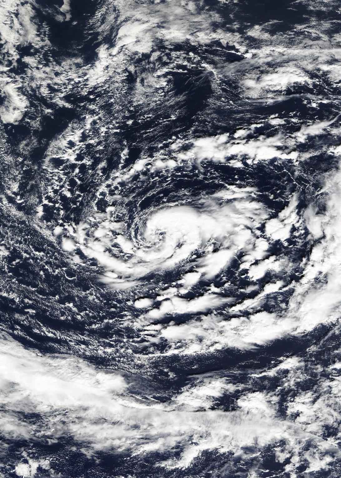
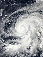
Climate change has become dangerously rampant by 2200, causing hurricane seasons to reach activity and intensity (total ACE) levels never before thought possible. After 2100, six other years in the 22nd century reached or surpassed 50 tropical depressions; these years were 2125, 2148, 2170, 2196, 2198, and 2199. Although 2125 fell a couple depressions short of 2100, 2148 was the year that 2100's activity record fell, seeing 65 depressions in total. 2170 saw activity in between 2100 and 2148, seeing 60 depressions. 2196 saw a very similar amount of activity as 2100, 2198 was like 2125 (seeing 52 depressions), while 2199 (as the precursor to this season) in turn beat 2148's record, seeing 79 depressions total. By 2200, climate change has increased summer and autumn sea surface temperatures in parts of the Atlantic (especially the Caribbean and Gulf of Mexico) to a whopping 100+°F in La Niña years with wind shear and dry air being ridiculously low throughout the basin, creating the perfect conditions for an ultra-hyperactive season to occur. Although 2200 saw perhaps one of the strongest La Niñas in recorded history, the Eastern Pacific still saw an above-average hurricane season by today's standards and a few Atlantic crossovers were still able to thrive there.
The season got off to a very early start, with a system forming in January and February and a record March major hurricane. Other records for earliness fell with Desiree (the earliest MDR formation ever) and May got unusually active due to exceptional conditions for the time of year, seeing intensity records fall one by one, starting with Grant and then Jenna, which became the first supercane of the season. Reasons for the early activity included hotter-than-average SSTs already exceeding 85 degrees Fahrenheit in many parts of the Atlantic and basin-wide very low wind shear. The Saharan Air Layer was much weaker than average this year, allowing storms to form out in the MDR as early as June, May, or in the case of Desiree and Fatima, even April.
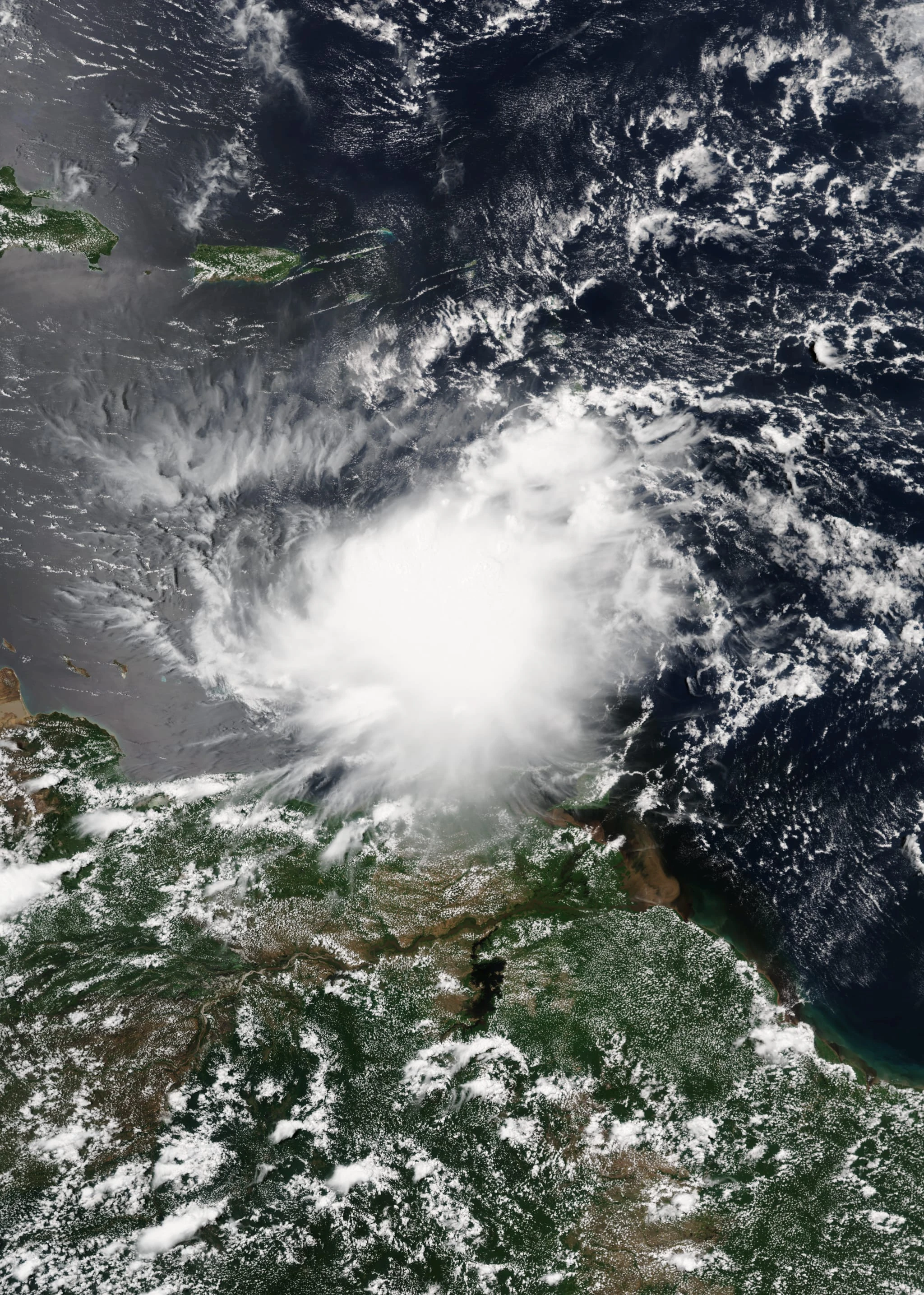
The season peaked from July through mid-September as systems took advantage of the exceptionally favorable environment basin-wide. SSTs in some places reached the triple digits during the peak of the season with shear and dry air at an all time low, allowing never before seen supercanes to spawn (such as Zia and Omega, although the latter occurred soon after SSTs peaked). However, after mid-September, activity waned down a bit due to an excess of cool upwelled water from previous systems and little room for new formations due to the hyperactivity. The later part of the season, while a little less active, still produced very notable storms such as Omega, which rivaled Zia in intensity and devastation. The last storm, Nun, an unusual late-December hurricane, finally concluded the season on January 2.
Seasonal summary[]
Note: Timeline only includes time spent in the Atlantic for crossovers into the Eastern Pacific.

(Intensity scale for storms beyond C5 in summary: C6 - 200-249 mph, C7 - 250-299 mph, C8 - 300-349 mph, C9 - 350-399 mph, C10 - 400-449 mph, Sub-Hypercane - 450-499 mph, Hypercane - 500-749 mph, Super Hypercane - 750-999 mph, Megacane - 1,000-1,499 mph, C2 Megacane - 1,500-1,999 mph, C3 Megacane - 2,000-2,499 mph, Superstorm - 2,500-4,999 mph, Biblical Storm - 5,000-9,999 mph, Armageddon Storm - 10,000-49,999 mph, World Ending Storm - 50,000-99,999 mph, Infinite Storm - 100,000-999,999 mph, Mini-Black Hole - 1,000,000 mph-9,999,999 mph, Super Mini-Black Hole - 10,000,000-99,999,999 mph, Hyper Mini-Black Hole - 100,000,000-499,999,999 mph, Ultra Mini-Black Hole - 500,000,000-999,999,999 mph, Astronomical Black Hole - 10^9-∞ mph, Universe & Time Ender - -∞ mph)
The ultra-hyperactive season began with the formation of a few extremely early storms; Alejandro, Brittany, and Cody each formed before April. Cody became the strongest ever recorded in the month of March, the third earliest major hurricane on record (after two majors that formed in January, one in 2109 and the other in 2154), and the earliest Category 2+ landfall in the U.S. on record. It was the first storm of the season to cause enough impacts to lead to its retirement. April began with a weak and short-lived Desiree forming in the Main Development Region (MDR); the earliest MDR formation on record. The month later saw tropical storm Ethan (one of the earliest tropical systems to ever make landfall on the Gulf Coast) and subtropical depression Six.
At the end of April, Fatima formed and became the strongest storm to ever form in April, although the majority of its existence was in May. Fatima and Grant (the earliest C5 on record and the strongest ever recorded in May) led the major explosion in activity that would cement 2200 in the record books. As May progressed, an unprecedented amount of systems formed, including Jenna which broke Grant's very short-lived record as the strongest Atlantic system ever recorded in May. Jenna was the first "supercane" of the season (C6+, 200+ mph), and caused cataclysmic devastation to New England. A few more systems formed after Jenna concluding with Marvin's formation. In total, 8 depressions and 7 named storms formed in May 2200, and Fatima also existed in the month (making 9 total). This far out-beats the previous record holders, 2148 and 2199, which each had 5 systems exist in the month. In total, 15 depressions formed before June, an all-time record that no previous year has even rivaled (previous records - 9 in 2199 and 8 in 2148).
June saw the formation of another 7 named storms and 8 depressions, and numbers were basically the same as May as the hyperactivity continued. Most notable was Penelope, which became a Category 8 supercane and was the 2nd most intense Atlantic system in recorded history at the time. At the time of its peak, it was the fourth-strongest tropical cyclone ever recorded on Earth, only beaten by two Western Pacific super typhoons and a Caribbean supercane. Impacting the Florida Panhandle at Category 7 intensity and the Windward Islands at Category 5 intensity, the result was biblical devastation, described as if a "nuclear bomb had wiped out the entire Florida Panhandle". Other than Penelope, other notable June storms were Marvin (which formed in May), Oren, and Tori; each caused enough devastation to be retired. With 9 storms existing in June, 2200 narrowly beat out the previous all-time June record held by the previous year (2199), which had 8 storms exist in the month.
As July arrived, the season absolutely exploded. The month saw a grand total of 17 depressions forming, 16 of them being named storms. This number demolished the previous record of 11 depressions, held by 2199. 19 depressions existed in the month, again beating 2199's previous record of 13. The most notable of the month were Yuri and Zoe, although Flora also brought significant attention. Two other notable storms, Igor and Joan, formed in this month but were most notable during August. Yuri became only the second C9-strength tropical cyclone in recorded history, after a Western Pacific super typhoon that occurred more than a decade prior. They were both tied for the strongest tropical cyclone ever recorded on Earth by wind speed, however the WPac typhoon was slightly more intense by pressure (734 vs. Yuri's 738). Yuri still held the distinction of being the most powerful ever recorded in the Western Hemisphere. As for impacts, Yuri caused cataclysmic devastation on the Gulf Coast after one of the most intense landfalls ever recorded on Earth. Much of Louisiana was virtually wiped out by the supercane. The other notable storm, Zoe, was another supercane. It was long-lived and caused devastation in the Lesser Antilles, the Bahamas, and in the Carolinas. Flora caused widespread devastation in Florida after hitting near Miami at peak C4 intensity.
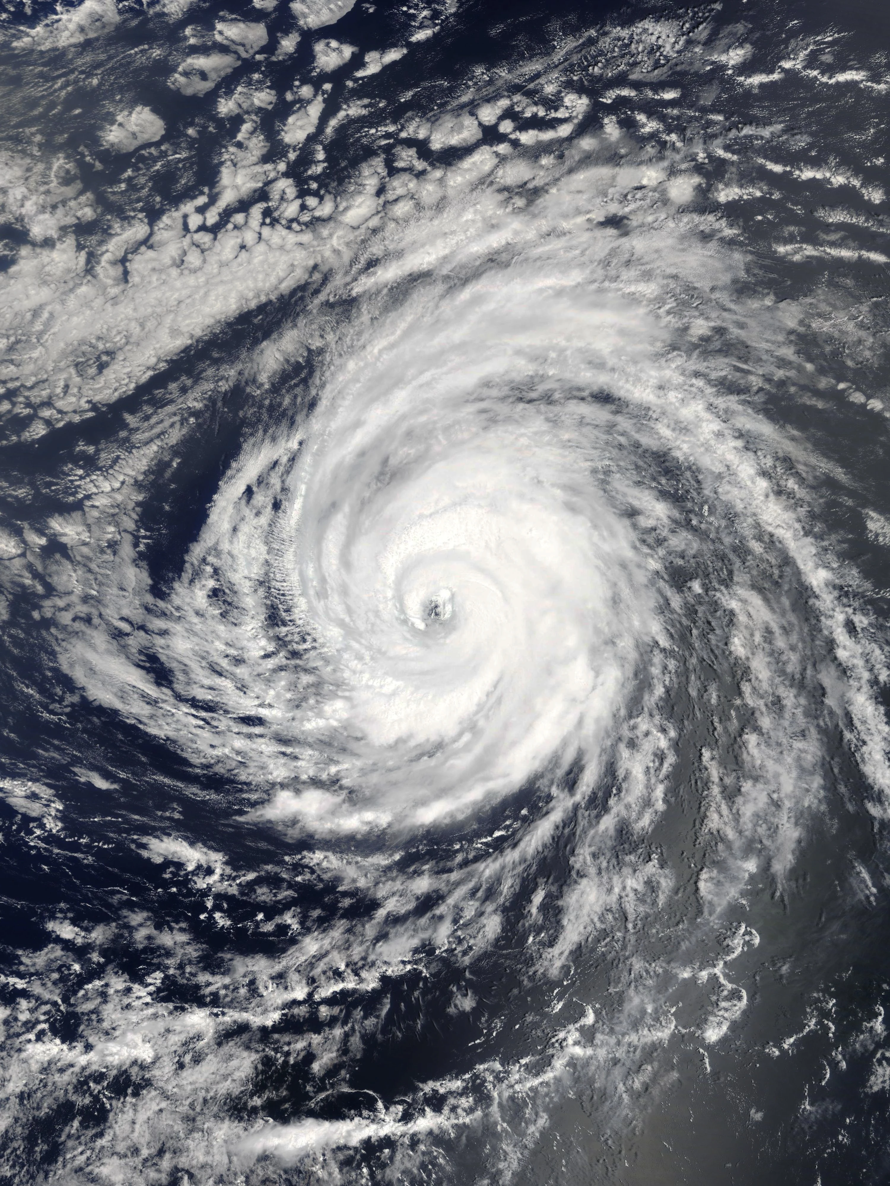
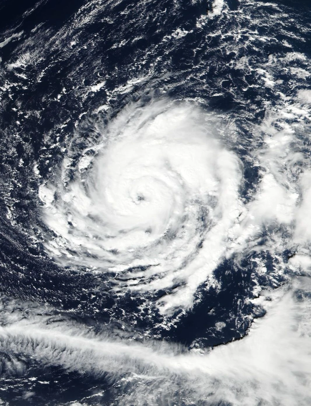
August was another record hyperactive month. 22 systems have existed in the month, including Igor and Joan. While both storms formed in July, they were very devastating and notable storms during August. Igor skirted by Bermuda as a C4 hurricane and struck New England as a large C1 system that shared similarities with Sandy almost two centuries prior. Joan was a catastrophic, deadly supercane which hit the Windward Islands at C3 intensity and made landfall in Nicaragua soon after weakening below peak intensity. The resulting devastation in Central America was immense, with hundreds of deaths. This was one of the deadliest systems of the past decades. The death toll from such a system would have been much higher in the more primitive-technology days of the early 21st century. Other devastating August cyclones were Matthew, Omar, and William. Matthew hit areas that were just starting to recover from Flora, while Omar stuck Hispaniola and Puerto Rico causing a high death toll. William caused massive devastation in Hispaniola and the Carolinas, after parking itself as a C7 off the east coast. Yet another notable August storm was Ulric, which devastated the Florida Panhandle as a C5. Near the end of the month, perhaps the most notable storm of the season, Zia, developed. It was considered to be the most devastating tropical cyclone in recorded history after reaching C10 (becoming the strongest tropical cyclone ever recorded) and impacting a variety of regions, including the Lesser Antilles, Florida, and the U.S. Gulf Coast. In total, August saw the formation of 20 depressions total, a record.
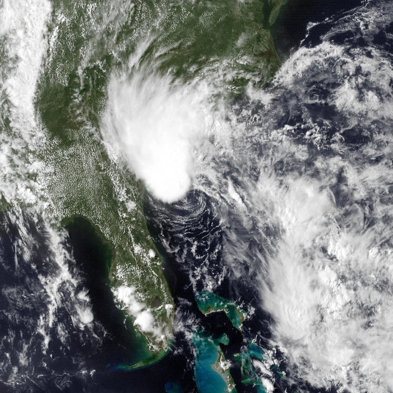
September has seen the formation of 20 systems, with an additional 6 crossing over from August. So many systems are forming and intensifying that the whole Atlantic basin is actually temporarily becoming less conducive for new tropical systems to develop due to shear and less space from all the other active systems and upwelled water. This caused a quieter period for new formations to occur after the formation of Kappa, with systems forming about every few days instead of almost every day. The most notable formations in the month have been Eta, a devastating supercane that wrecked havoc in Mexico; Epsilon, an unusually north-eastern hurricane that made landfall in Portugal; Xi, a devastating C7 supercane that wrecked the east coast of the United States; and Sigma, a destructive and deadly Central American hurricane that regenerated in the Eastern Pacific. Other very notable August systems, such as Zia, crossed over into September and caused the most havoc in this month. September has also seem a few systems absorbed into bigger systems due to little room for new developments.
The season began to quiet down (finally) in October, which has seen the formation of 12 storms, with 5 more crossing over from September. The most notable of the month was Omega, which became a C10 superstorm that rivaled Zia in intensity. It caused cataclysmic devastation along the eastern seaboard of the U.S., as well as in certain Caribbean islands. It became the 2nd most catastrophic hurricane ever recorded, behind Zia. Zayin, another supercane, formed late in the month and caused most of its impacts to Central America in November. Also relatively notable were Psi, which struck the Yucatan as a powerful major; Chi, which neared the Canary Islands at hurricane strength; and Alef, which struck South Carolina at C3 intensity. Alef made the season the first since 2100 to reach the Hebrews.
November has seen six systems form and another three more cross over from October, including supercanes Omega and Zayin. With the season quieting down, activity from here on out was much less notable than during the peak of the season. Most notably, Zayin devastated Central America in the early part of the month, Yod struck the southeastern U.S. in the middle of the month, and Kaf became the only major to form in the month and devastated the eastern seaboard. The dissipation of Kaf marked the end of a record 5+-month streak in which at least one system was active in the Atlantic at one time. The streak began when Oren formed on June 12 and ended on November 28 with Kaf's dissipation.
Activity continued into the post-season with the formations of Tropical Storm Mem and Hurricane Nun. Mem stayed out to sea, while Nun formed at a record southwestern latitude, striking Nicaragua as an unusually late hurricane. It later struck Cuba and Florida as a tropical storm and crossed into the new year, finally concluding the season on January 2.
Systems[]
Tropical Storm Alejandro[]
| Tropical storm (SSHWS) | |
  | |
| Duration | January 14 – January 18 |
|---|---|
| Peak intensity | 50 mph (85 km/h) (1-min) 998 mbar (hPa) |
Alejandro did not affect land and stayed well east of Bermuda throughout its lifespan. It was a rare January system.
Hurricane Brittany[]
| Category 1 hurricane (SSHWS) | |
  | |
| Duration | February 3 – February 11 |
|---|---|
| Peak intensity | 80 mph (130 km/h) (1-min) 984 mbar (hPa) |
Brittany was the second February hurricane ever recorded (after one in the late 21st century), and it mainly impacted Florida with slight effects in Cuba and the Yucatán. It caused $68 million in damage (2200 USD) and 2 deaths.
Hurricane Cody[]
| Category 3 hurricane (SSHWS) | |
  | |
| Duration | March 8 – March 16 |
|---|---|
| Peak intensity | 120 mph (195 km/h) (1-min) 961 mbar (hPa) |
Continuing the unusual early activity, Cody was the strongest March hurricane ever recorded. It hit New England as the earliest C2+ landfall on record, causing impacts that amounted to $12 billion in damage and 21 deaths. The name was later retired and replaced by Chad for use in 2206.
Tropical Storm Desiree[]
| Tropical storm (SSHWS) | |
  | |
| Duration | April 2 – April 3 |
|---|---|
| Peak intensity | 40 mph (65 km/h) (1-min) 1002 mbar (hPa) |
A weak tropical storm that stayed out in the Main Development Region. It was the earliest MDR formation ever recorded.
Tropical Storm Ethan[]
| Tropical storm (SSHWS) | |
  | |
| Duration | April 10 – April 14 |
|---|---|
| Peak intensity | 60 mph (95 km/h) (1-min) 996 mbar (hPa) |
As among the earliest Gulf Coast landfalls on record, it struck Louisiana with impacts in surrounding regions. Ethan caused $142 million in damage and killed 3 people.
Subtropical Depression Six[]
| Subtropical depression (SSHWS) | |
  | |
| Duration | April 16 – April 17 |
|---|---|
| Peak intensity | 35 mph (55 km/h) (1-min) 1005 mbar (hPa) |
Six was a weak subtropical depression that stayed out to sea (specifically southwest of the Azores), affecting no one.
Hurricane Fatima[]
| Category 4 hurricane (SSHWS) | |
  | |
| Duration | April 30 – May 10 |
|---|---|
| Peak intensity | 150 mph (240 km/h) (1-min) 941 mbar (hPa) |
Fatima struck the northern Bahamas, Florida, and the Gulf Coast around Mississippi - all at major hurricane intensity. As the initiator of the hyperactivity streak that would put 2200 in the record books, it was the second earliest major hurricane landfall in the Atlantic on record, after a C3 that made landfall in the Carolinas at that intensity at the beginning of May 2196 (just three days earlier than Fatima's first U.S. landfall as a Category 4). Fatima became the earliest C4 landfall in the U.S., and the whole Atlantic basin, on record. It was also the second earliest C4 hurricane on record, after a freak January C4 from 2154, and the strongest to ever form in April. Overall, Fatima caused $48 billion in damage and 63 deaths. The name was later retired and replaced by Felicity for the 2206 season.
Hurricane Grant[]
| Category 5 hurricane (SSHWS) | |
  | |
| Duration | May 8 – May 20 |
|---|---|
| Peak intensity | 165 mph (270 km/h) (1-min) 915 mbar (hPa) |
Affected the Lesser Antilles, Puerto Rico, and Bermuda. It was the earliest Category 5 on record as well as the strongest system ever recorded before June (later beaten by Jenna). Grant caused $135 million in damage and 4 deaths throughout its path.
Tropical Storm Heather[]
| Tropical storm (SSHWS) | |
  | |
| Duration | May 9 – May 12 |
|---|---|
| Peak intensity | 65 mph (100 km/h) (1-min) 994 mbar (hPa) |
Heather struck Belize and the Yucatán. It caused minimal damage and killed 1 person.
Tropical Storm Ibrahim[]
| Tropical storm (SSHWS) | |
  | |
| Duration | May 14 – May 16 |
|---|---|
| Peak intensity | 50 mph (85 km/h) (1-min) 999 mbar (hPa) |
Struck the Florida Panhandle, causing $25 million in damage and killing no one.
Supercane Jenna[]
| Category 6 hurricane (AMS) | |
  | |
| Duration | May 16 – May 29 |
|---|---|
| Peak intensity | 215 mph (345 km/h) (1-min) 866 mbar (hPa) |
The first supercane of the season, and beat Grant's short-lived record as the strongest system ever recorded before June. Passed north of the Lesser Antilles while strengthening, reached peak C6 intensity between Bermuda and the Bahamas, and made landfall in New Jersey while still a C4. Jenna's catastrophic landfall caused $160 billion in damage and 763 deaths, resulting in the retirement of the name - replacement is Jocelyn for 2206.
Hurricane Kurtis[]
| Category 2 hurricane (SSHWS) | |
  | |
| Duration | May 18 – May 23 |
|---|---|
| Peak intensity | 105 mph (165 km/h) (1-min) 973 mbar (hPa) |
Passed very close to Bermuda as an intensifying hurricane, and struck Nova Scotia while weakening to a tropical storm. Kurtis caused $65 million in damage and 1 death.
Tropical Depression Thirteen[]
| Tropical depression (SSHWS) | |
  | |
| Duration | May 24 – May 25 |
|---|---|
| Peak intensity | 35 mph (55 km/h) (1-min) 1004 mbar (hPa) |
Affected Nicaragua and Honduras with widespread flooding rain and mudslides. Thirteen caused $210 million in damage and 83 deaths.
Hurricane Leah[]
| Category 1 hurricane (SSHWS) | |
  | |
| Duration | May 26 – May 31 |
|---|---|
| Peak intensity | 80 mph (130 km/h) (1-min) 985 mbar (hPa) |
Leah was a weak C1 hurricane that stayed out in the Central Atlantic, affecting no one.
Hurricane Marvin[]
| Category 5 hurricane (SSHWS) | |
  | |
| Duration | May 31 – June 10 |
|---|---|
| Peak intensity | 175 mph (280 km/h) (1-min) 912 mbar (hPa) |
Initially peaked as a C1 very soon after crossing the Windward Islands. It re-intensified and peaked as a C5 over the western Caribbean, and made landfall in Honduras at that intensity. After crossing Central America and degenerating, it regenerated in the EPac and struck southern Mexico as a TS. In total, Marvin caused catastrophic devastation amounting to $13 billion in damage and 2,305 deaths, cementing it as among the deadliest in the last century. Due to the catastrophe, the name Marvin was retired and replaced by Micah for 2206.
Tropical Storm Natasha[]
| Tropical storm (SSHWS) | |
  | |
| Duration | June 2 – June 4 |
|---|---|
| Peak intensity | 50 mph (85 km/h) (1-min) 998 mbar (hPa) |
Formed in the Bay of Campeche and struck the Veracruz region. Natasha caused $145 million in damage and 12 deaths.
Tropical Depression Seventeen[]
| Tropical depression (SSHWS) | |
  | |
| Duration | June 9 – June 10 |
|---|---|
| Peak intensity | 35 mph (55 km/h) (1-min) 1005 mbar (hPa) |
This depression struck Louisiana. It caused only minimal damage.
Hurricane Oren[]
| Category 3 hurricane (SSHWS) | |
  | |
| Duration | June 12 – June 18 |
|---|---|
| Peak intensity | 115 mph (185 km/h) (1-min) 961 mbar (hPa) |
Affected Jamaica in its formative stages, far western Cuba as a C1/C2, and Florida as a C3. It weakened to a tropical storm over Florida, traveled up the East Coast, and turned extratropical. Oren caused $19 billion in damage and 45 deaths. The name was retired and replaced by Odin for 2206.
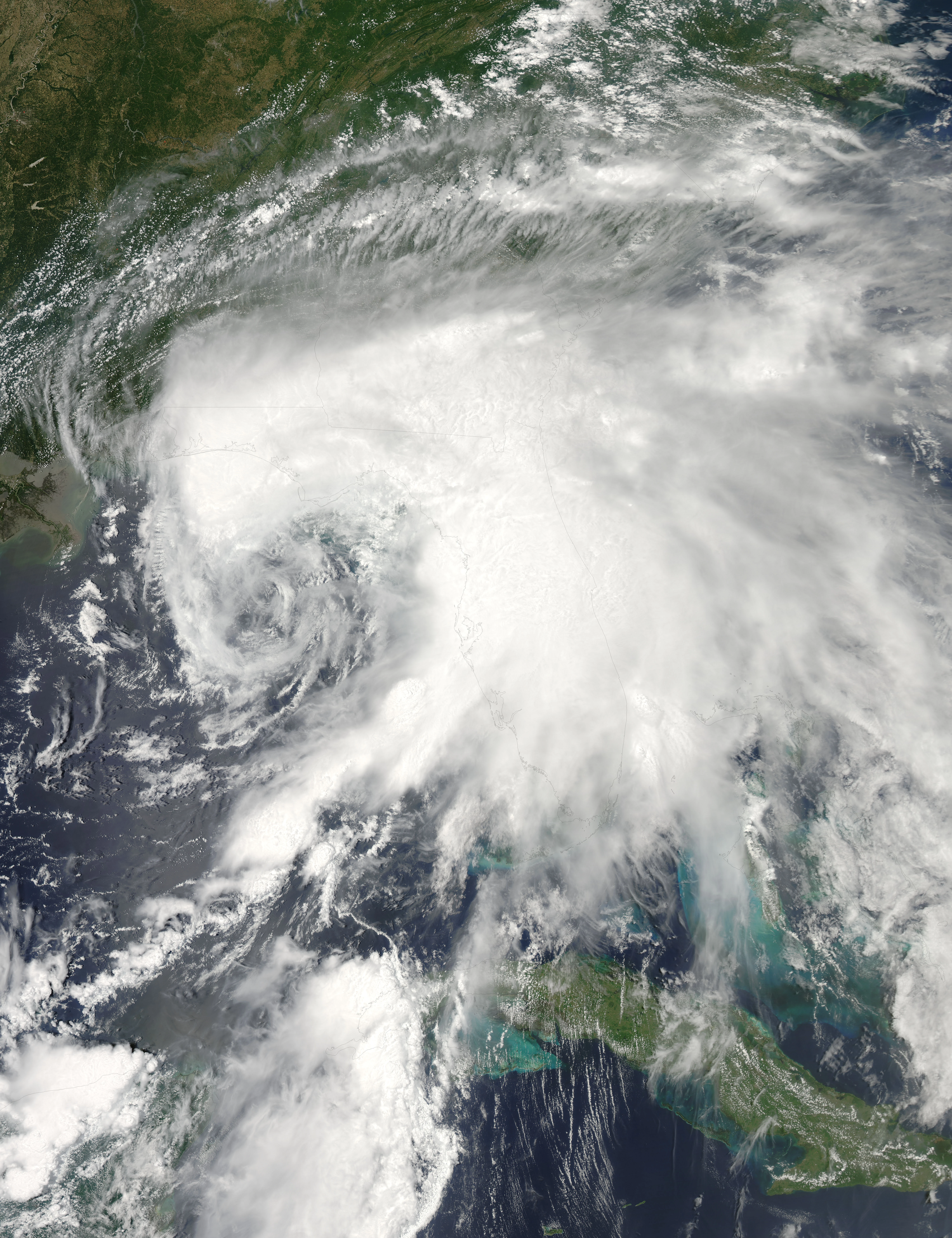
Supercane Penelope[]
| Category 8 hurricane | |
  | |
| Duration | June 13 – June 29 |
|---|---|
| Peak intensity | 320 mph (520 km/h) (1-min) 784 mbar (hPa) |
At the time, the second most intense in Atlantic history (after a slightly stronger Caribbean supercane in 2176), the fourth-most powerful ever recorded worldwide (behind two super typhoons and the aforementioned supercane), and the strongest ever recorded in the early season (before September). Penelope started out as a tropical storm southwest of Cape Verde, but fizzled out due to unfavorable conditions. It later regenerated and became monstrous, striking the Windward Islands as a C5, Hispaniola as a C3 after weakening in eastern Caribbean wind shear, the Turks & Caicos as a C1/C2, the Bahamas as a major hurricane, and it explosively intensified in the hot waters of the Florida Straits to become an extreme C7 hurricane. The Gulf of Mexico continued fueling the storm to C8 status before striking the Florida Panhandle at a record-breaking landfall intensity. It quickly weakened over land as it continued northward and it dissipated in Ohio. Overall, Penelope caused $678 billion in damage and killed 1,563 people. This devastating monster will never be forgotten. The name Penelope was later retired and replaced with Paige for 2206.
Hurricane Quigley[]
| Category 2 hurricane (SSHWS) | |
  | |
| Duration | June 21 – June 27 |
|---|---|
| Peak intensity | 105 mph (165 km/h) (1-min) 976 mbar (hPa) |
Formed in the western Caribbean and skirted Central America as a TS, affected both the Yucatán and Cuba as a C2, and headed west to strike near the Texas-Mexico border as a TS. Somewhat favorable conditions and very warm waters initially fueled its strengthening, but shear from the approaching Penelope weakened Quigley as it raced towards Texas/Mexico. In total, Quigley caused $48 million in damage and killed 2 people throughout its path.
Tropical Storm Rosalie[]
| Tropical storm (SSHWS) | |
  | |
| Duration | June 25 – June 28 |
|---|---|
| Peak intensity | 65 mph (100 km/h) (1-min) 996 mbar (hPa) |
Rosalie raced through the northern Lesser Antilles, Puerto Rico, and Hispaniola as a TS. It caused $59 million in damage and killed 4 people.
Hurricane Spencer[]
| Category 1 hurricane (SSHWS) | |
  | |
| Duration | June 26 – July 7 |
|---|---|
| Peak intensity | 80 mph (130 km/h) (1-min) 987 mbar (hPa) |
Formed from a tropical wave that moved off Africa, crossed through the Cape Verdes as a strengthening TS, peaked as a hurricane soon afterward, and degenerated under harsh dry air and shear. The remnants performed a loop and turned north, and it later regenerated as it approached the Azores, striking the islands as a TS before turning extratropical. The post-tropical system eventually struck the British Isles. Spencer caused $2 million in damage and 5 deaths throughout its path.
Hurricane Tori[]
| Category 4 hurricane (SSHWS) | |
  | |
| Duration | June 28 – July 6 |
|---|---|
| Peak intensity | 150 mph (240 km/h) (1-min) 935 mbar (hPa) |
Tori developed in the central Atlantic and initially intensified into a hurricane before striking the northern Lesser Antilles as a TS. After leaving, it rapidly intensified to a C4 and struck the Carolinas as a significant C3. It dissipated over the eastern seaboard. Tori caused $14 billion in damage and 41 deaths throughout its path, leading to the retirement of its name. Its replacement for use in 2206 is Tamara.
Tropical Storm Ulmer[]
| Tropical storm (SSHWS) | |
  | |
| Duration | July 1 – July 2 |
|---|---|
| Peak intensity | 50 mph (85 km/h) (1-min) 999 mbar (hPa) |
Ulmer developed in the northwestern Gulf of Mexico and struck Texas, west of the Houston area. It caused $9 million in damage and no deaths.
Hurricane Viviana[]
| Category 3 hurricane (SSHWS) | |
  | |
| Duration | July 3 – July 7 |
|---|---|
| Peak intensity | 120 mph (195 km/h) (1-min) 960 mbar (hPa) |
Formed in the western Caribbean and struck Honduras as a C3, moved slowly westward while fluctuating in intensity due to land interaction, made landfall near Guatemala's coastline, and dissipated over Central America. It later regenerated in the EPac, striking Mexico as a TS before dissipating for good. Overall, Viviana caused $760 million in damage and killed 936 people mainly due to devastating flash floods and mudslides throughout the region. It was retired and replaced with Vera for 2206.
Tropical Storm Wyatt[]
| Tropical storm (SSHWS) | |
  | |
| Duration | July 4 – July 7 |
|---|---|
| Peak intensity | 50 mph (85 km/h) (1-min) 999 mbar (hPa) |
Moved through the Lesser Antilles, Puerto Rico, and struck Hispaniola causing 2 deaths and about $10 million in damage.
Hurricane Xenia[]
| Category 1 hurricane (SSHWS) | |
  | |
| Duration | July 5 – July 10 |
|---|---|
| Peak intensity | 80 mph (130 km/h) (1-min) 986 mbar (hPa) |
A northerly minimal hurricane that stayed out to sea, although Newfoundland was affected after its extratropical transition.
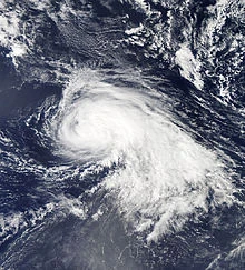
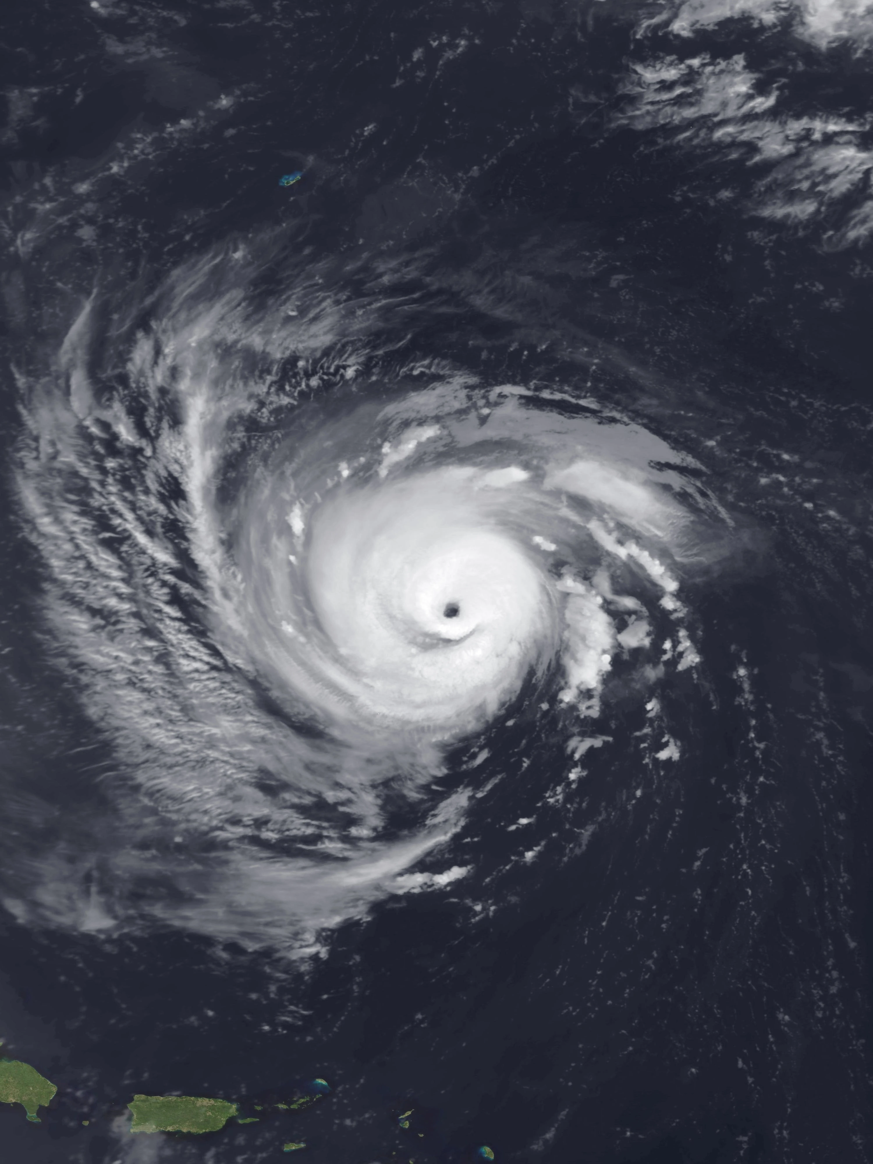
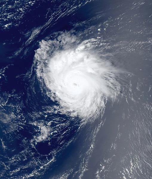
Supercane Yuri[]
| Category 9 hurricane | |
  | |
| Duration | July 7 – July 19 |
|---|---|
| Peak intensity | 370 mph (595 km/h) (1-min) 738 mbar (hPa) |
Only the second C9-strength tropical cyclone ever recorded on Earth, after a WPac super typhoon that occurred in 2187. Also the second most intense tropical cyclone recorded anywhere, and the most intense in the Western Hemisphere. By wind speed, they are both tied.
Yuri formed in the eastern Caribbean and skirted Hispaniola and Jamaica as it developed and strengthened, causing the first impacts recorded in relation to Yuri. Hit the western tip of Cuba as a strengthening C7, causing catastrophic devastation in the area. The Gulf of Mexico propelled the system to an intensity never before seen in the Atlantic basin. When it struck Louisiana at C8 intensity after slight weakening, the results were absolutely catastrophic. Described as the storm that "wiped away Louisiana's coastline forever," almost the whole state closer to the coast was flooded by extreme storm surge and the winds obliterated anything that remained standing from the surge. Yuri weakened quickly as it moved further inland, but it still left a trail of devastation that extended from Louisiana to the Ohio Valley. The final results: $1.06 trillion in damage and 5,195 deaths. The majority of the deaths were people who failed to evacuate from Louisiana in time. This was one of the very few trillion-dollar disasters in recorded history. As expected, the name was retired and replaced by Yves for the 2202 season.
Supercane Zoe[]
| Category 6 hurricane (AMS) | |
  | |
| Duration | July 9 – July 25 |
|---|---|
| Peak intensity | 225 mph (360 km/h) (1-min) 859 mbar (hPa) |
Another powerful and catastrophic supercane. It originated as a Cape-Verde type system, moving just south of the Cape Verdes as a developing tropical storm. A region of dry air weakened Zoe briefly to a tropical depression in the Central Atlantic. As it moved into more favorable conditions, it developed into a major hurricane and skirted the Lesser Antilles as a C4, resulting in the storm's first significant impacts. While north of the Bahamas, an eye-wall replacement cycle weakened Zoe briefly to a C4 but it recovered later on to reach the supercane classification, putting the Carolinas in danger of a catastrophe. It made landfall in South Carolina as a C5 causing extreme devastation. As it moved further inland, it quickly weakened and turned northeastward over the Ohio Valley, where it turned extratropical.It nearly destroyed everything in it's path.Zoe's totals were $185 billion in damage and 210 deaths, resulting in the name's retirement. It was replaced by Zephyr for 2202.
Tropical Depression Thirty[]
| Tropical depression (SSHWS) | |
  | |
| Duration | July 11 – July 12 |
|---|---|
| Peak intensity | 35 mph (55 km/h) (1-min) 1004 mbar (hPa) |
A weak tropical depression that struck Veracruz, resulting in very minimal damage.
Hurricane Allen[]
| Category 2 hurricane (SSHWS) | |
  | |
| Duration | July 12 – July 16 |
|---|---|
| Peak intensity | 105 mph (165 km/h) (1-min) 973 mbar (hPa) |
A very northeastern hurricane that struck the Azores at near peak intensity, causing $28 million in damage and 3 deaths.
Tropical Storm Betsy[]
| Tropical storm (SSHWS) | |
  | |
| Duration | July 14 – July 16 |
|---|---|
| Peak intensity | 50 mph (85 km/h) (1-min) 998 mbar (hPa) |
Tracked north into Atlantic Canada, causing minimal damage.
Tropical Storm Cesar[]
| Tropical storm (SSHWS) | |
  | |
| Duration | July 17 – July 19 |
|---|---|
| Peak intensity | 60 mph (95 km/h) (1-min) 996 mbar (hPa) |
Developed over the southern Windward Islands and moved southwestward into the Dutch Caribbean islands near Venezuela, where shear degenerated it to a tropical wave. Cesar caused minimal damage throughout its path.
Hurricane Dolly[]
| Category 3 hurricane (SSHWS) | |
  | |
| Duration | July 18 – July 29 |
|---|---|
| Peak intensity | 125 mph (205 km/h) (1-min) 956 mbar (hPa) |
Passed through the Cape Verdes as a tropical storm, causing $1 million in damage and 1 death. Reached peak intensity after rapidly intensifying northwest of the islands. After a dry air spell weakened Dolly to a tropical storm, a ridge moved it into more favorable conditions where it reintensified into a C2. Right before becoming extratropical, it passed just east of the Azores causing little impacts. The post-tropical remnants struck Britain causing significant impacts.
Hurricane Earl[]
| Category 2 hurricane (SSHWS) | |
  | |
| Duration | July 21 – July 25 |
|---|---|
| Peak intensity | 110 mph (175 km/h) (1-min) 968 mbar (hPa) |
Moved through the western Caribbean, affecting Central America, Belize, and the Yucatan. Earl caused $95 million in damage and 52 deaths.
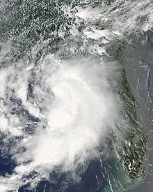
Hurricane Flora[]
| Category 4 hurricane (SSHWS) | |
  | |
| Duration | July 23 – July 29 |
|---|---|
| Peak intensity | 145 mph (230 km/h) (1-min) 943 mbar (hPa) |
Developed in the Central Caribbean and struck Haiti and eastern Cuba as a tropical storm. Over the Bahamas, Flora quickly intensified over favorable conditions and it struck near Miami at close to peak intensity, causing widespread devastation. Gradually weakening over Florida, the system emerged into the far northeastern Gulf of Mexico before making landfall on the Florida Panhandle. It degenerated over Alabama and its remnants affected places up to the Ohio Valley. In total, Flora caused $45 billion in damage mainly due to its Miami strike, and 80 deaths throughout its path. The name was later "re-retired" due to it being on the secondary list, and it was replaced by Florence for use in 2202.
Hurricane Gilbert[]
| Category 1 hurricane (SSHWS) | |
  | |
| Duration | July 24 – July 28 |
|---|---|
| Peak intensity | 85 mph (140 km/h) (1-min) 981 mbar (hPa) |
Developed in the Bay of Campeche and moved towards the Texas-Mexico border, making landfall just south of there. Gilbert caused $458 million in damage and 7 deaths.
Tropical Storm Hattie[]
| Tropical storm (SSHWS) | |
  | |
| Duration | July 26 – July 29 |
|---|---|
| Peak intensity | 65 mph (100 km/h) (1-min) 994 mbar (hPa) |
Stayed out to sea in the northern Atlantic 600–1000 miles southeast of Newfoundland and between Bermuda and the Azores.
Hurricane Igor[]
| Category 5 hurricane (SSHWS) | |
  | |
| Duration | July 28 – August 12 |
|---|---|
| Peak intensity | 175 mph (280 km/h) (1-min) 914 mbar (hPa) |
Igor was a Cape Verde-type hurricane that caused devastation in Bermuda and New England. It first developed near Cape Verde, gradually strengthening to a C2 as it moved into the Central Atlantic. A region of dry air weakened it to a C1 but it regained intensity afterwards. Igor peaked in intensity southeast of Bermuda and it skirted the island as a weakening C4, causing widespread destruction. It continued to gradually weaken but grew in size, and it reached New England as a large, low-pressure C1 system with an increasingly extratropical look (much like Sandy in 2012 but not as extreme). It weakened to TS intensity and turned extratropical shortly after landfall. In total, Igor caused $38 billion in damage and 59 deaths, resulting in the "re-retirement" of the name. Its replacement for 2202 is Ike.
Supercane Joan[]
| Category 7 hurricane | |
  | |
| Duration | July 29 – August 10 |
|---|---|
| Peak intensity | 290 mph (465 km/h) (1-min) 812 mbar (hPa) |
Developed in the central Atlantic, and immediately, it rapidly intensified into a major hurricane. It was weakened to a C2 by wind shear over the Windwards, and it crossed the islands at that intensity. In the Caribbean, the system encountered more favorable conditions which resulted in gradual intensification in the central Caribbean and then as it reached the western part of the Caribbean, it rapidly intensified to supercane status. Its peak intensity as a C7 was reached as it put Central America in danger. This monstrous cyclone moved slowly and made landfall as a C6, causing catastrophic devastation throughout. The mountains of Central America rapidly weakened it and it degenerated over Honduras. In total, the system caused catastrophic devastation amounting to $65 billion in damage and 5,450 deaths, making it one of the deadliest in the last century due to the extreme flooding, mudslides, etc. that Central America is susceptible to. Due to improved technology, had it occurred in the early 21st century, the death toll would have been much higher. The name was re-retired and replaced by Jeanne for use in 2202.
Subtropical Storm Klaus[]
| Subtropical storm (SSHWS) | |
 | |
| Duration | August 2 – August 4 |
|---|---|
| Peak intensity | 45 mph (75 km/h) (1-min) 998 mbar (hPa) |
A very unusual subtropical storm that was one of the north-easternmost tropical or subtropical storms on record. It existed near 50°N and at peak intensity, was closer to Ireland than the Azores.
Hurricane Lili[]
| Category 1 hurricane (SSHWS) | |
  | |
| Duration | August 3 – August 7 |
|---|---|
| Peak intensity | 80 mph (130 km/h) (1-min) 986 mbar (hPa) |
Developed in the eastern Gulf of Mexico and intensified to a hurricane as it tracked towards Florida. It made landfall near Crystal River, Florida as a minimal hurricane. Briefly, it moved over ocean again before making landfall in South Carolina as a tropical storm. Throughout its path, Lili was responsible for $260 million in damage and 9 deaths.
Hurricane Matthew[]
| Category 3 hurricane (SSHWS) | |
  | |
| Duration | August 5 – August 12 |
|---|---|
| Peak intensity | 125 mph (205 km/h) (1-min) 958 mbar (hPa) |
Matthew first developed near Puerto Rico before moving into Hispaniola, where land interaction weakened it back to a tropical depression. It curved more northward and passed through easternmost Cuba as a tropical storm. After leaving Cuba, it quickly intensified to a major hurricane over warm Bahamas waters. The Bahamas received plenty of devastation from Matthew as it passed through and reached peak intensity. Florida was now in danger again after already receiving devastation from Flora. Like Flora, Matthew made landfall near Miami as a major hurricane. Land interaction weakened it to a tropical storm as it emerged into the Gulf of Mexico, where favorable conditions reintensified Matthew to a hurricane. It then made landfall near Fort Walton Beach on the Panhandle. Over land, Matthew met its final fate over central Alabama and scattered showers continued as the remnants moved northward. Throughout its lifespan, Matthew was responsible for $32 billion in damage and 64 deaths, resulting in the name's re-retirement. Its replacement for 2202 is Mitch.
Hurricane Nadine[]
| Category 2 hurricane (SSHWS) | |
  | |
| Duration | August 7 – August 18 |
|---|---|
| Peak intensity | 105 mph (165 km/h) (1-min) 972 mbar (hPa) |
Nadine developed from a Cape-Verde tropical wave and intensified over the central Atlantic, reaching peak intensity before it weakened in a wind-shear environment and a developing ridge forced it to perform a loop. Once finished with the loop, it reintensified to a hurricane as it approached the Azores. Nadine gained extratropical characteristics and was declared post-tropical while still producing hurricane-force winds. It struck the Azores very soon afterward. The extratropical remnant of Nadine eventually reached Britain bringing significant impacts. Throughout its life, Nadine caused $20 million in damage and 2 deaths, mainly due to post-tropical impacts.
Hurricane Omar[]
| Category 3 hurricane (SSHWS) | |
  | |
| Duration | August 11 – August 17 |
|---|---|
| Peak intensity | 120 mph (195 km/h) (1-min) 961 mbar (hPa) |
Omar developed over the central Atlantic and intensified as it approached the Windward Islands, passing through the islands while becoming a Category 2. It reached major hurricane intensity with Puerto Rico and Hispaniola being threatened. Omar skirted by Puerto Rico at peak intensity, causing widespread destruction on the island. It made landfall in Hispaniola soon afterward, still as a major hurricane, but the mountainous terrain of Hispaniola weakened the storm rapidly. It traversed the whole island and came out only as a tropical depression. A brief period back over water allowed reintensification to a tropical storm, but Cuba halted this trend. It degenerated soon after Cuban landfall. Omar caused $690 million in damage and 126 deaths throughout its path. Despite the totals, the name was not "re-retired."
Hurricane Paloma[]
| Category 1 hurricane (SSHWS) | |
  | |
| Duration | August 12 – August 19 |
|---|---|
| Peak intensity | 80 mph (130 km/h) (1-min) 988 mbar (hPa) |
A tropical wave developed into Paloma over the western Caribbean. Soon after formation, it made landfall in the Yucatan as a weak tropical storm. Land interaction caused it to degenerate to a remnant low. However, the environment in the Bay of Campeche was favorable for redevelopment, as a result it redeveloped there. Over the Bay of Campeche, the system quickly intensified and reached hurricane intensity before making landfall just southeast of Veracruz. Mexico's mountainous terrain caused quick dissipation. Throughout its path, Paloma caused $140 million in damage and 12 deaths mainly due to flooding and mudslides in Mexico.
Tropical Depression Forty-Seven[]
| Tropical depression (SSHWS) | |
  | |
| Duration | August 13 – August 14 |
|---|---|
| Peak intensity | 35 mph (55 km/h) (1-min) 1003 mbar (hPa) |
Developed just east of Omar. Due to Omar's shear, the depression failed to intensify as it impacted the Lesser Antilles. Later, the system degenerated and was absorbed into Omar.
Tropical Storm Quincy[]
| Tropical storm (SSHWS) | |
  | |
| Duration | August 16 – August 19 |
|---|---|
| Peak intensity | 60 mph (95 km/h) (1-min) 996 mbar (hPa) |
Quincy developed in the waters east of New England and strengthened as it headed towards Nova Scotia, eventually making landfall there. The system only caused minimal damage.
Hurricane Roxanne[]
| Category 3 hurricane (SSHWS) | |
  | |
| Duration | August 19 – September 2 |
|---|---|
| Peak intensity | 125 mph (205 km/h) (1-min) 959 mbar (hPa) |
Developed from a tropical wave that recently moved off of Africa and skirted the southern Cape Verde islands as a tropical storm, bringing impacts there. As it left, favorable conditions favored quick intensification to a major hurricane. Later on, a developing ridge along with increased wind shear weakened Roxanne to a tropical storm and it performed a loop. The weakened Roxanne reintensified to a hurricane as it moved westward, but after a northward turn, began its final demise. Roxanne caused minimal damage in the Cape Verdes.
Hurricane Stan[]
| Category 2 hurricane (SSHWS) | |
  | |
| Duration | August 20 – August 25 |
|---|---|
| Peak intensity | 105 mph (165 km/h) (1-min) 975 mbar (hPa) |
A disturbance in the southwestern Caribbean developed and intensified. As it moved westward towards Nicaragua, favorable conditions allowed it to become a hurricane and then a C2. Stan made landfall at that intensity before Central America's mountains caused quick weakening and its demise. A total of $60 million in damage and 34 deaths was caused by Stan, mainly due to flooding and mudslides.
Hurricane Tanya[]
| Category 2 hurricane (SSHWS) | |
  | |
| Duration | August 21 – August 26 |
|---|---|
| Peak intensity | 105 mph (165 km/h) (1-min) 978 mbar (hPa) |
Formed near Bermuda and moved northward into favorable conditions. It intensified to Category 2 strength before making landfall in Nova Scotia as a C1, and turning extratropical over the region. Tanya caused $43 million in damage and killed 3 people due to widespread rain and flooding over Atlantic Canada.
Hurricane Ulric[]
| Category 5 hurricane (SSHWS) | |
  | |
| Duration | August 22 – September 1 |
|---|---|
| Peak intensity | 175 mph (280 km/h) (1-min) 915 mbar (hPa) |
Developed over the western Caribbean, gaining tropical depression characteristics near Cuba. It quickly strengthened to a tropical storm and moved northward, making landfall on the westernmost tip of Cuba. Highly favorable conditions in the Gulf of Mexico promoted rapid strengthening, and it peaked as a powerful C5 before making landfall in the Florida Panhandle. It quickly weakened over land and degenerated, but its remnants reorganized over the Atlantic south of the Carolinas. It rapidly regained tropical storm-force winds and developed a closed circulation, causing its immediate redevelopment into a tropical storm. The system moved towards the northeast relatively quickly before degenerating south of Nova Scotia, with its extratropical remnants affecting Newfoundland. Ulric wrought extensive devastation with $41 billion in damage and 95 deaths throughout its path, prompting the retirement of the name. It was replaced in 2202 with Ulfred.
Hurricane Virginie[]
| Category 4 hurricane (SSHWS) | |
  | |
| Duration | August 21 – August 27 |
|---|---|
| Peak intensity | 145 mph (230 km/h) (1-min) 939 mbar (hPa) |
A well-developed tropical wave and low-pressure center emerged over the Bay of Campeche, where favorable conditions resulted in its development into the next named storm of the season on August 21. Rapid intensification ensued, with Virginie becoming a major hurricane and then C4 as it approached the northeastern Mexican coastline. After making landfall as a borderline C3/C4, the hills in the region caused its rapid weakening, and it dissipated on August 27. In total, Virginie caused $119 million in damage and 27 deaths.
Supercane William[]
| Category 7 hurricane | |
  | |
| Duration | August 23 – September 10 |
|---|---|
| Peak intensity | 275 mph (445 km/h) (1-min) 827 mbar (hPa) |
It all started when a tropical wave developed into a tropical storm in the central Atlantic, and it quickly intensified under favorable conditions to a major hurricane as it reached the Windwards. Dry air slowed strengthening, but it eventually became a C5 as it closed in on Hispaniola, where it made landfall. The island's mountains caused rapid weakening to a C2, but very favorable conditions caused strengthening to start up again. It affected the Bahamas as a strengthening major hurricane, and soon became a supercane as it began to leave the islands. William eventually reached Category 7 strength and parked itself off the east coast of the U.S., where mass panic ensued due to the powerful monster's uncertain forecast. After performing a loop, it changed course to head straight towards South Carolina. Almost explosive weakening occurred before landfall due to an eyewall replacement cycle and wind shear, but William still made landfall as a Category 5. Continued rapid weakening occurred over land, and it degenerated as it began to follow the east coast. The extratropical system brought widespread impacts to New England and Atlantic Canada. Overall, William was responsible for $105 billion in damage and 137 deaths. The name was later re-retired, and replaced in 2202 by Wilfred (originally retired in 2074).
Subtropical Depression Fifty-Five[]
| Subtropical depression (SSHWS) | |
  | |
| Duration | August 25 – August 26 |
|---|---|
| Peak intensity | 35 mph (55 km/h) (1-min) 1005 mbar (hPa) |
An unusually northeast subtropical depression that stayed mainly out to sea, slightly affecting Madeira.
Tropical Storm Xuxa[]
| Tropical storm (SSHWS) | |
  | |
| Duration | August 27 – August 31 |
|---|---|
| Peak intensity | 50 mph (85 km/h) (1-min) 998 mbar (hPa) |
Developed from a low-latitude tropical wave, later impacting Trinidad & Tobago and Venezuela. Proximity to William inhibited much of its strengthening. Xuxa caused minimal damage and 2 deaths from flash flooding.
Hurricane Yusef[]
| Category 3 hurricane (SSHWS) | |
  | |
| Duration | August 27 – September 2 |
|---|---|
| Peak intensity | 125 mph (205 km/h) (1-min) 957 mbar (hPa) |
Developed in the western Caribbean and quickly intensified to a hurricane before impacting the Yucatan Peninsula. Land interaction weakened it to a tropical depression as it skirted the northern coast of the Yucatan. It then moved on a southwest trajectory into the Bay of Campeche, where very favorable conditions allowed intensification to a C3. Then, Yusef made landfall in the Mexican state of Veracruz and dissipated over the mountainous terrain. Overall, Yusef was responsible for $480 million in damages with 13 deaths.
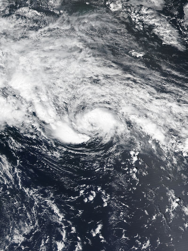
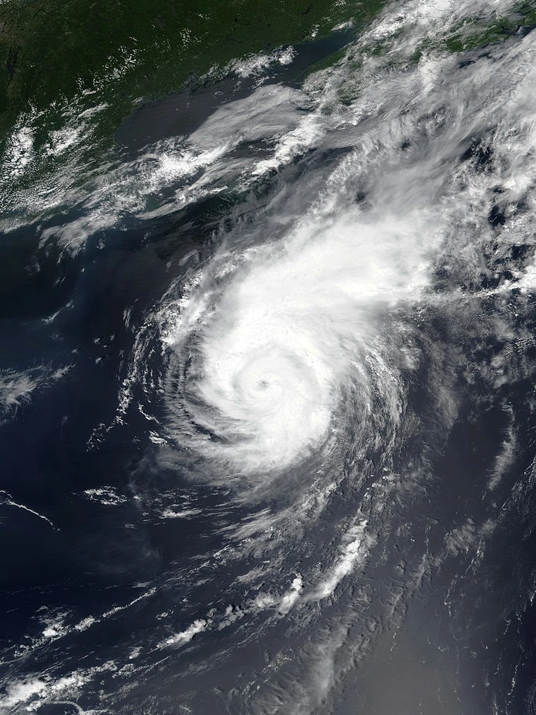
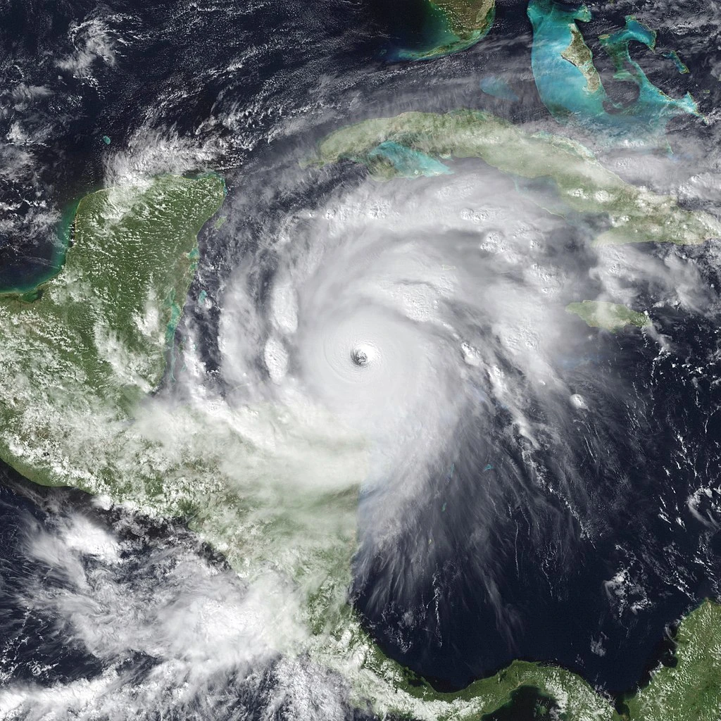
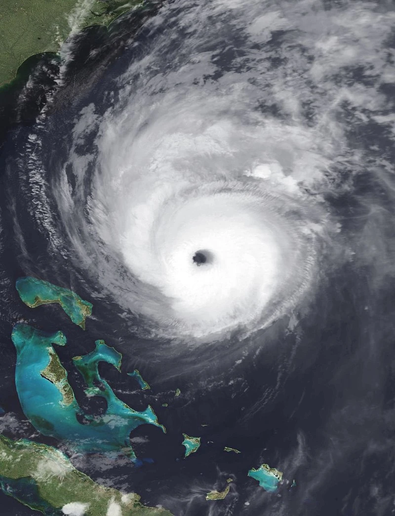
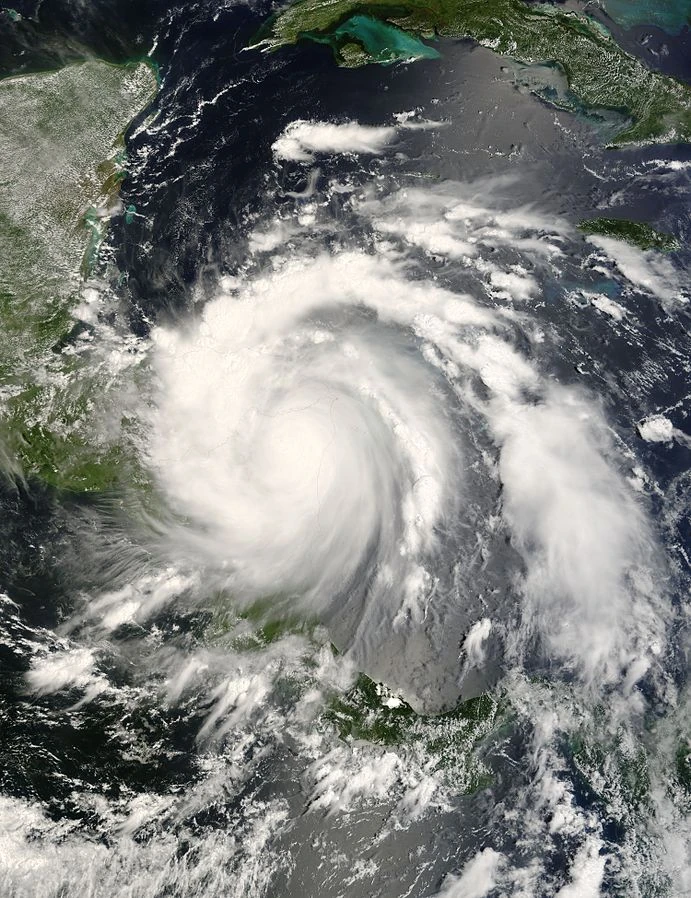
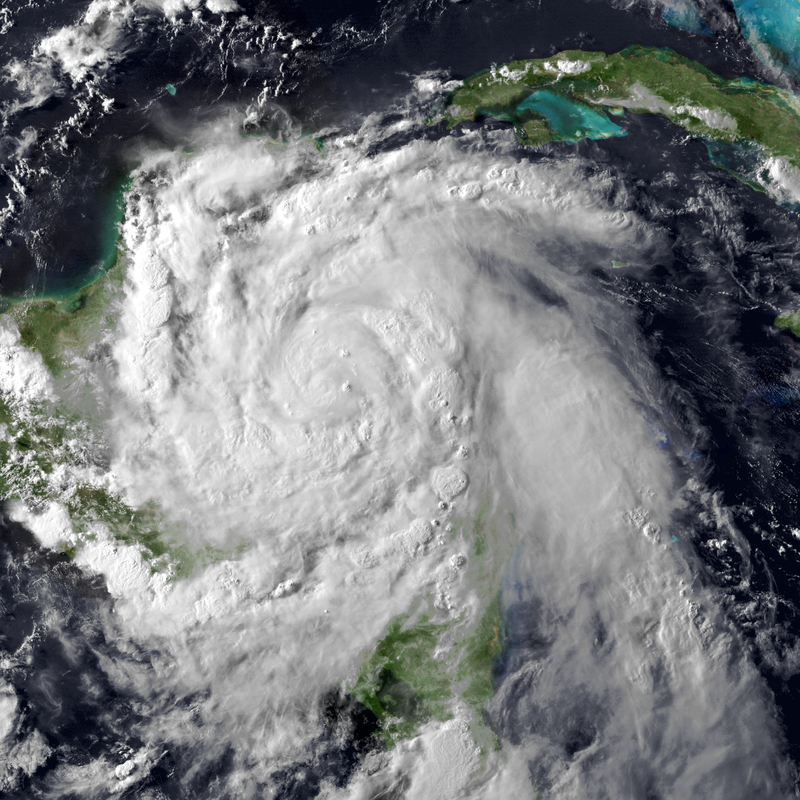
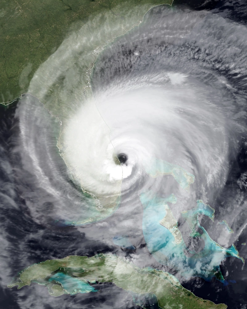
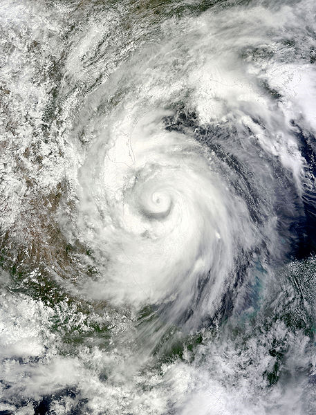
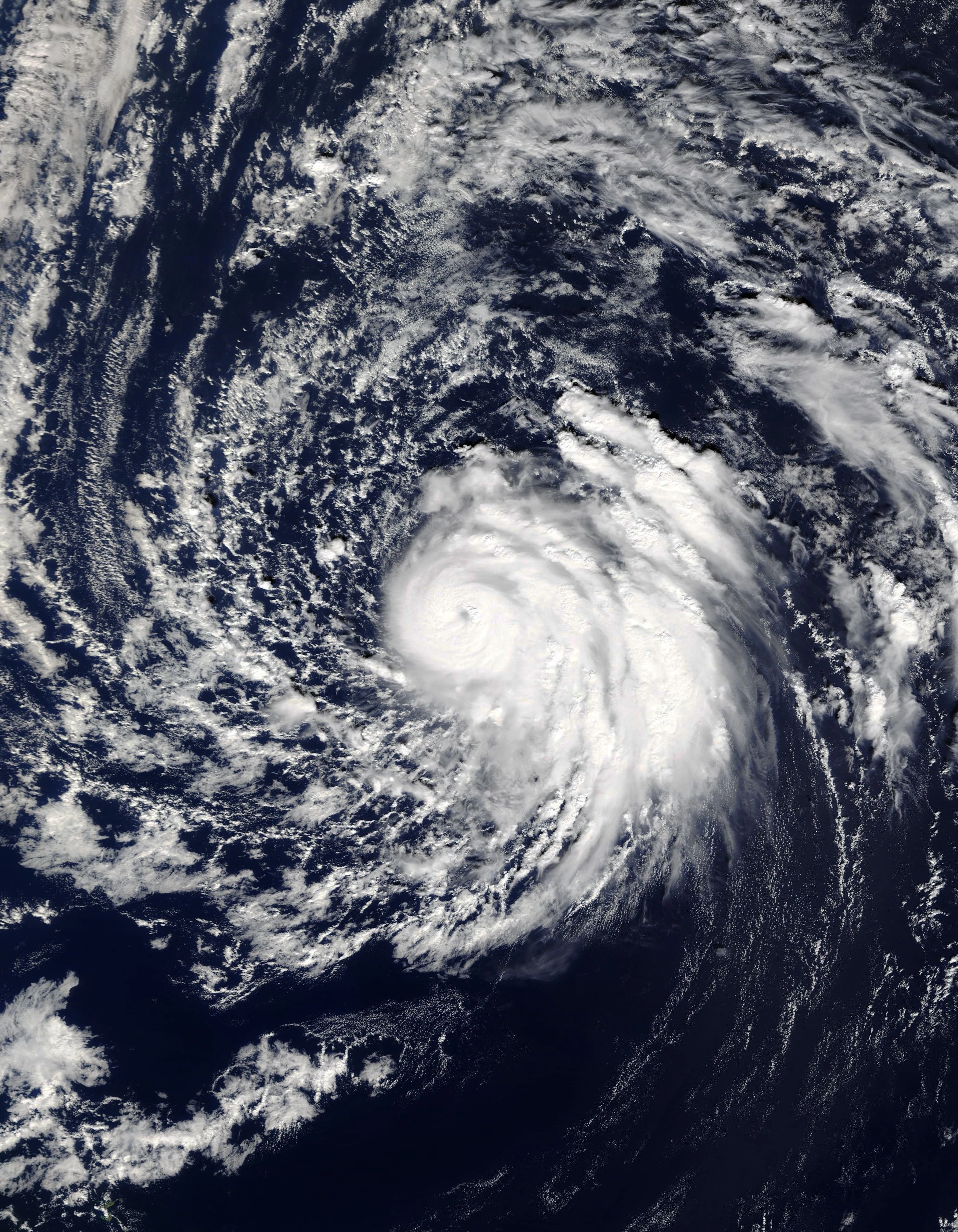
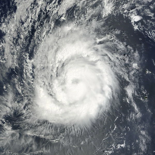
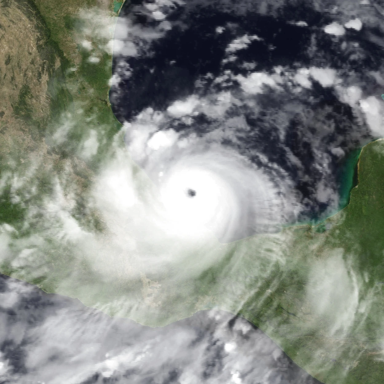
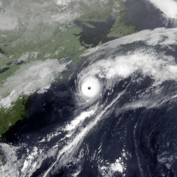
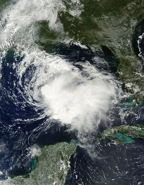
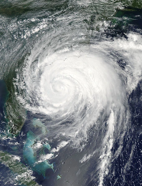
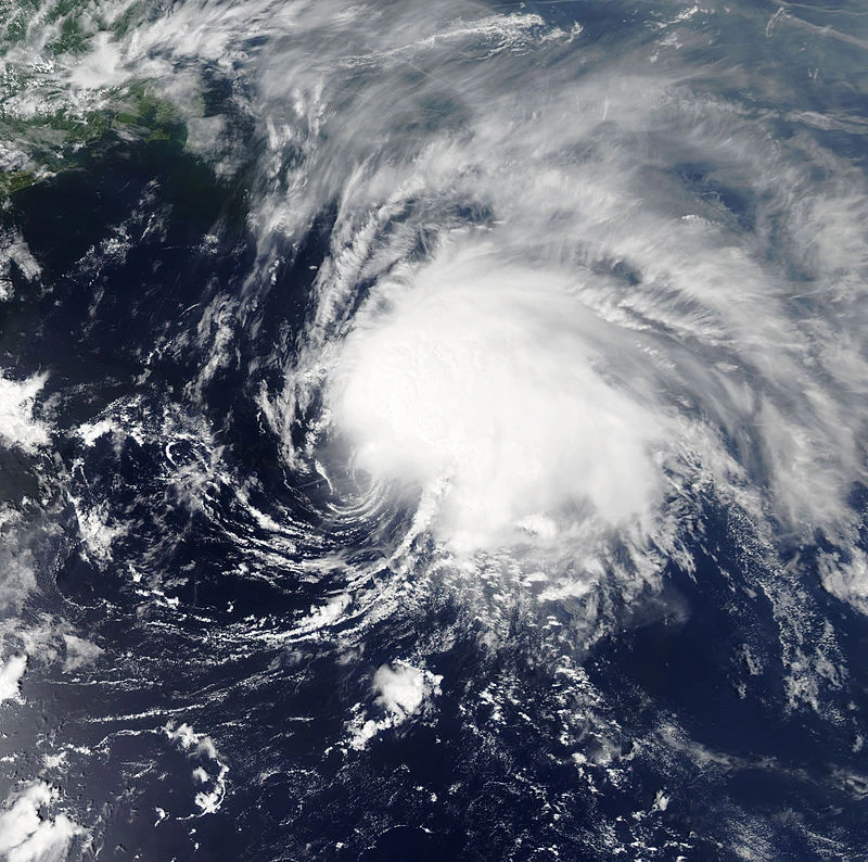
Supercane Zia[]
| Category 10 hurricane | |
  | |
| Duration | August 29 – September 19 |
|---|---|
| Peak intensity | 420 mph (675 km/h) (1-min) 682 mbar (hPa) |
Zia was a record-breaking storm. It holds the records for being both the most powerful tropical cyclone in world history, and for being the most devastating tropical cyclone ever recorded.
The soon-to-be infamous storm began as a tropical wave emerging off Africa, which quickly developed into a named storm and then a hurricane. Very favorable conditions promoted intensification as it trekked westward, and it first reached major hurricane status, and then C5 status while in the Central Atlantic. Zia would not stop there of course. It intensified into a C6 (supercane status), C7, and finally C8 as it closed in on the Lesser Antilles. It then struck full-force at that intensity, causing biblical devastation. Puerto Rico and Hispaniola took direct hits. Land interaction weakened it to a C6, but it would recover quickly as it entered the Bahamas where it reached a new category (C9). The Bahamas were basically submerged. Striking Florida at C9 intensity, the result was devastation that can only be described as absolutely cataclysmic. Miami and the keys were ruined beyond repair, and the whole area was abandoned in the aftermath. Zia entered the Gulf of Mexico afterward, where hot SSTs and almost no wind shear or dry air would continue promoting the storm. It intensified to C10 intensity, becoming the first storm in world history to reach that category (which entails winds of 400+ mph). Mass evacuations, possibly the biggest ever recorded, involved moving the whole population away from the Gulf Coast and towards more inland states away from the storm's track. Zia moved onshore Louisiana soon after that, completely erasing the whole delta off the map and permanently reshaping the coastline in drastic ways. The remains of New Orleans were completely submerged, permanently. The whole states of Louisiana and Mississippi were left in ruins and indefinitely abandoned until rebuilding efforts were in progress. Weakening ensued after landfall, but it wasn't until it was nearing the Great Lakes did it weaken enough to no longer be a significantly damaging storm. Midwest states in its path even far from the Gulf Coast were also absolutely devastated as a result. Zia entered the Great Lakes while still tropical, becoming one of very few tropical cyclones in recorded history to exist in the Great Lakes. The lakes fueled the system and it remained a tropical storm until it entered Canada, where it underwent extratropical transition at last.
Zia caused a record-breaking $8.5 trillion in damages and was also the deadliest storm in history, with an estimated 789,450 deaths recorded. These totals cement Zia as the most catastrophic tropical cyclone of all time. This storm will never be forgotten. As expected, it was retired, with its replacement for 2202 chosen to be Zora.
Tropical Storm Alpha[]
| Tropical storm (SSHWS) | |
  | |
| Duration | August 30 – September 2 |
|---|---|
| Peak intensity | 65 mph (100 km/h) (1-min) 994 mbar (hPa) |
Alpha developed southwest of the Azores. It intensified to a strong tropical storm as it passed close to the Azores, however, slight proximity to the dying Roxanne prevented it from strengthening further. It continued moving out to the northeast before turning extratropical, and Great Britain later took a beating from Alpha's remains. As a tropical system, Alpha did not cause any damage or deaths, however minimal damage was reported in Great Britain as a result of the extratropical system.
Hurricane Beta[]
| Category 4 hurricane (SSHWS) | |
  | |
| Duration | August 31 – September 9 |
|---|---|
| Peak intensity | 150 mph (240 km/h) (1-min) 936 mbar (hPa) |
Beta developed from a tropical wave in the central Atlantic, later intensifying as it approached Bermuda under favorable conditions. The system intensified to a hurricane and then a major hurricane as the island was put in danger of a direct hit. Soon after becoming a C4, Beta made landfall on the island, causing plenty of devastation there. Its peak intensity was reached soon afterward, with gradual weakening beginning as it approached Newfoundland. It made landfall there as a Category 1, before heading out in the far northern Atlantic and turning extratropical. In total Beta was responsible for $585 million in damage, mostly in Bermuda with some in Newfoundland, and 9 deaths (also mostly in Bermuda).
Hurricane Gamma[]
| Category 5 hurricane (SSHWS) | |
  | |
| Duration | September 1 – September 13 |
|---|---|
| Peak intensity | 165 mph (270 km/h) (1-min) 921 mbar (hPa) |
Gamma developed from an African tropical wave. Proximity to Zia limited strengthening for a bit, but it later became yet another major hurricane. It reached its peak of C5 over the open waters of the Central Atlantic, and gradually weakened afterwards, turning extratropical on September 13. It only caused minimal damage in the Cape Verde islands with no deaths.
Tropical Storm Delta[]
| Tropical storm (SSHWS) | |
  | |
| Duration | September 2 – September 4 |
|---|---|
| Peak intensity | 50 mph (85 km/h) (1-min) 999 mbar (hPa) |
A Gulf of Mexico disturbance developed into a tropical system in early September, after proximity to Yusef initially limited development. Delta moved generally NNW and made landfall near the Texas-Louisiana border, causing $14 million in damage and no deaths.
Hurricane Epsilon[]
| Category 1 hurricane (SSHWS) | |
  | |
| Duration | September 3 – September 7 |
|---|---|
| Peak intensity | 80 mph (130 km/h) (1-min) 985 mbar (hPa) |
Epsilon began as a subtropical system, transitioning to a fully tropical storm a day after forming. It strengthened to a hurricane, becoming one of the north-easternmost hurricanes ever recorded, and made landfall in Portugal before weakening to a tropical storm. It quickly dissipated over the hilly Iberian Peninsula. Due to the region's lack of preparedness, it caused extensive damage ($590 million) and 16 deaths.
Tropical Storm Zeta[]
| Tropical storm (SSHWS) | |
  | |
| Duration | September 5 – September 7 |
|---|---|
| Peak intensity | 45 mph (75 km/h) (1-min) 1000 mbar (hPa) |
The remnants of an Eastern Pacific system crossed into the Bay of Campeche, where favorable conditions promoted its development. It became Tropical Storm Zeta on September 5, and peaked as a weak-moderate tropical storm before making landfall near Tampico and dissipating over the hilly terrain of Mexico. Zeta caused an estimated $23 million in damage, and killed 1 person.
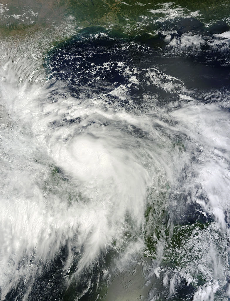
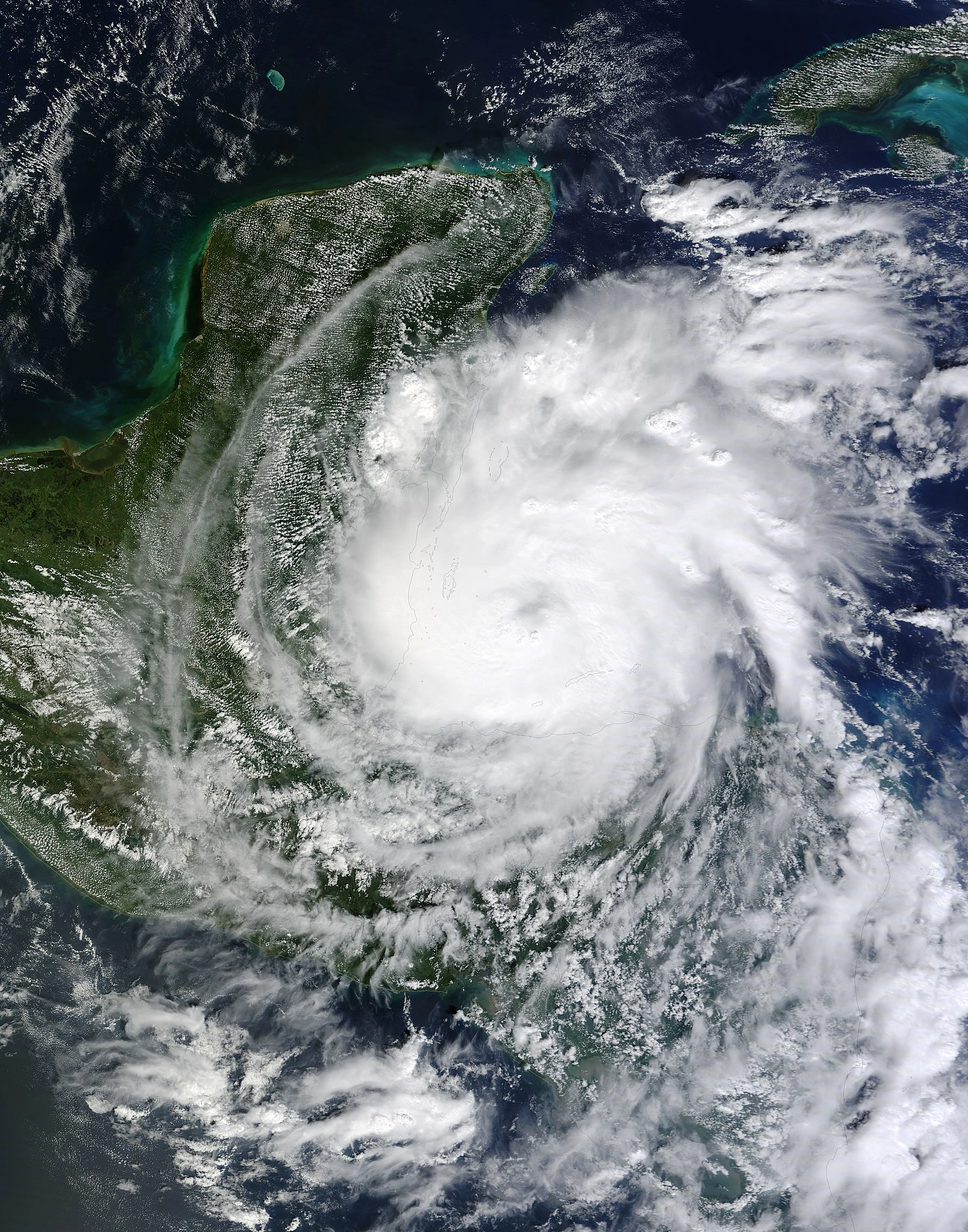
Supercane Eta[]
| Category 8 hurricane | |
  | |
| Duration | September 5 – September 19 |
|---|---|
| Peak intensity | 315 mph (510 km/h) (1-min) 791 mbar (hPa) |
Formed from a low-latitude tropical wave in the Caribbean. Exceptionally favorable conditions fueled explosive strengthening as it moved gradually into higher latitudes in the Caribbean. It then became the season's next supercane, and eventually reached C8 intensity as it closed in on the Yucatan Peninsula. Eta made landfall at that intensity, causing catastrophic devastation. Land interaction weakened it to a C6 as it began to interact with Zia. The interaction pushed Eta on a more westward trajectory. The occurrence of both supercanes at the same time in the Gulf of Mexico was described as looking like "the apocalypse" on satellite. Despite proximity to the even more powerful Zia, it reintensified to a C8 as it approached Tampico. Eta made landfall there, again at C8 intensity, causing further cataclysmic devastation. Explosive weakening and dissipation occurred over the mountainous terrain of Mexico. In total, Eta caused $610 billion in damages and 36,782 deaths mainly around Tampico and in the Yucatan Peninsula. This was perhaps the costliest storm in Mexican history. Due to the devastation, the NHC removed the name "Eta" from the Greek alphabet naming list for 100 years, and the name will return in 2300.
Hurricane Theta[]
| Category 1 hurricane (SSHWS) | |
  | |
| Duration | September 6 – September 10 |
|---|---|
| Peak intensity | 80 mph (130 km/h) (1-min) 986 mbar (hPa) |
A disturbance moved into the Gulf of Mexico and organized, becoming a Tropical Storm and named "Theta". While favorable enough conditions allowed intensification to hurricane status, proximity to William (which was nearing landfall in the Carolinas at the time of the storm's existence) limited further strengthening before it made landfall in Florida. Theta quickly weakened over land, dissipated, and its remnants were absorbed into William's extratropical remnants. In total Theta caused $580 million in damage and 7 deaths.
Tropical Depression Sixty-Seven[]
| Tropical depression (SSHWS) | |
  | |
| Duration | September 6 – September 7 |
|---|---|
| Peak intensity | 35 mph (55 km/h) (1-min) 1006 mbar (hPa) |
A tropical wave behind Zia gradually developed in early September despite proximity to the intensifying system. Contrary to most forecasts, it became a tropical depression, but further strengthening was halted due to its extreme proximity. Once Zia intensified further, TD 67 was dragged into the hurricane and absorbed within its outer rainbands. The Atlantic has become so active that little room remained for new systems to develop, causing two more of the next three systems (see below) to suffer the same fate.
Tropical Depression Sixty-Eight[]
| Tropical depression (SSHWS) | |
  | |
| Duration | September 7 – September 8 |
|---|---|
| Peak intensity | 35 mph (55 km/h) (1-min) 1004 mbar (hPa) |
A low-pressure area southeast of William was monitored before it became a depression on September 7. The system moved northwestward, pulled towards William and unable to strengthen, and was absorbed into the storm just as it was about to make landfall.
Hurricane Iota[]
| Category 5 hurricane (SSHWS) | |
  | |
| Duration | September 8 – September 21 |
|---|---|
| Peak intensity | 175 mph (280 km/h) (1-min) 911 mbar (hPa) |
A tropical wave developed into the next tropical storm of the season and it impacted Cape Verde. Favorable conditions promoted the gradual intensification to a C5 hurricane while out in the open Atlantic. After peaking at 175 mph/911 mbars, it gradually weakened as it wandered for days in the central Atlantic and then began to move rapidly northeastward. It was at that time it transitioned to an extratropical storm, which later brought minor impacts to the British Isles. In total Iota was responsible for $9 million in damage and 1 death in the Cape Verde Islands.
Tropical Storm Kappa[]
| Tropical storm (SSHWS) | |
  | |
| Duration | September 9 – September 11 |
|---|---|
| Peak intensity | 50 mph (85 km/h) (1-min) 998 mbar (hPa) |
Kappa formed in the Caribbean from a tropical wave ahead of Zia. It moved towards Cuba but could not get very strong due to shear from the approaching Zia. Soon after, it was absorbed into Zia's rainbands as it passed through the area. Kappa overall caused minimal damage and 2 deaths.
Tropical Storm Lambda[]
| Tropical storm (SSHWS) | |
  | |
| Duration | September 11 – September 15 |
|---|---|
| Peak intensity | 45 mph (75 km/h) (1-min) 1000 mbar (hPa) |
A tropical wave developed into Lambda near the Lesser Antilles. It struggled to intensify due to it moving directly over cool upwelled water from Supercane Zia. The result was a weak tropical storm that only brought minor impacts to Zia devastation zones before dissipating over the mountains of Hispaniola. In total, Lambda barely compounded the impacts from Zia: $44 million in damage and 3 deaths.
Hurricane Mu[]
| Category 3 hurricane (SSHWS) | |
  | |
| Duration | September 14 – September 21 |
|---|---|
| Peak intensity | 120 mph (195 km/h) (1-min) 963 mbar (hPa) |
Developed south of Bermuda and passed near the island as a tropical storm. It then intensified to a major hurricane as it tracked NNE towards Atlantic Canada. It struck Nova Scotia as a weakening Category 1 and Newfoundland as a tropical storm, becoming extratropical over western Newfoundland. In total, Mu caused $83 million in damage and killed 2 people.
Tropical Storm Nu[]
| Tropical storm (SSHWS) | |
  | |
| Duration | September 15 – September 18 |
|---|---|
| Peak intensity | 60 mph (95 km/h) (1-min) 997 mbar (hPa) |
A non-tropical disturbance became subtropical on September 15, becoming tropical shortly after far to the northeast of Bermuda. It intensified to 60 mph before cooling waters and shear caused its demise east of Newfoundland. Its remnants interacted with Iota and were eventually absorbed. Nu did not affect land, and thus did not cause any damage or deaths.
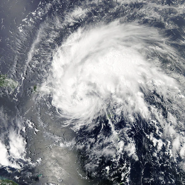
Supercane Xi[]
| Category 7 hurricane | |
  | |
| Duration | September 17 – October 3 |
|---|---|
| Peak intensity | 270 mph (435 km/h) (1-min) 831 mbar (hPa) |
As yet another devastating supercane, it caused catastrophic impacts to a country still reeling from the strikes of Zia, William, and many others. At this point, massive amounts of international humanitarian aid from all around the world was not enough to console the panicked, devastated, catastrophe-weary populace of the United States, particularly those along the Gulf and East Coasts.
Xi formed almost immediately after its tropical wave emerged off Africa. Gradual strengthening occurred and it initially peaked as a Category 2 before upwelled waters from Iota and Zia caused its weakening to a Category 1. Then it moved into warmer waters and recovered, quickly intensifying to a Category 5 and later became the season's next supercane. Xi continued intensifying north of the Greater Antilles, becoming a dangerous Category 7. An eye-wall replacement cycle made it stall in intensity as it approached the United States. With the Carolinas right in the center of the forecast cone, yet another mass evacuation occurred to move vast amounts of people to inland states. The cyclone weakened to a Category 6 before making landfall, sending massive storm surges that basically obliterated what remained of the Outer Banks (already mostly submerged from climate change-caused sea level rise). It quickly weakened as it moved up the East Coast towards New England, and turned extratropical approximately over Massachusetts. The extratropical system significantly affected Atlantic Canada. In total, Xi caused $267 billion in damage and 1,106 deaths. As a result, the name "Xi" was removed from the Greek Alphabet list for 100 years and will return in 2300.
Hurricane Omicron[]
| Category 2 hurricane (SSHWS) | |
  | |
| Duration | September 20 – September 28 |
|---|---|
| Peak intensity | 105 mph (165 km/h) (1-min) 976 mbar (hPa) |
Yet another Caribbean disturbance developed and organized, becoming Tropical Storm Omicron. Although the atmosphere was very favorable, strengthening was somewhat limited from cooler upwelled waters by previous systems, especially Eta and Joan. It quickly intensified to a Category 2 before making a brief landfall near the Nicaragua-Honduras border. Land interaction weakened it to a C1, but it then recovered and reached peak intensity before striking the Yucatan Peninsula. Over the peninsula, Omicron weakened significantly, emerging over the Bay of Campeche as a barely alive and disorganized tropical depression. Once it emerged, favorable conditions immediately propelled it back to TS status, but strengthening was slowed due to Eta's cool upwelled waters. However, it did become a hurricane once again before making landfall near Tampico, Mexico. The mountainous terrain of Mexico caused quick dissipation. Overall, Omicron caused $125 million in damage and 48 deaths.
Tropical Storm Pi[]
| Tropical storm (SSHWS) | |
  | |
| Duration | September 23 – September 25 |
|---|---|
| Peak intensity | 50 mph (85 km/h) (1-min) 999 mbar (hPa) |
Pi developed near the Bahamas and tracked towards the southeastern U.S. It peaked as a moderate tropical storm before making landfall on the Atlantic coast of Georgia. Pi caused $25 million in damages and killed no one.
Hurricane Rho[]
| Category 3 hurricane (SSHWS) | |
  | |
| Duration | September 24 – October 2 |
|---|---|
| Peak intensity | 120 mph (195 km/h) (1-min) 961 mbar (hPa) |
A disturbance in the central Atlantic became a tropical storm, being assigned the name "Rho". It moved NNE and then east. Favorable conditions allowed it to intensify to a major hurricane. Afterwards, a gradual weakening trend commenced as it approached the Azores. It passed to the west of the islands as a tropical storm and turned extratropical. Rho stayed out to sea throughout its path.
Hurricane Sigma[]
| Category 4 hurricane (SSHWS) | |
  | |
| Duration | September 26 – October 4 |
|---|---|
| Peak intensity | 140 mph (220 km/h) (1-min) 948 mbar (hPa) |
A tropical wave quickly gathered organization in the western Caribbean, and it developed into a tropical storm and was assigned the name "Sigma". The system rapidly intensified under very favorable atmospheric conditions, although upwelled waters from previous systems prevented explosive doomsday intensification. Once a major hurricane, it turned WSW on track towards Central America. Its peak of C4 was reached before making landfall in Honduras as a borderline C3/C4. The hilly terrain caused its quick degeneration, but its remnants survived to the EPac where they gathered organization yet again. South of Mexico, it reformed and became a hurricane once again before making landfall in Baja California. The system dissipated for good over the peninsula but its remnants fueled showers and thunderstorms throughout Southern California. Throughout its path, Sigma caused $8 billion in damage and 742 deaths due to widespread flooding and mudslides throughout Central America. The name Sigma was later removed from the Greek list for 25 years and will return in 2225.
Hurricane Tau[]
| Category 2 hurricane (SSHWS) | |
  | |
| Duration | September 27 – October 1 |
|---|---|
| Peak intensity | 105 mph (165 km/h) (1-min) 972 mbar (hPa) |
A non-tropical system between the Azores and Canary Islands became a subtropical storm, receiving the name "Tau" as it moved WNW. Tau became fully tropical soon after that. Quickly, it intensified to a hurricane and then a C2 as it approached the Azores. Those islands were struck at near peak intensity. Afterwards, Tau raced at a high speed towards Europe, becoming extratropical while still packing hurricane-force winds. The extratropical system brought a significant windstorm to the region. In total, Tau caused $95 million in damage and killed 3 people.
Tropical Storm Upsilon[]
| Tropical storm (SSHWS) | |
  | |
| Duration | September 30 – October 3 |
|---|---|
| Peak intensity | 50 mph (85 km/h) (1-min) 998 mbar (hPa) |
A tropical wave and associated disturbance organized near the Yucatan Peninsula, becoming a tropical storm receiving the name "Upsilon". The storm intensified only slightly because the Gulf of Mexico is now too cool to support any significant intensification due to the upwelled waters from previous supercanes, namely Zia, Eta, and Yuri. It made landfall in Zia and Yuri-devastated Louisiana and Mississippi, dying out soon after landfall. Upsilon did not help recovery efforts, and it caused $48 million in damage and 1 death.
Hurricane Phi[]
| Category 1 hurricane (SSHWS) | |
  | |
| Duration | October 3 – October 7 |
|---|---|
| Peak intensity | 80 mph (130 km/h) (1-min) 986 mbar (hPa) |
Developed north of Bermuda from a low pressure area. It strengthened to a hurricane as it moved northward and made landfall in Nova Scotia as it weakened to a TS. It became extratropical as it entered Newfoundland. In total, Phi caused $47 million in damage and 1 death.
Hurricane Chi[]
| Category 3 hurricane (SSHWS) | |
  | |
| Duration | October 4 – October 14 |
|---|---|
| Peak intensity | 125 mph (205 km/h) (1-min) 958 mbar (hPa) |
An African tropical wave moved out to sea, becoming Tropical Storm Chi and impacting the Cape Verde Islands. After leaving the islands, Chi became a hurricane and rapidly intensified to a major, peaking as a strong C3. Slow weakening began as it curved north and then northeastward, going down to a tropical storm, but it later reintensified to a hurricane due to favorable conditions near the Canary Islands, an unusual place. Chi weakened again to a TS as it skirted Morocco's coastline and then made landfall in Spain, becoming an extratropical windstorm over land. Chi caused, in total, $95 million in damage and 7 deaths throughout its path.
Hurricane Psi[]
| Category 5 hurricane (SSHWS) | |
  | |
| Duration | October 6 – October 15 |
|---|---|
| Peak intensity | 180 mph (285 km/h) (1-min) 901 mbar (hPa) |
Developed in the western Caribbean from a tropical wave, where favorable conditions promoted rapid intensification. After a few days of intensification, it became a C5 north of Honduras threatening the Yucatan. Psi peaked as a powerful 180 mph storm before making landfall on the Yucatan Peninsula. The system weakened all the way down to a TD over land but survived to the Bay of Campeche, where it reintensified to a TS. It made landfall in mainland Mexico and quickly dissipated over the mountainous terrain. Psi was responsible for $2.3 billion in damage and 105 deaths. However, it was not removed from the Greek list.
Tropical Depression Eighty-Four[]
| Tropical depression (SSHWS) | |
  | |
| Duration | October 7 – October 8 |
|---|---|
| Peak intensity | 35 mph (55 km/h) (1-min) 1006 mbar (hPa) |
An area of disturbed weather over the Bahamas organized under favorable conditions, becoming a tropical depression before making landfall in Florida. Land interaction prevented any further intensification. This TD caused only minimal damage with no deaths (especially because the area was mainly abandoned following previous supercanes, namely Zia).
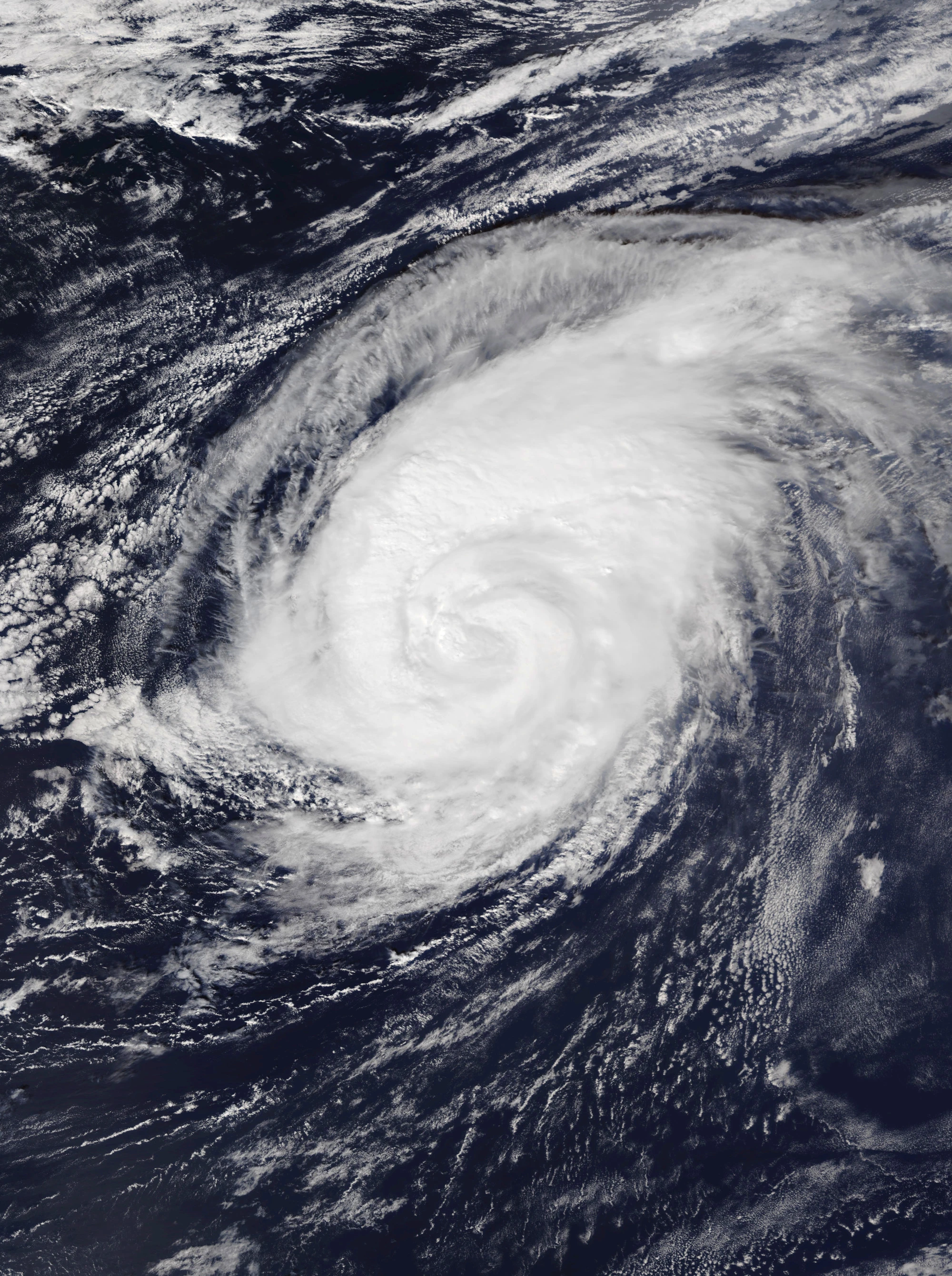
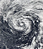
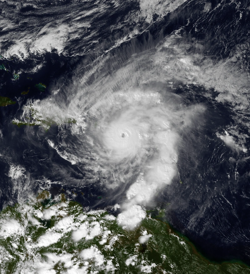
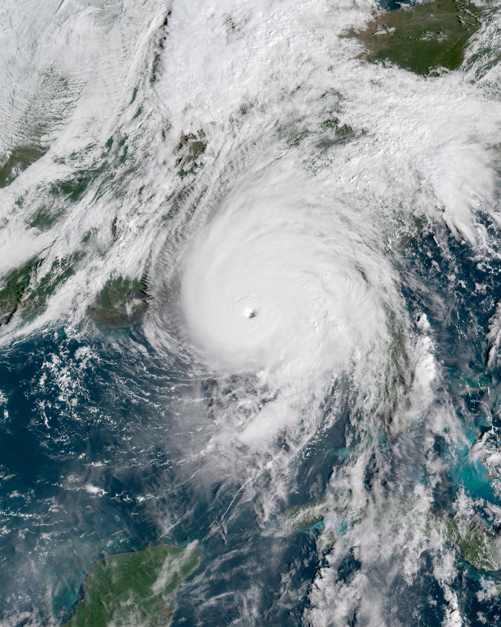
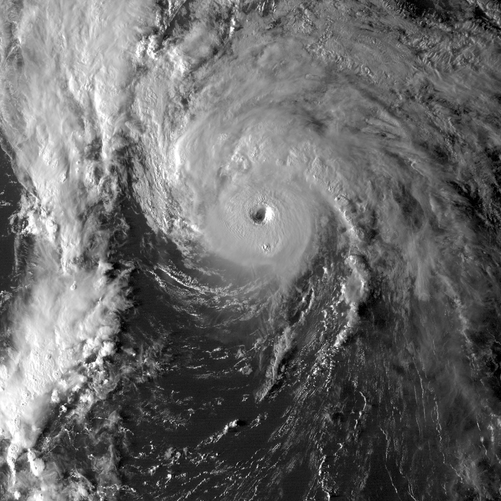
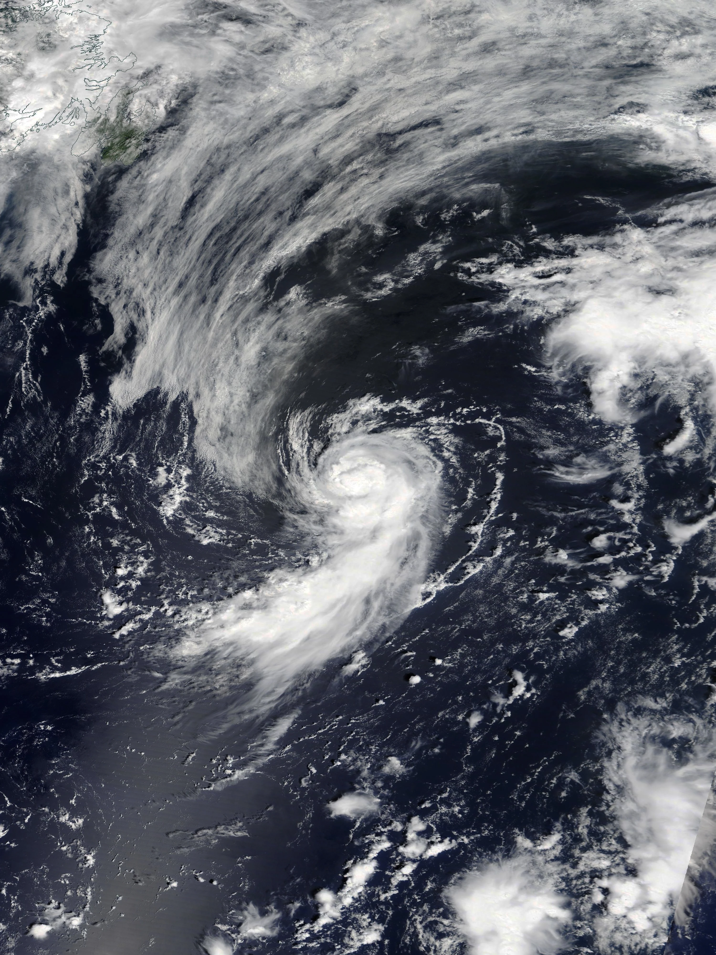
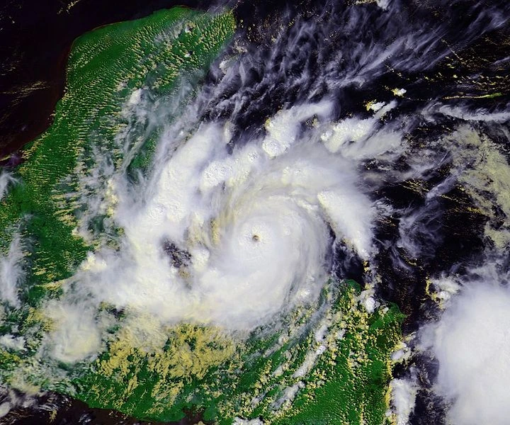
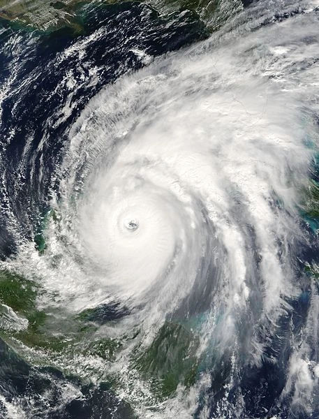
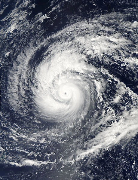
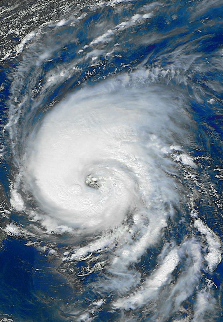
Supercane Omega[]
| Category 10 hurricane | |
  | |
| Duration | October 10 – November 3 |
|---|---|
| Peak intensity | 410 mph (655 km/h) (1-min) 698 mbar (hPa) |
The 2nd-most devastating tropical cyclone of all time, after Zia. Although it became a C10, it trails Zia in intensity as well, but this storm will never be forgotten.
It all began when a tropical wave emerged off Africa and developed into a tropical storm, which later intensified quickly to a major hurricane and then a C5 in the central Atlantic. It became a C6 supercane as it approached the Windwards and struck at that category, causing the first reports of catastrophic devastation. Moderate wind shear weakened it to a C5 in the eastern Caribbean, but it would recover and exceed its original peak when it parked itself south of Jamaica. The still very warm waters and virtually no wind shear and dry air caused extreme explosive intensification. After reintensifying to a supercane, it quickly became a C7 and then a C8. Then it reached C9 intensity, the third of the year to do so, as it turned northward towards Cuba. Omega struck, causing absolutely cataclysmic devastation throughout western Cuba. The Florida Straits, where it was headed next, provided perhaps the hottest waters remaining in the Atlantic. This fueled intensification to the much-coveted C10 intensity. It struck what remained of Miami at that intensity. The storm completely covered much of Florida with very high megatsunami-like storm surge and permanently reshaped the coastline, drowning much of the Florida peninsula forever. The catastrophic Florida devastation amounted in the trillions of dollars. The storm later moved up the eastern seaboard, gradually weakening along the way. The whole coastline up to New England was permanently reshaped, with New York City and other megacities along the coast suffering cataclysmic devastation. It wasn't until it entered Atlantic Canada that it weakened below 200 mph. The storm accelerated to the east while weakening gradually, later making it to the British Isles as a still-tropical hurricane, becoming one of very few systems to ever strike Great Britain with tropical characteristics. It finally turned extratropical over England/Scotland, but the hurricane-force windstorm brought large impacts to the area.
Omega caused a grand total of $5.8 trillion in damages and 127,634 deaths due to its landfalls at supercane intensity, making it the 2nd most devastating ever recorded. As expected, the name was removed from the Greek alphabet list for 100 years and will return in 2300.
Hurricane Alef[]
| Category 3 hurricane (SSHWS) | |
  | |
| Duration | October 12 – October 17 |
|---|---|
| Peak intensity | 120 mph (195 km/h) (1-min) 958 mbar (hPa) |
Developed in the Bahamas from a disturbance associated with a tropical wave. It moved northwestward and then north as it intensified to a major hurricane. It then made landfall in South Carolina and degenerated over land. Alef caused, in total, $3.9 billion in damage and 42 deaths. The name was removed for 25 years and will return in 2225. It was the first storm named using the Hebrew alphabet since 2100, and more incredibly, 2100 lacked a secondary naming list between the main list and the Greeks - as a result, the Hebrew alphabet was easier to reach back then.
Tropical Storm Bet[]
| Tropical storm (SSHWS) | |
  | |
| Duration | October 13 – October 15 |
|---|---|
| Peak intensity | 50 mph (85 km/h) (1-min) 999 mbar (hPa) |
Bet developed in the Gulf of Mexico, moved northward, but struggled to intensify due to cool upwelled waters from previous supercanes. It made landfall near Galveston, TX before dissipating over land. Bet caused $23 million in damage and no deaths.
Hurricane Gimel[]
| Category 5 hurricane (SSHWS) | |
  | |
| Duration | October 16 – October 25 |
|---|---|
| Peak intensity | 165 mph (270 km/h) (1-min) 917 mbar (hPa) |
An area of disturbed weather developed into Tropical Storm Gimel south of Bermuda, later intensifying. It struck Bermuda directly as a C2 and intensified further to a major hurricane and later a C5 as it moved eastward away from Bermuda. It then curved northward where increasingly hostile conditions caused weakening, and it became extratropical east of Newfoundland. Gimel caused $235 million in damage and 3 deaths in Bermuda.
Hurricane Dalet[]
| Category 1 hurricane (SSHWS) | |
  | |
| Duration | October 21 – October 24 |
|---|---|
| Peak intensity | 80 mph (130 km/h) (1-min) 988 mbar (hPa) |
Dalet formed south of the Azores and moved northward to strike the islands as a minimal hurricane. Its extratropical remnants would later hit the UK. Dalet caused an estimated $43 million in damage and 3 deaths.
Tropical Storm He[]
| Tropical storm (SSHWS) | |
  | |
| Duration | October 25 – October 26 |
|---|---|
| Peak intensity | 45 mph (75 km/h) (1-min) 1001 mbar (hPa) |
A Bay of Campeche disturbance organized into a tropical storm named "He". It remained relatively weak before hitting north of Veracruz, dissipating over the mountainous terrain and causing $20 million in damages and 1 death.
Hurricane Vav[]
| Category 2 hurricane (SSHWS) | |
  | |
| Duration | October 27 – November 2 |
|---|---|
| Peak intensity | 105 mph (165 km/h) (1-min) 974 mbar (hPa) |
Vav developed in the central Atlantic and peaked as a C2 west of the Azores, later causing minimal effects in the British Isles as an extratropical system. It never affected land while tropical.
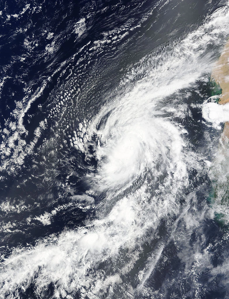
Supercane Zayin[]
| Category 7 hurricane | |
  | |
| Duration | October 30 – November 10 (crossed into the Eastern Pacific) |
|---|---|
| Peak intensity | 265 mph (425 km/h) (1-min) 829 mbar (hPa) |
Zayin was the final supercane of this incredibly hyperactive, catastrophic season.
A southerly tropical wave developed into a tropical storm west of the southern Windwards and strengthened as it moved westward. It intensified to a C2 while affecting parts of Venezuela and Colombia. Land interaction weakened it down to a C1 but it would quickly recover as it entered very favorable conditions in the southwestern Caribbean. Explosive intensification ensued, with the storm becoming a major hurricane, C5, and then a C6 supercane in the timespan of just a couple days. It then became a C7 and peaked as a powerful 265 mph monster with a 839 mbar pressure. The storm then hit Nicaragua as a borderline C6/C7 and rapidly weakened over land. Afterwards it emerged into the Eastern Pacific where it reintensified to a C4 and skirted the Mexican coastline as a C2/C3 hurricane. After making landfall, it finally dissipated for good over Mexico late on November 18. Zayin was responsible for catastrophic devastation; about $17 billion in damage and 15,874 deaths occurred throughout Central America and Mexico. The NHC later retired the name for 75 years, and it will return in 2275. They originally planned to remove it for 100 years but it was deemed as too overshadowed by the bigger storms of the season, namely Zia, Omega, and others.
Tropical Storm Het[]
| Tropical storm (SSHWS) | |
  | |
| Duration | November 4 – November 8 |
|---|---|
| Peak intensity | 70 mph (110 km/h) (1-min) 992 mbar (hPa) |
A tropical wave developed in the central Atlantic, becoming Tropical Storm Het. The system moved northward while intensifying to near-hurricane intensity before degenerating in high wind shear. Het never affected anyone. Its remnants absorbed Tet (see below).
Tropical Storm Tet[]
| Tropical storm (SSHWS) | |
  | |
| Duration | November 4 – November 8 |
|---|---|
| Peak intensity | 65 mph (100 km/h) (1-min) 994 mbar (hPa) |
Developed west of Bermuda, and was named only six hours after Het was named. Tet moved northeastward and gradually intensified to a strong tropical storm. Afterwards, wind shear spelled its demise. Tet never affected land. Its remnants were absorbed into Het's remnants.
Hurricane Yod[]
| Category 2 hurricane (SSHWS) | |
  | |
| Duration | November 9 – November 18 |
|---|---|
| Peak intensity | 105 mph (165 km/h) (1-min) 976 mbar (hPa) |
A tropical wave developed and became a tropical storm near the Lesser Antilles. The storm moved westward, later affecting Puerto Rico and Hispaniola, and then turned northwestward. It passed through the Turks & Caicos Islands before strengthening to a hurricane. Yod then reached C2 intensity as it approached landfall in the southeast U.S. It made landfall on the Georgia coast very soon after weakening back to a C1. It moved through Georgia as it weakened and then dissipated over land. Yod caused, in total, $675 million in damages and killed 9 people throughout its path.
Hurricane Kaf[]
| Category 4 hurricane (SSHWS) | |
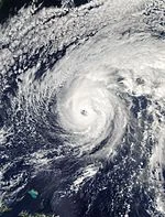  | |
| Duration | November 15 – November 28 |
|---|---|
| Peak intensity | 145 mph (230 km/h) (1-min) 941 mbar (hPa) |
Kaf developed in the central Caribbean and strengthened to a hurricane as it struck Haiti. It then gradually intensified as it passed through the Turks & Caicos, becoming a major hurricane and then a C4 out at sea. The system then turned towards the northwest, approaching the eastern seaboard while gradually weakening and increasing in diameter. It struck New York City as perhaps one of the largest tropical cyclones by diameter on record, and then turned extratropical well inland while still producing hurricane-force winds. Kaf caused a total of $65 billion in damages, comparable to Sandy in 2012, and 187 deaths. The name was removed from the list for 50 years and will return in 2250. If it was not overshadowed by previous systems, it could've been removed for a longer period of time.
Tropical Storm Lamed[]
| Tropical storm (SSHWS) | |
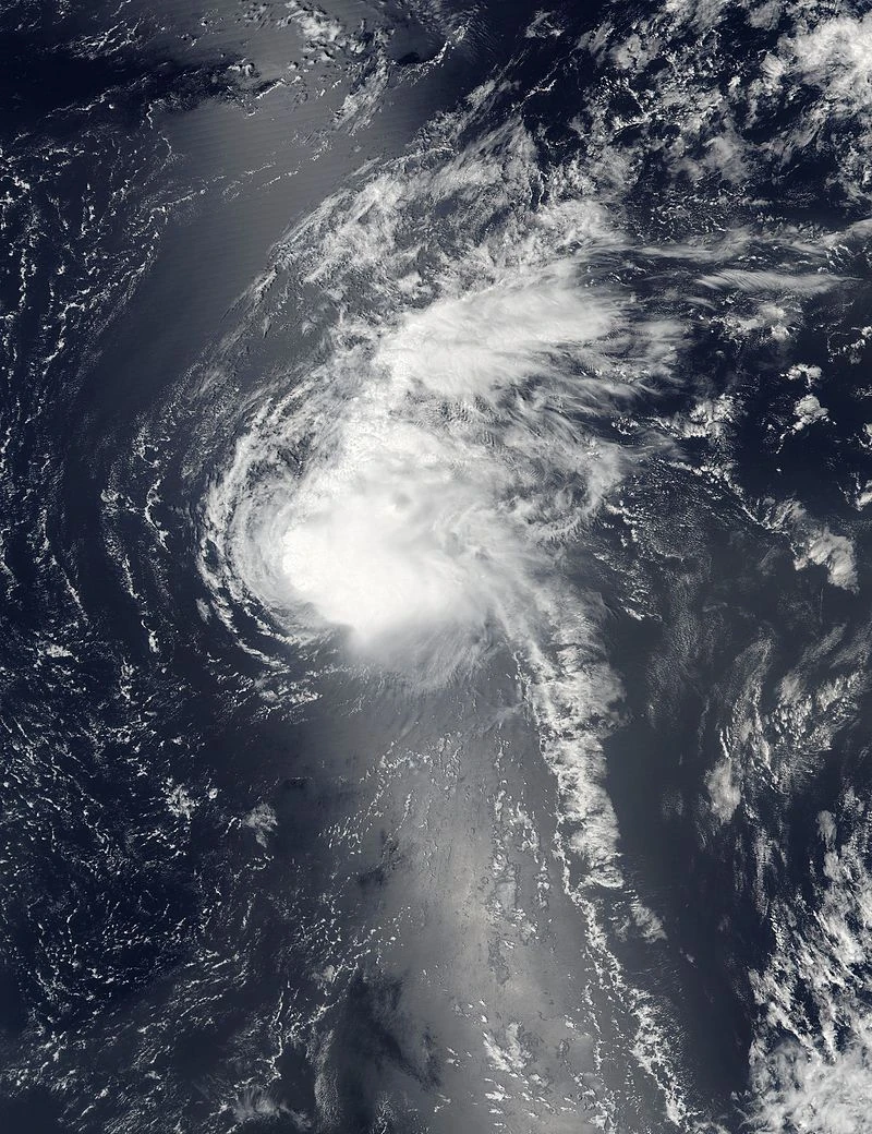  | |
| Duration | November 20 – November 25 |
|---|---|
| Peak intensity | 50 mph (85 km/h) (1-min) 999 mbar (hPa) |
A late-season tropical wave developed in the central Atlantic, becoming Tropical Storm Lamed under continued favorable conditions. This was among the latest formations in the MDR ever recorded. It intensified to a peak of 50 mph before outflow from Kaf caused its weakening and later demise. Lamed never affected anyone.
Tropical Depression Ninety-Eight[]
| Tropical depression (SSHWS) | |
  | |
| Duration | November 29 – November 30 |
|---|---|
| Peak intensity | 35 mph (55 km/h) (1-min) 1006 mbar (hPa) |
A late tropical wave developed into a tropical depression near Puerto Rico on November 29 in only marginally favorable conditions. The not-ideal conditions and land interaction kept it weak before it made landfall in Hispaniola and dissipated, causing minimal damage and no deaths.
Tropical Storm Mem[]
| Tropical storm (SSHWS) | |
  | |
| Duration | December 8 – December 14 |
|---|---|
| Peak intensity | 70 mph (110 km/h) (1-min) 993 mbar (hPa) |
A non-tropical disturbance in the central Atlantic developed and organized into a subtropical depression, later transitioning into a fully tropical storm. It peaked just shy of hurricane strength as it moved eastward southwest of the Azores. Later on, wind shear and cooler waters caused the storm's demise without it affecting land.
Hurricane Nun[]
| Category 1 hurricane (SSHWS) | |
  | |
| Duration | December 25 – January 2, 2201 |
|---|---|
| Peak intensity | 85 mph (140 km/h) (1-min) 984 mbar (hPa) |
A well-organized low pressure area formed over Colombia/Venezuela and emerged into the far southwestern Caribbean, where conditions were still quite favorable enough for tropical development. It became Tropical Storm Nun at a record southwestern latitude in the Caribbean and at an unusually late time of year (Christmas Day). It intensified to a hurricane over a remaining pocket of warm water, but later upwelled waters from Supercane Zayin inhibited strengthening before it made landfall in Nicaragua as a 75 mph hurricane. Land interaction weakened it to a depression as it entered the northwestern Caribbean but it would quickly recover. The system then gradually intensified as it moved through far western Cuba and approached Florida, reaching a secondary peak of 65 mph. It made landfall in Florida just after the new year began and degenerated during the morning of January 2. Its remnants contributed to the formation of a very powerful and damaging nor-easter. In total Nun caused $295 million in damage and 36 deaths.
Storm names[]
The following names were used to name tropical cyclones this year. This is the same list used in the 2194 season, expect for Cody, Jenna, and Oren, which replaced Connor, Jessica, and Orville. The names Quigley, Ulmer, Xenia, Yuri and Zoe were all used in the 2198 list, as those names cycle every other year.
|
|
|
|
List II[]
Upon exhaustion of the above list, the NHC has prepared a list of names that were retired before the year 2100, which emphasis on before 2050. Only if good retired names cannot be found from some letters (such as uncommonly used letters like T, V, or W) does a name retired between 2050 and 2100 be picked. These names have been brought back because the NHC argued that "nobody remembers those old retired storms anymore." They also thought it would be a good way to delay the use of the Greek Alphabet in hyperactive seasons. Because this season exhausted the main list, it moved on to this list. This list is recycled every 2 years like the Q, U, X, Y, and Z names in the first list, and thus this list was last used in 2198 and will next be used in 2202. Any "re-retired" names are replaced by another name that was retired before 2100.
This list is also not just old retired names. It also contains another set of Q, U, X, Y, and Z names in order to delay the Greeks even further. All names are recycled every 2 years.
|
|
|
|
Greek Alphabet[]
Due to extreme activity, the Greek Alphabet was used this year. This season was one of very few to reach the Greek Alphabet after a secondary naming list was introduced almost a century back. Storms using these names are not "retired." Instead, if the storms are devastating enough, the names are removed for a period of time depending on its devastation. It goes up to 100 years for the worst storms ever recorded, with lesser possible removals being 25, 50, or 75 years.
|
|
|
|
Hebrew Alphabet[]
The insane hyperactivity caused this season to exhaust even the Greek Alphabet, a feat not achieved since 2100, and more incredibly, it was achieved this year with an additional secondary list. Thus the NHC resorted to using the Hebrew Alphabet for the first time since 2100. The season got down the furthest in the list in history, surpassing 2100, which only reached Gimel.
|
|
|
|
Retirement[]
Primary list[]
Due to them causing extensive damages and deaths during their existences, the names Cody, Fatima, Jenna, Marvin, Oren, Penelope, Tori, Viviana, Yuri, and Zoe were retired and will never be used again (at least in the next hundred years) to name an Atlantic hurricane. They were replaced by Chad, Felicity, Jocelyn, Micah, Odin, Paige, Tamara, Vera, Yves, and Zephyr respectively for the 2206 season.
List for 2206 (Note: The Q, U, X, Y, and Z names are also used in 2202 and 2204; the actual list for 2206 might be slightly different if a name with one of those letters is retired in 2202 or 2204)[]
|
|
|
|
Secondary list[]
Due to them causing extensive damages and deaths during their existences, the names Flora, Igor, Joan, Matthew, Ulric, William, and Zia were retired (or in the case of every name except for Ulric and Zia, "re-retired") and will never be used again (at least in the next hundred years) to name an Atlantic hurricane. They were replaced by Florence (originally retired 2018), Ike (originally retired 2008), Jeanne (originally retired 2004), Mitch (originally retired 1998), Ulfred, Wilfred (originally retired 2074), and Zora respectively for the 2202 season.
List for 2202[]
|
|
|
|
Greek Alphabet[]
Due to them causing extensive damages and deaths during their existences, the letters Eta, Xi, Sigma, and Omega were removed for a period of time. The letters Eta, Xi, and Omega will not return until 2300 as they have been removed for 100 years. The letter Sigma was removed for 25 years and will return in 2225.
List for next year[]
|
|
|
Hebrew Alphabet[]
Due to them causing extensive damages and deaths during their existences, the letters Alef, Zayin, and Kaf were removed for a period of time. Alef was removed for 25 years and will return in 2225, Zayin was removed for 75 years and will return in 2275, and Kaf was removed for 50 years and will return in 2250.
List for next year[]
|
|
|
Season effects[]
This is a table of the storms and their effects in the 2200 Atlantic hurricane season. This table includes the storm's names, duration, peak intensity, areas affected, damages, and death totals. Damage and deaths include totals while the storm was extratropical, a wave or a low. All of the damage figures are in 2200 USD (the listed damage figure is in millions).
| Storm name |
Dates active | Storm category at peak intensity |
Max 1-min wind mph (km/h) |
Min. press. (mbar) |
Areas affected | Damage (USD) |
Deaths |
|---|---|---|---|---|---|---|---|
| Alejandro | January 14 – January 18 | Tropical storm | 50 mph (85 km/h) | 998 | None | None | 0 |
| Brittany | February 3 – February 11 | Category 1 hurricane | 80 mph (130 km/h) | 984 | Yucatan Peninsula, Cuba, Florida | 68 | 2 |
| Cody | March 8 – March 16 | Category 3 hurricane | 120 mph (195 km/h) | 961 | Mid-Atlantic and New England states (U.S.), Atlantic Canada | 12,000 | 21 |
| Desiree | April 2 – April 3 | Tropical storm | 40 mph (65 km/h) | 1002 | None | None | 0 |
| Ethan | April 10 – April 14 | Tropical storm | 60 mph (95 km/h) | 996 | Yucatan Peninsula (Mexico); South Central states, North Central states (U.S.) | 142 | 3 |
| Six | April 16 – April 17 | Tropical depression | 35 mph (55 km/h) | 1005 | None | None | 0 |
| Fatima | April 30 – May 10 | Category 4 hurricane | 150 mph (240 km/h) | 941 | The Bahamas; Florida, South Central states, Missouri, East North Central states, Pennsylvania, West Virginia, New York state (U.S.); Ontario (Canada) | 48,000 | 63 |
| Grant | May 8 – May 20 | Category 5 hurricane | 165 mph (270 km/h) | 915 | Leeward Islands, Puerto Rico, Dominican Republic, Turks & Caicos Islands, Bermuda, Newfoundland | 135 | 4 |
| Heather | May 9 – May 12 | Tropical storm | 65 mph (100 km/h) | 994 | Jamaica, Belize, Guatemala, Yucatan Peninsula, Southeastern Mexico | Minimal | 1 |
| Ibrahim | May 14 – May 16 | Tropical storm | 50 mph (85 km/h) | 999 | The Bahamas; Florida, Georgia, East South Central states (U.S.) | 25 | 0 |
| Jenna | May 16 – May 29 | Category 6 hurricane | 215 mph (345 km/h) | 866 | New England, Mid-Atlantic states (U.S.); Ontario, Quebec (Canada) | 160,000 | 763 |
| Kurtis | May 18 – May 23 | Category 2 hurricane | 105 mph (165 km/h) | 973 | Bermuda, Atlantic Canada, Quebec | 65 | 1 |
| Thirteen | May 24 – May 25 | Tropical depression | 35 mph (55 km/h) | 1004 | Nicaragua, Honduras, Belize, Guatemala | 210 | 83 |
| Leah | May 26 – May 31 | Category 1 hurricane | 80 mph (130 km/h) | 985 | None | None | 0 |
| Marvin | May 31 – June 10 | Category 5 hurricane | 175 mph (280 km/h) | 912 | Lesser Antilles, Jamaica, Honduras, El Salvador, Guatemala, Southeastern Mexico | 13,000 | 2,305 |
| Natasha | June 2 – June 4 | Tropical storm | 50 mph (85 km/h) | 998 | Southeastern Mexico | 145 | 12 |
| Seventeen | June 9 – June 10 | Tropical depression | 35 mph (55 km/h) | 1005 | Louisiana; parts of Mississippi, Arkansas, and Texas | Minimal | 0 |
| Oren | June 12 – June 18 | Category 3 hurricane | 115 mph (185 km/h) | 961 | Jamaica, Cayman Islands, Cuba; Florida, South Atlantic, Mid-Atlantic, and New England states (U.S.); Quebec (Canada) | 19,000 | 45 |
| Penelope | June 13 – June 29 | Category 8 hurricane | 320 mph (520 km/h) | 784 | Lesser Antilles, Puerto Rico, Hispaniola, Turks & Caicos Islands, Cuba, The Bahamas; Florida, South Atlantic, East South Central, East North Central, Mid-Atlantic states (U.S.); Ontario, Quebec (Canada) | 678,000 | 1,563 |
| Quigley | June 21 – June 27 | Category 2 hurricane | 105 mph (165 km/h) | 976 | Nicaragua, Honduras, Cuba, Yucatan Peninsula, Northeastern Mexico; West Central and Mountain states (U.S.) | 48 | 2 |
| Rosalie | June 25 – June 28 | Tropical storm | 65 mph (100 km/h) | 996 | Leeward Islands, Puerto Rico, Hispaniola, Turks & Caicos Islands, Cuba | 59 | 4 |
| Spencer | June 26 – July 7 | Category 1 hurricane | 80 mph (130 km/h) | 987 | Cape Verde Islands, Azores, British Isles | 2 | 5 |
| Tori | June 28 – July 6 | Category 4 hurricane | 150 mph (240 km/h) | 935 | Leeward Islands, Puerto Rico; South Atlantic, Mid-Atlantic, New England states (U.S); Atlantic Canada and Quebec (Canada) | 14,000 | 41 |
| Ulmer | July 1 – July 2 | Tropical storm | 50 mph (85 km/h) | 999 | Texas | 9 | 0 |
| Viviana | July 3 – July 7 | Category 3 hurricane | 120 mph (195 km/h) | 960 | Nicaragua, Honduras, Guatemala, Belize, El Salvador, Southern Mexico | 760 | 936 |
| Wyatt | July 4 – July 7 | Tropical storm | 50 mph (85 km/h) | 999 | Lesser Antilles, Puerto Rico, Hispaniola, Cuba | 10 | 2 |
| Xenia | July 5 – July 10 | Category 1 hurricane | 80 mph (130 km/h) | 986 | Newfoundland | None | 0 |
| Yuri | July 7 – July 19 | Category 9 hurricane | 370 mph (595 km/h) | 738 | Lesser Antilles, Hispaniola, Jamaica, Cayman Islands, Cuba, Florida Keys; South Central states, Missouri, East North Central states, Pennsylvania (U.S.); Ontario, Quebec (Canada) | 1,060,000 | 5,195 |
| Zoe | July 9 – July 25 | Category 6 hurricane | 225 mph (360 km/h) | 859 | Cape Verde Islands, Leeward Islands, Puerto Rico, The Bahamas; South Atlantic states, Tennessee, Kentucky, East North Central, Mid-Atlantic, New England states (U.S.); Quebec (Canada) | 185,000 | 210 |
| Thirty | July 11 – July 12 | Tropical depression | 35 mph (55 km/h) | 1004 | Southeastern Mexico | Minimal | 3 |
| Allen | July 12 – July 16 | Category 2 hurricane | 105 mph (165 km/h) | 973 | Azores | 28 | 3 |
| Betsy | July 14 – July 16 | Tropical storm | 50 mph (85 km/h) | 998 | Bermuda, Atlantic Canada | Minimal | 0 |
| Cesar | July 17 – July 19 | Tropical storm | 60 mph (95 km/h) | 996 | Windward Islands, Leeward Antilles, Venezuela | Minimal | 0 |
| Dolly | July 18 – July 29 | Category 3 hurricane | 125 mph (205 km/h) | 956 | Cape Verde Islands, Azores, British Isles | >1 | 1 |
| Earl | July 21 – July 25 | Category 2 hurricane | 110 mph (175 km/h) | 968 | Honduras, Belize, Yucatan Peninsula, Guatemala, Southeastern Mexico | 95 | 52 |
| Flora | July 23 – July 29 | Category 4 hurricane | 145 mph (230 km/h) | 943 | Haiti, Cuba, The Bahamas, Florida, South Atlantic and East South Central states | 45,000 | 80 |
| Gilbert | July 24 – July 28 | Category 1 hurricane | 85 mph (140 km/h) | 981 | Yucatan Peninsula, Northeastern Mexico, Texas | 458 | 7 |
| Hattie | July 26 – July 29 | Tropical storm | 65 mph (100 km/h) | 994 | None | None | 0 |
| Igor | July 28 – August 12 | Category 5 hurricane | 175 mph (280 km/h) | 914 | Cape Verde Islands, Bermuda, New England states and New York state (U.S.), Quebec and Newfoundland & Labrador (Canada) | 38,000 | 59 |
| Joan | July 29 – August 10 | Category 7 hurricane | 290 mph (465 km/h) | 812 | Windward Islands; parts of Leeward Antilles, Venezuela, and Colombia; Nicaragua, Honduras, El Salvador, Guatemala, Belize, Southeastern Mexico | 65,000 | 5,450 |
| Klaus | August 2 – August 4 | Subtropical storm | 45 mph (75 km/h) | 998 | None | None | 0 |
| Lili | August 3 – August 7 | Category 1 hurricane | 80 mph (130 km/h) | 986 | Cuba, Florida, South Atlantic and Mid-Atlantic states (U.S.) | 260 | 9 |
| Matthew | August 5 – August 12 | Category 3 hurricane | 125 mph (205 km/h) | 958 | Leeward Islands, Puerto Rico, Hispaniola, Cuba, Turks & Caicos Islands, The Bahamas, Florida, South Atlantic and East South Central states (U.S.) | 32,000 | 64 |
| Nadine | August 7 – August 18 | Category 2 hurricane | 105 mph (165 km/h) | 972 | Azores, British Isles | 20 | 2 |
| Omar | August 11 – August 17 | Category 3 hurricane | 120 mph (195 km/h) | 961 | Lesser Antilles, Puerto Rico, Hispaniola, Cuba | 690 | 126 |
| Paloma | August 12 – August 19 | Category 1 hurricane | 80 mph (130 km/h) | 988 | Yucatan Peninsula, Southeastern Mexico | 140 | 12 |
| Forty-Seven | August 13 – August 14 | Tropical depression | 35 mph (55 km/h) | 1003 | Leeward Islands, Puerto Rico | None | 0 |
| Quincy | August 16 – August 19 | Tropical storm | 60 mph (95 km/h) | 996 | Atlantic Canada, Quebec | Minimal | 0 |
| Roxanne | August 19 – September 2 | Category 3 hurricane | 125 mph (205 km/h) | 959 | Cape Verde Islands | Minimal | 0 |
| Stan | August 20 – August 25 | Category 2 hurricane | 105 mph (165 km/h) | 975 | Nicaragua, Honduras, El Salvador | 60 | 34 |
| Tanya | August 21 – August 26 | Category 2 hurricane | 105 mph (165 km/h) | 978 | Bermuda, Atlantic Canada | 43 | 3 |
| Ulric | August 22 – September 1 | Category 5 hurricane | 175 mph (280 km/h) | 915 | Cayman Islands, Cuba, East South Central and South Atlantic states (U.
S.), Atlantic Canada |
41 | 95 |
| Virginie | August 21 – August 27 | Category 4 hurricane | 145 mph (230 km/h) | 939 | Yucatan Peninsula, Northeastern Mexico | 119 | 27 |
| William | August 23 – September 10 | Category 7 hurricane | 275 mph (445 km/h) | 827 | Lesser Antilles, Puerto Rico, Hispaniola, Turks & Caicos Islands, The Bahamas; South Atlantic, Mid-Atlantic, East North Central and New England states (U.S.), Atlantic Canada and Quebec (Canada) | 105,000 | 137 |
| Fifty-Five | August 25 – August 26 | Subtropical depression | 35 mph (55 km/h) | 1005 | Madeira | None | 0 |
| Xuxa | August 27 – August 31 | Tropical storm | 50 mph (85 km/h) | 998 | Windward Islands, Venezuela, Leeward Antilles, Colombia | Minimal | 2 |
| Yusef | August 27 – September 2 | Category 3 hurricane | 125 mph (205 km/h) | 957 | Yucatan Peninsula, Southeastern Mexico | 480 | 13 |
| Zia | August 29 – September 19 | Category 10 hurricane | 420 mph (675 km/h) | 682 | Cape Verde Islands, Leeward Islands, Puerto Rico, Hispaniola, Turks & Caicos Islands, Cuba, The Bahamas, Florida, West and East South Central states, Missouri; East North Central, Mid-Atlantic, New England states (U.S.); Ontario, Quebec (Canada); Atlantic Canada | 8,500,000 | 789,450 |
| Alpha | August 30 – September 2 | Tropical storm | 65 mph (100 km/h) | 994 | Azores, British Isles | Minimal | 0 |
| Beta | August 31 – September 9 | Category 4 hurricane | 150 mph (240 km/h) | 936 | Bermuda, Atlantic Canada | 585 | 9 |
| Gamma | September 1 – September 13 | Category 5 hurricane | 165 mph (270 km/h) | 921 | Cape Verde Islands | Minimal | 0 |
| Delta | September 2 – September 4 | Tropical storm | 50 mph (85 km/h) | 999 | Texas, Louisiana, Mississippi, Arkansas, Missouri, Tennessee | 14 | 0 |
| Epsilon | September 3 – September 7 | Category 1 hurricane | 80 mph (130 km/h) | 985 | Iberian Peninsula (Spain, Portugal) | 590 | 16 |
| Zeta | September 5 – September 7 | Tropical storm | 45 mph (75 km/h) | 1000 | Eastern Mexico | 23 | 1 |
| Eta | September 5 – September 19 | Category 8 hurricane | 315 mph (510 km/h) | 791 | Leeward Antilles, Venezuela, Colombia; Jamaica, Cayman Islands, Cuba, Nicaragua, Honduras, Belize (all partially); Yucatan Peninsula, Eastern Mexico, Texas | 610,000 | 36,782 |
| Theta | September 6 – September 10 | Category 1 hurricane | 80 mph (130 km/h) | 986 | Cuba, South Atlantic states (U.S.), Alabama | 580 | 7 |
| Sixty-Seven | September 6 – September 7 | Tropical depression | 35 mph (55 km/h) | 1006 | None | None | 0 |
| Sixty-Eight | September 7 – September 8 | Tropical depression | 35 mph (55 km/h) | 1004 | None | None | 0 |
| Iota | September 8 – September 21 | Category 5 hurricane | 175 mph (280 km/h) | 911 | Cape Verde Islands, British Isles | 9 | 1 |
| Kappa | September 9 – September 11 | Tropical storm | 50 mph (85 km/h) | 998 | Haiti, Jamaica, Cuba | Minimal | 2 |
| Lambda | September 11 – September 15 | Tropical storm | 45 mph (75 km/h) | 1000 | Leeward Islands, Puerto Rico, Hispaniola, Cuba, The Bahamas | 44 | 3 |
| Mu | September 14 – September 21 | Category 3 hurricane | 120 mph (195 km/h) | 963 | Bermuda, Atlantic Canada | 83 | 2 |
| Nu | September 15 – September 18 | Tropical storm | 60 mph (95 km/h) | 997 | None | None | 0 |
| Xi | September 17 – October 3 | Category 7 hurricane | 270 mph (435 km/h) | 831 | Cape Verde Islands, The Carolinas, Mid-Atlantic and New England states (U.S.), Atlantic Canada and Quebec (Canada) | 267,000 | 1,106 |
| Omicron | September 20 – September 28 | Category 2 hurricane | 105 mph (165 km/h) | 976 | Nicaragua, Honduras, Guatemala, Belize, Yucatan Peninsula, Eastern Mexico | 125 | 48 |
| Pi | September 23 – September 25 | Tropical storm | 50 mph (85 km/h) | 999 | The Bahamas, South Atlantic states (U.S.), Alabama | 25 | 0 |
| Rho | September 24 – October 2 | Category 3 hurricane | 120 mph (195 km/h) | 961 | Azores | None | 0 |
| Sigma | September 26 – October 4 | Category 4 hurricane | 140 mph (220 km/h) | 948 | Nicaragua, Honduras, El Salvador, Belize, Guatemala, Southeastern Mexico, Baja California (after redeveloping in EPac) | 8,000 | 742 |
| Tau | September 27 – October 1 | Category 2 hurricane | 105 mph (165 km/h) | 972 | Azores, British Isles, France, Belgium, Luxembourg, Netherlands, Germany, Denmark, Switzerland, Poland | 95 | 3 |
| Upsilon | September 30 – October 3 | Tropical storm | 50 mph (85 km/h) | 998 | Yucatan Peninsula; South Central states, Missouri, and East North Central states (U.S.) | 48 | 1 |
| Phi | October 4 – October 14 | Category 1 hurricane | 80 mph (130 km/h) | 986 | Atlantic Canada | 47 | 1 |
| Chi | July 14 – July 16 | Category 3 hurricane | 125 mph (205 km/h) | 958 | Cape Verde Islands, Canary Islands, Morocco, Iberian Peninsula (Spain, Portugal), France, Italy, Switzerland | 95 | 7 |
| Psi | October 6 – October 15 | Category 5 hurricane | 180 mph (285 km/h) | 901 | Jamaica, Honduras, Belize, Guatemala, Yucatan Peninsula, Southeastern Mexico | 2,300 | 105 |
| Eighty-Four | October 7 – October 8 | Tropical depression | 35 mph (55 km/h) | 1006 | The Bahamas, Florida, Georgia, The Carolinas | Minimal | 0 |
| Omega | October 10 – November 3 | Category 10 hurricane | 410 mph (655 km/h) | 698 | Lesser Antilles, Jamaica, Cayman Islands, Cuba, Yucatan Peninsula, The Bahamas, Florida; South Atlantic, Mid-Atlantic, New England states (U.S.); Atlantic Canada, Quebec (Canada), British Isles, Netherlands, Denmark, Germany, Sweden, Finland, Latvia, Estonia, Poland | 5,800,000 | 127,634 |
| Alef | October 12 – October 17 | Category 3 hurricane | 120 mph (195 km/h) | 958 | Turks & Caicos Islands, The Bahamas; Ohio, South Atlantic, Mid-Atlantic, New England states (U.S.) | 3,900 | 42 |
| Bet | October 13 – October 15 | Tropical storm | 50 mph (85 km/h) | 999 | West South Central states (U.S.) | 23 | 0 |
| Gimel | October 16 – October 25 | Category 5 hurricane | 165 mph (270 km/h) | 917 | Bermuda, Newfoundland | 235 | 3 |
| Dalet | October 21 – October 24 | Category 1 hurricane | 80 mph (130 km/h) | 988 | Azores, British Isles | 43 | 3 |
| He | October 25 – October 26 | Tropical storm | 45 mph (75 km/h) | 1001 | Yucatan Peninsula, Eastern Mexico | 20 | 1 |
| Vav | October 27 – November 2 | Category 2 hurricane | 105 mph (165 km/h) | 974 | British Isles | None | 0 |
| Zayin | October 30 – November 10 | Category 7 hurricane | 265 mph (425 km/h) | 829 | Windward Islands, Leeward Antilles, Venezuela, Colombia, Nicaragua, Costa Rica, Honduras, El Salvador, Guatemala, Southeastern Mexico, South Central Mexico | 17,000 | 15,874 |
| Het | November 4 – November 8 | Tropical storm | 70 mph (110 km/h) | 992 | None | None | 0 |
| Tet | November 4 – November 8 | Tropical storm | 65 mph (100 km/h) | 994 | None | None | 0 |
| Yod | November 9 – November 18 | Category 2 hurricane | 105 mph (165 km/h) | 976 | Leeward Islands, Puerto Rico, Hispaniola, Turks & Caicos Islands, The Bahamas, South Atlantic states (U.S.), Alabama, Tennessee, Kentucky, Indiana | 675 | 9 |
| Kaf | November 15 – November 28 | Category 4 hurricane | 145 mph (230 km/h) | 941 | Lesser Antilles, Hispaniola, Jamaica, Cuba, The Bahamas, Turks & Caicos Islands, Bermuda, Mid Atlantic and New England states (U.S.), Atlantic Canada, Ontario, Quebec (Canada) | 65,000 | 187 |
| Lamed | November 20 – November 25 | Tropical storm | 50 mph (85 km/h) | 999 | Bermuda | None | 0 |
| Ninety-Eight | November 29 – November 30 | Tropical depression | 35 mph (55 km/h) | 1006 | Leeward Islands, Puerto Rico, Hispaniola, Cuba | Minimal | 0 |
| Mem | December 8 – December 14 | Tropical storm | 70 mph (110 km/h) | 993 | None | None | 0 |
| Nun | December 25 – January 2, 2201 | Category 1 hurricane | 85 mph (140 km/h) | 984 | Colombia, Panama, Costa Rica, Nicaragua, Honduras, Yucatan Peninsula, Cuba, Florida, South Atlantic and Mid-Atlantic states (U.S.) | 295 | 36 |