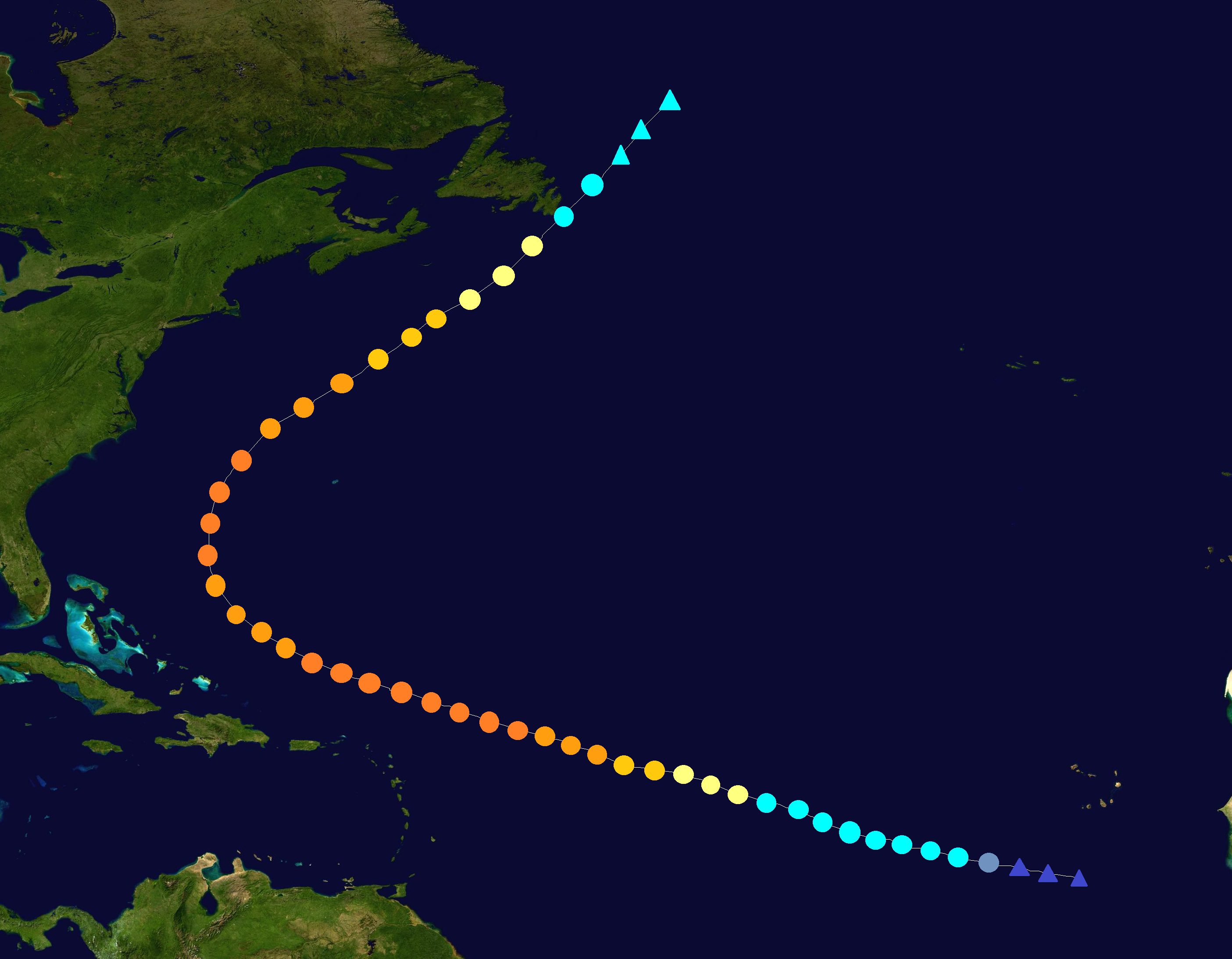
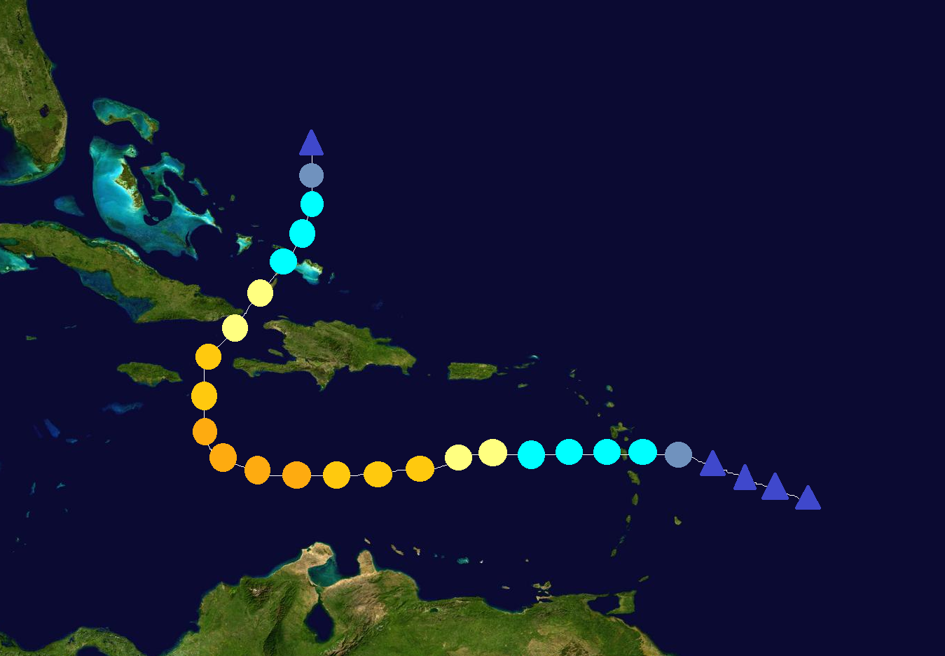
The 2014 Atlantic hurricane season was an active season, with 17 depressions, 16 named storms, 9 hurricanes, and 3 major hurricanes forming. It featured an above average number of named storms and hurricanes, and a near normal amount of major hurricanes. The season officially started on June 1 and ended on November 30. These dates conventionally delimit the period of each year when most tropical cyclones form in the Atlantic basin. The first system, Arthur, developed on June 2 east of The Carolinas, moved out into the Atlantic, and dissipated on June 5.
The most notable storms of the season were Dolly, Fay, and Omar. Dolly struck the northeast Caribbean islands as a TS, Florida as a Cat. 2, and Louisiana as a Cat. 2. It peaked as a Cat. 3 over the Gulf of Mexico. Dolly caused $8.6 billion in damage and killed 48. Fay affected Puerto Rico, Hispaniola, and Cuba as a TS, Florida as a C1, and South Carolina as a TS. Fay caused $1.8 billion in damage and killed 164. Finally, Omar affected the Windward Islands as a TS, and the Jamaica/Cuba/Haiti area as a C2/C1. It peaked as a C3 over the Caribbean. Omar caused $561 million in damage and killed 98, with most of the deaths in Haiti. The name Omar wasn't retired, however.
Season summary[]
The season started with Tropical Storm Arthur in early June. It existed in the western Atlantic in the US east coast/Bermuda area, but didn't affect land. Bertha formed in late June and was a Cat. 2 which affected Mexico.
In July, 3 storms, Cristobal, Dolly, and Edouard formed. Bertha crossed over from June. Cristobal was a TS that affected the Yucatan, Florida, and the Carolinas; Dolly was an early-season and destructive Cat. 3 which affected the Windward Islands, Florida, and the Gulf Coast; and Edouard was a Cat. 1 which didn't affect land.
In August, 5 storms; Fay, Gonzalo, Hanna, Isaias, and Josephine; formed. Fay was a C1 that affected Puerto Rico, the Leeward Islands, Florida, and the Carolinas; Gonzalo was a Cape-Verde type hurricane and the strongest of the season, reaching C4 strength in open waters and affecting Newfoundland as a TS, Hanna was a TS that affected Florida and Georgia, Isaias was a weak TS that didn't affect land, and Josephine was a Cat. 2 in the far eastern Atlantic that didn't affect land.
In September, 5 storms formed, including TD Twelve. Josephine crossed over from August. The 5 storms were: Kyle, TD 12, Laura, Marco, and Nana. Kyle was a Cat. 1 that affected Hispaniola and Puerto Rico as a TS and Bermuda as a C1, TD 12 affected Mexico, Laura was a TS that affected Texas and Louisiana, Marco was a weak TS that didn't affect land, and Nana was a western Caribbean Cat. 2 hurricane that affected the Yucatan as a C2/C1 and Cuba as a TS.
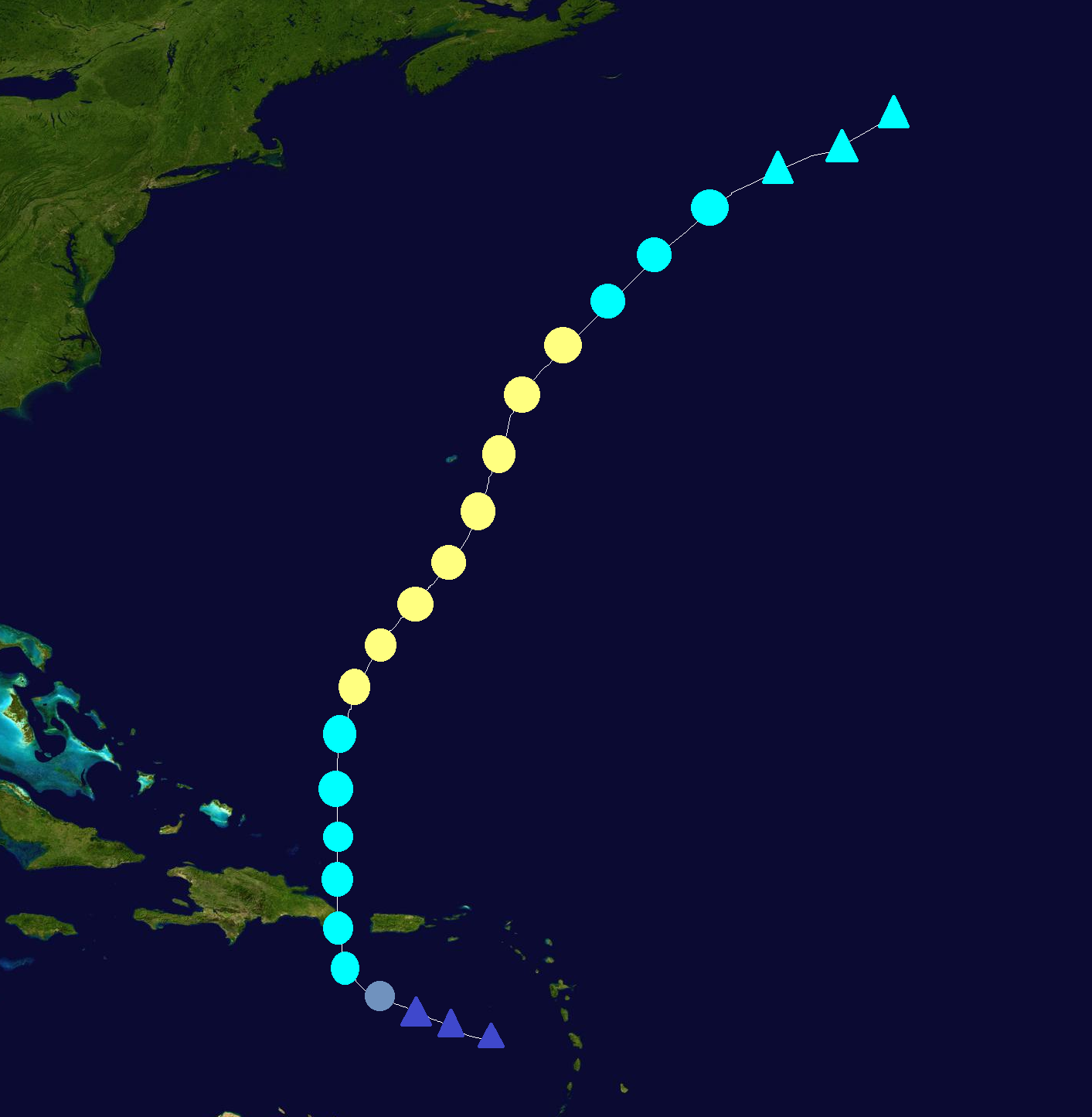
Finally, in October and November, the season went quiet due to a developing El Nino, and only 2 storms, Omar and Paulette, developed in the 2 months. Also, Nana crossed over from September. Omar was a Cat. 3 that affected the Windward Islands as a TS; Jamaica, Cuba, and Haiti as a C2/C1; and the Turks and Caicos Islands as a TS. Omar was the only storm that formed in October, making it the least active October in years. In early November, Paulette affected Bermuda. It was the last storm of the season and dissipated on November 9. Overall, this season was active, but not as active as 2010, 2011, and 2012. It was more active than 2013 though.
Seasonal forecasts[]
| Source | Date | Named storms |
Hurricanes | Major hurricanes | |
| Average (1981–2010) | 12.1 | 6.4 | 2.7 | ||
| Record high activity | 28 | 15 | 8 | ||
| Record low activity | 4 | 2 | 0† | ||
| ––––––––––––––––––––––––––––––––––––––––––––––––––––––– | |||||
| TSR | December 7, 2013 | 14 | 8 | 3 | |
| WSI | December 21, 2013 | 15 | 7 | 3 | |
| CSU | April 4, 2014 | 16 | 9 | 3 | |
| TSR | April 12, 2014 | 15 | 9 | 3 | |
| TWC | April 24, 2014 | 18 | 10 | 4 | |
| TSR | May 23, 2014 | 15 | 8 | 2 | |
| UKMO | May 24, 2014 | 14* | N/A | N/A | |
| NOAA | May 24, 2014 | 13–18 | 6–10 | 2–4 | |
| FSU COAPS | May 30, 2014 | 10-15 | 4-8 | N/A | |
| CSU | June 1, 2014 | 16 | 10 | 4 | |
| TSR | June 6, 2014 | 14 | 7 | 2 | |
| NOAA | August 9, 2014 | 14–19 | 7–11 | 2-4 | |
| ––––––––––––––––––––––––––––––––––––––––––––––––––––––– | |||||
| Actual activity |
16 | 9 | 3 | ||
| * June – November only: 16 storms observed in this period. † Most recent of several such occurrences. () | |||||
Timeline[]

List of storms[]
Tropical Storm Arthur[]
| Tropical storm (SSHWS) | |
  | |
| Duration | June 2 – June 5 |
|---|---|
| Peak intensity | 60 mph (95 km/h) (1-min) 996 mbar (hPa) |
An area of disturbed weather formed east of South Carolina on May 31. It gradually developed, and became Subtropical Storm Arthur on June 2. It became tropical the next day, and gradually strengthened as it moved eastward. Arthur peaked with 60 mph winds and a 996 mbar pressure north of Bermuda. After that, it started to weaken, and it dissipated on June 5. Arthur didn't affect land.
Hurricane Bertha[]
| Category 2 hurricane (SSHWS) | |
  | |
| Duration | June 28 – July 4 |
|---|---|
| Peak intensity | 105 mph (165 km/h) (1-min) 968 mbar (hPa) |
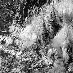
The NHC began to monitor an area of disturbed weather that had formed in the western Caribbean on June 26. It slowly became better organized, and became TD 2 on June 28. The depression strengthened into TS Bertha that night. At that time, the NHC predicted gradual strengthening before making landfall in the Yucatan. Bertha strengthened to its first peak intensity of 60 mph before making landfall in the Yucatan on the night of June 29. It weakened over land, and emerged into the Gulf of Mexico as a tropical depression. Favorable conditions allowed it to re-organize as it moved into the Gulf of Mexico, and it soon restrengthened into a TS. Bertha became a Cat. 1 on July 2nd and a Cat. 2 hurricane that night. It reached its peak of 105 mph and 968 mbar before making landfall south of the Texas border as a Cat. 1 hurricane. It quickly weakened over the mountains of Mexico before dissipating on July 4. Bertha caused $162 million dollars in damage and killed 36 people.
Tropical Storm Cristobal[]
| Tropical storm (SSHWS) | |
  | |
| Duration | July 7 – July 12 |
|---|---|
| Peak intensity | 60 mph (95 km/h) (1-min) 994 mbar (hPa) |
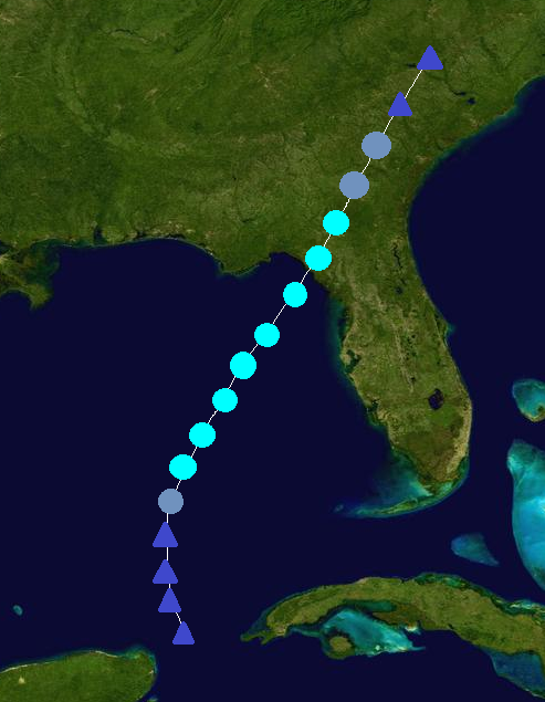
A tropical wave moved into the western Caribbean on July 4. The NHC began to monitor it the next day, and it gradually organized. It became a depression on July 7 while very near the Yucatan. It struggled to strengthen due to land interaction, but once it moved northward into the Gulf of Mexico, it became TS Cristobal. Cristobal strengthened to its peak of 60 mph and 994 mbar before making landfall near Tampa, Florida at its peak intensity. It weakened over land and emerged into the Atlantic as a tropical depression. Cristobal restrengthened into a TS and reached a secondary peak of 45 mph before making another landfall in North Carolina. It weakened over the state before dissipating on July 12. Its remnants continued going up the eastern seaboard. Cristobal caused $53 million in damage and killed 6.
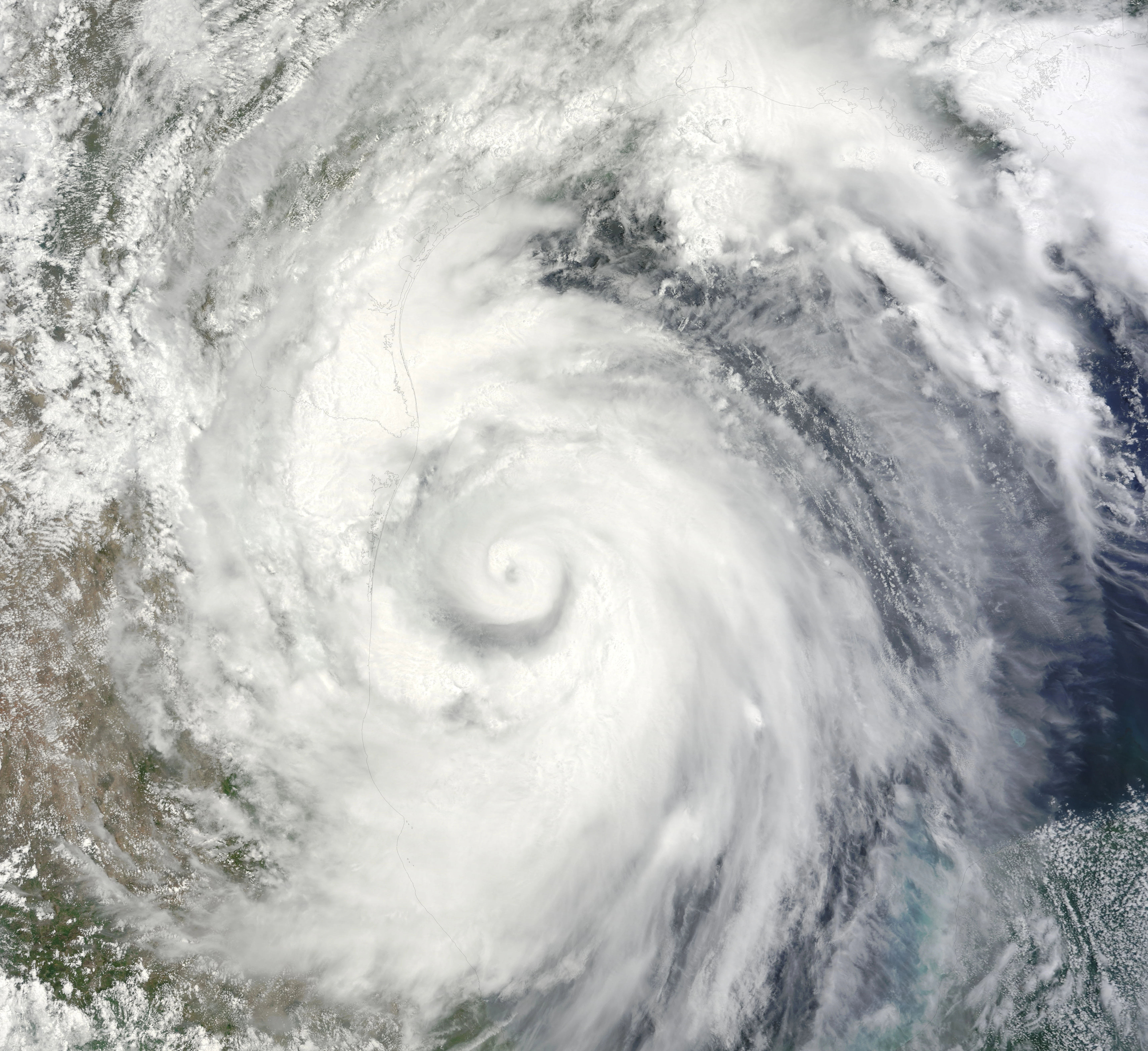
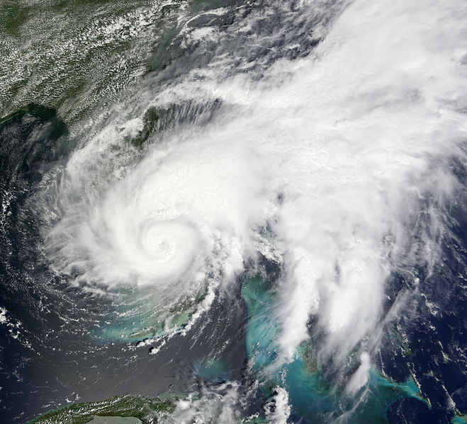
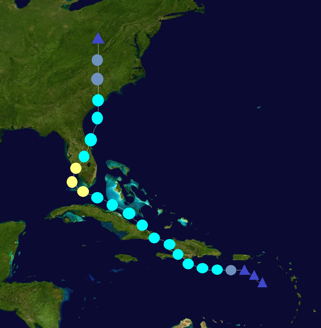
Hurricane Dolly[]
| Category 3 hurricane (SSHWS) | |
  | |
| Duration | July 16 – July 23 |
|---|---|
| Peak intensity | 120 mph (195 km/h) (1-min) 958 mbar (hPa) |
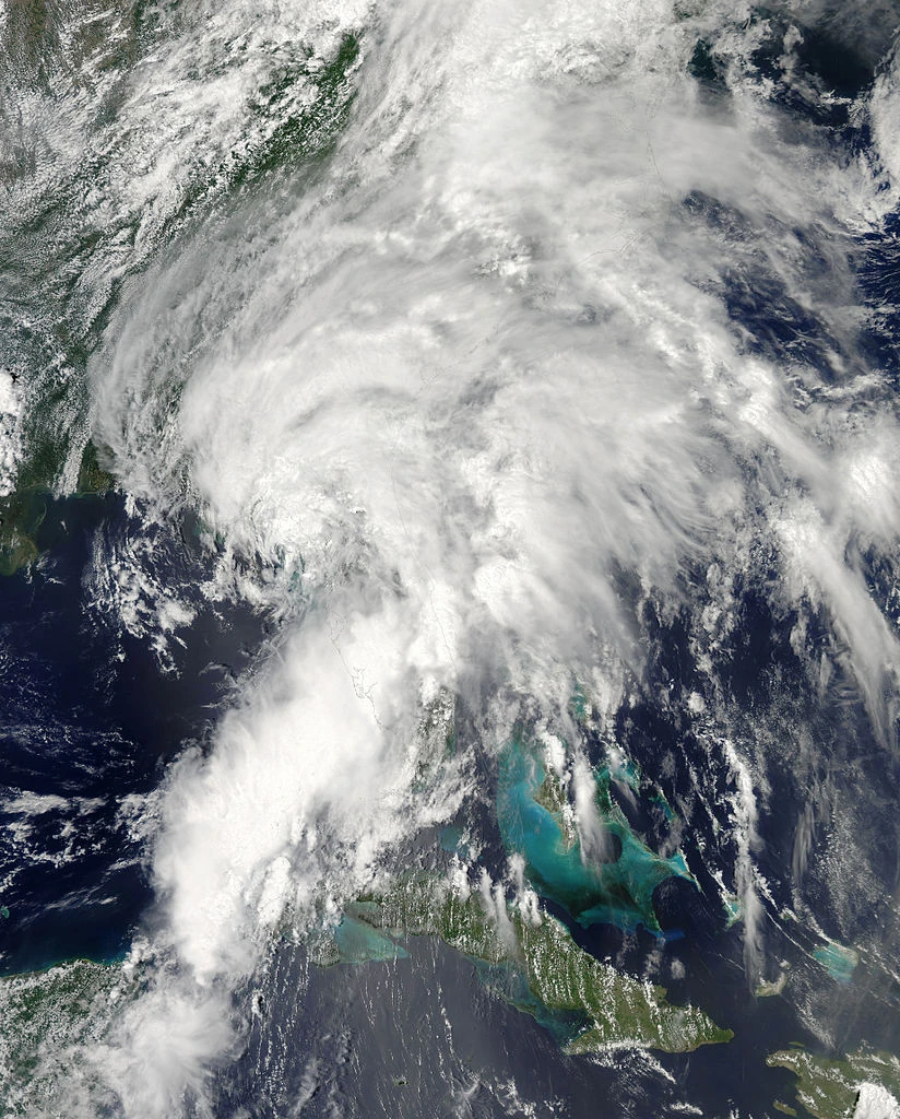
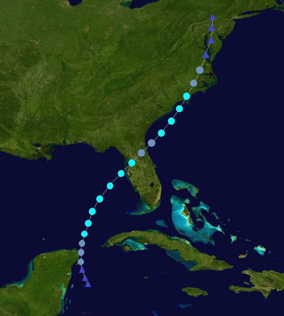
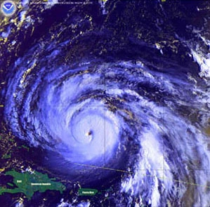
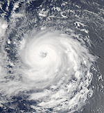
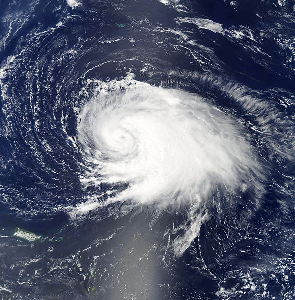
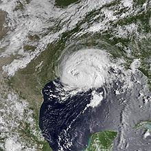
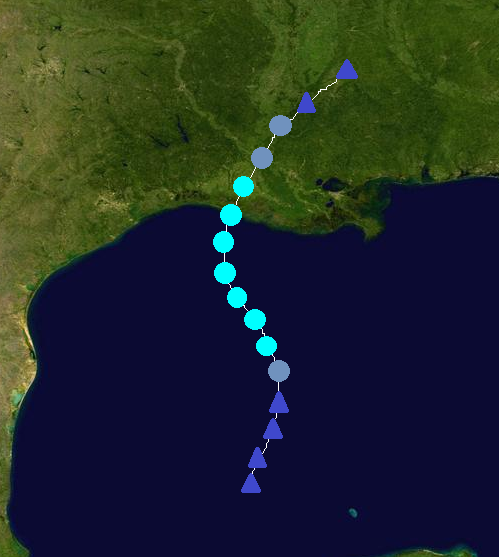
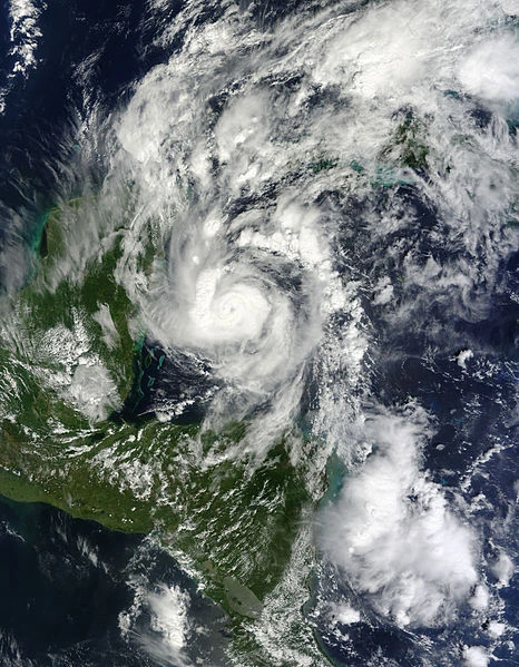
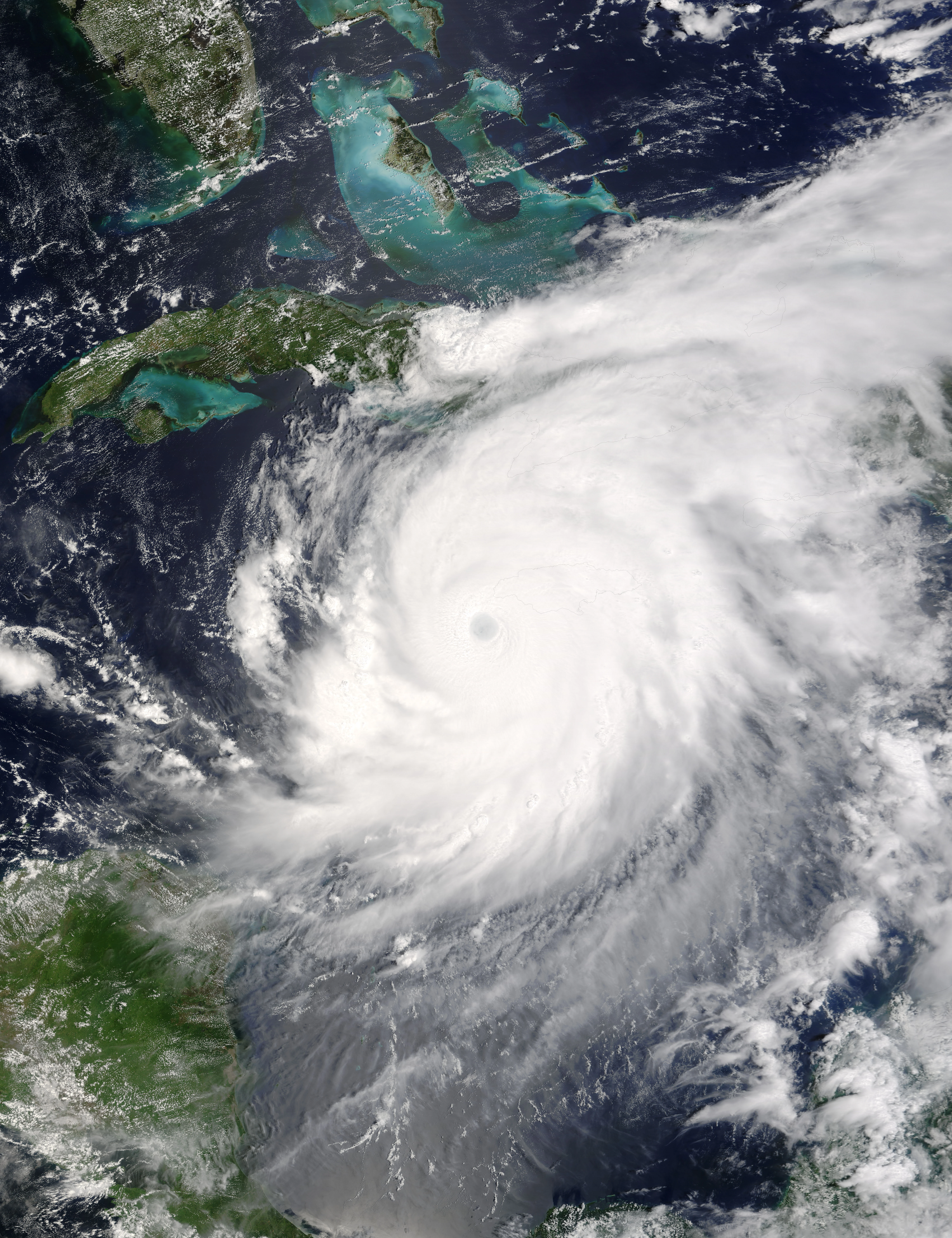
The NHC began to monitor a tropical wave near the Windward Islands on July 15. It quickly developed, and became a depression the next day while moving northwestward and crossing the islands. The depression strengthened into TS Dolly 6 hours later. The NHC predicted gradual strengthening under favorable conditions. Dolly continued to affect the northern Windward Islands and Puerto Rico before moving away from the area and strengthening into a Cat. 1 hurricane while beginning to affect the Bahamas. It moved closer to Florida as it strengthened, and the people who live there were preparing for the storm. Dolly strengthened into a Cat. 2 hurricane in the Bahamas and reached its first peak of 105 mph before making landfall north of Miami, Florida early on July 20. It weakened into a C1 hurricane over land, but remained well organized. In Florida, the storm caused lots of heavy rain, very strong winds, storm surge, and flooding. Dolly caused lots of damage in Florida. After leaving Florida, Dolly strengthened back into a Cat. 2 hurricane. It then became a C3 major hurricane and reached its peak of 120 mph and 958 mbar before making landfall near Lake Charles, Louisiana on July 22 as a Category 2 hurricane. Dolly quickly weakened over land before dissipating on July 23. It also caused lots of damage in Louisiana and eastern Texas due to lots of heavy rain, very strong winds, storm surge, and flooding. All in all, Dolly caused $8.6 billion dollars in damage and killed 48 people. The name Dolly was retired and was replaced by Doria for the 2020 season.
Hurricane Edouard[]
| Category 1 hurricane (SSHWS) | |
  | |
| Duration | July 26 – July 31 |
|---|---|
| Peak intensity | 90 mph (150 km/h) (1-min) 972 mbar (hPa) |
The NHC began to monitor a strong tropical wave in the central Atlantic on July 25. It quickly developed into a tropical depression on July 26. It became a tropical storm 6 hours later. Edouard gradually strengthened as it moved westward, and it became a hurricane on July 28. It turned northward and continued to slowly strengthen to its peak of 90 mph and 972 mbar. Cooler water and wind shear began to weaken the storm as it turned northeastward, and it became extratropical on July 31. Edouard didn't affect land.
Hurricane Fay[]
| Category 1 hurricane (SSHWS) | |
  | |
| Duration | August 2 – August 7 |
|---|---|
| Peak intensity | 75 mph (120 km/h) (1-min) 981 mbar (hPa) |
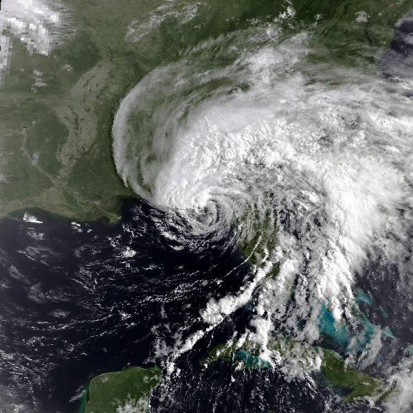
A tropical wave moved into the eastern Caribbean on July 31. The NHC had been monitoring it since it was in the central Atlantic, on July 29. It was a little disorganized when it entered the Caribbean, but after a burst of convection it was declared a tropical depression on August 2 near Puerto Rico. The depression strengthened into TS Fay 6 hours later. The NHC predicted little strengthening due to land interaction. Fay strengthened to winds of 50 mph before making landfall in Haiti on August 3. It weakened to 40 mph over land, but once it emerged into water it restrengthened to 45 mph. Fay made another brief landfall in Cuba without weakening, before leaving Cuba and starting to strengthen. Fay quickly strengthened into a strong tropical storm and then to a hurricane over warm waters and low wind shear as it approached Florida. It remained at the minimal strength for hurricanes before making landfall near Cape Coral, Florida late on August 5. Fay weakened into a tropical storm over land, and emerged back into the Atlantic. It moved northward before making landfall in South Carolina the night of August 6. Fay quickly weakened over land before dissipating on August 7 while in West Virginia. Fay caused $1.8 billion in damage and killed 164 people along its destructive path through the Caribbean and the U.S. The name Fay was later retired and replaced by Francine for the 2020 season.
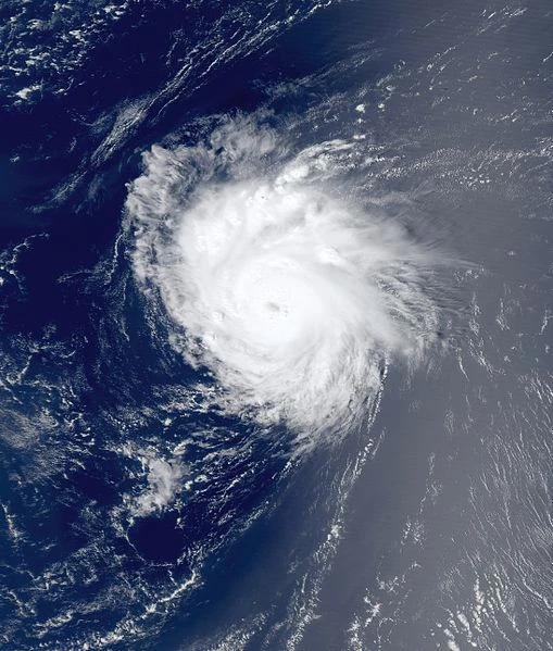
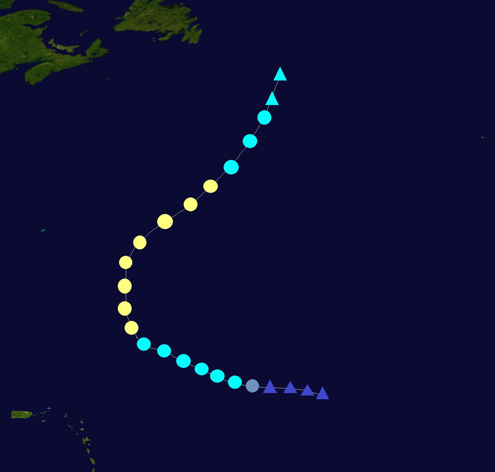
Hurricane Gonzalo[]
| Category 4 hurricane (SSHWS) | |
  | |
| Duration | August 14 – August 25 |
|---|---|
| Peak intensity | 150 mph (240 km/h) (1-min) 932 mbar (hPa) |
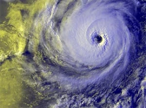
A strong tropical wave moved off the coast of Africa on August 12. It quickly developed as it moved westward, and developed into a depression on August 14. It strengthened into TS Gonzalo 6 hours later. The NHC predicted gradual strengthening under favorable conditions. Gonzalo strengthened into a hurricane on August 16 and began to strengthen faster. It became a Cat. 2 on August 19, a Cat. 3 early on August 20, and a Cat. 4 that night. Gonzalo reached its peak of 150 mph and 932 mbar north of the Windward Islands before undergoing an eye-wall replacement cycle. It weakened into a C3 before restrengthening into a C4 and reaching a 2nd peak intensity of 140 mph. It turned northeastward and weakened into a C3 due to cooling waters and increasing wind shear. It continued to weaken into a C2 and then a C1 as it approached Newfoundland. Gonzalo made landfall in Newfoundland just after weakening into a TS, and became extratropical on August 25. Gonzalo caused $29 million in damage and 3 deaths, mainly in Newfoundland. It also caused slight effects in Bermuda and the Lesser Antilles as well.
Tropical Storm Hanna[]
| Tropical storm (SSHWS) | |
  | |
| Duration | August 20 – August 23 |
|---|---|
| Peak intensity | 50 mph (85 km/h) (1-min) 997 mbar (hPa) |
The NHC began to monitor an area of disturbed weather near the Yucatan on August 19. It quickly developed into a depression on August 20. The depression became Tropical Storm Hanna 6 hours later. Hanna strengthened to its peak of 50 mph and 997 mbar before making landfall in northwestern Florida on August 22. It quickly weakened over land before dissipating on August 23. Its remnants continued up the eastern seaboard. Hanna caused $20 million in damage and killed 1 person.
Tropical Storm Isaias[]
| Tropical storm (SSHWS) | |
  | |
| Duration | August 25 – August 28 |
|---|---|
| Peak intensity | 45 mph (75 km/h) (1-min) 998 mbar (hPa) |
A tropical wave in the central Atlantic was monitored by the NHC on August 23-24. It quickly developed and was declared a depression on August 25. It became Tropical Storm Isaias early the next morning. Any strengthening was expected to be slow to occur as it moved northwestward due to only slightly favorable conditions. Isaias reached its peak of 45 mph and 998 mbar before weakening due to increasing wind shear. It dissipated on August 28. Isaias didn't affect land.
Hurricane Josephine[]
| Category 2 hurricane (SSHWS) | |
  | |
| Duration | August 28 – September 3 |
|---|---|
| Peak intensity | 105 mph (165 km/h) (1-min) 966 mbar (hPa) |
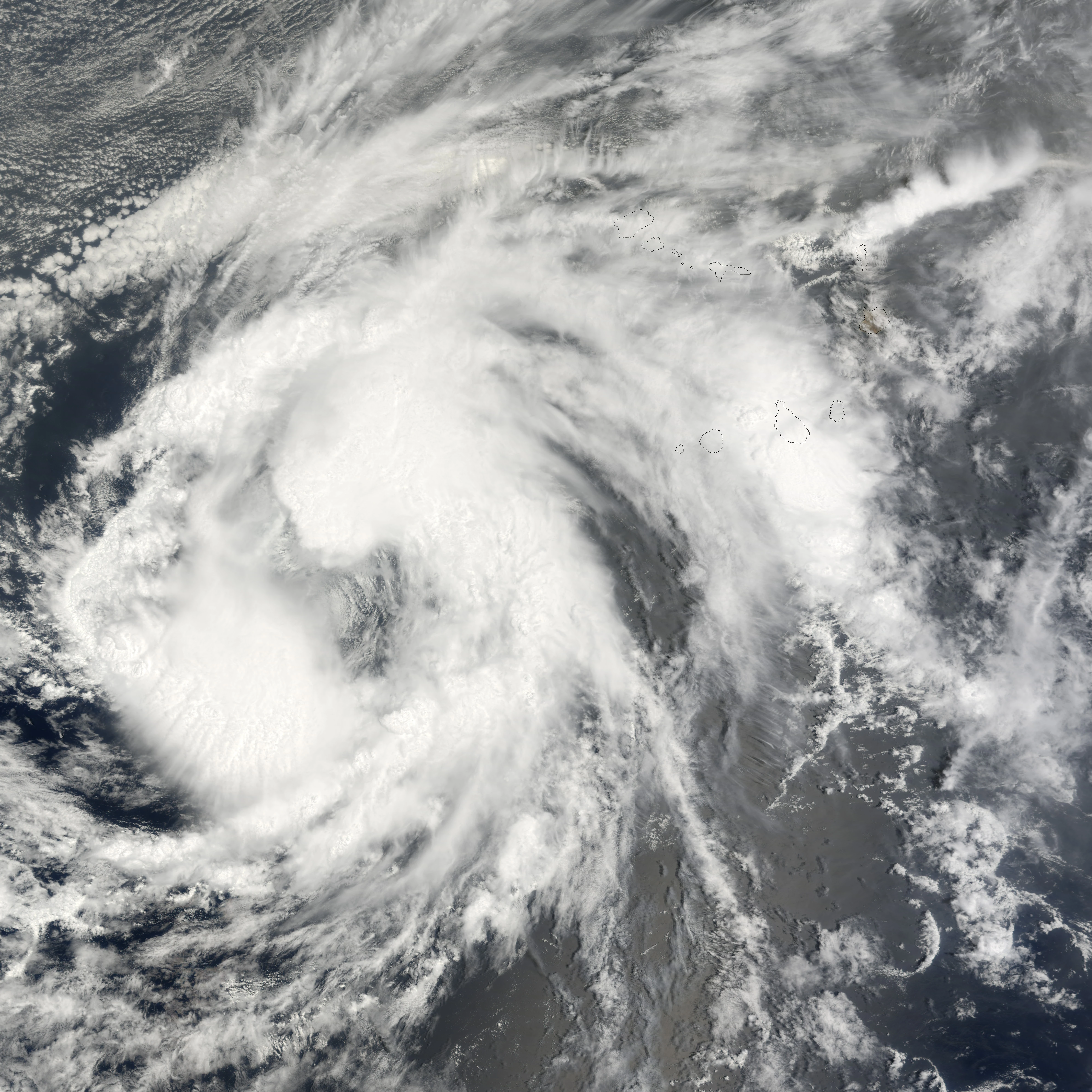
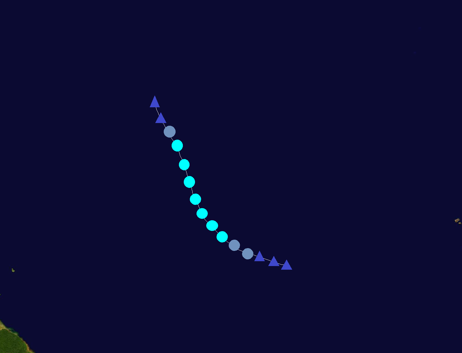
A strong tropical wave moved off the coast of Africa on August 26. It quickly developed, and became a depression on August 28 slightly west of Cape Verde. It strengthened into TS Josephine as it turned northwestward. Favorable conditions allowed it to strengthen further into a Cat. 1 and then a Cat. 2 as it moved northward. Josephine weakened into a Cat. 1 as it executed a cyclonic loop, and furthur weakened into a TS under increasing wind shear as it moved westward. It dissipated on September 3 west of the Azores. Josephine didn't significantly affect land, but did bring some rain to the Cape Verde Islands as it was developing.
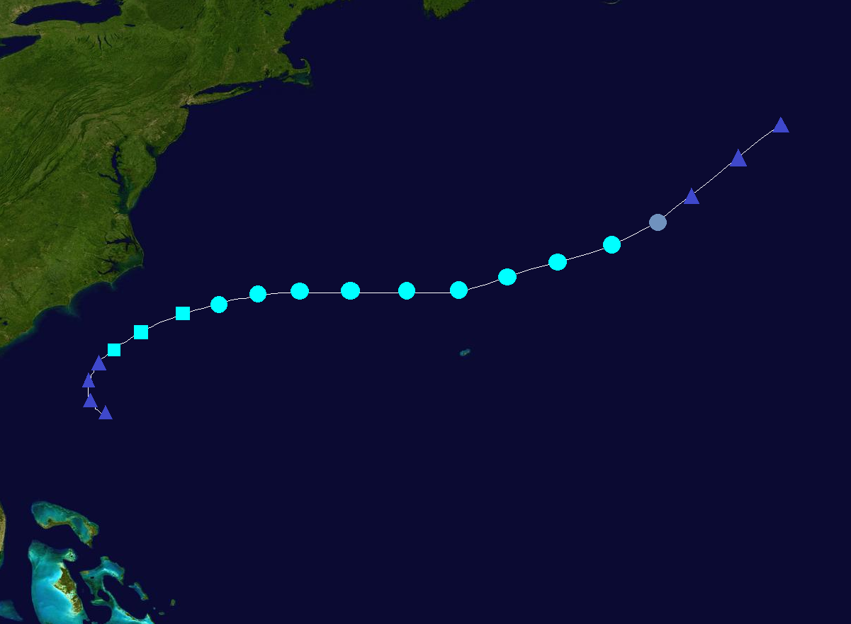
Hurricane Kyle[]
| Category 1 hurricane (SSHWS) | |
  | |
| Duration | September 7 – September 12 |
|---|---|
| Peak intensity | 90 mph (150 km/h) (1-min) 979 mbar (hPa) |
A tropical wave moved into the Caribbean early on September 6. The NHC had been monitoring it since it was in the central Atlantic. Once it entered the Caribbean, it quickly organized and became a depression on September 7 south of Puerto Rico. It strengthened into TS Kyle that night. Kyle moved northward and passed through Hispaniola-Puerto Rico territory before entering the Atlantic Ocean. In the Atlantic, it gradually strengthened under favorable conditions, and became a hurricane on September 9. It continued to strengthen and reached its peak intensity of 90 mph and 979 mbar near Bermuda. Kyle passed very close to Bermuda, bringing heavy rain and powerful winds to the island. After that, cooler waters and wind shear began to weaken the storm, and it became extratropical on September 12. Kyle caused $121 million dollars in damage and killed 8 people.
Tropical Depression Twelve[]
| Tropical depression (SSHWS) | |
  | |
| Duration | September 11 – September 12 |
|---|---|
| Peak intensity | 35 mph (55 km/h) (1-min) 1004 mbar (hPa) |
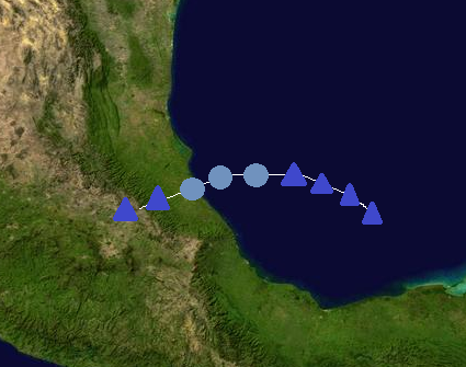
An area of disturbed weather formed in the southwestern Gulf of Mexico on September 9. It organized and became a depression on September 11. Not much strengthening was expected before making landfall in Mexico. TD 12 made landfall near Veracruz, Mexico without strengthening to a tropical storm, and it dissipated on September 12 over Mexico's mountains. TD 12 caused minimal damage.
Tropical Storm Laura[]
| Tropical storm (SSHWS) | |
  | |
| Duration | September 15 – September 18 |
|---|---|
| Peak intensity | 65 mph (100 km/h) (1-min) 990 mbar (hPa) |
The NHC began to monitor a tropical wave in the Gulf of Mexico on September 13. It slowly organized and became a depression on September 15. The depression strengthened into TS Laura that night as it moved northward. Laura continued to strengthen to its peak of 65 mph and 990 mbar before making landfall in western Louisiana on September 17. It quickly weakened over land before dissipating the next day. Laura caused $56 million in damage and killed 4.
Tropical Storm Marco[]
| Tropical storm (SSHWS) | |
  | |
| Duration | September 20 – September 22 |
|---|---|
| Peak intensity | 45 mph (75 km/h) (1-min) 1001 mbar (hPa) |
A tropical wave in the central Atlantic became better organized on September 19. It continued to develop, and became a depression the next day. It later strengthened into Tropical Storm Marco. Not much strengthening was expected due to wind shear, and it reached its peak of 45 mph and 1001 mbar. It began to weaken after that, and dissipated on September 22. Marco didn't affect land.
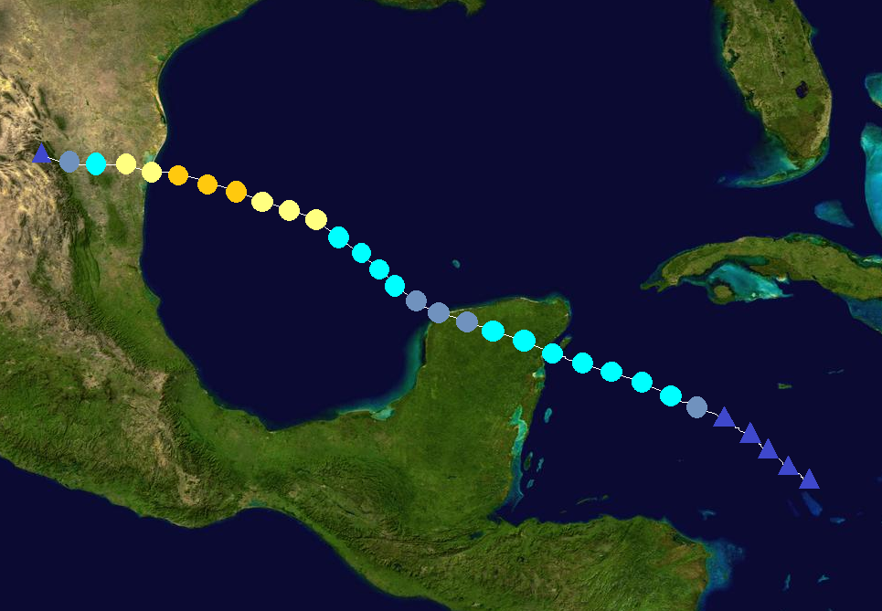
Hurricane Nana[]
| Category 2 hurricane (SSHWS) | |
  | |
| Duration | September 29 – October 4 |
|---|---|
| Peak intensity | 105 mph (165 km/h) (1-min) 968 mbar (hPa) |
A small area of disturbed weather formed in the western Caribbean on September 27. It moved slowly northwestward as it organized, and became a depression on September 29. The depression strengthened into TS Nana 6 hours later. The storm turned westward and continued to strengthen under favorable conditions, becoming a hurricane early on October 1 and a C2 that night as it approached the Yucatan. It reached its peak of 105 mph and 968 mbar before weakening into a C1 as it turned northward due to land interaction and increasing wind shear. It continued to weaken into a TS and made landfall in western Cuba. The storm dissipated on October 4. Its remnants were monitored for signs of regeneration as it moved northeastward through the Bahamas, before dissipating completely on October 7 in the open Atlantic. Nana caused $308 million in damage and killed 24 people.
Hurricane Omar[]
| Category 3 hurricane (SSHWS) | |
  | |
| Duration | October 18 – October 24 |
|---|---|
| Peak intensity | 120 mph (195 km/h) (1-min) 956 mbar (hPa) |
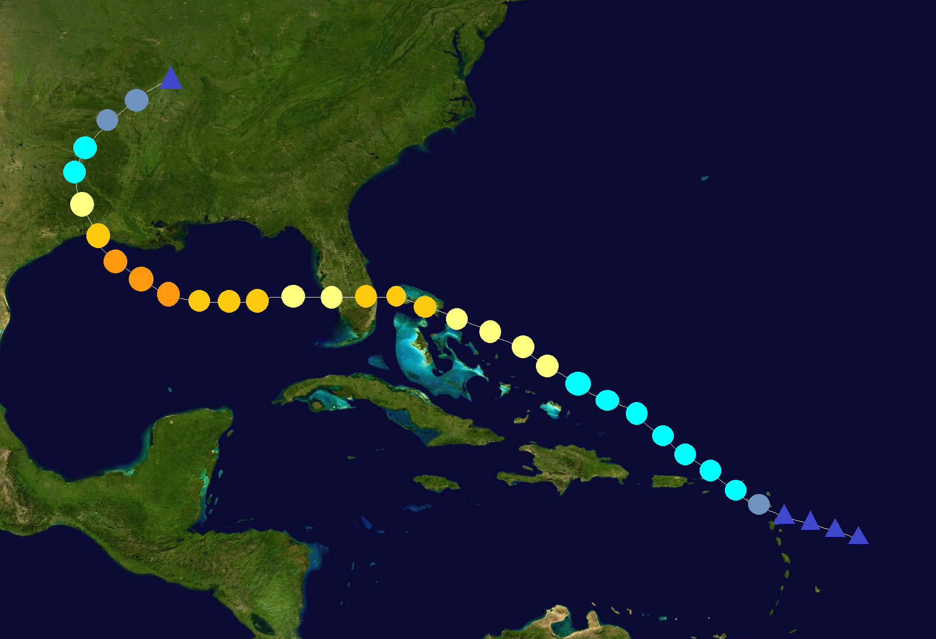
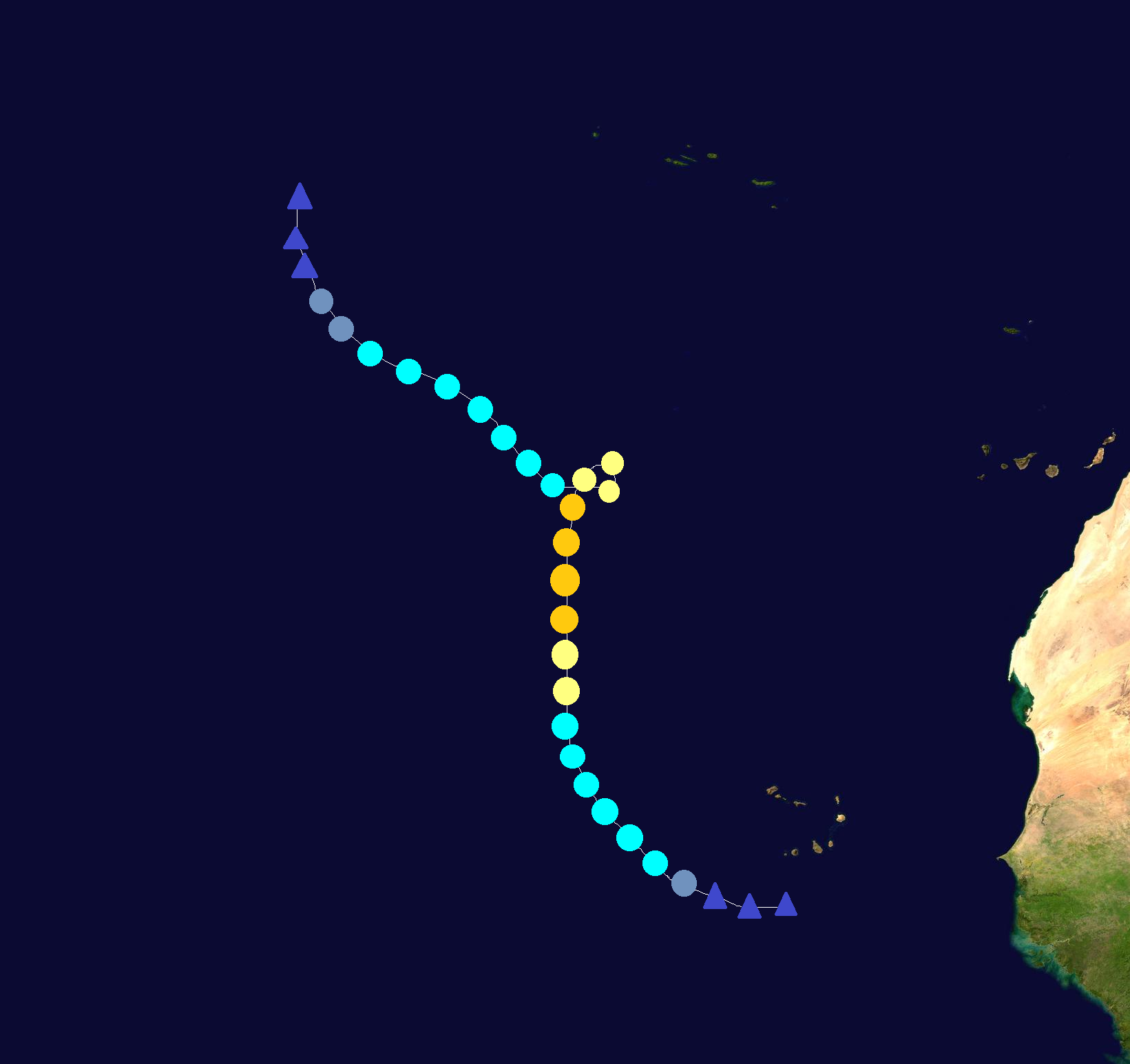
The NHC began to monitor a strong tropical wave east of the Windward Islands on October 16. It organized and became a depression on October 18. It strengthened into a tropical storm and crossed the Windward Islands as a weak TS. Favorable conditions allowed Omar to strengthen into a Cat. 1 hurricane, and C2, and then a C3 major hurricane as it moved westward though the Caribbean. The storm turned northward and entered Jamaica-Cuba-Haiti territory. Omar began to weaken after turning northward, and affected Jamaica as a C2 and Cuba/Haiti as a C2/C1. It weakened into a tropical storm in the Turks & Caicos Islands and dissipated on October 24. Wind shear prevented any redevelopment, and it dissipated completely in the open Atlantic. Omar caused $561 million in damage and killed 98, with most of the deaths in Haiti. The name wasn't retired.
Tropical Storm Paulette[]
| Tropical storm (SSHWS) | |
 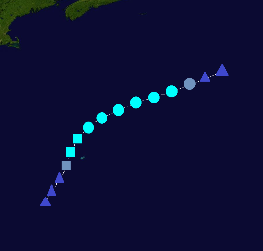 | |
| Duration | November 6 – November 9 |
|---|---|
| Peak intensity | 50 mph (85 km/h) (1-min) 995 mbar (hPa) |
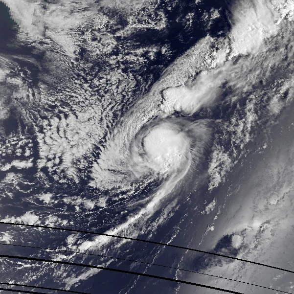
An extratropical storm formed on November 5 southwest of Bermuda. It acquired subtropical characteristics, and was declared a subtropical depression on November 6. The depression strengthened into STS Paulette 6 hours later while very close to Bermuda. Paulette became tropical and reached its peak intensity of 50 mph/995 mbar before weakening. It dissipated on November 9. Paulette caused minimal damage.
Storm names[]
The following names were used to name tropical cyclones this year. This is the same list used in the 2008 season, expect for Gonzalo, Isaias, and Paulette, which replaced Gustav, Ike, and Paloma. The names Gonzalo, Isaias, and Paulette were used for the first time this year. Names that were not used are marked in gray.
|
|
|
Retirement[]
Due to extensive damage and deaths, the names Dolly and Fay were officially retired, and will never be used again for an Atlantic hurricane. They were replaced by Doria and Francine for the 2020 season.
List for 2020:
|
|
|
Season effects[]
This is a table of the storms and their effects in the 2014 Atlantic hurricane season. This table includes the storm's names, duration, peak intensity, Areas affected, damages, and death totals. Damage and deaths include totals while the storm was extratropical, a wave or a low. All of the damage figures are in 2014 USD (the listed damage figure is in millions).
| Storm name |
Dates active | Storm category at peak intensity |
Max 1-min wind mph (km/h) |
Min. press. (mbar) |
Areas affected | Damage (USD) |
Deaths |
|---|---|---|---|---|---|---|---|
| Arthur | June 2 – June 5 | Tropical storm | 60 (95) | 996 | None | None | 0 |
| Bertha | June 28 – July 4 | Category 2 hurricane | 105 (165) | 968 | Yucatan Peninsula, Mexico, Texas | 162 | 36 |
| Cristobal | July 7 – July 12 | Tropical storm | 60 (95) | 994 | Yucatan Peninsula, Florida, The Carolinas, US East Coast | 53 | 6 |
| Dolly | July 16 – July 23 | Category 3 hurricane | 120 (195) | 958 | Windward Islands, Lesser Antilles, Puerto Rico, The Bahamas, Florida, US Gulf Coast | 8,600 | 48 |
| Edouard | July 26 – July 31 | Category 1 hurricane | 90 (150) | 972 | None | None | 0 |
| Fay | August 2 – August 7 | Category 1 hurricane | 75 (120) | 981 | Windward Islands, Lesser Antilles, Puerto Rico, Hispaniola, Cuba, Turks & Caicos Islands, The Bahamas, Florida, The Carolinas | 1,800 | 164 |
| Gonzalo | August 14 – August 25 | Category 4 hurricane | 150 (240) | 932 | Lesser Antilles, Bermuda, Newfoundland | 29 | 3 |
| Hanna | August 20 – August 23 | Tropical storm | 50 (85) | 997 | Florida, Alabama, Georgia, The Carolinas | 20 | 1 |
| Isaias | August 25 – August 28 | Tropical storm | 45 (75) | 998 | None | None | 0 |
| Josephine | August 28 – September 3 | Category 2 hurricane | 105 (165) | 966 | Cape Verde | None | 0 |
| Kyle | September 7 – September 12 | Category 1 hurricane | 90 (150) | 979 | Puerto Rico, Hispaniola, Bermuda | 121 | 8 |
| Twelve | September 11 – September 12 | Tropical depression | 35 (55) | 1004 | Mexico | Minimal | 0 |
| Laura | September 15 – September 18 | Tropical storm | 65 (100) | 990 | Texas, Louisiana | 56 | 4 |
| Marco | September 20 – September 22 | Tropical storm | 45 (75) | 1001 | None | None | 0 |
| Nana | September 29 – October 4 | Category 2 hurricane | 105 (165) | 968 | Belize, Yucatan Peninsula, Cuba | 308 | 24 |
| Omar | October 18 – October 24 | Category 3 hurricane | 120 (195) | 956 | Windward Islands, Jamaica, Haiti, Cuba, Turks & Caicos Islands | 561 | 98 |
| Paulette | November 6 – November 9 | Tropical storm | 50 (85) | 995 | Bermuda | Minimal | 0 |