NOTICE: This is in no way based on real life storms - the storms listed here are entirely fictional for the year, and do not represent the season in the physical world. Please be guided.
The 2022 Atlantic hurricane season is an above-average season, but slightly less destructive than previous season. It featured some intense storms like Earl and Lisa, which ravages the Caribbean, Paula, which hits Haiti, and Julia, which is a fishspinner. Lisa is the most destructive of the all.
Timeline[]

Systems[]
|
Tropical Depression One[]
| Tropical depression (SSHWS) | |
  | |
| Duration | July 4 – July 7 |
|---|---|
| Peak intensity | 35 mph (55 km/h) (1-min) 1008 mbar (hPa) |
A very well-defined tropical wave moved off the African coast on July 2. It gradually took on tropical characteristics over the next few days, and became TD Nine on July 4. Initially, it was predicted to become a weak hurricane that could potentially threaten the Caribbean. However, shear increased more than anticipated and the Depression began to weaken. The Depression became a remnant low on July 7.
Tropical Storm Alex[]
| Tropical storm (SSHWS) | |
  | |
| Duration | July 11 – July 15 |
|---|---|
| Peak intensity | 45 mph (75 km/h) (1-min) 1002 mbar (hPa) |
A well-defined low pressure area moved across the United States. The national hurricane center marked this unusual occurrence on their TWO, stating that a TC could form if a closed center formed. The low approached the Florida and began to rapidly develop as it made contact with water, developing into Tropical Depression Two while still located over the banks. Moving offshore, it intensified into Tropical Storm Alex later that day. Moderate wind shear prevented any further intensification despite an organized appearance. Alex transitioned into a post-tropical cyclone on July 15 while located south of Newfoundland.
Hurricane Bonnie[]
| Category 2 hurricane (SSHWS) | |
  | |
| Duration | July 15 – July 22 |
|---|---|
| Peak intensity | 100 mph (155 km/h) (1-min) 969 mbar (hPa) |
Another tropical wave emerged off the coast of Africa on July 13. The wave developed rapidly despite nearby dry air, become Tropical Depression Three on July 15. That evening, it intensified into Tropical Storm Bonnie. Bonnie steadily intensified over the next few days, intensifying into a hurricane July 18. Henri reached peak intensity on July 19, with 100 mph winds, before increasing wind shear caused weakening. Bonnie accelerated north, but wind shear further weakened this storm, Bonnie began to accelerate further, and became extratropical on July 21. It was absorbed by a larger extratropical system in the next day, which causes some rain in England.
Hurricane Colin[]
| Category 1 hurricane (SSHWS) | |
  | |
| Duration | July 23 – July 29 |
|---|---|
| Peak intensity | 80 mph (130 km/h) (1-min) 986 mbar (hPa) |
An increase in convection in the ITCZ allowed for a tropical wave to form on July 20. This wave moved unusually, moving almost directly northward and changing speed erratically. On July 24, it was declared a Tropical Storm, and named Colin. Colin gradually intensified due to its large structure, becoming a hurricane on July 25 and peaking early the next day with 80 mph winds. After this time, Colin entered cooler waters and was picked up by a trough, causing it to accelerate and weaken. Colin became post-tropical on July 29.
Hurricane Danielle[]
| Category 1 hurricane (SSHWS) | |
  | |
| Duration | July 26 – August 1 |
|---|---|
| Peak intensity | 80 mph (130 km/h) (1-min) 981 mbar (hPa) |
An organized low pressure area was spawned in the Bay of Campeche on July 24. Gradual organization occurred over the next several days, and TD Five formed on July 26. It intensified into Tropical Storm Danielle the next day. Shortly after this time, rapid intensification began, as conditions were favorable. With an eye forming, Danielle became a hurricane on July 28. Despite a well-defined eye under the convection, it never had an opportunity to pop out before wind shear began to increase. Danielle peaked with 80 mph winds before it began to weaken. It weakened below hurricane status on July 30, and it made landfall in Mexico, later that day as a strong tropical storm. Danielle continued inland, before dissipating over northeastern Mexico on August 1.
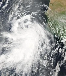
Tropical Depression Five[]
| Tropical depression (SSHWS) | |
  | |
| Duration | August 5 – August 7 |
|---|---|
| Peak intensity | 35 mph (55 km/h) (1-min) 1009 mbar (hPa) |
A non-tropical low began to show signs of tropical formation on August 2. It gradually increased in organization, and persistent convection occurred. Tropical Depression Five formed on August 5. It was forecast to become a Tropical Storm, and would have been named Earl. However, colder waters prevented any change in strength during its life. Twelve became a remnant low on August.
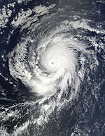
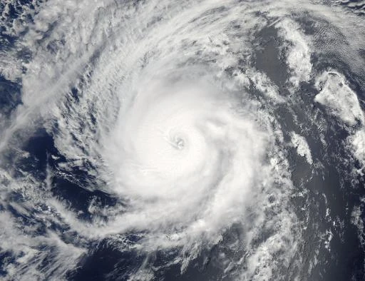
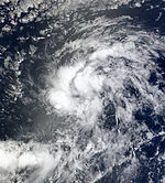
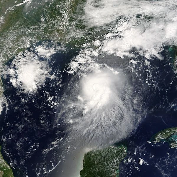
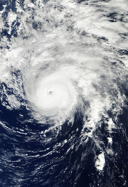
Hurricane Earl[]
- Main article: Hurricane Earl (2022)
| Category 4 hurricane (SSHWS) | |
  | |
| Duration | August 8 – August 17 |
|---|---|
| Peak intensity | 140 mph (220 km/h) (1-min) 942 mbar (hPa) |
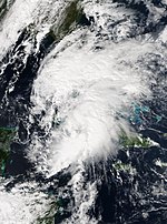
Tropical Depression Six developed from a tropical wave on August 8, while located south of Cape Verde. It tracked west-northwestward and intensified into Tropical Storm Earl on the next day. Favorable conditions such as warm sea surface temperature and good upper-level outflow allowed the storm to rapidly deepen. By August 12, Earl peaked as a 140 mph (220 km/h) Category 4 hurricane. However, it weakened due to wind shear. Earl passed south of Hispaniola, fluctuating between Category 1 and 2 status. Later, it passed south of Cuba retaining hurricane-force winds. On August 14, the storm weakened to a tropical storm as it heads toward Alabama. Georges quickly weakened to a tropical depression on August 16, by which time it made landfall on Georgia. By August 17, it dissipated close to the Atlantic Ocean near the Florida-Georgia border.
Hurricane Fiona[]
| Category 3 hurricane (SSHWS) | |
  | |
| Duration | August 15 – August 23 |
|---|---|
| Peak intensity | 125 mph (205 km/h) (1-min) 958 mbar (hPa) |
Tropical Depression Seven developed from a tropical wave on August 15, while located well east of the Lesser Antilles. After tracking west-northwestward for 24 hours, the depression was upgraded to Tropical Storm Fiona. While at tropical storm intensity, Bonnie made a cyclonic loop on Puerto Rico and the Virgin Islands on August 17. Early on the following day, a hurricane hunter aircraft indicated that the storm strengthened into a hurricane. Bonnie curved north-northeastward on August 18, shortly before it peaked with winds of 125 mph (205 km/h). The storm weakened slightly due to wind shear, to a Category 2 hurricane. Colder waters weakened Fiona further to a tropical storm by late on August 21. The storm then accelerated east-northeastward offshore Newfoundland and Atlantic Canada, before becoming an extratropical cyclone on August 23.
Tropical Storm Gaston[]
| Tropical storm (SSHWS) | |
  | |
| Duration | August 20 – August 26 |
|---|---|
| Peak intensity | 60 mph (95 km/h) (1-min) 1000 mbar (hPa) |
A tropical wave moved off the coast of Africa on August 15. The wave lost definition for a short period due to increased vertical wind shear, but began to re-organize on August 19. The next day, it had the sufficient organization to be declared Tropical Depression Eight. Sometime the next day, it was upgraded to Tropical Storm Gaston. It gradually intensified to peak winds of 60 mph before entering an area of increasing shear. With the convection sheared to the east of the center, Gaston was downgraded to a Tropical Depression on August 25, and the storm fully dissipated the next day.
Tropical Storm Hermine[]
| Tropical storm (SSHWS) | |
  | |
| Duration | August 25 – August 29 |
|---|---|
| Peak intensity | 60 mph (95 km/h) (1-min) 996 mbar (hPa) |
A tropical wave emerged off the coast of Africa on August 16. It did not develop further until August 25, when it became Tropical Depression Nine. On August 26, it intensified into Tropical Storm Hermine. Hermine quickly began to curve out to sea, and developed a banding eye. It was initially thought to have peaked at 70 mph on August 27, but post analysis dropped the peak to 60 mph. After peak, Hermine encountered colder waters and began to weaken. Hermine began to accelerate to the northeast until it became post-tropical on August 29. Hermine's remnants brought disturbed weather to the Newfoundland.
Tropical Depression Ten[]
| Tropical depression (SSHWS) | |
  | |
| Duration | September 2 – September 5 |
|---|---|
| Peak intensity | 30 mph (45 km/h) (1-min) 1012 mbar (hPa) |
A poorly defined tropical wave moved off the coast of Africa on August 27. Due to unfavorable conditions, the wave did not develop further until it approached the Florida, where marginally favorable conditions allowed for Tropical Depression Ten to form, on September 2. Wind shear plagued the Depression through its life, and it was never anticipated to become a Tropical Storm. Seventeen dissipated on September 5.
Hurricane Ian[]
| Category 3 hurricane (SSHWS) | |
  | |
| Duration | September 12 – September 23 |
|---|---|
| Peak intensity | 120 mph (195 km/h) (1-min) 964 mbar (hPa) |
A tropical wave spawned Tropical Depression Eleven on September 12. Late that night, it strengthened into Tropical Storm ian. Gradual intensification occurred, with Ian becoming a hurricane on September 16. Ian then fluctuated between hurricane and tropical storm status for a short time as wind shear briefly impacted the system. Ian then peaked winds with 120 mph (195 km/hr). When Ian moved north of the Leeward Islands, the system began to weaken due to wind shear, down to Category 2 on September 18. Ian then began to accelerate away from land, fluctuating in strength. Gonzalo retained hurricane intensity until it became tropical storm, then post-tropical on September 21, and it dipped northeast into the Newfoundland, causing hurricane conditions there. The remnant cyclone dissipated on September 23.
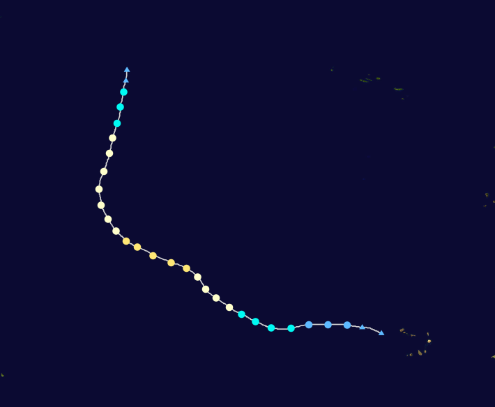
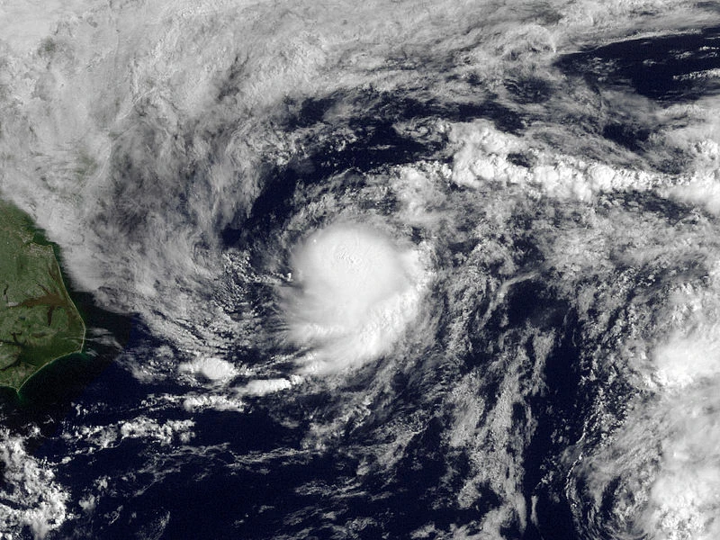
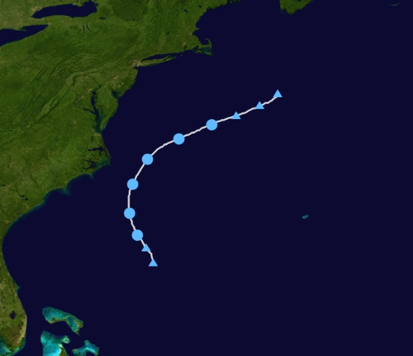
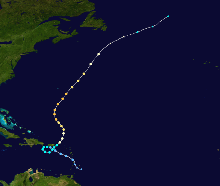
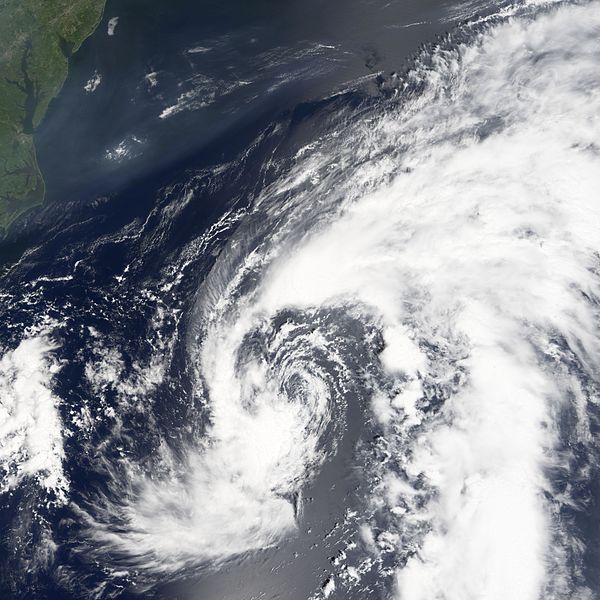
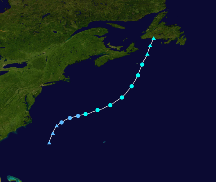
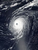
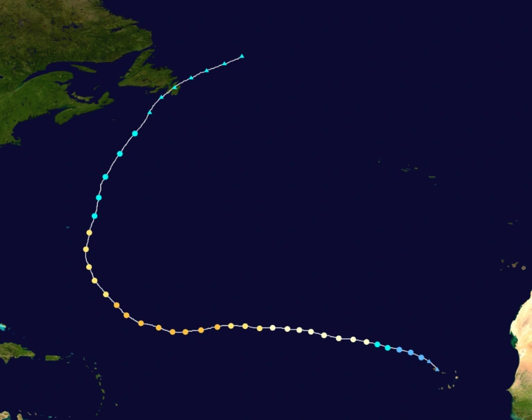
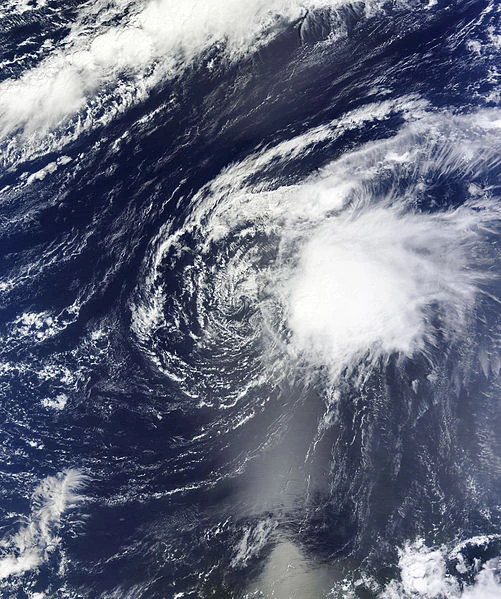
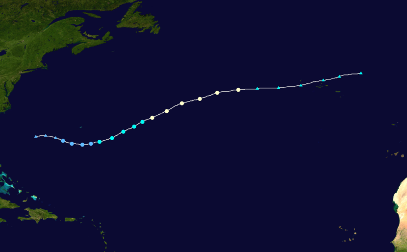
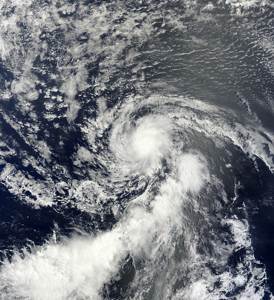
Hurricane Julia[]
- Main article: Hurricane Julia (2022)
| Category 4 hurricane (SSHWS) | |
  | |
| Duration | September 17 – September 29 |
|---|---|
| Peak intensity | 140 mph (220 km/h) (1-min) 945 mbar (hPa) |
A tropical wave immediately followed the wave that would become Tropical Depression Twelve. It quickly intensified into Tropical Storm Julia, and immediately began rapid intensification in very favorable conditions. It became a hurricane on September 19, and a major hurricane the following three days, the fourth one of the season. As Julia's eye cleared out, it intensified into a Category 4 hurricane, and peaked with winds of 140 mph on September 23. Shortly after peak, it began to weaken due to decreasing ocean temperatures and wind shear. It curved eastward west of Bermuda high as it weakened to a Category 1 hurricane. Julia maintained Category 1 status until it made landfall in Newfoundland. It became extratropical over the country on September 29. Julia caused some swells in Bermuda, and hurricane conditions in Newfoundland, causing moderate damage.
Tropical Storm Karl[]
| Tropical storm (SSHWS) | |
  | |
| Duration | September 20 – September 25 |
|---|---|
| Peak intensity | 65 mph (100 km/h) (1-min) 993 mbar (hPa) |
A large non-tropical low began to organize on September 18. The NHC, noting fairly favorable conditions, marked the low for development. Initially shear kept the system from developing much, but shear decreased on September 20, and TD Thirteen formed the next day. It strengthened into Tropical Storm Karl the next day as it moved erratically in a series of curves, which formed an erratic loop. Karl peaked on September 23, with winds of 60 mph, until cooler waters caused weakening. Karl dissipated on September 25, with little to no land impact.
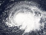
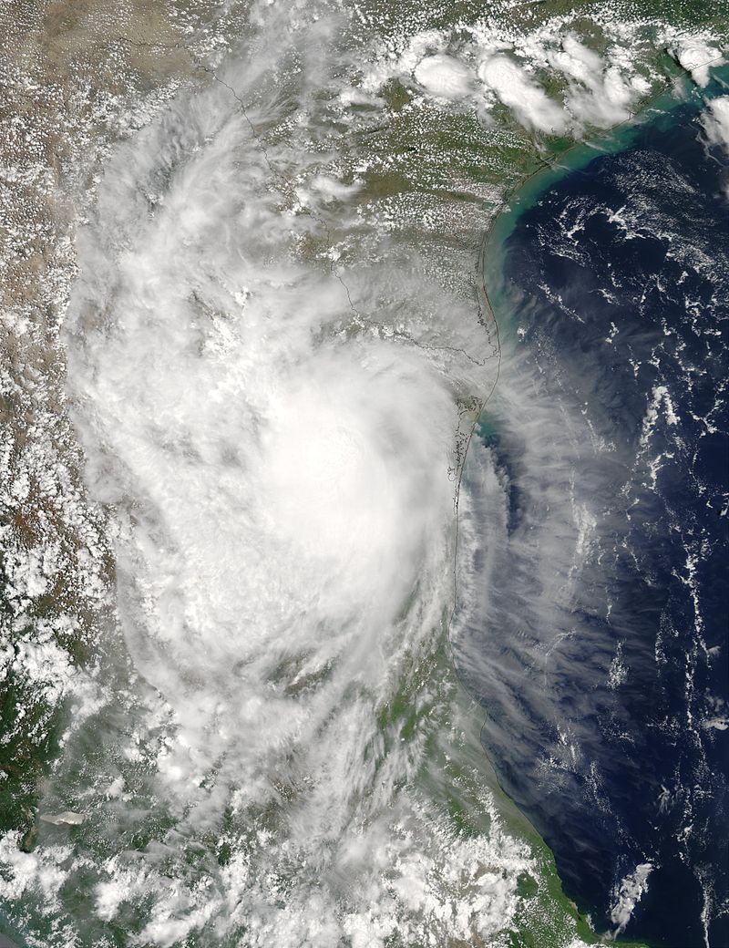
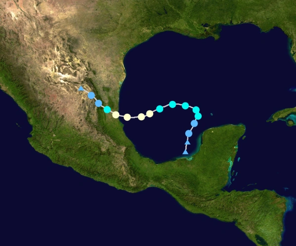
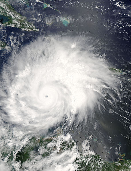
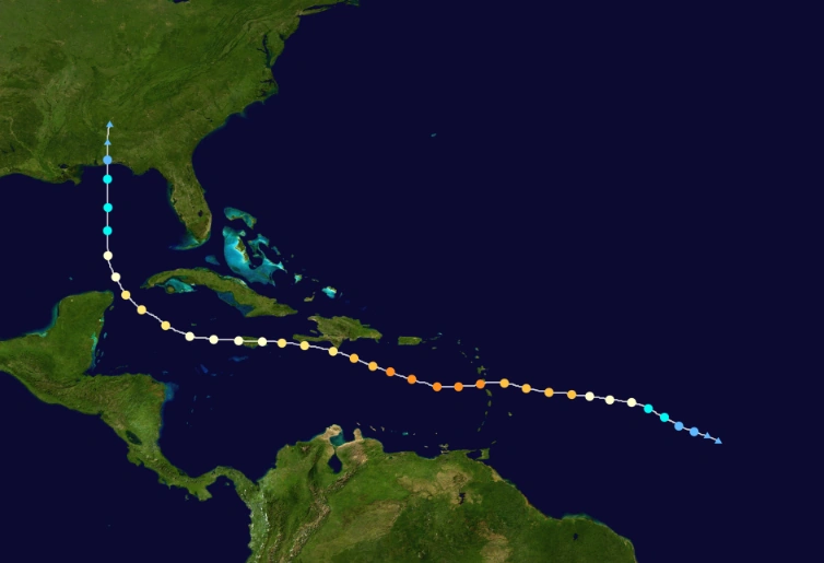
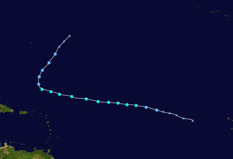
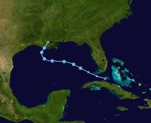
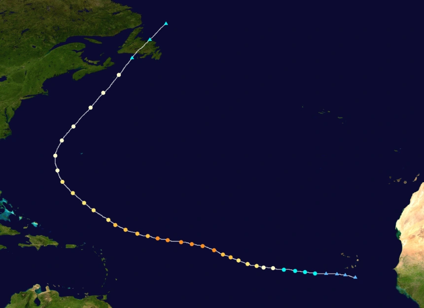
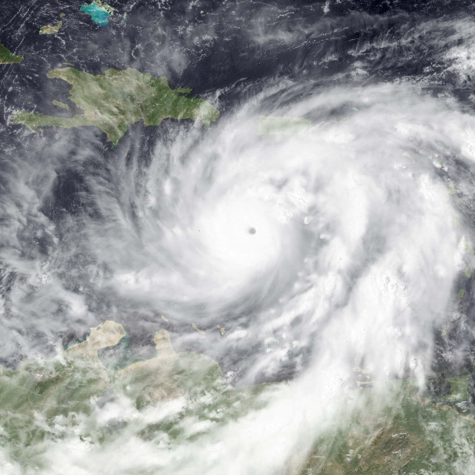
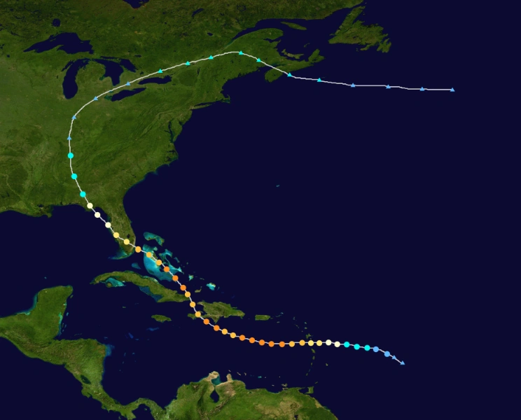
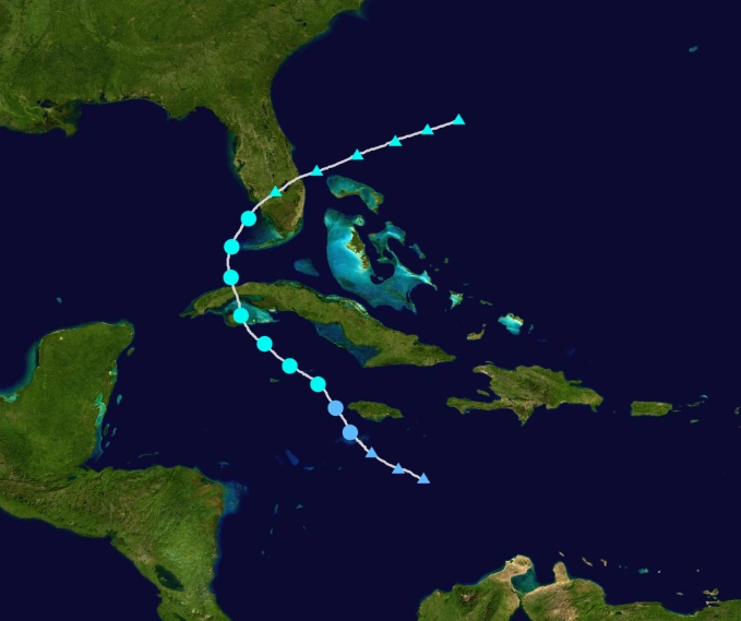
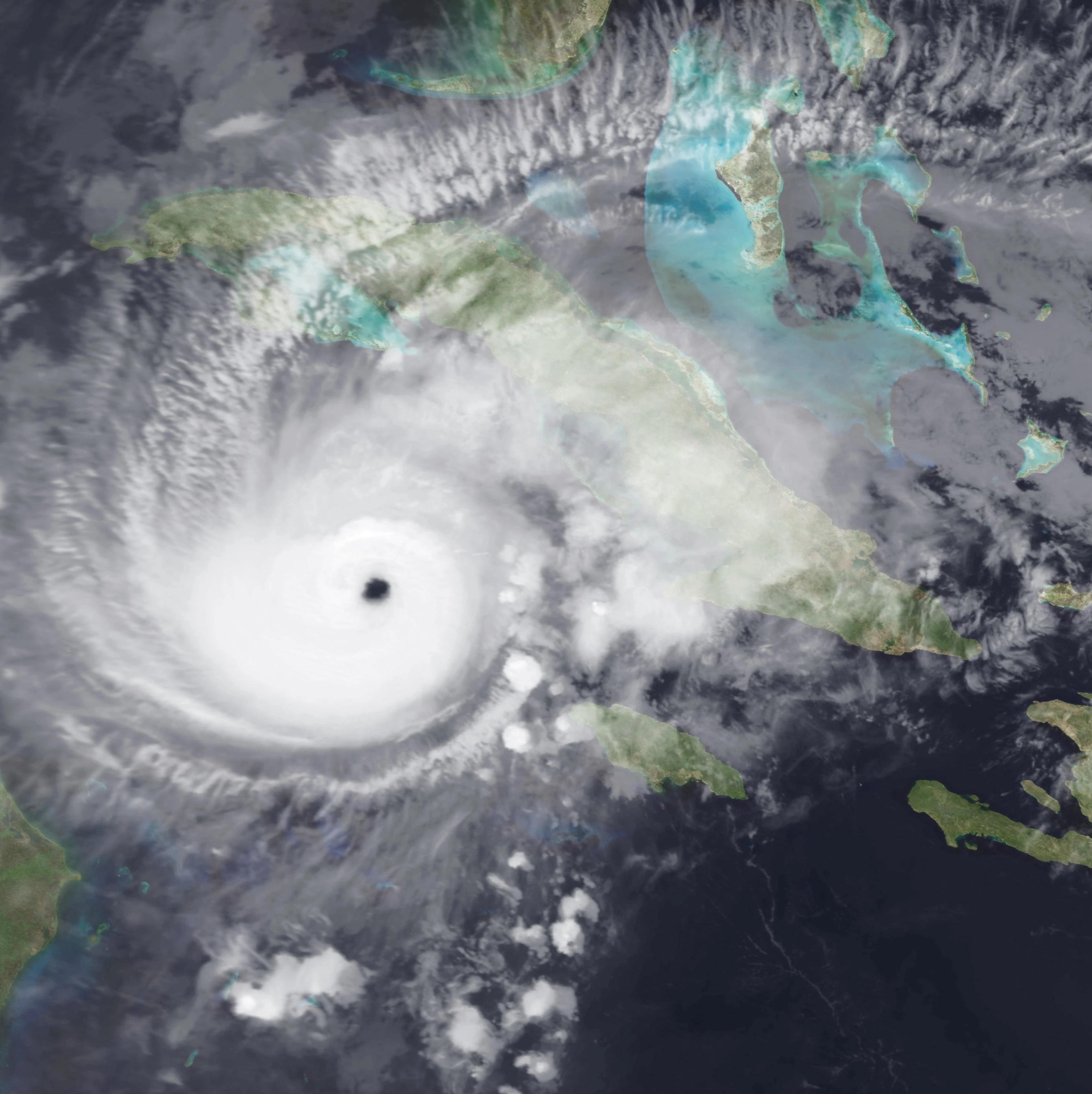
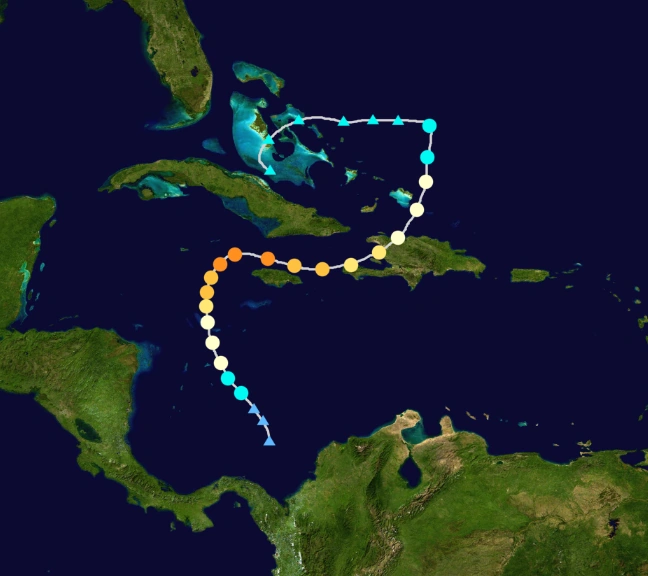
Hurricane Lisa[]
- Main article: Hurricane Lisa (2022)
| Category 4 hurricane (SSHWS) | |
  | |
| Duration | September 21 – October 4 |
|---|---|
| Peak intensity | 150 mph (240 km/h) (1-min) 932 mbar (hPa) |
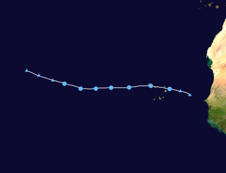
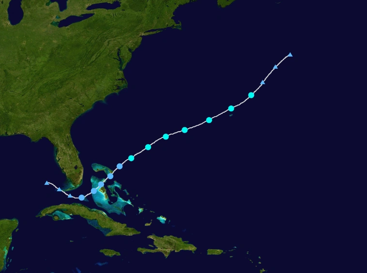
A tropical wave, the largest one, emerged off Africa on September 16. This wave was slow to consolidate despite favorable conditions. The NHC said on September 19 that the wave was close to Depression status, and sure enough, TD Fourteen was declared on September 21. The next day it strengthened into Tropical Storm Lisa. With a favorable environment, Lisa became a hurricane on September 23. Lisa remained a fairly weak hurricane after this however, due to a slight increase in shear. On the next day, it began rapid intensification, becoming a major hurricane. On September 24, Lisa intensified into a Category 4 hurricane, reaching peak winds of 150 mph. Lisa buffeted Hispaniola, and due to that, Lisa weakened to a Category 3 hurricane on September 25 due to an eyewall replacement cycle, but it briefly regenerated to a Category 4, than weakening yet again. Lisa then made landfall near Miami, Florida as a Category 3 hurricane, causing catastrophic impact. Lisa made it's final landfall on Florida again, as a Category 1. After landfall, Lisa curved east, and became an extratropical cyclone on October 4. The extratropical remnants caused some weather disturbances in far north.
Hurricane Martin[]
| Category 1 hurricane (SSHWS) | |
  | |
| Duration | October 6 – October 12 |
|---|---|
| Peak intensity | 90 mph (150 km/h) (1-min) 974 mbar (hPa) |
A tropical wave moved off Africa in late September. Due to unfavorable conditions, the wave was not initially monitored. It traversed the Atlantic, and began to develop disorganized convection as it moved north of the Leewards on October 3. The wave was monitored for development as conditions were somewhat favorable. On October 6 a recon jet confirmed that Tropical Depression Fifteen had formed, and it intensified into Tropical Storm Martin the next day. The storm moved eastward due to the influence of a high pressure area. An eye briefly appeared on October 9 as Martin intensified into a hurricane, peaking at 90 mph. After this, Marin reached colder waters and began to weaken, and Marin lost tropical characteristics and was declared extratropical on October 12.
Tropical Storm Nicole[]
| Tropical storm (SSHWS) | |
  | |
| Duration | October 13 – October 17 |
|---|---|
| Peak intensity | 60 mph (95 km/h) (1-min) 998 mbar (hPa) |
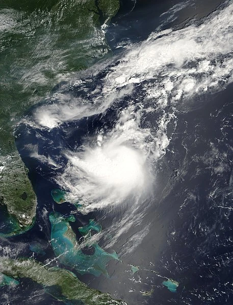
A tropical wave was tracked as it moved across the Atlantic. Despite the wave was anticipated to develop east of the Caribbean, little change in structure occurred. Stronger wind shear in the Caribbean caused the NHC to almost drop the wave. In the Central Caribbean, convection rapidly increased. It and quickly developed into Tropical Depression Sixteen, and into Tropical Storm Nicole the next day. In an area of low steering currents, Nicole moved northwest, fluctuating between Tropical Storm and Depression status, due to some wind shear. On October 15, Nicole began to quickly intensify due to a convective burst, and made landfall in Florida, with winds of 60 mph. The storm quickly crossed Florida and lost tropical characteristics on October 17.
Tropical Storm Owen[]
| Tropical storm (SSHWS) | |
  | |
| Duration | October 23 – October 26 |
|---|---|
| Peak intensity | 45 mph (75 km/h) (1-min) 1005 mbar (hPa) |
A tropical wave emerged off the coast of Africa on October 21, and quickly began to develop, becoming a Tropical Depression on October 23. On the next day, the Depression intensified into Tropical Storm Owen. Despite the NHC was anticipating gradual intensification to near hurricane status, Ian struggled with strong wind shear its entire 3-day lifespan, not being able to intensify past 45 mph. By October 25, Owen was becoming very disorganized and conditions were not looking any more favorable. Continued weakening occurred until October 26, when Owen degenerated into a Tropical wave north of Lesser Antilles.
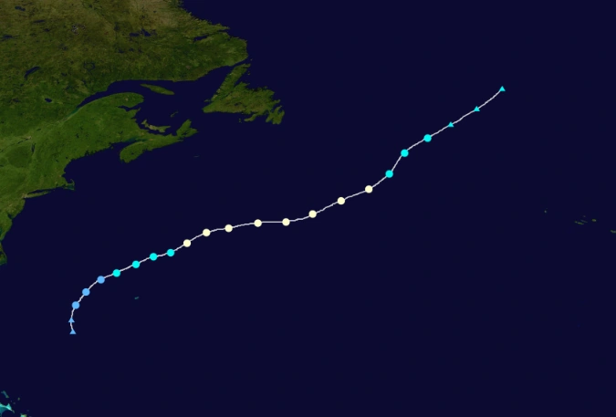
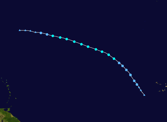
Hurricane Paula[]
- Main article: Hurricane Paula (2022)
| Category 4 hurricane (SSHWS) | |
  | |
| Duration | November 3 – November 10 |
|---|---|
| Peak intensity | 130 mph (215 km/h) (1-min) 949 mbar (hPa) |
A broad area of disturbed weather developed in the southwestern Caribbean Sea on November 1, ultimately coalescing into a tropical depression on November 3. It moved north amid a favorable environment, becoming Tropical Storm Paula twelve hours after formation and attaining hurricane intensity on November 5. An impinging upper-level trough directed Paula toward the northeast while enhancing outflow, prompting a period of rapid intensification that brought the storm to its peak as a Category 4 hurricane with winds of 130 mph (215 km/h) on November 6, the strongest November hurricane since Paloma. An increase in wind shear soon began to take a toll on the cyclone, weakening Paula to Category 2 strength as it made landfall near Haiti, and further to a tropical storm on November 9. It ultimately degenerating to a remnant low early the next day.
Season Effects[]
| Storm name |
Dates active | Storm category at peak intensity |
Max 1-min wind mph (km/h) |
Min. press. (mbar) |
Areas affected | Damage (USD) |
Deaths | |||
|---|---|---|---|---|---|---|---|---|---|---|
| One | July 4 – July 7 | Tropical depression | 35 | 1008 | None | None | None | |||
| Alex | July 11 – July 15 | Tropical storm | 45 | 1002 | Bahamas, United States | 3.2 | None | |||
| Bonnie | July 15 – July 22 | Category 2 hurricane | 100 | 969 | None | None | None | |||
| Colin | July 23 – July 29 | Category 1 hurricane | 80 | 986 | None | None | None | |||
| Danielle | July 26 – August 1 | Category 1 hurricane | 80 | 981 | Mexico | 85.5 | 2 | |||
| Five | September 12 – September 15 | Tropical depression | 35 | 1009 | None | None | None | |||
| Earl | August 5 – August 7 | Category 4 hurricane | 140 | 942 | Greater Antilles, Puerto Rico, Jamaica, Cuba, Mexico, United States | 6750 | 56 | |||
| Fiona | August 8 – August 17 | Category 3 hurricane | 125 | 958 | Puerto Rico, Hispaniola | 45 | 11 | |||
| Gaston | August 20 – August 26 | Tropical storm | 60 | 1000 | None | None | None | |||
| Hermine | August 25 – August 29 | Tropical storm | 60 | 996 | Newfoundland | None | None | |||
| Ten | September 2 – September 5 | Tropical depression | 30 | 1012 | United States | 134 | 5 | |||
| Ian | September 12 – September 23 | Category 3 hurricane | 120 | 964 | Newfoundland, Cape Verde | Minimal | None | |||
| Julia | September 17 – September 29 | Category 4 hurricane | 140 | 945 | Newfoundland, Cape Verde | 89 | 2 | |||
| Karl | September 20 – September 25 | Tropical storm | 65 | 993 | None | None | None | |||
| Lisa | September 21 – October 4 | Category 4 hurricane | 150 | 932 | Cape Verde, Lesser Antilles, Puerto Rico, Hispaniola, Haiti, Cuba, Bahamas, United States | 87650 | 345 | |||
| Martin | October 6 – October 12 | Category 1 hurricane | 90 | 974 | None | None | None | |||
| Nicole | October 13 – October 17 | Tropical storm | 60 | 998 | Jamaica, Cuba, United States | 43.6 | 1 | |||
| Owen | October 23 – October 26 | Tropical storm | 55 | 1005 | None | None | None | |||
| Paula | November 3 – November 10 | Category 4 hurricane | 130 | 949 | Jamaica, Cuba, Hispaniola | 5670 | 125 | |||
| Season aggregates | ||||||||||
| 22 systems | July 21 –
December 13 |
$100.470 Billion | 547 | |||||||
Storm Names[]
The following names were used for named storms that formed in the North Atlantic in 2022. The names not retired from this list were used again in the 2028 season. This is the same list used for the 2016 season, except for Martin and Owen, which replaced Matthew and Otto. Names that were not assigned are marked in gray.
|
|
|
Retirement []
The World Meteorological Organization retired three names in the spring of 2023: Earl, Lisa and Paula. They were replaced in the 2028 season by Edgar, Lucille and Paige, respectively.
Other Seasons[]
| Atlantic hurricane seasons | |
|---|---|
| 2018-2019 | 2018 • 2019 |
| 2020-2030 | 2020 • 2021 • 2022 • 2023 • 2024 • 2025 • 2026 • 2027 • 2028 • 2029 |
| 2030-2040 | 2030 • 2031 • 2032 • 2033 • 2034 • 2035 • 2036 • 2037 • 2038 • 2039 |
| 2040-2050 | 2040 • 2041 • 2042 • 2043 • 2044 • 2045 • 2046 • 2047 • 2048 • 2049 |
| 2050-2060 | 2050 • 2051 • 2052 • 2053 • 2054 • 2055 • 2056 • 2057 • 2058 • 2059 |