NOTICE: This is in no way based on real life storms - the storms listed here are entirely fictional for the year, and do not represent the season in the physical world. Please be guided.
The 2020 Atlantic hurricane season was the first in a group of three extremely active Atlantic hurricane seasons. It is tied alongside 1887, 1995, 2011, 2012 with 19 tropical storms, the third highest count in recorded history. It featured 11 hurricanes, which is the third highest total.
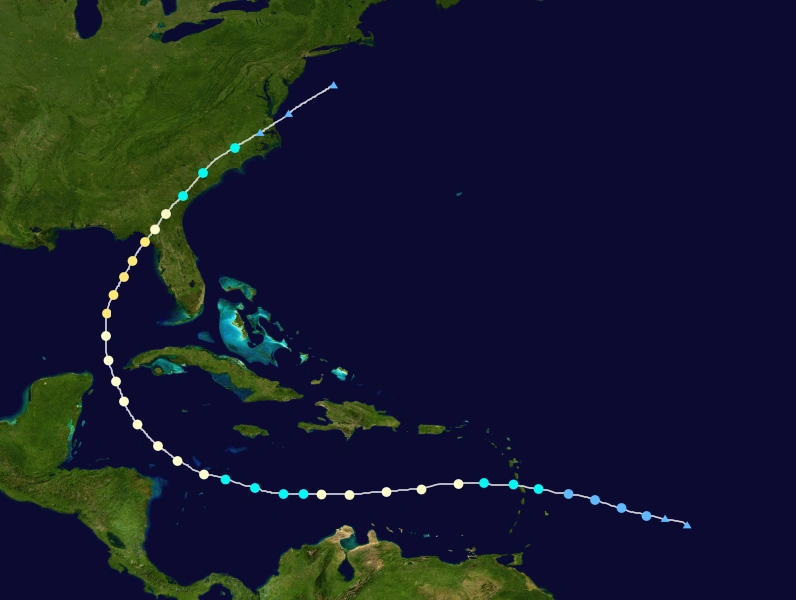
The season produced a handful of very destructive hurricanes: Edouard, Isaias, Marco and Sally. Edouard is a very strong storm which slams Texas at Category 4 intensity, the strongest since Harvey. Isaias is a very destructive East Coast hurricane, and the first List VI Category 5 hurricane. Marco is the strongest Atlantic hurricane in history, beating Wilma and Allen. It is also one of the deadliest and the costliest storm in the basin. Marco caused a total of $442 billion, mostly in Louisiana. The last destructive storm, Sally, further decimated the areas already devastated by Marco. Most of United States received the impact, but Florida escaped most of the damage. The season also produced a ton of ACE and featured the first December storm in a decade. Other storms like Nana and Laura caused minimal damage.
Timeline[]

Systems[]
|
Hurricane Arthur[]
| Category 1 hurricane (SSHWS) | |
  | |
| Duration | June 7 – June 13 |
|---|---|
| Peak intensity | 80 mph (130 km/h) (1-min) 979 mbar (hPa) |
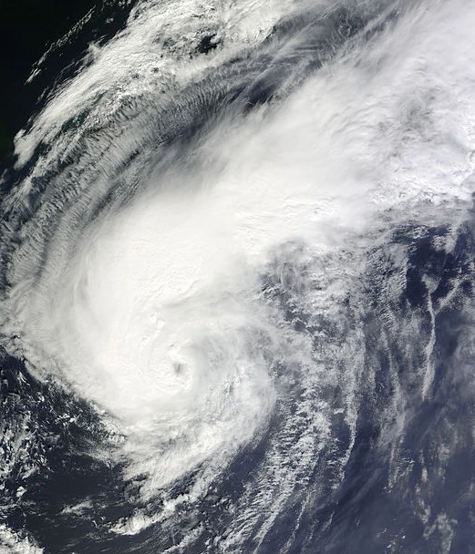
On June 2, a piece of low-level energy formed over the northwestern Gulf of Mexico. After crossing Georgia and South Carolina. An area of low pressure developed off the Southeast United States by June 5, eventually leading to the formation of a tropical depression on June 7. Amid a generally favorable environment, the depression intensified into Tropical Storm Arthur that same day and further to a Category 1 hurricane on June 9. An approaching mid-level trough directed the storm north-northeastward as it continued to intensify, and Arthur reached its peak with winds of 80 mph (130 km/h) on June 9. A few hours later, it moved ashore on North Carolina. Following landfall, Arthur accelerated northeast across the western Atlantic while encountering an increasingly unfavorable environment, weakening to a tropical storm on June 11 and transitioning into an extratropical cyclone a day later. The post-tropical low eventually dissipated east of Labrador late on June 13.
Tropical Storm Bertha[]
| Tropical storm (SSHWS) | |
  | |
| Duration | July 11 – July 15 |
|---|---|
| Peak intensity | 50 mph (85 km/h) (1-min) 999 mbar (hPa) |
A tropical wave moved off the west coast of Africa on July 9, developing into a tropical depression on July 19, On July 13, the depression strengthened to Tropical storm Bertha. On July 14, Bertha peaked with sustained winds of 50 mph (85 km/h) and a minimum pressure of 999 mbar. The storm soon began weakening due increasing wind shear, but Bertha briefly restrengthened on July 14. Lisa managed to maintain tropical storm intensity while battling unfavorable conditions until early on July 15, weakening to a tropical depression at that time, and became a remnant low.
Tropical Storm Cristobal[]
| Tropical storm (SSHWS) | |
  | |
| Duration | July 16 – July 22 |
|---|---|
| Peak intensity | 65 mph (100 km/h) (1-min) 996 mbar (hPa) |
An area of low pressure developed into Tropical Depression Three on July 16. Moving steadily west-northwestwards, Cristobal intensified into a tropical storm on July 18. Shortly thereafter, the storm reached its peak winds of 65 mph (100 km/h). It maintained it's strength for few days before weakening to a depression hours before making landfall on North Carolina, on July 21. Steering currents collapsed afterwards, but became a non-tropical low early the next day to the north of the Carolinas. The remnants moved west-northwest until dissipating on July 22.
Hurricane Dolly[]
| Category 2 hurricane (SSHWS) | |
  | |
| Duration | July 19 – July 26 |
|---|---|
| Peak intensity | 105 mph (165 km/h) (1-min) 973 mbar (hPa) |
On July 15, a tropical wave moved off the African coast. It did not develop until it entered the subtropical Atlantic on July 19, when it became Tropical Storm Dolly, Dolly was initially upgraded into a hurricane on July 30, but it did not maintain this peak for long, and it weakened back to a tropical storm due to wind shear. Shear relaxed shortly afterwards, however, and Dolly was able to re-intensify into a hurricane on July 22. It peaked the following day as a moderate Category 2 hurricane. Further intensification was halted by cooler waters as the storm began to accelerate north. Dolly transitioned into a powerful extratropical system on July 26 as it passed east of Newfoundland.
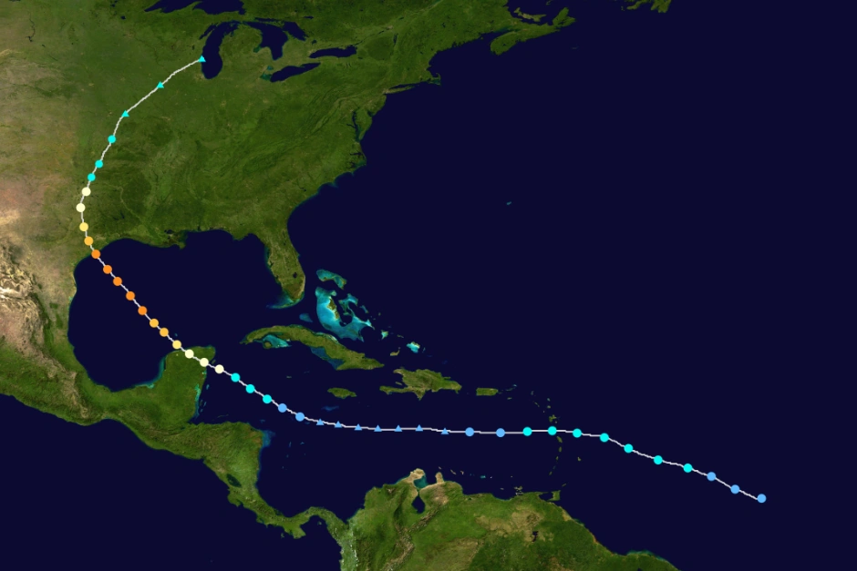
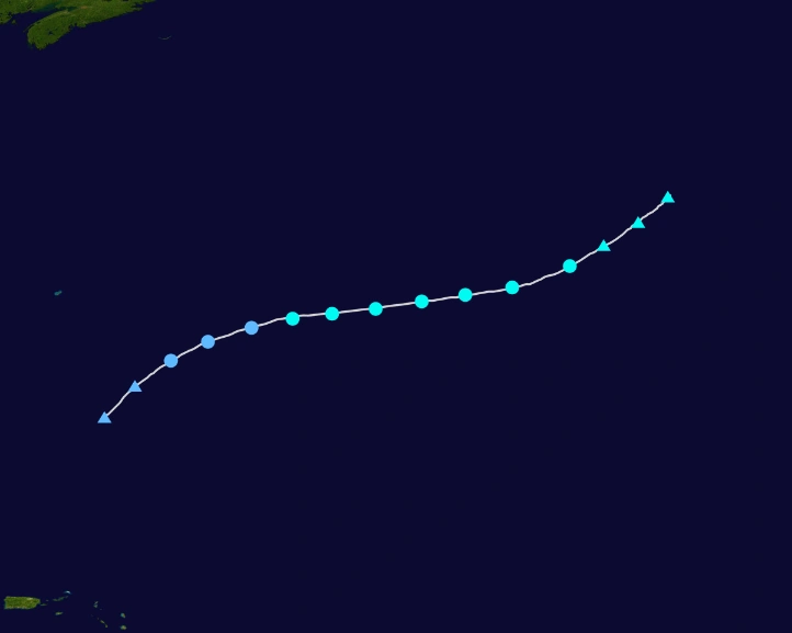
Hurricane Edouard[]
- Main article: Hurricane Edouard (2020)
| Category 4 hurricane (SSHWS) | |
  | |
| Duration | August 3 – August 15 |
|---|---|
| Peak intensity | 155 mph (250 km/h) (1-min) 927 mbar (hPa) |
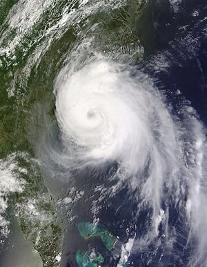
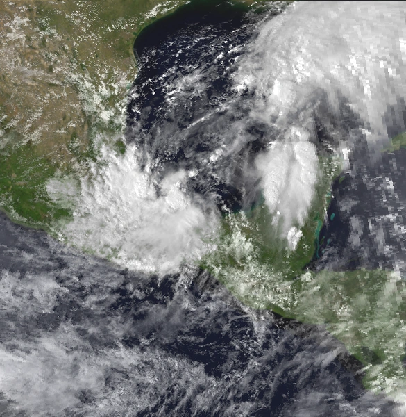
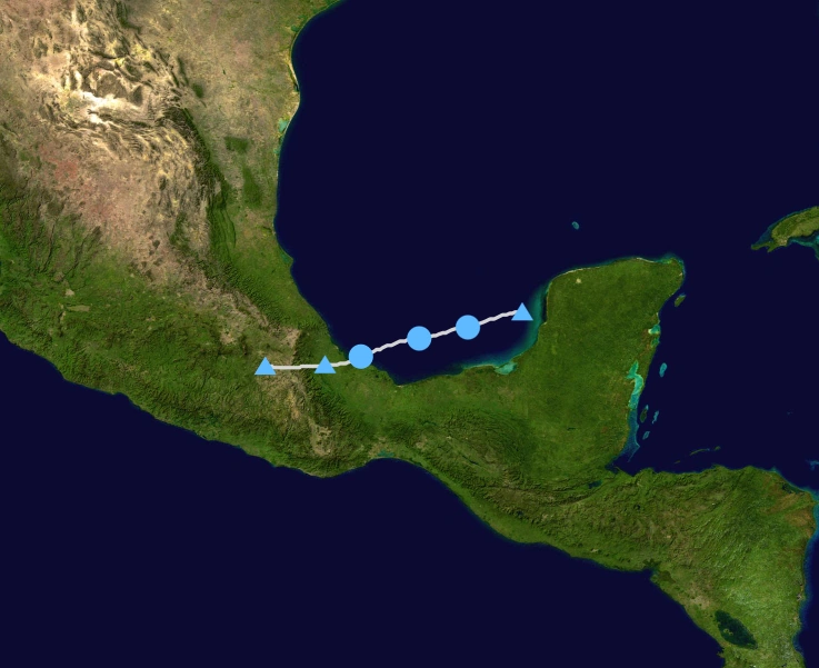
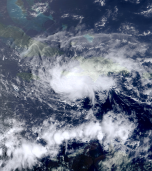
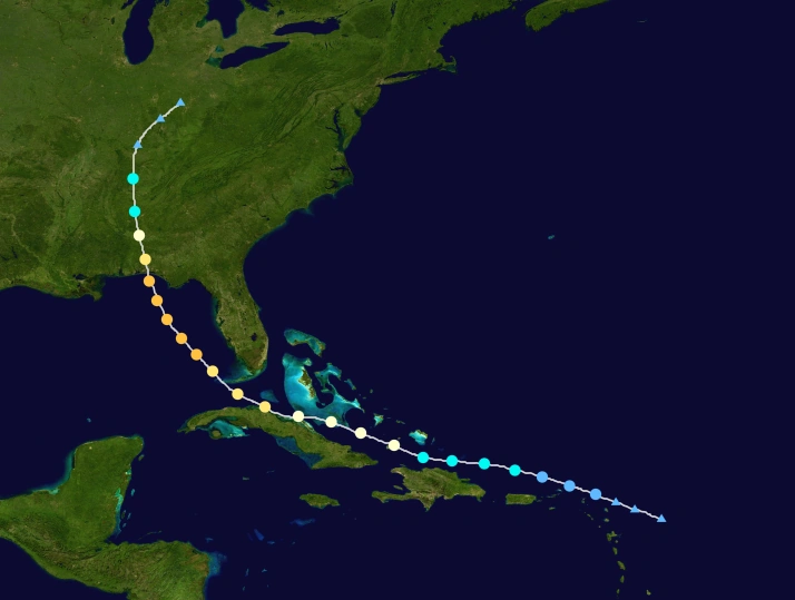
A tropical wave emerged off the coast of Africa on July 29. Due to unfavorable conditions, the wave did not develop further until August 3, it approached the Lesser Antilles, where Tropical Depression Five was declared. It did not take long for it to intensify into Tropical Storm Edouard. Upon forming, it was initally forecast to hit Haiti, but it turned west instead. Edouard weakened to a Tropical Depression on August 5, and it degenerated into a remnant low. Edouard regenerated later due to shear cooling down and warmer surface temperatures approaching. Edouard found favorable conditions in the Western Caribbean and rapidly intensified into a hurricane as it made landfall on the Yucatan Peninsula. A determined storm, Edouard retained hurricane intensity. It was at this point that a U.S threat was suggested. Edouard emerged over the Gulf of Mexico as a minimal hurricane on August 9, but began to quickly intensify after about 12 hours. It reached Category 2 status on August 11, and later that day, Edouard was the first major hurricane of the season as it continued northwest. Edouard cleared out a large eye, and intensification continued. On August 13, Edouard reached peak winds of 155 mph before it makes landfall in Texas. After landfall, Edouard weakened as it curved northeast. It then accelerated over the United States, dissipating afterwards. Edouard caused at least $177 billion (2020 USD), making it costliest hurricane behind Karen. It caused 135 deaths, most of it is in the United States.
Tropical Depression Six[]
| Tropical depression (SSHWS) | |
  | |
| Duration | August 12 – August 14 |
|---|---|
| Peak intensity | 35 mph (55 km/h) (1-min) 1010 mbar (hPa) |
The sixth tropical depression of the season originated from a tropical wave that crossed the western coast of Africa on August 8. Tracking westward, the wave reached the Caribbean Sea and became increasingly ill-defined while in the central Caribbean. An increase in convection was observed on August 10 and the subsequent day as the wave entered the western Caribbean. After moving into the Bay of Campeche, a broad low-pressure area formed in association with the system on August 11. An increase in deep convection on August 12 led to the formation of a tropical depression. The cyclone then moved west-southwest under the influence of an anticyclone. On August 14, the depression made landfall in Mexico. Once inland, the depression quickly diminished to a remnant low.
Tropical Storm Fay[]
| Tropical storm (SSHWS) | |
  | |
| Duration | August 15 – August 20 |
|---|---|
| Peak intensity | 65 mph (100 km/h) (1-min) 997 mbar (hPa) |
A tropical wave developed into a tropical depression just west of Puerto Rico on August 13. It soon intensified into Tropical Storm Fay, before striking Cuba later that day. Fay strengthened further after reaching the Straits of Florida on the following day. The system then struck Florida while it peaked with winds of 65 mph (100 km/h) near Lake Okeechobee on the next day. The storm moved east of North Carolina before becoming extratropical east of Maryland on August 20. The remnants dissipated just hours after. Fay caused at least $655 million (2020 USD) and 12 deaths.
Hurricane Gonzalo[]
| Category 1 hurricane (SSHWS) | |
  | |
| Duration | August 17 – August 23 |
|---|---|
| Peak intensity | 80 mph (130 km/h) (1-min) 978 mbar (hPa) |
A tropical wave departed the western coast of Africa on August 12, becoming entangled with an upper-level trough to form a tropical depression on August 17. The depression recurved northeast and quickly strengthened into Tropical Storm Gonzalo a day after formation. The system further intensified into a hurricane on August 20 and attained peak winds of 80 mph (130 km/h) twelve hours later. An abrupt increase in wind shear caused Otto to weaken as it accelerated northeast; it fell to tropical storm intensity on August 23 and transitioned into an extratropical cyclone six hours later, and dissipating later afterwards. It didn't cause any impact.
Tropical Storm Hanna[]
| Tropical storm (SSHWS) | |
  | |
| Duration | August 18 – August 23 |
|---|---|
| Peak intensity | 45 mph (75 km/h) (1-min) 1003 mbar (hPa) |
A large and convective tropical wave moved off the western coast of Africa in August 14, developing into a tropical depression on August 18. Satellite imagery and data from a research aircraft indicated the depression intensified into Tropical Storm Hanna two days later. Directed by an expansive mid-level ridge to its north, the cyclone moved west-northwest for several days, attaining peak winds of 45 mph (75 km/h) on August 21. It turned the storm northeast and then east as it encountered increasingly strong wind shear and began to weaken. Expansive outflow from Gonzalo caused Hanna's low-level circulation to become dislocated from its convection, and the system degenerated into a remnant low on August 23. The remnant low passed and dissipated six hours later.
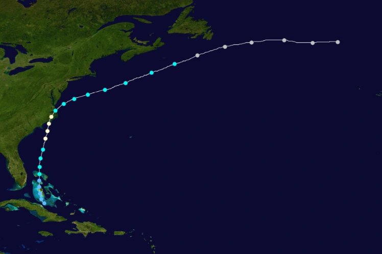
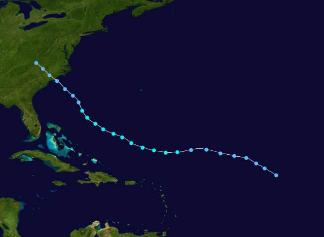
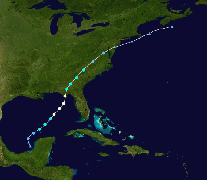
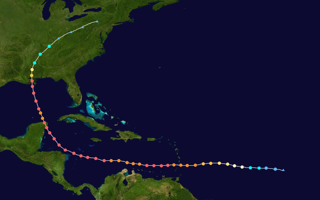
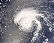
Hurricane Isaias[]
- Main article: Hurricane Isaias (2020)
| Category 5 hurricane (SSHWS) | |
  | |
| Duration | August 21 – September 3 |
|---|---|
| Peak intensity | 175 mph (280 km/h) (1-min) 910 mbar (hPa) |
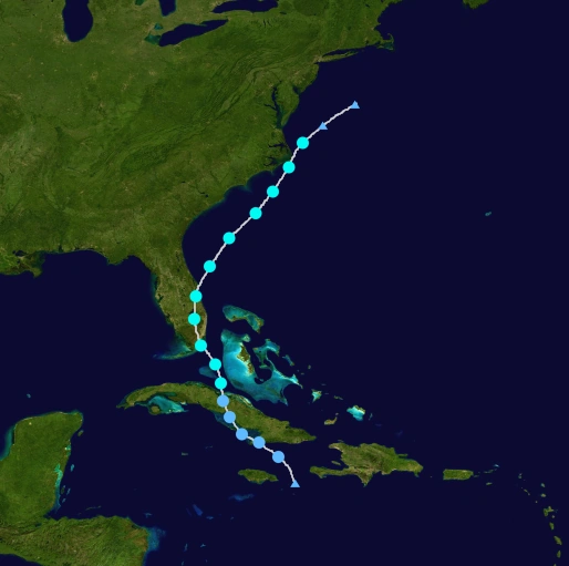
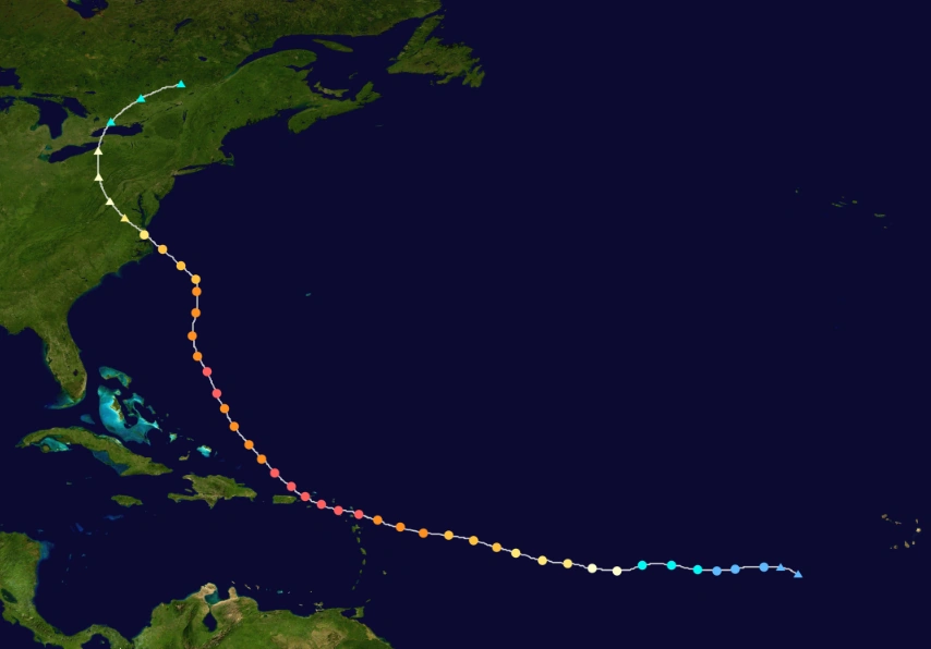
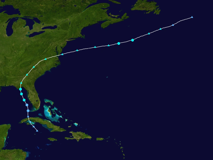
A tropical wave moved off the coast of Africa on August 17, which developed into Tropical Depression Ten early on August 21 to the southwest of the Cape Verde islands. It quickly intensified into Tropical Storm Isaias, and it continued to gradually intensify within an area of light wind shear and warm waters. Isaias strengthened to a hurricane on August 24, and the following two days it attained major hurricane status. Its intensity fluctuated over the subsequent days as it passed very close to the Lesser Antilles, and it attained peak winds of 175 mph (280 km/h) on August 27, a Category 5 hurricane on the Saffir-Simpson Scale. The hurricane oscillated between Category 4 and Category 5 status over the following four days, before weakening due to wind shear. On September 1, Isaias made landfall in North Carolina with winds of 115 mph (185 km/h). It continued northwestward, becoming extratropical over western Pennsylvania before being absorbed by a larger storm over Ontario on September 3.
Strong winds from Isaias extended from Lesser Antilles to New England and westward to West Virginia. The winds, combined with previous rainfall which moistened the soil, downed many trees and power lines across its path, leaving about 20 million electricity customers without power at some point. Coastal areas suffered from waves and its powerful storm surge, with areas in eastern North Carolina, Puerto Rico and southeast Virginia reporting severe damage from both winds and the storm surge. Throughout its path, Isaias resulted in $103 billion in damage (2017 USD) and 78 deaths, of which 12 were directly related to the storm's effects.
Tropical Storm Josephine[]
| Tropical storm (SSHWS) | |
  | |
| Duration | August 26 – September 2 |
|---|---|
| Peak intensity | 60 mph (95 km/h) (1-min) 998 mbar (hPa) |
An area of low pressure formed near the Bahamas on August 23 and gradually began to organize while moving north-northeast. On August 26 it was classified as Tropical Depression Eleven and was named Tropical Storm Josephine shortly thereafter while southeast of Newfoundland. The storm weakened on August 29 and it later tracked into the North Atlantic as an extratropical storm. Josephine moved east of Newfoundland where flooding was observed, where about 4 inches of rain caused the postponement of the annual Royal St. John's Regatta. Insured damage across the area totaled $8 million
Hurricane Kyle[]
| Category 1 hurricane (SSHWS) | |
  | |
| Duration | September 11 – September 17 |
|---|---|
| Peak intensity | 75 mph (120 km/h) (1-min) 983 mbar (hPa) |
Tropical Depression Five developed from a tropical wave in the southwestern Gulf of Mexico at on September 11, while located about midway between Mérida, Yucatán and Tampico, Tamaulipas. The depression is estimated to have strengthened into Tropical Storm Kyle. The storm headed north-northeastward and was difficult to track, due to multiple centers on satellite imagery. Kyle slowly curved east-northeastward and continued strengthening, with reconnaissance aircraft data indicating that the storm reached hurricane intensity on September 2. It peaked with winds of 75 mph (120 km/h). However, the storm weakened back to a tropical storm early on September 3, before landfall near Panama City, Florida. Kyle rapidly weakened to a tropical storm about six hours later and transitioned into an extratropical cyclone over Georgia late on September 17. Kyle caused storm surge mostly in areas of Florida and Alabama. It is estimated to have caused at least $1.2 billion (2020 USD) and 11 deaths.
Tropical Depression Thirteen[]
| Tropical depression (SSHWS) | |
  | |
| Duration | September 13 – September 15 |
|---|---|
| Peak intensity | 30 mph (45 km/h) (1-min) 1008 mbar (hPa) |
A tropical wave developed in the eastern Atlantic Ocean on September 10. The system slowly organized, developing a surface low pressure on September 12. Convection associated with the storm steadily increased as the low moved towards west. By September 13, the low organized into Tropical Depression Thirteen. An upper-level low to the west caused strong southwesterly wind shear, which inhibited development. On September 14, a building ridge caused the depression to slow at the same time as the convection began decreasing. By September 15, the depression degenerated into a remnant low.
Hurricane Laura[]
- Main article: Hurricane Laura (2020)
| Category 2 hurricane (SSHWS) | |
  | |
| Duration | September 15 – September 26 |
|---|---|
| Peak intensity | 105 mph (165 km/h) (1-min) 973 mbar (hPa) |
On September 11, a tropical wave moved off the coast of Africa and across the Atlantic. It developed a low level cloud circulation midway between Africa and the Lesser Antilles on September 14. The next day, the system had become sufficiently organized to classify the system as a tropical depression. On September 19 Laura became a hurricane while passing over the Caribbean Sea. The storm attained Category 2 status in the Gulf of Mexico before making landfall on the Florida coast on September 24. The next two days, it was absorbed by an extratropical low. In Florida, wind gusts reaching 100 mph (155 km/h), coupled with over 2 inches of rainfall and a storm surge of 3 feet, caused $2.4 billion (2020 USD) in damage. A total of 100,000 people lost power, and oil rigs offshore were shut down for up to a week.
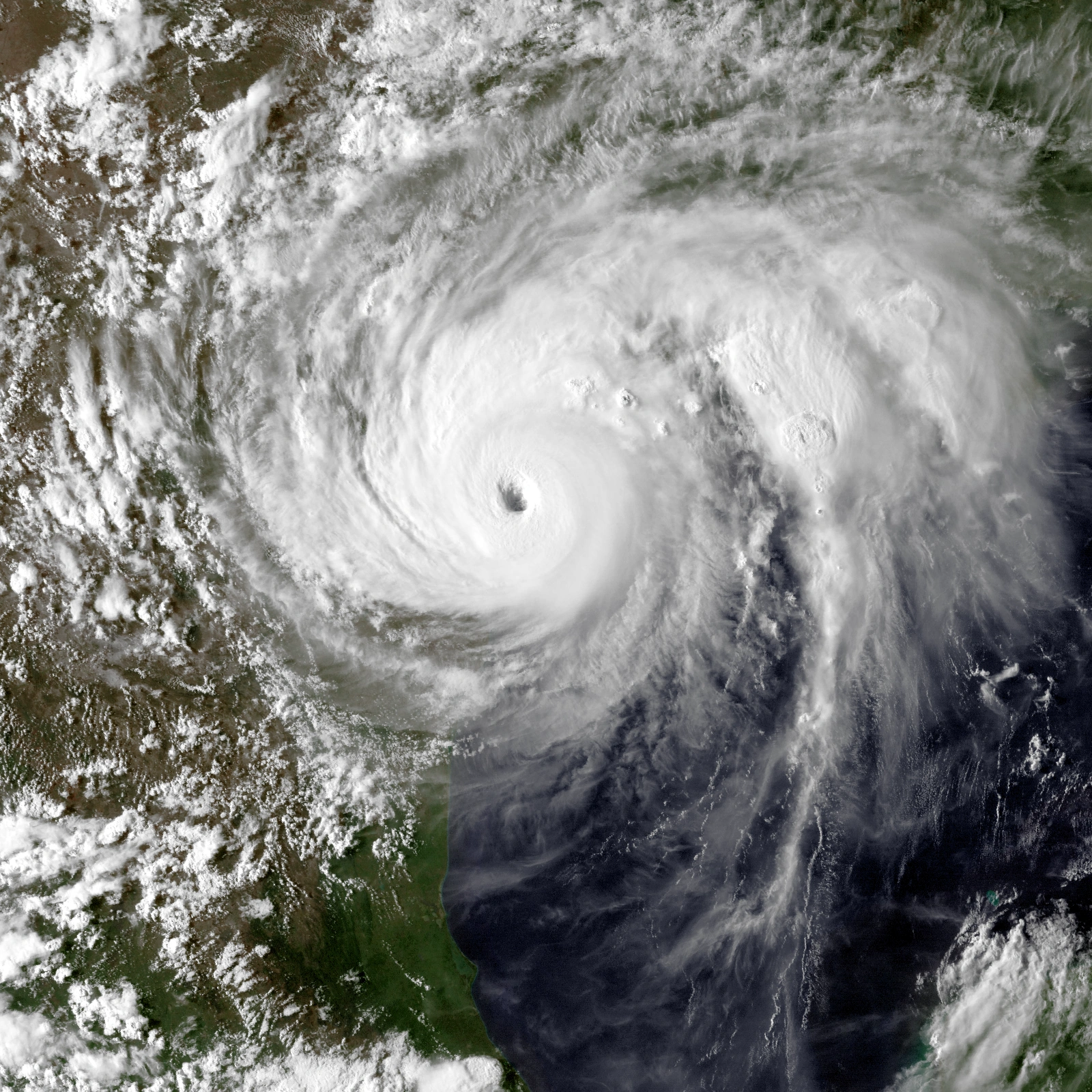
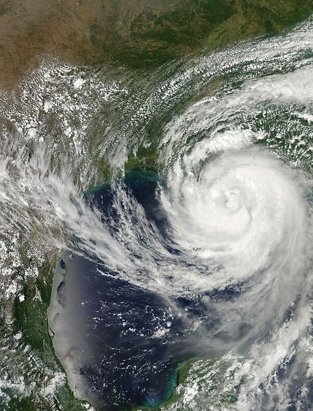
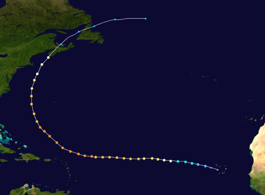
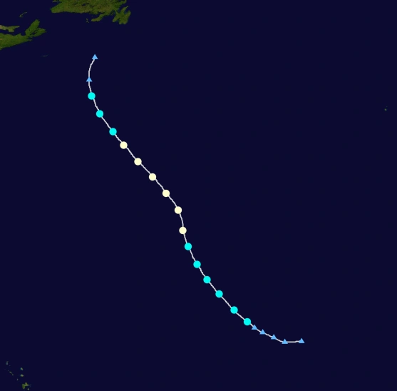
Hurricane Marco[]
- Main article: Hurricane Marco (2020)
| Category 5 hurricane (SSHWS) | |
  | |
| Duration | September 18 – October 2 |
|---|---|
| Peak intensity | 195 mph (315 km/h) (1-min) 881 mbar (hPa) |
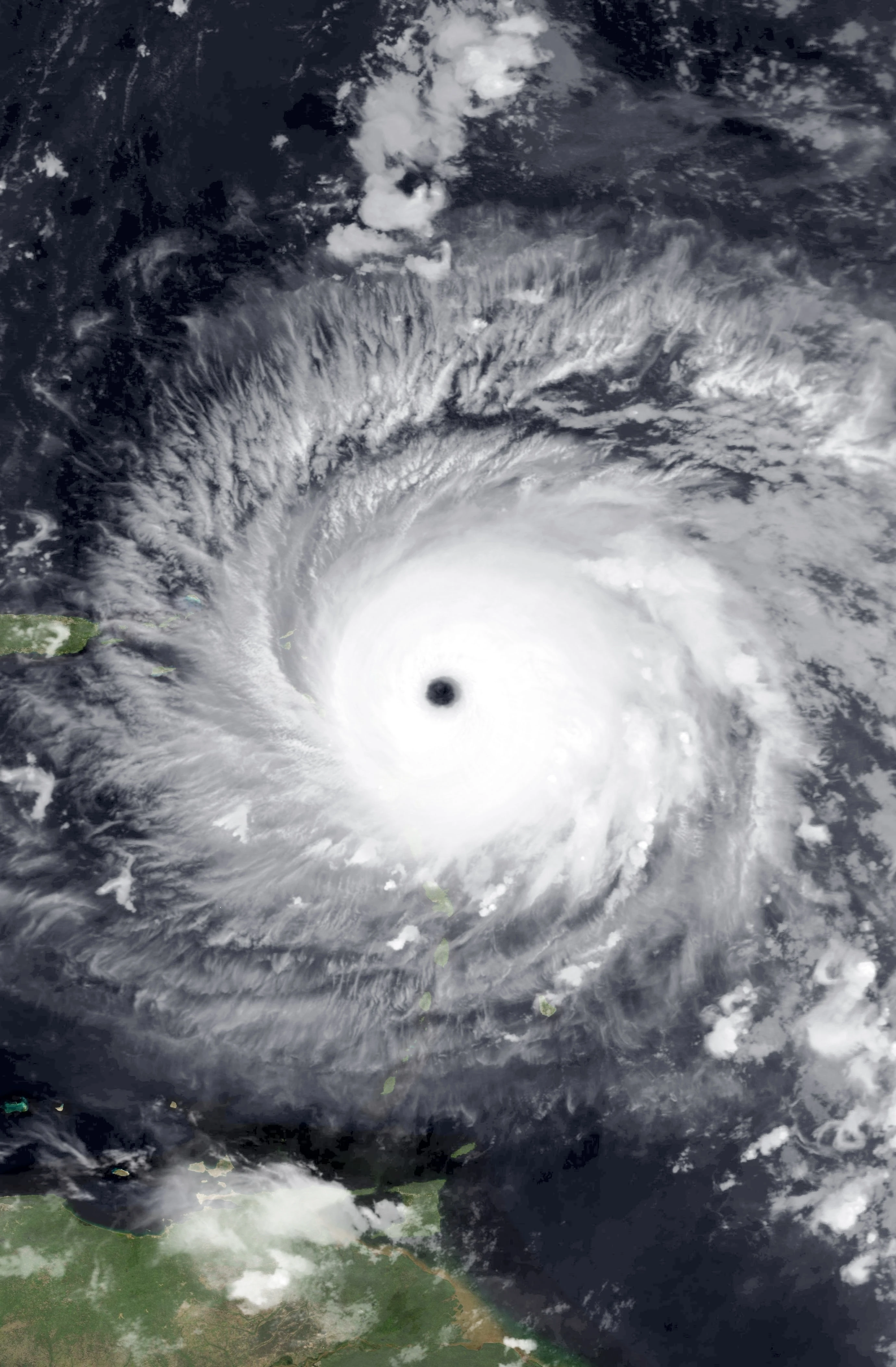
A westward-moving tropical wave developed into a tropical depression on September 14, before becoming Tropical Storm Marco on the following day. Tracking westward, Marco gradually strengthened, reaching hurricane intensity on September 5. On September 6, the storm strengthened significantly, becoming a Category 4 hurricane, despite being located at an unusually low latitude. It subsequently weakened, though it reached major hurricane status again the next day. On September 24, Marco became a Category 5 hurricane. During the next five days, Ivan fluctuated between a Category 4 and 5 hurricane. The storm passed north of Honduras on September 26. It attained the peak intensity of 190 mph (305 km/hr) and pressure of 894 mbar, causing it to become one of the most powerful hurricane on record. While curving northwestward, Marco brushed Yucatan Peninsula as a Category 5 hurricane on September 27.
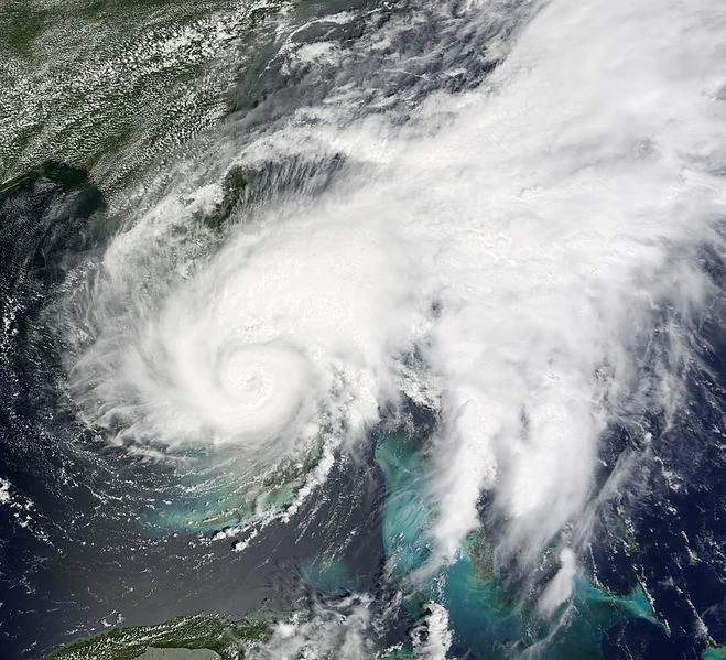
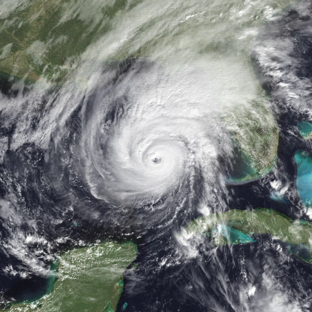
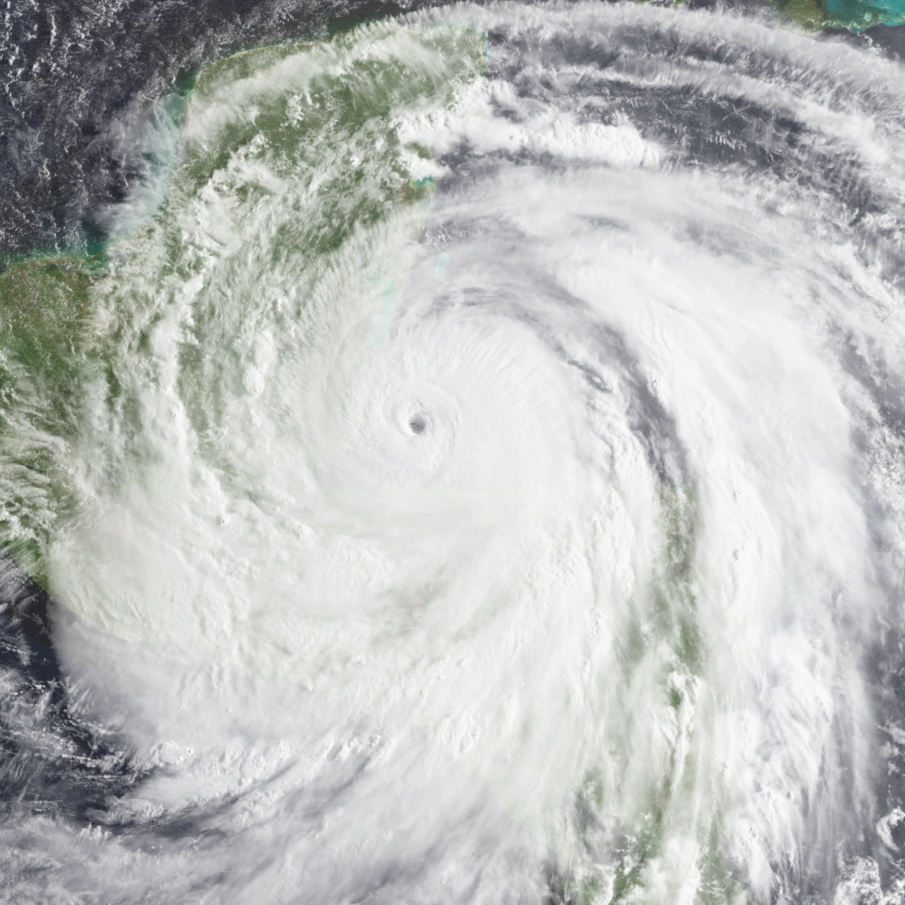
Shortly after moving to the east of Yucatan on September 27, Marco entered the Gulf of Mexico. Over the next two days, the storm gradually weakened while tracking north-northwestward and northward. On September 30, Marco made landfall near New Orleans, Louisiana with winds of 175 mph (280 km/h). It quickly weakened inland, falling to tropical storm status later that day and tropical depression strength by early on October 1. It turned extratropical the next day. Throughout the Lesser Antilles and in Venezuela, Marco caused 24 deaths and slightly more than $2 billion in losses, with nearly all of the damage and fatalities in Grenada. While Marco was passing north of Honduras, heavy landslide and storm surge makes it one of the deadliest hurricanes ever recorded. It caused 8,000 deaths and $29 billion losses in Honduras alone. Heavy damage was reported along the Gulf Coast of the United States. Marco produced a record tornado outbreak, with at least 167 twisters spawned collectively in twelve states. Throughout the United States, the hurricane left 103 fatalities and $405 billion in damage. Overall, Marco caused $442 billion in damages and 8,198 deaths, making the costliest storm, beating Karen, and has both most destructive and deadly hurricane which is last seen in Katrina of 2005. Marco becomes the most intense Atlantic hurricane, beating Wilma, and the most powerful Atlantic hurricane in terms of winds, beating Allen, though some analysis concludes that Marco could have been strong as 210 mph and 868 mbar.
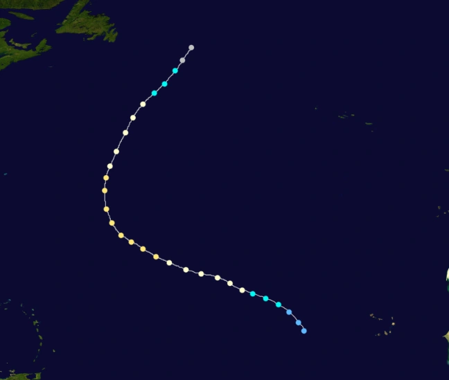
Hurricane Nana[]
| Category 4 hurricane (SSHWS) | |
  | |
| Duration | September 25 – October 11 |
|---|---|
| Peak intensity | 150 mph (240 km/h) (1-min) 933 mbar (hPa) |
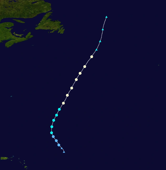
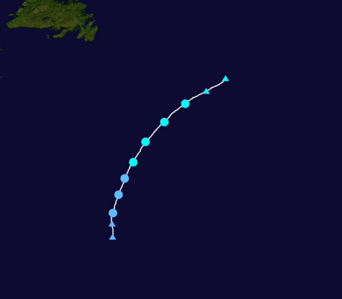
Nana began as a tropical wave that organized into a tropical depression southeast of Cabo Verde early on September 24. Initial organization was fast-paced, and the depression intensified into Tropical Storm Nana six hours after formation. Nana moved west, and it re-attained tropical storm intensity the next day and further strengthened to a hurricane on September 29. After rapid intensification and a subsequent eyewall replacement cycle, Nana attained its peak with maximum sustained winds of 150 mph (240 km/h) on October 4. Inner core changes continued after peak, and Igor continued as a Category 4 hurricane for several days until increased shear and dry air entrainment forced a consistent weakening trend early on October 8. The system recurved north-northeast. It eventually made landfall in Nova Scotia with winds of 85 mph (140 km/h) on October 10 and transitioned into an extratropical cyclone three hours later. The extratropical low was absorbed by a larger such system between Greenland and Labrador on October 11. Nana caused moderate damage in Nova Scotia, amounting to $300 million, and 7 deaths.
Tropical Depression Seventeen[]
| Tropical depression (SSHWS) | |
  | |
| Duration | September 29 – October 1 |
|---|---|
| Peak intensity | 35 mph (55 km/h) (1-min) 1007 mbar (hPa) |
A tropical wave emerged off the coast of Africa on September 27. The wave was well-defined, and it developed quickly in favorable conditions. Tropical Depression Seventeen formed on September 29. It failed to intensify further, due to wind shear, and continued on a northeastward track. Seventeen gradually intensified to peak winds of 35 mph, before a gradual increase in wind shear prevented further strengthening. On September 30 wind shear increased significantly, accelerating the weakening. Seventeen dissipated on October 1.
Tropical Storm Omar[]
| Tropical storm (SSHWS) | |
  | |
| Duration | October 12 – October 15 |
|---|---|
| Peak intensity | 45 mph (75 km/h) (1-min) 1004 mbar (hPa) |
A large trough existed in the Atlantic in early October. On October 9, a part of it broke off, and a low pressure developed from this area. Rapidly shedding any frontal features, it developed into Tropical Depression Eighteen on October 12, and it quickly intensified into Tropical Storm Omar. Omar initially moved north, but was forced northeast by another trough emerging off the U.S coast. Omar peaked with 45 mph winds on October 14, before maintaining intensity as it transitioned into a post-tropical cyclone on October 15. It dissipated six hours later.
Tropical Storm Paulette[]
| Tropical storm (SSHWS) | |
  | |
| Duration | October 17 – October 22 |
|---|---|
| Peak intensity | 50 mph (85 km/h) (1-min) 999 mbar (hPa) |
A tropical wave moved across the Atlantic basin. The wave would not initially strengthen due to cold surface temperatures, until it began developing lots of convection on October 15. It moved north of Lesser Antilles and developed into a Tropical Depression on October 17. In favorable conditions, it intensified into Tropical Storm Paulette, marking the first use of the name for a tropical cyclone. Paulette gradually intensified to peak winds of 50 mph before it entered cooler waters and began to move northeast. Paulette became post-tropical on October 22.
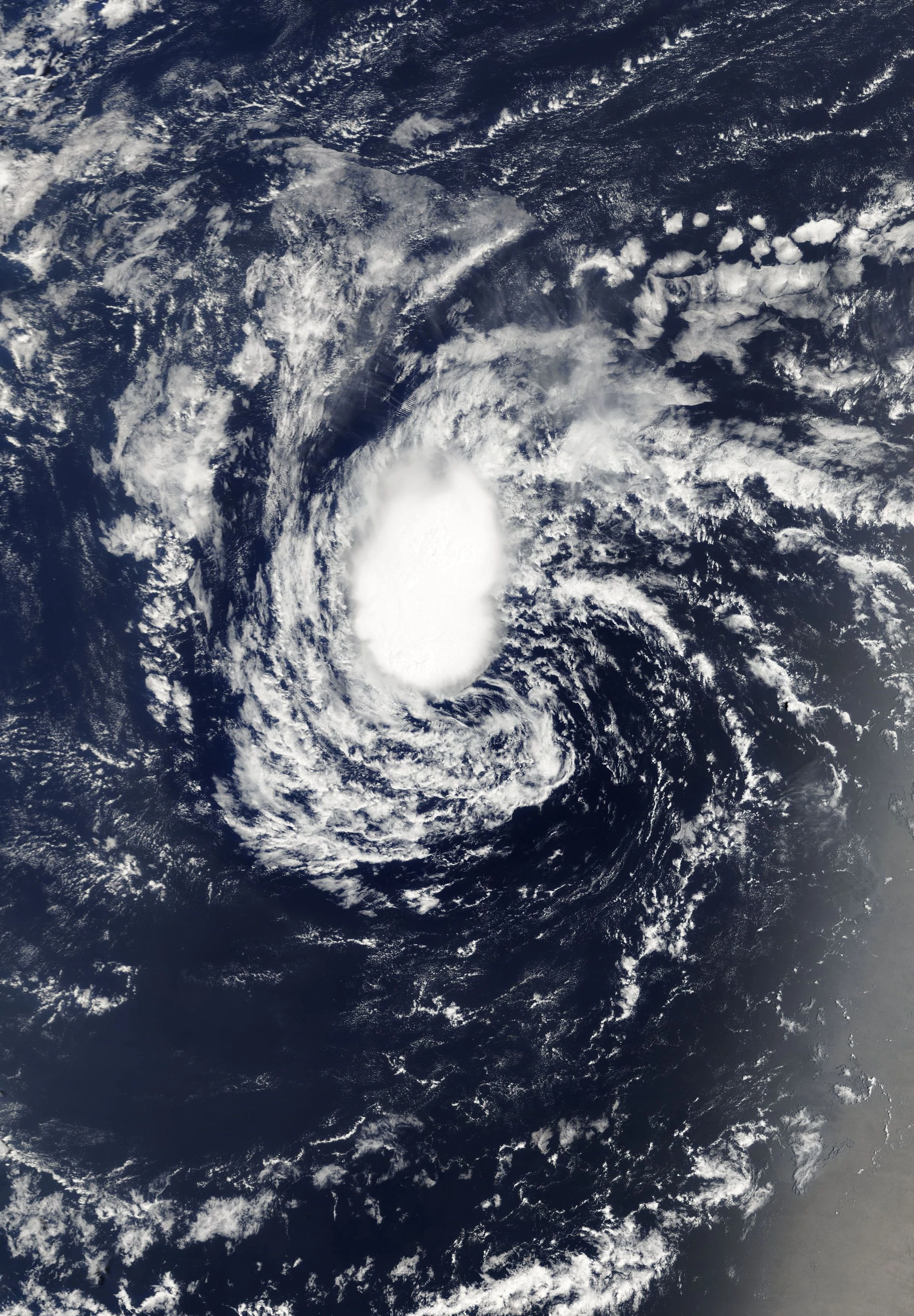
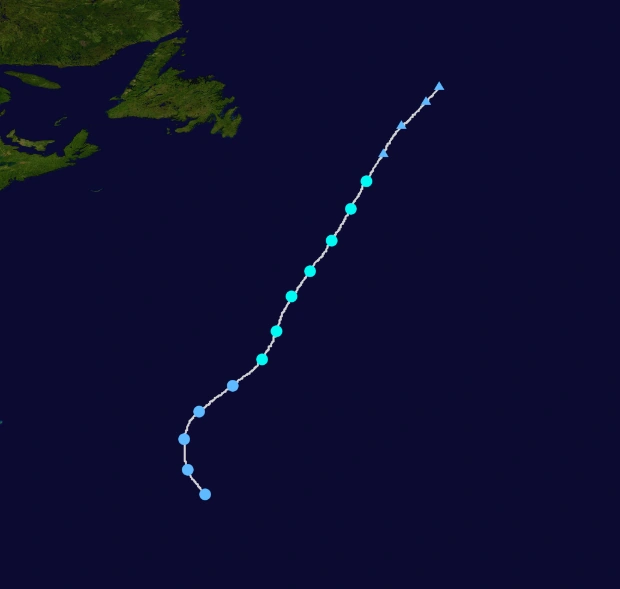
Hurricane Rene[]
| Category 1 hurricane (SSHWS) | |
  | |
| Duration | October 20 – October 26 |
|---|---|
| Peak intensity | 85 mph (140 km/h) (1-min) 983 mbar (hPa) |
A non-tropical low moved out over the Atlantic, and began to show signs of development on October 18. In favorable conditions, a broad circulation formed, and Tropical Depression Twenty was declared. It remained weak until the next day, when it intensified into Tropical Storm Rene. The storm moved erratically, and became a hurricane on October 23. It quickly reached peak winds of 85 mph as a clear eye briefly appeared on satellite, before it began to weaken due to colder waters. Rene was picked up by a trough on October 24, which resulted in the storm hooking to the north. The storm became post-tropical before even reaching Newfoundland.
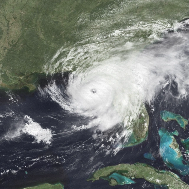
Hurricane Sally[]
- Main article: Hurricane Sally (2020)
| Category 3 hurricane (SSHWS) | |
  | |
| Duration | October 29 – November 6 |
|---|---|
| Peak intensity | 115 mph (185 km/h) (1-min) 962 mbar (hPa) |
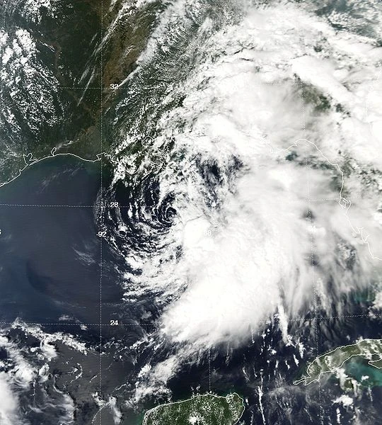
A convective mass in the Caribbean spawned a low-pressure area on October 29. Despite proximity to Hispaniola, it developed into Tropical Depression Twenty-One. Land interaction prevented initial intensification, but it moved into the Bahamas and intensified into Tropical Storm Sally on November 1. As Sally moved through the Bahamas, it began to rapidly intensify, and was forecast to make landfall in Florida. The governor, Rick Scott, issued a mandatory evacuation, but a ridge made Sally further south, thus entering the Gulf. However, Sally strengthened to a Category 3 hurricane. Sally made landfall near Alabama, then it turned post-tropical afterwards. Sally caused $43 billion (2020 USD) and 11 deaths.
Tropical Storm Teddy[]
| Tropical storm (SSHWS) | |
  | |
| Duration | December 6 – December 12 |
|---|---|
| Peak intensity | 60 mph (95 km/h) (1-min) 995 mbar (hPa) |
A large extratropical system formed in the Gulf of Mexico on December 3. It began to move northeast across the southern United States, forming an area of low pressure near the Yucatan Peninsula. This low pressure area moved in tandem with the system until it was near Florida, when they separated. The low rapidly began to develop subtropical characteristics as it moved off Florida, and became a subtropical storm on December 6, but was not initially declared for 12 more hours due to the rapid formation. It was named Teddy. Teddy then became tropical for short time, with 60 mph winds. Teddy turned into remnant low and became subtropical on December 11. The next day, Teddy was absorbed into an extratropical cyclone, having caused little land impact.
Season Effects[]
| Storm name |
Dates active | Storm category at peak intensity |
Max 1-min wind mph (km/h) |
Min. press. (mbar) |
Areas affected | Damage (USD) |
Deaths | |||
|---|---|---|---|---|---|---|---|---|---|---|
| Arthur | June 7 – June 13 | Category 1 hurricane | 80 | 979 | Bahamas, United States | 145 | 4 | |||
| Bertha | July 11 – July 15 | Tropical storm | 50 | 999 | None | None | None | |||
| Cristobal | July 16 – July 22 | Tropical storm | 65 | 996 | United States | 95.5 | 7 | |||
| Dolly | July 19 – July 26 | Category 2 hurricane | 105 | 973 | None | None | None | |||
| Edouard | August 3 – August 15 | Category 4 hurricane | 155 | 927 | Mexico, United States, Greater Antilles, Honduras, Jamaica | 177210 | 135 | |||
| Six | August 12 – August 14 | Tropical depression | 35 | 1010 | Mexico | Minimal | None | |||
| Fay | August 15 – August 20 | Tropical storm | 65 | 997 | Cuba, United States | 665 | 12 | |||
| Gonzalo | August 17 – August 23 | Category 1 hurricane | 80 | 978 | None | None | None | |||
| Hanna | August 18 – August 23 | Tropical storm | 45 | 1003 | None | None | None | |||
| Isaias | August 21 – September 3 | Category 5 hurricane | 175 | 910 | Greater Antilles, Puerto Rico, United States, Canada, Hispaniola | 103040 | 78 | |||
| Josephine | August 26 – September 2 | Tropical storm | 60 | 998 | Newfoundland | >8 | 1 | |||
| Kyle | September 11 – September 17 | Category 1 hurricane | 75 | 983 | Mexico, United States, Canada | 1227 | 11 | |||
| Thirteen | September 13 – September 15 | Tropical depression | 30 | 1008 | None | None | None | |||
| Laura | September 15 – September 26 | Category 2 hurricane | 105 | 973 | Haiti, United States, Honduras, Mexico | 2385 | 5 | |||
| Marco | September 18 – October 2 | Category 5 hurricane | 195 | 881 | Lesser Antilles, Colombia, Jamaica, Venezuela, Honduras, Nicaragua, Belize, Mexico, United States | 442560 | 8198 | |||
| Nana | September 25 – October 11 | Category 4 hurricane | 150 | 933 | Bermuda, United States, Canada | 298.6 | 7 | |||
| Seventeen | September 29 – October 1 | Tropical depression | 35 | 1007 | None | None | None | |||
| Omar | October 12 – October 15 | Tropical storm | 45 | 1004 | None | None | None | |||
| Paulette | October 17 – October 22 | Tropical storm | 50 | 999 | None | None | None | |||
| Rene | October 20 – October 26 | Category 1 hurricane | 85 | 983 | None | None | None | |||
| Sally | October 9 – November 6 | Category 3 hurricane | 115 | 962 | Cuba, Greater Antilles, Hispaniola, United States | 43120 | 11 | |||
| Teddy | December 6 – December 12 | Tropical storm | 60 | 995 | Cuba, United States | Minimal | None | |||
| Season aggregates | ||||||||||
| 12 systems | June 7 – December 12 | 195 | 881 | $769.813 Billion | 8,469 Total | |||||
Storm Names[]
The following names were used for named storms that formed in the North Atlantic in 2020. The names not retired from this list were used again in the 2026 season. This is the same list used for the 2014 season. Storms were named Isaias, Paulette, and Rene for the first time in 2020. Names that were not assigned are marked in gray.
|
|
|
Retirement[]
The World Meteorological Organization retired four names in the spring of 2021: Edouard, Isaias, Marco and Sally. They were replaced in the 2026 season by Edmund, Ibrahim, Malcolm and Sylvia, respectively.
Other Seasons[]
| Atlantic hurricane seasons | |
|---|---|
| 2018-2019 | 2018 • 2019 |
| 2020-2030 | 2020 • 2021 • 2022 • 2023 • 2024 • 2025 • 2026 • 2027 • 2028 • 2029 |
| 2030-2040 | 2030 • 2031 • 2032 • 2033 • 2034 • 2035 • 2036 • 2037 • 2038 • 2039 |
| 2040-2050 | 2040 • 2041 • 2042 • 2043 • 2044 • 2045 • 2046 • 2047 • 2048 • 2049 |
| 2050-2060 | 2050 • 2051 • 2052 • 2053 • 2054 • 2055 • 2056 • 2057 • 2058 • 2059 |