The 2019 Atlantic hurricane season was a quiet season that produced 9 named storms, 5 hurricanes, and 2 major hurricanes. This was mainly due to the influence of a moderate El Niño event. The season ran from June 1, 2019 to November 30, 2019. However, Tropical Storm Andrea did not form until early July, an event not seen since 2014. August and September were surprisingly active, seeing seven named storms combined, which is close to the average. This year was also the first season since 2015 to not feature a U.S landfalling hurricane.
This season had some notable storms. In August, Hurricane Barry caused damage across the Caribbean before making landfall in Florida, and Hurricane Chantal caused flooding in Mexico. In September, Erin attained major hurricane status, and Humberto did the same late in the month. In October, Tropical Storm Imelda brought flooding to Nicaragua and Honduras. The season had three unnamed Tropical Depressions, with the final one ending the season, on November 1.
Timeline[]

The 2019 Atlantic hurricane season officially began on June 1, 2019. It was a below average season, with nine named storms. Five of those storms intensified further into hurricanes, and two of those hurricanes attained major hurricane status. The lack of activity was mainly attributed to an atmospheric circulation that favored dry, sinking air over low latitudes to the west of 40°W and westerly wind shear enhanced by El Niño. While some notable events did occur in 2019, most of the storms remained away from land or caused little damage.
In 2019, for the first time since 2014, tropical cyclone activity did not occur before the official start on June 1. On the contrary, activity began rather late, with Tropical Storm Andrea forming on July 5. There was one other system in July, a tropical depression. In August, four tropical cyclones formed, Hurricanes Barry and Chantal, Tropical Storm Dorian, and Hurricane Erin. September featured four tropical cyclones. These were Tropical Storm Fernand, Hurricane Gabrielle, TD Nine, and Hurricane Humberto. In addition, Hurricane Priscilla survived a crossover from the Eastern Pacific, landfalling in the Bay of Campeche. October featured two tropical cyclones, Tropical Storm Imelda and Tropical Depression Twelve. The season ended on November 1, despite the official end was not until November 30.
The 2019 Atlantic hurricane season's activity was reflected with an Accumulated Cyclone Energy (ACE) rating of 59, which was well below the 1981–2010 median of 92. Broadly speaking, ACE is a measure of the power of a tropical or subtropical storm multiplied by the length of time it existed. Therefore, a storm with a longer duration or stronger intensity, such as Humberto, will have higher values of ACE. It is only calculated for full advisories on specific tropical and subtropical systems reaching or exceeding wind speeds of 39 mph (63 km/h). Accordingly, tropical depressions are not included here.
Storms[]
|
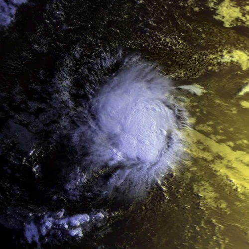
Tropical Storm Andrea[]
| Tropical storm (SSHWS) | |
  | |
| Duration | July 5 – July 8 |
|---|---|
| Peak intensity | 50 mph (85 km/h) (1-min) 997 mbar (hPa) |
A tropical wave moved off the coast of Africa on June 30. The wave lost definition for a short period due to increased vertical wind shear, but began to re-organize on July 4. The next day, it had the sufficient organization to be declared Tropical Depression One. Sometime the next day, it was upgraded to Tropical Storm Andrea. It gradually intensified to peak winds of 50 mph before entering an area of increasing shear. With the convection sheared to the east of the center, Andrea was downgraded to a Tropical Depression on July 7, and the storm fully dissipated the next day.
Tropical Depression Two[]
| Tropical depression (SSHWS) | |
  | |
| Duration | July 10 – July 11 |
|---|---|
| Peak intensity | 35 mph (55 km/h) (1-min) 1009 mbar (hPa) |
A second tropical wave followed Andrea's wave off the coast of Africa. This one was poorly defined as it continued west, but conditions were expected to become more favorable. The wave continued slowly to the west, and began to increase in organization as it approached the Leeward Islands. It was declared a Tropical Depression on July 10, and was forecast to become a tropical storm. But the storm began to degenerate quicker than anticipated. As it passed north of Trinidad, it became a remnant low on July 11.
Hurricane Barry[]
| Category 1 hurricane (SSHWS) | |
  | |
| Duration | August 5 – August 12 |
|---|---|
| Peak intensity | 85 mph (140 km/h) (1-min) 978 mbar (hPa) |
At the end of July, a third tropical wave moved off the coast of Africa. It did not organize further until it was roughly halfway across the Main Development Region. It became Tropical Depression Three on August 5, and it intensified into Tropical Storm Barry that evening. It moved through the Lesser Antilles, and made landfall in Puerto Rico. It crossed over the island without losing much intensity. Now in the southeastern Bahamas, it began to intensify again, and Barry became a hurricane on August 9. It peaked with 85 mph winds early the next morning, and the NHC noted further intensification was possible. However, it began to weaken due to dry air entrainment, and it weakened below hurricane status on August 10. The storm continued northwest and made landfall near Miami, Florida, with winds of 65 mph. The storm continued up the Peninsula while steadily weakening. Barry became a remnant low on August 12.
Hurricane Chantal[]
| Category 1 hurricane (SSHWS) | |
  | |
| Duration | August 17 – August 21 |
|---|---|
| Peak intensity | 80 mph (130 km/h) (1-min) 982 mbar (hPa) |
A large convective area, the same one that spawned Tropical Storm Juliette in the Eastern Pacific, spawned an organized low pressure area in the Bay of Campeche on August 14. Gradual organization occurred over the next several days, and TD Four formed on August 17. It intensified into Tropical Storm Chantal the next day. Shortly after this time, rapid intensification began, as conditions were favorable. With an eye forming, Chantal became a hurricane on August 19. Despite a well-defined eye under the convection, it never had an opportunity to pop out before wind shear began to increase. Chantal peaked with 80 mph winds before it began to weaken. It weakened below hurricane status on August 20, and it made landfall in Brownsville, Texas, later that day as a strong tropical storm. Chantal continued inland, before dissipating over extreme northeastern Mexico on August 21.
Tropical Storm Dorian[]
| Tropical storm (SSHWS) | |
  | |
| Duration | August 20 – August 23 |
|---|---|
| Peak intensity | 70 mph (110 km/h) (1-min) 991 mbar (hPa) |
Another tropical wave became Tropical Storm Dorian on August 20. Shortly after forming, Dorian began to quickly intensify, and it was noted that it could possibly become a hurricane. With a semi-complete eyewall, Dorian peaked with winds of 70 mph on August 22. Weakening began due to colder-than-average water, however. Dorian lost most of its convection, and was declared a remnant low on August 23, having had no land impact.
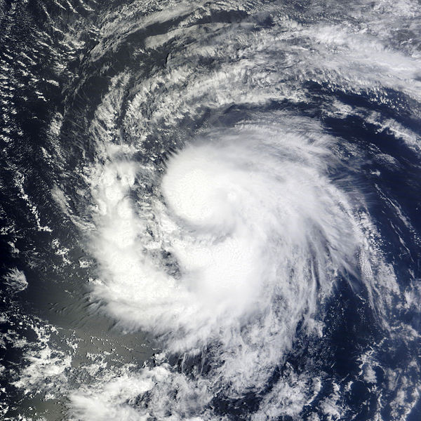
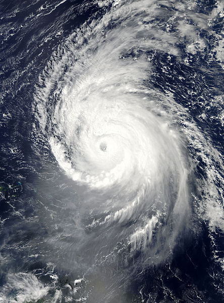
Hurricane Erin[]
| Category 3 hurricane (SSHWS) | |
  | |
| Duration | August 30 – September 8 |
|---|---|
| Peak intensity | 115 mph (185 km/h) (1-min) 966 mbar (hPa) |
A somewhat organized tropical wave moved off the coast of Africa on August 25. It gradually organized, becoming Tropical Depression Six on August 30. It quickly intensified into Tropical Storm Erin, and gradually intensified for the next few days, becoming a hurricane on September 2. Erin reached initial peak winds of 110 mph before an eyewall replacement cycle began. However, favorable conditions in the subtropics allowed for Erin to rapidly intensify, and it became the first major hurricane of the season on September 4, as a well-defined eye appeared on satellite imagery, as it reached peak winds of 115 mph. However, an increase in wind shear began to weaken Erin. It retained hurricane intensity for two more days, before becoming a Tropical Storm on September 7. At 00z on September 8, Erin became extratropical, and moved into the open Atlantic. Erin caused little impact on land.
Tropical Storm Fernand[]
| Tropical storm (SSHWS) | |
  | |
| Duration | September 3 – September 6 |
|---|---|
| Peak intensity | 45 mph (75 km/h) (1-min) 1003 mbar (hPa) |
A tropical wave moved off the coast of Africa. It entered the Caribbean sea in late August, where unfavorable conditions prevented any development for the time being. It entered the Western Caribbean on September 1, where a slight decrease in shear allowed for organization. It crossed over the Yucatan into the Bay of Campeche, where it rapidly became a Tropical Depression on September 3. About 18 hours later, a recon jet discovered it had intensified into Tropical Storm Fernand. The storm slowly moved through the Bay of Campeche, peaking with 45 mph winds. The slow moving storm made landfall in Mexico on September 5, before weakening began. Fernand became a remnant low on September 6.
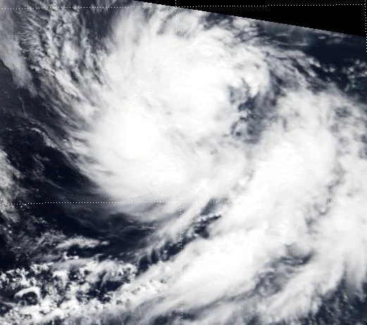
Hurricane Gabrielle[]
| Category 1 hurricane (SSHWS) | |
  | |
| Duration | September 12 – September 18 |
|---|---|
| Peak intensity | 90 mph (150 km/h) (1-min) 974 mbar (hPa) |
A non-tropical low moved out over the Gulf stream, and began to show signs of development on September 11. In favorable conditions, a broad circulation formed, and Subtropical Depression Eight was declared. It remained weak until September 13, when it intensified into Tropical Storm Gabrielle. The storm moved erratically, and became a hurricane on September 15. It quickly reached peak winds of 90 mph as a clear eye briefly appeared on satellite, before it began to weaken due to colder waters. Gabrielle was picked up by a trough on September 17, which resulted in the storm hooking to the east and making landfall in Newfoundland early on September 18. The storm became post-tropical while over Newfoundland.
Tropical Depression Nine[]
| Tropical depression (SSHWS) | |
  | |
| Duration | September 15 – September 19 |
|---|---|
| Peak intensity | 35 mph (55 km/h) (1-min) 1006 mbar (hPa) |
A very well-defined tropical wave moved off the African coast on September 11. It gradually took on tropical characteristics over the next few days, and became TD Nine on September 15. Initially, it was predicted to become a weak hurricane that could potentially threaten the east coast as a stronger hurricane. However, shear increased more than anticipated and the Depression began to weaken. The Depression became a remnant low on September 19.
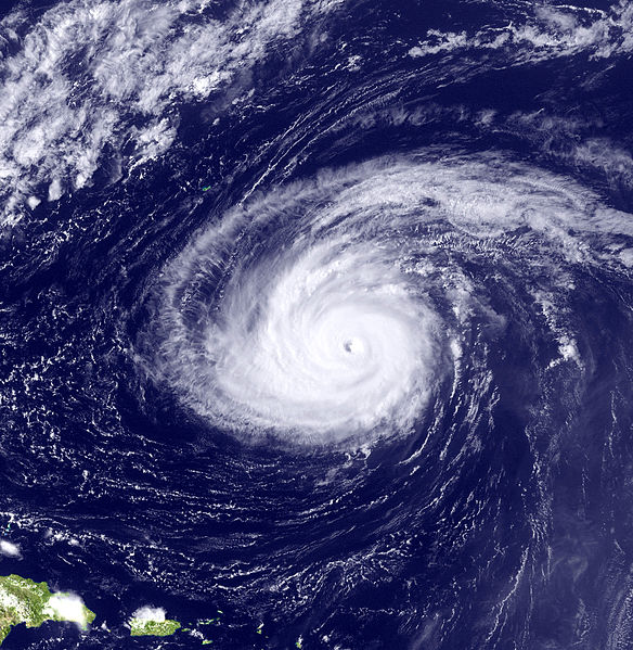
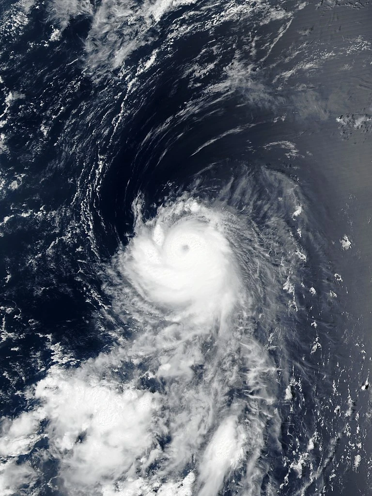
Hurricane Humberto[]
| Category 4 hurricane (SSHWS) | |
  | |
| Duration | September 18 – September 27 |
|---|---|
| Peak intensity | 140 mph (220 km/h) (1-min) 943 mbar (hPa) |
A tropical wave immediately followed the wave that would become Nine. It took longer to develop, partly due to Tropical Depression Nine causing moderate shear. However, Nine began to weaken as this wave continued north. As it approached the Lesser Antilles, it became Tropical Depression Ten on September 18. It quickly intensified into Tropical Storm Humberto, and immediately began rapid intensification in very favorable conditions. It became a hurricane on September 19, and a major hurricane the following day, the second one of the season. As Humberto's eye cleared out, it intensified into a Category 4 hurricane, and peaked with winds of 140 mph on September 22, making it the strongest storm of the season. Shortly after peak, it began to weaken due to decreasing ocean temperatures. It curved eastward around the Bermuda high as it weakened to a Category 1 hurricane. Humberto maintained Category 1 status until it made landfall in Nova Scotia as a minimal hurricane. It weakened to a Tropical Storm, and made a second landfall in Newfoundland as a Tropical Storm. It became extratropical over the country on September 27, in a similar fashion to Gabrielle.
Tropical Storm Imelda[]
| Tropical storm (SSHWS) | |
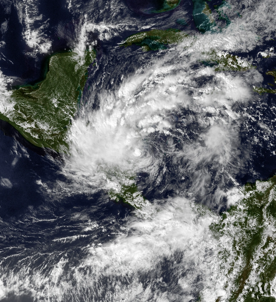  | |
| Duration | October 13 – October 15 |
|---|---|
| Peak intensity | 60 mph (95 km/h) (1-min) 997 mbar (hPa) |
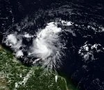
A large convective gyre, that spawned Tropical Storm Sonia in the East Pacific, generated a low in the Caribbean at the same time in early October. By the time October came around, the El Nino had weakened significantly, and shear was low in the Western Caribbean. An increase in convection allowed for the declaration of Tropical Storm Imelda on October 13. Imelda intensified as it continued northwest, peaking with winds of 60 mph as it made landfall in Nicaragua. The storm quickly began to weaken over land, and was declared a remnant low as it moved off the coast of Honduras on October 15.
Tropical Depression Twelve[]
| Tropical depression (SSHWS) | |
  | |
| Duration | October 29 – November 1 |
|---|---|
| Peak intensity | 30 mph (45 km/h) (1-min) 1008 mbar (hPa) |
A non-tropical low began to show signs of tropical formation on October 26. It gradually increased in organization, and persistent convection occurred. Tropical Depression Twelve formed on October 29. It was forecast to become a Tropical Storm, and would have been named Jerry. However, colder waters prevented any change in strength during its life. Twelve became a remnant low on November 1, ending the 2019 Atlantic hurricane season.
Other Systems[]


On September 27, Tropical Depression Priscilla entered the basin from the East Pacific. The system turned west and made landfall in Mexico without becoming a tropical storm. The storm caused limited damages.
Season Effects[]
| Storm name |
Dates active | Storm category at peak intensity |
Max 1-min wind mph (km/h) |
Min. press. (mbar) |
Areas affected | Damage (USD) |
Deaths | |||
|---|---|---|---|---|---|---|---|---|---|---|
| Andrea | July 5 – July 8 | Tropical storm | 50 | 997 | Lesser Antilles | Minimal | None | |||
| Two | July 10 – July 11 | Tropical depression | 35 | 1009 | Leeward Islands, Trinidad & Tobago | Minimal | 2 | |||
| Barry | August 5 – August 12 | Category 1 hurricane | 85 | 978 | Lesser Antilles, Puerto Rico Dominican Republic, Haiti, Cuba, Bahamas, United States | 97.5 | 12 | |||
| Chantal | August 17 – August 21 | Category 1 hurricane | 80 | 982 | Mexico, United States | 49 | 8 | |||
| Dorian | August 20 – August 23 | Tropical storm | 70 | 991 | Lesser Antilles | Minimal | None | |||
| Erin | August 30 – September 8 | Category 3 hurricane | 115 | 966 | Lesser Antilles, Bermuda | Minimal | 1 | |||
| Fernand | September 3 – September 6 | Tropical storm | 45 | 1003 | Mexico | 12 | 4 | |||
| Gabrielle | September 12 – September 18 | Category 1 hurricane | 90 | 974 | United States, Atlantic Canada | Minimal | 1 | |||
| Nine | September 15 – September 19 | Tropical depression | 35 | 1006 | None | None | None | |||
| Humberto | September 18 – September 27 | Category 4 hurricane | 140 | 943 | Lesser Antilles, Bermuda, United States, Atlantic Canada | 23 | 3 | |||
| Imelda | October 13 – October 15 | Tropical storm | 60 | 997 | Nicaragua, Honduras, Mexico | 50 | 20 | |||
| Twelve | October 28 – November 1 | Tropical depression | 30 | 1008 | None | None | None | |||
| Season aggregates | ||||||||||
| systems | July 5 – November 1 | 145 | 943 | $231.5 Million | 51 | |||||
Storm Names[]
The following names were used for storm names in the North Atlantic in 2019. This is the same list used in the 2013 season except for Imelda, which replaced Ingrid. No names were retired this season, so the same names were used in 2025. The name Imelda was used for the first time in 2019.
|
|
|