The 2019 Atlantic Hurricane Season was the most active atlantic season since 2012. The season was influenced by a la nina and had 16 storms, 8 hurricanes, and 3 major hurricanes. However, this was the first season since 2014 to not feature a storm before the season officially began, on June 1. Tropical activity began on June 15, with Tropical Depression One, and ended on November 20, when Hurricane Pablo exited the Atlantic basin.
The season had many significant storms. In July, Hurricane Andrea caused moderate damage in Mexico as a category 1 hurricane. In August, Hurricane Dorian caused damage in the Dominican Republic, and Hurricane Gabrielle caused some damage in the Carolinas. In September, Hurricane Humberto became the season's strongest storm, and caused serious damage in New England. In October, Hurricane Melissa wreaked havoc across the Caribbean, and eventually the United States, as a category 4 storm. In November, Hurricane Pablo's remnants entered the East Pacific and re-developed into Tropical Storm Mario.
Timeline[]

Storms[]
Tropical Depression One[]
| Tropical depression (SSHWS) | |
  | |
| Duration | June 15 – June 17 |
|---|---|
| Peak intensity | 35 mph (55 km/h) (1-min) 1006 mbar (hPa) |
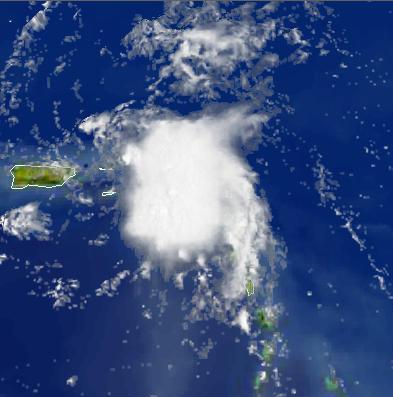
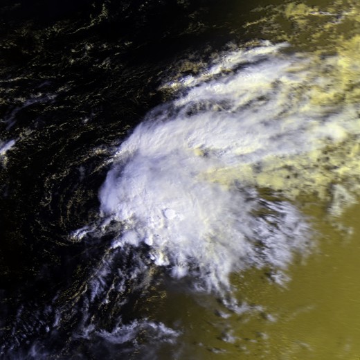
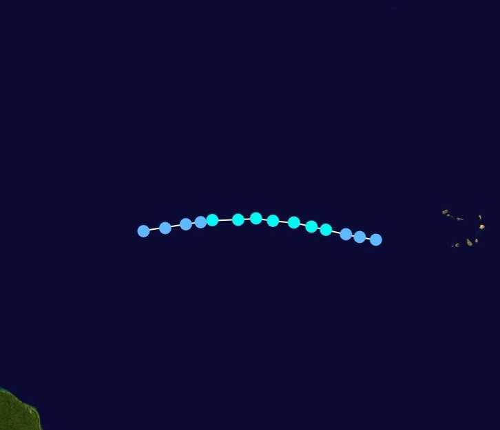
An early season tropical wave emerged off the coast of Africa. No development occurred until June 14, when convective bursts began to occur. Based on satellite imagery and ASCAT, the system was upgraded to Tropical Depression One on June 15. Initially forecast to become a weak tropical storm, moderate wind shear caused the center to become exposed. The system eventually made landfall in the Dominican Republic on June 17, and dissipated over the island that day. Landslides from the storm killed 5 people.
Hurricane Andrea[]
| Category 1 hurricane (SSHWS) | |
  | |
| Duration | July 4 – July 9 |
|---|---|
| Peak intensity | 80 mph (130 km/h) (1-min) 982 mbar (hPa) |
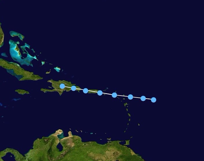
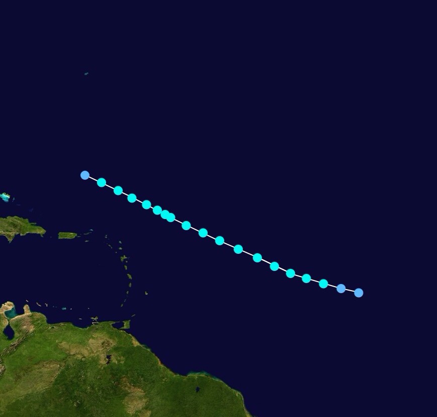
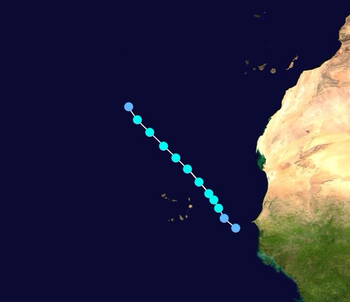
A tropical wave moved off the coast of Africa in late June. The system moved across the tropical Atlantic fairly quickly, and developed gale force winds. It entered the Caribbean on July 2, and began to develop under favorable conditions. Tropical Storm Andrea was declared on July 4, after a closed circulation was confirmed by recon. Andrea gradually intensified as it moved west, and became a hurricane on July 6. It peaked with 80 mph winds and made landfall in Quinta Roo, Mexico that day. The storm weakened over land, but re-intensified over the Bay of Campeche, almost becoming a hurricane again. However, the storm made landfall before that could happen, and Andrea dissipated on July 9.
Tropical Storm Barry[]
| Tropical storm (SSHWS) | |
  | |
| Duration | July 11 – July 13 |
|---|---|
| Peak intensity | 45 mph (75 km/h) (1-min) 1005 mbar (hPa) |
A low pressure area broke off from a decaying cold front, and became tropical depression three on July 11. Moving northward through the Bahamas, it intensified into Tropical Storm Barry early the next day. The storm moved toward the Carolinas, and despite developing organized banding, peaked with 45 mph winds. The storm made landfall in North Carolina at peak intensity, and moved inland, dissipating over Virginia on July 13. Barry only caused heavy rainfall and moderate winds.
Tropical Storm Chantal[]
| Tropical storm (SSHWS) | |
  | |
| Duration | August 3 – August 7 |
|---|---|
| Peak intensity | 60 mph (95 km/h) (1-min) 995 mbar (hPa) |
A tropical wave exited the coast of Africa, and developed into Tropical Depression Four. Twelve hours later, it intensified into Tropical Storm Chantal on August 4. Chantal moved in a generally northwest direction, parallel to the greater Antilles. Chantal peaked on August 5, with winds of 60 mph. However, Chantal entered an area of increasing vertical wind shear, and began to weaken. Chantal turned north and eventually began to become extratropical, completing this transition on August 7. Chantal brought high tides to the United States, Bahamas, and to Bermuda, but impacts were light.
Hurricane Dorian[]
| Category 3 hurricane (SSHWS) | |
  | |
| Duration | August 9 – August 16 |
|---|---|
| Peak intensity | 125 mph (205 km/h) (1-min) 951 mbar (hPa) |
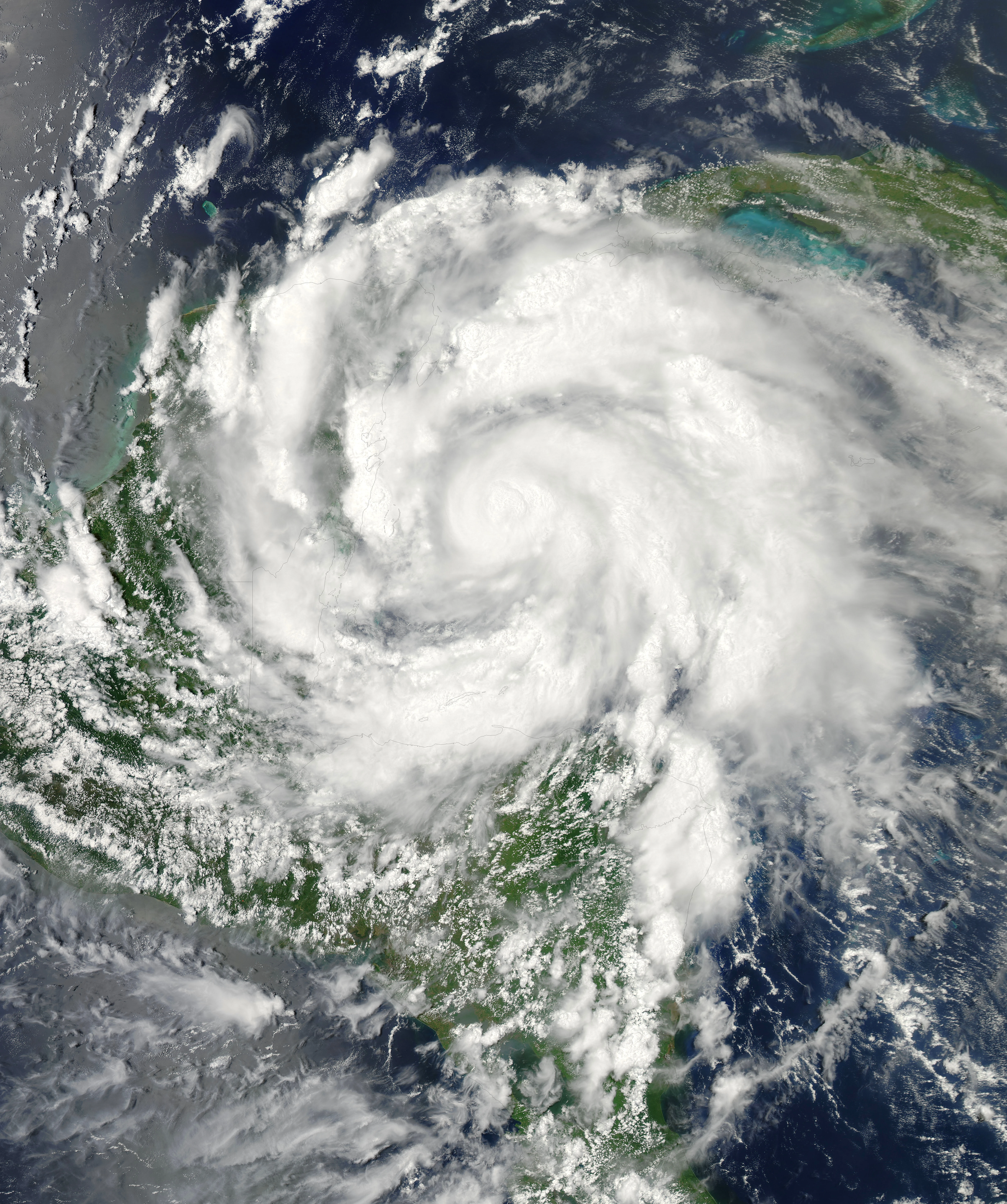
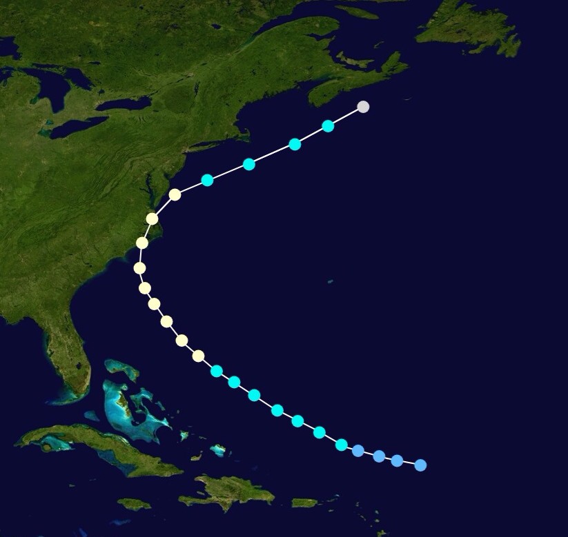
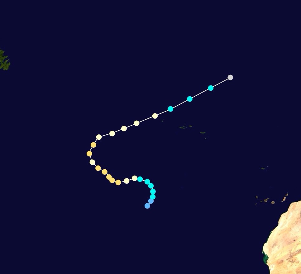
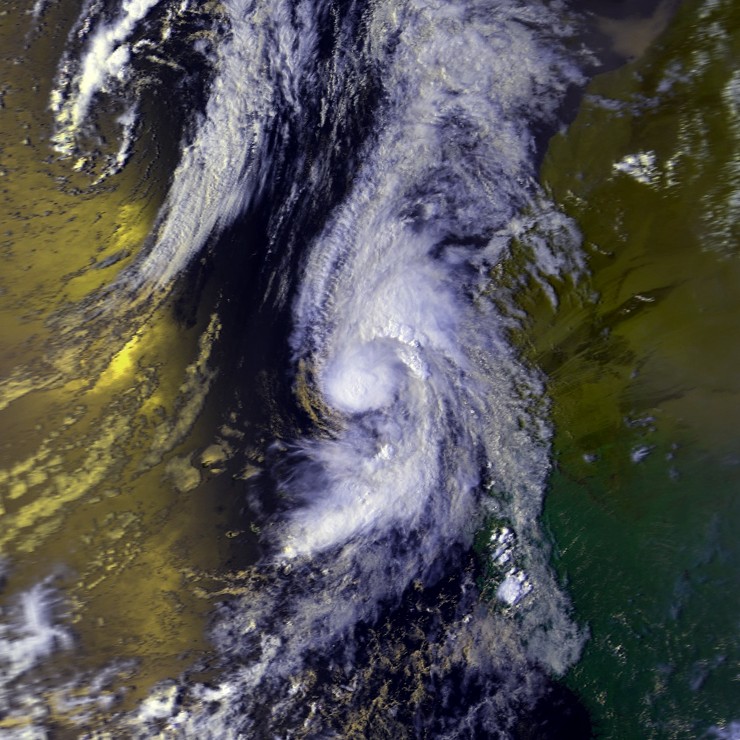
Interactions between an area of low pressure and a tropical wave spawned Tropical Depression Five on August 7. It quickly intensified into Dorian. This storm proved hard to forecast, as models took it all over the place. Dorian passed through the lesser antilles, and entered the Caribbean. Dorian developed an eye, and became a hurricane on August 12. It intensified to winds of 90 mph and struck the Dominican Republic, and entered the open Atlantic. Situated in a more favorable environment, Dorian began to intensify, despite the storm's altitude. The storm passed near Bermuda as a category 2 storm, before becoming the first major hurricane of the season on August 14. It peaked that day, with 125 mph winds. It began to quickly weaken as conditions deteriorated, but Dorian managed to make landfall in Newfoundland during the morning hours of August 16, as a category 1 hurricane. Dorian weakened in the Bay of St. Lawrence, and quickly became extratropical. Dorian's remnants caused some disruption in Canada.
Tropical Depression Six[]
| Tropical depression (SSHWS) | |
  | |
| Duration | August 11 – August 12 |
|---|---|
| Peak intensity | 30 mph (45 km/h) (1-min) 1010 mbar (hPa) |
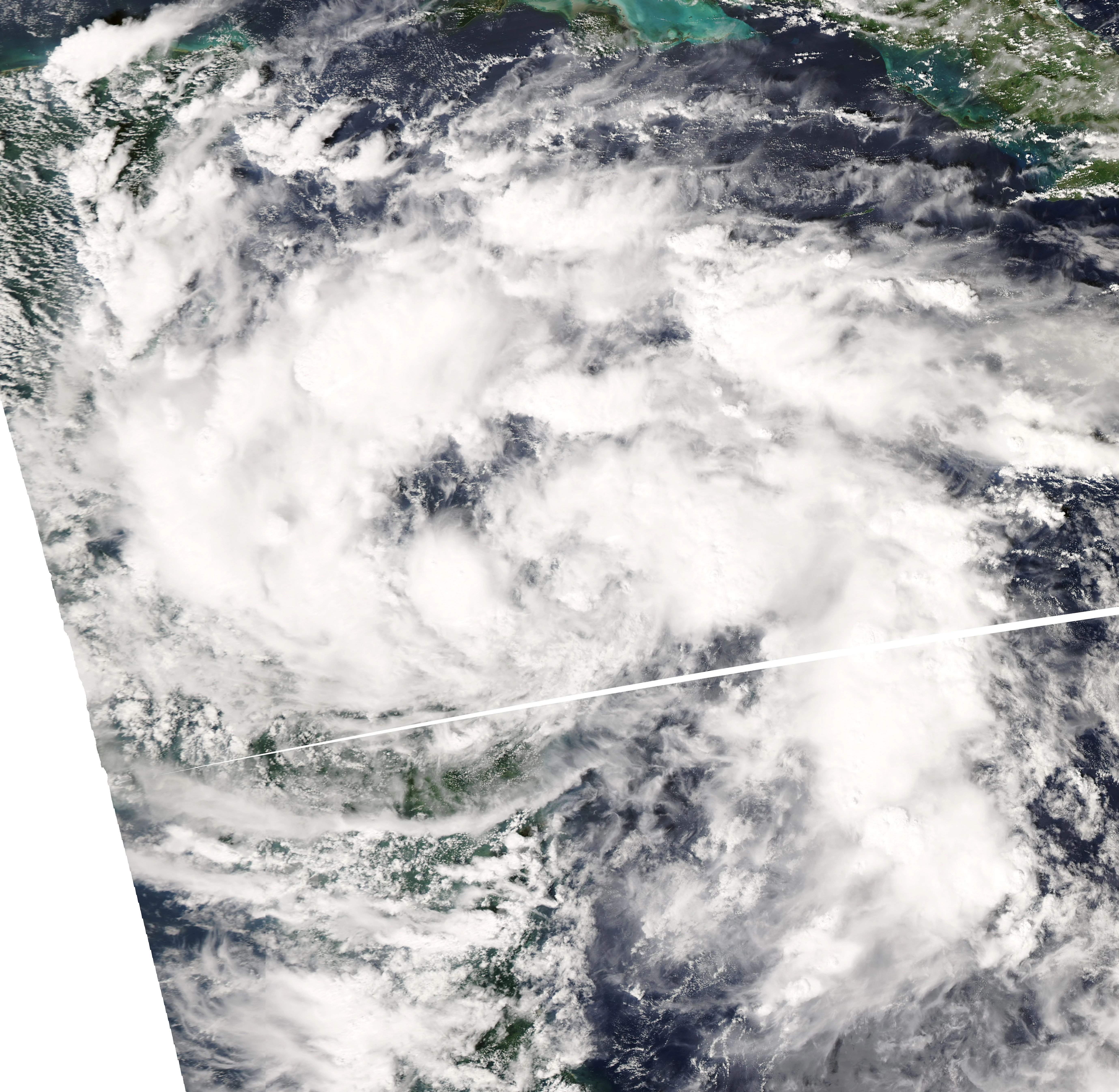
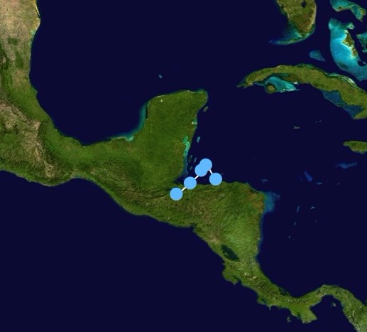
A broad low pressure area in the Caribbean began to show signs of tropical development in August. It developed into Tropical Depression Six on August 11. Despite models forecasting a hurricane near Florida out of the system in a few days, the system's proximity to Honduras prevented any strengthening. The storm made landfall in Honduras on August 12, and dissipated inland that day. The remnants would later contribute to Tropical Storm Flossie.
Tropical Storm Erin[]
| Tropical storm (SSHWS) | |
  | |
| Duration | August 15 – August 20 |
|---|---|
| Peak intensity | 60 mph (95 km/h) (1-min) 1001 mbar (hPa) |
A tropical wave moved off the coast of Africa, without much development for a few days. It became a Tropical Depression on August 15, and it intensified into Erin shortly after. Erin moved northwest, in an area of light to moderate wind shear. Erin briefly developed a low-level eye structure as it peaked with winds of 60 mph. Shortly after peak, dry air got into the system, and Erin began to weaken. Erin persisted until August 20, during which it dissipated back into a tropical wave. Erin had no impacts on land.
Tropical Storm Fernand[]
| Tropical storm (SSHWS) | |
  | |
| Duration | August 23 – August 25 |
|---|---|
| Peak intensity | 45 mph (75 km/h) (1-min) 1008 mbar (hPa) |
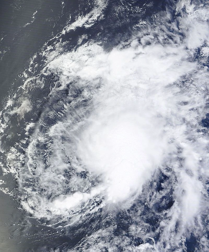
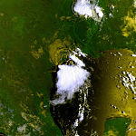
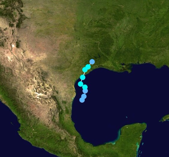
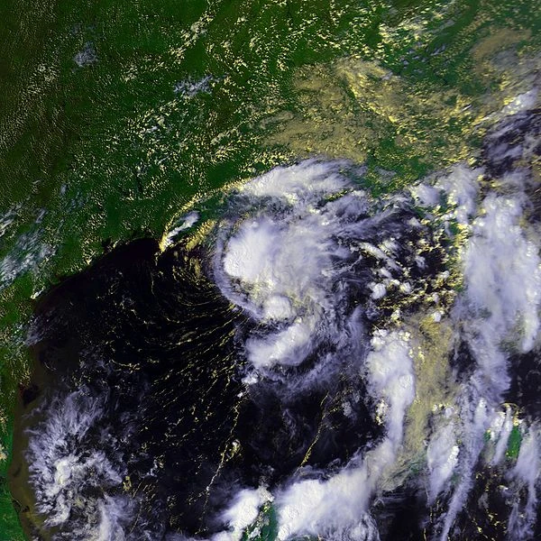
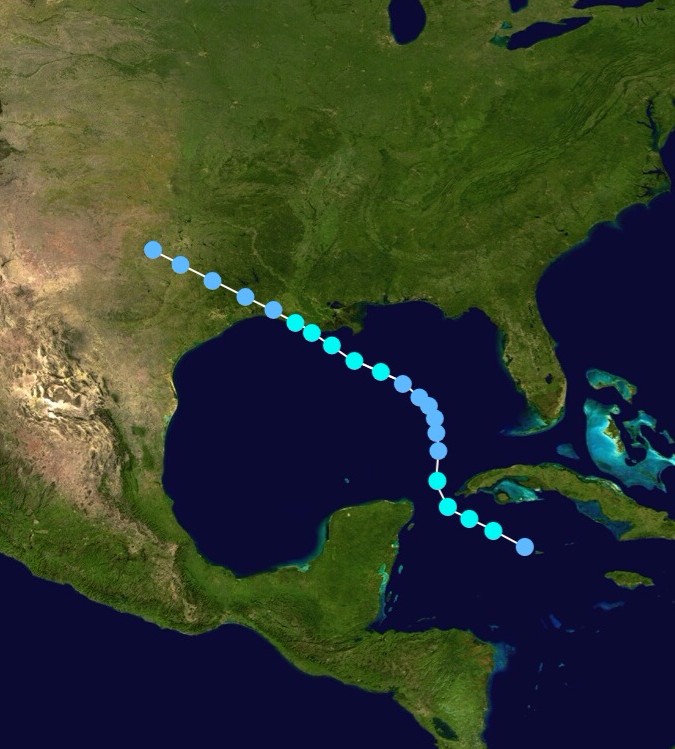
A decaying front left an area of convection in the Gulf of Mexico on August 22. The next day, unforecasted by any models, the system rapidly organized into a Tropical Depression. Initially not expected to intensity due to proximity to land, it intensified into Tropical Storm Fernand on August 24. Fernand moved slowly off the coast of Texas, caused severe coastal flooding, up until the storm's landfall the next morning, at peak intensity with 45 mph winds. Fernand managed to remain tropical until that night. The storm, despite being fairly small and weak, caused $500 million in damage due to flooding.
Hurricane Gabrielle[]
| Category 1 hurricane (SSHWS) | |
  | |
| Duration | August 26 – September 2 |
|---|---|
| Peak intensity | 85 mph (140 km/h) (1-min) 976 mbar (hPa) |
In mid August, a tropical wave moved off the coast of Africa. It moved through the Atlantic with not much development, until August 26, when it became a Tropical Depression, north of the Lesser Antilles. It intensified into Tropical Storm Gabrielle the next day, and gradually intensified in marginal conditions. Gabrielle became a hurricane on August 30, and quickly reached peak winds of 85 mph. On August 31, the storm made landfall in Jacksonville, North Carolina, with 80 mph winds. The storm remained a hurricane inland due to interactions with the outer banks, but weakened below hurricane status shortly after re-emerging into the Atlantic. Gabrielle accelerated east, and became extratropical on September 2.
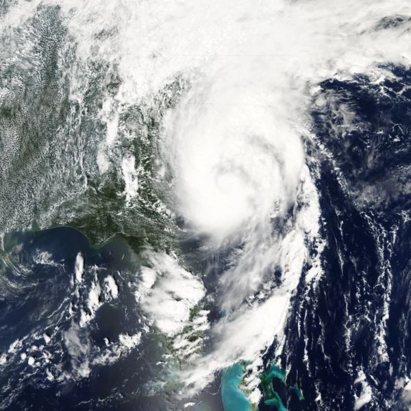
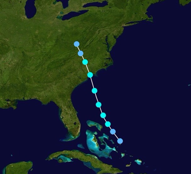
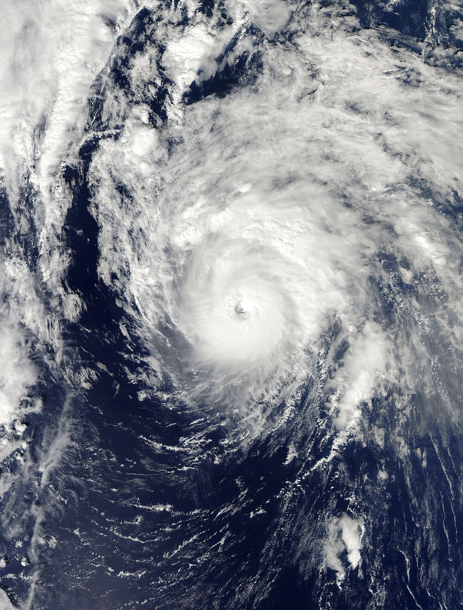
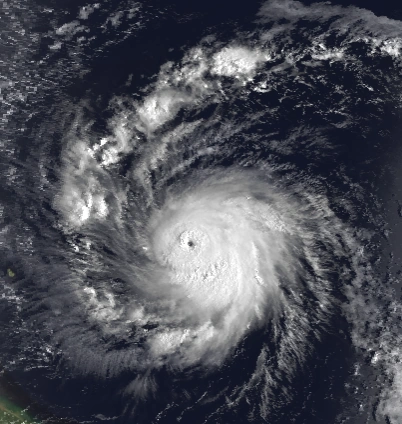
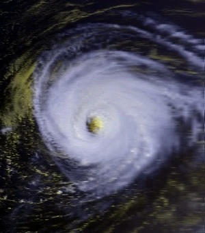
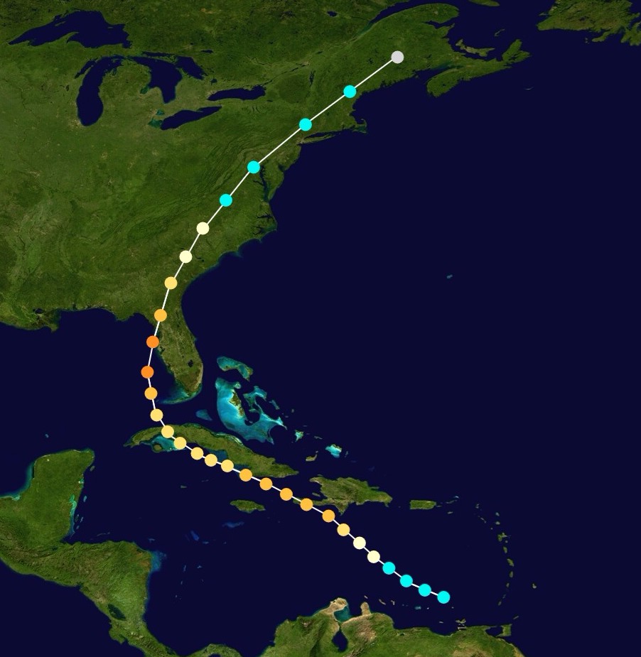
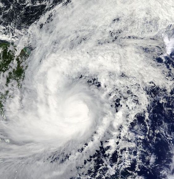
Hurricane Humberto[]
| Category 4 hurricane (SSHWS) | |
  | |
| Duration | September 2 – September 15 |
|---|---|
| Peak intensity | 150 mph (240 km/h) (1-min) 931 mbar (hPa) |
Tropical Storm Imelda[]
| Tropical storm (SSHWS) | |
  | |
| Duration | September 4 – September 9 |
|---|---|
| Peak intensity | 60 mph (95 km/h) (1-min) 999 mbar (hPa) |
Hurricane Jerry[]
| Category 2 hurricane (SSHWS) | |
  | |
| Duration | September 12 – September 18 |
|---|---|
| Peak intensity | 110 mph (175 km/h) (1-min) 971 mbar (hPa) |
Tropical Storm Karen[]
| Tropical storm (SSHWS) | |
  | |
| Duration | September 18 – September 21 |
|---|---|
| Peak intensity | 40 mph (65 km/h) (1-min) 1006 mbar (hPa) |
Tropical Storm Lorenzo[]
| Tropical storm (SSHWS) | |
  | |
| Duration | September 21 – September 23 |
|---|---|
| Peak intensity | 50 mph (85 km/h) (1-min) 1003 mbar (hPa) |
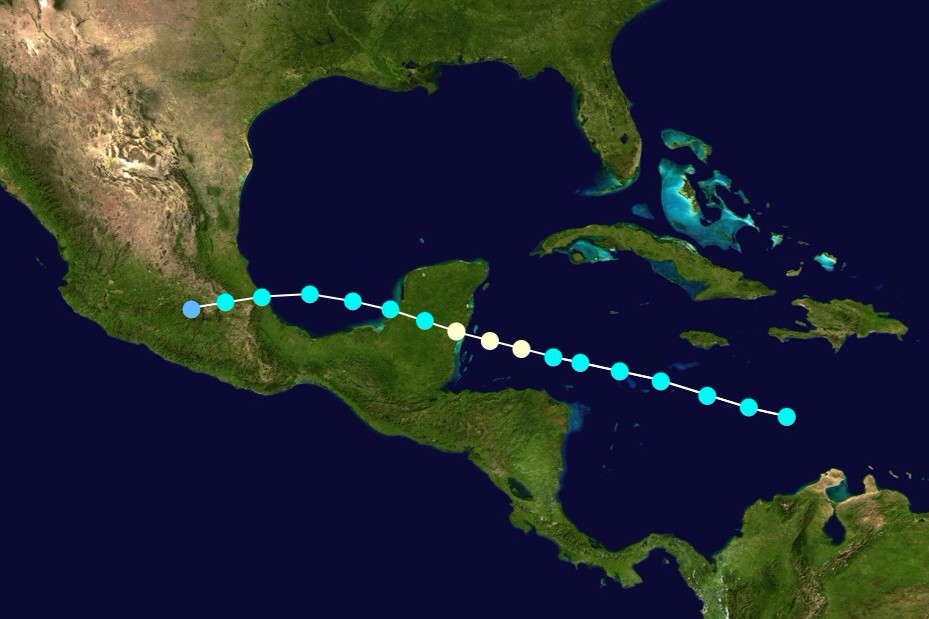
Hurricane Melissa[]
| Category 4 hurricane (SSHWS) | |
  | |
| Duration | September 30 – October 6 |
|---|---|
| Peak intensity | 145 mph (230 km/h) (1-min) 937 mbar (hPa) |
Hurricane Nestor[]
| Category 1 hurricane (SSHWS) | |
  | |
| Duration | October 10 – October 15 |
|---|---|
| Peak intensity | 80 mph (130 km/h) (1-min) 967 mbar (hPa) |
Subtropical Storm Olga[]
| Subtropical storm (SSHWS) | |
  | |
| Duration | October 29 – October 31 |
|---|---|
| Peak intensity | 50 mph (85 km/h) (1-min) 1005 mbar (hPa) |
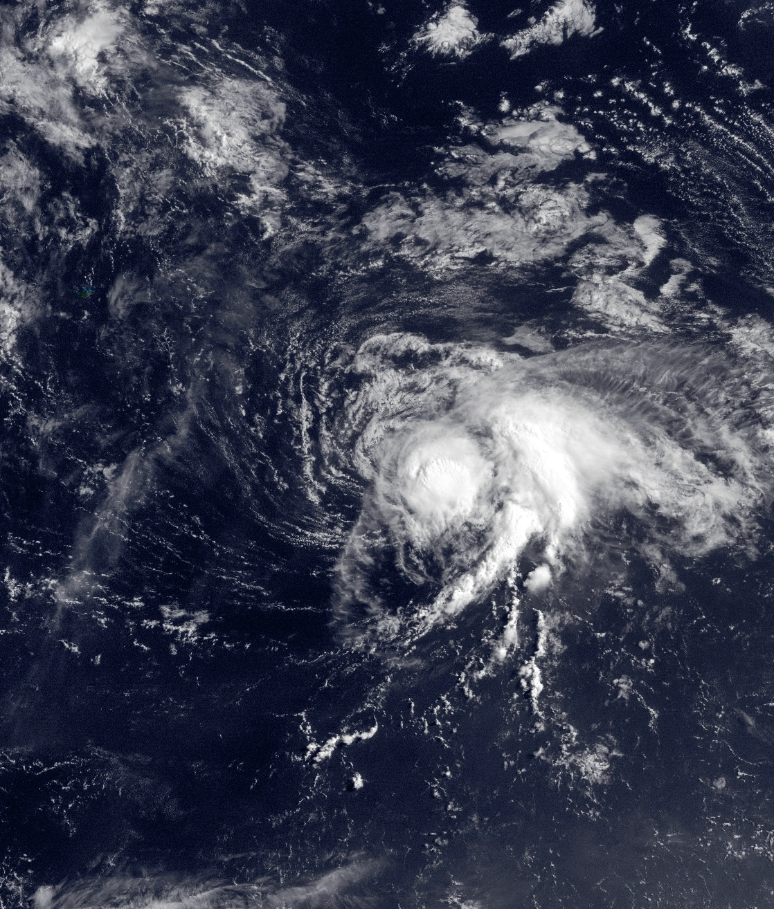
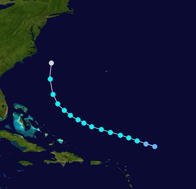
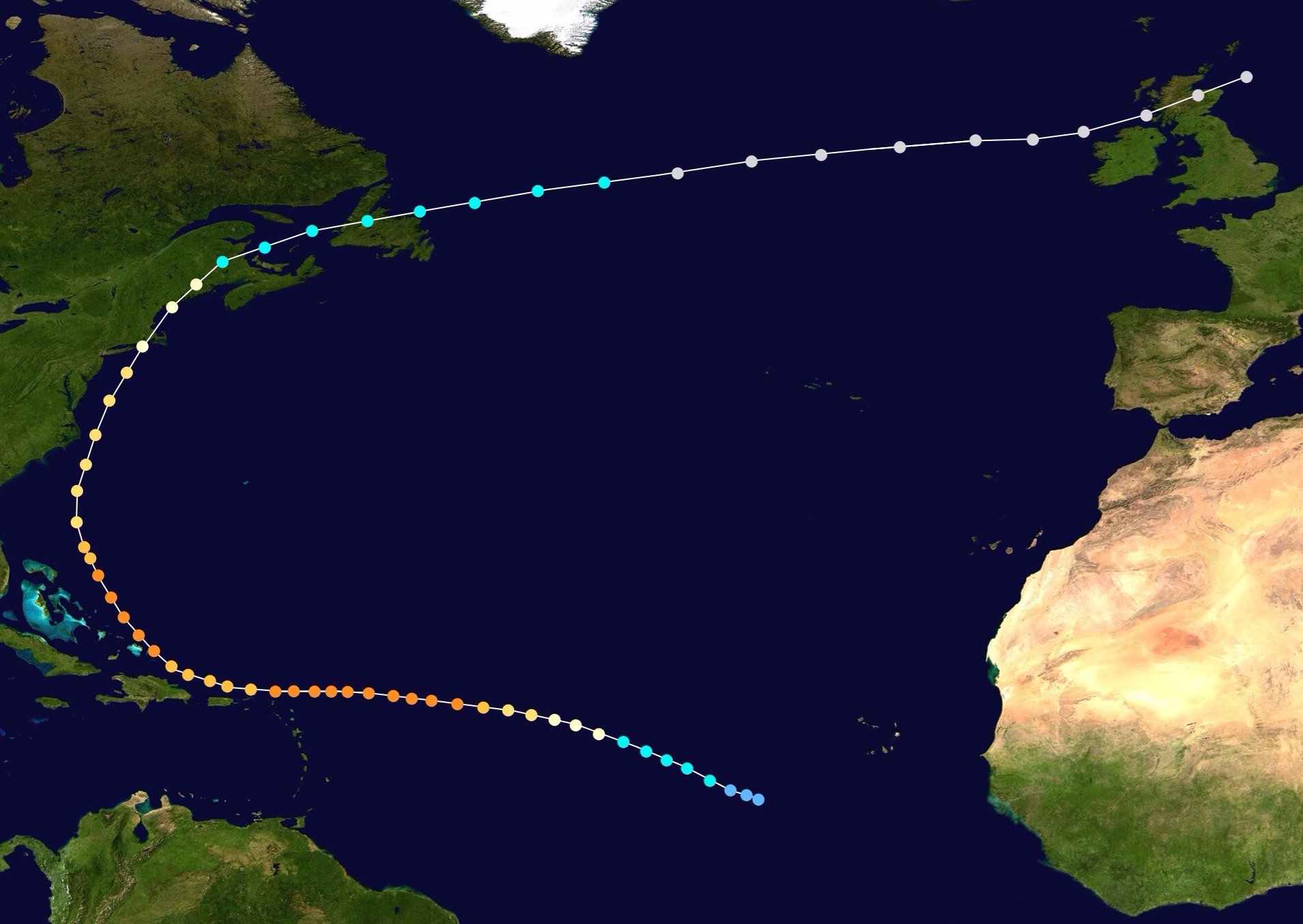
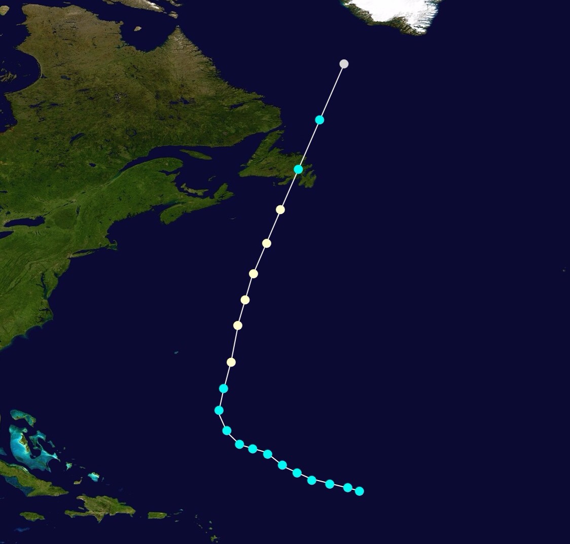
Hurricane Pablo[]
| Category 1 hurricane (SSHWS) | |
 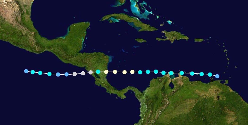 | |
| Duration | November 16 – November 20 (exited basin) |
|---|---|
| Peak intensity | 85 mph (140 km/h) (1-min) 980 mbar (hPa) |
Season Effects[]
| Storm name |
Dates active | Storm category at peak intensity |
Max 1-min wind mph (km/h) |
Min. press. (mbar) |
Areas affected | Damage (USD) |
Deaths | |||
|---|---|---|---|---|---|---|---|---|---|---|
| One | June 15 - June 17 | Tropical depression | 35 | 1006 | Lesser Antilles, Puerto Rico, Dominican Republic, Haiti | Minimal | 5 | |||
| Andrea | July 4 - July 9 | Category 1 hurricane | 80 | 982 | Lesser Antilles, Mexico | 107 | 11 | |||
| Barry | July 11 - July 13 | Tropical storm | 80 | 982 | Bahamas, United States | 24.7 | 2 | |||
| Chantal | August 3 - August 7 | Tropical storm | 60 | 995 | Bahamas, United States, Bermuda | Minimal | None | |||
| Season aggregates | ||||||||||
| 18 systems | 150 | 931 | ||||||||
Storm Names[]
This list of names was used to name storms that formed in 2019. Names not retired from this list will be used again in the 2025 Atlantic Hurricane Season. This is the same list used in the 2013 season, except for Imelda, which replaced Ingrid. The names Imelda and Nestor were used for the first time this year.
|
|
|
Retirement[]
In the spring of 2020, the WMO determined that the names Humberto, Melissa, and Pablo were worthy of retirement, and they will never be used for another Atlantic hurricane. The names Hubert, Monica, and Pierre will replace them in 2025.