Disclaimer: This is just a hypothetical live season which exclusive at Philippine Area of Responsibility, the place where local weather center tracks typhoons. not related to ongoing real Pacific typhoon season
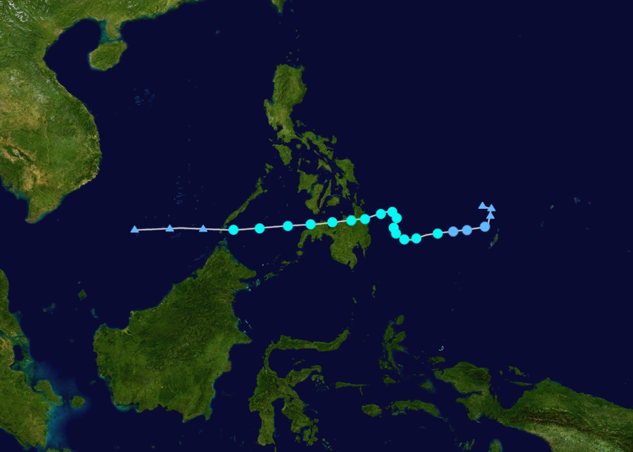
The 2018 Philippine basin typhoon season is a live season which takes place in the Philippine Area of Responsibility (PAR), which is part of Western Pacific basin. This time, local Filipino names are assigned in use for the typhoons that will enter the area. It does not track areas outside of the PAR. The season will officially start at May 15, and will last through the end of the year.
Seasonal Forecasts
| Source | Date | Named storms |
Typhoons | Super typhoons |
|
| FRMC | May 10, 2018 | 20 | 15 | 4 | |
| BNMA | May 10, 2018 | 20-30 | 14-19 | 7-10 | |
| DHC | May 10, 2018 | 11 | 1-5 | 1 | |
| BMA | May 10, 2018 | 20 | 13 | 5 | |
| LHC | May 20, 2018 | 18-21 | 9-11 | 3-5 | |
| PEHC | May 29, 2018 | 20-24 | 10-14 | 4-6 | |
| OSMC | May 29, 2018 | 20-17 | 8-6 | 1-4 | |
| LHC | June 12, 2018 | 19-22 | 9-11 | 1-4 | |
| MWHA | July 19, 2018 | 23-26 | 17-20 | 6-10 | |
| LHC | July 23, 2018 | 23-27 | 10-15 | 3-7 | |
| Actual activity |
23 | 15 | 7 |
Seasonal Summary

Outlook
FARM RIVER METEOROLOGICAL CENTER
PHILIPPINE AREA OF RESPONSIBILITY
TROPICAL WEATHER OUTLOOK
OCTOBER 5, 2018
7:00 PM PHT

An low pressure area is expected to form by the end of the week. Conditions are expected to be conductive and a tropical depression may form this weekend.

Formation chances within 48 hours...low...30 percent
Formation chances within 5 days...high...70 percent

~FORECASTER FARM
The Lucarius Hurricane Center (LHC) has also issued the c as a weather model to showcase the model forecast for the active disturbances.Gary K Weather Center (GKWC) has also issued his own Wind Probability Models
Forecasters
Main Forecasters
- Farm River - head forecaster.
- GloriouslyBlonde - simulated storm image maker, head of recon.
- Charka123 - Model intensity guide maker.
- KingLucarius - Forecaster, Wind Model Producer.
Occasional Forecasters
Current Advisories
All advisories issued are found here: 2018 Philippine basin typhoon season/advisory archive
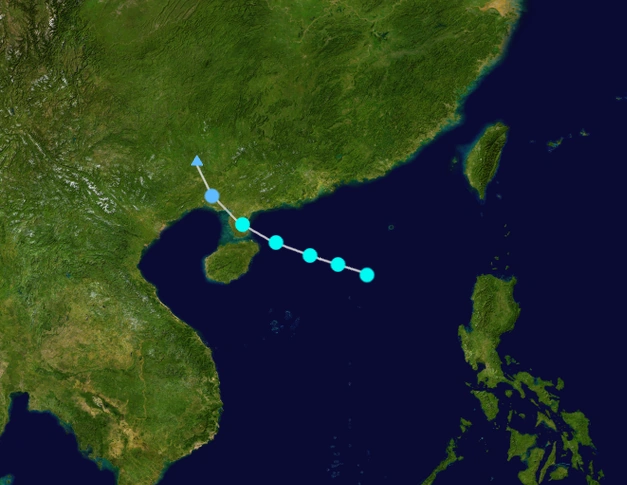
...CARSON DEGENERATES FURTHER... 7:00pm PHT, October 20 |
Forecast
Typhoon Carson
TROPICAL STORM CARSON FORECAST

INIT FORECAST VALID 10/20/2018
MAX WIND  75 KPH (10-MIN) 65 KPH (1-MIN)...PRESSURE  995 MBAR.

FORECAST VALID 10/21/2018
DISSIPATED
Systems
Super Typhoon Albert (Adarna)
| Super typhoon (PAGASA) | |
|---|---|
| Category 5 super typhoon (SSHWS) | |
  | |
| Duration | May 18 – June 1 |
| Peak intensity | 205 km/h (115 mph) 10-min 923 mbar (hPa) |
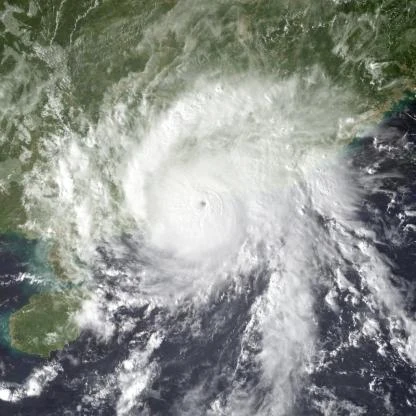
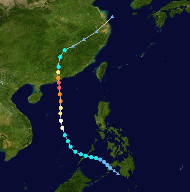
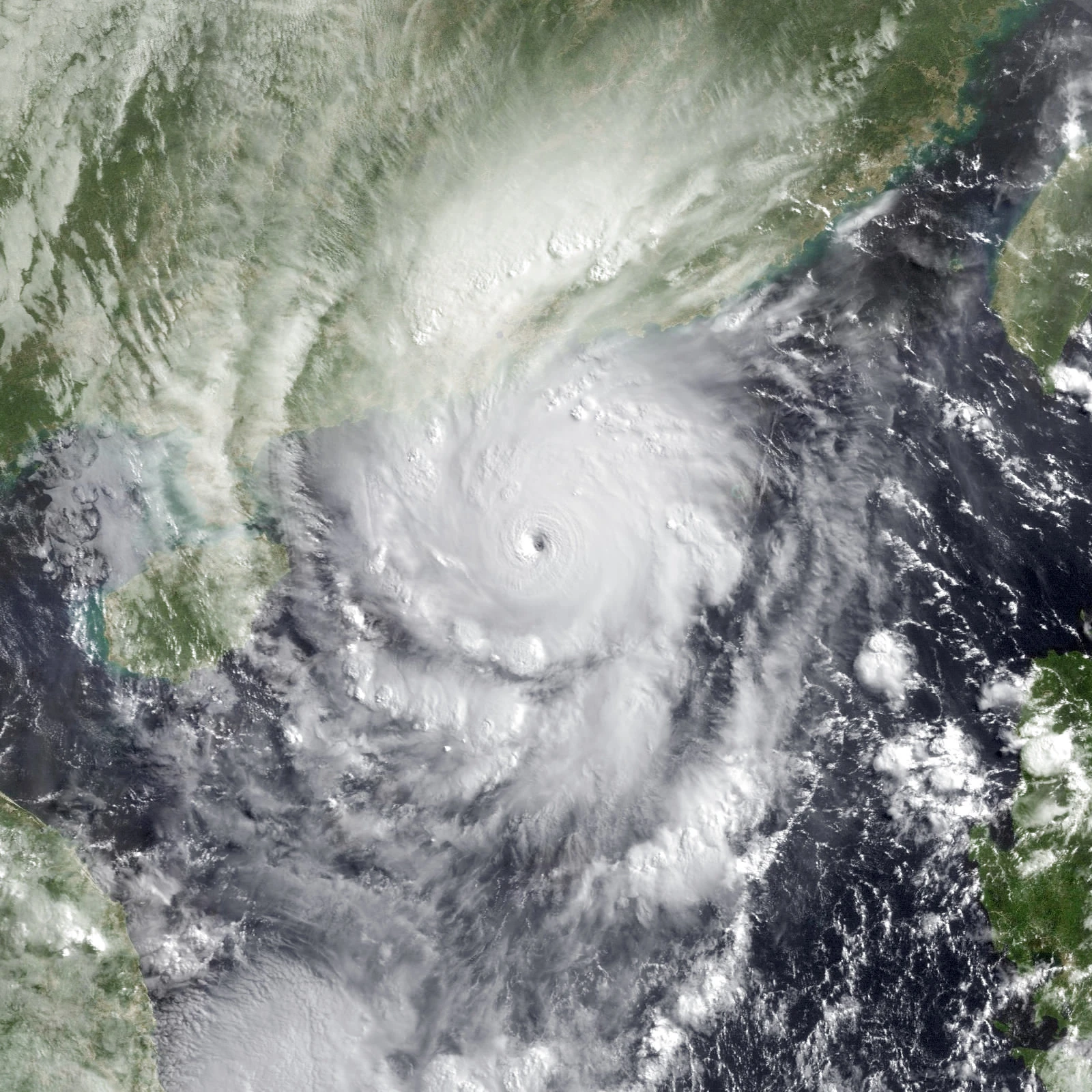
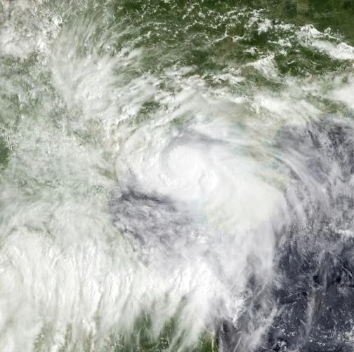
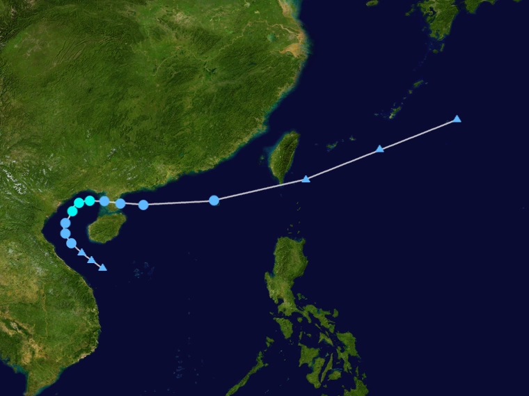
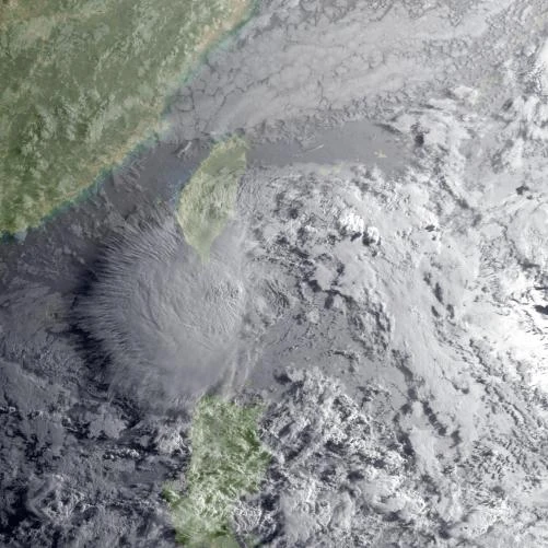
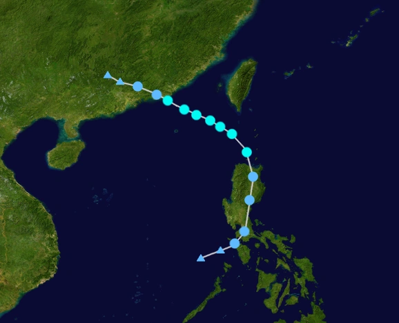
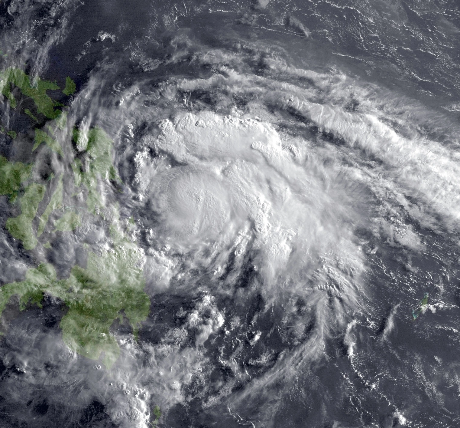
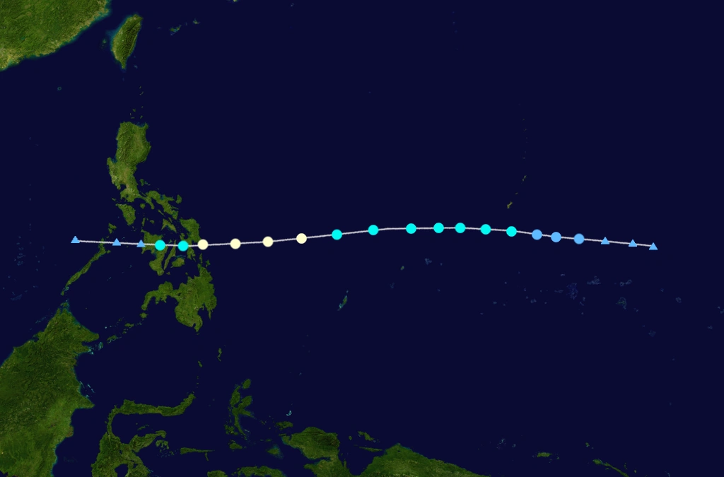
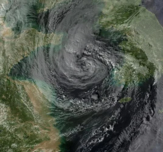
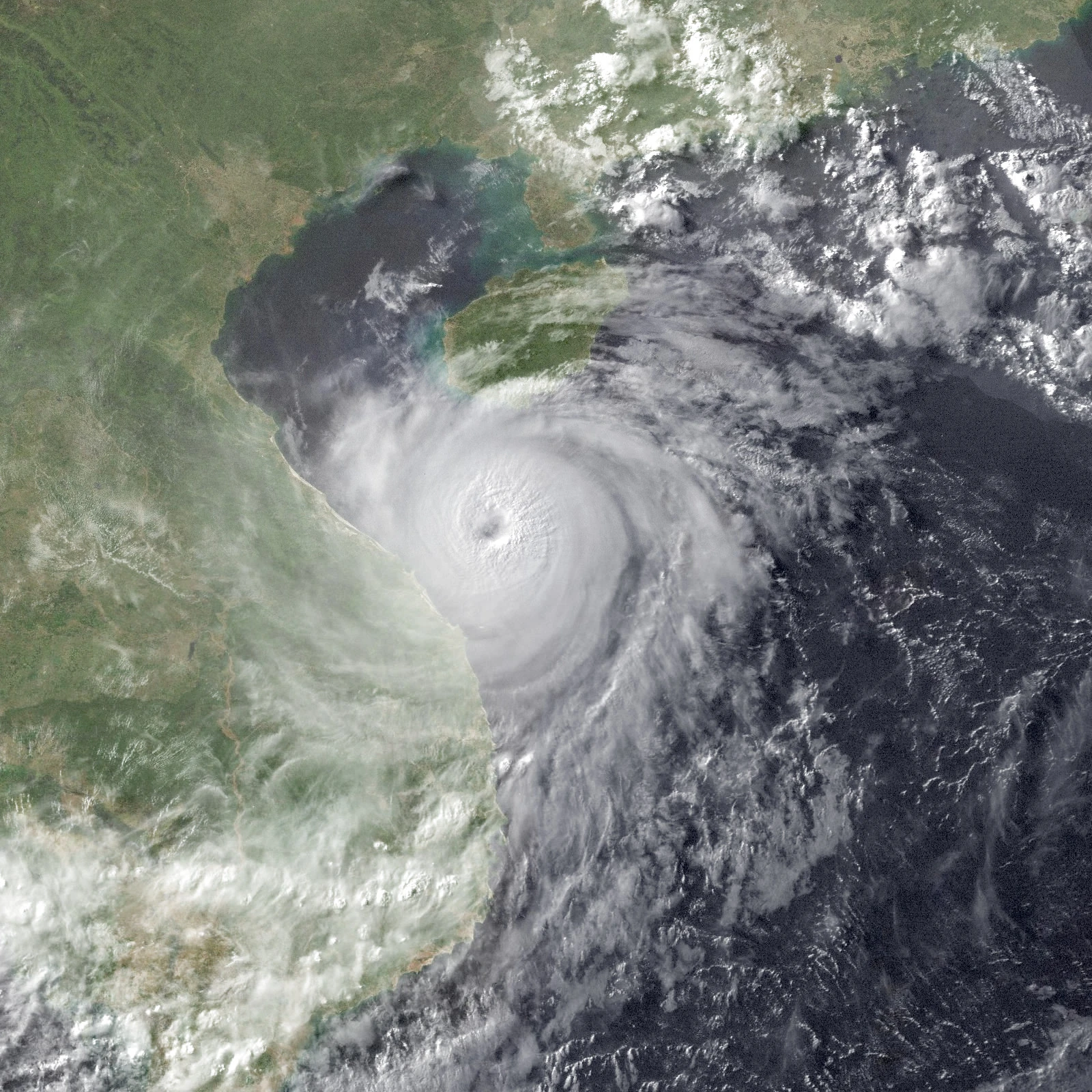
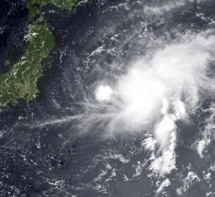
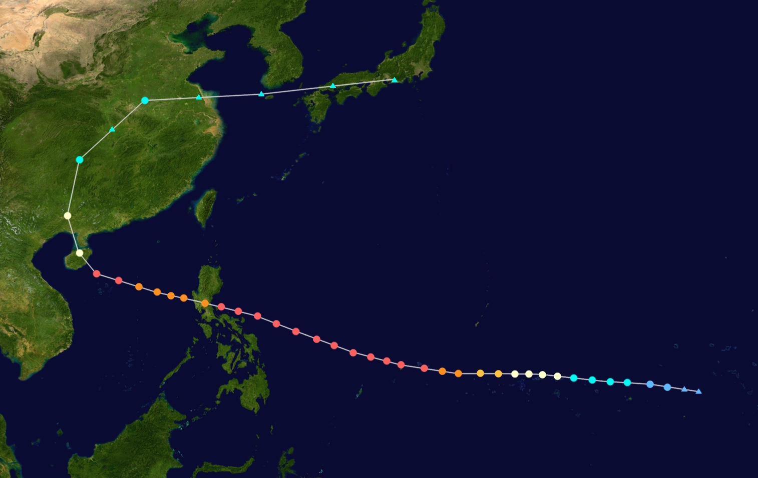
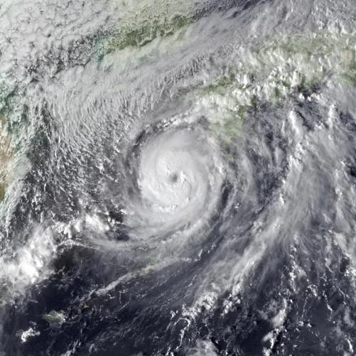
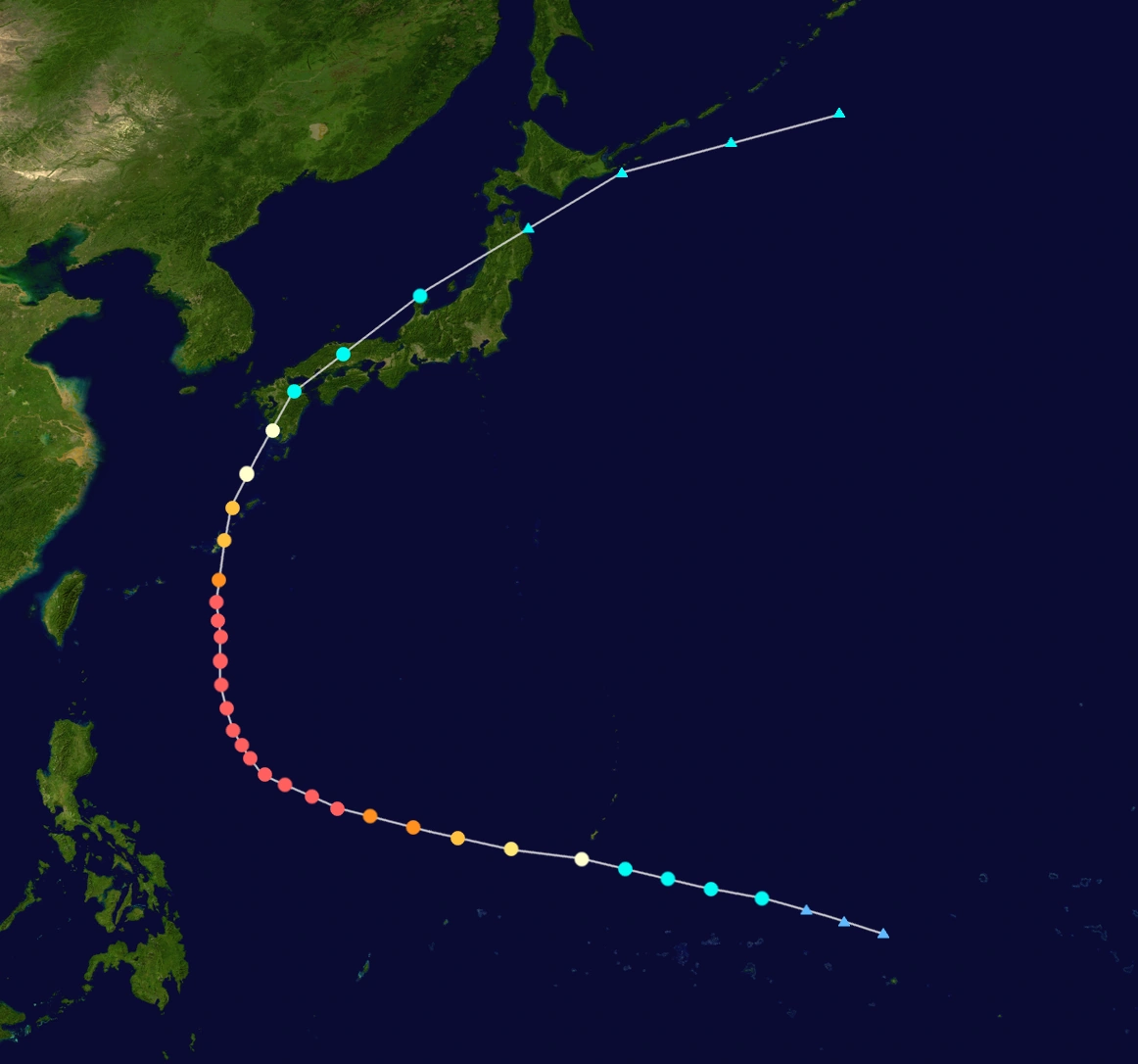
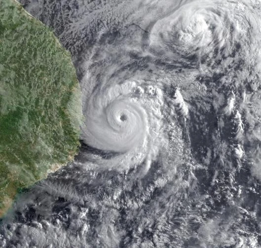
A disturbance developed into a tropical depression on May 18 while located to the southeast of Zamboanga. It gradually intensified and reached tropical storm status on the night of May 19 and named Albert by FRMC, and Adarna by PAGASA. It gradually intensified and became a strong typhoon, after entering the northwestern part of the South China Sea. On May 27, 16:00 HKT, Albert strengthened to a super typhoon, around 100 km south of Hong Kong. Recon data found winds of 205 km/h and pressure of 923 mbar. At 1:00 HKT, the next day the eye was approximately 20 km southwest of Hong Kong with the typhoon heading onto the mainland in a northerly direction. It transitioned to a post-tropical cyclone afterwards. Hong Kong Observatory issued Hurricane Signal No. 10 due to the storm. It only caused few deaths in the main city, but the others were from other towns and Macao. The storm caused an estimated damage of $12 billion, making one of the most damaging typhoon in the basin. It also caused 295 deaths. In Philippines, many fishermen were stalled by the storm, but no deaths were reported. Rough waves were reported along coastline of Palawan.
Severe Tropical Storm Brianna (Bayani)
| Severe tropical storm (PAGASA) | |
|---|---|
| Tropical storm (SSHWS) | |
  | |
| Duration | May 28 – June 14 |
| Peak intensity | 95 km/h (65 mph) 10-min 997 mbar (hPa) |
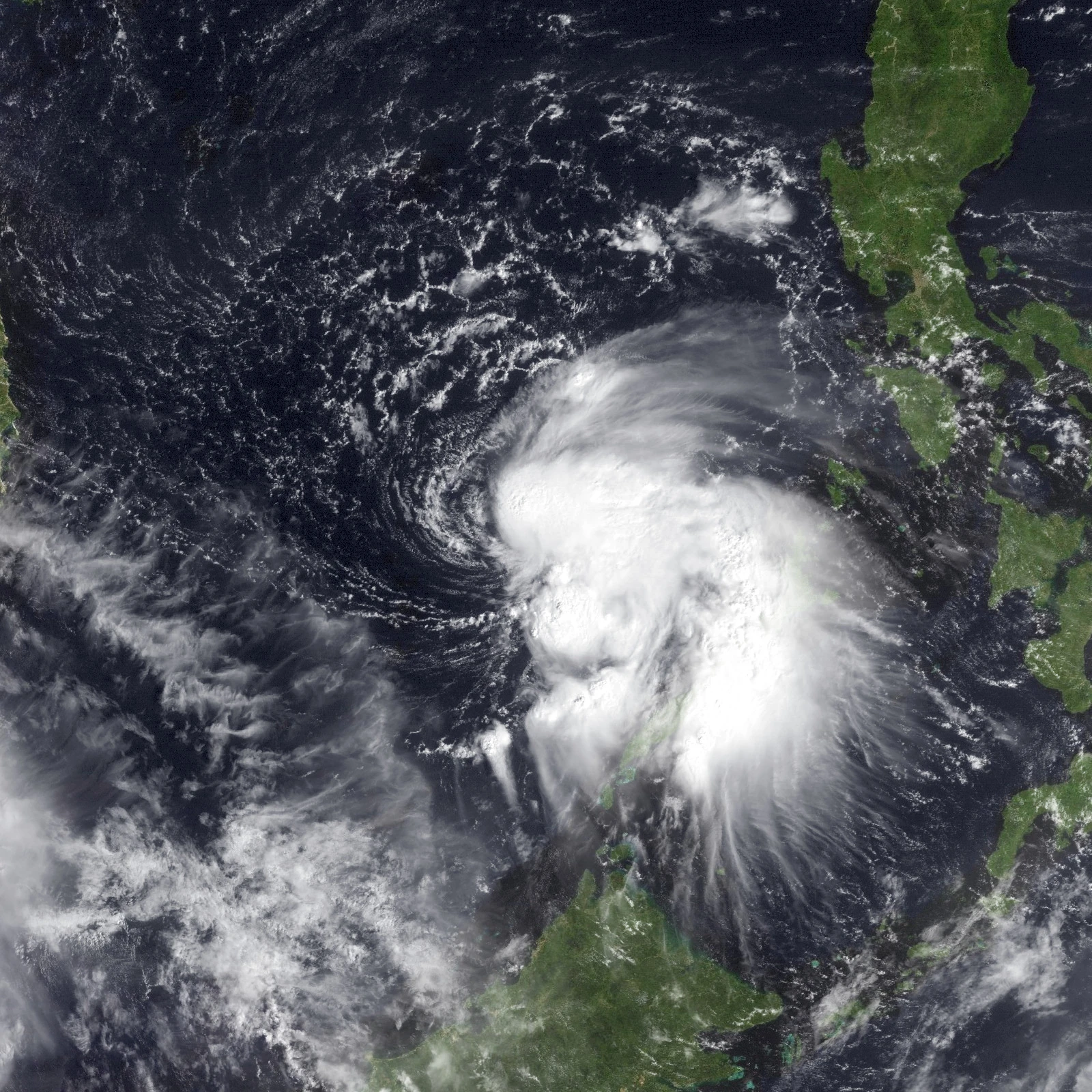
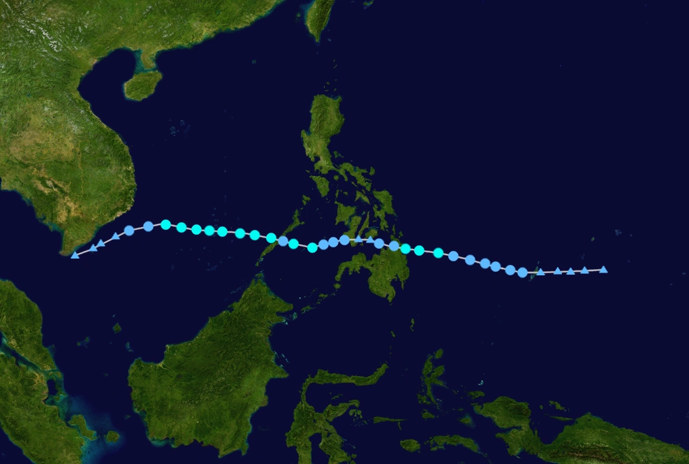
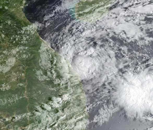
An area of low pressure was spotted east of Mindanao. On May 28, PAGASA declared it as tropical depression, naming "Bayani". Two days after it's formation, FRMC also issued an advisory on it, making it a tropical depression. It stalled and weakened a bit due to wind shear, but on June 4, it strengthened to a tropical storm and named Brianna, off the coast of Mindanao. However, it is only brief, as it weakens again. On June 6, FRMC issued it's last advisory on it, but next day, it regenerated and advisories were resumed. When it entered the Sulu Sea, conditions were favorable for further development, as it became more organized. It strengthened to a severe tropical storm, and made landfall in Palawan. Wind shear weakened the storm, and it was downgraded to a remnant low by June 14.
Typhoon Cyrus (Cielo)
| Typhoon (PAGASA) | |
|---|---|
| Category 5 super typhoon (SSHWS) | |
  | |
| Duration | June 10 – June 20 |
| Peak intensity | 175 km/h (115 mph) 10-min 932 mbar (hPa) |
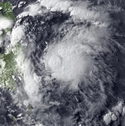
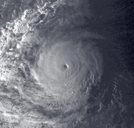
Another disturbance was spotted east of Mindanao. Later it would strengthen and reached Tropical Storm status by June 11, prompting FRMC to give the name Cyrus, and Cielo by PAGASA. It gradually intensified, but it would able to intensify to a severe tropical storm and later a weak typhoon. Favorable conditions allowed the storm to further intensify, as it becoming more annular and deepening further. It reached super typhoon status south of Taiwan, prompting immediate evacuation. It further intensified to a Category 5, and reached it's peak intensity of 185 km/h and pressure of 928 mbar. However, it entered rapid cool waters and extremely high wind shear, allowing the storm to rapidly weaken and dissipate by June 20, never making any landfall except on islands of Batanes. Like Albert, the Hong Kong Observatory issued Gale Wind Signal No.8 due to the storm. It caused far less damage than Albert, but it still killed a lot and destroyed several homes, plus flash flooding in Hong Kong. It caused $728 million in damage and 43 deaths.
Super Typhoon Denise (Danilo)
| Super typhoon (PAGASA) | |
|---|---|
| Category 5 super typhoon (SSHWS) | |
  | |
| Duration | June 24 – July 16 |
| Peak intensity | 185 km/h (115 mph) 10-min 932 mbar (hPa) |
A disturbance formed well East of the Philippines. It organized before being classified as a Tropical Depression. However, it wasn't long before it was named Tropical Storm Denise. Denise began gradual intensification as she neared the Philippines. It went through fluctuation between Category 2 and 3 as Denise moved through the islands, still continuing to strengthen. Denise reached Category 4 status in the Sulu Sea, prompting a Signal No.4 watch in certain areas. It finally reached Category 5 Super Typhoon strength before making landfall in Palawan. It wasn't long before Denise started to weaken. Denise finally level out, sustaining Category 1 Typhoon level winds up until landfall. Denise started to rapidly dissipate after landfall. On July 16th, Denise was announced to have fully dissipated. Denise did over $250 million in damage and killed almost 200, mostly in Central Philippines (mostly Cebu and Bohol).
Tropical Storm Ernie
| Tropical storm (FRMC) | |
|---|---|
| Tropical depression (SSHWS) | |
  | |
| Duration | June 27 – July 3 |
| Peak intensity | 75 km/h (45 mph) 10-min 1007 mbar (hPa) |
A disturbance was found near China. On June 27th was designated a Tropical Depression. Not long after, the storm strengthened sufficiently to receive the name Ernie. It would slowly move East before making landfall. The interaction with land weakened the storm back down to Tropical Depression status. The storm failed to restrengthen, moving West-Northwest at very high speeds over the next few days. Ernie brushed Southern Taiwan but overall effects were minimal. It dissipated well west of Taiwan on July 3rd.
Typhoon Francine
| Typhoon (FRMC) | |
|---|---|
| Category 4 super typhoon (SSHWS) | |
  | |
| Duration | July 4 – July 23 |
| Peak intensity | 175 km/h (110 mph) 10-min 937 mbar (hPa) |
A low pressure area was spotted near Guam. Initial observations made the low stay at it's current state. However, on July 4, conditions began to increase favorability for development, and the system was named Francine. Francine stalled for a bit but it resumed it strengthening period where it become a typhoon. It began a period of rapid deepening, where Francine reached high-end Category 4 strength with 175 kph (10-min) winds, closing into super typhoon status. Francine maintained it's strength for hours before weakening again, mostly due to eyewall replacement cycle, and began to accelerate east. Francine turned extratropical around July 23, and was absorbed later on.
Tropical Storm Gerald (Erning)
| Tropical storm (PAGASA) | |
|---|---|
| Tropical storm (SSHWS) | |
  | |
| Duration | July 7 – July 14 |
| Peak intensity | 75 km/h (45 mph) 10-min 1000 mbar (hPa) |
On July 7th, a Tropical Depression formed near the Philippine Islands. The depression moved over the islands, sustaining winds as it headed North. The depression was named Gerald, North of the Philippines. Gerald strengthened marginally as it curved West toward China. It finally made landfall before dissipating on July 14th. Gerald dealt minimal damage and no lives were lost. It still enhanced the monsoon, causing minimal rains.
Typhoon Hope (Fernan)
| Typhoon (PAGASA) | |
|---|---|
| Category 3 typhoon (SSHWS) | |
  | |
| Duration | July 8 – July 26 |
| Peak intensity | 150 km/h (95 mph) 10-min 966 mbar (hPa) |
On July 8th a Tropical Depression formed a short distance East of the Philippine Islands. It quickly intensified into Tropical Storm Hope. Hope began to rapidly intensify, as it reached typhoon status. Hope finally peaked at Category 3 Typhoon status, having a bit disorganized structure. Despite this it weakened considerably down to a Category 2 Typhoon before making it's first landfall. It weakened down to a Tropical Storm as it emerged into the South China Sea, allowing it to restrengthen back to a Category 1 Typhoon. Hope made it's final landfall in Hainan, in China, as a typhoon, dissipating rapidly. Hope dealt 78 million in damages and killed 34.
Typhoon Irving (Gemma)
| Typhoon (PAGASA) | |
|---|---|
| Category 1 typhoon (SSHWS) | |
  | |
| Duration | July 15 – July 26 |
| Peak intensity | 120 km/h (75 mph) 10-min 975 mbar (hPa) |
A Tropical Depression formed well East of the Philippine Islands. It intensified at a moderate rate, becoming Tropical Storm Irving. Irving continued to steadily intensify over the next several days. Irving reached Category 1 Typhoon status before making landfall that same day. Irving weakened considerably down to a Tropical Depression. Irving despite re-converging into water dissipated on July 26th. Irving caused $22 million in damages and killed 3 people.
Severe Tropical Storm Janice (Hilario)
| Severe tropical storm (PAGASA) | |
|---|---|
| Tropical storm (SSHWS) | |
  | |
| Duration | July 16 – July 20 |
| Peak intensity | 95 km/h 60 mph) 10-min 994 mbar (hPa) |
A Tropical Depression spawned East of the Philippines before moving in a non-linear path Northward. It strengthened sufficiently to be named Janice, rapidly intensifying. Janice would peak as a Severe Tropical Storm before weakening due to cooler waters. It became Extratropical before hitting Japan. Overall damage was minimal and 6 deaths were recorded.
Super Typhoon Kurt
| Super typhoon (FRMC) | |
|---|---|
| Category 5 super typhoon (SSHWS) | |
  | |
| Duration | July 20 – August 3 |
| Peak intensity | 215 km/h (135 mph) 10-min 917 mbar (hPa) |
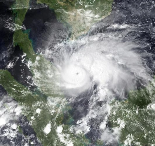
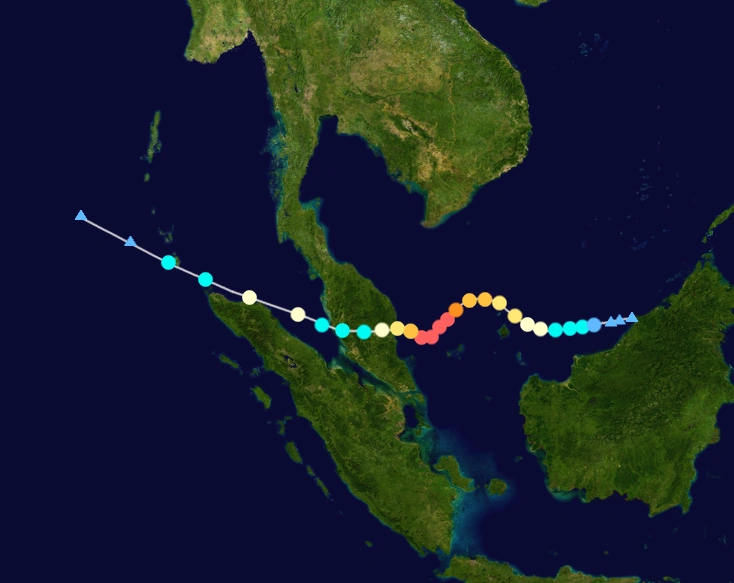
On July 20th, a Tropical Depression spawned off the coast of Indonesia. The young system intensified steadily over that day before being named. Shortly after recieving the name Kurt, it quickly became a Category 1 Typhoon. Kurt accelerated intensification further, quickly becoming a Super Typhoon, the 3rd of the season. It would sustain for a little while before weakening shortly before landfall in Malasia. It would weaken down to a Tropical Storm due to land interaction, However, Kurt would intensify back to a minimal Typhoon for a short time before weakening once again to to cooler Sea Surface Temperatures. It would brush Indonesia's other landform. It dissipated on August 3rd.
Typhoon Lauren (Isadora)
| Typhoon (PAGASA) | |
|---|---|
| Category 1 typhoon (SSHWS) | |
  | |
| Duration | July 24 – July 29 |
| Peak intensity | 120 km/h (75 mph) 10-min 981 mbar (hPa) |
On July 24, a Tropical Depression formed a decent distance East of the Philippines. It strengthened as it went north before making an abrupt turn West. Lauren would reach Typhoon status not long later. Lauren would weaken to a Tropical Storm before making landfall in the Philippines. Lauren finally would dissipate over the islands on July 29th.
Tropical Storm Mateo
| Tropical storm (FRMC) | |
|---|---|
| Tropical storm (SSHWS) | |
  | |
| Duration | July 29 – August 2 |
| Peak intensity | 75 km/h 45 mph) 10-min 1003 mbar (hPa) |
A Tropical Depression spawned off the Northern coasts of China on July 29. It would go East before making an erratic turn Northward. It would strengthen enough to receive the name Mateo West of South Korea. Mateo would finally strike North Korea as a Tropical Storm. Not long after, Mateo would dissipate into a Tropical Depression. Mateo would become unrecognizable in the Sea of Japan.
Tropical Depression 14F
| Tropical depression (FRMC) | |
|---|---|
| Tropical depression (SSHWS) | |
  | |
| Duration | August 5 – August 7 |
| Peak intensity | 55 km/h 30 mph) 10-min 1007 mbar (hPa) |
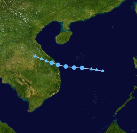
A tropical system formed a small distance East of Vietnam. It would quickly develop into a Tropical Depression shortly before making landfall in Vietnam. It would soon degenerate into a wave before dying over Laos.
Typhoon Nina (Jasmine)
| Typhoon (PAGASA) | |
|---|---|
| Category 4 typhoon (SSHWS) | |
  | |
| Duration | August 8 – September 1 |
| Peak intensity | 175 km/h (105 mph) 10-min 938 mbar (hPa) |
On August 8, a Tropical Depression spawned not far to the West of the International Dateline. The Depression would intensify and organize quickly, soon receiving the name Nina as a result. Intensification would continue steadily over the next several days. Intensification led to the classification of Typhoon. Strengthening would still continue up to landfall in the Philippines. Nina would weaken slightly before resuming intensification. Nina would soon peak as a Category 4 Typhoon near Vietnam. However, Nina would begin rapid weakening due to land interaction before making landfall in Vietnam as a Category 2 Typhoon. From there, Nina would dissipate after pushing itself into Laos on September 1st. Overall, damages and fatalities are unknown.
Tropical Storm Odell (Kokoy)
| Tropical storm (PAGASA) | |
|---|---|
| Tropical storm (SSHWS) | |
  | |
| Duration | August 13 – August 24 |
| Peak intensity | 75 km/h (45 mph) 10-min 998 mbar (hPa) |
On August 13, a Tropical Depression formed and quickly developed a short distance East of the Philippines. This Depression would rapidly organized, soon to receive the name Odell(Kokoy). Odell would however weaken temporarily after moving North-Northwest near Taiwan. Odell abruptly changed direction to South then to West. Odell would strengthen again back to a Tropical Storm before making Landfall in China and therefore, dissipating. Damages amount to $176 million with 45 deaths.
Tropical Depression 17F
| Tropical depression (PAGASA) | |
|---|---|
| Tropical depression (SSHWS) | |
  | |
| Duration | August 28 – September 2 |
| Peak intensity | 55 km/h (35 mph) 10-min 1004 mbar (hPa) |
A Tropical Depression spawned on August 28 well to the South of Japan. It would move North, changing very little in intensity. A few days later, the weak Depression would turn Northeast and undergo an eventual Extratropical Transition. Seventeen would become unrecognizable on September 2 well to the East of Japan. The Depression did not make landfall, as a result causing no damage or fatalities.
Severe Tropical Storm Portia (Lorenzo)
| Severe tropical storm (PAGASA) | |
|---|---|
| Tropical storm (SSHWS) | |
  | |
| Duration | August 28 – September 9 |
| Peak intensity | 95 km/h (60 mph) 10-min 992 mbar (hPa) |
A Tropical Depression formed on August 28 in the open Western Pacific Ocean. The Depression would begin to intensify as it moved West. Later on August 30, the young system would gain enough strength to receive the name Portia, with the Philippine name Lorenzo. Portia would begin to stall Northward a short distance from the Philippine Islands before resuming it's Westward track. Portia would make landfall with peak winds of 60 mph, and an intensity of 992 mbar. The storm would weaken due to land interaction. It re-entered the waters of the Philippine sea. Portia failed to strengthen back again, resulting in dissipation on September 9. Damages are currently unknown, 18 deaths were counted.
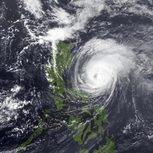
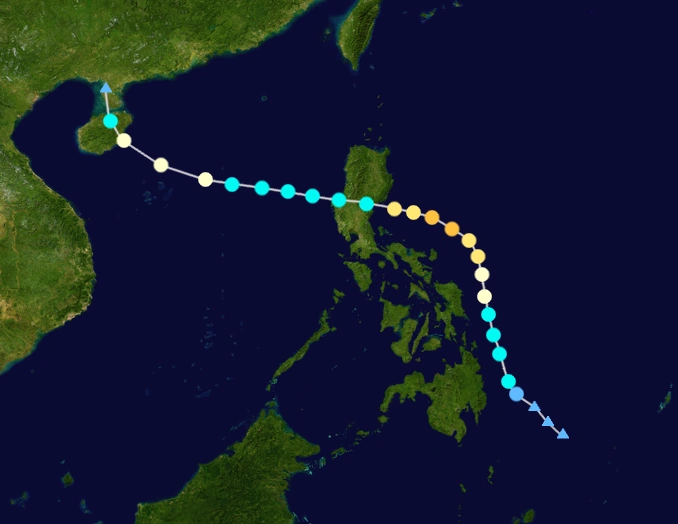
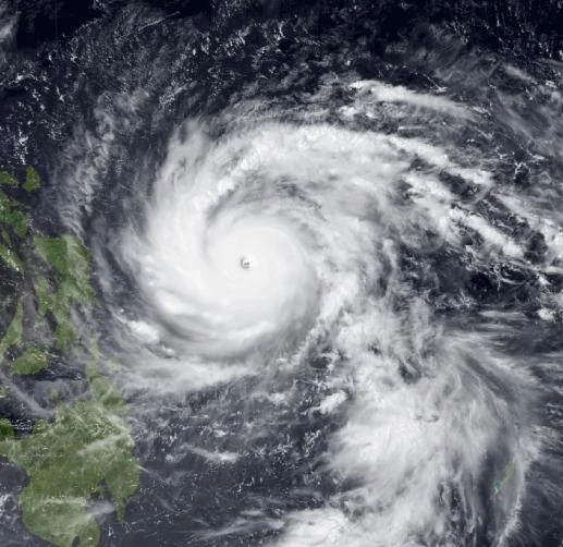
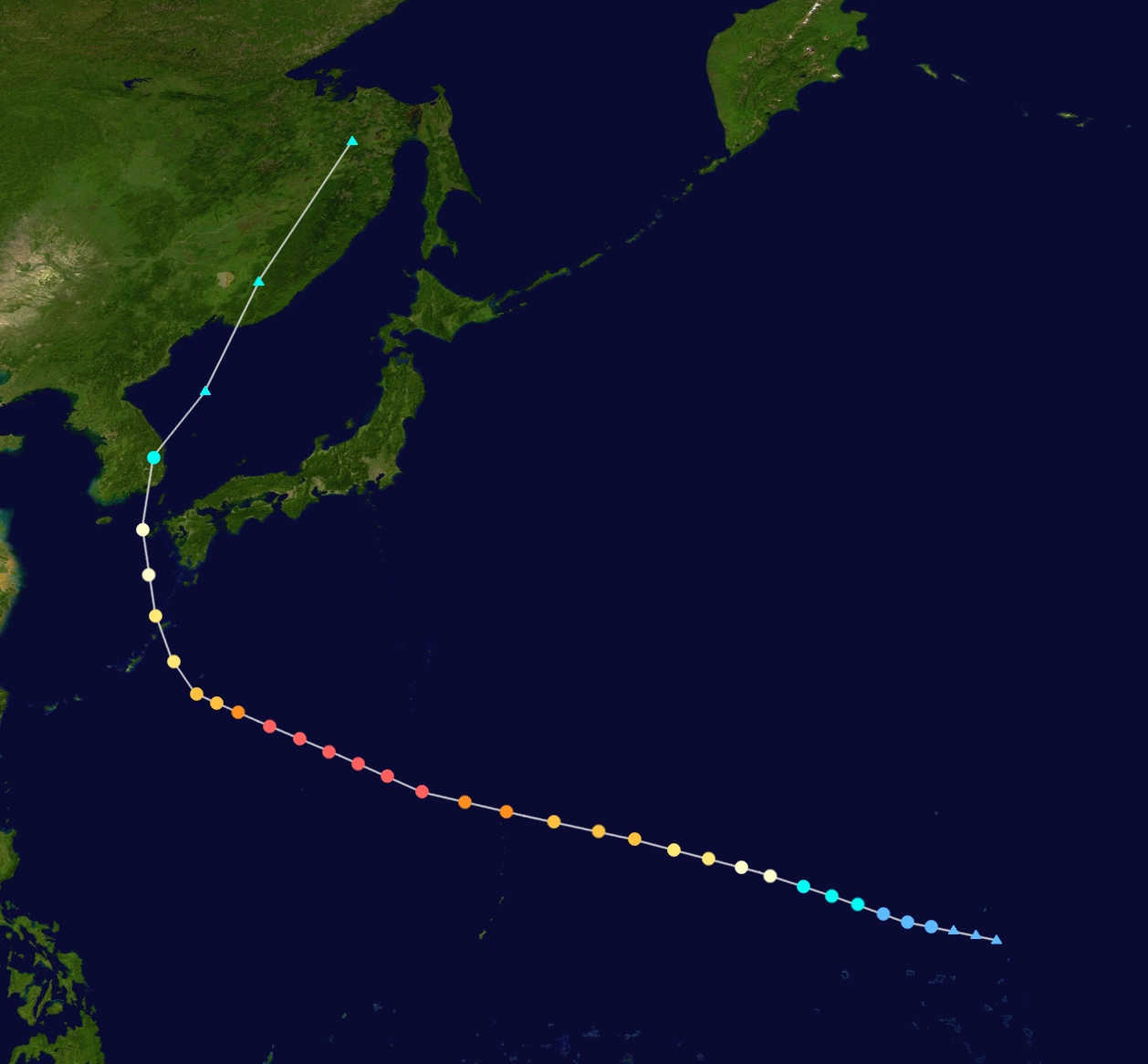
Super Typhoon Ron (Myrna)
| Super typhoon (PAGASA) | |
|---|---|
| Category 5 super typhoon (SSHWS) | |
  | |
| Duration | August 31 – September 19 |
| Peak intensity | 220 km/h (135 mph) 10-min 899 mbar (hPa) |
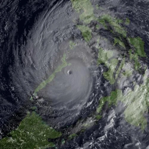
A Tropical Depression would form a short distance from the International Dateline on August 31. The Depression began rapid intensification over favorable conditions, soon being named Ron. Ron began to accelerate to the West, strengthening quickly. Ron would soon become the 10th Typhoon of the season. Still strengthening, Ron entered Philippine area of responsibility, gaining the Philippine name of Myrna. Later on, Ron would gain Super Typhoon status. This would be the 5th Typhoon to do so this season. Ron barreled towards the Philippine Islands, maintaining Category 5 Super Typhoon status. Ron would reach an eventual peak of 135 mph, 899 mbar. Not soon after, Ron made landfall in the Philippine Island of Luzon, weakening down to Category 4 Status for the first time in 3 days. Ron re-entered waters of the Philippine sea, restrengthening to Category 5 Intensity. Ron would make a second landfall in Hong Kong as a Category 5 Super Typhoon. Due to land interaction, Ron would rapidly weaken as a result before turning Extratropical over Northern China. The Extratropical remnants of Ron would turn abruptly East and strike Japan before becoming unrecognizeable on September 19.
Typhoon Shelby (Ningning)
| Typhoon (PAGASA) | |
|---|---|
| Category 3 typhoon (SSHWS) | |
  | |
| Duration | September 1 – September 12 |
| Peak intensity | 140 km/h (90 mph) 10-min 970 mbar (hPa) |
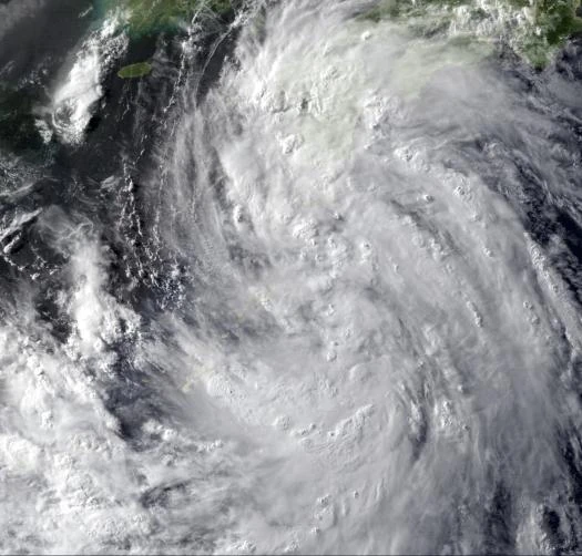
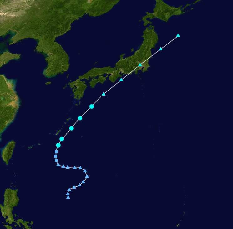
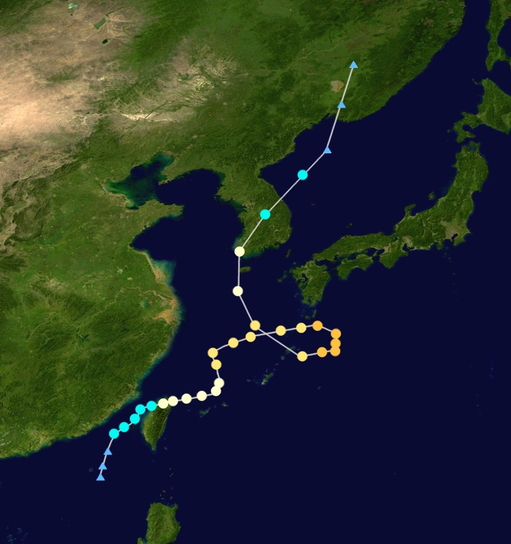
A Tropical Depression formed South of China on September 1. It immediately began to intensify while moving North-Northeast. The system would be given the name Shelby, Philippine name Ningning the next day. Shelby would become a Typhoon, the 11th of the season, on September 4 with it's Southern eyewall over Taiwan. Shelby temporarily assumed a more Easterly track before making an abrupt turn North, becoming a Category 2 Typhoon not long after. Shelby went into a loop South of Japan. Midway through this process, Shelby peaked at Category 3 Typhoon status at 90 mph, 970 mbar. As a result of cooler Sea Surface Tempuratures, Shelby weakened before making landfall in South Korea as a minimal Typhoon. Shelby would undergo an Extratropical transition in the Sea of Japan on September 12.
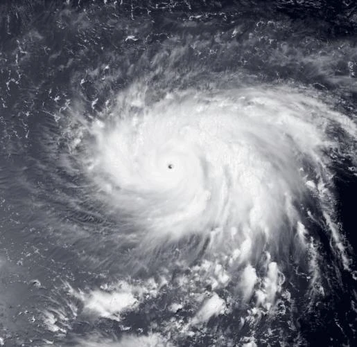
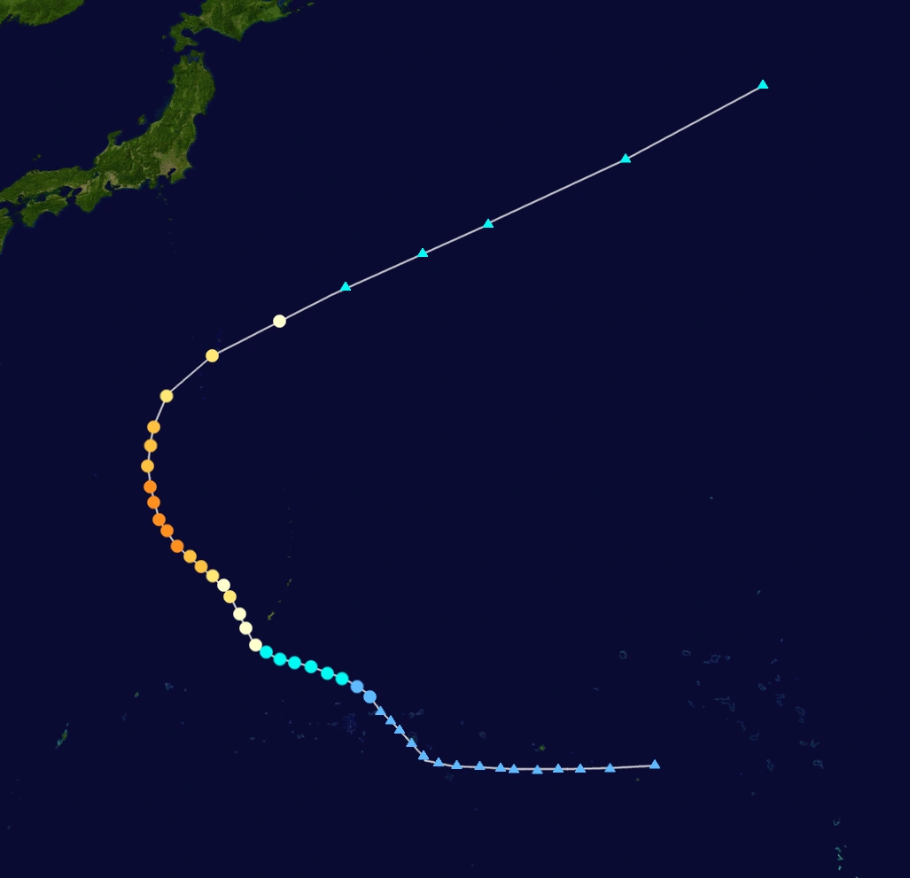
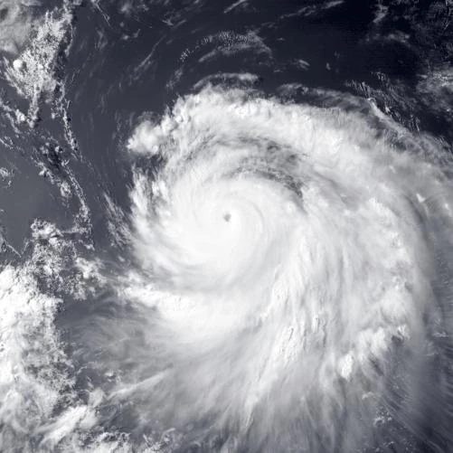
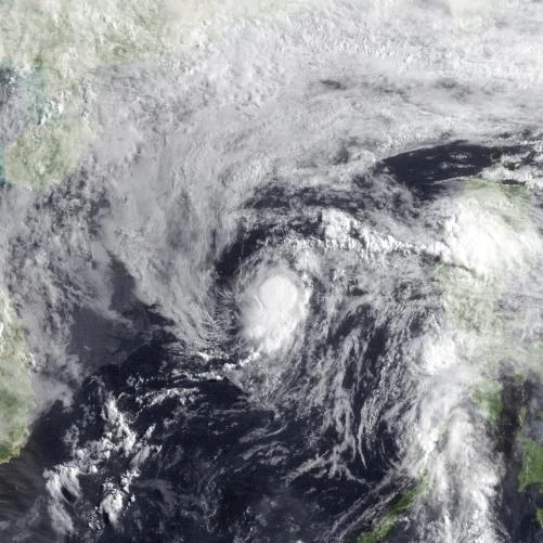
Super Typhoon Timothy (Olivia)
| Super typhoon (PAGASA) | |
|---|---|
| Category 5 super typhoon (SSHWS) | |
  | |
| Duration | September 15 – September 30 |
| Peak intensity | 195 km/h (120 mph) 10-min 911 mbar (hPa) |
Super Typhoon Victoria (Precy)
| Super typhoon (PAGASA) | |
|---|---|
| Category 5 super typhoon (SSHWS) | |
  | |
| Duration | September 18 – October 1 |
| Peak intensity | 185 km/h (115 mph) 10-min 922 mbar (hPa) |
Tropical Storm Wilson
| Tropical storm (FRMC) | |
|---|---|
| Tropical storm (SSHWS) | |
  | |
| Duration | September 24 – September 28 |
| Peak intensity | 75 km/h (45 mph) 10-min 998 mbar (hPa) |
Typhoon Antony (Quising)
| Typhoon (PAGASA) | |
|---|---|
| Category 2 typhoon (SSHWS) | |
 | |
| Duration | September 26 – October 6 |
| Peak intensity | 140 km/h (85 mph) 10-min 965 mbar (hPa) |
Super Typhoon Wormadam
| Super typhoon (FRMC) | |
|---|---|
| Category 5 super typhoon (SSHWS) | |
 | |
| Duration | October 2 (entered basin) – October 13 |
| Peak intensity | 195 km/h (120 mph) 10-min 922 mbar (hPa) |
Tropical Storm Bianca (Rolando)
| Tropical storm (PAGASA) | |
|---|---|
| Tropical storm (SSHWS) | |
 | |
| Duration | October 6 – October 11 |
| Peak intensity | 75 km/h (45 mph) 10-min 1000 mbar (hPa) |
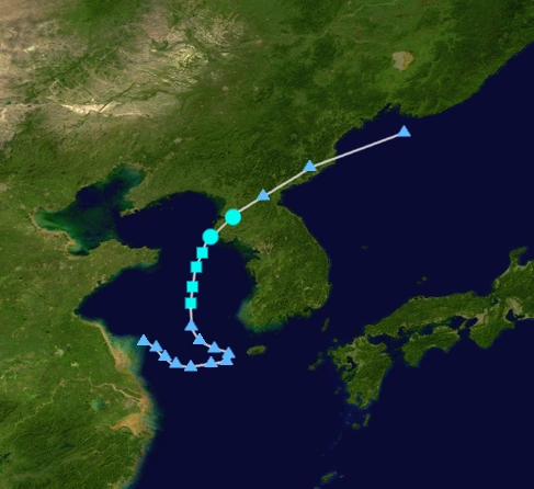
Typhoon Carson (Susan)
| |||
|---|---|---|---|
 | |||
Tropical storm (PAGASA) | |||
Tropical storm (SSHWS) | |||
| As of | Saturday, October 20, 2018 | ||
| Location | Pacific Ocean | ||
| Intensity | 75 kph (10-min), 65 kph (1-min), 995 mbar | ||
| Movement | NNW at 15 kph | ||
Storm Names
Main Page: 2018 Philippine basin typhoon season/naming
The PAGASA and JTWC uses these names to name any tropical depression that enters the PAR area.
| Adarna | Bayani | Cielo | Danilo | Erning |
| Fernan | Gemma | Hilario | Isadora | Jasmine |
| Kokoy | Lorenzo | Myrna | Ningning | Olivia |
| Precy | Quising | Rolando | Susan (active) | Tomas (unused) |
| Umberto (unused) | Vilma (unused) | Wendell (unused) | Yanni (unused) | Zoren (unused) |
| Auxiliary list | ||||
|---|---|---|---|---|
| Agapito (unused) | Benjamin (unused) | Claudia (unused) | Dolores (unused) | Eugenio (unused) |
| Flor (unused) | Gino (unused) | Helena (unused) | Ivy (unused) | Josefa (unused) |
Farm River Meteorological Center
The FRMC also names storms that reached tropical storm intensity.
|
|
|
Auxiliary
Will be used once the main list gets exhausted.
|
|
|
One name, Wormadam crossed from the Central Pacific, and retained it's name.
Season Effects
| Saffir–Simpson hurricane wind scale | ||||||
| TD | TS | C1 | C2 | C3 | C4 | C5 |
| Storm name |
Dates active | Storm category at peak intensity |
Max 1-min wind mph (km/h) |
Min. press. (mbar) |
Areas affected | Damage (USD) |
Deaths | |||
|---|---|---|---|---|---|---|---|---|---|---|
| Albert (Adarna) | May 18 – June 1 | Category 5 hurricane | 205 | 923 | Philippines, Hong Kong, China | $12 billion | 290+ | |||
| Brianna (Bayani) | May 28 – June 14 | Severe tropical storm | 95 | 996 | Minandao, Visayas, Palawan | $2 million | 12 | |||
| Cyrus (Cielo) | June 10 – June 20 | Category 5 hurricane | 185 | 928 | Luzon, Taiwan, Hong Kong, China | $728 million | 43 | |||
| Denise (Danilo) | June 24 – July 16 | Category 5 hurricane | 185 | 930 | Palau, Philippines | $265 million+ | 185+ | |||
| Ernie | June 27 – July 3 | Tropical storm | 75 | 1007 | Vietnam, China | $104 million | 16 | |||
| Francine | July 4 – July 23 | Category 4 hurricane | 175 | 937 | Mariana Islands | None | 1 | |||
| Gerald (Erning) | July 7 – July 14 | Tropical storm | 75 | 1000 | Philippines | None | None | |||
| Hope (Fernan) | July 8 – July 26 | Category 3 hurricane | 150 | 967 | Philippines | $78 million | 34 | |||
| Irving (Gemma) | July 15 – July 26 | Category 1 hurricane | 120 | 976 | None | $22 million | 3 | |||
| Janice (Hilario) | July 16 – July 20 | Severe tropical storm | 95 | 994 | Japan | Minimal | 6 | |||
| Kurt | July 20 – August 3 | Category 5 hurricane | 215 | 917 | Malaysia, Singapore | $4 billion | 296 | |||
| Lauren (Isadora) | July 24 – July 29 | Category 1 hurricane | 120 | 981 | None | None | None | |||
| Mateo | July 29 – August 2 | Subtropical storm | 75 | 1003 | None | $15 million | 2 | |||
| 14F | August 5 – August 7 | Tropical depression | 55 | 1007 | Vietnam | $60 million | 5 | |||
| Nina (Jasmine) | August 8 – September 1 | Category 4 hurricane | 170 | 938 | None | Unknown | Unknown | |||
| Odell (Kokoy) | August 13 – August 24 | Tropical storm | 75 | 998 | Luzon | $176 million | 45 | |||
| 17F | August 28 – September 2 | Tropical depression | 55 | 1004 | None | None | None | |||
| Portia (Lorenzo) | August 28 – September 9 | Severe tropical storm | 95 | 992 | Philippines | Unknown | 18 | |||
| Ron (Myrna) | August 31 – September 19 | Category 5 hurricane | 220 | 899 | Guam, Saipan, Philippines, China, Vietnam | $860 million | 160+ | |||
| Shelby (Ningning) | September 1 – September 12 | Category 3 hurricane | 140 | 970 | Taiwan, China, Japan | $40 million | 35 | |||
| Timothy (Olivia) | September 15 - Currently Active | Category 5 hurricane | 195 | 911 | Japan, Korea | $270 million | 45 | |||
| Victoria (Precy) | September 18 - Currently Active | Category 5 hurricane | 185 | 922 | Japan, Korea | $165 million | 16 | |||
| Wilson | September 24 - September 28 | Tropical storm | 75 | 998 | China | Minimal | 4 | |||
| Antony (Quising) | September 26 - October 5 | Category 2 hurricane | 140 | 965 | Taiwan, China | None | None | |||
| Wormadam | October 2 - October 13 | Category 5 hurricane | 195 | 922 | None | None | None | |||
| Bianca (Rolando) | October 6 - October 11 | Tropical storm | 75 | 1000 | None | None | None | |||
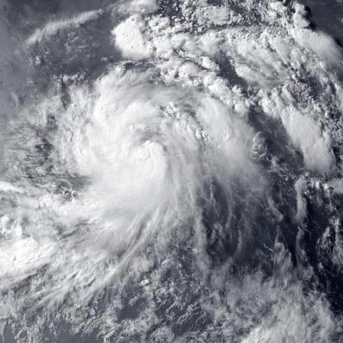
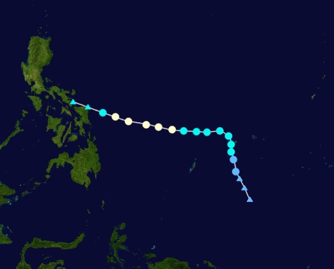
| Carson (Susan) | October 11 - Currently Active | Category 4 hurricane | 155 | 947 | None | None | None | |||
| Season aggregates | ||||||||||
| 25 systems | May 18 –Currently Active | 220 | 899 | Unknown | Unknown | |||||